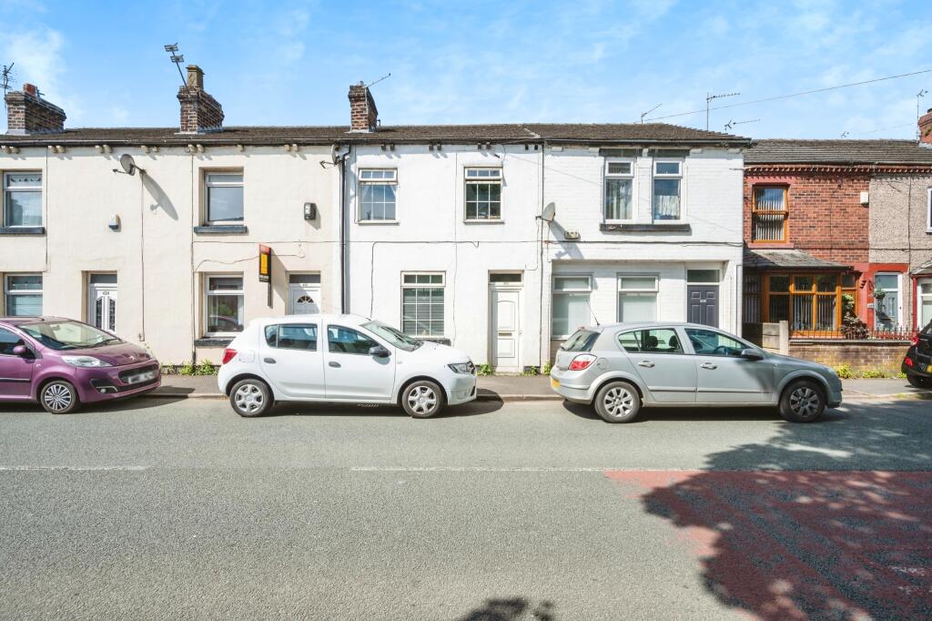
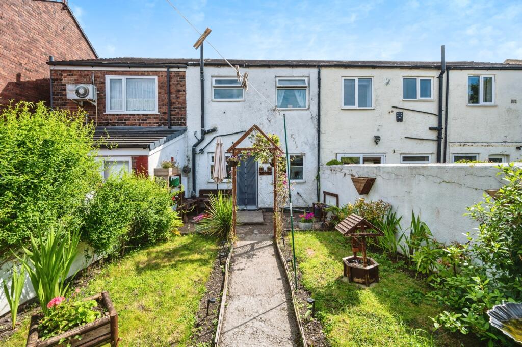
420 WARGRAVE ROAD
NEWTON-LE-WILLOWS, NEWTON-LE-WILLOWS, MERSEYSIDE WA12 8RT
£125,000
Property details
Tenure
FREEHOLD
Floor area
75 m²
Council tax band
TBC
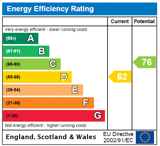
EPC rating
C
Year built
England and Wales: 1930-1949
Last sold
£31,000 Oct 2001
Price per m²
£1,667/m²
Local average
£161,661 (-22.7%)
Deprivation
Decile 5 (13,863 of 33,755)
Street crime
146 incidents within 1 mile (Mar 2026)
Key features
- Freehold
- Mid Terrace
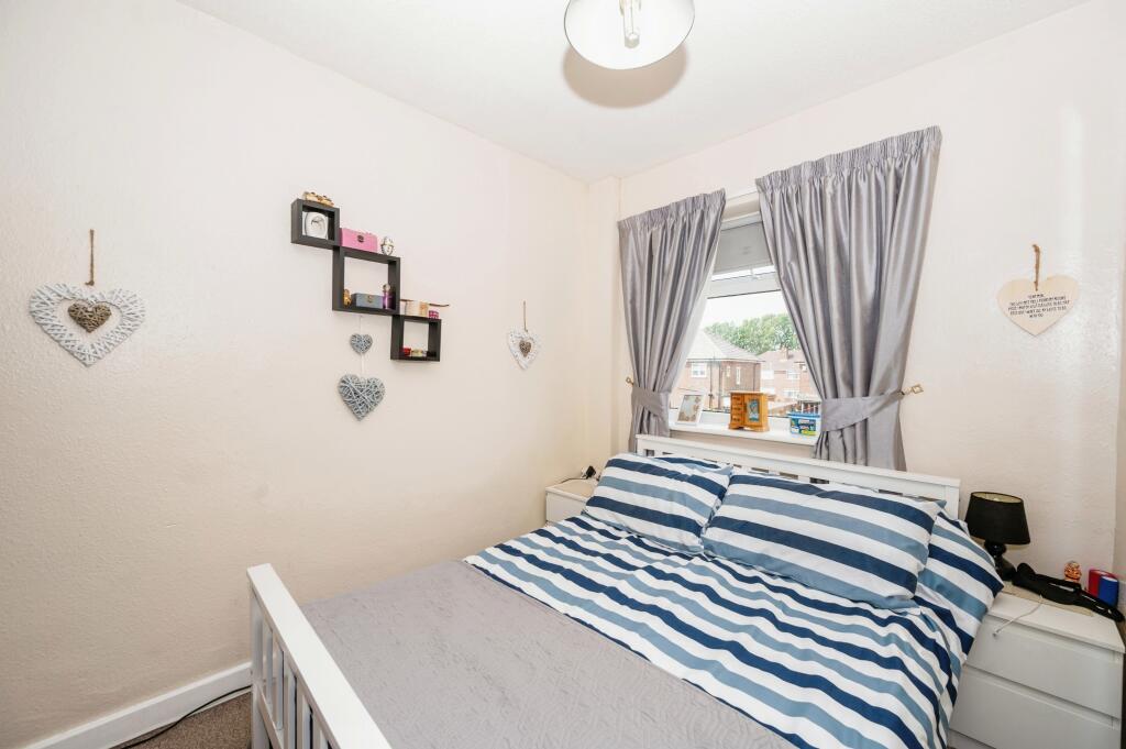
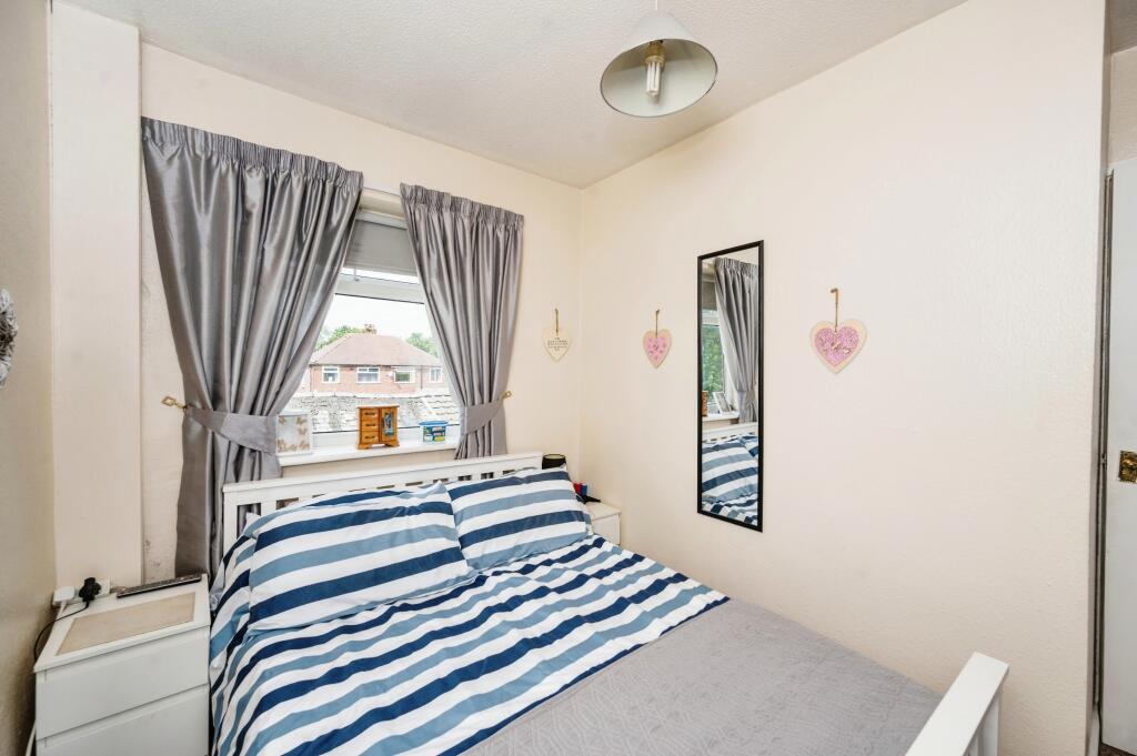
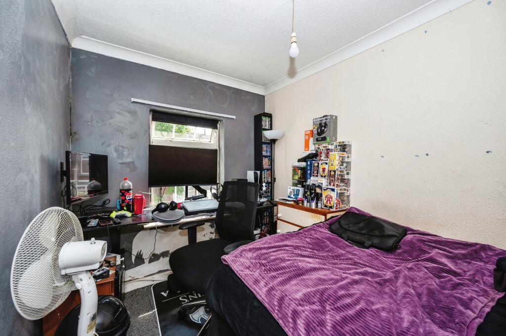
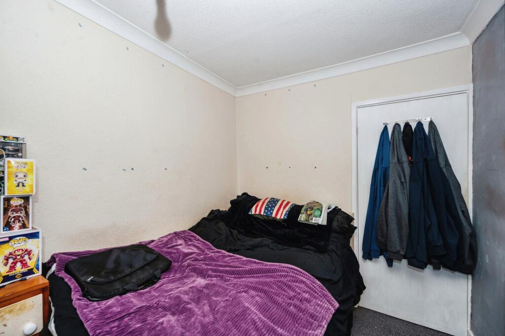
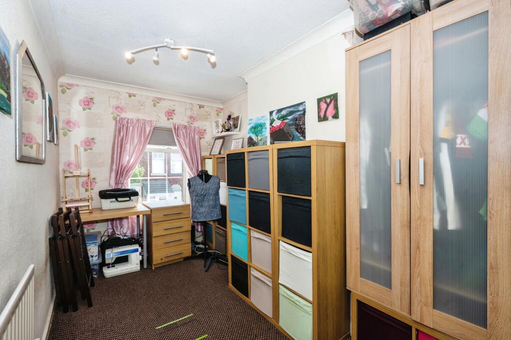
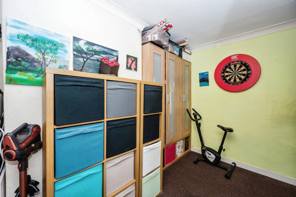
- Three bedroom
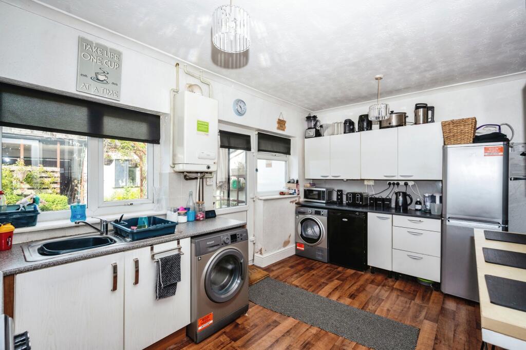
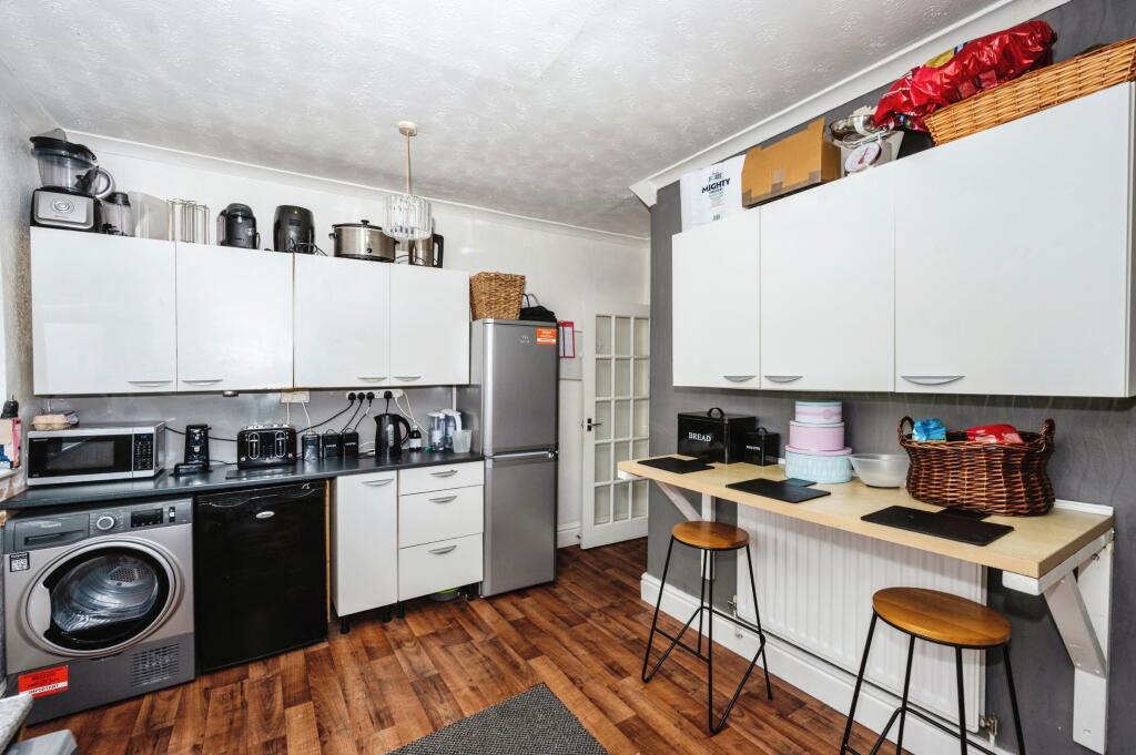
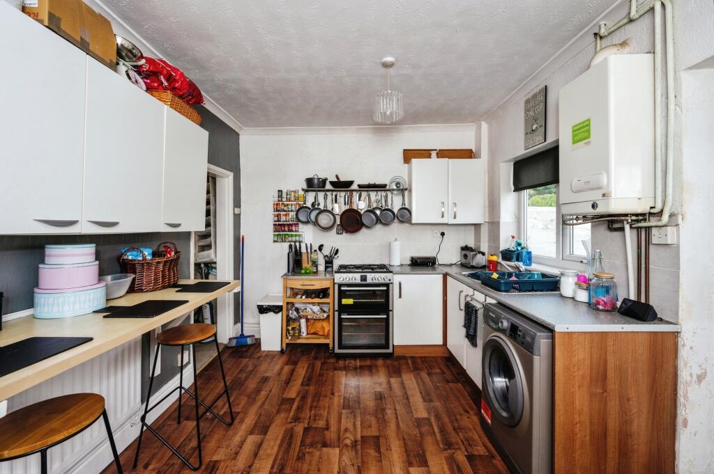
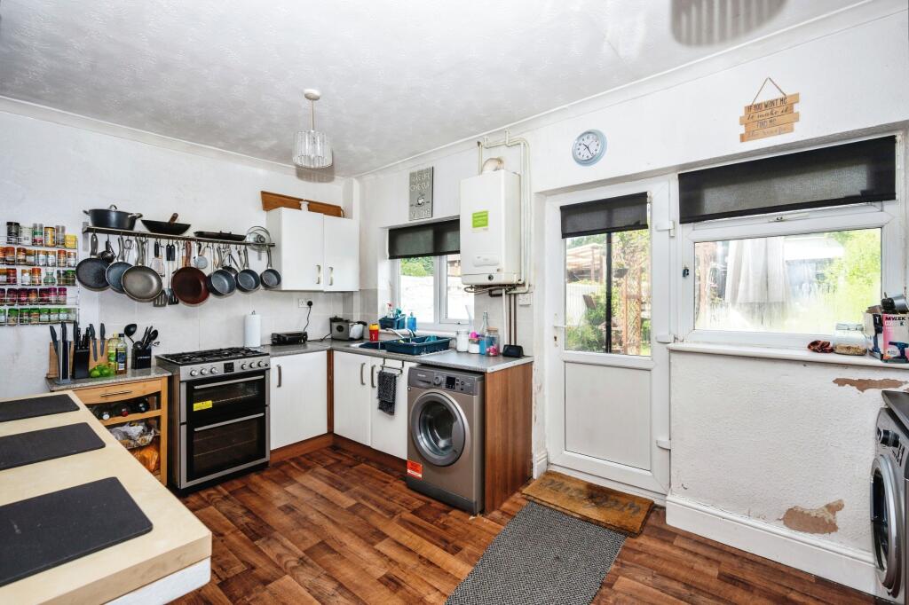
- Large kitchen
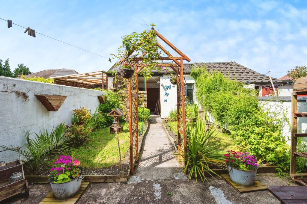
- Garden
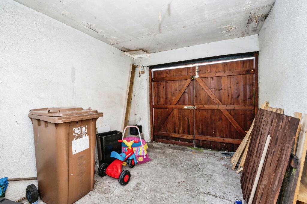
- Garage
- EPC
Additional details
- Parking
- Yes
- Garden
- Yes
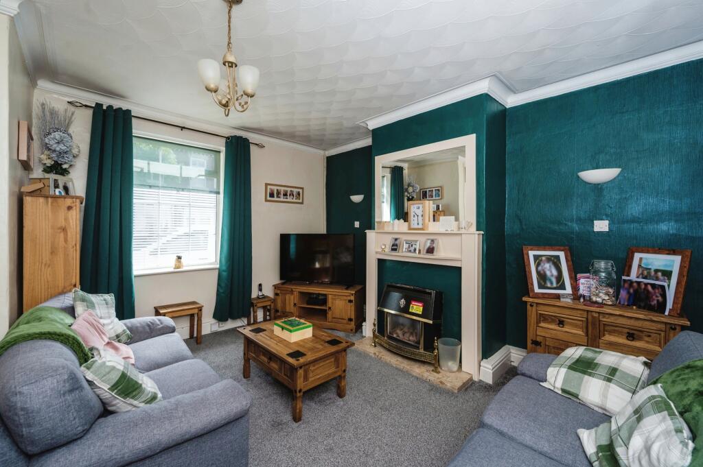
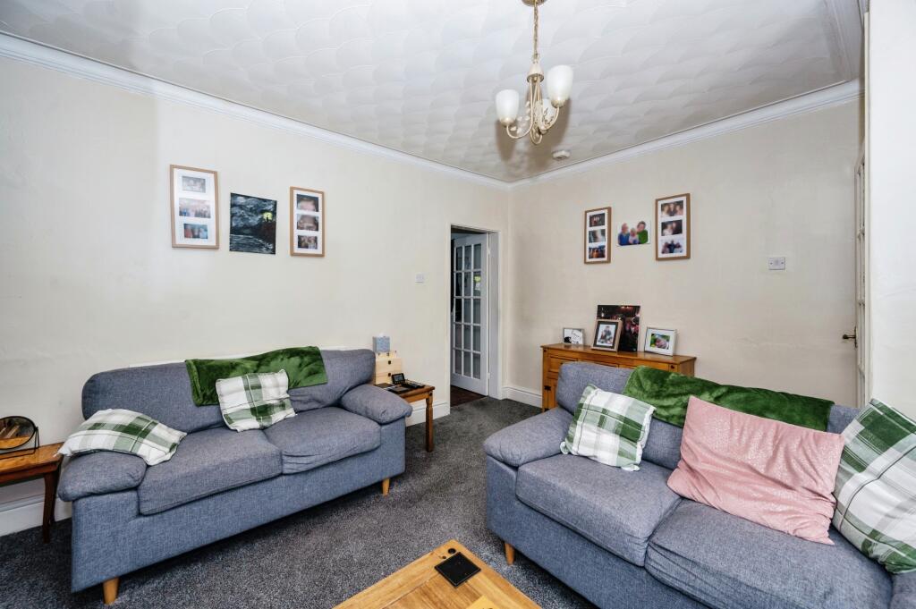
Description
Listed by
Newton-le-Willows
Countrywide UK Sales - Connells
Reference: 149502458
EPC Rating & Upgrade Cost
Current rating: C
Potential rating: B
Inspection date: 30/01/2025
Current heating cost: £618/year
Potential heating cost: £529/year
Est. upgrade cost to C: £10,725
Recommendations
- Increase loft insulation to 270 mm (£100 - £350)
- Cavity wall insulation (£500 - £1,500)
- Solar water heating (£4,000 - £6,000)
- Solar photovoltaic panels, 2.5 kWp (£3,500 - £5,500)
Flood risk
Zone: 1
Risk: Low
Job (default Low)
Floorplans
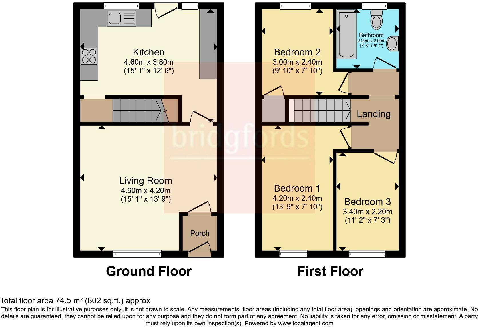
FLOOR-PLAN
EPC Graphs
EPC Rating Graph
Price history
72% since 1996
| Event | Date | Price | % change |
|---|---|---|---|
| Sold | 01/10/2001 (24 years ago) | £31,000 | -11.4% |
| Sold | 03/05/2001 (25 years ago) | £35,000 | +16.7% |
| Sold | 27/02/1997 (29 years ago) | £29,995 | +66.6% |
| Sold | 17/12/1996 (29 years ago) | £18,000 | — |
Source: HM Land Registry Price Paid Data. Crown copyright.
Sold Comparables
Same street and nearby sales within 0.25 miles (last 5 years). Data from Land Registry Price Paid.
| Address | Price | Date | Type |
|---|---|---|---|
| 95 BRADLEGH ROAD, NEWTON-LE-WILLOWS, ST HELENS, MERSEYSIDE, WA12 8QT | £168,000 | 17/12/2025 | Terraced |
| 2 MALDEN ROAD, NEWTON-LE-WILLOWS, ST HELENS, MERSEYSIDE, WA12 8AA | £240,000 | 25/07/2025 | Terraced |
| Same street 398 WARGRAVE ROAD, NEWTON-LE-WILLOWS, ST HELENS, MERSEYSIDE, WA12 8RT | £145,000 | 17/10/2024 | Terraced |
| 85 BRADLEGH ROAD, NEWTON-LE-WILLOWS, ST HELENS, MERSEYSIDE, WA12 8QT | £147,000 | 27/10/2023 | Terraced |
| 421 WARGRAVE ROAD, NEWTON-LE-WILLOWS, ST HELENS, MERSEYSIDE, WA12 8RS | £77,000 | 18/10/2023 | Terraced |
| 18 CAUNCE AVENUE, NEWTON-LE-WILLOWS, ST HELENS, MERSEYSIDE, WA12 8QU | £124,000 | 22/09/2023 | Terraced |
| 56 DREWRY GROVE, NEWTON-LE-WILLOWS, ST HELENS, MERSEYSIDE, WA12 8AW | £208,950 | 28/07/2023 | Terraced |
| 52 DREWRY GROVE, NEWTON-LE-WILLOWS, ST HELENS, MERSEYSIDE, WA12 8AW | £272,995 | 28/07/2023 | Terraced |
| 103 BRADLEGH ROAD, NEWTON-LE-WILLOWS, ST HELENS, MERSEYSIDE, WA12 8QT | £148,000 | 15/12/2022 | Terraced |
| 7 OLD HEY WALK, NEWTON-LE-WILLOWS, ST HELENS, MERSEYSIDE, WA12 8SN | £135,000 | 08/12/2022 | Terraced |
| 1 DAISY AVENUE, NEWTON-LE-WILLOWS, ST HELENS, MERSEYSIDE, WA12 8HD | £190,000 | 21/10/2022 | Terraced |
| 83 BRADLEGH ROAD, NEWTON-LE-WILLOWS, ST HELENS, MERSEYSIDE, WA12 8QT | £160,000 | 14/10/2022 | Terraced |
| 24 DREWRY GROVE, NEWTON-LE-WILLOWS, ST HELENS, MERSEYSIDE, WA12 8AW | £229,995 | 23/09/2022 | Terraced |
| 28 DREWRY GROVE, NEWTON-LE-WILLOWS, ST HELENS, MERSEYSIDE, WA12 8AW | £180,995 | 23/09/2022 | Terraced |
| 26 DREWRY GROVE, NEWTON-LE-WILLOWS, ST HELENS, MERSEYSIDE, WA12 8AW | £229,995 | 23/09/2022 | Terraced |
| 18 DREWRY GROVE, NEWTON-LE-WILLOWS, ST HELENS, MERSEYSIDE, WA12 8AW | £180,995 | 29/07/2022 | Terraced |
| 16 DREWRY GROVE, NEWTON-LE-WILLOWS, ST HELENS, MERSEYSIDE, WA12 8AW | £176,995 | 29/07/2022 | Terraced |
| 14 DREWRY GROVE, NEWTON-LE-WILLOWS, ST HELENS, MERSEYSIDE, WA12 8AW | £180,995 | 28/07/2022 | Terraced |
| 362 WARGRAVE ROAD, NEWTON-LE-WILLOWS, ST HELENS, MERSEYSIDE, WA12 8RP | £165,000 | 30/05/2022 | Terraced |
| 121 BRADLEGH ROAD, NEWTON-LE-WILLOWS, ST HELENS, MERSEYSIDE, WA12 8SH | £112,500 | 12/05/2022 | Terraced |
| 34 PARK ROAD SOUTH, NEWTON-LE-WILLOWS, ST HELENS, MERSEYSIDE, WA12 8EX | £140,000 | 11/04/2022 | Terraced |
| Same street 436 WARGRAVE ROAD, NEWTON-LE-WILLOWS, ST HELENS, MERSEYSIDE, WA12 8RT | £120,000 | 25/03/2022 | Terraced |
| Same street 406 WARGRAVE ROAD, NEWTON-LE-WILLOWS, ST HELENS, MERSEYSIDE, WA12 8RT | £182,500 | 27/01/2022 | Terraced |
Street average: £149,167 (3 sales)
Area average: £173,421 (20 sales)
Capital growth trend
Land Registry outcode average: last 12 months vs 5y and 10y ago (from sold prices).
House Price Index (HM Land Registry — official index, not sold-price averages): St Helens. Series: Terraced. As of February 2026.
Rental Range
Estimated market rent for St. Helens. Low = conservative, Realistic = average, Optimistic = best case.
Based on Local Authority from postcode lookup → St. Helens.
LHA (30th percentile) floor for Kendal: £773/mo (Apr 2025 – Mar 2026)
Location
Nearby
Nearest stations, universities and amenities (distance from property).
| Type | Name | Distance |
|---|---|---|
| Bus stop | WARGRAVE RD/WARGRAVE SCH | 0.0 miles |
| Shop | The Art of Barber | 0.3 miles |
| Shop | Thrifty's | 0.3 miles |
| Train station | Earlestown | 0.6 miles |
| Train station | Newton-le-Willows | 0.9 miles |
| Hospital | St Helens Hospital | 3.7 miles |
| University | University of Chester - Warrington Campus | 3.9 miles |
| Hospital | Leigh Health Centre | 6.4 miles |
| University | University of Bolton | 11.8 miles |
Street-level crime
| Category | Count |
|---|---|
| Violence and sexual offences | 57 |
| Anti-social behaviour | 20 |
| Shoplifting | 16 |
| Criminal damage and arson | 15 |
| Public order | 14 |
| Other theft | 8 |
| Drugs | 6 |
| Other crime | 5 |
| Vehicle crime | 3 |
| Burglary | 1 |
| Robbery | 1 |
| Total incidents | 146 |
Within 1 mile during Mar 2026. Source: data.police.uk (England & Wales).
Schools nearby
Nearest open schools with Ofsted ratings (England). Closed schools are not shown. Data from Get Information about Schools and Ofsted.
| Name | Type | Distance | Ofsted |
|---|---|---|---|
| Wargrave House School | Other | 0.1 miles | Good — 30 Jun 2022 |
| Ascent Autism Specialist College | Other | 0.1 miles | — (No rating) |
| Wargrave CofE Primary School | Primary | 0.2 miles | — (Inspected (no overall grade)) |
| Newton-le-Willows Primary School | Primary | 0.7 miles | Good — 16 Jun 2016 |
| St Mary's Catholic Junior Academy | Primary | 0.7 miles | Requires improvement — 23 Jan 2023 |
Rental Comparables
Rental listings exist nearby, but none matched the 3-bedroom estimate from EPC for this property.
Rent-driven metrics
Based on Area rent estimate.
- This street — Gross yield for this street only (Land Registry sales + rental comparables, same postcode + street).
- Rent ratio — Monthly rent ÷ purchase price (1% rule). 1%+ = strong, 0.8–1% = okay, <0.8% = weak for cashflow.
- Max investor price — Rent ÷ 0.8%; the price at which rent would be 0.8% of price (Stoke-style target).
- Target investor price — Rent ÷ 1%; the price at which rent would be 1% of price (strong cashflow band).
- Gross yield — Annual rent as % of purchase price (no costs).