47 WALLIS AVENUE
BEDFORD, SHORTSTOWN, BEDFORD MK42 0ZS
£1,250 pcm
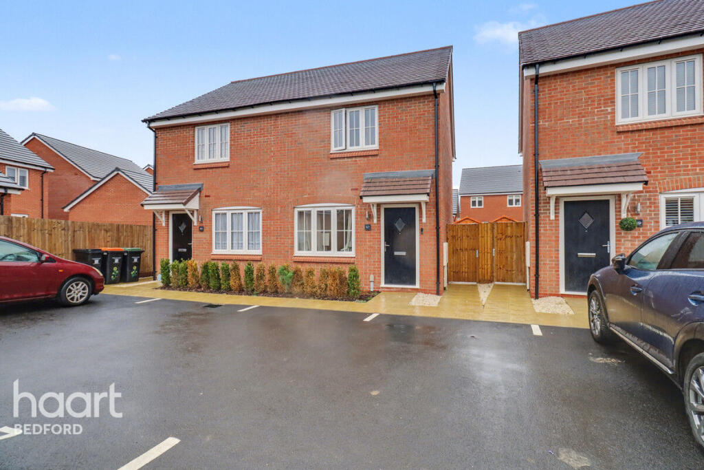
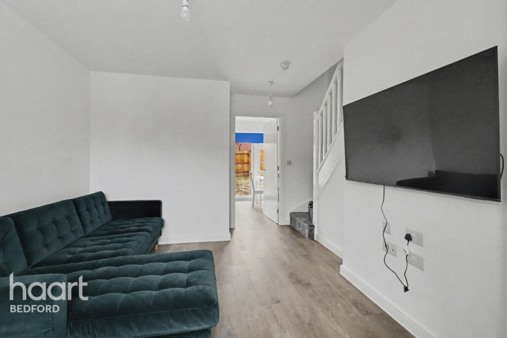
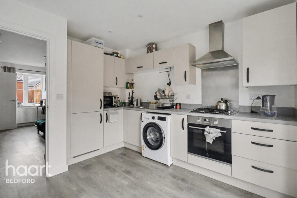
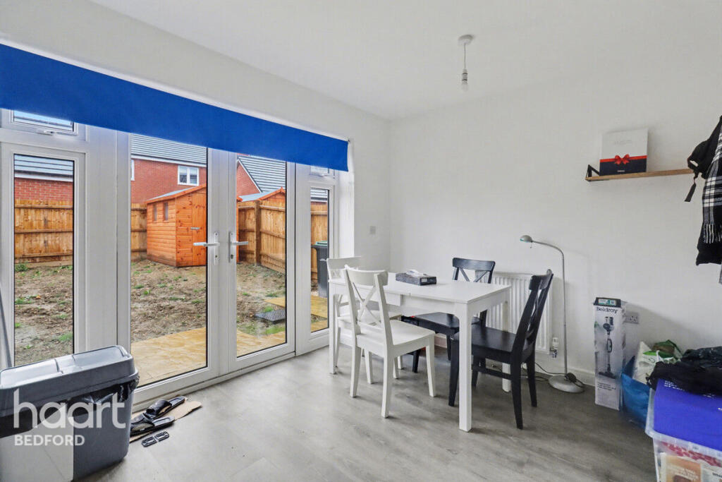
Photo 1 Photo 2 Photo 3 Photo 4 Photo 5 Photo 6 Photo 7 Photo 8 Photo 9 Photo 10 Photo 11
/ 11
Property details
Floor area
62 m²
Deprivation
Decile 4 (13,220 of 33,755)
Street crime
42 incidents within 1 mile (Mar 2026)
Key features
- 1 Weeks Rent Free
- Available Jan 2026
- x2 allocated parking
- Shortstown
Additional details
- Parking
- Yes
- Garden
- Yes
Description
Shortstown is a popular and well-connected area just south of Bedford, offering a welcoming community feel with convenient access to local shops, parks, schools, and everyday amenities. Its close proximity to Bedford town centre provides easy links to transport services, including mainline trains to London, while nearby road routes such as the A421 make commuting simple. With a blend of modern developments and open green spaces, Shortstown is a sought-after location for families and professionals alike.
If you move in by the 15th of January 2026, then you will have 1 week off your first months rent!
Listed by
Bedford
Spicerhaart Lettings
Reference: 170523728
EPC Rating & Upgrade Cost
Fetching EPC data… Refresh this page in a moment.
Flood risk
Zone: 1
Risk: Low
Job (default Low)
EPC Graphs
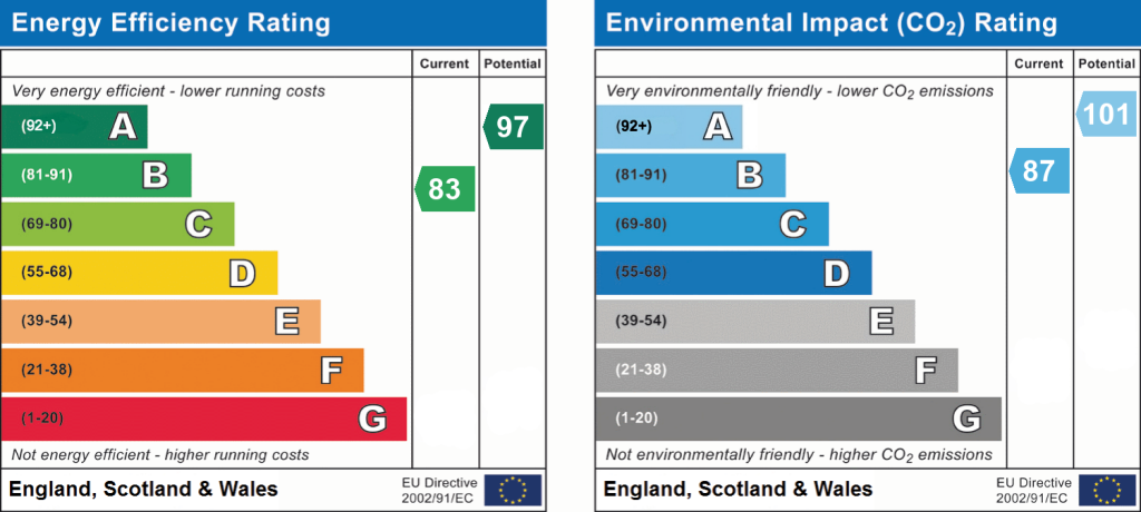
EPC 1
Rental Range
Estimated market rent for Bedford. Low = conservative, Realistic = average, Optimistic = best case.
Based on Local Authority from postcode lookup → Bedford.
LHA (30th percentile) floor for Bedford: £823/mo (Apr 2025 – Mar 2026)
Location
Nearby
Nearest stations, universities and amenities (distance from property).
| Type | Name | Distance |
|---|---|---|
| Bus stop | Unknown | 0.2 miles |
| Shop | Tesco Express | 0.6 miles |
| Shop | Morrisons Daily | 0.7 miles |
| University | University of Bedfordshire Polhill Campus | 2.4 miles |
| Train station | Bedford St Johns | 2.5 miles |
| Hospital | Bedford Hospital SDEC - Same Day Emergency Care | 2.6 miles |
| Hospital | Bedford Hospital South Wing | 2.6 miles |
| Train station | Bedford | 3.2 miles |
| University | University of Bedfordshire | 6.9 miles |
Street-level crime
| Category | Count |
|---|---|
| Violence and sexual offences | 19 |
| Anti-social behaviour | 9 |
| Other theft | 5 |
| Public order | 4 |
| Vehicle crime | 2 |
| Burglary | 1 |
| Drugs | 1 |
| Shoplifting | 1 |
| Total incidents | 42 |
Within 1 mile during Mar 2026. Source: data.police.uk (England & Wales).
Schools nearby
Nearest open schools with Ofsted ratings (England). Closed schools are not shown. Data from Get Information about Schools and Ofsted.
| Name | Type | Distance | Ofsted |
|---|---|---|---|
| Shortstown Primary School | Primary | 0.6 miles | Good — 21 Nov 2021 |
| Cotton End Forest School | Primary | 1.1 miles | Requires improvement — 19 Mar 2023 |
| Sheerhatch Primary School | Primary | 1.5 miles | Good — 24 Jan 2022 |
| Bedford Academy | Secondary | 1.6 miles | Good — 16 May 2023 |
| King's Oak Primary School | Primary | 1.6 miles | Good — 2 Mar 2022 |
Rental Comparables
Residential lets from OpenRent and Rightmove for the area (same bedroom count). Use to validate rent estimates. Student lets are excluded.
| Title | Rent | Beds | Distance | As seen on |
|---|---|---|---|---|
| 2 Bed Flat, Bedford, MK42 | £1,060/mo | 2 | 0.66 miles | OpenRent |
Average rent: £1,060/mo (1 listing)