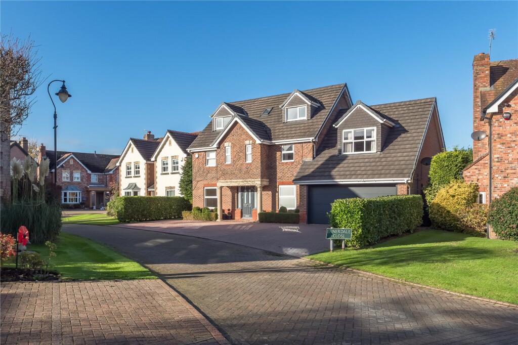
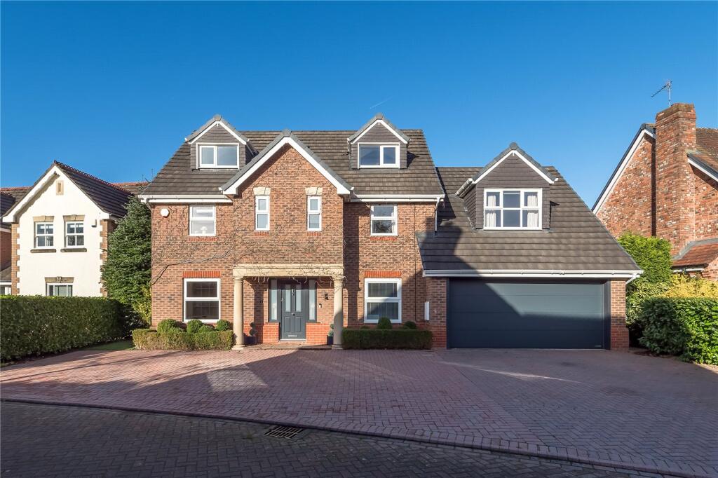
2 ENNERDALE CLOSE
ALDERLEY EDGE, CHESHIRE EAST SK9 7WF
Property details
Tenure
FREEHOLD
Floor area
277 m²
Council tax band
G
Last sold
£640,000 May 2015
Local average
£959,785 (+4.2%)
Deprivation
Decile 9 (28,188 of 33,755)
Street crime
2 incidents within 1 mile (Apr 2026)
Key features
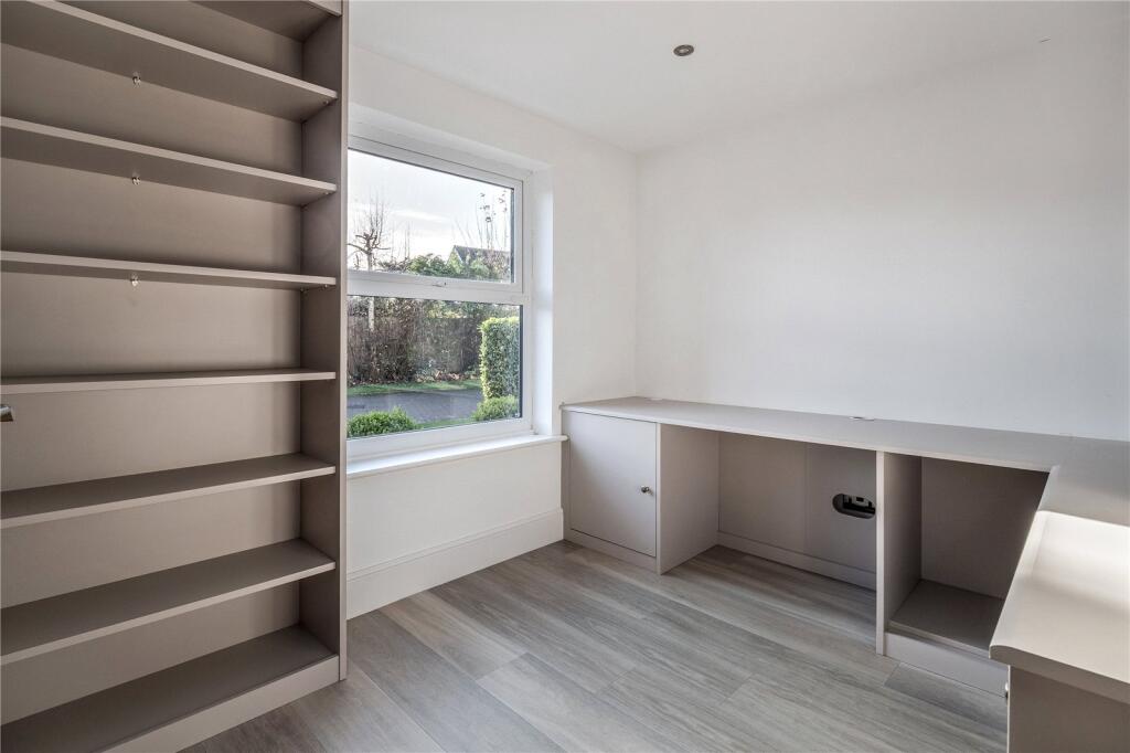
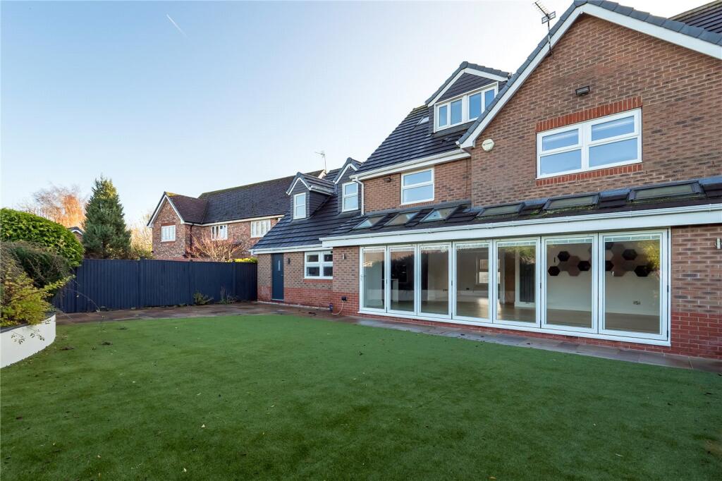
- IN ALL APPROX. 2,865 SQ FT
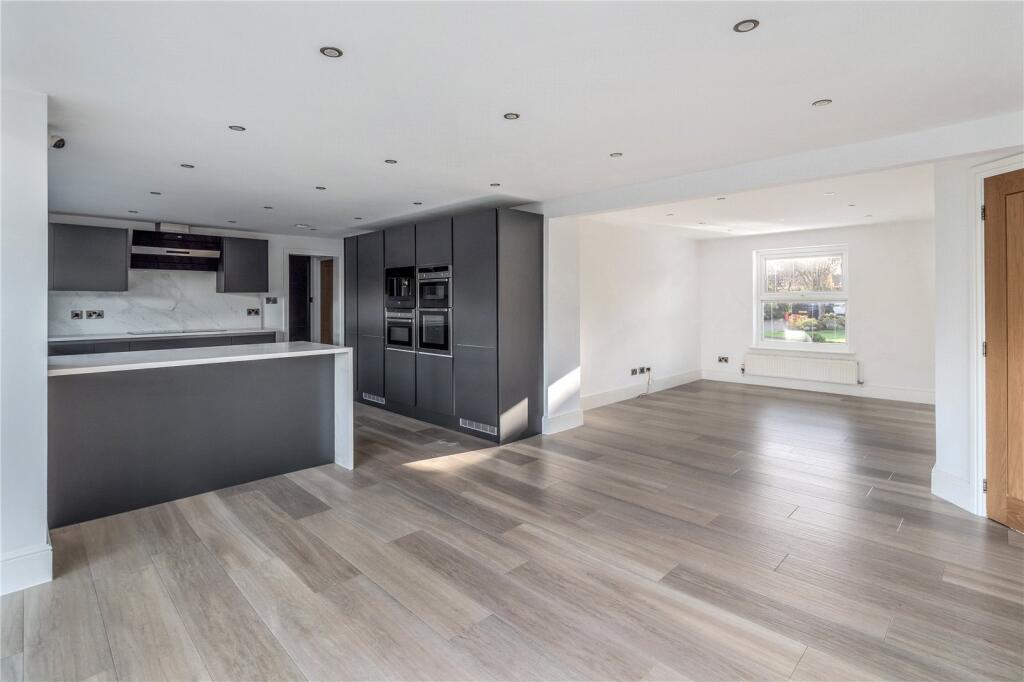
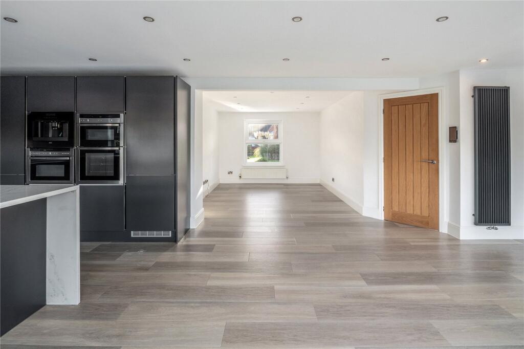
- CONSIDERED SALE WITH CONTEMPORARY DESIGN
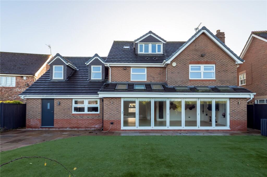
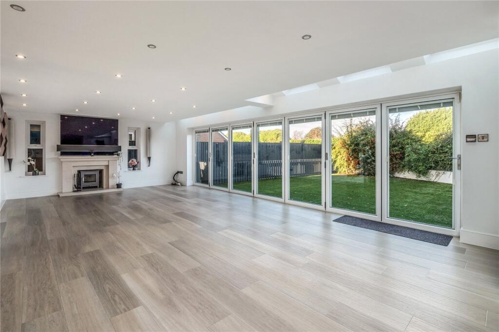
- ZONED KITCHEN/DINING/LIVING AREAS
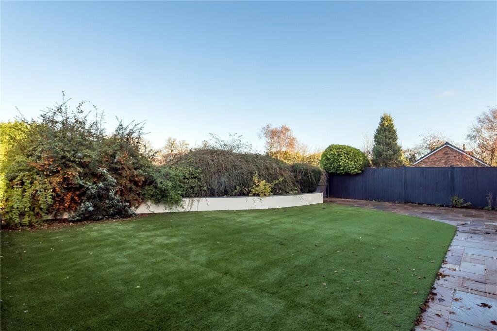
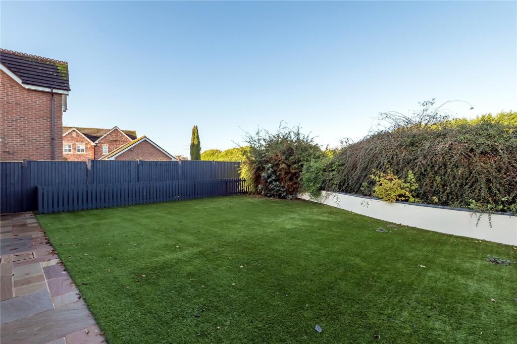
- OPEN VISTAS OVER FIELDS TO THE REAR
- LOW MAINTENANCE GARDEN
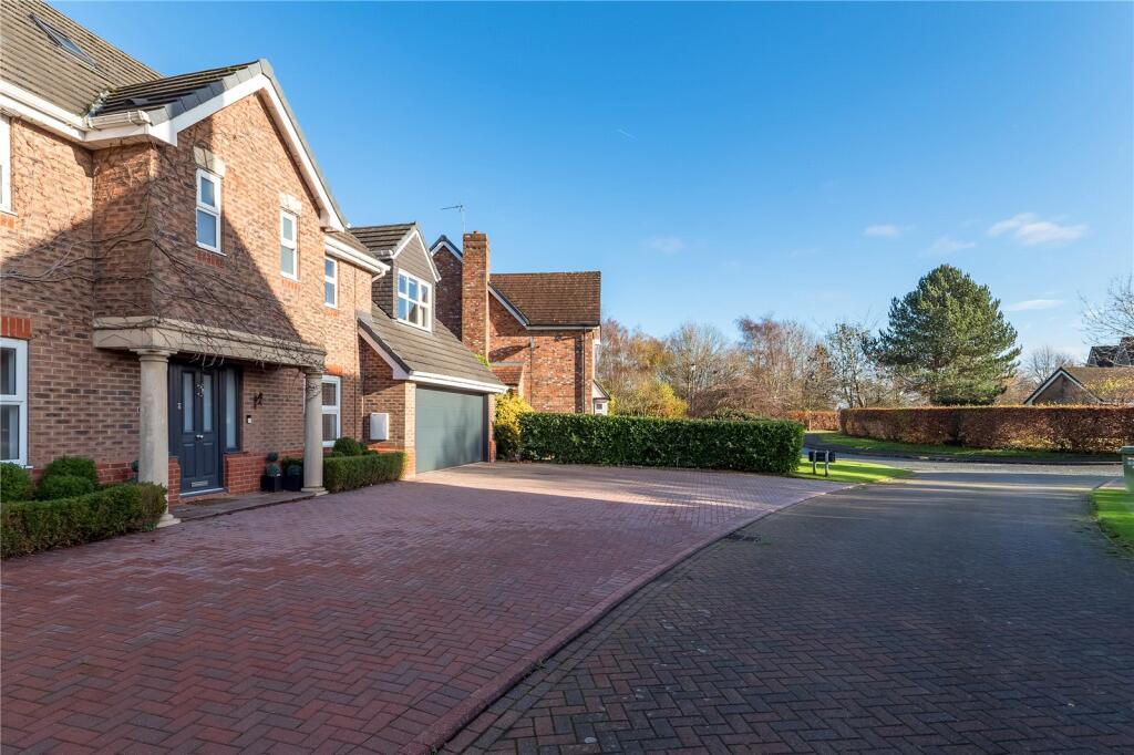
- WITHIN EASY REACH OF ALDERLEY EDGE VILLAGE
Additional details
- Electricity
- Mains supply
- Water
- Mains supply
- Sewerage
- Mains supply
- Heating
- Gas
- Parking
- Garage, Driveway
- Garden
- Yes
- Listed property
- No
- Restrictions
- Yes
- Required access
- No
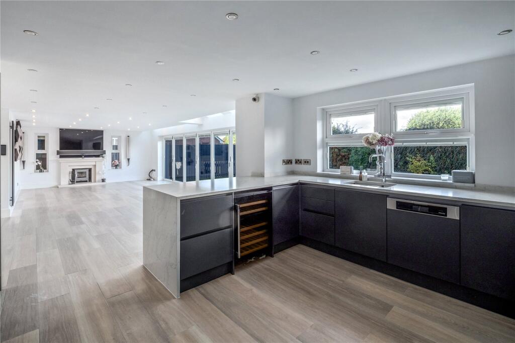
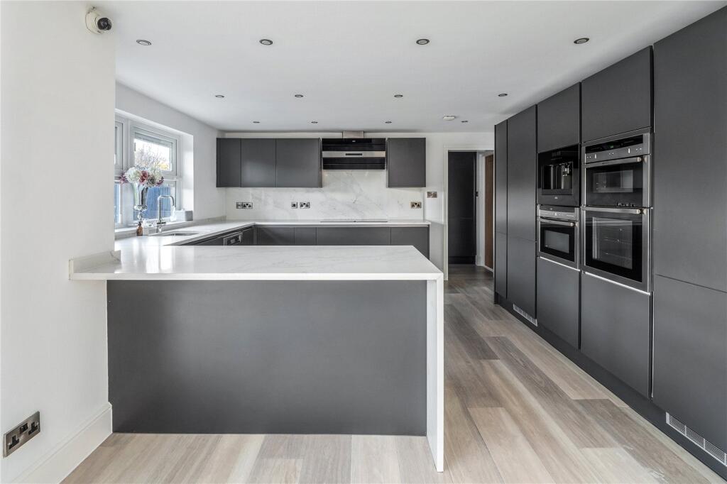
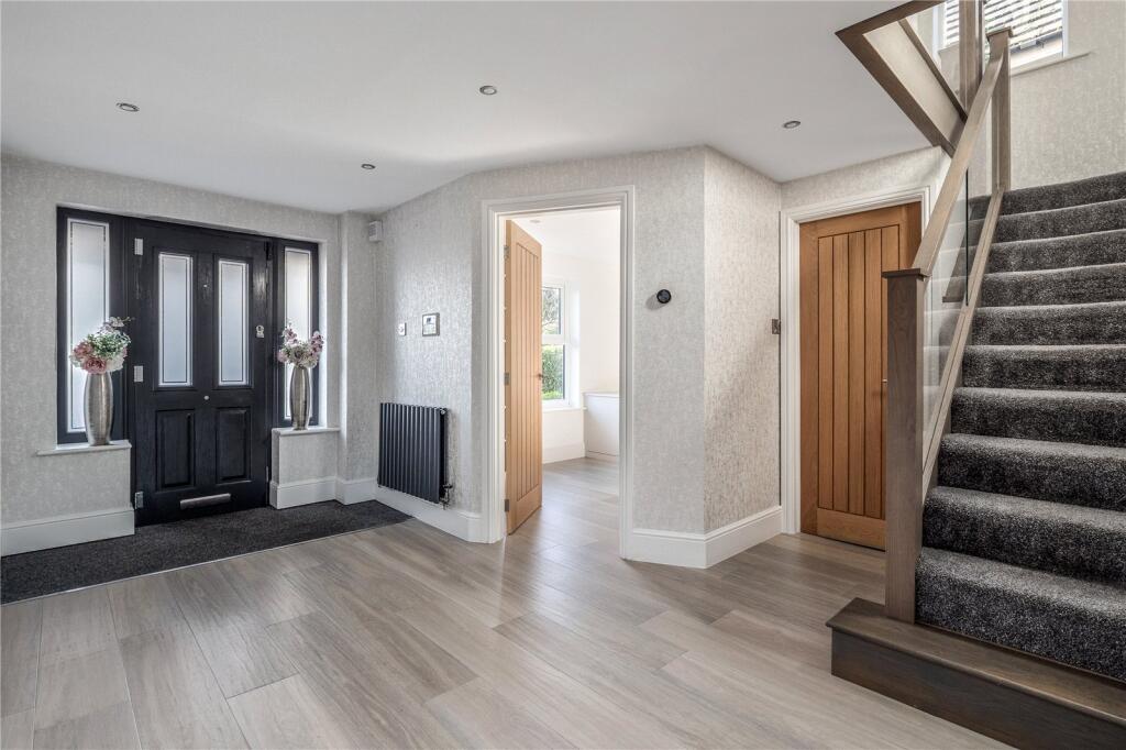
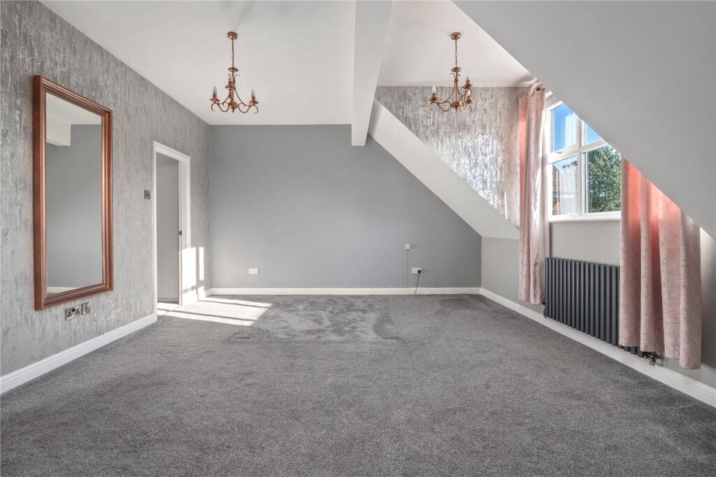
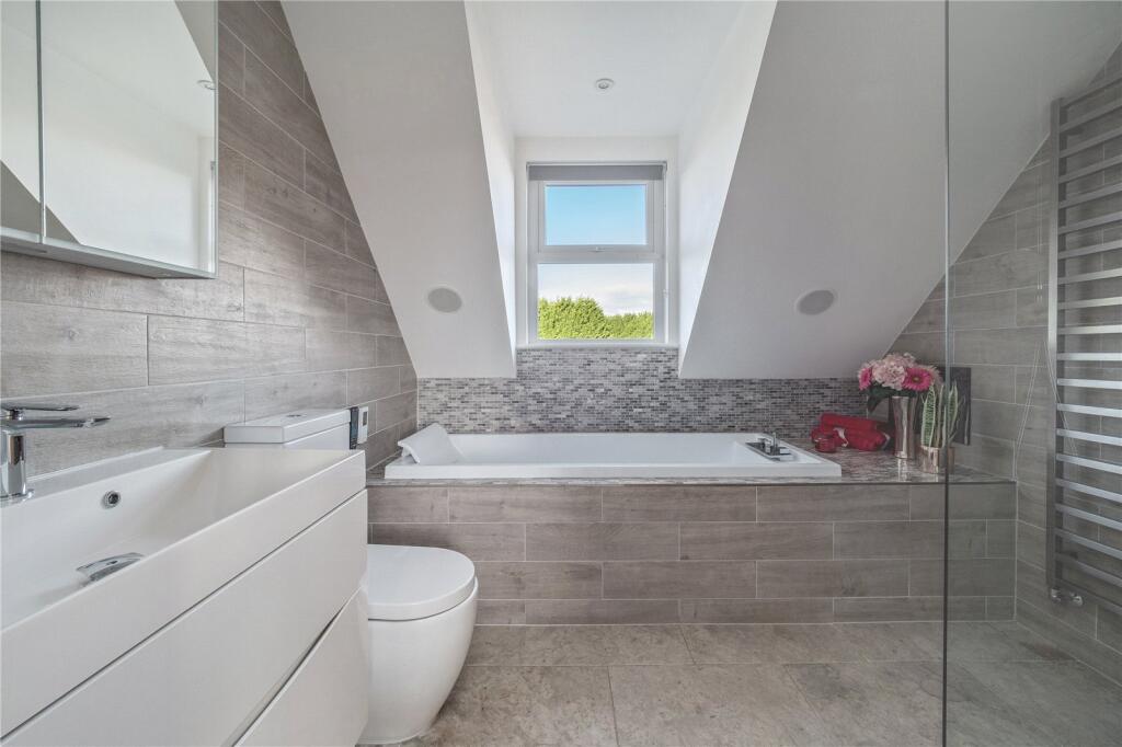
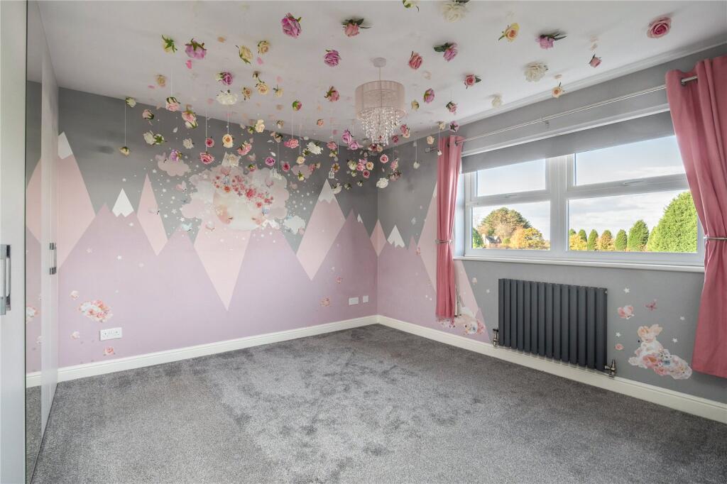
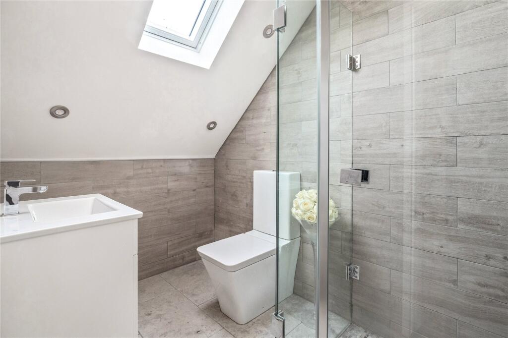
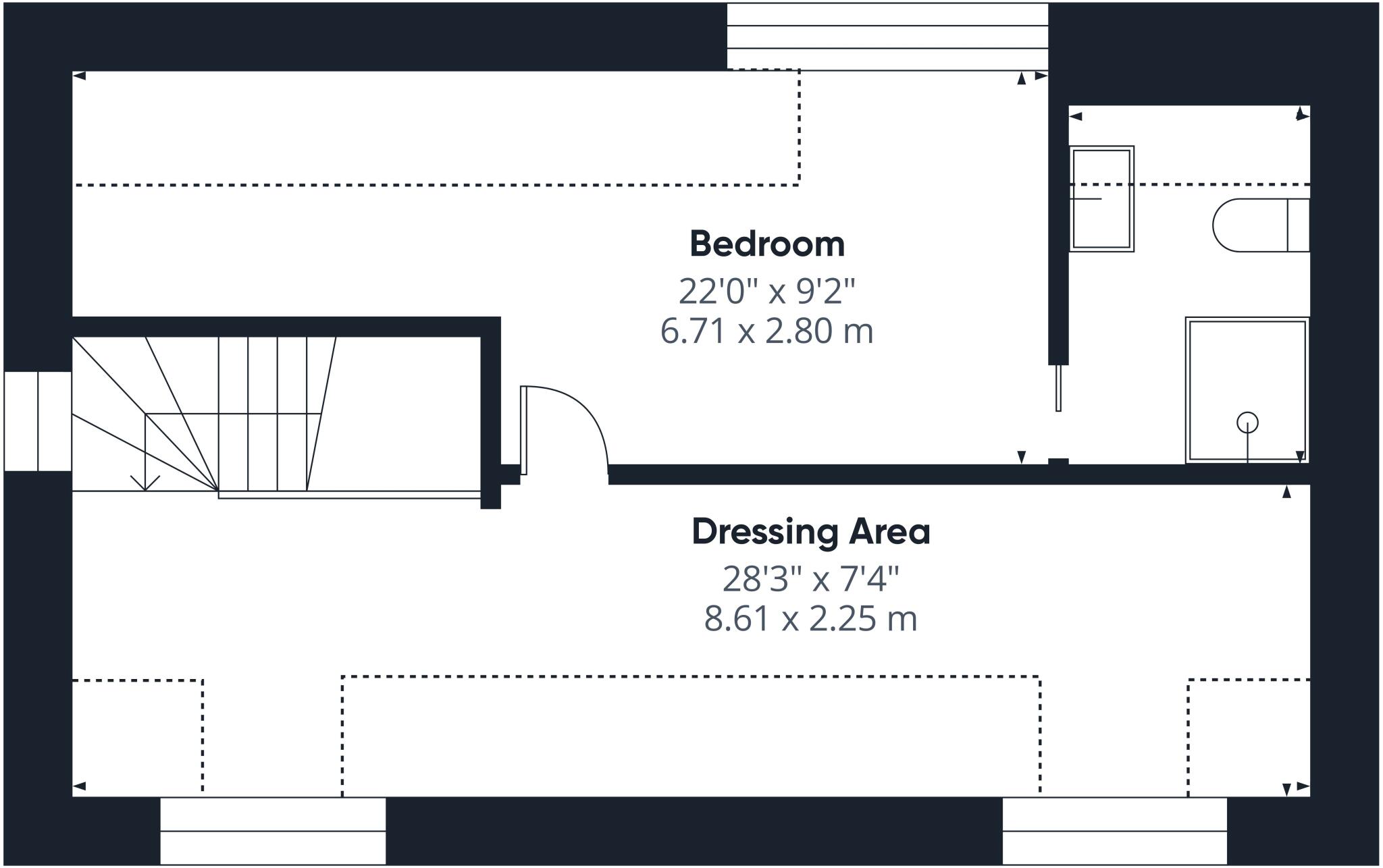
Description
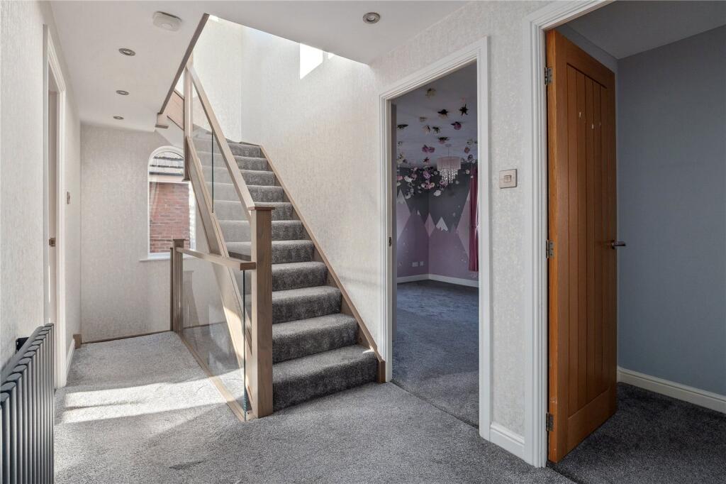
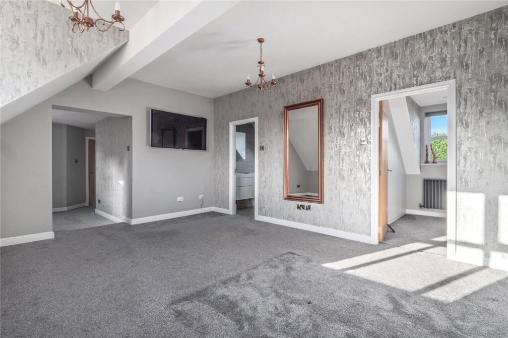
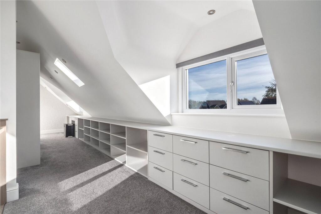
- Five bedrooms
- Principal bedroom with dressing room and en suite
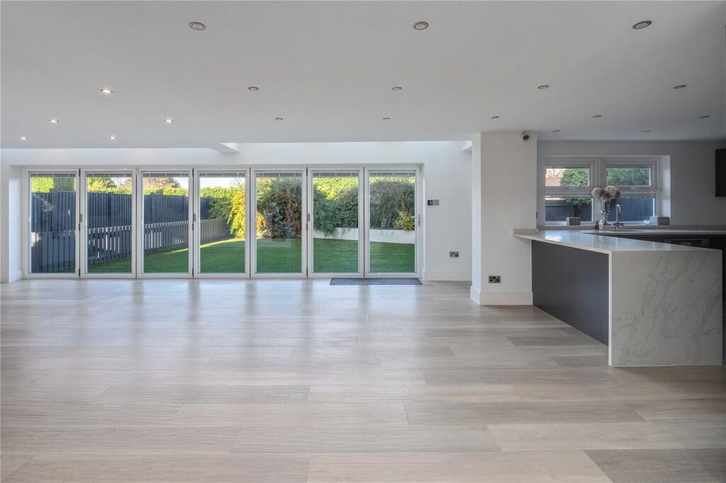
- Open-plan kitchen/dining
- Chesney stove
- Bi-fold doors
- Integral double garage
- Semi-rural location
Listed by
Alderley Edge
Jackson-Stops & Staff
Reference: 169531250
EPC Rating & Upgrade Cost
Fetching EPC data… Refresh this page in a moment.
Flood risk
Zone: 1
Risk: Low
Job (default Low)
Floorplans
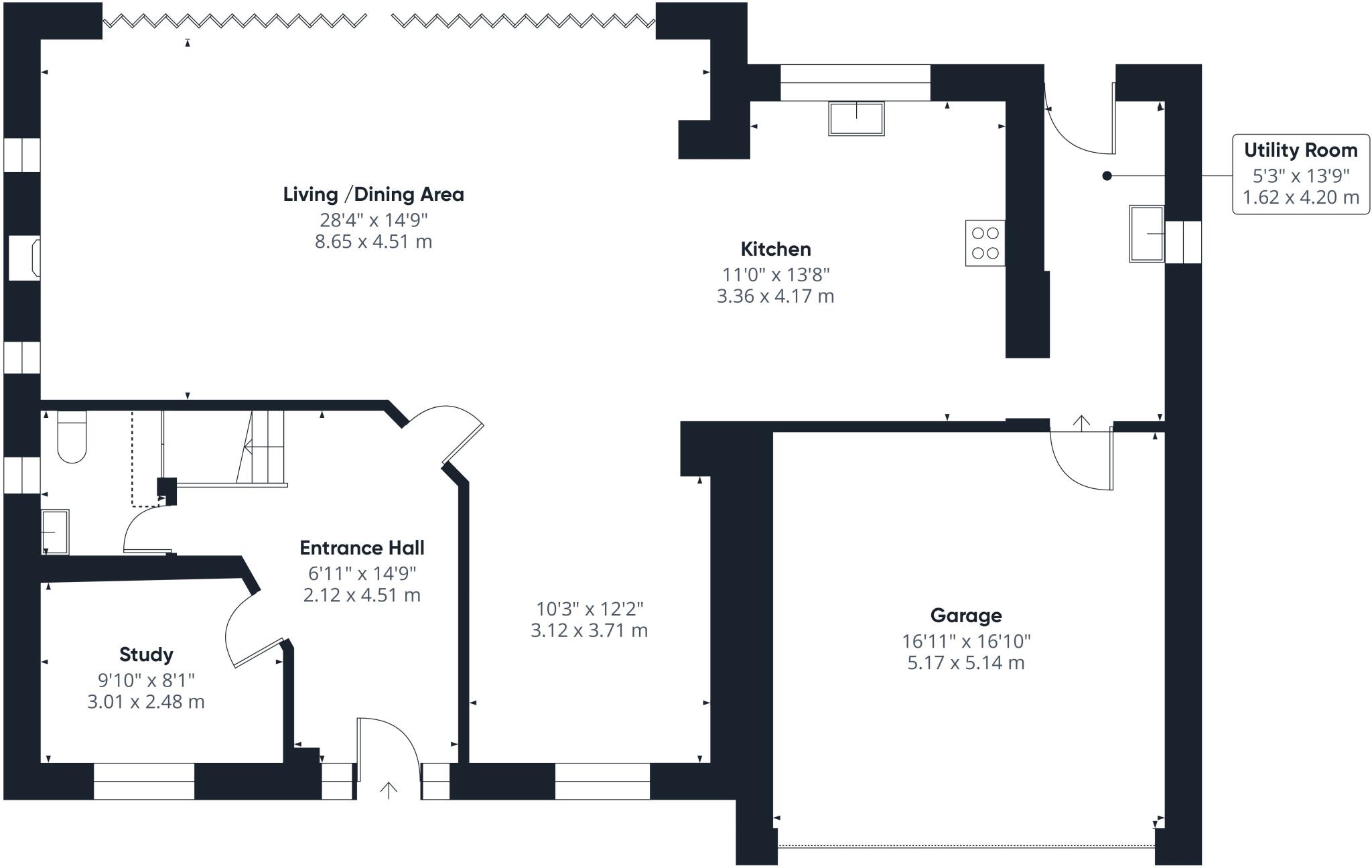
Ground Floor
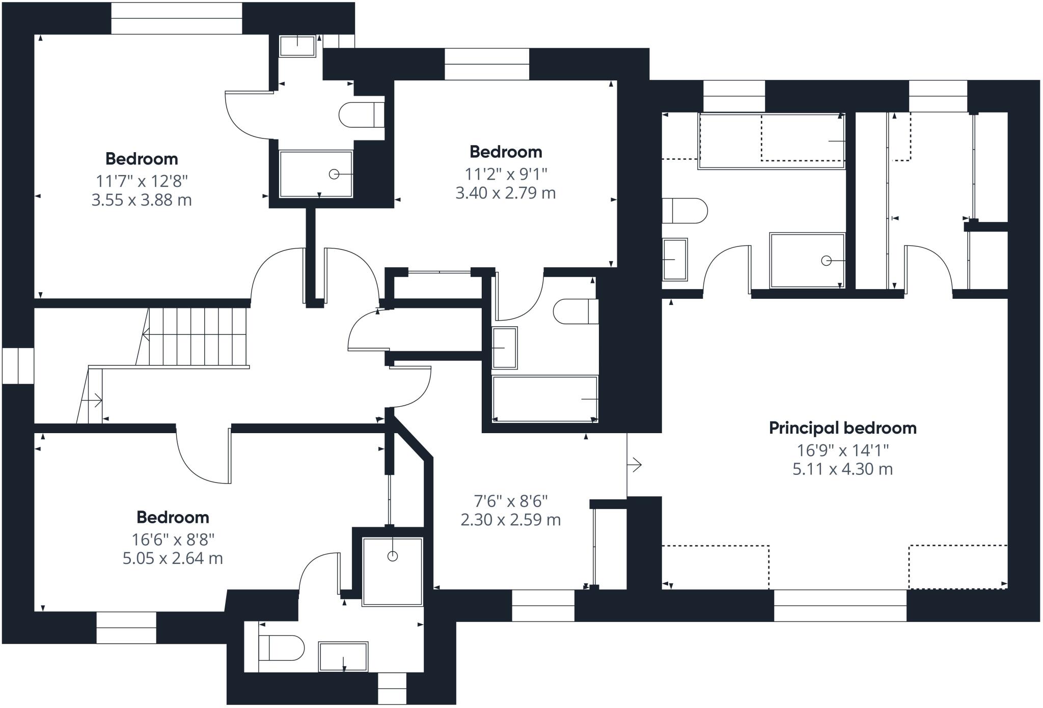
First Floor
Second Floor
EPC Graphs
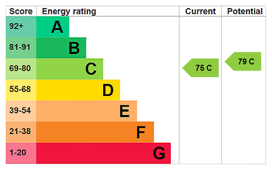
EPC Rating Graph
FENSA Certificates
This property has 1 FENSA certificate(s) on record, indicating window/door installations by FENSA-approved installers.
FENSA Certificate #12549530
Property Details
Street: 2 Ennerdale Close
Town: ALDERLEY EDGE
Postcode: SK9 7WF
Installation Details
Items: 20 windows and 2 doors
Certificate Issued: 18/09/2017
Work Completed: 31/07/2017
This certificate data was retrieved from FENSA's database
What is FENSA? FENSA (Fenestration Self-Assessment Scheme) is a government-authorised scheme that monitors building regulation compliance for replacement windows and doors. Certificates indicate that work was completed by FENSA-approved installers.
Price history
| Event | Date | Price | % change |
|---|---|---|---|
| Listed for sale | — | £999,999 | +56.2% |
| Sold | 11/05/2015 (11 years ago) | £640,000 | — |
Source: HM Land Registry Price Paid Data. Crown copyright.
Sold Comparables
Same street and nearby sales within 0.25 miles (last 5 years). Data from Land Registry Price Paid.
| Address | Price | Date | Type |
|---|---|---|---|
| 1 ULLSWATER DRIVE, ALDERLEY EDGE, CHESHIRE EAST, SK9 7WB | £930,000 | 09/11/2022 | Detached |
Area average: £930,000 (1 sale)
Capital growth trend
Land Registry outcode average: last 12 months vs 5y and 10y ago (from sold prices).
House Price Index (HM Land Registry — official index, not sold-price averages): Cheshire East. Series: Detached. As of March 2026.
Rental Range
Estimated market rent for Cheshire East. Low = conservative, Realistic = average, Optimistic = best case.
Based on Local Authority from postcode lookup → Cheshire East.
LHA (30th percentile) floor for West Pennine: £760/mo (Apr 2025 – Mar 2026)
Location
Nearby
Nearest stations, universities and amenities (distance from property).
| Type | Name | Distance |
|---|---|---|
| Bus stop | Great Warford, Ancoats Lane / Buttermere Drive | 0.1 miles |
| Bus stop | Great Warford, Ancoats Lane / Noonsun Farm | 0.6 miles |
| Hospital | Soss Moss Hospital | 1.0 miles |
| Shop | The Village Salon | 1.5 miles |
| Shop | A. J. Boon traditional family butcher | 1.5 miles |
| Train station | Chelford | 1.6 miles |
| Train station | Alderley Edge | 2.3 miles |
| Hospital | The Wilmslow Hospital | 3.1 miles |
| University | Fallowfield Reception and Richmond Amenities Building | 10.9 miles |
| University | University of Manchester Fallowfield Campus | 10.9 miles |
Street-level crime
| Category | Count |
|---|---|
| Burglary | 1 |
| Violence and sexual offences | 1 |
| Total incidents | 2 |
Within 1 mile during Apr 2026. Source: data.police.uk (England & Wales).
Schools nearby
Nearest open schools with Ofsted ratings (England). Closed schools are not shown. Data from Get Information about Schools and Ofsted.
| Name | Type | Distance | Ofsted |
|---|---|---|---|
| David Lewis School | Other | 0.4 miles | Good — 12 Jan 2015 |
| The David Lewis Centre | Other | 0.4 miles | — (No rating) |
| Chelford CofE Primary School | Primary | 1.4 miles | Good — 30 Nov 2023 |
| Lindow Community Primary School | Primary | 1.9 miles | Good — 11 Mar 2014 |
| The Ryleys School | Other | 2.0 miles | — (No rating) |
Rental Comparables
Loading rental comparables for this postcode. Refresh in a few minutes.
Rent-driven metrics
Based on Area rent estimate.
- Rent ratio — Monthly rent ÷ purchase price (1% rule). 1%+ = strong, 0.8–1% = okay, <0.8% = weak for cashflow.
- Max investor price — Rent ÷ 0.8%; the price at which rent would be 0.8% of price (Stoke-style target).
- Target investor price — Rent ÷ 1%; the price at which rent would be 1% of price (strong cashflow band).
- Gross yield — Annual rent as % of purchase price (no costs).