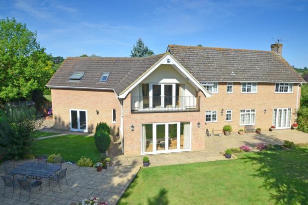
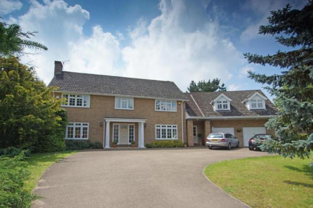
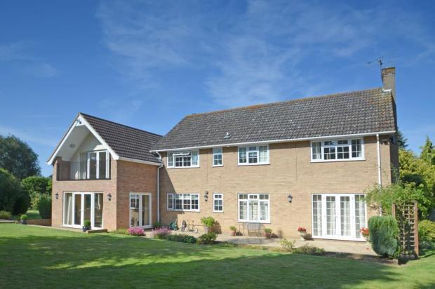
7 HARDWICK PARK GARDENS
BURY ST. EDMUNDS, BURY ST. EDMUNDS, SUFFOLK IP33 2QU
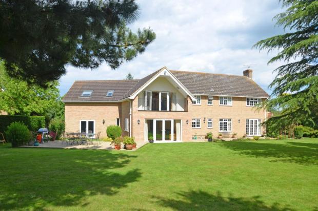
Property details
Last sold
£420,000 Aug 2003
Local average
£638,081 (+16.8%)
Deprivation
Decile 10 (31,350 of 33,755)
Street crime
53 incidents within 1 mile (Apr 2026)
Additional details
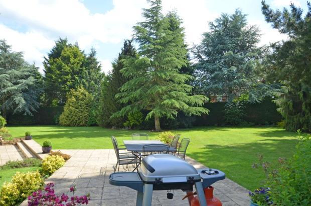
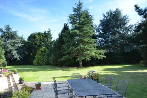
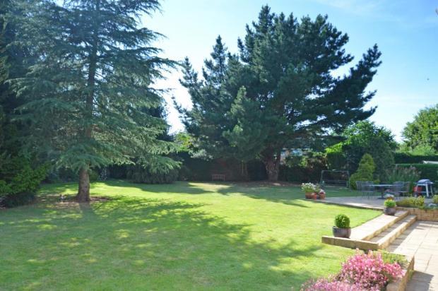
- Garden
- Yes
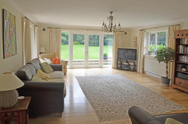
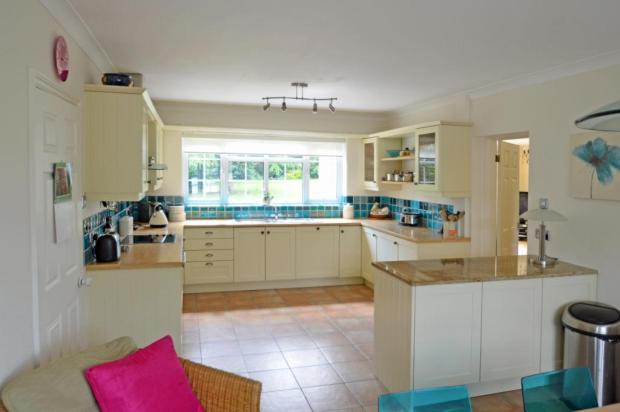
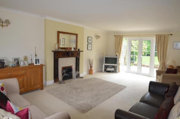
Description
Listed by
Bury St Edmunds
Bedfords
Reference: 30880485
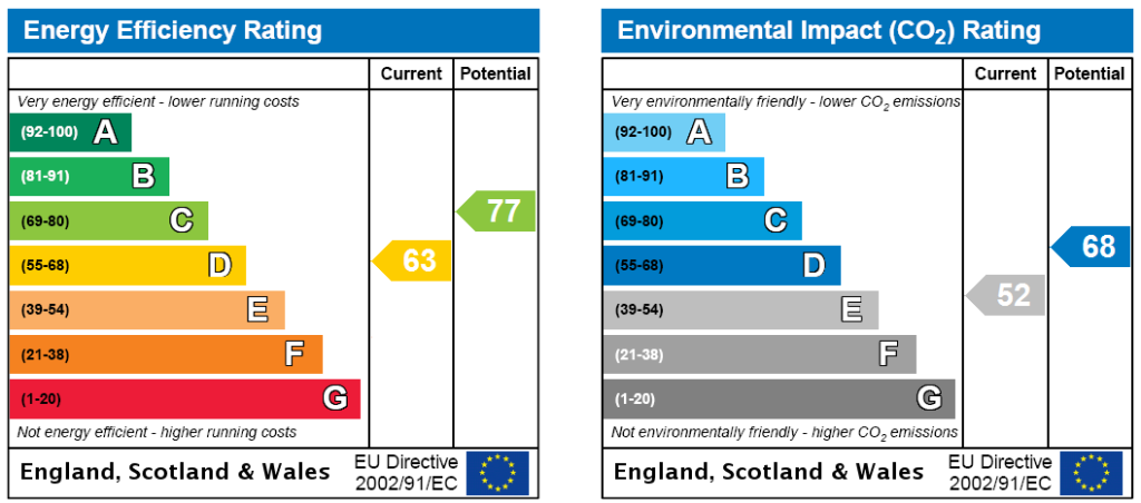
EPC Rating & Upgrade Cost
Fetching EPC data… Refresh this page in a moment.
Flood risk
Zone: 1
Risk: Low
Job (default Low)
FENSA Certificates
This property has 3 FENSA certificate(s) on record, indicating window/door installations by FENSA-approved installers.
FENSA Certificate #7579673
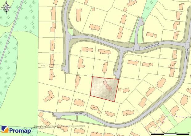
Property Details
Street: 7 Hardwick Park Gardens
Town: Bury St. Edmunds
Postcode: IP33 2QU
Installation Details
Items: 5 windows
Certificate Issued: 17/08/2010
Work Completed: 23/07/2010
This certificate data was retrieved from FENSA's database
FENSA Certificate #5367441
Property Details
Street: 7 Hardwick Park Gardens
Town: Bury St. Edmunds
Postcode: IP33 2QU
Installation Details
Items: 4 windows
Certificate Issued: 21/01/2008
Work Completed: 06/12/2007
This certificate data was retrieved from FENSA's database
FENSA Certificate #1349519
Property Details
Street: 7 Hardwick Park Gardens
Town: Bury St. Edmunds
Postcode: IP33 2QU
Installation Details
Items: 4 windows and 2 doors
Certificate Issued: 22/12/2003
Work Completed: 07/11/2003
This certificate data was retrieved from FENSA's database
What is FENSA? FENSA (Fenestration Self-Assessment Scheme) is a government-authorised scheme that monitors building regulation compliance for replacement windows and doors. Certificates indicate that work was completed by FENSA-approved installers.
Price history
| Event | Date | Price | % change |
|---|---|---|---|
| Sold | 08/08/2003 (22 years ago) | £420,000 | — |
Source: HM Land Registry Price Paid Data. Crown copyright.
Sold Comparables
Same street and nearby sales within 0.25 miles (last 5 years). Data from Land Registry Price Paid.
| Address | Price | Date | Type |
|---|---|---|---|
| 81 HOME FARM LANE, BURY ST EDMUNDS, WEST SUFFOLK, SUFFOLK, IP33 2QL | £835,000 | 30/07/2025 | Detached |
| 87 HOME FARM LANE, BURY ST EDMUNDS, WEST SUFFOLK, SUFFOLK, IP33 2QL | £885,000 | 17/11/2023 | Detached |
| 82 HOME FARM LANE, BURY ST EDMUNDS, WEST SUFFOLK, SUFFOLK, IP33 2QL | £850,000 | 11/07/2022 | Detached |
| Same street BRIAR LODGE, 5 HARDWICK PARK GARDENS, BURY ST EDMUNDS, WEST SUFFOLK, SUFFOLK, IP33 2QU | £775,025 | 17/12/2021 | Detached |
Street average: £775,025 (1 sale)
Area average: £856,667 (3 sales)
Capital growth trend
Land Registry outcode average: last 12 months vs 5y and 10y ago (from sold prices).
House Price Index (HM Land Registry — official index, not sold-price averages): West Suffolk. Series: Detached. As of March 2026.
Rental Range
Estimated market rent for West Suffolk. Low = conservative, Realistic = average, Optimistic = best case.
Based on Local Authority from postcode lookup → West Suffolk.
LHA (30th percentile) floor for Bury St Edmunds: £1,296/mo (Apr 2025 – Mar 2026)
Location
Nearby
Nearest stations, universities and amenities (distance from property).
| Type | Name | Distance |
|---|---|---|
| Bus stop | Kestrel Road | 0.3 miles |
| Bus stop | The Lodge | 0.3 miles |
| Hospital | West Suffolk Hospital | 0.3 miles |
| Shop | Friends of West Suffolk Hospital | 0.3 miles |
| Shop | WHSmith | 0.3 miles |
| Train station | Bury St Edmunds | 1.8 miles |
| Train station | Thurston | 4.3 miles |
Street-level crime
| Category | Count |
|---|---|
| Violence and sexual offences | 21 |
| Criminal damage and arson | 10 |
| Public order | 6 |
| Anti-social behaviour | 4 |
| Drugs | 4 |
| Other theft | 4 |
| Burglary | 1 |
| Other crime | 1 |
| Possession of weapons | 1 |
| Vehicle crime | 1 |
| Total incidents | 53 |
Within 1 mile during Apr 2026. Source: data.police.uk (England & Wales).
Schools nearby
Nearest open schools with Ofsted ratings (England). Closed schools are not shown. Data from Get Information about Schools and Ofsted.
| Name | Type | Distance | Ofsted |
|---|---|---|---|
| Riverwalk School | Other | 0.3 miles | Good — 8 Sep 2024 |
| Hardwick Primary School | Primary | 0.5 miles | Good — 12 Jul 2013 |
| South Lee School | Other | 0.5 miles | — (No rating) |
| St Edmund's Catholic Primary School | Primary | 0.9 miles | Good — 19 Apr 2012 |
| Learning Support, Western Area Education Office | Other | 0.9 miles | — (No rating) |
Rental Comparables
Rental comparables are temporarily unavailable while listing-site fetches are paused. Try again later.
Rent-driven metrics
Based on Area rent estimate.
- Rent ratio — Monthly rent ÷ purchase price (1% rule). 1%+ = strong, 0.8–1% = okay, <0.8% = weak for cashflow.
- Max investor price — Rent ÷ 0.8%; the price at which rent would be 0.8% of price (Stoke-style target).
- Target investor price — Rent ÷ 1%; the price at which rent would be 1% of price (strong cashflow band).
- Gross yield — Annual rent as % of purchase price (no costs).