52 LANSDOWNE ROAD
LOWESTOFT, SUFFOLK NR33 7ES
£134,995
Property details
Floor area
77 m²
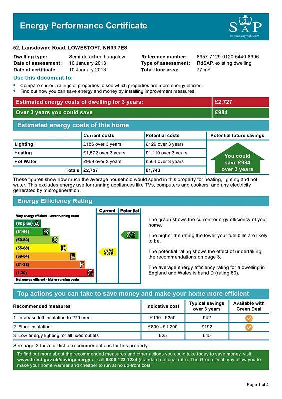
EPC rating
D
Year built
England and Wales: 1950-1966
Last sold
£130,000 Mar 2013
Price per m²
£1,753/m²
Local average
£347,123 (-61.1%)
Deprivation
Decile 7 (22,958 of 33,755)
Street crime
75 incidents within 1 mile (May 2026)
Key features
- 3 Separate Bedrooms
- Gas Fired Central Heating
- UPVC Double Glazing
- Excellent Decorations
- Extended Dining Room
- ENERGY RATING:
Additional details
- Parking
- Yes
- Garden
- Yes
Description
ENTRANCE HALL - LOUNGE - SITTING ROOM/DINING ROOM - KITCHEN - REAR LOBBY - SEPARATE W.C. - BATHROOM - 3 BEDROOMS - GARDENS
ENTRANCE HALL
With sealed unit aluminium framed double glazed entrance door and matching panel, radiator, coved ceiling, wall mounted central heating thermostat.
LOUNGE
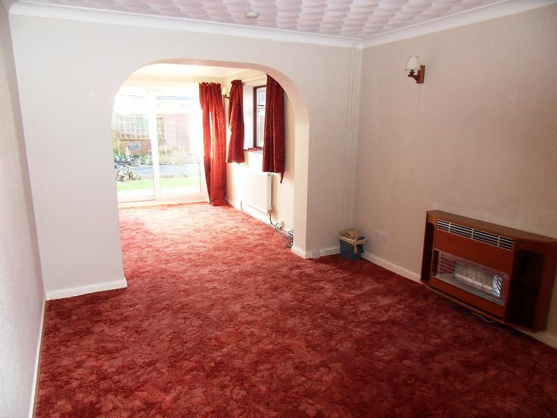
14' x 10' 9 with wall mounted gas fire having back boiler for domestic hot water and central heating, power points, telephone point, wall light points, radiator, TV aerial, arch opening to:
SITTING ROOM/DINING ROOM
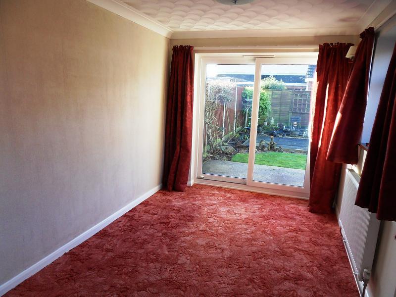
10' 10 x 8' 5 with sealed unit double glazed window and matching sliding patio doors to rear garden, radiator, power points, wall light points.
KITCHEN
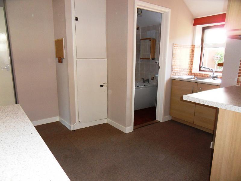
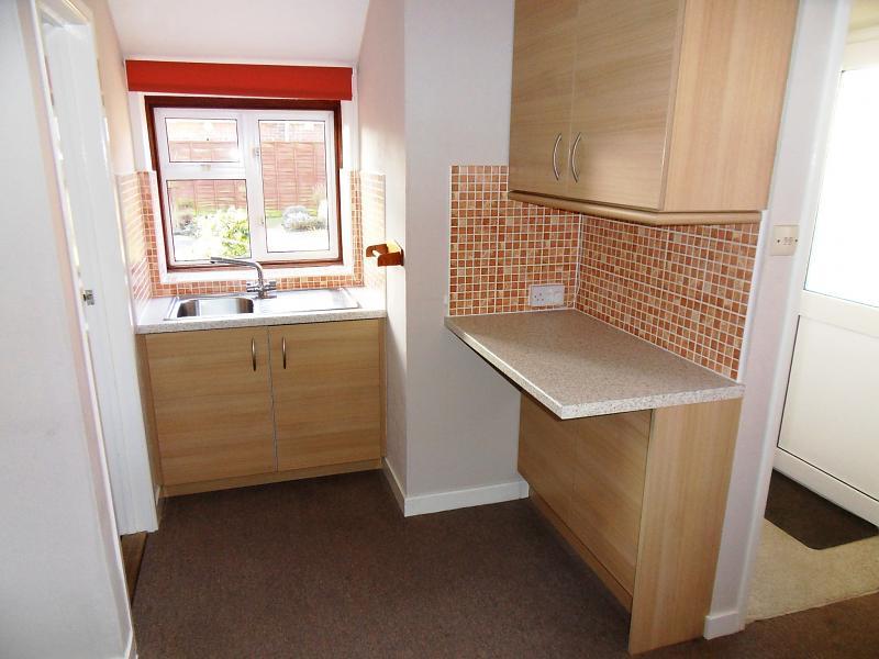
13' maximum x 12' 6 maximum with inset stainless steel sink unit (h&c) mixer tap, cupboards under, work tops with cupboards, drawers, recesses under, matching wall cupboards, electric cooker control panel, radiator, coved ceiling, sealed unit double glazed windows, airing cupboard with central heating time controls, power points, plumbing for washing machine, fluorescent lighting, part tiled walls.
REAR LOBBY
With sealed unit double glazed rear entrance door.
SEPARATE W.C.
With low level suite, sealed unit double glazed window.
BATHROOM
With white suite comprising panelled bath (h&c) mixer tap, pedestal washbasin (h&c) mixer, full ceramic wall tiling, sealed unit double glazed window.
BEDROOM 1
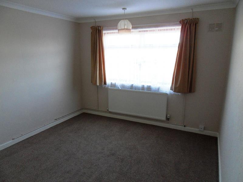
13' x 10' 10 with sealed unit double glazed window overlooking front garden, radiator, power points, coved ceiling, TV point.
BEDROOM 2
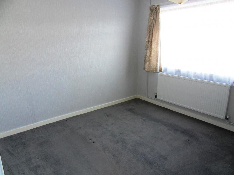
10' 9 x 10' 3 with a sealed unit double glazed window overlooking front garden, radiator, power points.
BEDROOM 3
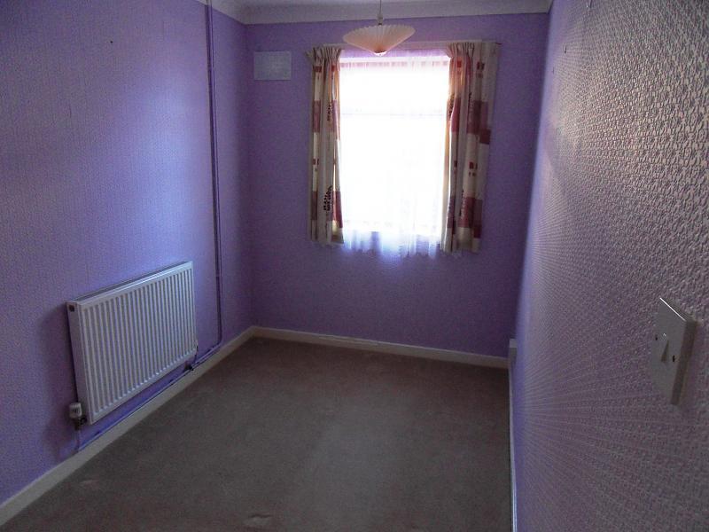
10' 9 x 6' 9 with sealed unit double glazed window, radiator, power points.
OUTSIDE
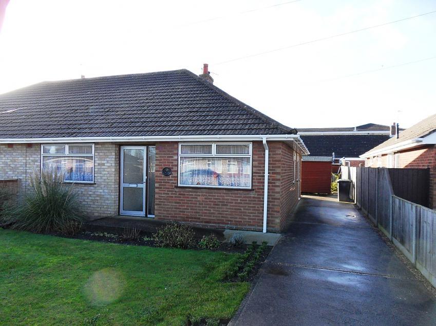
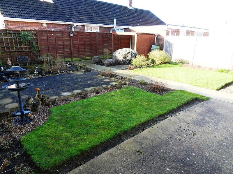
To the front: Walled garden with lawn area, borders, various shrubs and plants, concrete path to main entrance, side concrete driveway, ample car standing space, garage space. Enclosed rear garden with concrete area, ramp to patio doors, paved patio, lawn, borders, covered area, various shrubs and plants, ornamental fish pond.
PLEASE NOTE:
All barge boards, fascias, soffits, gutters and down pipes have been replaced in white UPVC.
**
Listed by
Lowestoft
Spicerhaart Lettings
Reference: 40584812
EPC Rating & Upgrade Cost
Current rating: D
Potential rating: B
Inspection date: 10/01/2013
Expiry date: 09/01/2023 (expired)
Est. upgrade cost to C: £20,350
Recommendations
- Increase loft insulation to 270 mm (£100 - £350)
- Floor insulation (£800 - £1,200)
- Low energy lighting for all fixed outlets (£25)
- Replace boiler with new condensing boiler (£2,200 - £3,000)
- Solar water heating (£4,000 - £6,000)
- Solar photovoltaic panels, 2.5 kWp (£9,000 - £14,000)
Flood risk
Zone: 1
Risk: Low
Job (default Low)
Floorplans

Floorplan 1
FENSA Certificates
This property has 3 FENSA certificate(s) on record, indicating window/door installations by FENSA-approved installers.
FENSA Certificate #11066394
Property Details
Street: 52 Lansdowne Road
Town: LOWESTOFT
Postcode: NR33 7ES
Installation Details
Items: 1 door
Certificate Issued: 29/06/2015
Work Completed: 18/06/2015
This certificate data was retrieved from FENSA's database
FENSA Certificate #9702463
Property Details
Street: 52 Lansdowne Road
Town: LOWESTOFT
Postcode: NR33 7ES
Installation Details
Items: 8 windows and 1 door
Certificate Issued: 05/08/2013
Work Completed: 19/07/2013
This certificate data was retrieved from FENSA's database
FENSA Certificate #6935513
Property Details
Street: 52 Lansdowne Road
Town: LOWESTOFT
Postcode: NR33 7ES
Installation Details
Items: 1 door
Certificate Issued: 03/11/2009
Work Completed: 01/10/2009
This certificate data was retrieved from FENSA's database
What is FENSA? FENSA (Fenestration Self-Assessment Scheme) is a government-authorised scheme that monitors building regulation compliance for replacement windows and doors. Certificates indicate that work was completed by FENSA-approved installers.
Price history
| Event | Date | Price | % change |
|---|---|---|---|
| Sold | 27/03/2013 (13 years ago) | £130,000 | — |
Source: HM Land Registry Price Paid Data. Crown copyright.
Sold Comparables
Same street and nearby sales within 0.25 miles (last 5 years). Data from Land Registry Price Paid.
| Address | Price | Date | Type |
|---|---|---|---|
| 30 CRANLEIGH ROAD, LOWESTOFT, EAST SUFFOLK, SUFFOLK, NR33 7EX | £195,000 | 24/07/2025 | Detached |
| 59 CRANESBILL ROAD, LOWESTOFT, EAST SUFFOLK, SUFFOLK, NR33 7EE | £229,000 | 30/08/2024 | Detached |
| 40 CRANLEIGH ROAD, LOWESTOFT, EAST SUFFOLK, SUFFOLK, NR33 7EX | £135,000 | 29/11/2023 | Detached |
| 46 SHIP ROAD, LOWESTOFT, EAST SUFFOLK, SUFFOLK, NR33 7DW | £285,000 | 13/10/2023 | Detached |
| 73 CRANESBILL ROAD, LOWESTOFT, EAST SUFFOLK, SUFFOLK, NR33 7EE | £192,500 | 29/08/2023 | Detached |
| 1 RANVILLE, CARLTON COLVILLE, LOWESTOFT, EAST SUFFOLK, SUFFOLK, NR33 8UB | £412,000 | 11/08/2023 | Detached |
| 61 CRANESBILL ROAD, LOWESTOFT, EAST SUFFOLK, SUFFOLK, NR33 7EE | £257,500 | 30/06/2023 | Detached |
| 28 CRANLEIGH ROAD, LOWESTOFT, EAST SUFFOLK, SUFFOLK, NR33 7EX | £260,000 | 24/03/2023 | Detached |
| 6 CRANLEIGH ROAD, LOWESTOFT, EAST SUFFOLK, SUFFOLK, NR33 7EX | £400,000 | 21/10/2022 | Detached |
| 1 DOVEDALE, CARLTON COLVILLE, LOWESTOFT, EAST SUFFOLK, SUFFOLK, NR33 8TE | £270,000 | 20/10/2022 | Detached |
| 2 PRIMROSE CLOSE, LOWESTOFT, EAST SUFFOLK, SUFFOLK, NR33 7EG | £238,000 | 18/10/2022 | Detached |
| 6 SPEEDWELL CLOSE, LOWESTOFT, EAST SUFFOLK, SUFFOLK, NR33 7DU | £300,000 | 13/10/2022 | Detached |
| 2 RIDGEVILLE, CARLTON COLVILLE, LOWESTOFT, EAST SUFFOLK, SUFFOLK, NR33 8UA | £265,000 | 07/09/2022 | Detached |
| 36 CRANLEIGH ROAD, LOWESTOFT, EAST SUFFOLK, SUFFOLK, NR33 7EX | £265,000 | 02/08/2022 | Detached |
| 71 CRANESBILL ROAD, LOWESTOFT, EAST SUFFOLK, SUFFOLK, NR33 7EE | £268,000 | 26/07/2022 | Detached |
| 10 RANVILLE, CARLTON COLVILLE, LOWESTOFT, EAST SUFFOLK, SUFFOLK, NR33 8UB | £342,000 | 15/07/2022 | Detached |
| 6 COLTSFOOT CLOSE, LOWESTOFT, EAST SUFFOLK, SUFFOLK, NR33 7EQ | £212,000 | 08/07/2022 | Detached |
| 9 RANVILLE, CARLTON COLVILLE, LOWESTOFT, EAST SUFFOLK, SUFFOLK, NR33 8UB | £325,000 | 22/04/2022 | Detached |
| 5 SPEEDWELL CLOSE, LOWESTOFT, EAST SUFFOLK, SUFFOLK, NR33 7DU | £251,000 | 04/04/2022 | Detached |
| 17 ROCHDALE, CARLTON COLVILLE, LOWESTOFT, EAST SUFFOLK, SUFFOLK, NR33 8TF | £350,000 | 25/02/2022 | Detached |
Area average: £272,600 (20 sales)
Capital growth trend
Land Registry outcode average: last 12 months vs 5y and 10y ago (from sold prices).
House Price Index (HM Land Registry — official index, not sold-price averages): East Suffolk. Series: Detached. As of April 2026.
Rental Range
Estimated market rent for East Suffolk. Low = conservative, Realistic = average, Optimistic = best case.
Based on Local Authority from postcode lookup → East Suffolk.
LHA (30th percentile) floor for Lowestoft & Great Yarmouth: £628/mo (Apr 2025 – Mar 2026)
Location
Nearby
Nearest stations, universities and amenities (distance from property).
| Type | Name | Distance |
|---|---|---|
| Bus stop | Marsden Close | 0.1 miles |
| Shop | Shelton Road Convenience | 0.1 miles |
| Shop | Card Factory | 0.3 miles |
| Train station | Oulton Broad South | 1.4 miles |
| Train station | Chapel Road | 1.5 miles |
| Hospital | Airey Close | 3.2 miles |
| Hospital | Beccles and District War Memorial Hospital | 6.7 miles |
Street-level crime
| Category | Count |
|---|---|
| Violence and sexual offences | 24 |
| Shoplifting | 13 |
| Other theft | 11 |
| Anti-social behaviour | 6 |
| Criminal damage and arson | 5 |
| Public order | 5 |
| Drugs | 4 |
| Burglary | 2 |
| Vehicle crime | 2 |
| Bicycle theft | 1 |
| Other crime | 1 |
| Possession of weapons | 1 |
| Total incidents | 75 |
Within 1 mile during May 2026. Source: data.police.uk (England & Wales).
Schools nearby
Nearest open schools with Ofsted ratings (England). Closed schools are not shown. Data from Get Information about Schools and Ofsted.
| Name | Type | Distance | Ofsted |
|---|---|---|---|
| Pakefield High School | Secondary | 0.2 miles | Good — 9 Nov 2023 |
| Pakefield Primary School | Primary | 0.3 miles | Good — 18 Nov 2021 |
| Westwood Primary School | Primary | 0.7 miles | Good — 20 Apr 2017 |
| Elm Tree Primary School | Primary | 1.0 miles | Good — 26 Sep 2022 |
| Grove Primary School | Primary | 1.0 miles | Good — 4 Dec 2022 |
Rental Comparables
Residential lets from OpenRent and Rightmove for the area (same bedroom count). Use to validate rent estimates. Student lets are excluded.
| Title | Rent | Beds | Distance | As seen on |
|---|---|---|---|---|
| 3 Bed Bungalow, Stradbroke Road, NR33 | £1,400/mo | 3 | 0.3 miles | OpenRent |
| 3 Bed Flat, Morton Road, NR33 | £900/mo | 3 | 0.67 miles | OpenRent |
Average rent: £1,150/mo (2 listings)
Rent-driven metrics
Based on OpenRent comparables.
- Rent ratio — Monthly rent ÷ purchase price (1% rule). 1%+ = strong, 0.8–1% = okay, <0.8% = weak for cashflow.
- Max investor price — Rent ÷ 0.8%; the price at which rent would be 0.8% of price (Stoke-style target).
- Target investor price — Rent ÷ 1%; the price at which rent would be 1% of price (strong cashflow band).
- Gross yield — Annual rent as % of purchase price (no costs).
- Cost-to-rent — Price ÷ annual rent (from OpenRent comparables). Under 14× = strong, 14–16× = acceptable, 17×+ = compressed.
- Cashflow — Rent minus mortgage, 10% maintenance, £25/mo compliance. Assumes 75% LTV, 3.95% APR (5yr fixed), 25yr term.
- ROI — Annual profit ÷ cash in (deposit + 4% purchase costs).