55 WINDSOR STREET
LUTON, LUTON, LUTON LU1 5DT
£490 pcm
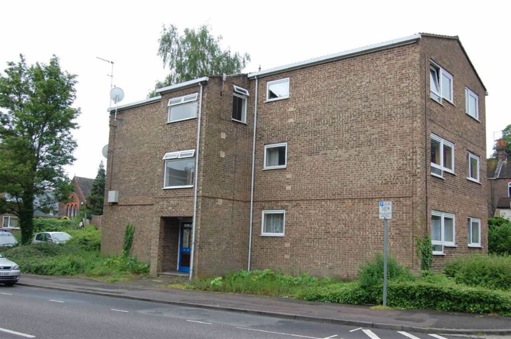
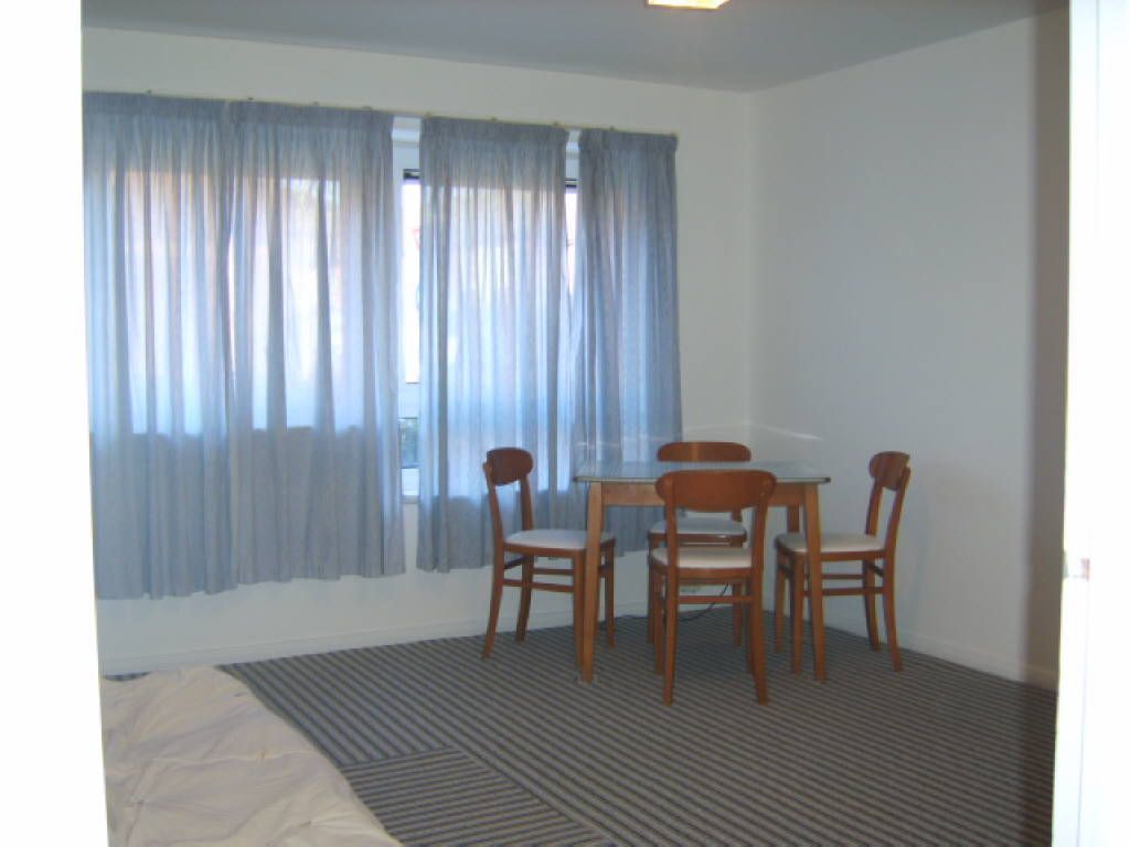
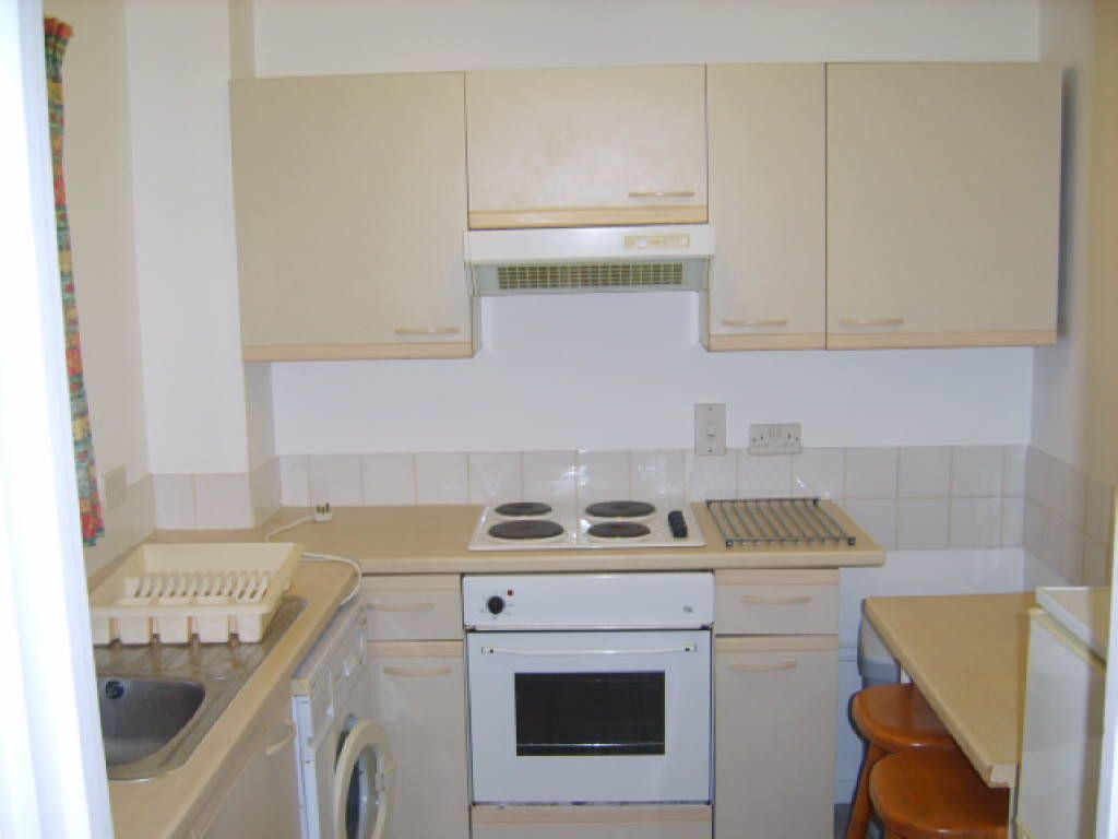
Photo 1 Photo 2 Photo 3
/ 3
Property details
Floor area
48 m²
Deprivation
Decile 3 (7,638 of 33,755)
Street crime
860 incidents within 1 mile (Apr 2026)
Key features
- Lounge
- Kitchen
- Bathroom
- Bedroom
- Electric Heating
- Double Glazing
- Off Road Parking
- Furnished
Additional details
- Parking
- Yes
Description
LoungeKitchen1. REFERENCES WILL BE TAKEN UP WITH APPLICANTS BANK, EMPLOYER AND PREVIOUS LANDLORD (IF APPLICABLE). A CREDIT REFERENCE WILL ALSO BE OBTAINED FOR WHICH THERE WILL BE ADMINISTRATION CHARGE OF £100.00 PER PERSON (INCLUSIVE OF VAT)
2. ANY APPLICANT WHO IS UNEMPLOYED OR IS NOT IN FULL TIME EMPLOYMENT (I.E.STUDENTS) WILL BE REQUIRED TO PROVIDE A GUARANTOR, WHO IS FULLY EMPLOYED AND IS A UK RESIDENT, SO AS TO COMPLY WITH INSURANCE REQUIREMENTS.
3. ONE MONTH'S RENT PLUS 1 1/2 MONTH'S DEPOSIT WILL BE REQUIRED AND RENT PAYABLE CALENDAR MONTHLY.
4. APPLICANTS TO SIGN FOR ALL UTILITIES I.E. GAS, ELECTRIC, TELEPHONE, WATER RATES AND COUNCIL TAX.
5. THE TENANCY WILL BE AN ASSURED SHORTHOLD TENANCY UNDER PART 1 OF THE HOUSING ACT 1988.
Listed by
Luton
Williams
Reference: 23156592
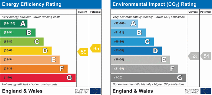
EPC Rating & Upgrade Cost
Fetching EPC data… Refresh this page in a moment.
Flood risk
Zone: 1
Risk: Low
Job (default Low)
EPC Graphs
EPC 1
Rental Range
Estimated market rent for Luton. Low = conservative, Realistic = average, Optimistic = best case.
Based on Local Authority from postcode lookup → Luton.
LHA (30th percentile) floor for Luton: £698/mo (Apr 2025 – Mar 2026)
Location
Nearby
Nearest stations, universities and amenities (distance from property).
| Type | Name | Distance |
|---|---|---|
| Shop | Continental Food Store | 0.1 miles |
| Shop | Windsor Food & Wine | 0.1 miles |
| Bus stop | Elizabeth Street | 0.1 miles |
| Bus stop | Russell Street | 0.1 miles |
| University | University Of Bedfordshire | 0.4 miles |
| Train station | Luton | 0.6 miles |
| Train station | Luton Airport Parkway | 1.0 miles |
| Hospital | Luton and Dunstable Hospital | 2.8 miles |
| Hospital | Widecombe Nursing Home | 3.0 miles |
Street-level crime
| Category | Count |
|---|---|
| Violence and sexual offences | 294 |
| Anti-social behaviour | 111 |
| Shoplifting | 76 |
| Other theft | 72 |
| Vehicle crime | 70 |
| Public order | 67 |
| Drugs | 47 |
| Criminal damage and arson | 46 |
| Other crime | 17 |
| Burglary | 16 |
| Robbery | 15 |
| Bicycle theft | 11 |
| Theft from the person | 10 |
| Possession of weapons | 8 |
| Total incidents | 860 |
Within 1 mile during Apr 2026. Source: data.police.uk (England & Wales).
Schools nearby
Nearest open schools with Ofsted ratings (England). Closed schools are not shown. Data from Get Information about Schools and Ofsted.
| Name | Type | Distance | Ofsted |
|---|---|---|---|
| Chapel Street Nursery School | Nursery | 0.0 miles | Good — 22 Mar 2013 |
| Rothesay Nursery School | Nursery | 0.3 miles | Good — 9 Sep 2016 |
| Hillborough Junior School | Primary | 0.3 miles | Outstanding — 14 Jan 2024 |
| Hillborough Infant and Nursery School | Primary | 0.3 miles | Good — 13 Jun 2017 |
| Tennyson Road Primary School | Primary | 0.3 miles | Outstanding — 1 Jul 2024 |
Rental Comparables
Residential lets from OpenRent and Rightmove for the area (same bedroom count). Use to validate rent estimates. Student lets are excluded.
| Title | Rent | Beds | Distance | As seen on |
|---|---|---|---|---|
| Studio Flat, Dumfries St, LU1 | £700/mo | 1 | 0.09 miles | OpenRent |
Average rent: £700/mo (1 listing)