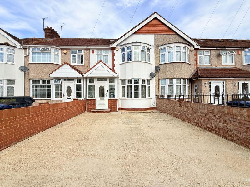
5 ASCOT GARDENS
SOUTHALL, GREATER LONDON UB1 2RZ
£549,950
Property details
Tenure
FREEHOLD
Floor area
85 m²
EPC rating
C
Year built
England and Wales: 1930-1949
Last sold
£546,000 Sep 2025
Price per m²
£6,470/m²
Local average
£487,710 (+12.8%)
Deprivation
Decile 4 (11,583 of 33,755)
Street crime
719 incidents within 1 mile (Apr 2026)
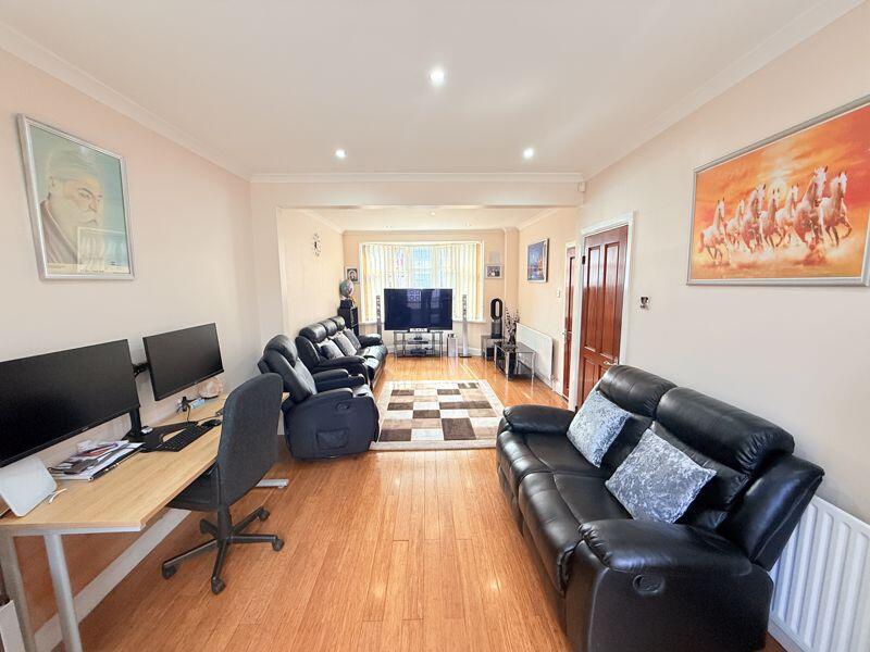
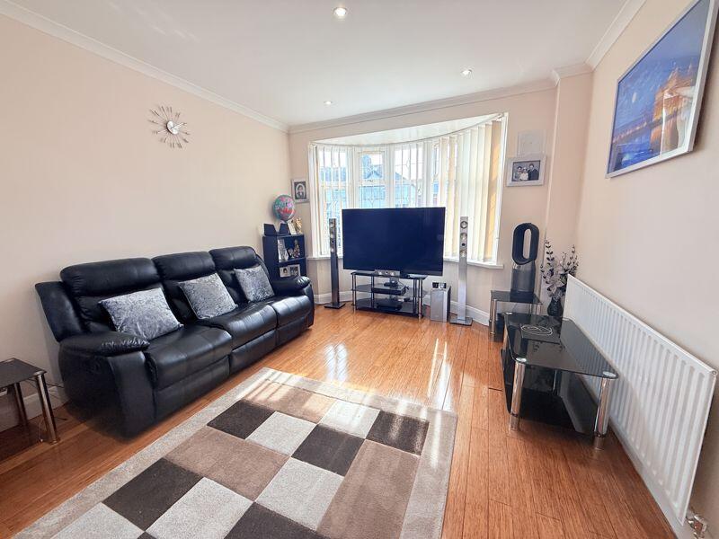
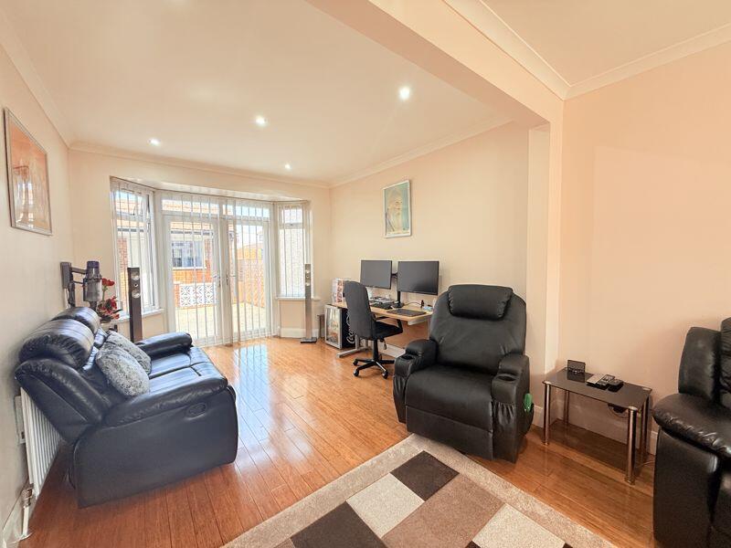
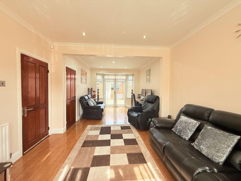
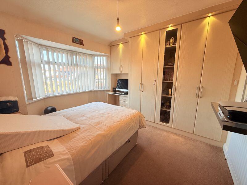
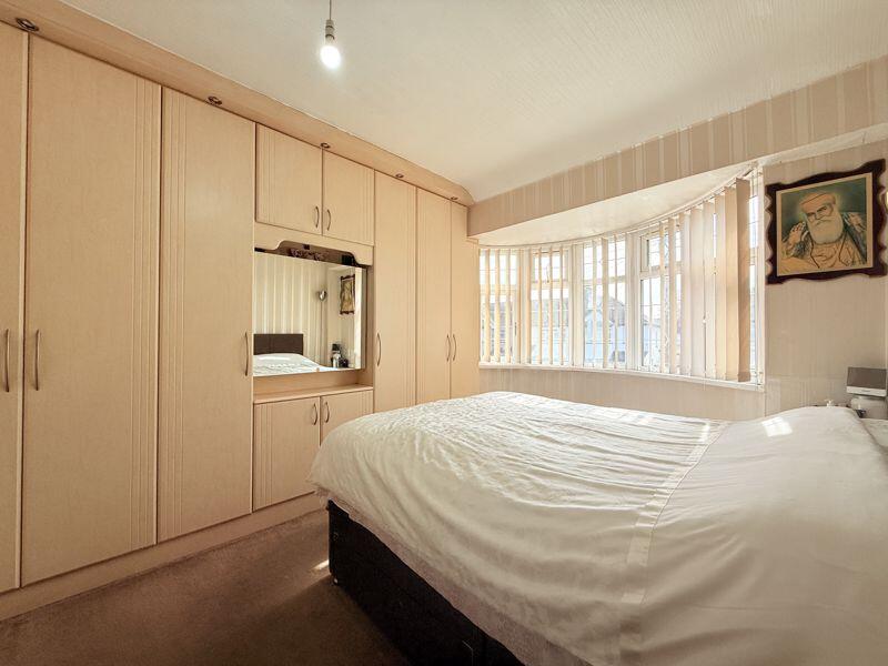
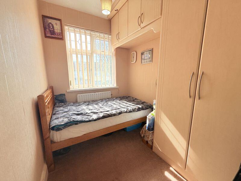
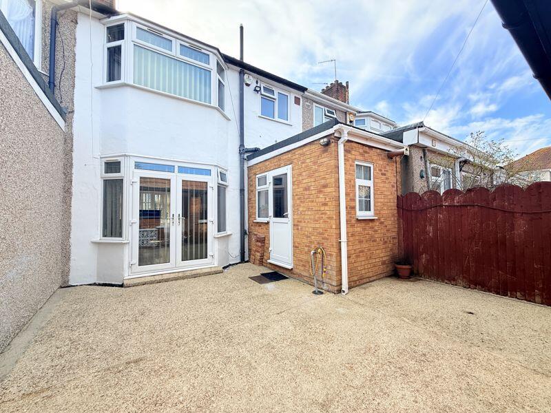
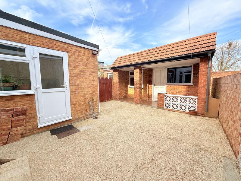
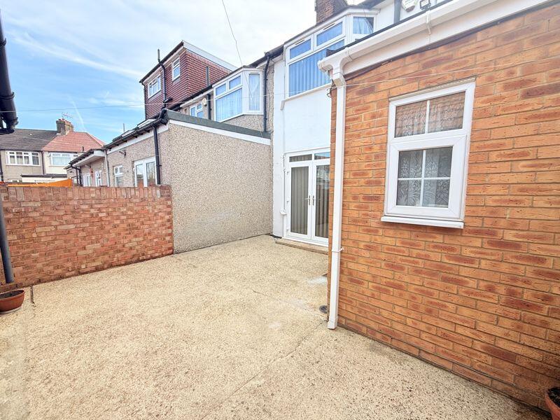
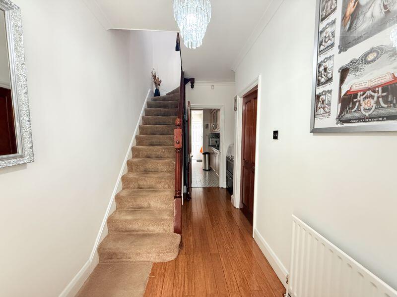
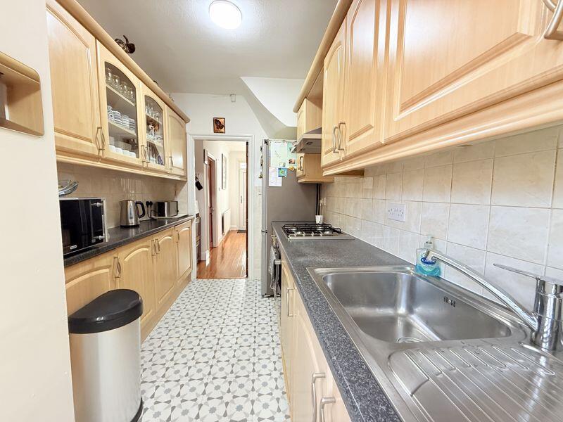
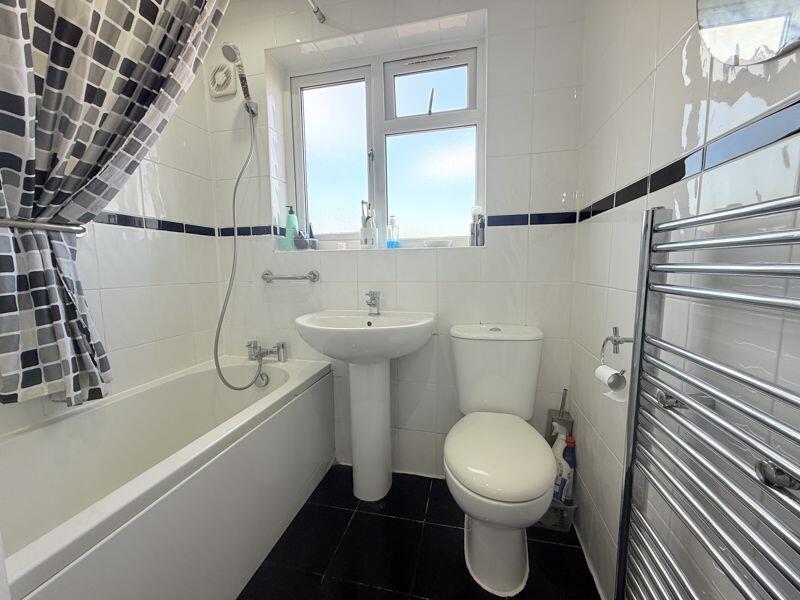
Key features
- Stunning Condition
- Freehold
- Off Street Parking
- A Must View
- Garage
- Through Lounge
Additional details
- Parking
- Yes
Description
Listed by
Northolt
Brian Cox
Reference: 159716837
EPC Rating & Upgrade Cost
Current rating: C
Potential rating: B
Inspection date: 18/09/2020
Expiry date: 17/09/2030
Current heating cost: £464/year
Potential heating cost: £375/year
Est. upgrade cost to C: £19,500
Recommendations
- 50 mm internal or external wall insulation (£4,000 - £14,000)
- Floor insulation (suspended floor) (£800 - £1,200)
- Solar water heating (£4,000 - £6,000)
- Solar photovoltaic panels, 2.5 kWp (£3,500 - £5,500)
Flood risk
Zone: 1
Risk: Low
Job (default Low)
Floorplans
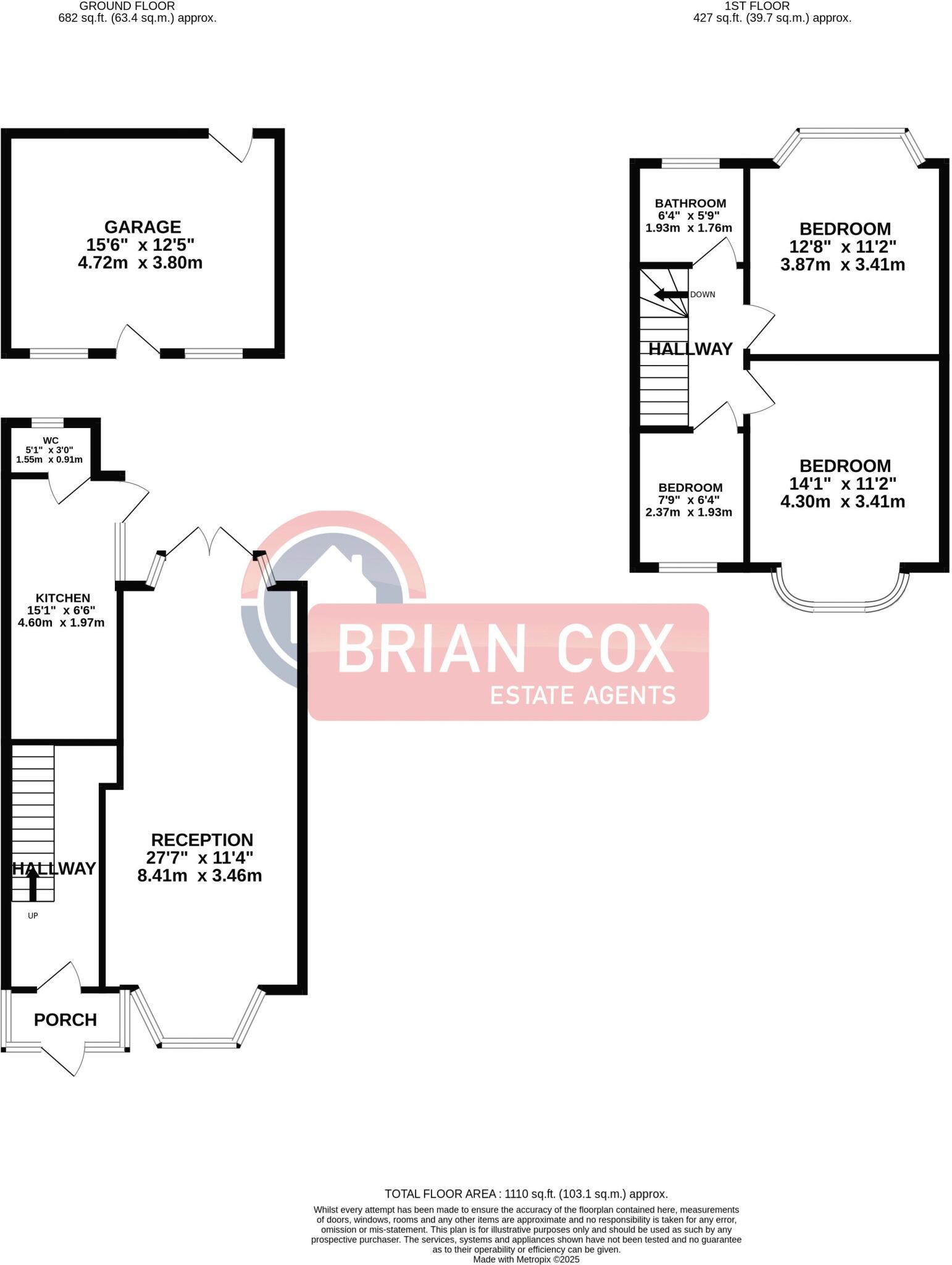
Floorplan 1
Price history
| Event | Date | Price | % change |
|---|---|---|---|
| Sold | 19/09/2025 (8 months ago) | £546,000 | — |
Source: HM Land Registry Price Paid Data. Crown copyright.
Sold Comparables
Same street and nearby sales within 0.25 miles (last 5 years). Data from Land Registry Price Paid.
| Address | Price | Date | Type |
|---|---|---|---|
| 29 ST PETERS ROAD, SOUTHALL, EALING, GREATER LONDON, UB1 2TL | £540,000 | 28/11/2025 | Terraced |
| 4 CRAVEN AVENUE, SOUTHALL, EALING, GREATER LONDON, UB1 2DJ | £365,000 | 25/09/2025 | Terraced |
| 5 SOMERSET ROAD, SOUTHALL, EALING, GREATER LONDON, UB1 2TZ | £560,000 | 18/07/2025 | Terraced |
| 12 DERWENT ROAD, SOUTHALL, EALING, GREATER LONDON, UB1 2UJ | £728,000 | 03/03/2025 | Terraced |
| 130 ASCOT GARDENS, SOUTHALL, EALING, GREATER LONDON, UB1 2SB | £580,000 | 25/08/2023 | Terraced |
| Same street 2 ASCOT GARDENS, SOUTHALL, EALING, GREATER LONDON, UB1 2RZ | £550,000 | 27/03/2023 | Terraced |
| 15 DORELL CLOSE, SOUTHALL, EALING, GREATER LONDON, UB1 2SF | £300,000 | 07/02/2023 | Terraced |
| 228A LADY MARGARET ROAD, SOUTHALL, EALING, GREATER LONDON, UB1 2RU | £550,000 | 17/11/2022 | Terraced |
| Same street 21 ASCOT GARDENS, SOUTHALL, EALING, GREATER LONDON, UB1 2RZ | £475,000 | 11/11/2022 | Terraced |
| 28 SOMERSET ROAD, SOUTHALL, EALING, GREATER LONDON, UB1 2TR | £572,500 | 04/11/2022 | Terraced |
| 12 ST CRISPINS CLOSE, SOUTHALL, EALING, GREATER LONDON, UB1 2UH | £451,000 | 30/09/2021 | Terraced |
| 32 CORNWALL AVENUE, SOUTHALL, EALING, GREATER LONDON, UB1 2TB | £455,000 | 24/09/2021 | Terraced |
| 16 DERWENT ROAD, SOUTHALL, EALING, GREATER LONDON, UB1 2UJ | £490,000 | 30/06/2021 | Terraced |
Street average: £512,500 (2 sales)
Area average: £508,318 (11 sales)
Capital growth trend
Land Registry outcode average: last 12 months vs 5y and 10y ago (from sold prices).
House Price Index (HM Land Registry — official index, not sold-price averages): Ealing. Series: Terraced. As of March 2026.
Rental Range
Estimated market rent for Ealing. Low = conservative, Realistic = average, Optimistic = best case.
Based on Local Authority from postcode lookup → Ealing.
LHA (30th percentile) floor for South West Herts: £1,496/mo (Apr 2025 – Mar 2026)
Location
Nearby
Nearest stations, universities and amenities (distance from property).
| Type | Name | Distance |
|---|---|---|
| Bus stop | Ascot Gardens | 0.1 miles |
| Bus stop | Rutland Road | 0.1 miles |
| Shop | Rugworld | 0.2 miles |
| Shop | Betfred | 0.2 miles |
| Train station | Southall | 1.1 miles |
| Train station | Hanwell | 1.7 miles |
| University | University of West London | 2.8 miles |
| University | University of West London - Hellenic Institute Of Maritime Studies | 2.8 miles |
| Hospital | Hounslow Medical Centre | 3.6 miles |
| Hospital | Watford General Hospital | 8.9 miles |
Street-level crime
| Category | Count |
|---|---|
| Anti-social behaviour | 216 |
| Violence and sexual offences | 166 |
| Shoplifting | 51 |
| Vehicle crime | 48 |
| Criminal damage and arson | 39 |
| Public order | 39 |
| Other theft | 33 |
| Theft from the person | 32 |
| Drugs | 30 |
| Robbery | 30 |
| Burglary | 21 |
| Other crime | 7 |
| Possession of weapons | 5 |
| Bicycle theft | 2 |
| Total incidents | 719 |
Within 1 mile during Apr 2026. Source: data.police.uk (England & Wales).
Schools nearby
Nearest open schools with Ofsted ratings (England). Closed schools are not shown. Data from Get Information about Schools and Ofsted.
| Name | Type | Distance | Ofsted |
|---|---|---|---|
| Lady Margaret Primary School | Primary | 0.1 miles | Good — 31 Mar 2011 |
| Durdans Park Primary School | Primary | 0.2 miles | Good — 30 Jan 2014 |
| Allenby Primary School | Primary | 0.4 miles | Good — 3 Jul 2014 |
| Dormers Wells High School | Secondary | 0.4 miles | Good — 15 Jun 2012 |
| Grangewood School | Other | 0.6 miles | Good — 14 May 2020 |
Rental Comparables
Rental listings exist nearby, but none matched the 3-bedroom count for this property.
Rent-driven metrics
Based on Area rent estimate.
- Rent ratio — Monthly rent ÷ purchase price (1% rule). 1%+ = strong, 0.8–1% = okay, <0.8% = weak for cashflow.
- Max investor price — Rent ÷ 0.8%; the price at which rent would be 0.8% of price (Stoke-style target).
- Target investor price — Rent ÷ 1%; the price at which rent would be 1% of price (strong cashflow band).
- Gross yield — Annual rent as % of purchase price (no costs).