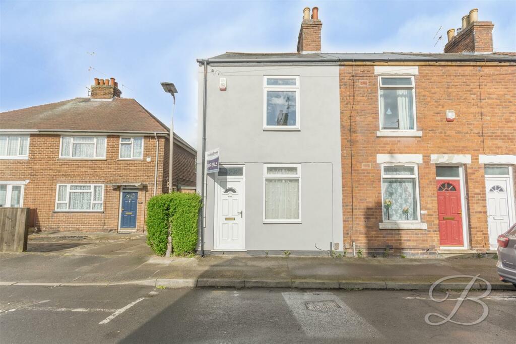
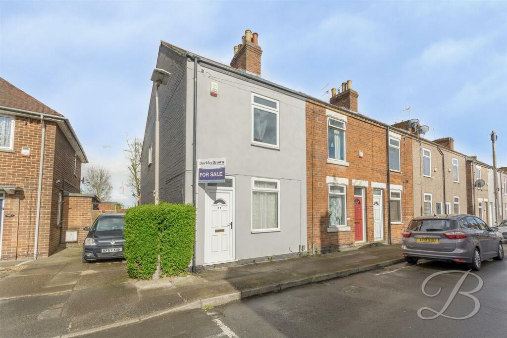
Spencer Street
Mansfield, NG18 5LR
Property details
Tenure
FREEHOLD
Council tax band
A
EPC rating
C
Last sold
£65,000
Price per m²
£1,269/m²
Local average
£125,029 (-32%)
Deprivation
Decile 1 (1,958 of 33,755)
Street crime
565 incidents within 1 mile (Apr 2026)
Additional details
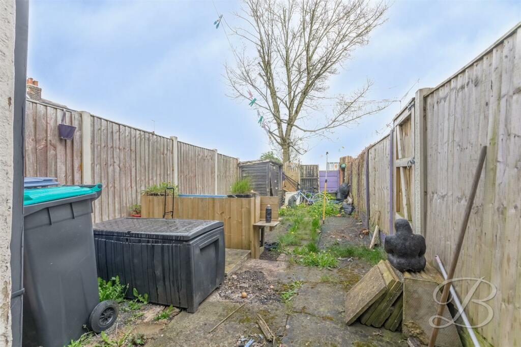
- Garden
- Yes
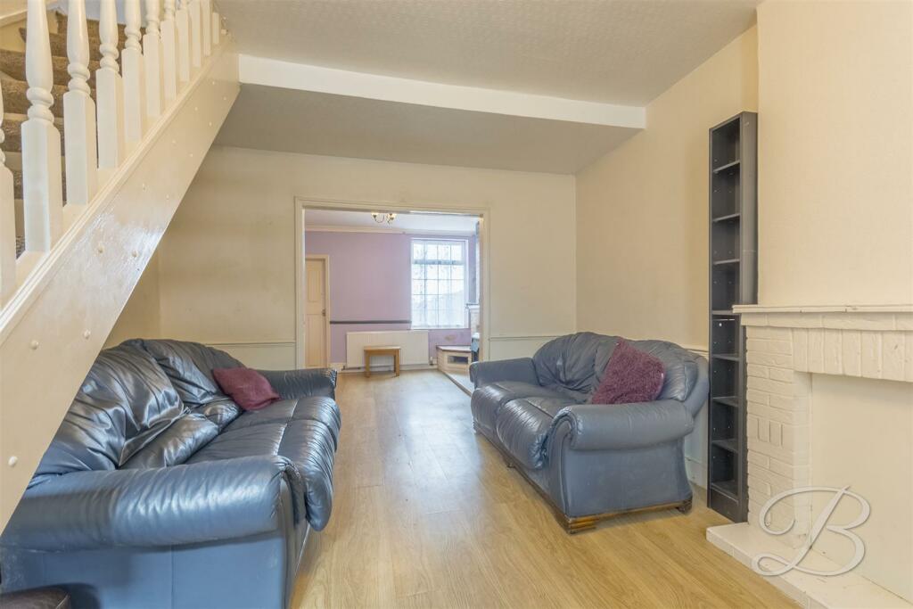
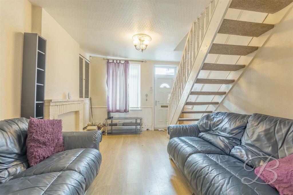
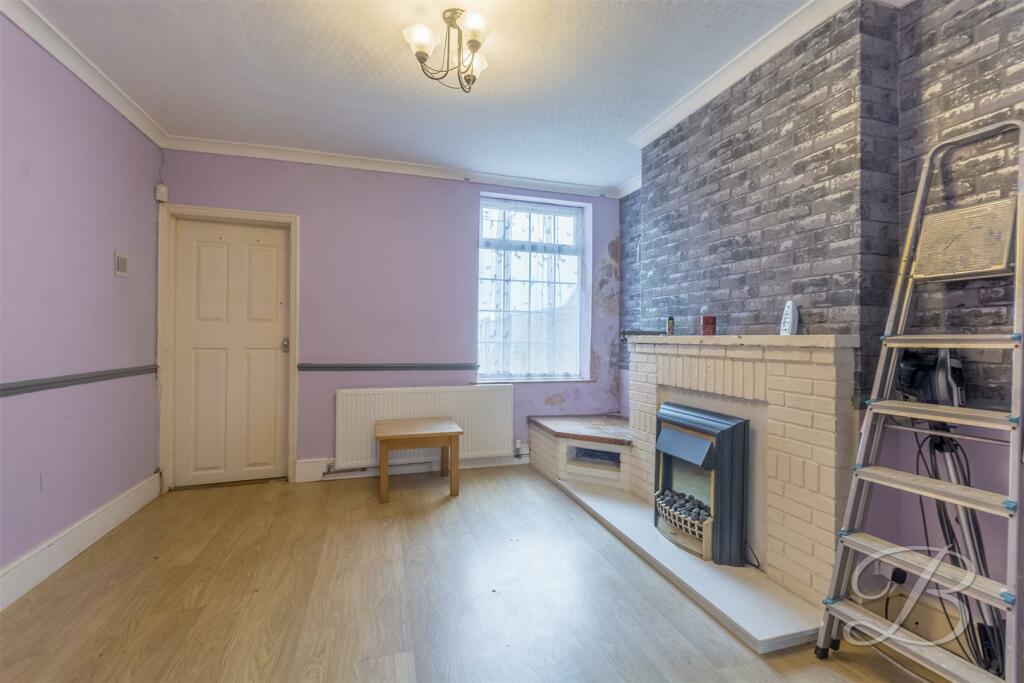
Description
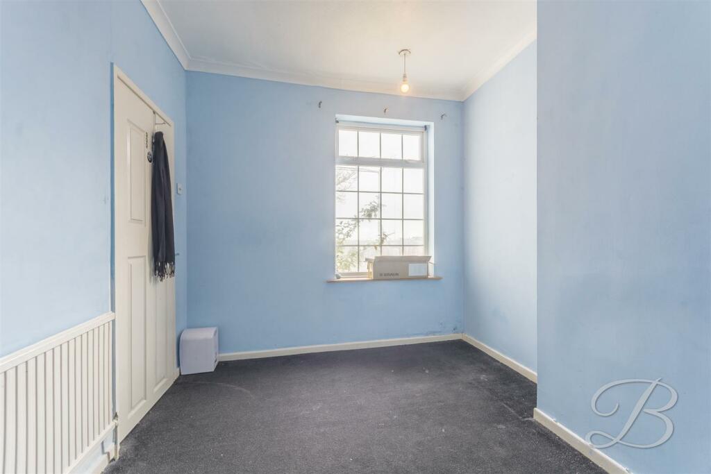
Stepping inside, you will be pleased to find a spacious lounge with a window overlooking the front, allowing plenty of light to flood in. This space lends the perfect spot for all your furnishings and homely touches. Flowing nicely from here, you'll be greeted by generously sized dining room with ample space for a dining set and chairs, making it ideal for inviting round friends and family.
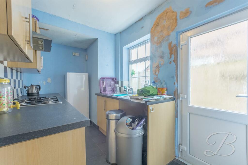
The kitchen is fitted with a range of matching units and cabinets, together with ample worktop space for preparing meals. As well as a door leading outside to the rear garden.
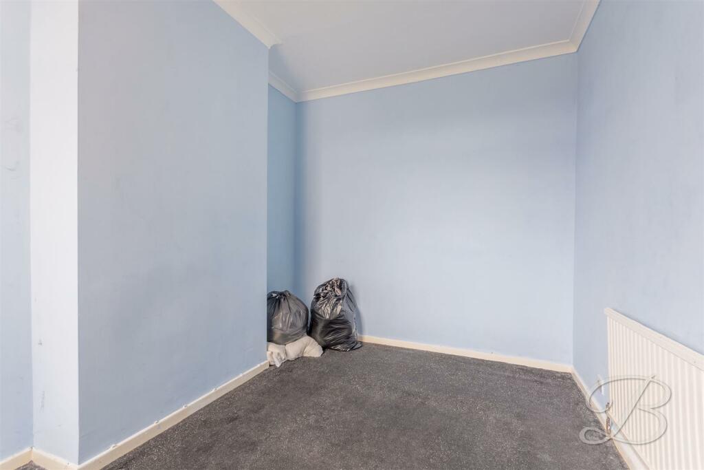
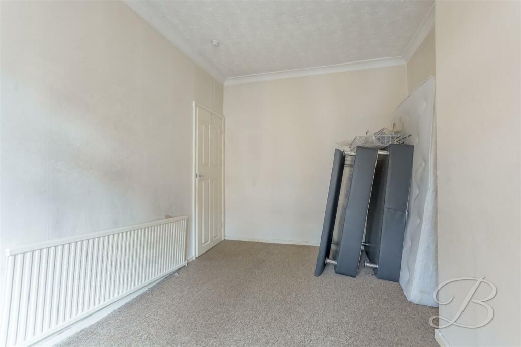
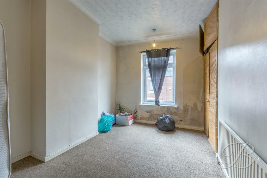
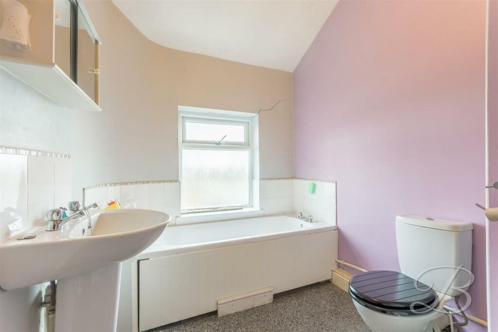
The first floor presents two flexible bedrooms, all of which boast tons of potential for you to decorate and add your own stamp. Completing this property is a bathroom comprised of a panelled bath, low flush WC and wash hand basin.
Outside offers an established garden to the rear with a fence surround. Is this the one for you? Call now to book a viewing!
*CASH BUYERS ONLY*
Listed by
Mansfield
Eakring Property Services Ltd
Reference: 145481081
EPC Rating & Upgrade Cost
Current rating: C
Potential rating: B
Inspection date: 16/11/2018
Expiry date: 15/11/2028
Current heating cost: £490/year
Potential heating cost: £359/year
Recommendations
- Flat roof or sloping ceiling insulation (1,500)
- 50 mm internal or external wall insulation (14,000)
- Solar water heating (6,000)
- Solar photovoltaic panels, 2.5 kWp (8,000)
Flood risk
Zone: 1
Risk: Low
Job (default Low)
Floorplans
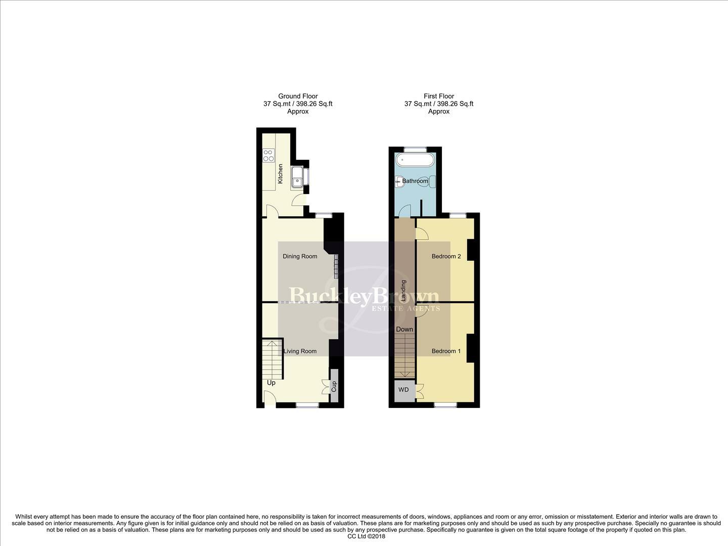
44_Spencer_Street__Mansfield_NG18_5LR WM.jpg
EPC Graphs
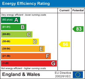
EE Rating
Price history
125% since 1996
| Event | Date | Price | % change |
|---|---|---|---|
| Sold | 01/01/2009 (17 years ago) | £65,000 | +140.7% |
| Sold | 01/01/2001 (25 years ago) | £27,000 | -6.7% |
| Sold | 01/01/1996 (30 years ago) | £28,950 | — |
Source: HM Land Registry Price Paid Data. Crown copyright.
Sold Comparables
Same street and nearby sales within 0.25 miles (last 5 years). Data from Land Registry Price Paid.
| Address | Price | Date | Type |
|---|---|---|---|
| 2 HOLDEN STREET, MANSFIELD, NOTTINGHAMSHIRE, NG18 5LH | £130,000 | 19/12/2025 | Terraced |
| 14 TENNYSON STREET, MANSFIELD, NOTTINGHAMSHIRE, NG18 5PN | £190,000 | 23/10/2025 | Terraced |
| 21 LAYTON AVENUE, MANSFIELD, NOTTINGHAMSHIRE, NG18 5PJ | £242,000 | 01/09/2025 | Terraced |
| 35 PADLEY HILL, MANSFIELD, NOTTINGHAMSHIRE, NG18 5LJ | £72,000 | 17/01/2025 | Terraced |
| 27 BANCROFT LANE, MANSFIELD, NOTTINGHAMSHIRE, NG18 5LG | £90,000 | 21/07/2023 | Terraced |
| 40 MOOR STREET, MANSFIELD, NOTTINGHAMSHIRE, NG18 5SJ | £66,000 | 14/07/2023 | Terraced |
| 10 HARRINGTON STREET, MANSFIELD, NOTTINGHAMSHIRE, NG18 5LS | £105,000 | 08/06/2023 | Terraced |
| 1 GOLDSMITH STREET, MANSFIELD, NOTTINGHAMSHIRE, NG18 5PF | £87,500 | 07/06/2023 | Terraced |
| 19 MOOR STREET, MANSFIELD, NOTTINGHAMSHIRE, NG18 5SH | £83,000 | 22/03/2023 | Terraced |
| 3 GOLDSMITH STREET, MANSFIELD, NOTTINGHAMSHIRE, NG18 5PF | £88,000 | 23/02/2023 | Terraced |
| Same street 22 SPENCER STREET, MANSFIELD, NOTTINGHAMSHIRE, NG18 5LR | £105,000 | 26/01/2023 | Terraced |
| 14 BANCROFT LANE, MANSFIELD, NOTTINGHAMSHIRE, NG18 5LQ | £101,000 | 13/12/2022 | Terraced |
| 65 BANCROFT LANE, MANSFIELD, NOTTINGHAMSHIRE, NG18 5LG | £101,500 | 09/12/2022 | Terraced |
| 45 HARRINGTON STREET, MANSFIELD, NOTTINGHAMSHIRE, NG18 5LS | £85,000 | 06/12/2022 | Terraced |
| 14 HERBERT STREET, MANSFIELD, NOTTINGHAMSHIRE, NG18 5QF | £103,000 | 01/12/2022 | Terraced |
| 21 PADLEY HILL, MANSFIELD, NOTTINGHAMSHIRE, NG18 5LJ | £75,000 | 21/11/2022 | Terraced |
| 24 CHAUCER STREET, MANSFIELD, NOTTINGHAMSHIRE, NG18 5PE | £116,250 | 14/11/2022 | Terraced |
| 32 GOLDSMITH STREET, MANSFIELD, NOTTINGHAMSHIRE, NG18 5PG | £117,500 | 10/11/2022 | Terraced |
| Same street 14 SPENCER STREET, MANSFIELD, NOTTINGHAMSHIRE, NG18 5LR | £115,000 | 30/09/2022 | Terraced |
| 25 BANCROFT LANE, MANSFIELD, NOTTINGHAMSHIRE, NG18 5LG | £116,000 | 30/09/2022 | Terraced |
| 10 BANCROFT LANE, MANSFIELD, NOTTINGHAMSHIRE, NG18 5LQ | £65,000 | 29/07/2022 | Terraced |
| 27 STOCKWELL COURT, MANSFIELD, NOTTINGHAMSHIRE, NG18 5QQ | £80,000 | 21/06/2022 | Terraced |
| Same street 34 SPENCER STREET, MANSFIELD, NOTTINGHAMSHIRE, NG18 5LR | £97,000 | 17/03/2022 | Semi-detached |
| Same street 48 SPENCER STREET, MANSFIELD, NOTTINGHAMSHIRE, NG18 5LR | £135,000 | 20/08/2021 | Semi-detached |
| Same street 33 SPENCER STREET, MANSFIELD, NOTTINGHAMSHIRE, NG18 5LR | £96,000 | 05/07/2021 | Semi-detached |
Street average: £109,600 (5 sales)
Area average: £105,688 (20 sales)
Capital growth trend
Land Registry outcode average: last 12 months vs 5y and 10y ago (from sold prices).
House Price Index (HM Land Registry — official index, not sold-price averages): Mansfield. Series: Terraced. As of March 2026.
Rental Range
Estimated market rent for Mansfield. Low = conservative, Realistic = average, Optimistic = best case.
Based on Local Authority from postcode lookup → Mansfield.
LHA (30th percentile) floor for North Nottingham: £549/mo (Apr 2025 – Mar 2026)
Location
Address
Spencer Street
Nearby
Nearest stations, universities and amenities (distance from property).
| Type | Name | Distance |
|---|---|---|
| Bus stop | Cape Street | 0.1 miles |
| Shop | NOT Motors | 0.1 miles |
| Bus stop | Community Hospital | 0.1 miles |
| Shop | Unknown | 0.1 miles |
| Hospital | Mansfield Community Hospital | 0.1 miles |
| Train station | Mansfield | 0.4 miles |
| Hospital | Kings Mill Hospital | 1.2 miles |
| Train station | Mansfield Woodhouse | 1.4 miles |
| University | Nottingham Trent University Vision University Centre | 1.7 miles |
| University | Clinical Sciences | 10.6 miles |
Street-level crime
| Category | Count |
|---|---|
| Violence and sexual offences | 189 |
| Shoplifting | 87 |
| Anti-social behaviour | 80 |
| Criminal damage and arson | 39 |
| Public order | 38 |
| Vehicle crime | 38 |
| Other theft | 30 |
| Drugs | 21 |
| Burglary | 12 |
| Possession of weapons | 11 |
| Robbery | 11 |
| Other crime | 7 |
| Theft from the person | 2 |
| Total incidents | 565 |
Within 1 mile during Apr 2026. Source: data.police.uk (England & Wales).
Schools nearby
Nearest open schools with Ofsted ratings (England). Closed schools are not shown. Data from Get Information about Schools and Ofsted.
| Name | Type | Distance | Ofsted |
|---|---|---|---|
| Sutton Road Primary School | Primary | 0.3 miles | Good — 14 Jun 2012 |
| St Philip Neri With St Bede Catholic Voluntary Academy | Primary | 0.5 miles | Good — 31 Oct 2012 |
| Wainwright Primary Academy | Primary | 0.5 miles | Good — 19 Sep 2023 |
| Intake Farm Primary School | Primary | 0.6 miles | Good — 16 Feb 2018 |
| R.E.A.L. Independent Schools Mansfield | Other | 0.7 miles | Good — 2 May 2024 |
Rental Comparables
Rental listings exist nearby, but none matched the 2-bedroom count for this property.
Rent-driven metrics
Based on Area rent estimate.
- Rent ratio — Monthly rent ÷ purchase price (1% rule). 1%+ = strong, 0.8–1% = okay, <0.8% = weak for cashflow.
- Max investor price — Rent ÷ 0.8%; the price at which rent would be 0.8% of price (Stoke-style target).
- Target investor price — Rent ÷ 1%; the price at which rent would be 1% of price (strong cashflow band).
- Gross yield — Annual rent as % of purchase price (no costs).
Enter House Number
Enter the house number to help us retrieve more accurate pricing history and property data.
Please log in to submit or correct the house number for this listing.
Log in to continue