Hospital Car Park
Hilton Road, Hilton Road, Stoke-On-Trent, ST4 6RR
POA
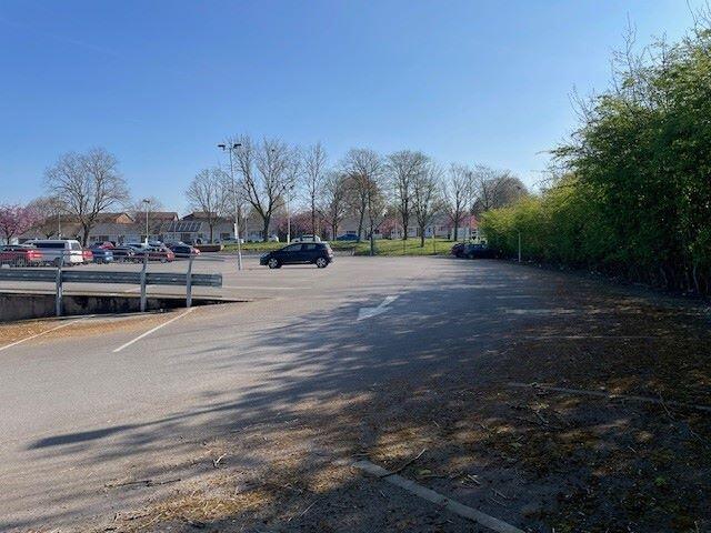
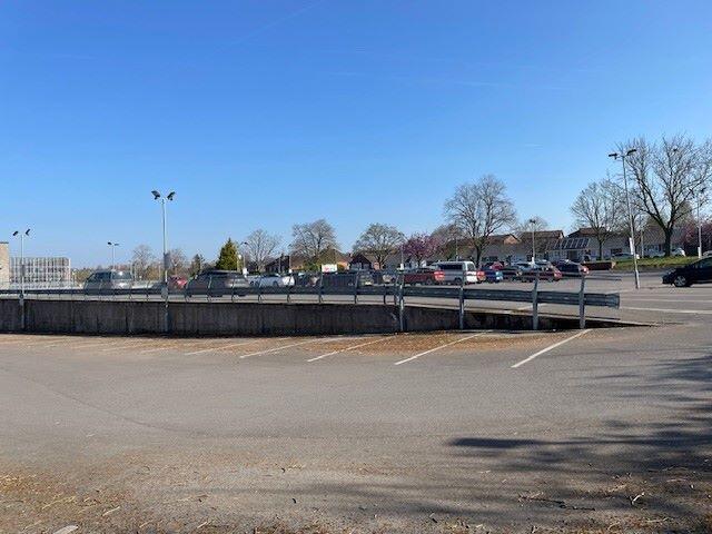
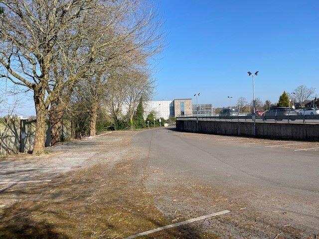
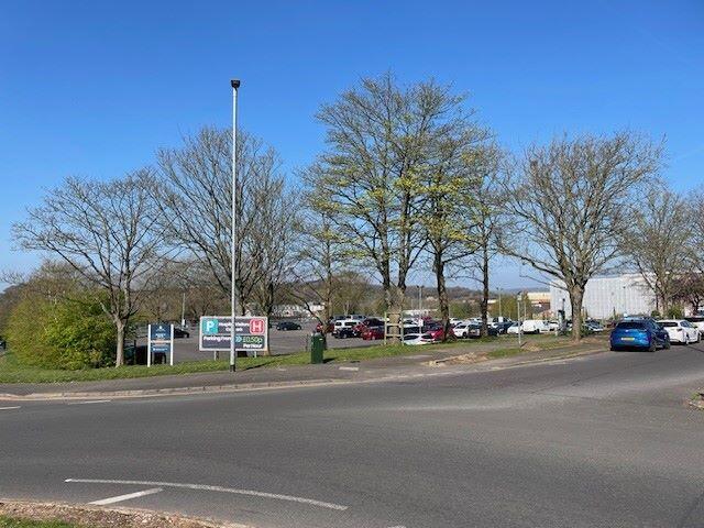
Photo 1 Photo 2 Photo 3 Photo 4
/ 4
Property details
Tenure
FREEHOLD
Local average
£202,484 (+393.9%)
Deprivation
Decile 4 (11,370 of 33,755)
Street crime
353 incidents within 1 mile (Apr 2026)
Key features
- Car park investment extending to 1.73 acres
- The car park is let to two operators and is producing a combined gross income of £189,583p.a.
- Situated around 1.5 miles from Stoke City Centre within a mixed use area.
- Located next to Harplands Hospital with Royal Stoke University Hospital also very close by.
- Development potential (STP)
Additional details
- Parking
- Yes
- Flooded in last 5 years
- No
- Flood defences
- No
Description
Description
Car park investment extending to 1.73 acres.
The car park has a tarmac surface and has around 250 marked spaces. It is relatively square in shape and extends to around 1.743 acres.
Location
The property is located around 1.5 miles to the west of Stoke city centre within a mixed use area. It is situated next to Harplands Hospital and the Royal Stoke University Hospital is also very close by. There are residential dwellings along Newcastle Road. The site is located in an ideal area for providing car parking for the neighbouring healthcare properties and is easily accessed from Newcastle Road.
Tenure
Freehold
Tenancies
Let to two operators and producing a combined annual income of £189,583p.a.
There is an operational agreement in place to Bank Parking with 3 years remaining producing an income of £150,000p.a. There is additional income of £3,298.61pcm being received from the North Staffordshire Combined Healthcare NHS Trust by way of a licence.
Listed by
Manchester
Landwood Commercial (Manchester) Limited
Reference: 161826980
EPC Rating & Upgrade Cost
Fetching EPC data… Refresh this page in a moment.
Flood risk
Zone: 1
Risk: Low
Job (default Low)
Price history
No sales history found for this property in Land Registry Price Paid data.
Sold Comparables
Sold comparables data is not available for this property.
Capital growth trend
Land Registry outcode average: last 12 months vs 5y and 10y ago (from sold prices).
House Price Index (HM Land Registry — official index, not sold-price averages): Stoke-on-Trent. Series: All dwelling types. As of March 2026.
Rental Range
Estimated market rent for Stoke-on-Trent. Low = conservative, Realistic = average, Optimistic = best case.
Based on Local Authority from postcode lookup → Stoke-on-Trent.
LHA (30th percentile) floor for Staffordshire North: Apr 2025 – Mar 2026
Location
Address
Hilton Road
Nearby
Nearest stations, universities and amenities (distance from property).
| Type | Name | Distance |
|---|---|---|
| Hospital | Harplands Hospital | 0.0 miles |
| Hospital | Car park site | 0.1 miles |
| Bus stop | Newcastle Road, opposite Newcastle Lane | 0.1 miles |
| Shop | Pinkstones | 0.2 miles |
| Bus stop | Royal Stoke University Hospital, Newcastle Road | 0.2 miles |
| Shop | ALDI | 0.2 miles |
| Train station | Stoke-on-Trent | 1.3 miles |
| University | University of Staffordshire Stoke Campus | 1.4 miles |
| Train station | Trentham Leisure | 2.8 miles |
Street-level crime
| Category | Count |
|---|---|
| Violence and sexual offences | 112 |
| Anti-social behaviour | 74 |
| Public order | 35 |
| Criminal damage and arson | 28 |
| Shoplifting | 22 |
| Other theft | 18 |
| Drugs | 16 |
| Burglary | 15 |
| Other crime | 11 |
| Vehicle crime | 9 |
| Possession of weapons | 8 |
| Theft from the person | 3 |
| Robbery | 2 |
| Total incidents | 353 |
Within 1 mile during Apr 2026. Source: data.police.uk (England & Wales).
Schools nearby
Nearest open schools with Ofsted ratings (England). Closed schools are not shown. Data from Get Information about Schools and Ofsted.
| Name | Type | Distance | Ofsted |
|---|---|---|---|
| St John's CofE (A) Primary School | Primary | 0.1 miles | Requires improvement — 14 Jun 2023 |
| Thistley Hough Academy | Secondary | 0.4 miles | Good — 26 Apr 2017 |
| Coppice Academy | Other | 0.7 miles | Good — 6 Mar 2014 |
| The Willows Primary School | Primary | 0.7 miles | Good — 14 Dec 2010 |
| Harpfield Primary Academy | Primary | 0.7 miles | Good — 10 Feb 2015 |
Rental Comparables
Residential lets from OpenRent and Rightmove for the area. Bedroom counts vary — use the Beds column to compare like-for-like lets. Student lets are excluded.
Average rent: £787/mo (121 listings)
Rent-driven metrics
Based on OpenRent comparables.
- Rent ratio — Monthly rent ÷ purchase price (1% rule). 1%+ = strong, 0.8–1% = okay, <0.8% = weak for cashflow.
- Max investor price — Rent ÷ 0.8%; the price at which rent would be 0.8% of price (Stoke-style target).
- Target investor price — Rent ÷ 1%; the price at which rent would be 1% of price (strong cashflow band).
- Gross yield — Annual rent as % of purchase price (no costs).
- Cost-to-rent — Price ÷ annual rent (from OpenRent comparables). Under 14× = strong, 14–16× = acceptable, 17×+ = compressed.
- Cashflow — Rent minus mortgage, 10% maintenance, £25/mo compliance. Assumes 75% LTV, 3.95% APR (5yr fixed), 25yr term.
- ROI — Annual profit ÷ cash in (deposit + 4% purchase costs).
Enter House Number
Enter the house number to help us retrieve more accurate pricing history and property data.
Please log in to submit or correct the house number for this listing.
Log in to continue