High Street
Tunstall, ST6 5TD
£550 pcm
Property details
Council tax band
A
Deprivation
Decile 2 (5,697 of 33,755)
Street crime
409 incidents within 1 mile (Apr 2026)
Key features
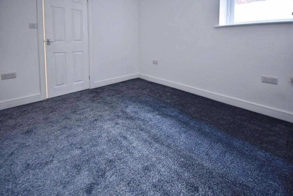
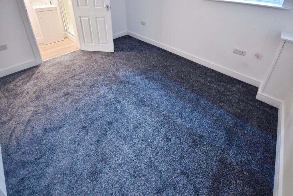
- 1 bedroom flat
- Ground Floor
- Open Plan Kitchen Diner
- Double Bedroom
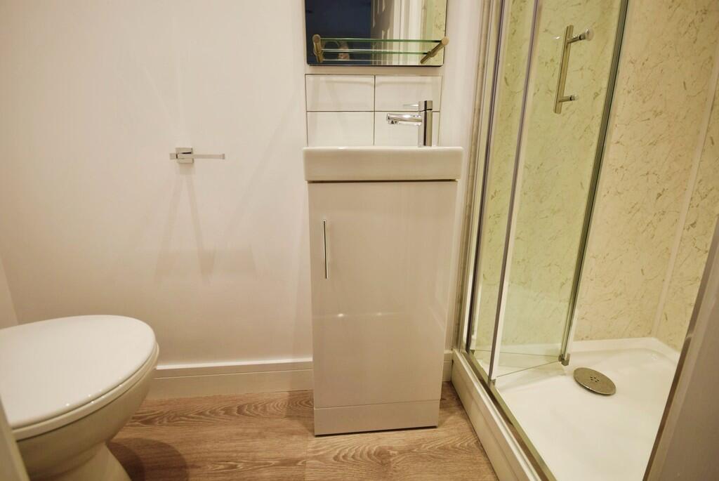
- Shower Room
- UPVC Double Glazing
- Water Bill Included
- Town Centre Location
Description
Listed by
Stoke On Trent
The Property Franchise Group
Reference: 89253132
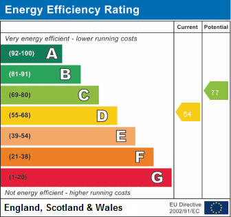
EPC ratings on this postcode
We don't have a matched EPC for this property yet. Below are efficiency scores and details for other addresses on this postcode.
| Address | Current | Potential | Floor area | Age band | Type |
|---|---|---|---|---|---|
| 31a High Street, STOKE-ON-TRENT | 71 | 78 | 57 m² | England and Wales: 1900-1929 | Flat |
| FLAT 1, 27 HIGH STREET, TUNSTALL, STOKE-ON-TRENT | 40 | 72 | 30 m² | England and Wales: 1900-1929 | Flat |
| Flat 1, 31 High Street, STOKE-ON-TRENT | 64 | 76 | 27 m² | England and Wales: 1900-1929 | Flat |
| Flat 1, 33 High Street, STOKE-ON-TRENT | 66 | 77 | 50 m² | England and Wales: 1900-1929 | Flat |
| Flat 2, 27 High Street, STOKE-ON-TRENT | 70 | 75 | 35 m² | England and Wales: 1900-1929 | Flat |
| Flat 2, 31 High Street, STOKE-ON-TRENT | 60 | 73 | 28 m² | England and Wales: 1900-1929 | Flat |
| Flat 2, 33 High Street, STOKE-ON-TRENT | 65 | 75 | 55 m² | England and Wales: 1900-1929 | Flat |
| Flat 3, 27 High Street, STOKE-ON-TRENT | 72 | 77 | 59 m² | England and Wales: 1900-1929 | Flat |
| Flat 3, 31 High Street, STOKE-ON-TRENT | 76 | 76 | 22 m² | England and Wales: 1900-1929 | Flat |
| Flat 4 27 High Street, Tunstall, Stoke on Trent | 64 | 77 | 21 m² | England and Wales: 1930-1949 | Flat |
| Flat 4, 31 High Street, STOKE-ON-TRENT | 75 | 75 | 22 m² | England and Wales: 1900-1929 | Flat |
| Flat 5, 31 High Street, STOKE-ON-TRENT | 74 | 76 | 18 m² | England and Wales: 1900-1929 | Flat |
| Flat 6, 31 High Street, STOKE-ON-TRENT | 74 | 74 | 18 m² | England and Wales: 1900-1929 | Flat |
| GROUND FLOOR FLAT, 33A HIGH STREET, STOKE-ON-TRENT | 72 | 78 | 27 m² | England and Wales: 1900-1929 | Flat |
Flood risk
Zone: 1
Risk: Low
Job (default Low)
EPC Graphs
EPC 1
Rental Range
Estimated market rent for Stoke-on-Trent. Low = conservative, Realistic = average, Optimistic = best case.
Based on Local Authority from postcode lookup → Stoke-on-Trent.
LHA (30th percentile) floor for Staffordshire North: Apr 2025 – Mar 2026
Location
Address
Connaught Street
Nearby
Nearest stations, universities and amenities (distance from property).
| Type | Name | Distance |
|---|---|---|
| Bus stop | Tunstall, High Street / Highgate | 0.0 miles |
| Bus stop | Tunstall, High Street / Woodland Street (stop C) | 0.1 miles |
| Shop | Vana Mini Market | 0.1 miles |
| Shop | Specsavers | 0.2 miles |
| Hospital | Haywood Hospital Walk-in Centre | 0.9 miles |
| Train station | Longport | 1.0 miles |
| Train station | Kidsgrove | 2.6 miles |
| Hospital | Royal Stoke University Hospital | 3.6 miles |
| University | Keele University | 4.5 miles |
| University | Buxton & Leek College | 8.6 miles |
Street-level crime
| Category | Count |
|---|---|
| Violence and sexual offences | 129 |
| Anti-social behaviour | 80 |
| Vehicle crime | 38 |
| Other theft | 31 |
| Criminal damage and arson | 29 |
| Public order | 25 |
| Burglary | 23 |
| Shoplifting | 18 |
| Drugs | 11 |
| Robbery | 8 |
| Possession of weapons | 7 |
| Other crime | 6 |
| Bicycle theft | 3 |
| Theft from the person | 1 |
| Total incidents | 409 |
Within 1 mile during Apr 2026. Source: data.police.uk (England & Wales).
Schools nearby
Nearest open schools with Ofsted ratings (England). Closed schools are not shown. Data from Get Information about Schools and Ofsted.
| Name | Type | Distance | Ofsted |
|---|---|---|---|
| The Nest | Other | 0.1 miles | Good — 13 Sep 2023 |
| St Mary's Church of England Primary School | Primary | 0.1 miles | Outstanding — 13 Jun 2024 |
| Active Wellbeing School | Other | 0.3 miles | Requires improvement — 29 Nov 2023 |
| Co-op Academy Stoke-On-Trent | Secondary | 0.3 miles | Good — 27 Mar 2013 |
| St Wilfrid's Catholic Primary School | Primary | 0.4 miles | Good — 12 Jun 2017 |
Rental Comparables
Residential lets from OpenRent and Rightmove for the area. Bedroom counts vary — use the Beds column to compare like-for-like lets. Student lets are excluded.
| Title | Rent | Beds | Distance | As seen on |
|---|---|---|---|---|
| High Street, Tunstall | £550/mo | — | 0 miles | Rightmove |
| High Street, Stoke-on-Trent, Staffordshire, ST6 | £550/mo | 1 | 0.09 miles | Rightmove |
| Pinnox Street, Stoke-On-Trent | £850/mo | 2 | 0.16 miles | Rightmove |
| 2 Bed Terraced House, Pinnox Street, ST6 | £750/mo | 2 | 0.17 miles | OpenRent |
| The Boulevard, Stoke-on-Trent, ST6 | £595/mo | — | 0.27 miles | Rightmove |
| King William Street, Tunstall | £750/mo | 2 | 0.27 miles | Rightmove |
| 2 Bed Terraced House, King William Street, ST6 | £750/mo | 2 | 0.29 miles | OpenRent |
| 2 Bed Terraced House, Richards Avenue, ST6 | £875/mo | 2 | 0.35 miles | OpenRent |
| Machin Street, Tunstall | £750/mo | 2 | 0.37 miles | Rightmove |
| Stanley Street, Tunstall | £850/mo | 3 | 0.42 miles | Rightmove |
| St Aidans Street, Stoke-on-trent | £750/mo | 2 | 0.55 miles | Rightmove |
| Bond Street, Tunstall | £750/mo | 2 | 0.57 miles | Rightmove |
| Federation Road, Burslem | £625/mo | 2 | 0.6 miles | Rightmove |
| Lancashire Court, Federation Road, Burslem, Stoke-on-Trent, ST6 | £600/mo | 1 | 0.63 miles | Rightmove |
| Victoria Park Road, Stoke-on-trent, ST6 6DY | £850/mo | 2 | 0.66 miles | Rightmove |
| Lyndhurst Street, Burslem | £695/mo | 2 | 0.81 miles | Rightmove |
| Westport Road, Stoke-On-Trent, ST6 | £625/mo | 1 | 0.83 miles | Rightmove |
| Newcastle Street, Stoke-on-Trent, Staffordshire, ST6 | £750/mo | 1 | 0.88 miles | Rightmove |
| Moorland Road, Burslem, Stoke-on-Trent | £715/mo | 2 | 0.93 miles | Rightmove |
| Railway Inn Apartments, Stoke-On-Trent, ST6 | £425/mo | 1 | 0.93 miles | Rightmove |
Average rent: £745/mo (52 listings)
Enter House Number
Enter the house number to help us retrieve more accurate pricing history and property data.
Please log in to submit or correct the house number for this listing.
Log in to continue