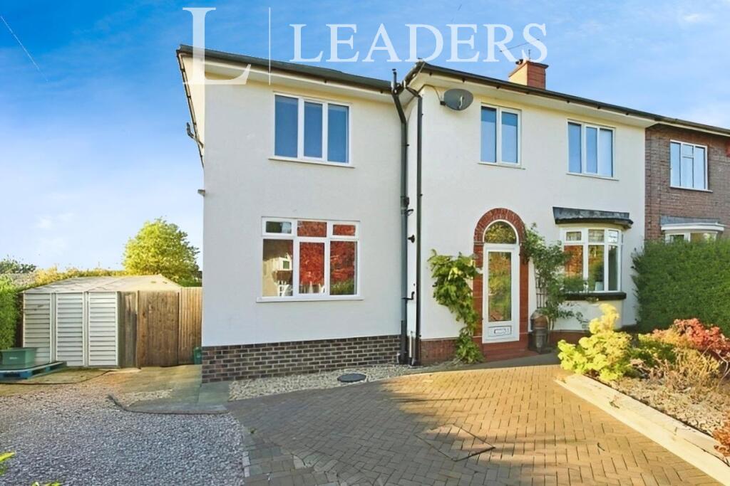
142 THE AVENUE
STOKE-ON-TRENT, STOKE-ON-TRENT, STAFFORDSHIRE ST4 6BZ
£600 pcm
Property details
Floor area
142 m²
Council tax band
D
Last sold
£174,950 May 2007
Local average
£202,484 (-99.7%)
Deprivation
Decile 3 (9,427 of 33,755)
Street crime
398 incidents within 1 mile (May 2026)
Key features
- NEW TO THE MARKET
- Less than 10 minute walk to Royal Stoke Hospital
- Close to Newcastle Town Centre
- Fully Furnished
- Utility Bills Included
- Available August 2026
Additional details
- Heating
- Gas central
- Parking
- Yes
- Garden
- Yes
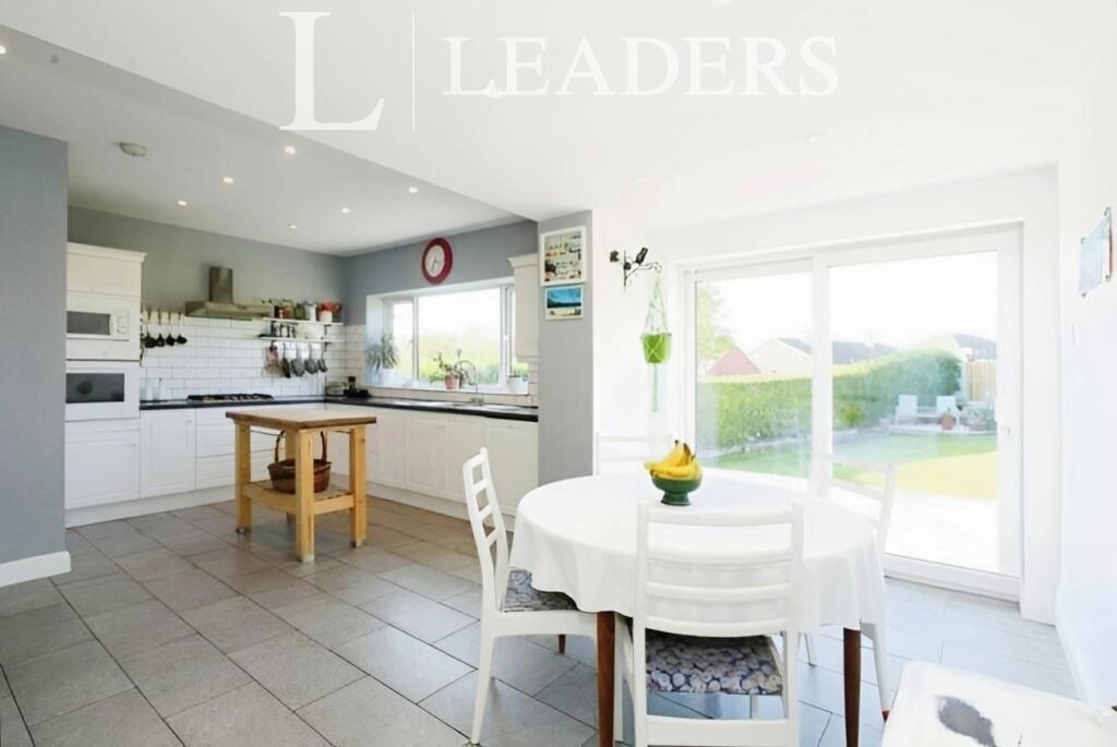
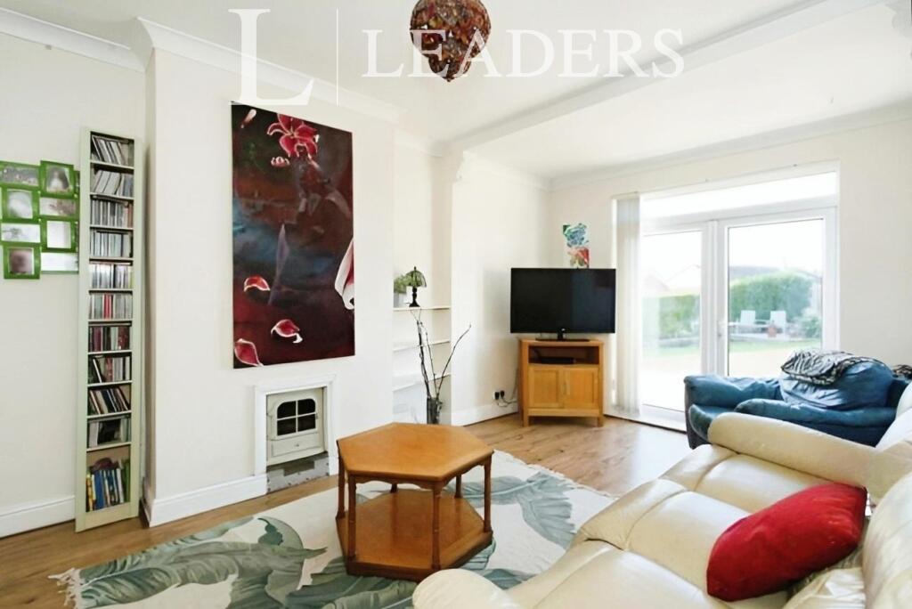
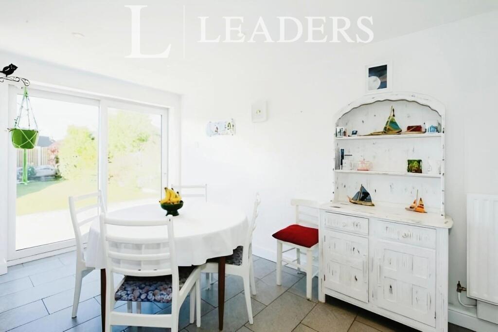
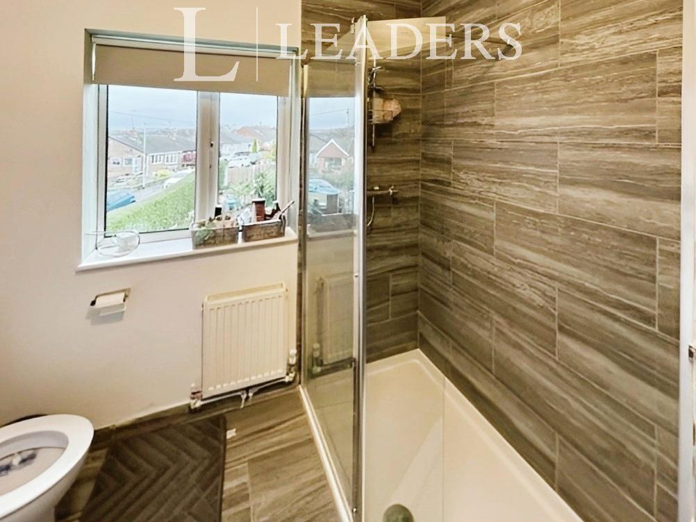
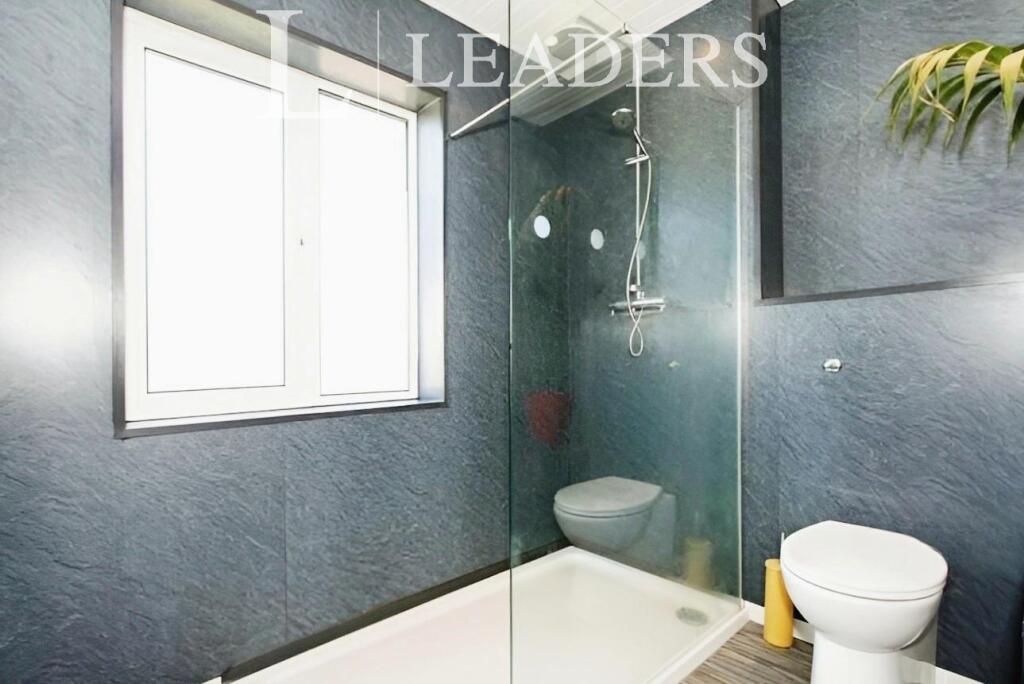
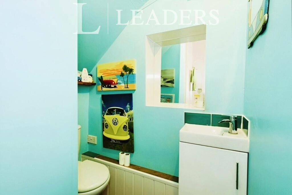
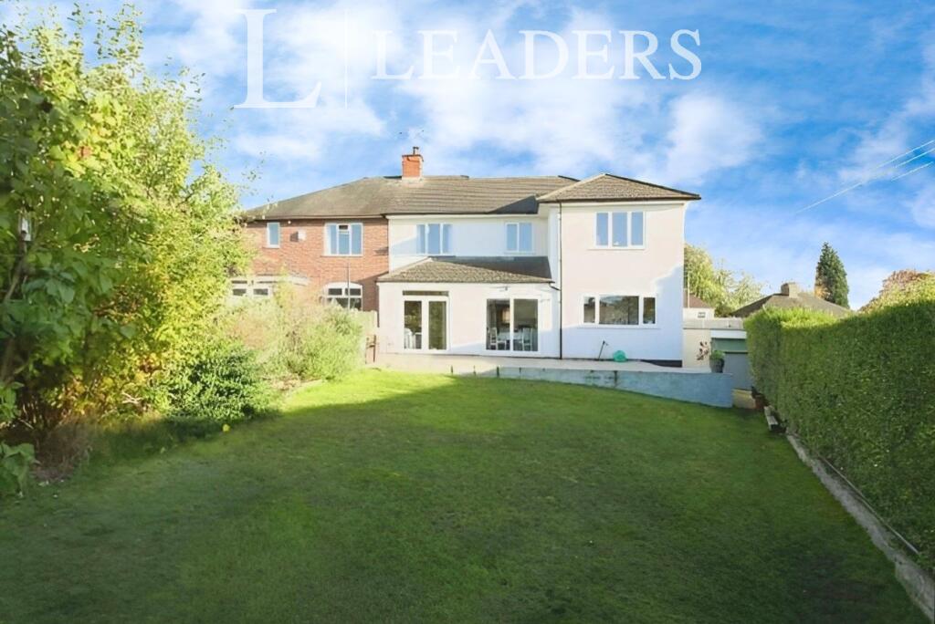
Description
Comprising internally as follows;
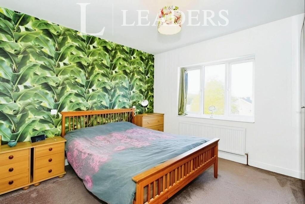
Room 1 is located on the ground floor and comes complete with a bed, wardrobe, drawers and a study desk and chair.
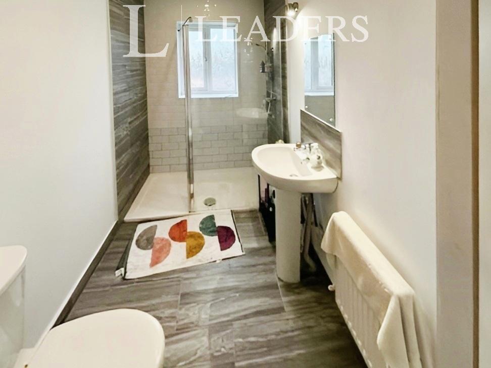
There are three communal shower rooms located to the first floor, meaning just two rooms share a bathroom
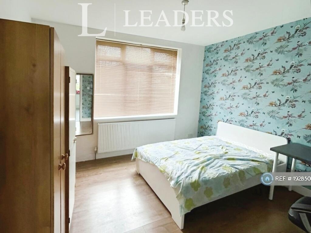
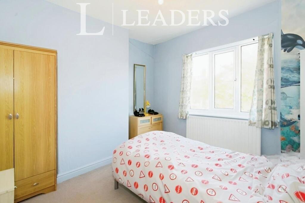
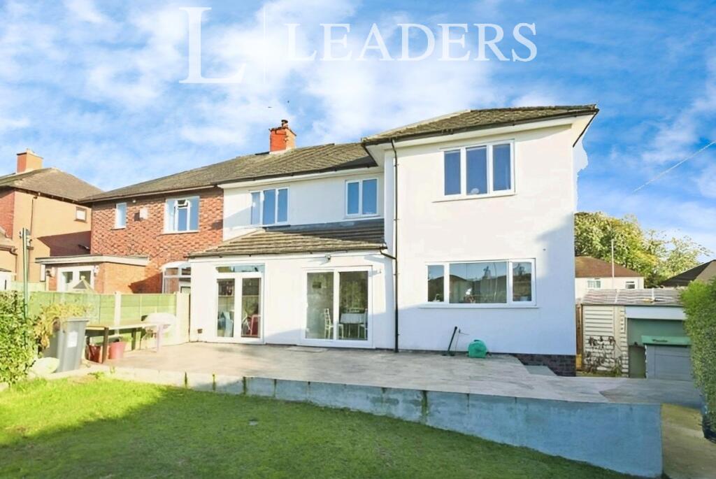
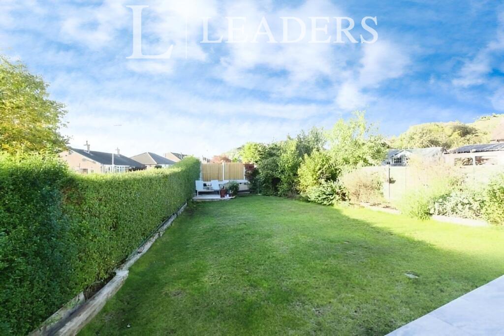
Additional benefits include modern neutral decor throughout, off road parking to the front of the property and a private enclosed zero maintenance rear garden as there is a gardener included duriing the summer months.
Early viewing is essential to avoid missing out as this one will not be available for long!
Call the team today for more information and to arrange your viewing now. Available August 2026.
Available fully furnished. EPC Rating: C. Council tax band: D. Rent is inclusive of utilities. Rent excludes the tenancy deposit and any other permitted payments. A Holding Deposit is required to reserve this property. Please contact us for further details or for a link to a video tour.
Listed by
Hartshill
Leaders and Romans Group
Reference: 172913690
EPC Rating & Upgrade Cost
Fetching EPC data… Refresh this page in a moment.
Flood risk
Zone: 1
Risk: Low
Job (default Low)
Price history
| Event | Date | Price | % change |
|---|---|---|---|
| Listed for sale | — | £600 | -99.7% |
| Sold | 16/05/2007 (19 years ago) | £174,950 | — |
Source: HM Land Registry Price Paid Data. Crown copyright.
Sold Comparables
Same street and nearby sales within 0.25 miles (last 5 years). Data from Land Registry Price Paid.
| Address | Price | Date | Type |
|---|---|---|---|
| 113 - 115 LONDON ROAD, NEWCASTLE, NEWCASTLE-UNDER-LYME, STAFFORDSHIRE, ST5 1ND | £587,500 | 06/09/2024 | Other |
| Same street 142 THE AVENUE, STOKE-ON-TRENT, NEWCASTLE-UNDER-LYME, STAFFORDSHIRE, ST4 6BZ | £315,000 | 26/05/2023 | Semi-detached |
| Same street 108 THE AVENUE, STOKE-ON-TRENT, NEWCASTLE-UNDER-LYME, STAFFORDSHIRE, ST4 6BZ | £250,000 | 29/07/2022 | Semi-detached |
| Same street 128 THE AVENUE, STOKE-ON-TRENT, NEWCASTLE-UNDER-LYME, STAFFORDSHIRE, ST4 6BZ | £210,000 | 04/02/2022 | Semi-detached |
| Same street 140 THE AVENUE, STOKE-ON-TRENT, NEWCASTLE-UNDER-LYME, STAFFORDSHIRE, ST4 6BZ | £230,000 | 25/08/2021 | Semi-detached |
Street average: £251,250 (4 sales)
Area average: £587,500 (1 sale)
Capital growth trend
Land Registry outcode average: last 12 months vs 5y and 10y ago (from sold prices).
House Price Index (HM Land Registry — official index, not sold-price averages): Newcastle-under-Lyme. Series: All dwelling types. As of April 2026.
Company ownership
Registered legal owner is a company.
Company: PS2 PROPERTIES LIMITED (11309496)
Rental Range
Estimated market rent for Newcastle-under-Lyme. Low = conservative, Realistic = average, Optimistic = best case.
Based on Local Authority from postcode lookup → Newcastle-under-Lyme.
LHA (30th percentile) floor for Staffordshire North: £424/mo (Apr 2025 – Mar 2026)
Location
Nearby
Nearest stations, universities and amenities (distance from property).
| Type | Name | Distance |
|---|---|---|
| Bus stop | The Avenue | 0.1 miles |
| Bus stop | Royal Stoke University Hospital / Chapel | 0.1 miles |
| Hospital | Royal Stoke University Hospital | 0.2 miles |
| Shop | Enable.Business | 0.2 miles |
| Shop | Pinkstones | 0.3 miles |
| Hospital | Car park site | 0.4 miles |
| Train station | Stoke-on-Trent | 1.5 miles |
| University | University of Staffordshire Stoke Campus | 1.6 miles |
| Train station | Longport | 2.6 miles |
Street-level crime
| Category | Count |
|---|---|
| Violence and sexual offences | 147 |
| Anti-social behaviour | 92 |
| Public order | 39 |
| Shoplifting | 28 |
| Criminal damage and arson | 26 |
| Other theft | 18 |
| Drugs | 17 |
| Burglary | 12 |
| Bicycle theft | 5 |
| Robbery | 5 |
| Vehicle crime | 5 |
| Other crime | 2 |
| Possession of weapons | 1 |
| Theft from the person | 1 |
| Total incidents | 398 |
Within 1 mile during May 2026. Source: data.police.uk (England & Wales).
Schools nearby
Nearest open schools with Ofsted ratings (England). Closed schools are not shown. Data from Get Information about Schools and Ofsted.
| Name | Type | Distance | Ofsted |
|---|---|---|---|
| Coppice Academy | Other | 0.4 miles | Good — 6 Mar 2014 |
| Newcastle-under-Lyme School | Other | 0.4 miles | — (No rating) |
| Harpfield Primary Academy | Primary | 0.4 miles | Good — 10 Feb 2015 |
| Hassell Primary School | Primary | 0.5 miles | Good — 25 Oct 2023 |
| St John's CofE (A) Primary School | Primary | 0.5 miles | Requires improvement — 14 Jun 2023 |
Rental Comparables
Residential lets from OpenRent and Rightmove for the area (same bedroom count). Use to validate rent estimates. Student lets are excluded.
Average rent: £612/mo (33 listings)
Rent-driven metrics
Based on OpenRent comparables.
- Rent ratio — Monthly rent ÷ purchase price (1% rule). 1%+ = strong, 0.8–1% = okay, <0.8% = weak for cashflow.
- Max investor price — Rent ÷ 0.8%; the price at which rent would be 0.8% of price (Stoke-style target).
- Target investor price — Rent ÷ 1%; the price at which rent would be 1% of price (strong cashflow band).
- Gross yield — Annual rent as % of purchase price (no costs).
- Cost-to-rent — Price ÷ annual rent (from OpenRent comparables). Under 14× = strong, 14–16× = acceptable, 17×+ = compressed.
- Cashflow — Rent minus mortgage, 10% maintenance, £25/mo compliance. Assumes 75% LTV, 3.95% APR (5yr fixed), 25yr term.
- ROI — Annual profit ÷ cash in (deposit + 4% purchase costs).