6A
RAEBURN ROAD, BRISTOL, CITY OF BRISTOL BS5 8PS
Property details
Tenure
FREEHOLD
Floor area
125 m²
Council tax band
C
EPC rating
D
Year built
England and Wales: 1967-1975
Last sold
£490,000 Oct 2023
Price per m²
£4,000/m²
Local average
£344,611 (+45.1%)
Deprivation
Decile 7 (22,154 of 33,755)
Street crime
372 incidents within 1 mile (Apr 2026)
Key features
- NO ONWARD CHAIN
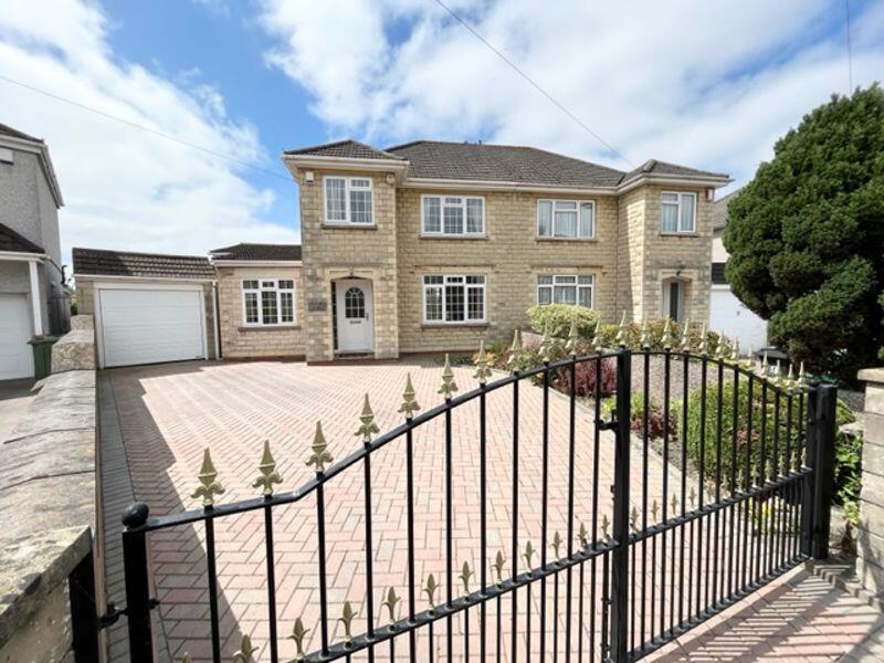
- EXTENDED SEMI DETACHED HOME
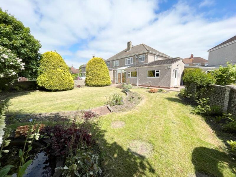
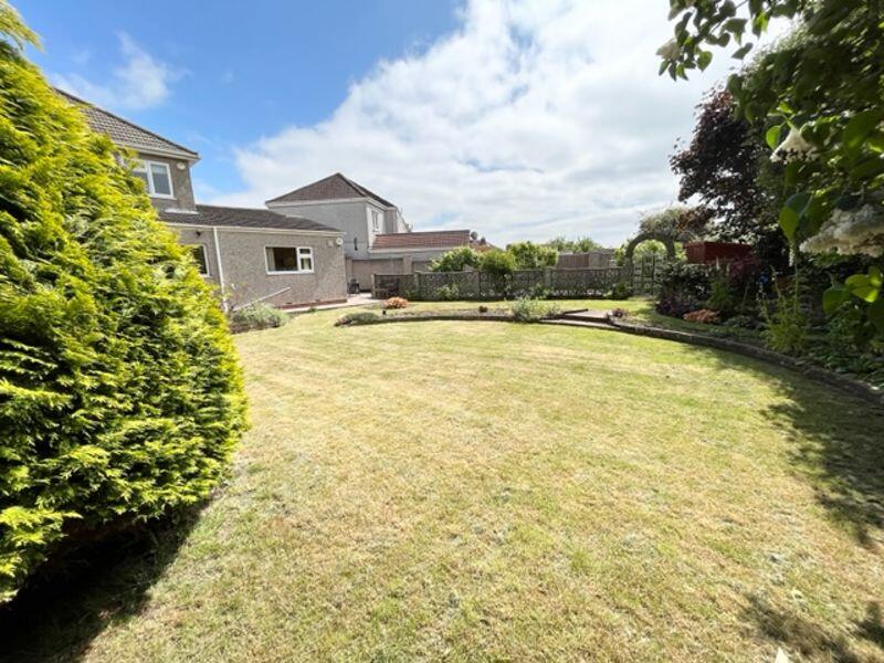
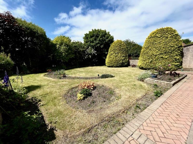
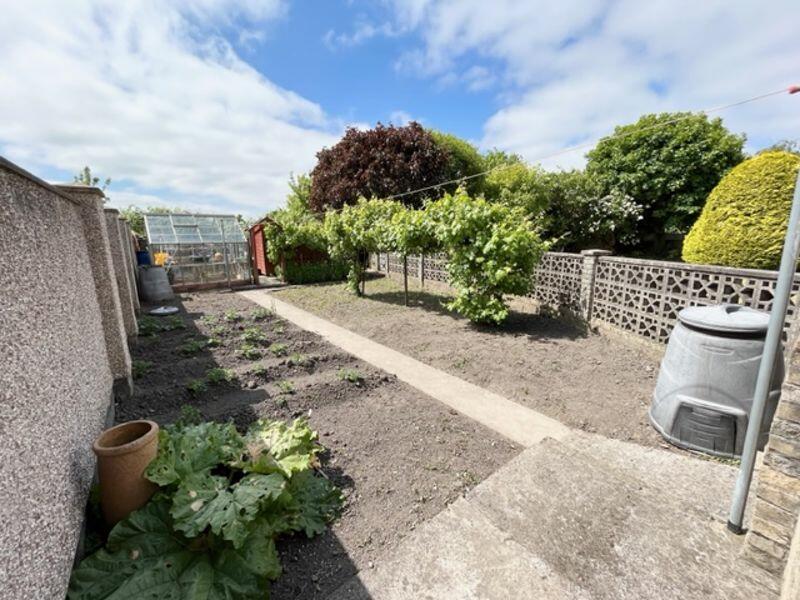
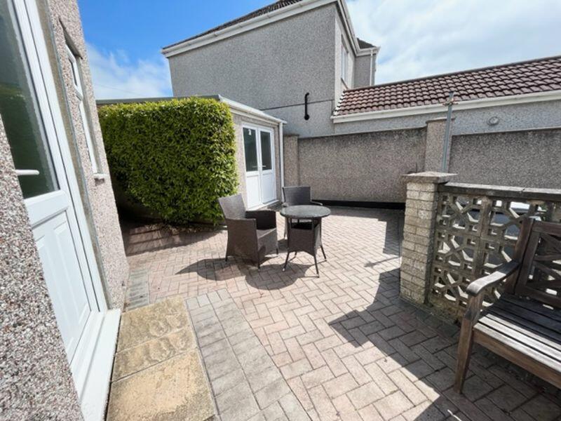
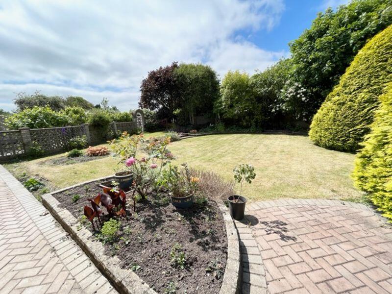
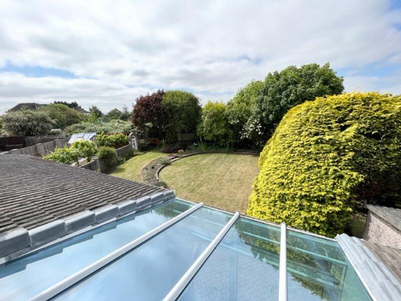
- LARGER THAN AVERAGE SOUTH FACING GARDEN
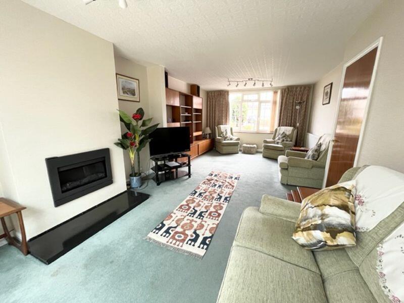
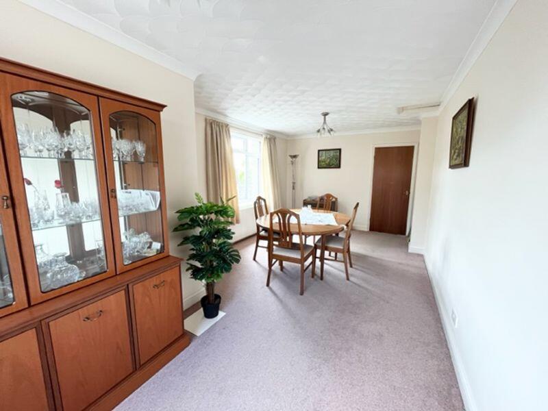
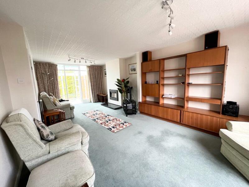
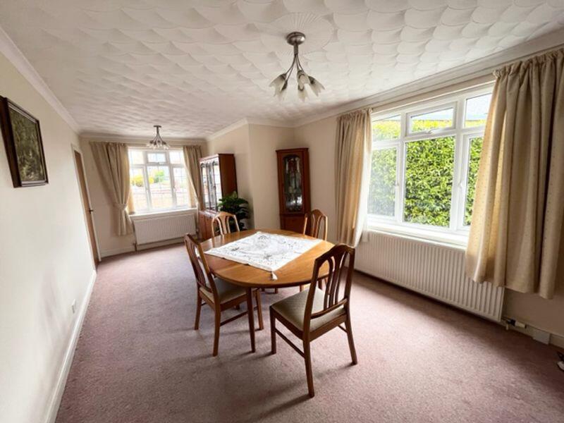
- TWO SPACIOUS RECEPTION ROOMS
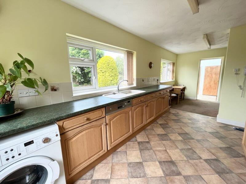
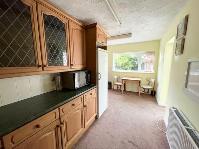
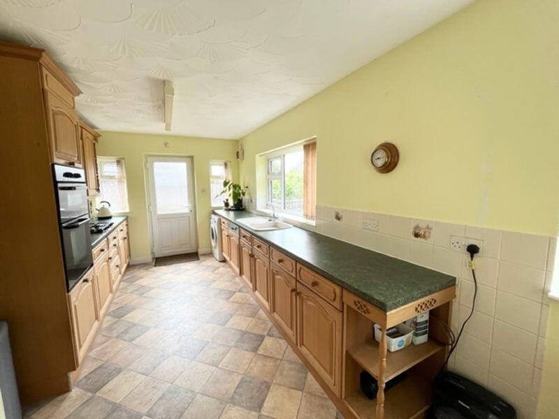
- KITCHEN/BREAKFAST ROOM
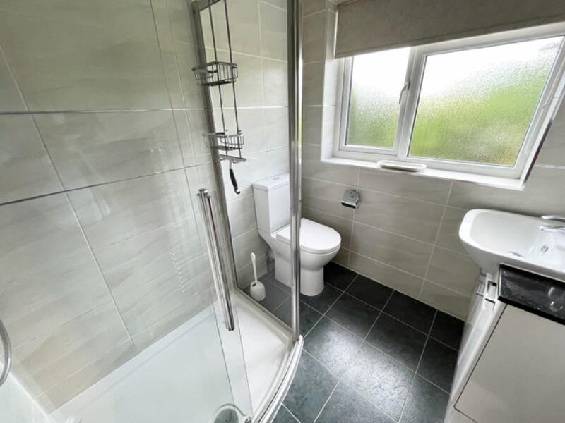
- MODERN SHOWER ROOM
- DRIVEWAY
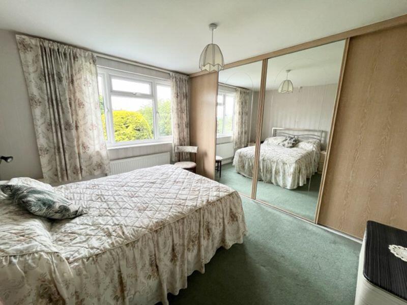
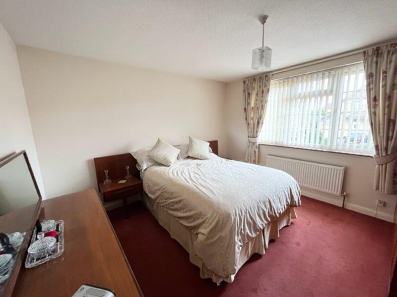
- THREE GENEROUS BEDROOMS
- UPVC DOUBLE GLAZING
- EARLY VIEWING ADVISED
Additional details
- Parking
- Yes
- Garden
- Yes
Description
Listed by
Bristol
Anne James Estate Agents
Reference: 135692951
EPC Rating & Upgrade Cost
Current rating: D
Potential rating: C
Inspection date: 15/06/2023
Expiry date: 14/06/2033
Est. upgrade cost to C: £11,500
Recommendations
- Cavity wall insulation (£500 - £1,500)
- Floor insulation (suspended floor) (£800 - £1,200)
- Solar water heating (£4,000 - £6,000)
- Solar photovoltaic panels, 2.5 kWp (£3,500 - £5,500)
Flood risk
Zone: 1
Risk: Low
Job (default Low)
Floorplans
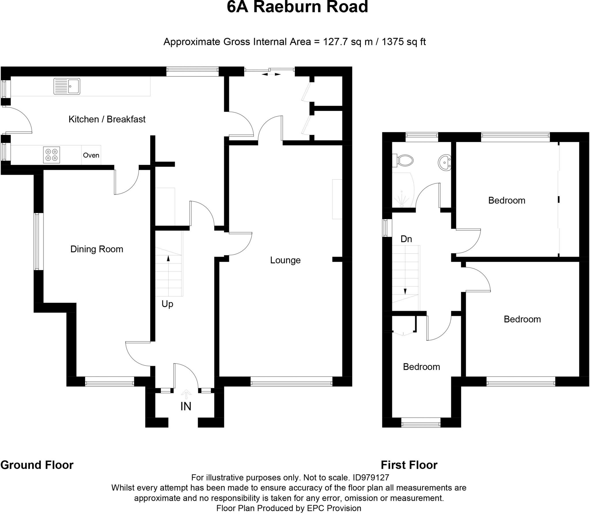
Floorplan 1
FENSA Certificates
This property has 4 FENSA certificate(s) on record, indicating window/door installations by FENSA-approved installers.
FENSA Certificate #10364152
Property Details
Street: 6a Raeburn Road
Town: BRISTOL
Postcode: BS5 8PS
Installation Details
Items: 2 doors
Certificate Issued: 01/07/2014
Work Completed: 06/06/2014
This certificate data was retrieved from FENSA's database
FENSA Certificate #7104975
Property Details
Street: 6a Raeburn Road
Town: BRISTOL
Postcode: BS5 8PS
Installation Details
Items: 7 windows
Certificate Issued: 18/01/2010
Work Completed: 04/01/2010
This certificate data was retrieved from FENSA's database
FENSA Certificate #12494330
Property Details
Street: 6a Raeburn Road
Town: BRISTOL
Postcode: BS5 8PS
Installation Details
Items: 6 windows and 1 door
Certificate Issued: 14/08/2017
Work Completed: 27/06/2017
This certificate data was retrieved from FENSA's database
FENSA Certificate #16620294 Recent
Property Details
Street: 6a Raeburn Road
Town: BRISTOL
Postcode: BS5 8PS
Installation Details
Items: 1 door
Certificate Issued: 29/12/2024
Work Completed: 17/12/2024
This certificate data was retrieved from FENSA's database
What is FENSA? FENSA (Fenestration Self-Assessment Scheme) is a government-authorised scheme that monitors building regulation compliance for replacement windows and doors. Certificates indicate that work was completed by FENSA-approved installers.
Price history
| Event | Date | Price | % change |
|---|---|---|---|
| Sold | 20/10/2023 (2 years ago) | £490,000 | — |
Source: HM Land Registry Price Paid Data. Crown copyright.
Sold Comparables
Same street and nearby sales within 0.25 miles (last 5 years). Data from Land Registry Price Paid.
| Address | Price | Date | Type |
|---|---|---|---|
| 14 WESTMEAD ROAD, ST GEORGE, BRISTOL, CITY OF BRISTOL, BS5 8NY | £390,000 | 12/12/2025 | Semi-detached |
| 7 WINDSOR AVENUE, BRISTOL, CITY OF BRISTOL, BS5 8RF | £450,000 | 09/12/2025 | Semi-detached |
| 16 WINDSOR AVENUE, BRISTOL, CITY OF BRISTOL, BS5 8RF | £370,000 | 18/07/2023 | Semi-detached |
| 28 KINGSCOTE PARK, BRISTOL, CITY OF BRISTOL, BS5 8QX | £352,000 | 13/06/2023 | Semi-detached |
| 4 WESTMEAD ROAD, ST GEORGE, BRISTOL, CITY OF BRISTOL, BS5 8NY | £250,000 | 20/04/2023 | Semi-detached |
| 233 KINGSWAY, ST GEORGE, BRISTOL, CITY OF BRISTOL, BS5 8NT | £248,000 | 10/03/2023 | Semi-detached |
| 12 RAEBURN ROAD, BRISTOL, CITY OF BRISTOL, BS5 8PS | £370,000 | 21/10/2022 | Semi-detached |
| 6 HEADFORD AVENUE, ST GEORGE, BRISTOL, CITY OF BRISTOL, BS5 8PF | £305,000 | 07/10/2022 | Semi-detached |
| 32 HEADFORD AVENUE, ST GEORGE, BRISTOL, CITY OF BRISTOL, BS5 8PF | £344,000 | 05/09/2022 | Semi-detached |
| 39 ROSSITERS LANE, BRISTOL, CITY OF BRISTOL, BS5 8TN | £333,000 | 02/09/2022 | Semi-detached |
| 13 FURBER VALE, BRISTOL, CITY OF BRISTOL, BS5 8PZ | £350,050 | 22/08/2022 | Semi-detached |
| 43A KINGSCOTE PARK, BRISTOL, CITY OF BRISTOL, BS5 8QX | £380,000 | 28/04/2022 | Semi-detached |
| 17 RAEBURN ROAD, BRISTOL, CITY OF BRISTOL, BS5 8PS | £400,000 | 25/01/2022 | Semi-detached |
| 17 RAEBURN ROAD, BRISTOL, CITY OF BRISTOL, BS5 8PS | £400,000 | 25/01/2022 | Semi-detached |
| 43B KINGSCOTE PARK, BRISTOL, CITY OF BRISTOL, BS5 8QX | £345,000 | 21/12/2021 | Semi-detached |
| 34 STAPLEGROVE CRESCENT, BRISTOL, CITY OF BRISTOL, BS5 8QW | £353,000 | 26/10/2021 | Semi-detached |
| 30 KINGSCOTE PARK, BRISTOL, CITY OF BRISTOL, BS5 8QX | £340,000 | 24/09/2021 | Semi-detached |
| 217 KINGSWAY, ST GEORGE, BRISTOL, CITY OF BRISTOL, BS5 8NT | £350,000 | 23/09/2021 | Semi-detached |
| 29 NORTHFIELD ROAD, BRISTOL, CITY OF BRISTOL, BS5 8PA | £270,000 | 17/09/2021 | Semi-detached |
| 14 FURBER COURT, BRISTOL, CITY OF BRISTOL, BS5 8PU | £291,000 | 12/08/2021 | Semi-detached |
Area average: £344,553 (20 sales)
Capital growth trend
Land Registry outcode average: last 12 months vs 5y and 10y ago (from sold prices).
House Price Index (HM Land Registry — official index, not sold-price averages): City of Bristol. Series: Semi-detached. As of March 2026.
Rental Range
Estimated market rent for Bristol, City of. Low = conservative, Realistic = average, Optimistic = best case.
Based on Local Authority from postcode lookup → Bristol, City of.
LHA (30th percentile) floor for Bristol: £1,296/mo (Apr 2025 – Mar 2026)
Location
Nearby
Nearest stations, universities and amenities (distance from property).
| Type | Name | Distance |
|---|---|---|
| Bus stop | Kingsway Shops | 0.1 miles |
| Bus stop | Bryants Hill | 0.1 miles |
| Shop | KSK News | 0.3 miles |
| Shop | Bargain Beer | 0.5 miles |
| Train station | Lawrence Hill | 1.8 miles |
| Train station | Stapleton Road | 2.1 miles |
| University | Bristol Digital Futures Institute | 2.3 miles |
| University | dBs Institute Bristol Campus | 2.8 miles |
| Hospital | South West Regional Laboratories | 3.4 miles |
| Hospital | Spire Bristol | 4.1 miles |
Street-level crime
| Category | Count |
|---|---|
| Violence and sexual offences | 134 |
| Anti-social behaviour | 52 |
| Public order | 34 |
| Shoplifting | 33 |
| Burglary | 27 |
| Criminal damage and arson | 26 |
| Vehicle crime | 24 |
| Other theft | 20 |
| Other crime | 11 |
| Robbery | 5 |
| Drugs | 3 |
| Bicycle theft | 2 |
| Theft from the person | 1 |
| Total incidents | 372 |
Within 1 mile during Apr 2026. Source: data.police.uk (England & Wales).
Schools nearby
Nearest open schools with Ofsted ratings (England). Closed schools are not shown. Data from Get Information about Schools and Ofsted.
| Name | Type | Distance | Ofsted |
|---|---|---|---|
| John Cabot Academy | Secondary | 0.4 miles | — (Inspected (no overall grade)) |
| Air Balloon Hill Primary School | Primary | 0.4 miles | Good — 21 May 2018 |
| Two Mile Hill Primary School | Primary | 0.5 miles | Requires improvement — 21 Sep 2022 |
| Beacon Rise Primary School | Primary | 0.6 miles | Outstanding — 29 Jan 2024 |
| Samuel White's Infant School | Primary | 0.7 miles | Good — 31 Jan 2023 |
Rental Comparables
Rental listings exist nearby, but none matched the 3-bedroom count for this property.
Rent-driven metrics
Based on Area rent estimate.
- Rent ratio — Monthly rent ÷ purchase price (1% rule). 1%+ = strong, 0.8–1% = okay, <0.8% = weak for cashflow.
- Max investor price — Rent ÷ 0.8%; the price at which rent would be 0.8% of price (Stoke-style target).
- Target investor price — Rent ÷ 1%; the price at which rent would be 1% of price (strong cashflow band).
- Gross yield — Annual rent as % of purchase price (no costs).