13 BOUNDARY ROAD
BISHOP'S STORTFORD, HERTFORDSHIRE CM23 5LE
£425,000
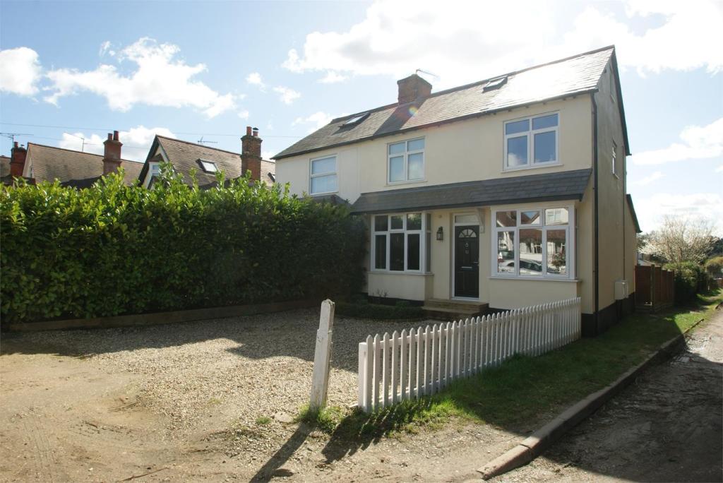
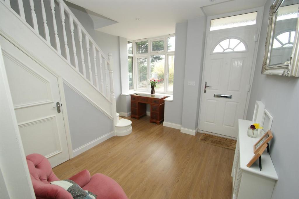
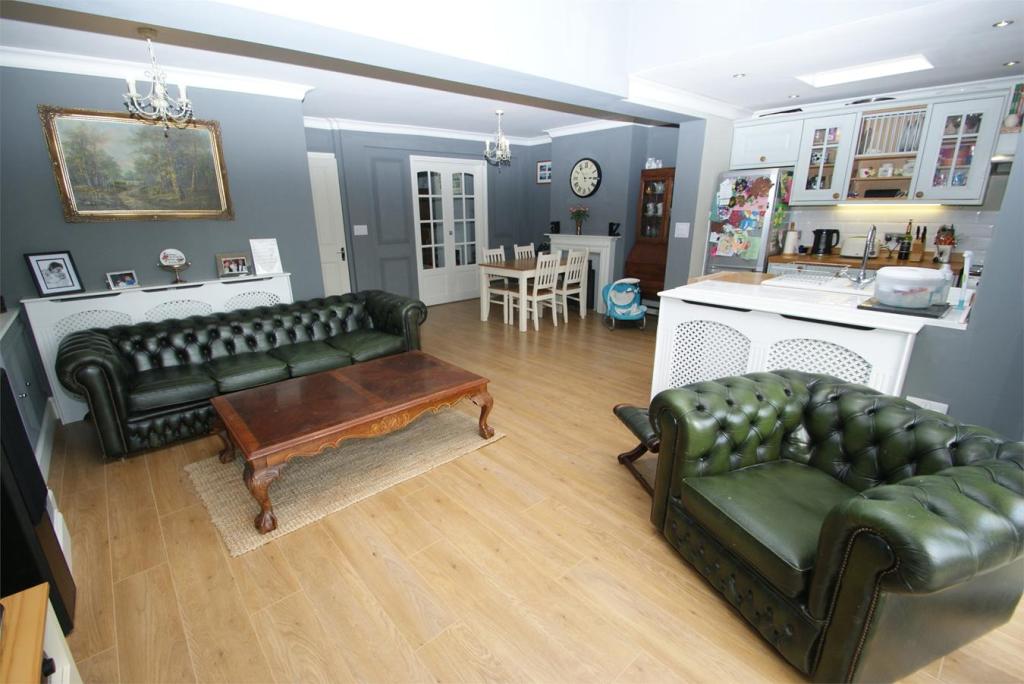
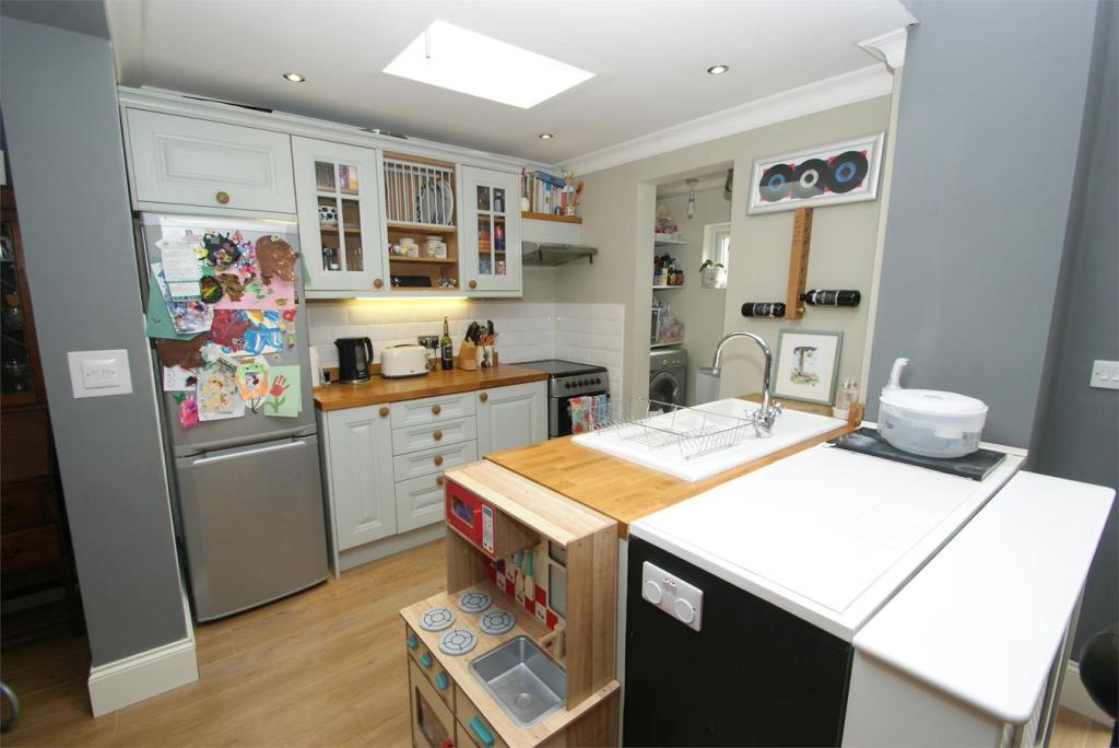
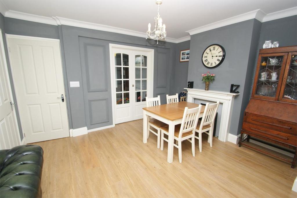
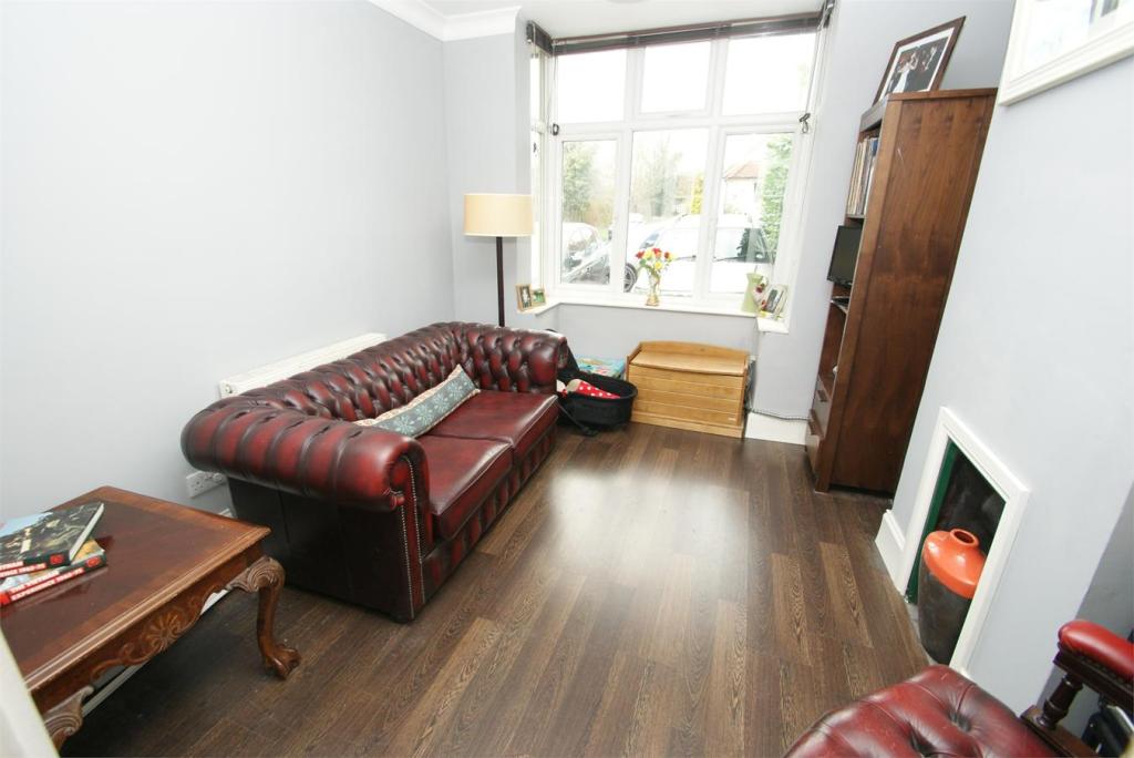
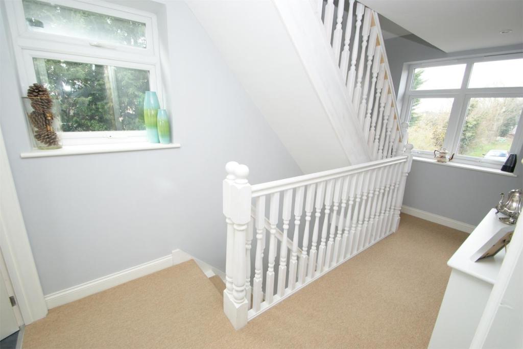
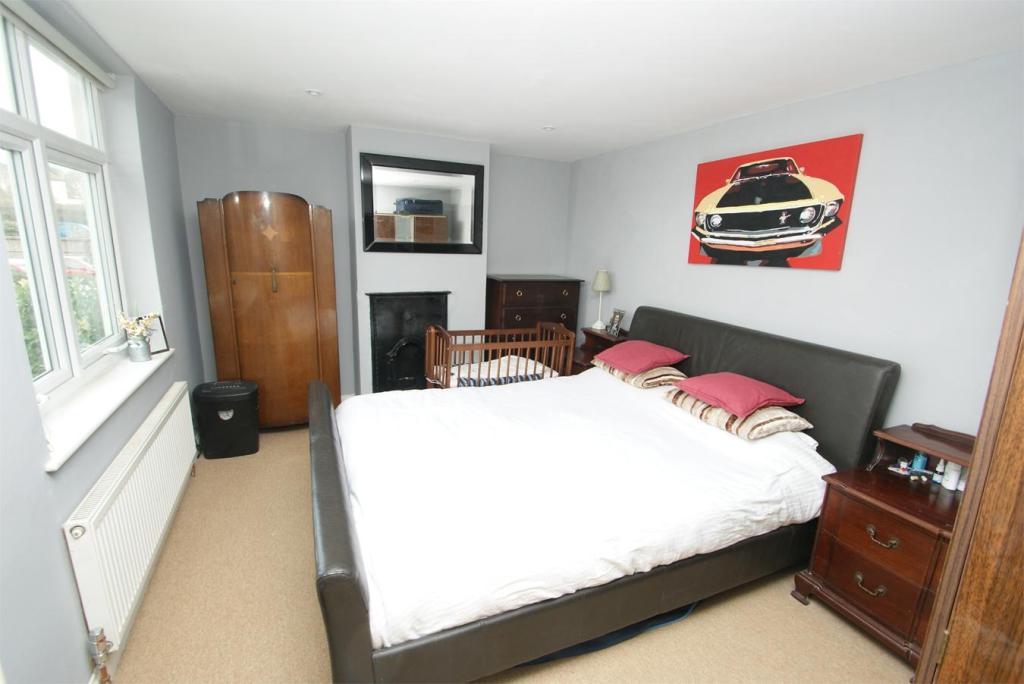
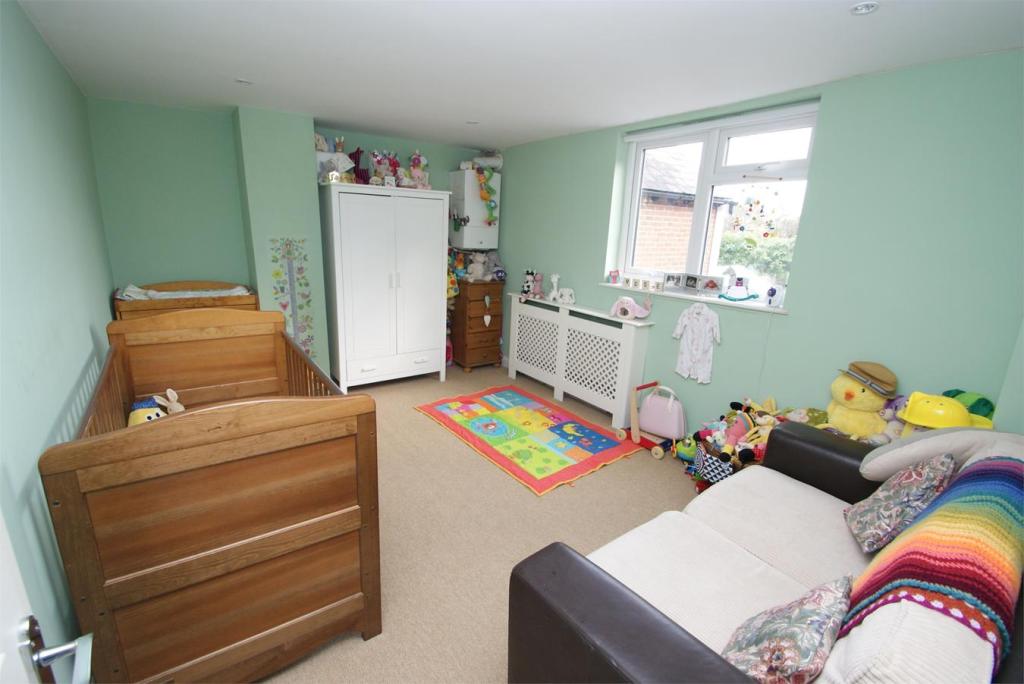
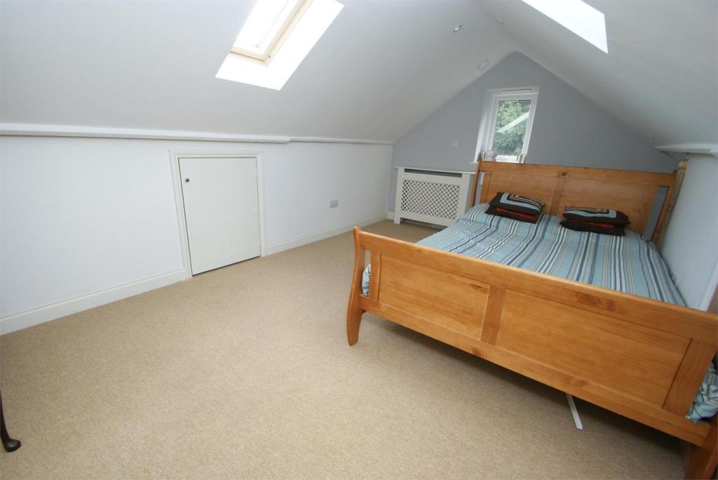
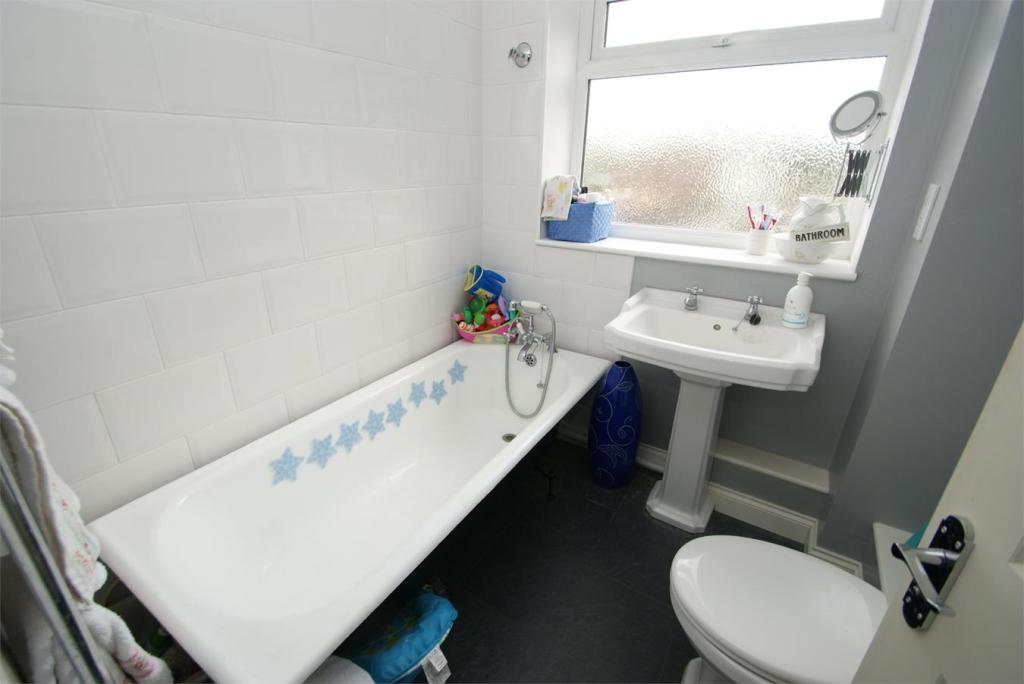
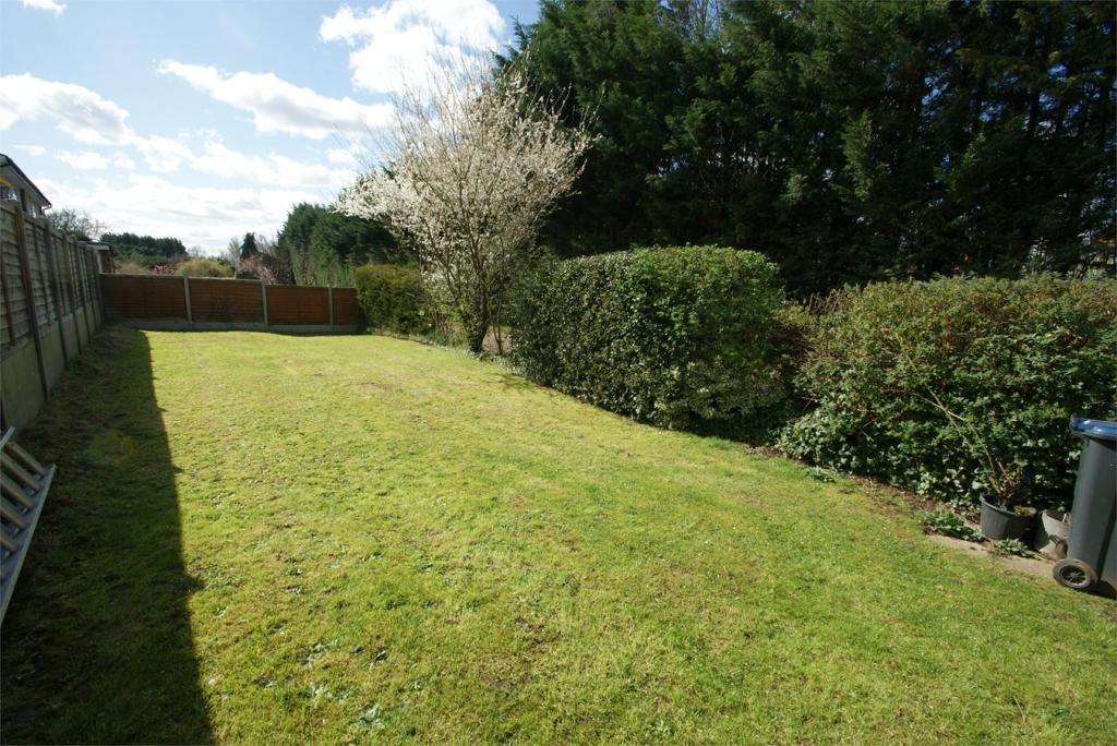
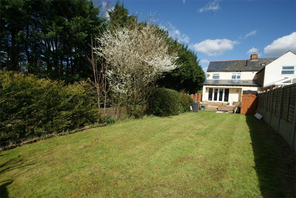
Photo 1 Photo 2 Photo 3 Photo 4 Photo 5 Photo 6 Photo 7 Photo 8 Photo 9 Photo 10 Photo 11 Photo 12 Photo 13
/ 13
Property details
Tenure
FREEHOLD
Floor area
111 m²
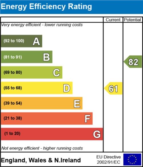
EPC rating
D
Year built
England and Wales: 1900-1929
Last sold
£400,000 Aug 2015
Price per m²
£3,829/m²
Local average
£526,310 (-19.2%)
Deprivation
Decile 9 (28,496 of 33,755)
Street crime
207 incidents within 1 mile (Apr 2026)
Additional details
- Parking
- Communal
- Garden
- Yes
Description
Property ref: 121_1769_3725771
Listed by
Bishop's Stortford
Fordyce Furnivall
Reference: 51561686
EPC Rating & Upgrade Cost
Current rating: D
Potential rating: B
Inspection date: 01/04/2015
Expiry date: 31/03/2025 (expired)
Recommendations
- Room-in-roof insulation (2,700)
- 50 mm internal or external wall insulation (14,000)
- Low energy lighting for all fixed outlets (15)
- Upgrade heating controls (450)
- Solar water heating (6,000)
- Solar photovoltaic panels, 2.5 kWp (8,000)
Flood risk
Zone: 1
Risk: Low
Job (default Low)
Floorplans
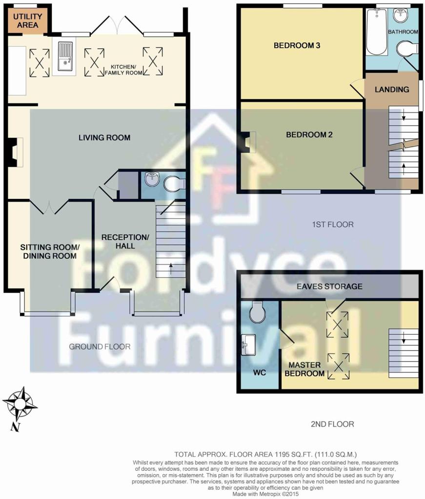
Floorplan 1
EPC Graphs
EER
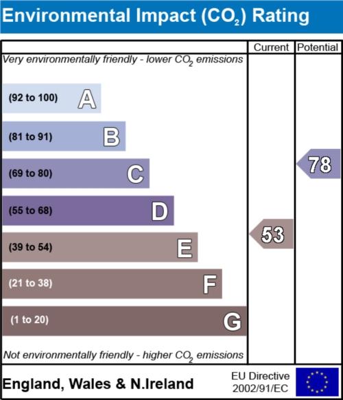
EIR
FENSA Certificates
This property has 2 FENSA certificate(s) on record, indicating window/door installations by FENSA-approved installers.
FENSA Certificate #12204670
Property Details
Street: 13 Boundary Road
Town: BISHOP'S STORTFORD
Postcode: CM23 5LE
Installation Details
Items: 2 windows
Certificate Issued: 20/02/2017
Work Completed: 06/01/2017
This certificate data was retrieved from FENSA's database
FENSA Certificate #14746693 Recent
Property Details
Street: 13 Boundary Road
Town: BISHOP'S STORTFORD
Postcode: CM23 5LE
Installation Details
Items: 3 windows
Certificate Issued: 22/08/2021
Work Completed: 13/08/2021
This certificate data was retrieved from FENSA's database
What is FENSA? FENSA (Fenestration Self-Assessment Scheme) is a government-authorised scheme that monitors building regulation compliance for replacement windows and doors. Certificates indicate that work was completed by FENSA-approved installers.
Price history
| Event | Date | Price | % change |
|---|---|---|---|
| Sold | 07/08/2015 (10 years ago) | £400,000 | — |
Source: HM Land Registry Price Paid Data. Crown copyright.
Sold Comparables
Same street and nearby sales within 0.25 miles (last 5 years). Data from Land Registry Price Paid.
| Address | Price | Date | Type |
|---|---|---|---|
| CROSSWAYS, 1 BOUNDARY ROAD, BISHOP'S STORTFORD, EAST HERTFORDSHIRE, HERTFORDSHIRE, CM23 5LE | £658,000 | 27/03/2025 | Semi-detached |
| 2 PRYORS CLOSE, BISHOP'S STORTFORD, EAST HERTFORDSHIRE, HERTFORDSHIRE, CM23 5JX | £510,000 | 16/10/2023 | Semi-detached |
| 4 BOUNDARY ROAD, BISHOP'S STORTFORD, EAST HERTFORDSHIRE, HERTFORDSHIRE, CM23 5LE | £535,000 | 21/08/2023 | Semi-detached |
| 3 SOUTHMILL ROAD, BISHOP'S STORTFORD, EAST HERTFORDSHIRE, HERTFORDSHIRE, CM23 3FR | £540,000 | 14/10/2022 | Semi-detached |
| 13 SOUTHMILL ROAD, BISHOP'S STORTFORD, EAST HERTFORDSHIRE, HERTFORDSHIRE, CM23 3FR | £585,000 | 07/04/2022 | Semi-detached |
| 44 HALLINGBURY ROAD, BISHOP'S STORTFORD, EAST HERTFORDSHIRE, HERTFORDSHIRE, CM23 5LA | £595,000 | 25/03/2022 | Semi-detached |
| 15 SOUTHMILL ROAD, BISHOP'S STORTFORD, EAST HERTFORDSHIRE, HERTFORDSHIRE, CM23 3FR | £520,000 | 02/02/2022 | Semi-detached |
| 30 SOUTH ROAD, BISHOP'S STORTFORD, EAST HERTFORDSHIRE, HERTFORDSHIRE, CM23 3JJ | £510,500 | 30/11/2021 | Semi-detached |
Area average: £556,688 (8 sales)
Capital growth trend
Land Registry outcode average: last 12 months vs 5y and 10y ago (from sold prices).
House Price Index (HM Land Registry — official index, not sold-price averages): East Hertfordshire. Series: Semi-detached. As of March 2026.
Rental Range
Estimated market rent for East Hertfordshire. Low = conservative, Realistic = average, Optimistic = best case.
Based on Local Authority from postcode lookup → East Hertfordshire.
LHA (30th percentile) floor for Harlow & Stortford: £1,207/mo (Apr 2025 – Mar 2026)
Location
Nearby
Nearest stations, universities and amenities (distance from property).
| Type | Name | Distance |
|---|---|---|
| Bus stop | Beldams Lane | 0.1 miles |
| Shop | Little Waitrose | 0.2 miles |
| Shop | Bakers Bikes | 0.2 miles |
| Train station | Bishop's Stortford | 0.3 miles |
| Train station | Stansted Mountfitchet | 3.0 miles |
| Hospital | Jacob's Neuro Centre | 4.0 miles |
| Hospital | Saffron Walden Community Hospital (no A&E) | 11.9 miles |
Street-level crime
| Category | Count |
|---|---|
| Violence and sexual offences | 70 |
| Anti-social behaviour | 47 |
| Shoplifting | 34 |
| Burglary | 12 |
| Criminal damage and arson | 12 |
| Vehicle crime | 9 |
| Other theft | 8 |
| Drugs | 4 |
| Public order | 4 |
| Theft from the person | 3 |
| Possession of weapons | 2 |
| Bicycle theft | 1 |
| Robbery | 1 |
| Total incidents | 207 |
Within 1 mile during Apr 2026. Source: data.police.uk (England & Wales).
Schools nearby
Nearest open schools with Ofsted ratings (England). Closed schools are not shown. Data from Get Information about Schools and Ofsted.
| Name | Type | Distance | Ofsted |
|---|---|---|---|
| Thorn Grove Primary School | Primary | 0.3 miles | Good — 9 Jun 2019 |
| The Hertfordshire & Essex High School and Science College | Secondary | 0.4 miles | Outstanding — 14 Jan 2024 |
| The Bishop's Stortford High School | Secondary | 0.5 miles | Outstanding — 16 May 2017 |
| Thorley Hill Primary School | Primary | 0.5 miles | Good — 27 Sep 2014 |
| Hockerill Anglo-European College | Secondary | 0.6 miles | Good — 19 Apr 2023 |
Rental Comparables
Rental listings exist nearby, but none matched the 3-bedroom count for this property.
Rent-driven metrics
Based on Area rent estimate.
- Rent ratio — Monthly rent ÷ purchase price (1% rule). 1%+ = strong, 0.8–1% = okay, <0.8% = weak for cashflow.
- Max investor price — Rent ÷ 0.8%; the price at which rent would be 0.8% of price (Stoke-style target).
- Target investor price — Rent ÷ 1%; the price at which rent would be 1% of price (strong cashflow band).
- Gross yield — Annual rent as % of purchase price (no costs).