8 RICHARDSON STREET
SWANSEA, SWANSEA, SWANSEA SA1 3JF

Property details
Floor area
124 m²
Last sold
£60,000 Dec 1996
Local average
£681,990 (-99.7%)
Street crime
676 incidents within 1 mile (Apr 2026)
Additional details
- Parking
- Permit
Description
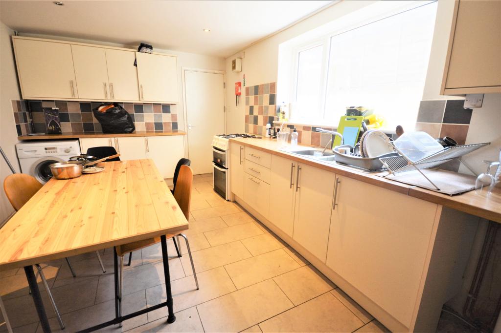
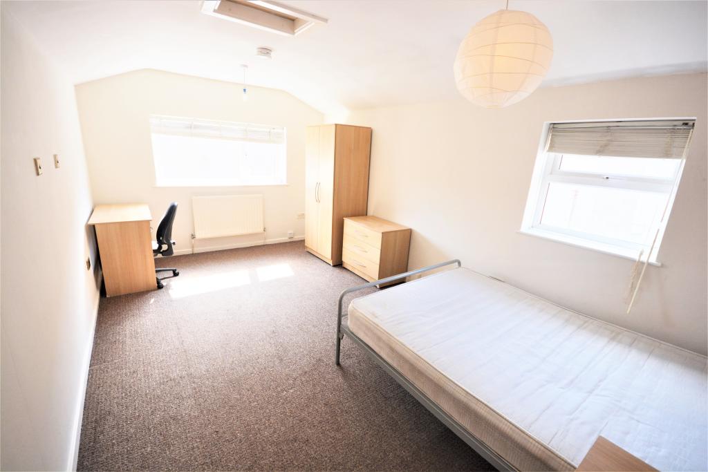
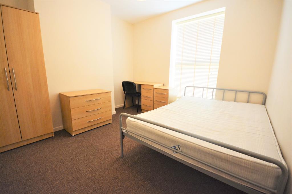
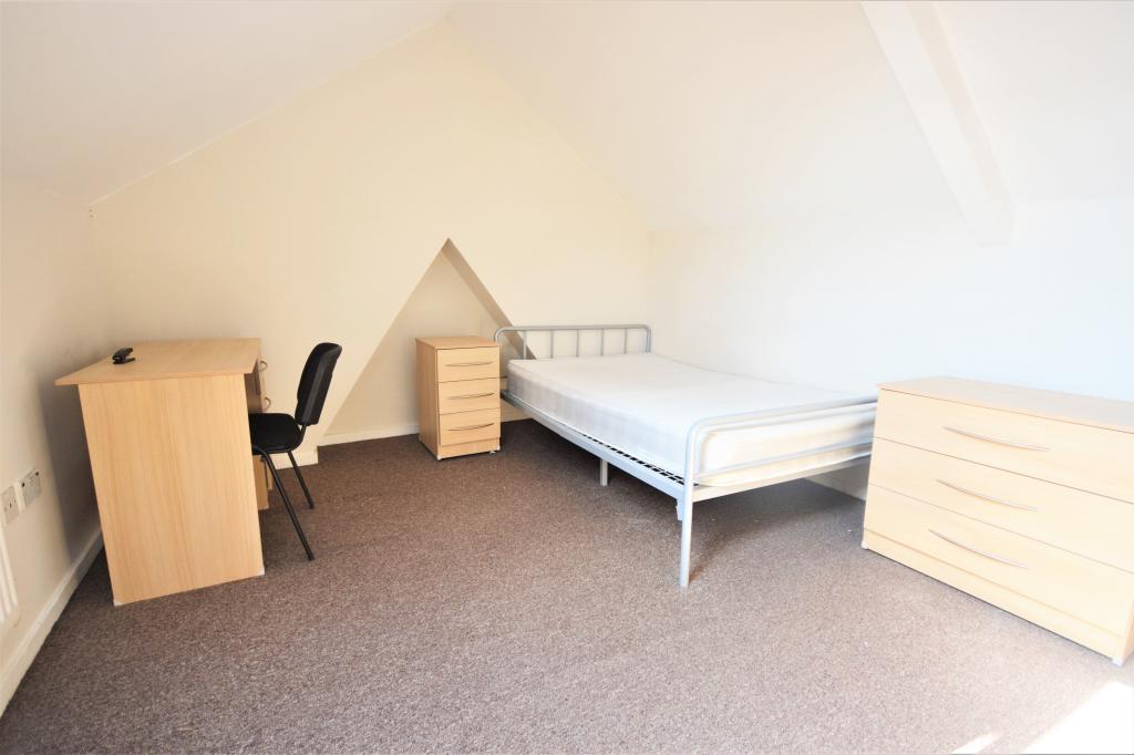
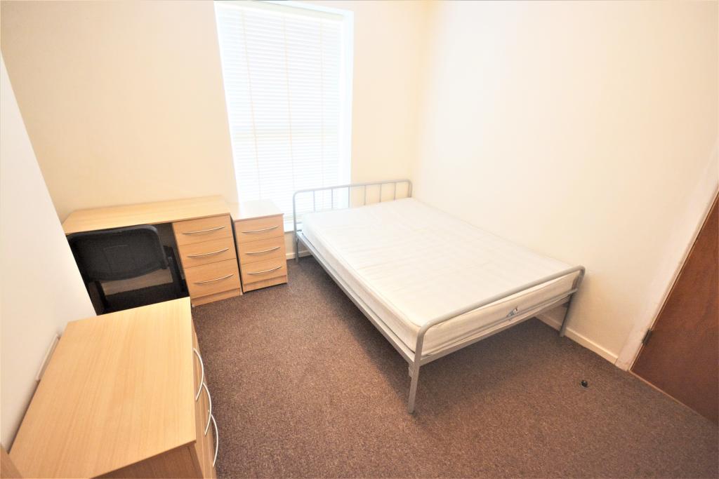
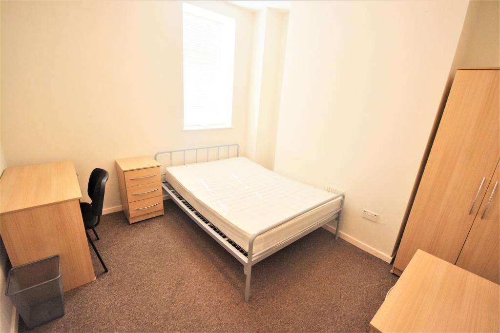
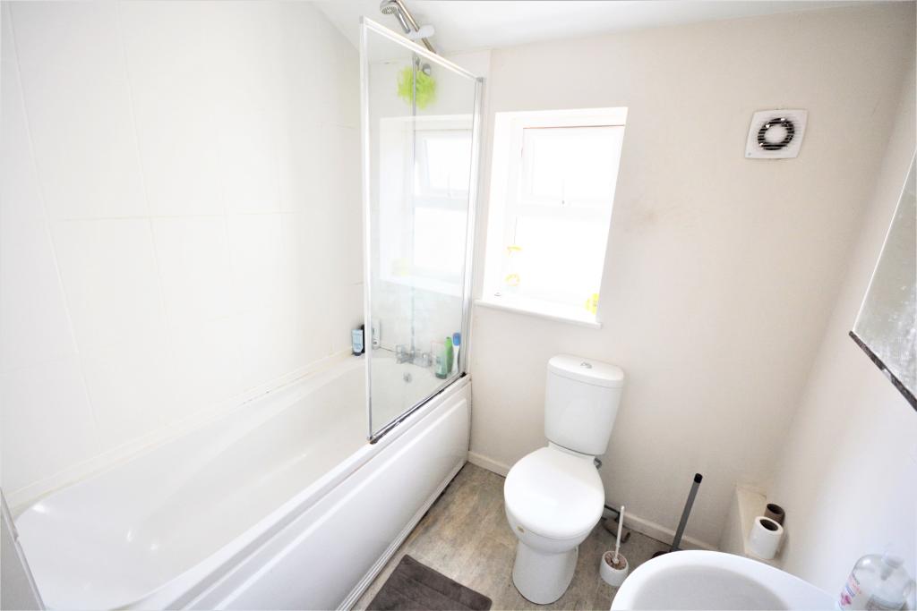
Studentdigz are excited to present this fantastic 5 bed student property located on Richardson Street in the area of Sandfields, Swansea. This property has 5 double bedrooms and benefits from a communal lounge, large kitchen and two bathrooms! Ideally located within walking distance to the city centre, there is a vast range of shops, cafes and restaurants, as well, as the bus station providing great transport links. This property is fantastic for students studying on both Singleton and Bay Campus! Book your viewing now!!
Listed by
Swansea
StudentDigz
Reference: 128840159
EPC Rating & Upgrade Cost
Fetching EPC data… Refresh this page in a moment.
Flood risk
Zone: 1
Risk: Low
Job (default Low)
FENSA Certificates
This property has 1 FENSA certificate(s) on record, indicating window/door installations by FENSA-approved installers.
FENSA Certificate #9596286
Property Details
Street: 8 Richardson Street
Town: SWANSEA
Postcode: SA1 3JF
Installation Details
Items: 9 windows and 2 doors
Certificate Issued: 10/06/2013
Work Completed: 24/05/2013
This certificate data was retrieved from FENSA's database
What is FENSA? FENSA (Fenestration Self-Assessment Scheme) is a government-authorised scheme that monitors building regulation compliance for replacement windows and doors. Certificates indicate that work was completed by FENSA-approved installers.
Price history
| Event | Date | Price | % change |
|---|---|---|---|
| Sold | 30/12/1996 (29 years ago) | £60,000 | — |
Source: HM Land Registry Price Paid Data. Crown copyright.
Sold Comparables
Same street and nearby sales within 0.25 miles (last 5 years). Data from Land Registry Price Paid.
| Address | Price | Date | Type |
|---|---|---|---|
| Same street 2 RICHARDSON STREET, SWANSEA, SA1 3JF | £155,000 | 03/04/2023 | Terraced |
| SUN ALLIANCE HOUSE, 166 - 167 ST HELENS ROAD, SWANSEA, SA1 4DQ | £8,000,000 | 30/11/2022 | Other |
| 74 OXFORD STREET, SWANSEA, SA1 3JG | £170,000 | 03/08/2022 | Other |
| 38 - 39 OXFORD STREET, SWANSEA, SA1 3HT | £344,698 | 07/06/2022 | Other |
| Same street 3 RICHARDSON STREET, SWANSEA, SA1 3JF | £155,000 | 27/10/2021 | Terraced |
| 208 OXFORD STREET, SWANSEA, SA1 3HT | £137,500 | 13/10/2021 | Other |
| 32 OXFORD STREET, SWANSEA, SA1 3AN | £80,000 | 08/10/2021 | Other |
| SUN ALLIANCE HOUSE, 166 - 167 ST HELENS ROAD, SWANSEA, SA1 4DQ | £1,500,000 | 03/08/2021 | Other |
| TY JOHN PENRI, 11 UNITS D AND E ST HELENS ROAD, SWANSEA, SA1 4AL | £117,000 | 07/07/2021 | Other |
Street average: £155,000 (2 sales)
Area average: £1,478,457 (7 sales)
Capital growth trend
Land Registry outcode average: last 12 months vs 5y and 10y ago (from sold prices).
House Price Index (HM Land Registry — official index, not sold-price averages): Swansea. Series: All dwelling types. As of March 2026.
Rental Range
Estimated market rent for Swansea. Low = conservative, Realistic = average, Optimistic = best case.
Based on Local Authority from postcode lookup → Swansea.
Location
Nearby
Nearest stations, universities and amenities (distance from property).
| Type | Name | Distance |
|---|---|---|
| Bus stop | Argyle Street | 0.0 miles |
| Shop | Swansea Timber & Ply | 0.0 miles |
| Shop | Easy Fit Automotive | 0.1 miles |
| Bus stop | Capel Henrietta | 0.1 miles |
| University | UWTSD - Mount Pleasant Campus | 0.5 miles |
| Train station | Swansea | 0.8 miles |
| University | Unknown | 2.4 miles |
| Train station | Llansamlet | 4.2 miles |
| Hospital | Morriston Hospital | 4.6 miles |
| Hospital | Gower Physiotherapy Clinic | 4.8 miles |
Street-level crime
| Category | Count |
|---|---|
| Violence and sexual offences | 215 |
| Shoplifting | 118 |
| Anti-social behaviour | 90 |
| Public order | 67 |
| Drugs | 45 |
| Vehicle crime | 35 |
| Criminal damage and arson | 28 |
| Other theft | 27 |
| Burglary | 12 |
| Possession of weapons | 11 |
| Other crime | 9 |
| Robbery | 7 |
| Bicycle theft | 6 |
| Theft from the person | 6 |
| Total incidents | 676 |
Within 1 mile during Apr 2026. Source: data.police.uk (England & Wales).
Schools nearby
Nearest open schools with Ofsted ratings (England). Closed schools are not shown. Data from Get Information about Schools and Ofsted.
| Name | Type | Distance | Ofsted |
|---|---|---|---|
| St Helen's Primary School | Other | 0.1 miles | — (No rating) |
| Christchurch (C.I.W.) Voluntary Aided Primary School | Other | 0.3 miles | — (No rating) |
| Ffynone House School Trust | Other | 0.4 miles | — (No rating) |
| Terrace Road Primary School | Other | 0.4 miles | — (No rating) |
| Sea View Community Primary School | Other | 0.5 miles | — (No rating) |
Rental Comparables
Rental listings exist nearby, but none matched the 5-bedroom count for this property.
Rent-driven metrics
Based on Area rent estimate.
- Rent ratio — Monthly rent ÷ purchase price (1% rule). 1%+ = strong, 0.8–1% = okay, <0.8% = weak for cashflow.
- Max investor price — Rent ÷ 0.8%; the price at which rent would be 0.8% of price (Stoke-style target).
- Target investor price — Rent ÷ 1%; the price at which rent would be 1% of price (strong cashflow band).
- Gross yield — Annual rent as % of purchase price (no costs).