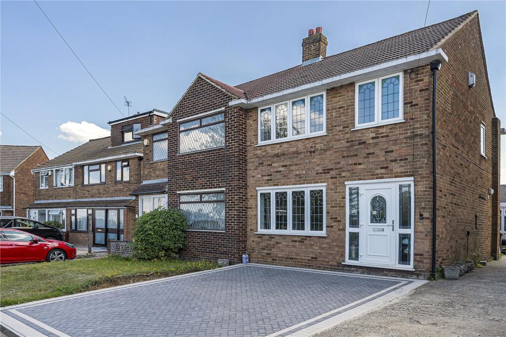
12 PATTERDALE ROAD
DARTFORD, KENT DA2 6LP
Property details
Tenure
FREEHOLD
Floor area
73 m²
Council tax band
D
EPC rating
C
Year built
England and Wales: 1950-1966
Last sold
£395,000 Jan 2026
Price per m²
£5,479/m²
Local average
£439,722 (-9%)
Deprivation
Decile 9 (30,012 of 33,755)
Street crime
388 incidents within 1 mile (Apr 2026)
Key features
- Garage Accessed Via The Shared Driveway
- Ideally Located For The Fast Track Bus Stop
- A Short Walk From Darent Valley Hospital
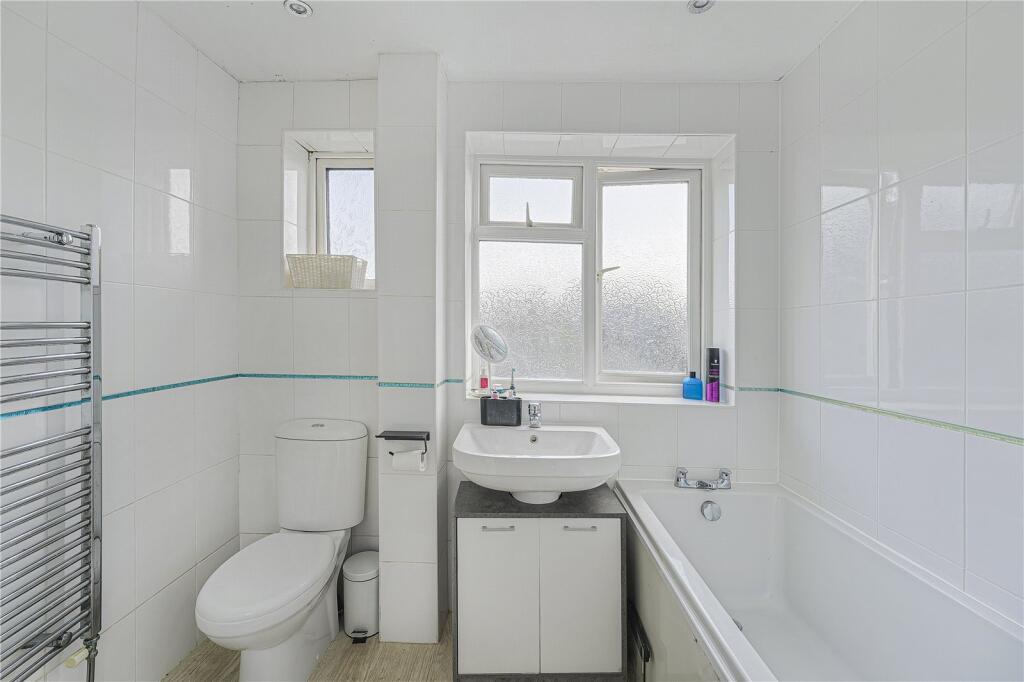
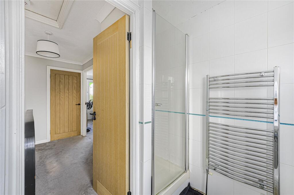
- Four Piece Bathroom With Separate Shower
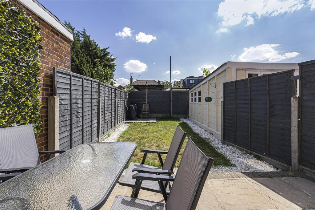
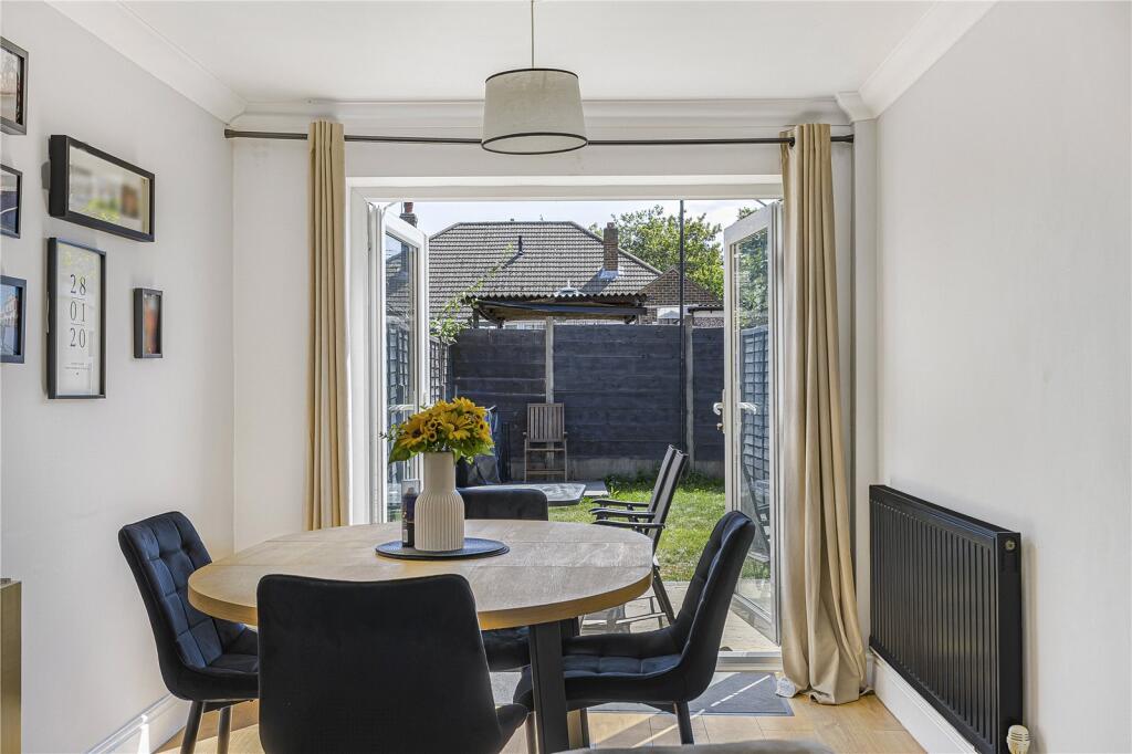
- South East Facing Garden
- Viewing Comes Highly Recommended
Additional details
- Parking
- Yes
- Garden
- Yes
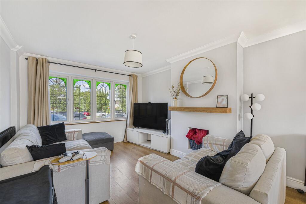
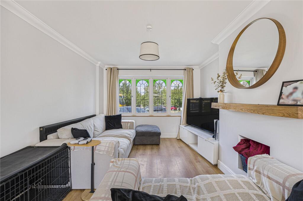
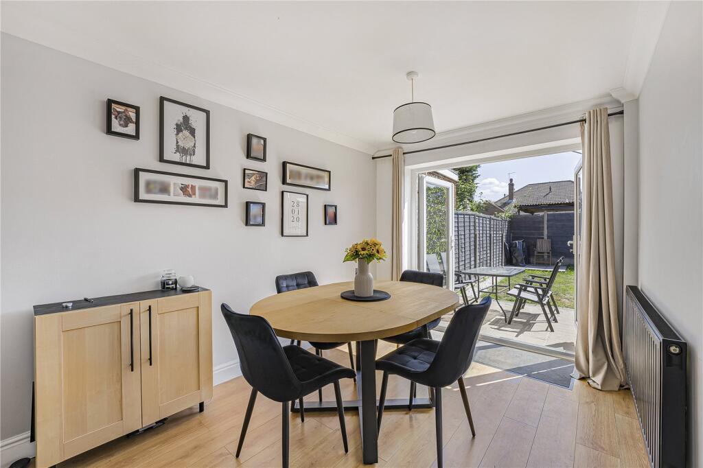
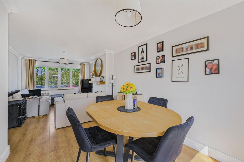
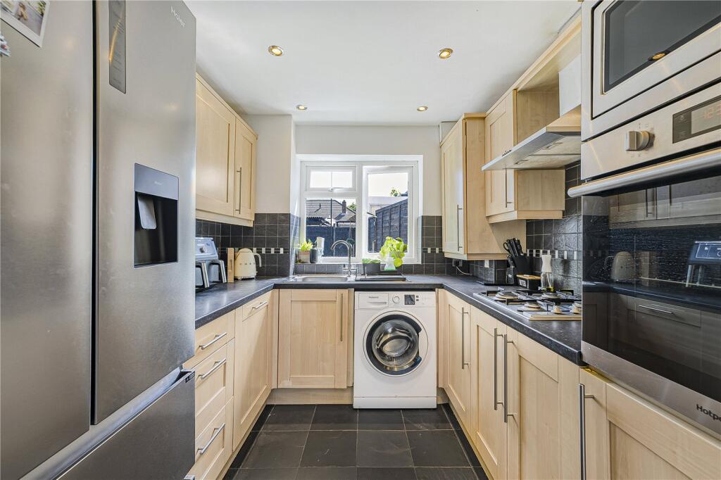
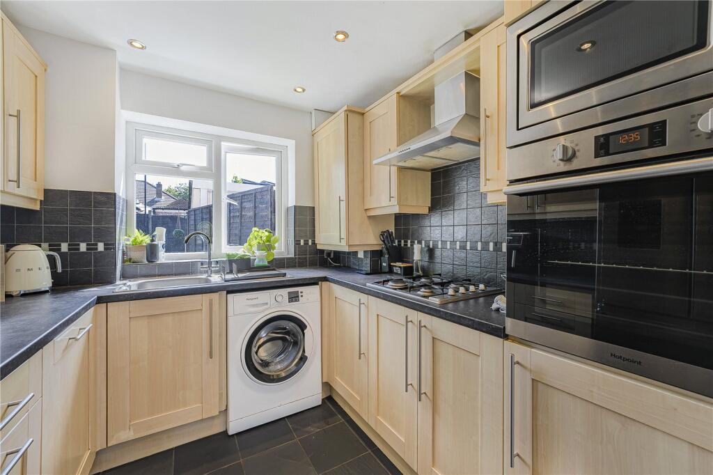
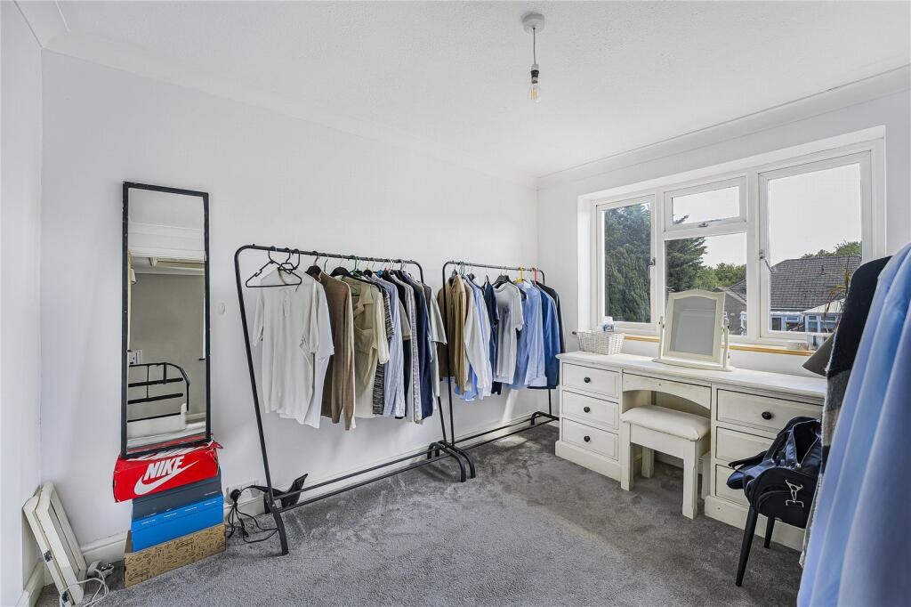
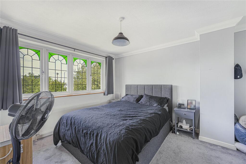
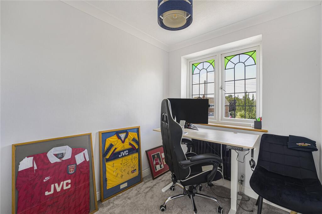
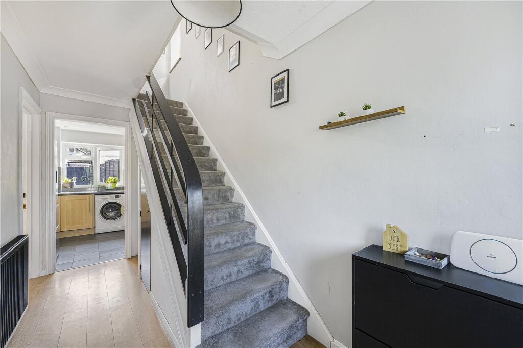
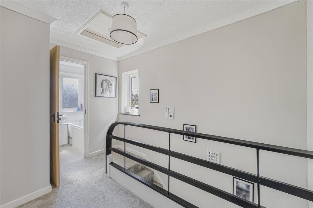
Description
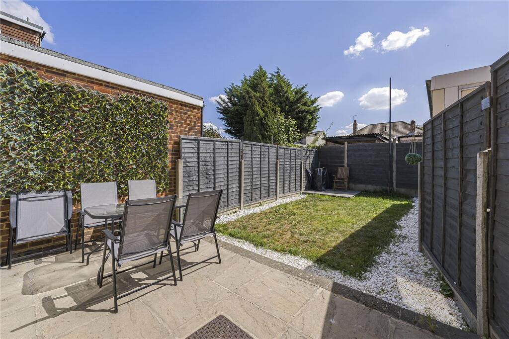
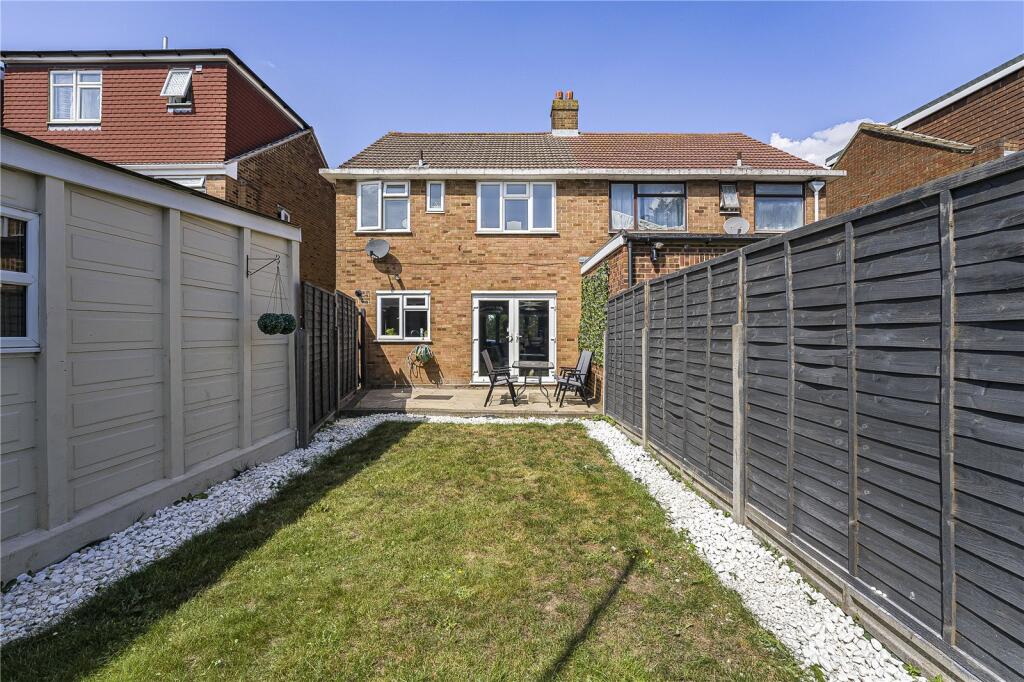
Exterior
Garden: Approx 24ft Patio. Lawn. Side gated access. Outside tap.
Garage And Parking: Double glazed windows to front and side. Power and lighting. Shared Driveway.
Front Garden: Brick laid driveway providing off street parking with access from the shared driveway.
Key Terms
The property measures 73 Square Metres
The boiler is in the kitchen and is approximately 3 years old.
The garden faces South East.
The property is sold chain free.
Listed by
Dartford
Robinson Jackson
Reference: 166025615
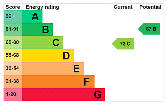
EPC Rating & Upgrade Cost
Current rating: C
Potential rating: B
Inspection date: 24/01/2023
Expiry date: 23/01/2033
Current heating cost: £431/year
Potential heating cost: £399/year
Est. upgrade cost to C: £14,500
Recommendations
- Floor insulation (solid floor) (£4,000 - £6,000)
- Solar water heating (£4,000 - £6,000)
- Solar photovoltaic panels, 2.5 kWp (£3,500 - £5,500)
Flood risk
Zone: 1
Risk: Low
Job (default Low)
Floorplans
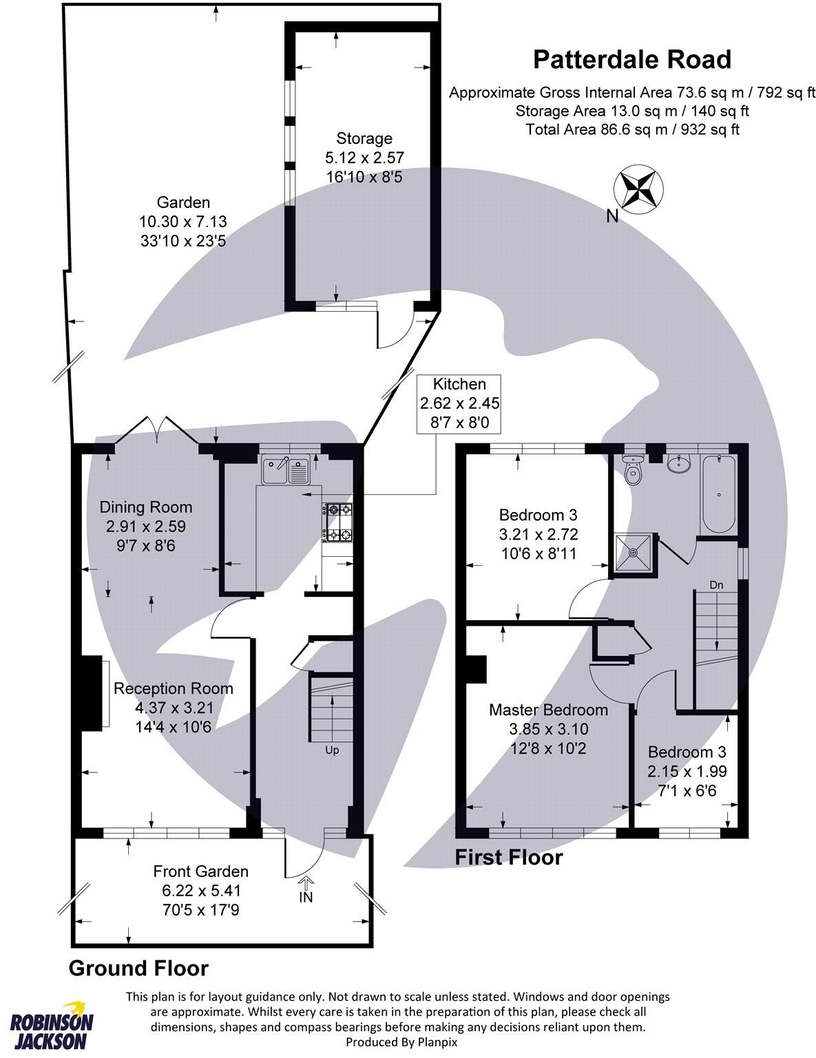
Floorplan
EPC Graphs
EPC Rating Graph
Price history
| Event | Date | Price | % change |
|---|---|---|---|
| Sold | 16/01/2026 (4 months ago) | £395,000 | — |
Source: HM Land Registry Price Paid Data. Crown copyright.
Sold Comparables
Same street and nearby sales within 0.25 miles (last 5 years). Data from Land Registry Price Paid.
| Address | Price | Date | Type |
|---|---|---|---|
| 7 AIREDALE CLOSE, DARTFORD, KENT, DA2 6JL | £413,500 | 28/11/2025 | Semi-detached |
| 60 LUNEDALE ROAD, DARTFORD, KENT, DA2 6LN | £465,000 | 28/11/2025 | Semi-detached |
| 15 CLARENDON GARDENS, DARTFORD, KENT, DA2 6EY | £437,000 | 15/12/2023 | Semi-detached |
| 65 LUNEDALE ROAD, DARTFORD, KENT, DA2 6LW | £355,000 | 23/10/2023 | Semi-detached |
| 1 TEESDALE ROAD, DARTFORD, KENT, DA2 6LJ | £435,000 | 06/10/2023 | Semi-detached |
| 74 LONSDALE CRESCENT, DARTFORD, KENT, DA2 6LG | £370,000 | 01/09/2023 | Semi-detached |
| Same street 34 PATTERDALE ROAD, DARTFORD, KENT, DA2 6LP | £385,000 | 16/06/2023 | Semi-detached |
| 15 WEARDALE AVENUE, DARTFORD, KENT, DA2 6LF | £382,250 | 12/05/2023 | Semi-detached |
| 7 AIREDALE CLOSE, DARTFORD, KENT, DA2 6JL | £420,000 | 09/05/2023 | Semi-detached |
| 682 PRINCES ROAD, DARTFORD, KENT, DA2 6JG | £319,000 | 27/01/2023 | Semi-detached |
| 33 TEESDALE ROAD, DARTFORD, KENT, DA2 6LJ | £411,000 | 20/12/2022 | Semi-detached |
| 20 WEARDALE AVENUE, DARTFORD, KENT, DA2 6LE | £417,500 | 16/11/2022 | Semi-detached |
| 115 WEARDALE AVENUE, DARTFORD, KENT, DA2 6LF | £440,000 | 26/08/2022 | Semi-detached |
| 7 MYRTLE PLACE, DARTFORD, KENT, DA2 6ER | £325,000 | 26/08/2022 | Semi-detached |
| 56 GORE ROAD, DARTFORD, KENT, DA2 6LT | £375,000 | 18/08/2022 | Semi-detached |
| 1 LUNEDALE ROAD, DARTFORD, KENT, DA2 6LR | £425,000 | 04/08/2022 | Semi-detached |
| 6 AIREDALE CLOSE, DARTFORD, KENT, DA2 6JL | £385,000 | 15/07/2022 | Semi-detached |
| 58 GORE ROAD, DARTFORD, KENT, DA2 6LT | £390,000 | 30/06/2022 | Semi-detached |
| 36 CLARENDON GARDENS, DARTFORD, KENT, DA2 6EZ | £450,000 | 30/06/2022 | Semi-detached |
| 1 CLARENDON GARDENS, DARTFORD, KENT, DA2 6EY | £390,000 | 27/05/2022 | Semi-detached |
| 58 WEARDALE AVENUE, DARTFORD, KENT, DA2 6LE | £372,000 | 03/05/2022 | Semi-detached |
| Same street 16 PATTERDALE ROAD, DARTFORD, KENT, DA2 6LP | £447,000 | 28/01/2022 | Semi-detached |
Street average: £416,000 (2 sales)
Area average: £398,863 (20 sales)
Capital growth trend
Land Registry outcode average: last 12 months vs 5y and 10y ago (from sold prices).
House Price Index (HM Land Registry — official index, not sold-price averages): Dartford. Series: Semi-detached. As of March 2026.
Rental Range
Estimated market rent for Dartford. Low = conservative, Realistic = average, Optimistic = best case.
Based on Local Authority from postcode lookup → Dartford.
LHA (30th percentile) floor for North West Kent: £1,197/mo (Apr 2025 – Mar 2026)
Location
Nearby
Nearest stations, universities and amenities (distance from property).
| Type | Name | Distance |
|---|---|---|
| Bus stop | Patterdale Road | 0.0 miles |
| Hospital | Childrens Resource Centre | 0.2 miles |
| Shop | Bellegrove | 0.2 miles |
| Shop | DA MOT Centre Ltd | 0.2 miles |
| Hospital | Darent Valley Hospital | 0.2 miles |
| University | University of Greenwich | 0.7 miles |
| Train station | Stone Crossing | 1.1 miles |
| Train station | Greenhithe | 1.5 miles |
| University | University of Greenwich Avery Hill Campus | 7.6 miles |
Street-level crime
| Category | Count |
|---|---|
| Shoplifting | 192 |
| Violence and sexual offences | 87 |
| Anti-social behaviour | 42 |
| Criminal damage and arson | 19 |
| Other theft | 11 |
| Vehicle crime | 10 |
| Burglary | 7 |
| Public order | 7 |
| Drugs | 4 |
| Possession of weapons | 3 |
| Robbery | 3 |
| Other crime | 2 |
| Theft from the person | 1 |
| Total incidents | 388 |
Within 1 mile during Apr 2026. Source: data.police.uk (England & Wales).
Schools nearby
Nearest open schools with Ofsted ratings (England). Closed schools are not shown. Data from Get Information about Schools and Ofsted.
| Name | Type | Distance | Ofsted |
|---|---|---|---|
| Fleetdown Primary Academy | Primary | 0.3 miles | Outstanding — 17 Oct 2014 |
| Stone St Mary's CofE Primary School | Primary | 0.5 miles | Good — 3 Jun 2014 |
| The Brent Primary School | Primary | 0.5 miles | Good — 23 Sep 2024 |
| The Gateway Primary Academy | Primary | 0.7 miles | Good — 24 Oct 2012 |
| Stone Lodge School | Secondary | 0.7 miles | Good — 22 Nov 2023 |
Rental Comparables
Residential lets from OpenRent and Rightmove for the area (same bedroom count). Use to validate rent estimates. Student lets are excluded.
| Title | Rent | Beds | Distance | As seen on |
|---|---|---|---|---|
| 3 Bed Semi-Detached House, Patterdale Road, DA2 | £800/mo | 3 | 0.02 miles | OpenRent |
Average rent: £800/mo (1 listing)
Rent-driven metrics
Based on OpenRent comparables.
- This street — Gross yield for this street only (Land Registry sales + rental comparables, same postcode + street).
- Rent ratio — Monthly rent ÷ purchase price (1% rule). 1%+ = strong, 0.8–1% = okay, <0.8% = weak for cashflow.
- Max investor price — Rent ÷ 0.8%; the price at which rent would be 0.8% of price (Stoke-style target).
- Target investor price — Rent ÷ 1%; the price at which rent would be 1% of price (strong cashflow band).
- Gross yield — Annual rent as % of purchase price (no costs).
- Cost-to-rent — Price ÷ annual rent (from OpenRent comparables). Under 14× = strong, 14–16× = acceptable, 17×+ = compressed.
- Cashflow — Rent minus mortgage, 10% maintenance, £25/mo compliance. Assumes 75% LTV, 3.95% APR (5yr fixed), 25yr term.
- ROI — Annual profit ÷ cash in (deposit + 4% purchase costs).