75 MARSHFIELD ROAD
BRISTOL, CITY OF BRISTOL BS16 4JF
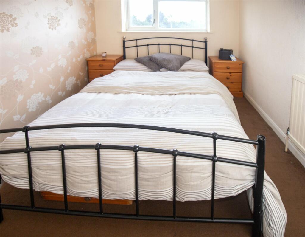
Property details
Tenure
FREEHOLD
Floor area
81 m²
Council tax band
C
EPC rating
C
Last sold
£150,000 Feb 2025
Price per m²
£3,395/m²
Local average
£346,697 (-20.7%)
Deprivation
Decile 2 (4,770 of 33,755)
Street crime
553 incidents within 1 mile (May 2026)
Key features
- Three Generous Sized Bedrooms
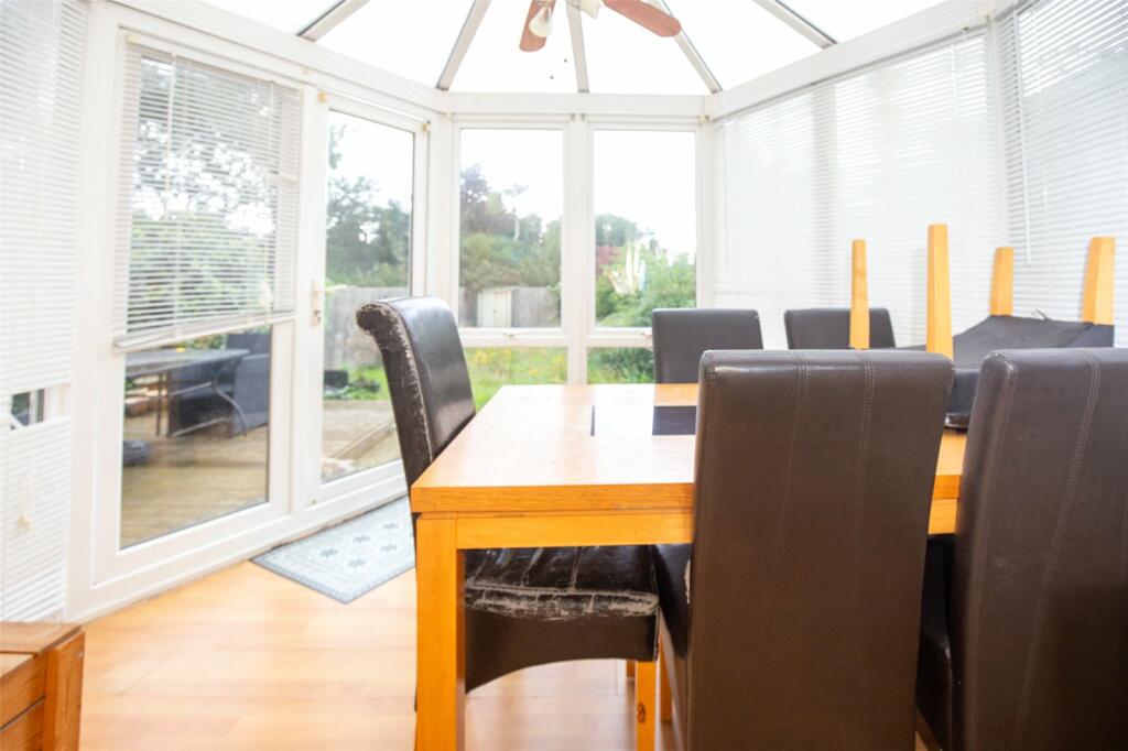
- Conservatory
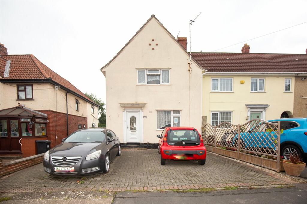
- Driveway Providing Off Street Parking
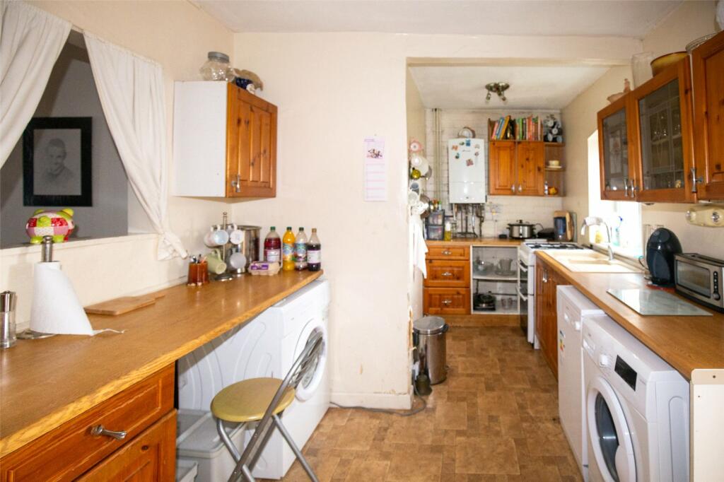
- In Need Of Some Modernisation
- No Onward Chain
- Popular Location
- Rear Garden
Additional details
- Parking
- Yes
- Garden
- Yes
Description
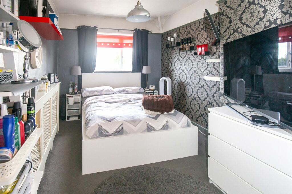
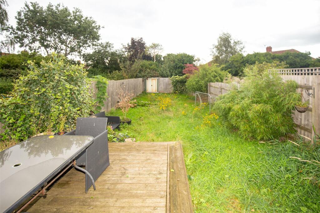
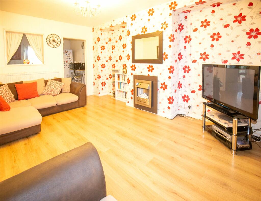
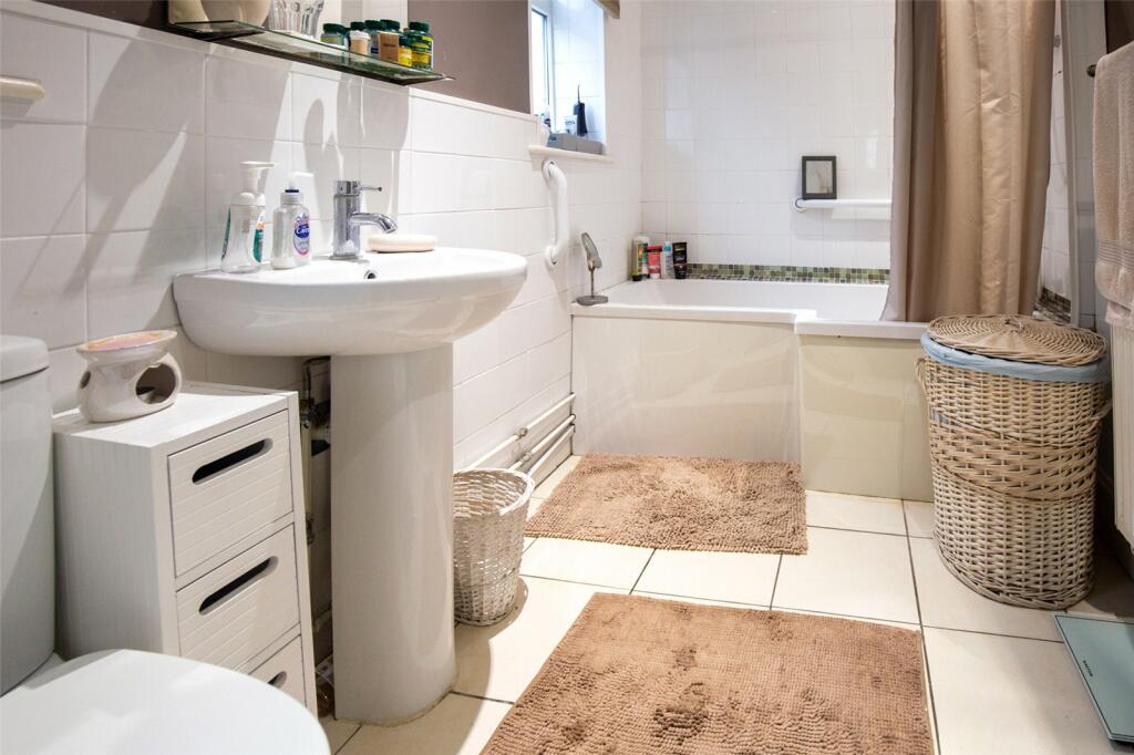
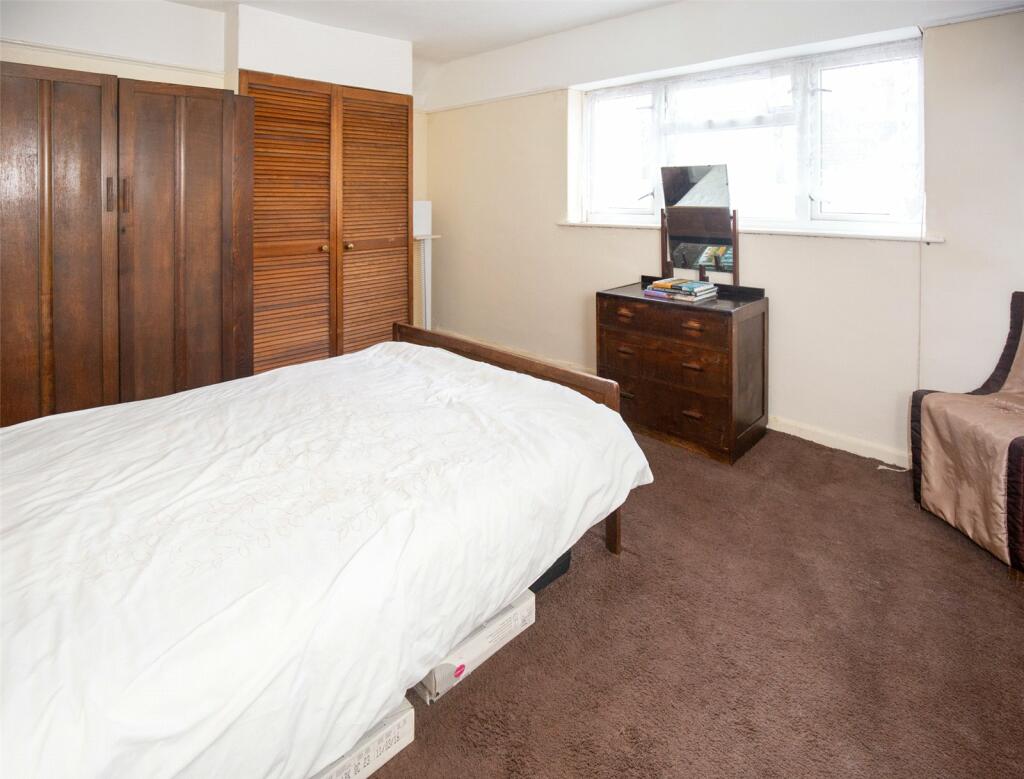
The property offers an entrance hallway, lounge, kitchen/breakfast room, conservatory, and bathroom on the ground floor. There are three generously sized bedrooms on the first floor, with built-in cupboards in the master. Externally, the home includes a front drive providing off-street parking and an enclosed rear garden, which is mainly laid to lawn.
Marshfield Road is conveniently located near Fishponds High Street and Lodge Causeway, with its array of shops and restaurants and excellent transport links to Bristol City Centre, with local motorways M32, M4/5, and Ring Road providing access to Keynsham, Bath, and beyond.
Tenure - Freehold
Council Tax Band - B
EPC Rating - C
Listed by
Downend
The Property Franchise Group
Reference: 142463240
EPC Rating & Upgrade Cost
Current rating: C
Potential rating: B
Inspection date: 27/09/2023
Expiry date: 26/09/2033
Current heating cost: £986/year
Potential heating cost: £911/year
Est. upgrade cost to C: £14,510
Recommendations
- Floor insulation (solid floor) (£4,000 - £6,000)
- Low energy lighting for all fixed outlets (£10)
- Solar water heating (£4,000 - £6,000)
- Solar photovoltaic panels, 2.5 kWp (£3,500 - £5,500)
Flood risk
Zone: 1
Risk: Low
Job (default Low)
Floorplans
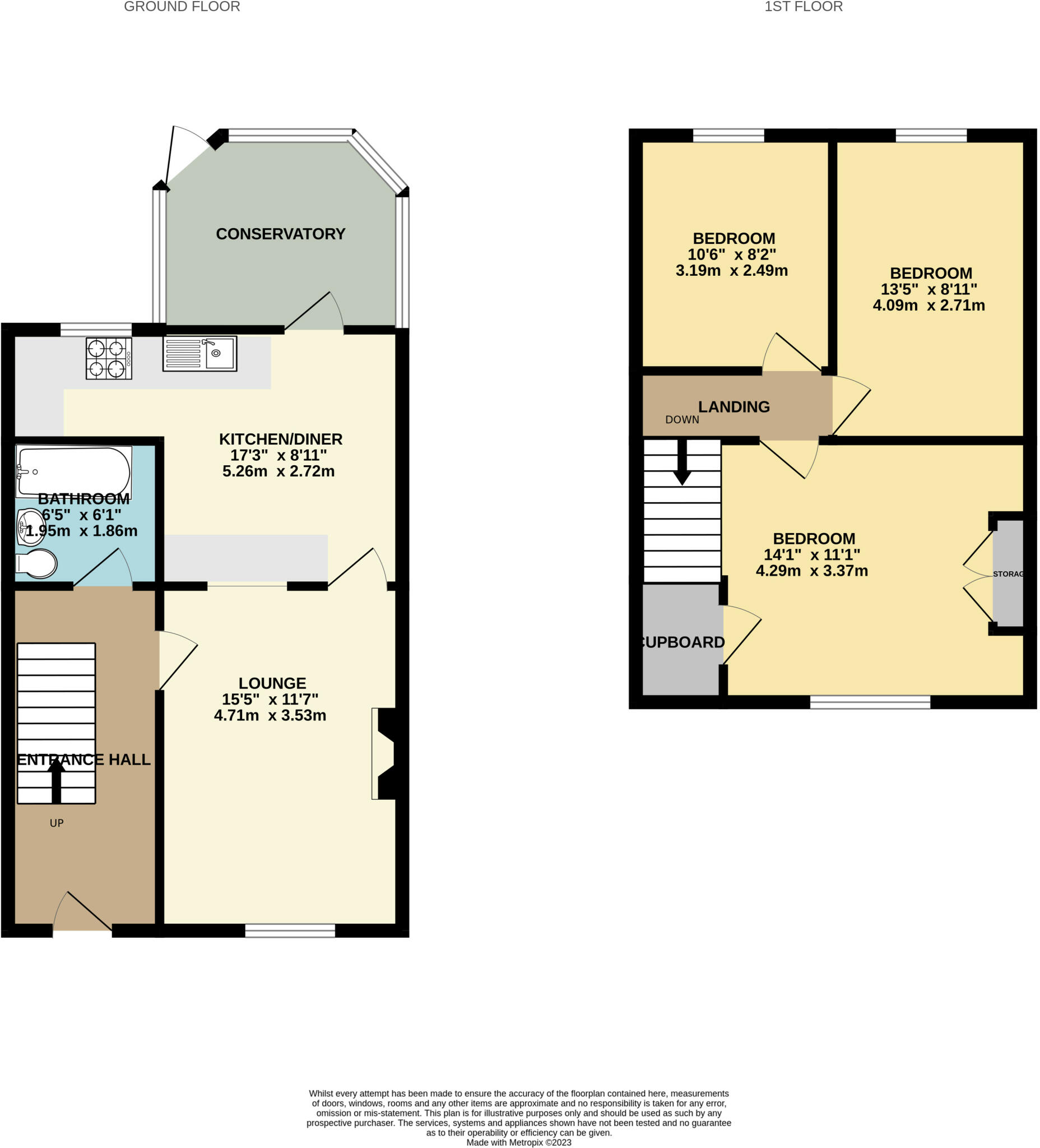
Floorplan
EPC Graphs
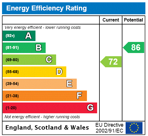
EPC Rating Graph
FENSA Certificates
This property has 1 FENSA certificate(s) on record, indicating window/door installations by FENSA-approved installers.
FENSA Certificate #16779041 Recent
Property Details
Street: 75 Marshfield Road
Town: BRISTOL
Postcode: BS16 4JF
Installation Details
Items: 8 windows and 1 door
Certificate Issued: 27/04/2025
Work Completed: 25/03/2025
This certificate data was retrieved from FENSA's database
What is FENSA? FENSA (Fenestration Self-Assessment Scheme) is a government-authorised scheme that monitors building regulation compliance for replacement windows and doors. Certificates indicate that work was completed by FENSA-approved installers.
Price history
| Event | Date | Price | % change |
|---|---|---|---|
| Sold | 10/02/2025 (1 year ago) | £150,000 | — |
Source: HM Land Registry Price Paid Data. Crown copyright.
Sold Comparables
Same street and nearby sales within 0.25 miles (last 5 years). Data from Land Registry Price Paid.
| Address | Price | Date | Type |
|---|---|---|---|
| 79 ACACIA ROAD, BRISTOL, SOUTH GLOUCESTERSHIRE, BS16 4PY | £220,000 | 15/12/2025 | Terraced |
| 23 MARSHFIELD ROAD, BRISTOL, CITY OF BRISTOL, BS16 4BG | £335,000 | 12/12/2025 | Terraced |
| 53 FRAMPTON CRESCENT, BRISTOL, CITY OF BRISTOL, BS16 4JD | £292,000 | 28/11/2025 | Terraced |
| Same street 71 MARSHFIELD ROAD, BRISTOL, CITY OF BRISTOL, BS16 4JF | £238,000 | 14/11/2025 | Semi-detached |
| 6 RAILWAY TERRACE, BRISTOL, CITY OF BRISTOL, BS16 4LP | £335,000 | 11/03/2025 | Terraced |
| 13 THE ELMS, STAPLE HILL, BRISTOL, SOUTH GLOUCESTERSHIRE, BS16 4BN | £330,000 | 20/12/2023 | Terraced |
| 67 FRAMPTON CRESCENT, BRISTOL, CITY OF BRISTOL, BS16 4JD | £305,000 | 17/11/2023 | Terraced |
| 40 BRIAR WAY, BRISTOL, CITY OF BRISTOL, BS16 4ED | £125,800 | 24/04/2023 | Terraced |
| 16 RAILWAY TERRACE, BRISTOL, CITY OF BRISTOL, BS16 4LP | £465,000 | 24/03/2023 | Terraced |
| 14 THE ELMS, STAPLE HILL, BRISTOL, SOUTH GLOUCESTERSHIRE, BS16 4BN | £365,000 | 17/01/2023 | Terraced |
| 40 FRAMPTON CRESCENT, BRISTOL, CITY OF BRISTOL, BS16 4JE | £305,000 | 16/12/2022 | Terraced |
| 122 MARSHFIELD ROAD, BRISTOL, CITY OF BRISTOL, BS16 4JG | £210,000 | 15/12/2022 | Terraced |
| 7 BRIAR WALK, BRISTOL, CITY OF BRISTOL, BS16 4JJ | £340,000 | 20/09/2022 | Terraced |
| 139 THICKET AVENUE, FISHPONDS, BRISTOL, CITY OF BRISTOL, BS16 4BQ | £351,000 | 21/07/2022 | Terraced |
| Same street 83 MARSHFIELD ROAD, BRISTOL, CITY OF BRISTOL, BS16 4JF | £275,000 | 30/06/2022 | Terraced |
| 58 BRIAR WAY, BRISTOL, CITY OF BRISTOL, BS16 4ED | £275,000 | 01/04/2022 | Terraced |
| 29 SOUTHERNHAY, STAPLE HILL, BRISTOL, SOUTH GLOUCESTERSHIRE, BS16 4LS | £336,250 | 16/03/2022 | Terraced |
| 40 FRAMPTON CRESCENT, BRISTOL, CITY OF BRISTOL, BS16 4JE | £271,000 | 09/03/2022 | Terraced |
| 83 ACACIA ROAD, BRISTOL, SOUTH GLOUCESTERSHIRE, BS16 4PY | £270,000 | 11/02/2022 | Terraced |
| 64 FRAMPTON CRESCENT, BRISTOL, CITY OF BRISTOL, BS16 4JE | £240,000 | 10/12/2021 | Terraced |
| 23 SOUTHERNHAY, STAPLE HILL, BRISTOL, SOUTH GLOUCESTERSHIRE, BS16 4LS | £316,000 | 23/09/2021 | Terraced |
| 117 THICKET AVENUE, FISHPONDS, BRISTOL, CITY OF BRISTOL, BS16 4JQ | £260,000 | 27/08/2021 | Terraced |
Street average: £256,500 (2 sales)
Area average: £297,353 (20 sales)
Capital growth trend
Land Registry outcode average: last 12 months vs 5y and 10y ago (from sold prices).
House Price Index (HM Land Registry — official index, not sold-price averages): City of Bristol. Series: Terraced. As of April 2026.
Rental Range
Estimated market rent for Bristol, City of. Low = conservative, Realistic = average, Optimistic = best case.
Based on Local Authority from postcode lookup → Bristol, City of.
LHA (30th percentile) floor for Gloucester: £848/mo (Apr 2025 – Mar 2026)
Location
Nearby
Nearest stations, universities and amenities (distance from property).
| Type | Name | Distance |
|---|---|---|
| Bus stop | Rose Walk | 0.1 miles |
| Bus stop | Briar Way | 0.1 miles |
| Shop | Create a Cut | 0.1 miles |
| Shop | Acacia Stores | 0.1 miles |
| University | School of Architecture and Environment | 2.2 miles |
| Train station | Stapleton Road | 2.3 miles |
| Train station | Lawrence Hill | 2.5 miles |
| University | Bristol Digital Futures Institute | 3.2 miles |
| Hospital | Bristol Royal Infirmary | 3.7 miles |
| Hospital | Bristol Heart Institute | 3.7 miles |
Street-level crime
| Category | Count |
|---|---|
| Violence and sexual offences | 202 |
| Anti-social behaviour | 82 |
| Shoplifting | 63 |
| Public order | 56 |
| Criminal damage and arson | 39 |
| Other theft | 34 |
| Vehicle crime | 22 |
| Burglary | 21 |
| Drugs | 8 |
| Other crime | 8 |
| Robbery | 8 |
| Bicycle theft | 5 |
| Theft from the person | 3 |
| Possession of weapons | 2 |
| Total incidents | 553 |
Within 1 mile during May 2026. Source: data.police.uk (England & Wales).
Schools nearby
Nearest open schools with Ofsted ratings (England). Closed schools are not shown. Data from Get Information about Schools and Ofsted.
| Name | Type | Distance | Ofsted |
|---|---|---|---|
| Briarwood School | Other | 0.3 miles | — (Inspected (no overall grade)) |
| Minerva Primary Academy | Primary | 0.3 miles | Good — 4 Jul 2024 |
| Staple Hill Primary School | Primary | 0.4 miles | Good — 21 Sep 2022 |
| Christ Church, Church of England Junior School, Downend | Primary | 0.5 miles | Good — 12 Feb 2016 |
| Pathways Learning Centre | Other | 0.5 miles | Good — 13 Nov 2022 |
Rental Comparables
Rental comparables are temporarily unavailable while listing-site fetches are paused. Try again later.
Rent-driven metrics
Based on Area rent estimate.
- Rent ratio — Monthly rent ÷ purchase price (1% rule). 1%+ = strong, 0.8–1% = okay, <0.8% = weak for cashflow.
- Max investor price — Rent ÷ 0.8%; the price at which rent would be 0.8% of price (Stoke-style target).
- Target investor price — Rent ÷ 1%; the price at which rent would be 1% of price (strong cashflow band).
- Gross yield — Annual rent as % of purchase price (no costs).