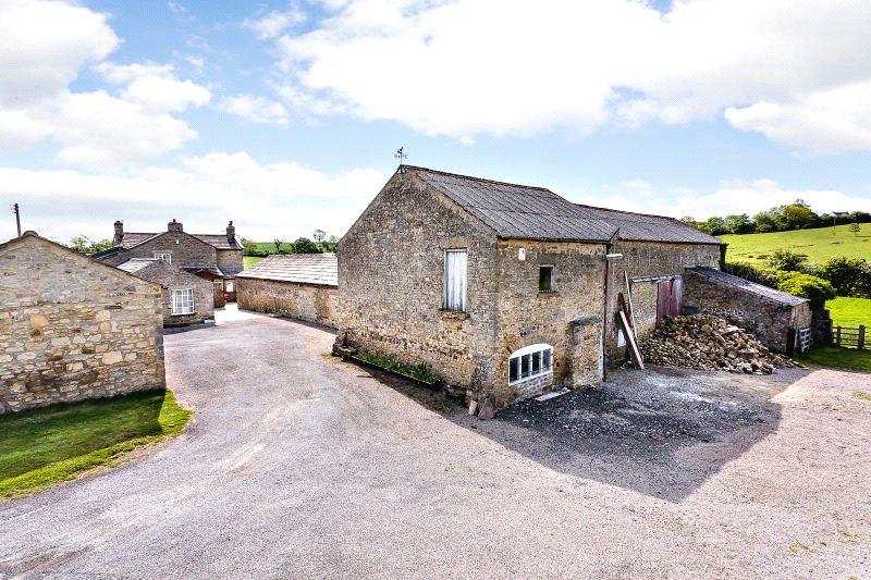
Thornton Grange
RIPON, THORNTON STEWARD, NORTH YORKSHIRE HG4 4BQ
Property details
Tenure
FREEHOLD
Floor area
289 m²
Year built
England and Wales: before 1900
Last sold
£760,000 Jul 2017
Price per m²
£2,751/m²
Local average
£536,730 (+48.1%)
Deprivation
Decile 6 (18,039 of 33,755)
Street crime
1 incident within 1 mile (Apr 2026)
Additional details
- Parking
- Yes
- Garden
- Yes
Description
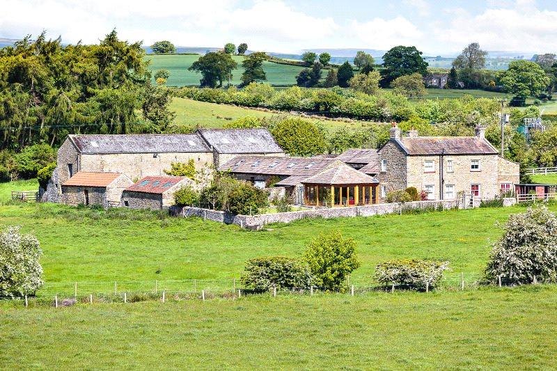
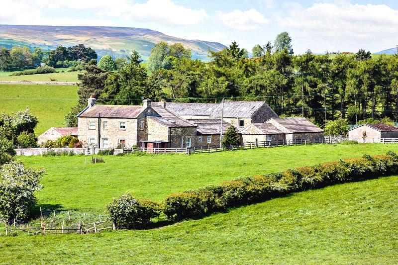
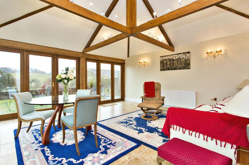
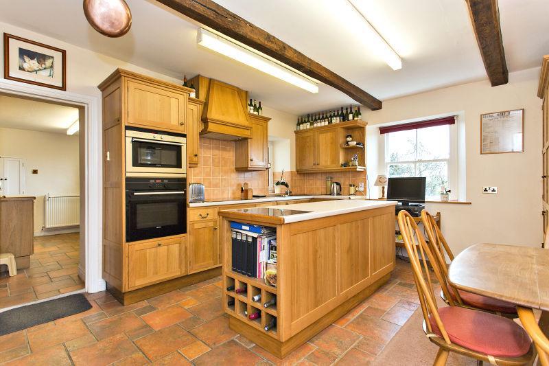
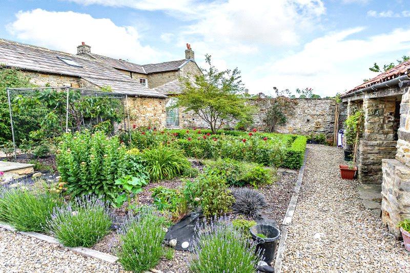
Thornton Grange is an attractive detached Dales farmhouse which has been extended, altered and improved over the course of the last 12 years to create an appealing property which provides well proportioned accommodation ideal for everyday family living. It occupies a lovely setting, surrounded by its own land and with the added benefit of a range of traditional barns which have undoubted development opportunities.
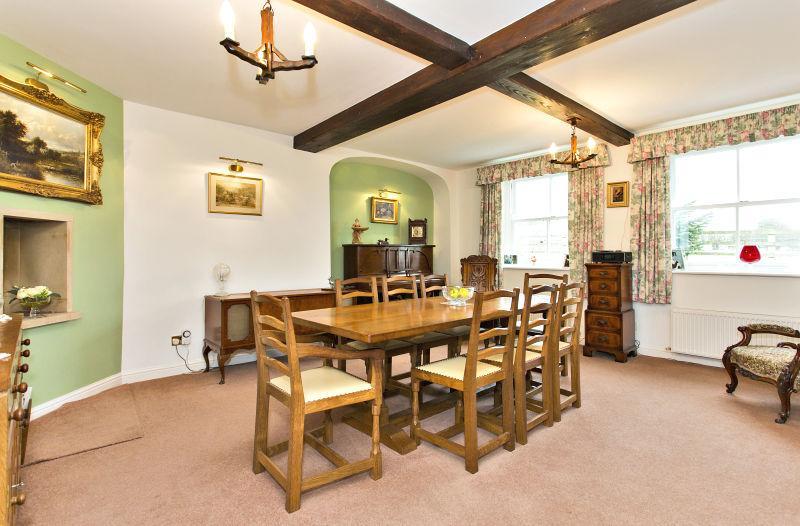
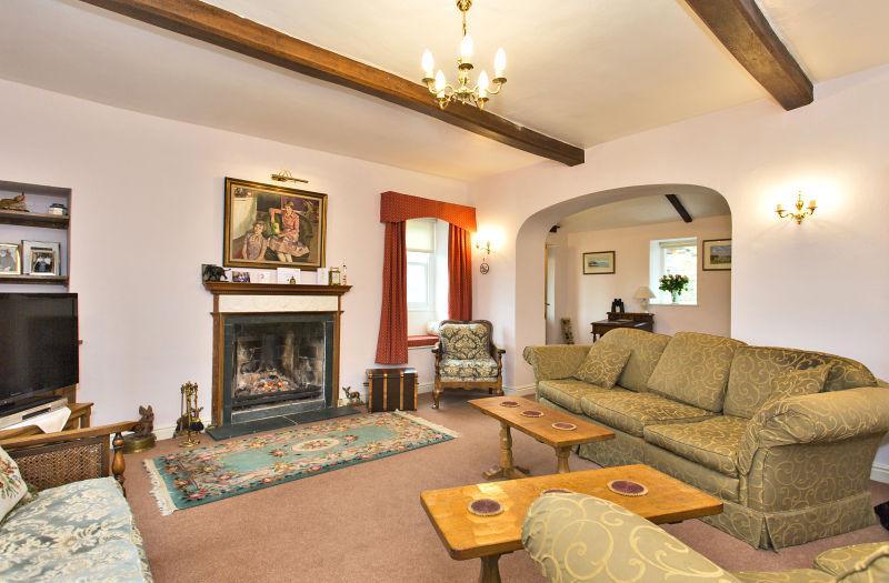
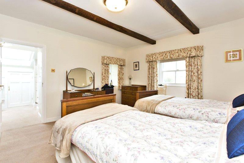
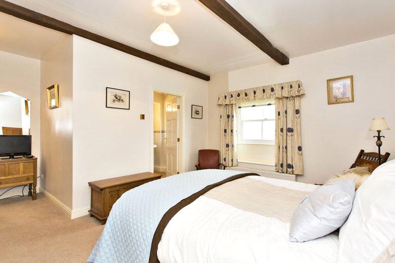
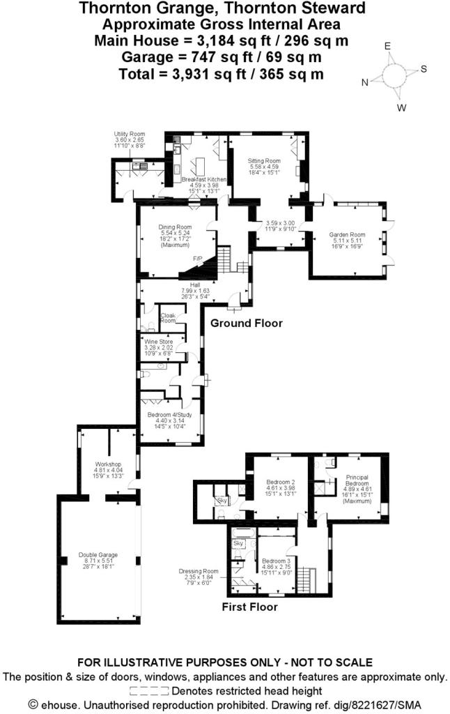
The accommodation is arranged over two floors and includes a reception hall, toilet, sitting room with a delightful adjoining garden room, breakfast kitchen, utility room, dining room, inner hall, cloakroom, storage/cellar and a potential en suite to fourth bedroom/study. On the first floor is a landing and three double bedrooms - all of which have either an en suite bathroom or shower room.
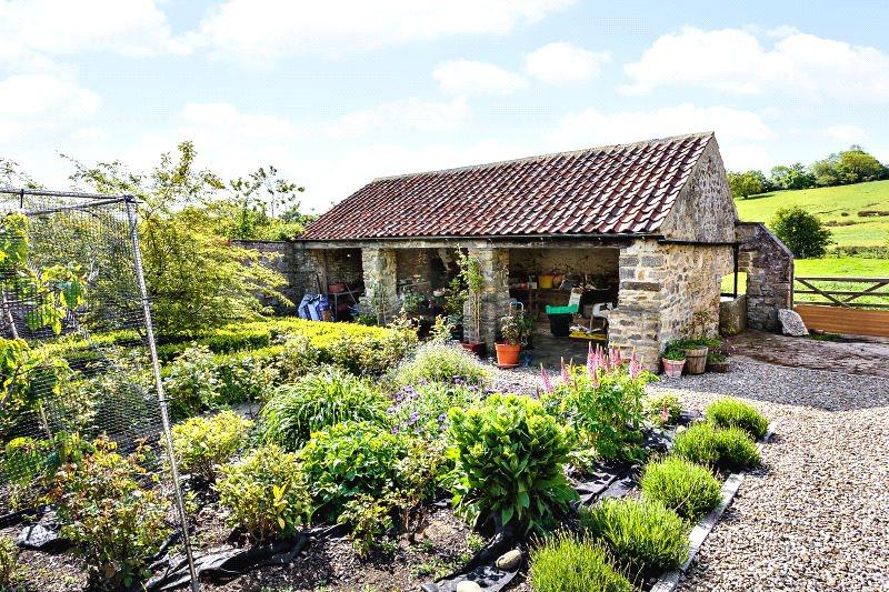
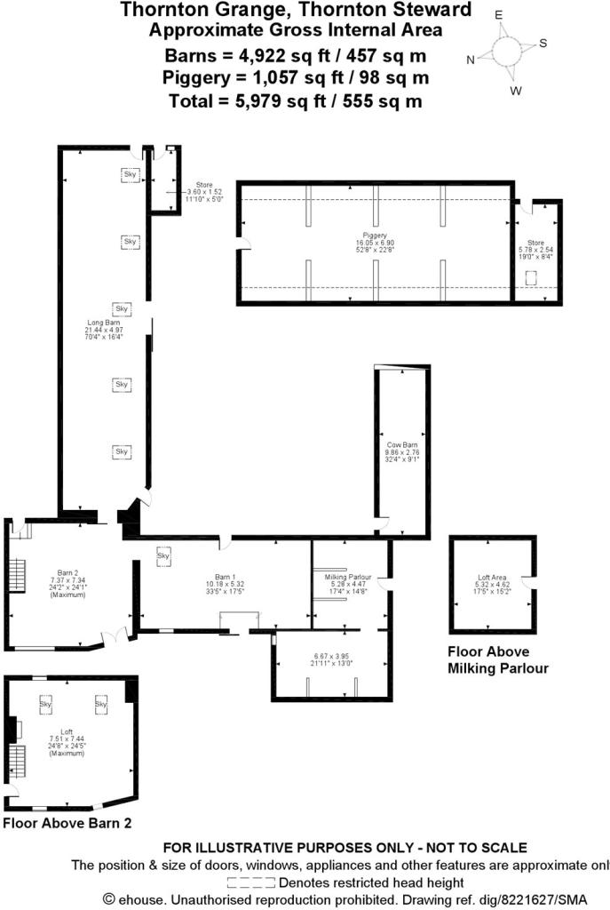
In addition, there are an extensive range of traditional barns which lie to the rear of the house and provide potential for a variety of uses, whether that be in conjunction with the house itself or for conversion/development into additional residential properties. Planning permission for conversion of the buildings to form two dwellings with garages was granted in 2003 but has now lapsed.
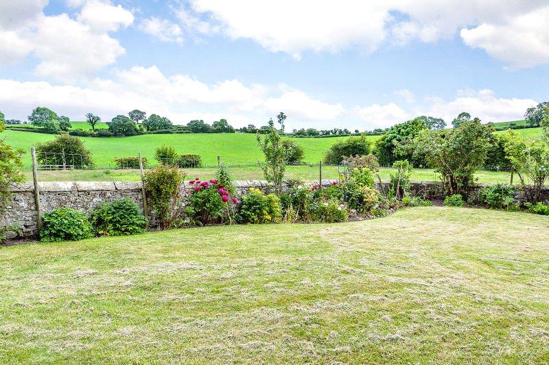
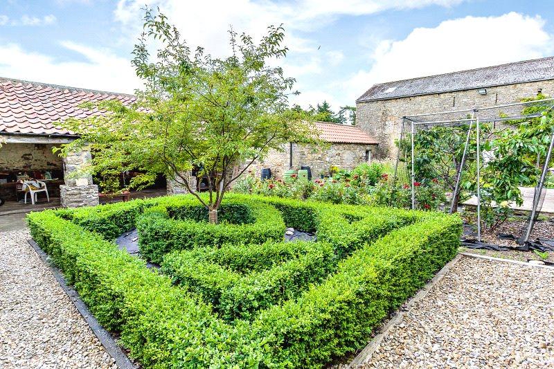
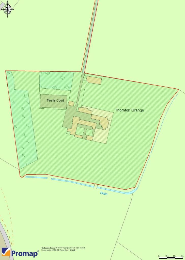
Outside, the property is approached via a long driveway which leads into a courtyard, off which lie the aforementioned barns as well as a double garage. Lawned gardens lie to three sides of the house and there is a pretty walled garden which has a pleasant south west aspect. Beyond, there is a tennis court, an orchard, a former piggery, a 4 acre (1.62 ha) paddock and a shelter belt of woodland to the western boundary.
THE VENDORS HAVE ASKED US TO ADVISE POTENTIAL PURCHASERS THAT ALTHOUGH THERE IS A WATER PUMPING STATION IN CLOSE PROXIMITY THIS DOES NOT EFFECT THE DAY TO DAY LIVING AT THORNTON GRANGE.
Listed by
Harrogate
Carter Jonas
Reference: 44150436
EPC ratings on this postcode
We don't have a matched EPC for this property yet. Below are efficiency scores and details for other addresses on this postcode.
| Address | Current | Potential | Floor area | Age band | Type |
|---|---|---|---|---|---|
| Arklow Bungalow, Thornton Steward, RIPON | 42 | 99 | 103 m² | England and Wales: 1976-1982 | Detached |
| Thornton Grange, Thornton Steward, RIPON | 54 | 79 | 289 m² | England and Wales: before 1900 | Detached |
Flood risk
Zone: 1
Risk: Low
Job (default Low)
Floorplans
Floorplan
Floorplan
Price history
181% since 1997
| Event | Date | Price | % change |
|---|---|---|---|
| Sold | 13/07/2017 (8 years ago) | £760,000 | +55.1% |
| Sold | 29/08/2003 (22 years ago) | £489,976 | +81.5% |
| Sold | 15/06/1997 (28 years ago) | £270,000 | — |
Source: HM Land Registry Price Paid Data. Crown copyright.
Sold Comparables
Same street and nearby sales within 0.25 miles (last 5 years). Data from Land Registry Price Paid.
| Address | Price | Date | Type |
|---|---|---|---|
| ARKLOW BUNGALOW, THORNTON STEWARD, RIPON, NORTH YORKSHIRE, HG4 4BQ | £580,000 | 18/12/2023 | Detached |
Area average: £580,000 (1 sale)
Capital growth trend
Land Registry outcode average: last 12 months vs 5y and 10y ago (from sold prices).
House Price Index (HM Land Registry — official index, not sold-price averages): Yorkshire and The Humber. Series: Detached. As of March 2026.
Rental Range
Estimated market rent for Yorkshire and The Humber. Low = conservative, Realistic = average, Optimistic = best case.
Based on Region from postcode lookup → Yorkshire and The Humber.
LHA (30th percentile) floor for Harrogate: £1,271/mo (Apr 2025 – Mar 2026)
Location
Address
Moor Lane
Nearby
Nearest stations, universities and amenities (distance from property).
| Type | Name | Distance |
|---|---|---|
| Train station | Finghall Lane | 1.3 miles |
| Bus stop | Hall | 1.7 miles |
| Shop | Country Cupboard Antiques | 3.5 miles |
| Shop | Middleham Motors | 3.5 miles |
| Train station | Leyburn | 4.4 miles |
| Hospital | Friary Community Hospital | 8.2 miles |
Street-level crime
| Category | Count |
|---|---|
| Other theft | 1 |
| Total incidents | 1 |
Within 1 mile during Apr 2026. Source: data.police.uk (England & Wales).
Schools nearby
Nearest open schools with Ofsted ratings (England). Closed schools are not shown. Data from Get Information about Schools and Ofsted.
| Name | Type | Distance | Ofsted |
|---|---|---|---|
| Aysgarth School | Other | 1.7 miles | — (No rating) |
| Hunton and Arrathorne Community Primary School | Primary | 2.8 miles | Good — 10 Oct 2023 |
Rental Comparables
Loading rental comparables for this postcode. Refresh in a few minutes.
Rent-driven metrics
Based on Area rent estimate.
- Rent ratio — Monthly rent ÷ purchase price (1% rule). 1%+ = strong, 0.8–1% = okay, <0.8% = weak for cashflow.
- Max investor price — Rent ÷ 0.8%; the price at which rent would be 0.8% of price (Stoke-style target).
- Target investor price — Rent ÷ 1%; the price at which rent would be 1% of price (strong cashflow band).
- Gross yield — Annual rent as % of purchase price (no costs).
Enter House Number
Enter the house number to help us retrieve more accurate pricing history and property data.
Please log in to submit or correct the house number for this listing.
Log in to continue