Boylestone
Ashbourne, DE6, DE6 5AA

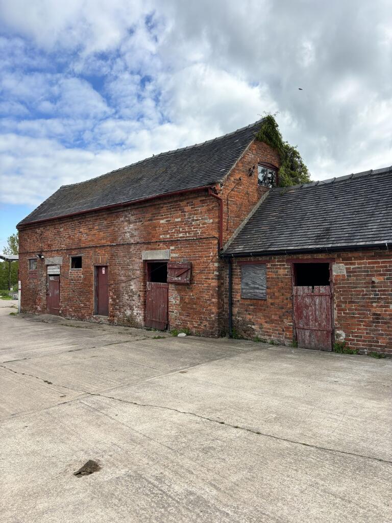
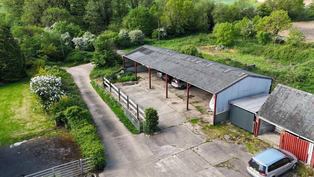
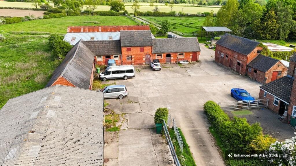
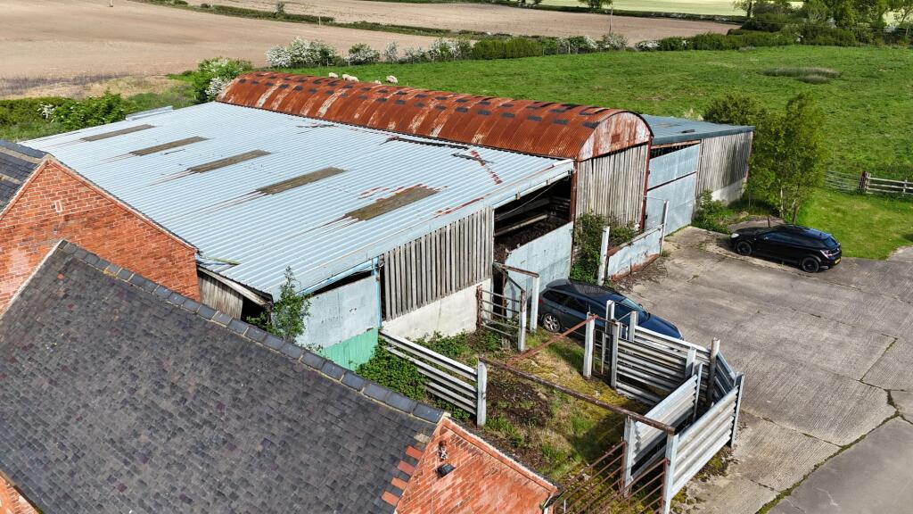
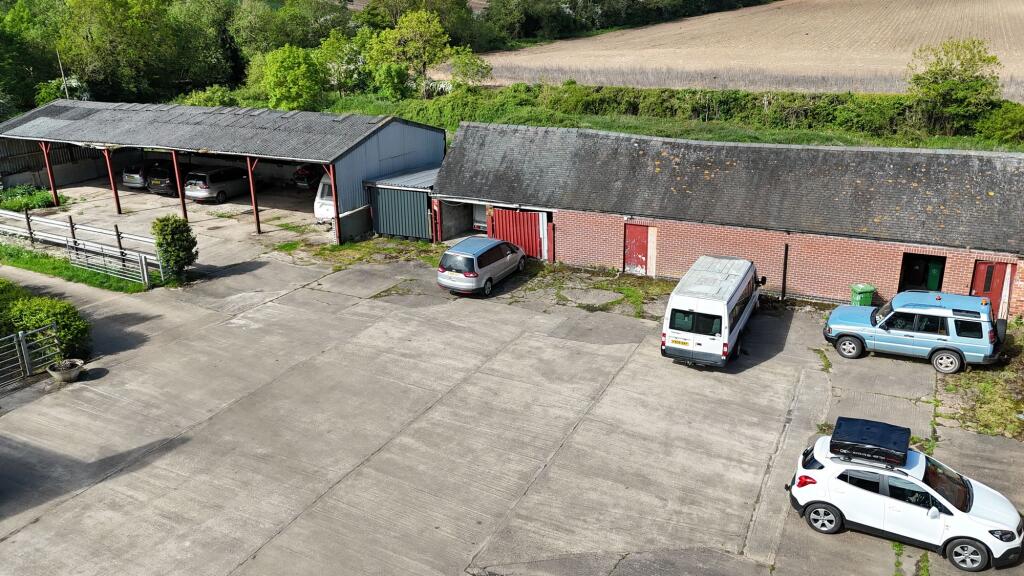
Photo 1 Photo 2 Photo 3 Photo 4 Photo 5 Photo 6 Photo 7 Photo 8
/ 8
Property details
Tenure
FREEHOLD
Council tax band
E
Local average
£1,039,625 (+44.3%)
Deprivation
Decile 6 (18,895 of 33,755)
Street crime
0 incidents within 1 mile (Jul 2026)
Key features
- Rural development opportunity
- Class Q planning permission granted for the conversion of agricultural barns into 9 dwellings.
- Attractive listed red-brick farmhouse requiring modernisation.
- Further planning application currently awaiting determination of selected agricultural barns and the erection of five new-build dwellings
Additional details
- Garden
- Yes
- Listed property
- No
- Restrictions
- No
- Required access
- No
- Rights of way
- No
- Flooded in last 5 years
- No
- Flood defences
- No
Description
Class Q planning permission granted for the conversion of agricultural barns into 9 dwellings.
Attractive listed red-brick farmhouse requiring modernisation.
Further planning application currently awating determination of selected agricultrual barms and the erection of five new-build dwellings.
Listed by
Loughborough
Sheldon Bosley Knight
Reference: 92699022
EPC ratings on this postcode
We don't have a matched EPC for this property yet. Below are efficiency scores and details for other addresses on this postcode.
| Address | Current | Potential | Floor area | Age band | Type |
|---|---|---|---|---|---|
| 1 Sunnyside, Chapel Lane, Boylestone, ASHBOURNE | 36 | 94 | 143 m² | England and Wales: 1900-1929 | Detached |
| Cottage Farmhouse, Boylestone, ASHBOURNE | 65 | 82 | 213 m² | England and Wales: before 1900 | Detached |
| Harehill Cottage, Boylestone, ASHBOURNE | 43 | 81 | 158 m² | England and Wales: before 1900 | Detached |
| Hayloft Cottage, Chapel Lane, Boylestone, ASHBOURNE | 58 | 89 | 118 m² | England and Wales: 1996-2002 | Detached |
| New House Farm, Boylestone, ASHBOURNE | 66 | 80 | 207 m² | England and Wales: 1900-1929 | Detached |
| Penfold House Farm, Boylestone, ASHBOURNE | 69 | 76 | 454 m² | England and Wales: 2003-2006 | Detached |
| Riddings Barn Cottage, Chapel Lane, Boylestone, ASHBOURNE | 22 | 63 | 76 m² | England and Wales: 1900-1929 | Detached |
| Sapperton Wood Farm, Boylestone, ASHBOURNE | 1 | 59 | 261 m² | England and Wales: 1900-1929 | Detached |
| The Cottage, Chapel Lane, Boylestone, ASHBOURNE | 48 | 75 | 91 m² | England and Wales: before 1900 | Detached |
| The Old Post Office, Boylestone, ASHBOURNE | 53 | 87 | 218 m² | England and Wales: before 1900 | Detached |
| The Old Post Office, Boylestone, ASHBOURNE | 29 | 47 | 204 m² | England and Wales: before 1900 | Detached |
| Yew Tree Cottage, Boylestone, ASHBOURNE | 47 | 87 | 163 m² | England and Wales: before 1900 | Detached |
| Younds Cottage Farm, Boylestone, ASHBOURNE | 48 | 77 | 182 m² | England and Wales: 1983-1990 | Detached |
| Younds Cottage Farm, Boylestone, ASHBOURNE | 54 | 82 | 183 m² | England and Wales: 1967-1975 | Detached |
Flood risk
Zone: 1
Risk: Low
Job (default Low)
Registered land (INSPIRE)
This location falls inside an HM Land Registry INSPIRE registered freehold polygon.
Plot: ~87,381 m² (21.59 acres)
Source: HM Land Registry INSPIRE Index Polygons.
Floorplans
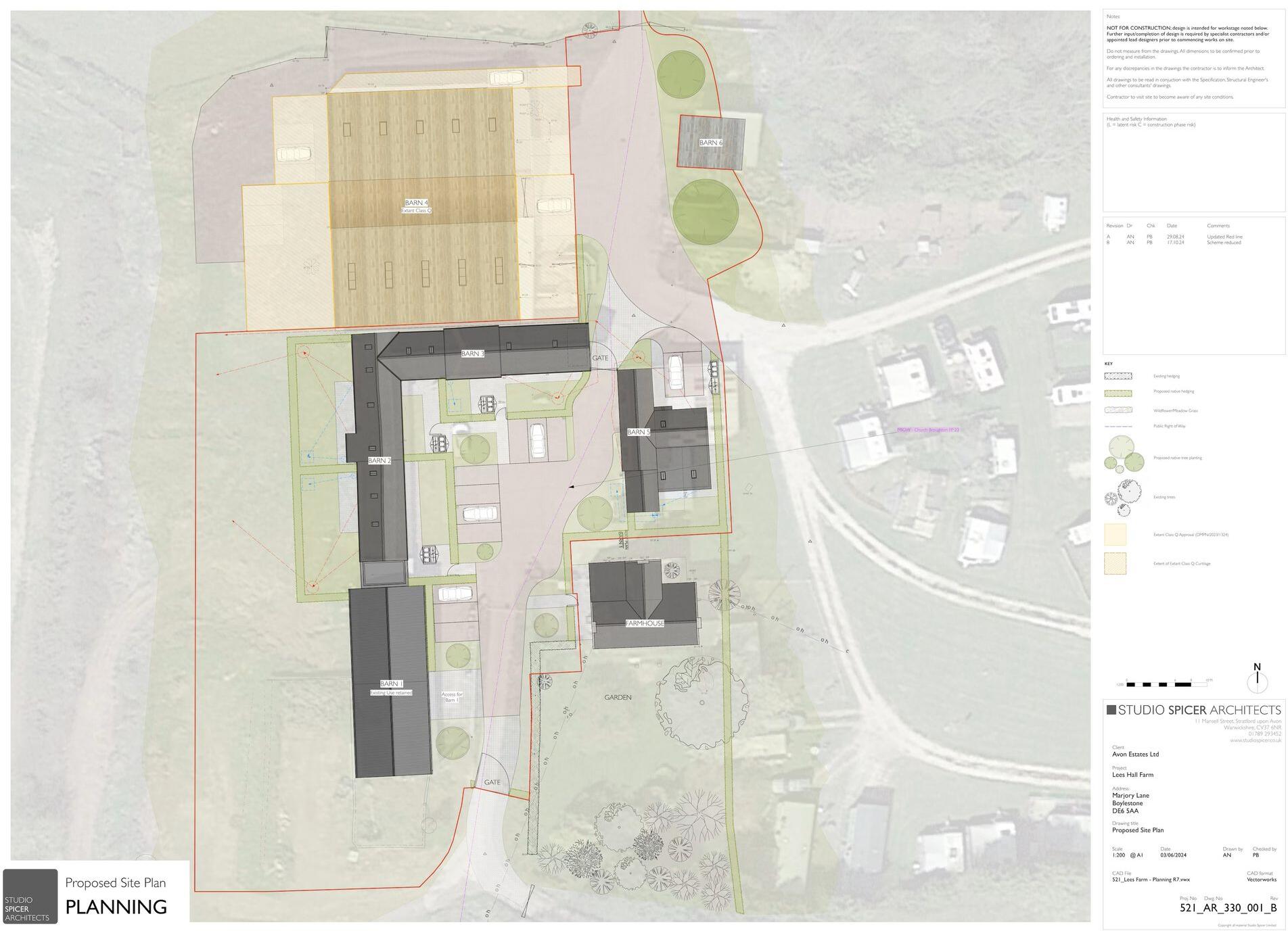
Site Plan
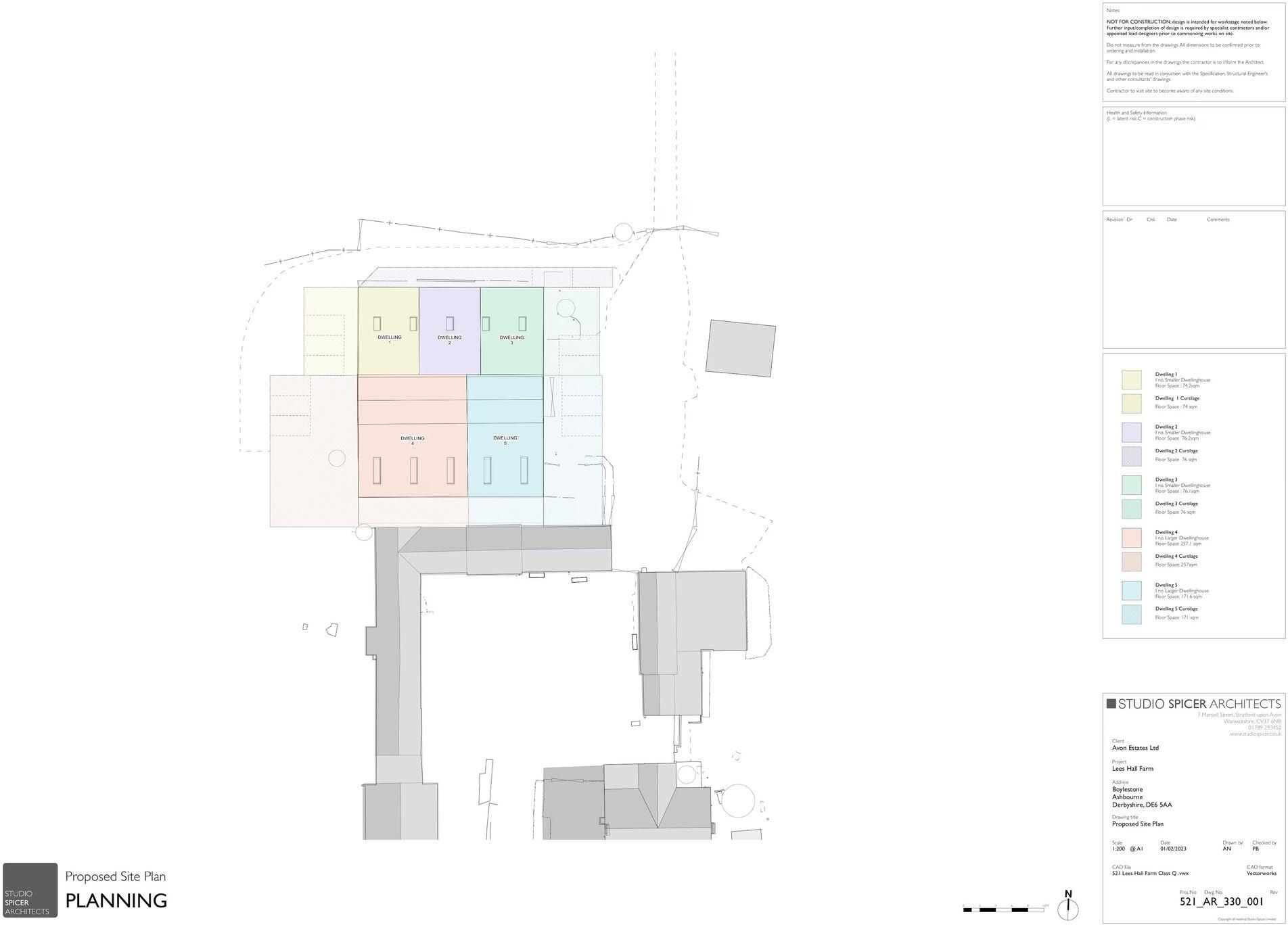
Site Plan
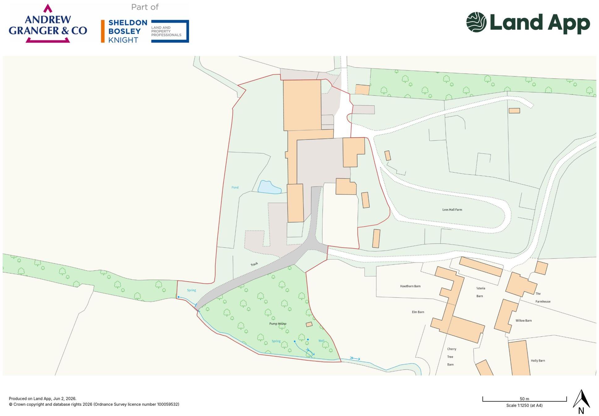
Site Plan
Price history
| Event | Date | Price | % change |
|---|---|---|---|
| Listed for sale | — | £1,500,000 | — |
Source: HM Land Registry Price Paid Data. Crown copyright.
Sold Comparables
Sold comparables data is not available for this property.
Capital growth trend
Land Registry outcode average: last 12 months vs 5y and 10y ago (from sold prices).
House Price Index (HM Land Registry — official index, not sold-price averages): Derbyshire Dales. Series: All dwelling types. As of June 2026.
Rental Range
Estimated market rent for Derbyshire Dales. Low = conservative, Realistic = average, Optimistic = best case.
Based on Local Authority from postcode lookup → Derbyshire Dales.
LHA (30th percentile) floor for Peaks & Dales: £898/mo (Apr 2025 – Mar 2026)
Location
Address
Marjory Lane
Nearby
Nearest stations, universities and amenities (distance from property).
| Type | Name | Distance |
|---|---|---|
| Bus stop | Aston Farm North | 1.9 miles |
| Shop | Sticky Fingers | 2.1 miles |
| Shop | Hot House Ceramics | 2.1 miles |
| Train station | Tutbury and Hatton | 3.9 miles |
| Train station | Uttoxeter | 5.1 miles |
| Hospital | Outwood Site | 7.0 miles |
| Hospital | Saint Oswald's Hospital | 7.1 miles |
| University | University of Derby | 10.1 miles |
| University | Agard Court | 10.5 miles |
Street-level crime
| Category | Count |
|---|---|
| Total incidents | 0 |
Within 1 mile during Jul 2026. Source: data.police.uk (England & Wales).
Schools nearby
Nearest open schools with Ofsted ratings (England). Closed schools are not shown. Data from Get Information about Schools and Ofsted.
| Name | Type | Distance | Ofsted |
|---|---|---|---|
| Church Broughton CofE Primary School | Primary | 1.9 miles | Good — 26 Feb 2016 |
| Sudbury Primary School | Primary | 2.1 miles | Requires improvement — 16 Jul 2023 |
| Longford CofE Primary School | Primary | 3.1 miles | Good — 8 Dec 2011 |
| Marston Montgomery Primary School | Primary | 3.4 miles | Requires improvement — 19 Dec 2023 |
| Heath Fields Primary School | Primary | 3.6 miles | Good — 28 Sep 2023 |
Rental Comparables
Rental comparables are temporarily unavailable while listing-site fetches are paused. Try again later.
Rent-driven metrics
Based on Area rent estimate.
- Rent ratio — Monthly rent ÷ purchase price (1% rule). 1%+ = strong, 0.8–1% = okay, <0.8% = weak for cashflow.
- Max investor price — Rent ÷ 0.8%; the price at which rent would be 0.8% of price (Stoke-style target).
- Target investor price — Rent ÷ 1%; the price at which rent would be 1% of price (strong cashflow band).
- Gross yield — Annual rent as % of purchase price (no costs).
Enter House Number
Enter the house number to help us retrieve more accurate pricing history and property data.
Please log in to submit or correct the house number for this listing.
Log in to continue