Church Lane
Derrington, ST18 9LY
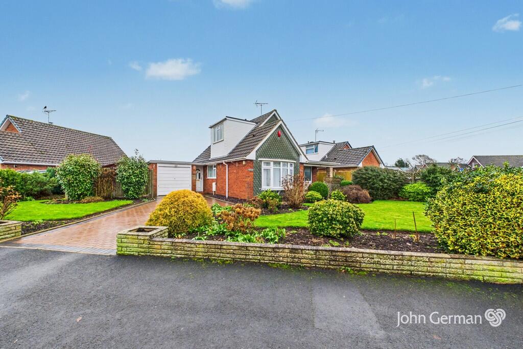
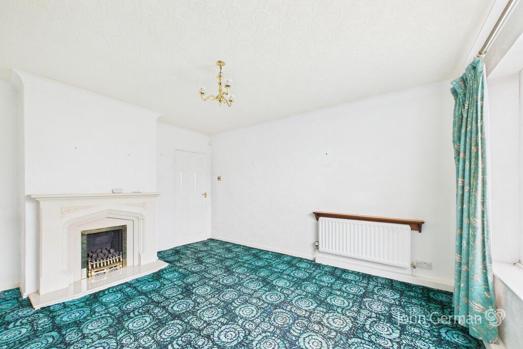
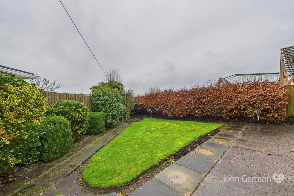
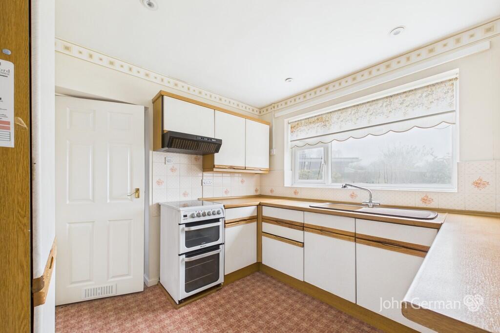
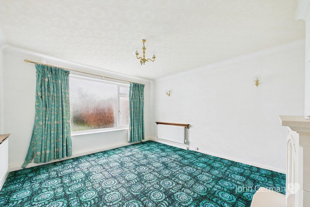
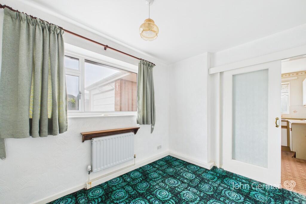
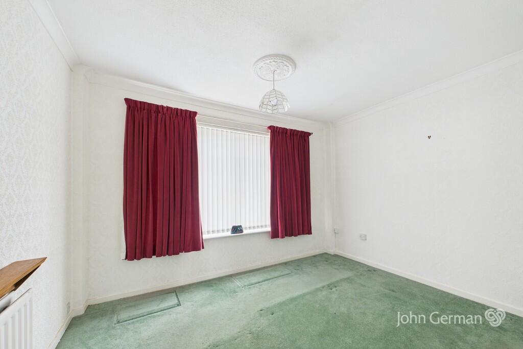
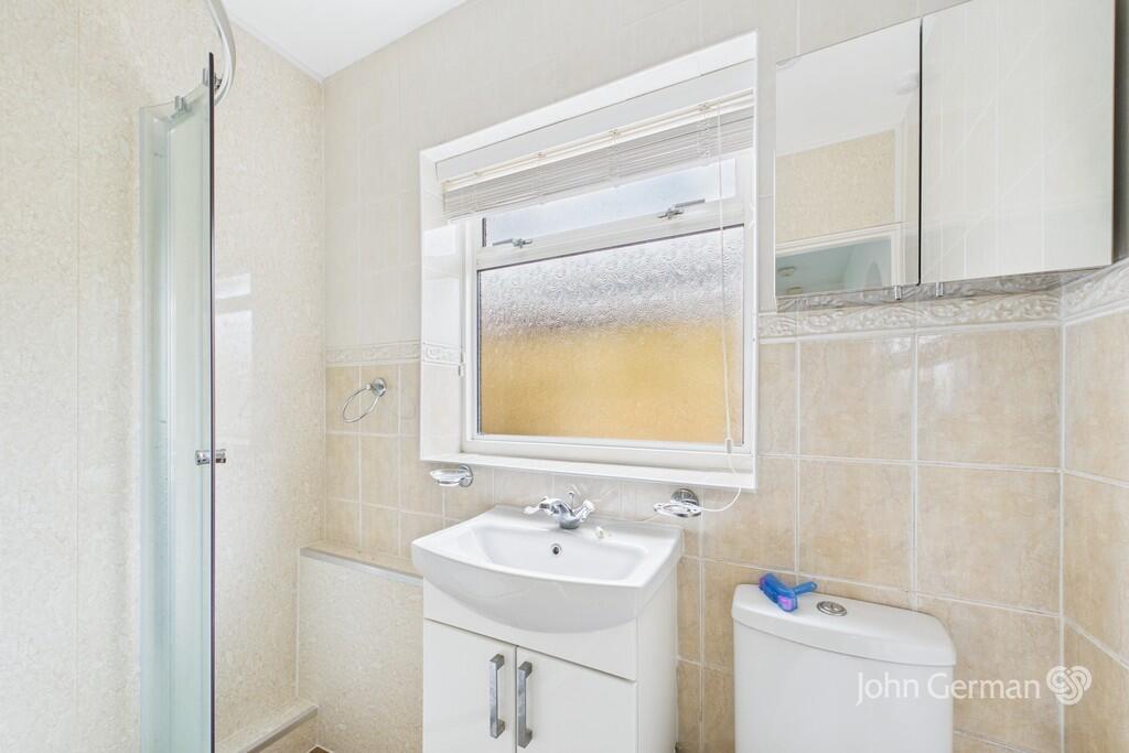
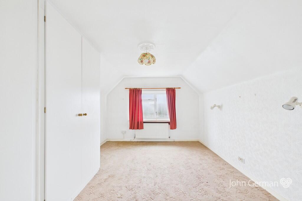
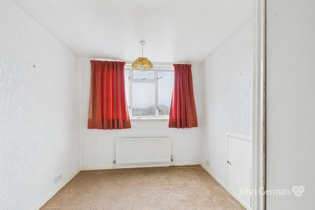
Photo 1 Photo 2 Photo 3 Photo 4 Photo 5 Photo 6 Photo 7 Photo 8 Photo 9 Photo 10
/ 10
Property details
Tenure
FREEHOLD
Council tax band
D
Local average
£509,354 (-41.1%)
Deprivation
Decile 7 (23,442 of 33,755)
Street crime
18 incidents within 1 mile (Apr 2026)
Key features
- Attractive detached dormer bungalow
- Delightful corner plot position
- Lovely front & rear gardens
- Lounge
- Dining room
- Garage
- No upward chain
- EPC rating C. Council tax band D
Additional details
- Electricity
- Mains supply
- Water
- Mains supply
- Sewerage
- Mains supply
- Heating
- Gas central
- Parking
- Garage, Off street
- Garden
- Yes
Description
The kitchen has a range of high and low level units, tiled splash backs and a stainless steel sink and drainer. A sliding door opens to the dining room. A separate side access lobby has doors to both the front and rear of the property.
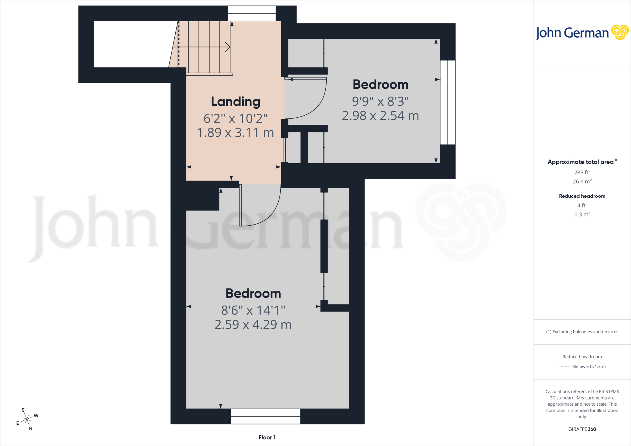
There is a ground floor double bedroom with a wardrobe and an attractive shower room has a shower, wash basin with integrated cupboard beneath, WC and a mix of full height tiling and splash plates plus a chrome towel radiator.
Off the first floor landing are two bedrooms, one of which has built in wardrobes.
Outside - The bungalow occupies an attractive corner plot with lovely front garden having established borders and a dwarf height wall. A further garden area lies to the side of the property. The block paved drive gives access to the garage. In addition there is a spacious shed. The lawned rear garden has attractive borders.
Derrington is situated a very short distance from the county town of Stafford which has a wide range of amenities including an intercity railway station. Junctions 13 and 14 of the M6 provide direct access into the national motorway network and M6 Toll.
Notes: The property forms part of a deceased estate and therefore there is very limited information available.
The property is not registered with Land Registry and will require a first registration on sale, for which most solicitors will make an additional charge.
We are unaware if there are any rights, restrictions of covenants.
Tenure: Freehold (purchasers are advised to satisfy themselves as to the tenure via their legal representative).
Please note: It is quite common for some properties to have a Ring doorbell and internal recording devices.
Property construction: Traditional
Parking: Drive
Electricity supply:
Water supply:
Sewerage:
Heating:
(Purchasers are advised to satisfy themselves as to their suitability).
Broadband type: Unknown
See Ofcom link for speed:
Mobile signal/coverage: See Ofcom link
Local Authority/Tax Band: Stafford Borough Council / Tax Band D
Useful Websites:
Our Ref: JGA/20012026
The property information provided by John German Estate Agents Ltd is based on enquiries made of the vendor and from information available in the public domain. If there is any point on which you require further clarification, please contact the office and we will be pleased to check the information for you, particularly if contemplating travelling some distance to view the property. Please note if your enquiry is of a legal or structural nature, we advise you to seek advice from a qualified professional in their relevant field.
We are required by law to comply fully with The Money Laundering Regulations 2017 and as such need to complete AML ID verification and proof / source of funds checks on all buyers and, where relevant, cash donors once an offer is accepted on a property. We use the Checkboard app to complete the necessary checks, this is not a credit check and therefore will have no effect on your credit history. With effect from 1st March 2025 a non-refundable compliance fee of £30.00 inc. VAT per buyer / donor will be required to be paid in advance when an offer is agreed and prior to a sales memorandum being issued.
Listed by
Stafford
John German
Reference: 171363107
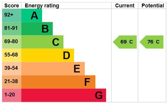
EPC ratings on this postcode
We don't have a matched EPC for this property yet. Below are efficiency scores and details for other addresses on this postcode.
| Address | Current | Potential | Floor area | Age band | Type |
|---|---|---|---|---|---|
| 10 Church Lane, Derrington, STAFFORD | 39 | 76 | 102 m² | England and Wales: 1950-1966 | Detached |
| 12, Church Lane, Derrington, STAFFORD | 62 | 81 | 137 m² | England and Wales: 1967-1975 | Detached |
| 14 CHURCH LANE, DERRINGTON, STAFFORD | 57 | 82 | 89 m² | England and Wales: 1967-1975 | Detached |
| 18, Church Lane, Derrington, STAFFORD | 63 | 82 | 96 m² | England and Wales: 1967-1975 | Detached |
| 18, Church Lane, Derrington, STAFFORD | 58 | 82 | 96 m² | England and Wales: 1967-1975 | Detached |
| 2 Church Lane, Derrington, STAFFORD | 69 | 76 | 94 m² | England and Wales: 1967-1975 | Detached |
| 20, Church Lane, Derrington, STAFFORD | 58 | 82 | 96 m² | England and Wales: 1967-1975 | Detached |
| 22 Church Lane, Derrington, STAFFORD | 71 | 82 | 118 m² | England and Wales: 1967-1975 | Detached |
| 32, Church Lane, Derrington, STAFFORD | 60 | 111 | 70 m² | England and Wales: 1967-1975 | Detached |
| 34, Church Lane, Derrington, STAFFORD | 79 | 81 | 119 m² | England and Wales: 1967-1975 | Detached |
| 34, Church Lane, Derrington, STAFFORD | 66 | 82 | 113 m² | England and Wales: 1967-1975 | Detached |
| 4 Church Lane, Derrington, STAFFORD | 59 | 81 | 84 m² | England and Wales: 1967-1975 | Detached |
| Branksome, Church Lane, Derrington, STAFFORD | 56 | 80 | 121 m² | England and Wales: 1967-1975 | Detached |
| High Trees, Church Lane, Derrington, STAFFORD | 57 | 69 | 157 m² | England and Wales: 1967-1975 | Detached |
| Wilberick, Church Lane, Derrington, STAFFORD | 57 | 76 | 151 m² | England and Wales: 1930-1949 | Detached |
Flood risk
Zone: 1
Risk: Low
Job (default Low)
Floorplans
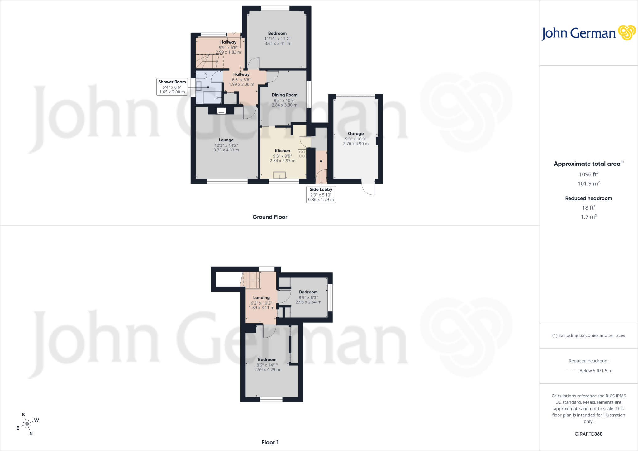
Floorplan 1
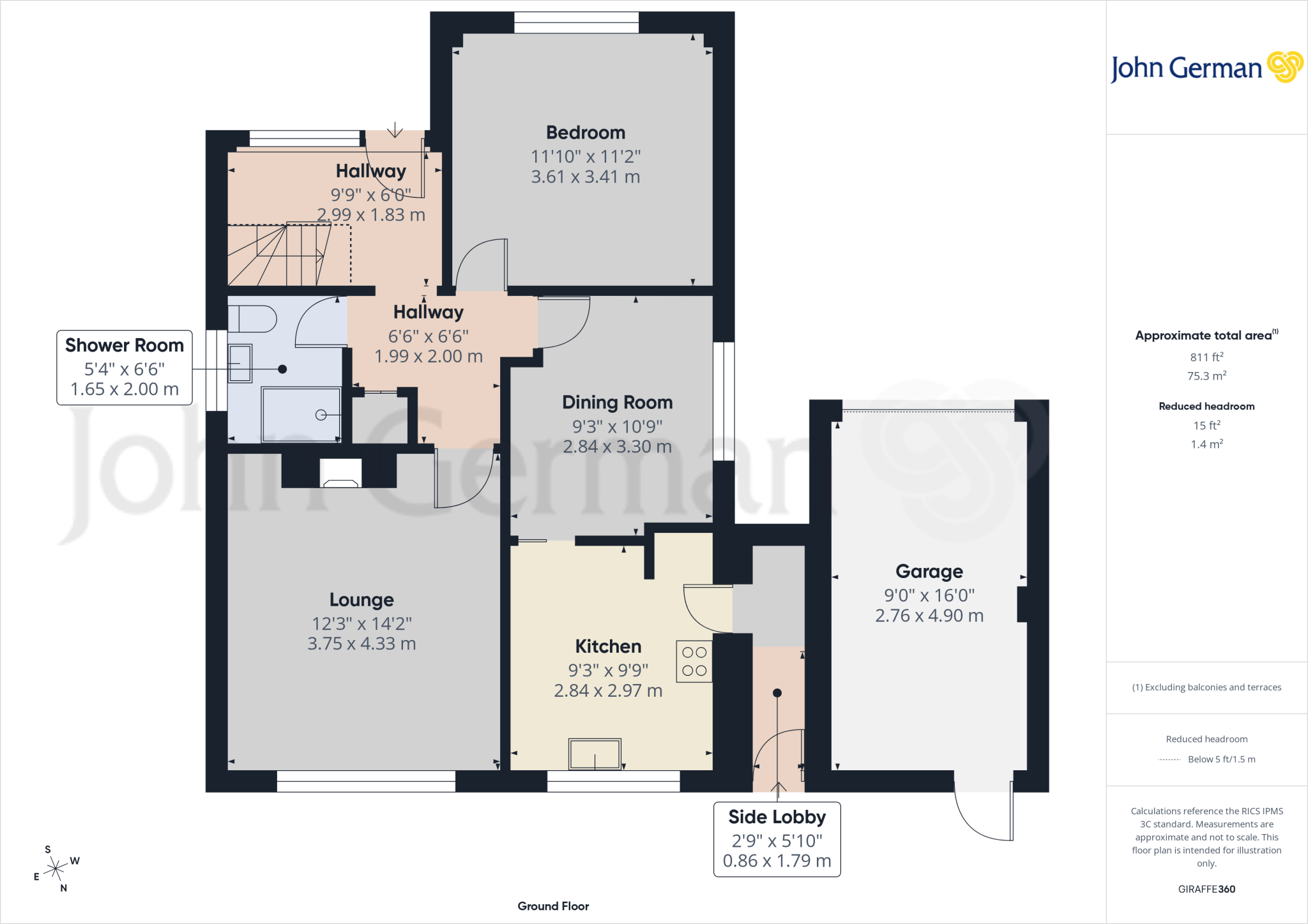
Floorplan 2
Floorplan 3
EPC Graphs
EPC 1
Price history
| Event | Date | Price | % change |
|---|---|---|---|
| Listed for sale | — | £299,950 | — |
Source: HM Land Registry Price Paid Data. Crown copyright.
Sold Comparables
Same street and nearby sales within 0.25 miles (last 5 years). Data from Land Registry Price Paid.
| Address | Price | Date | Type |
|---|---|---|---|
| 36 ST MATTHEWS DRIVE, DERRINGTON, STAFFORD, STAFFORDSHIRE, ST18 9LU | £250,000 | 25/08/2023 | Detached |
| 19 MEADOW LANE, DERRINGTON, STAFFORD, STAFFORDSHIRE, ST18 9NA | £220,000 | 25/11/2022 | Detached |
| Same street 10 CHURCH LANE, DERRINGTON, STAFFORD, STAFFORDSHIRE, ST18 9LY | £365,000 | 04/11/2022 | Detached |
| QUORN HOUSE BILLINGTON LANE, DERRINGTON, STAFFORD, STAFFORDSHIRE, ST18 9LR | £395,000 | 04/11/2022 | Detached |
| Same street WILBERICK CHURCH LANE, DERRINGTON, STAFFORD, STAFFORDSHIRE, ST18 9LY | £487,500 | 26/09/2022 | Detached |
| 17 ST MATTHEWS DRIVE, DERRINGTON, STAFFORD, STAFFORDSHIRE, ST18 9LS | £250,000 | 29/07/2022 | Detached |
| 33 ST MATTHEWS DRIVE, DERRINGTON, STAFFORD, STAFFORDSHIRE, ST18 9LU | £315,000 | 22/07/2022 | Detached |
| 9 TWEMLOW CLOSE, DERRINGTON, STAFFORD, STAFFORDSHIRE, ST18 9LX | £228,000 | 16/06/2022 | Detached |
| 37 MOUNT PLEASANT, DERRINGTON, STAFFORD, STAFFORDSHIRE, ST18 9NB | £275,000 | 07/06/2022 | Detached |
| 1 CHESTNUT CLOSE, DERRINGTON, STAFFORD, STAFFORDSHIRE, ST18 9NJ | £403,000 | 04/02/2022 | Detached |
| Same street 14 CHURCH LANE, DERRINGTON, STAFFORD, STAFFORDSHIRE, ST18 9LY | £235,000 | 02/08/2021 | Detached |
| 38 ST MATTHEWS DRIVE, DERRINGTON, STAFFORD, STAFFORDSHIRE, ST18 9LU | £215,000 | 05/07/2021 | Detached |
Street average: £362,500 (3 sales)
Area average: £283,444 (9 sales)
Capital growth trend
Land Registry outcode average: last 12 months vs 5y and 10y ago (from sold prices).
House Price Index (HM Land Registry — official index, not sold-price averages): Stafford. Series: Detached. As of March 2026.
Rental Range
Estimated market rent for Stafford. Low = conservative, Realistic = average, Optimistic = best case.
Based on Local Authority from postcode lookup → Stafford.
LHA (30th percentile) floor for Mid Staffs: £738/mo (Apr 2025 – Mar 2026)
Location
Address
Church Lane
Nearby
Nearest stations, universities and amenities (distance from property).
| Type | Name | Distance |
|---|---|---|
| Bus stop | Mount Pleasant | 0.1 miles |
| Shop | Aston Bank Farm | 0.7 miles |
| Shop | hair@108 | 1.1 miles |
| Hospital | Rowley Hall Hospital | 1.6 miles |
| Train station | Stafford | 1.6 miles |
| Hospital | St George's Hospital | 2.3 miles |
| University | Staffordshire University Blackheath Lane Site | 3.8 miles |
| Train station | Unknown | 5.1 miles |
| University | Harper Adams University | 11.3 miles |
Street-level crime
| Category | Count |
|---|---|
| Violence and sexual offences | 9 |
| Anti-social behaviour | 2 |
| Criminal damage and arson | 2 |
| Burglary | 1 |
| Other crime | 1 |
| Other theft | 1 |
| Possession of weapons | 1 |
| Public order | 1 |
| Total incidents | 18 |
Within 1 mile during Apr 2026. Source: data.police.uk (England & Wales).
Schools nearby
Nearest open schools with Ofsted ratings (England). Closed schools are not shown. Data from Get Information about Schools and Ofsted.
| Name | Type | Distance | Ofsted |
|---|---|---|---|
| Doxey Academy | Primary | 1.1 miles | Requires improvement — 21 Mar 2023 |
| Castlechurch Primary School | Primary | 1.3 miles | Good — 14 Dec 2023 |
| King Edward VI High School | Secondary | 1.4 miles | Good — 4 Sep 2018 |
| Cooper Perry Primary School | Primary | 1.5 miles | Good — 3 Oct 2011 |
| Blessed Mother Teresa's Catholic Primary School | Primary | 1.6 miles | Good — 18 May 2022 |
Rental Comparables
Residential lets from OpenRent and Rightmove for the area (same bedroom count). Use to validate rent estimates. Student lets are excluded.
| Title | Rent | Beds | Distance | As seen on |
|---|---|---|---|---|
| 3 Bed Semi-Detached House, Monmouth Drive, ST16 | £1,280/mo | 3 | 0.78 miles | OpenRent |
| 3 Bed Semi-Detached House, Plover Green, ST16 | £1,325/mo | 3 | 0.81 miles | OpenRent |
| 3 Bed Semi-Detached House, Plover Green, ST16 | £1,200/mo | 3 | 0.82 miles | OpenRent |
| 3 Bed Semi-Detached House, Martin Drive, ST16 | £1,350/mo | 3 | 0.88 miles | OpenRent |
Average rent: £1,289/mo (4 listings)
Rent-driven metrics
Based on OpenRent comparables.
- Rent ratio — Monthly rent ÷ purchase price (1% rule). 1%+ = strong, 0.8–1% = okay, <0.8% = weak for cashflow.
- Max investor price — Rent ÷ 0.8%; the price at which rent would be 0.8% of price (Stoke-style target).
- Target investor price — Rent ÷ 1%; the price at which rent would be 1% of price (strong cashflow band).
- Gross yield — Annual rent as % of purchase price (no costs).
- Cost-to-rent — Price ÷ annual rent (from OpenRent comparables). Under 14× = strong, 14–16× = acceptable, 17×+ = compressed.
- Cashflow — Rent minus mortgage, 10% maintenance, £25/mo compliance. Assumes 75% LTV, 3.95% APR (5yr fixed), 25yr term.
- ROI — Annual profit ÷ cash in (deposit + 4% purchase costs).
Enter House Number
Enter the house number to help us retrieve more accurate pricing history and property data.
Please log in to submit or correct the house number for this listing.
Log in to continue