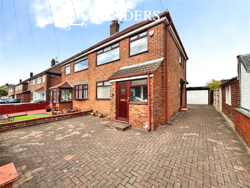
Irwell Road
Warrington, Cheshire, WA4 6BA
£280,000
Property details
Tenure
FREEHOLD
Council tax band
TBC
Local average
£368,647 (-24%)
Deprivation
Decile 9 (27,704 of 33,755)
Street crime
277 incidents within 1 mile (Mar 2026)
Key features
- Sought-after South Warrington location
- Ideal for first-time buyers
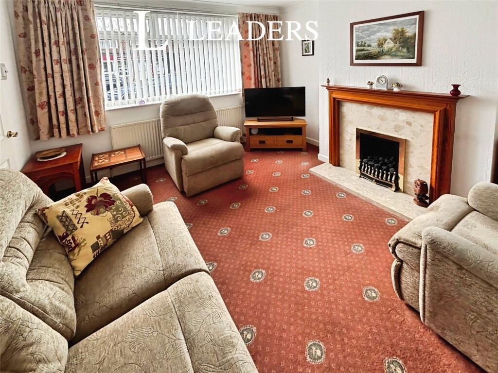
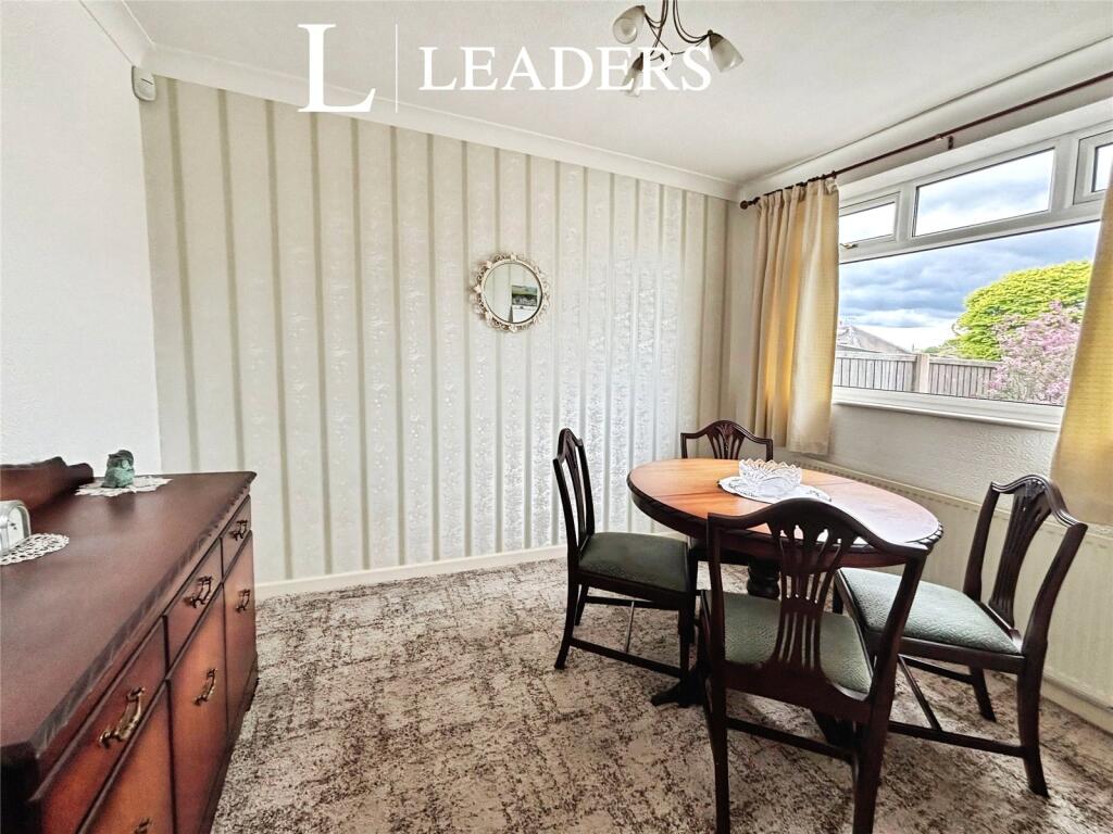
- Two spacious reception rooms
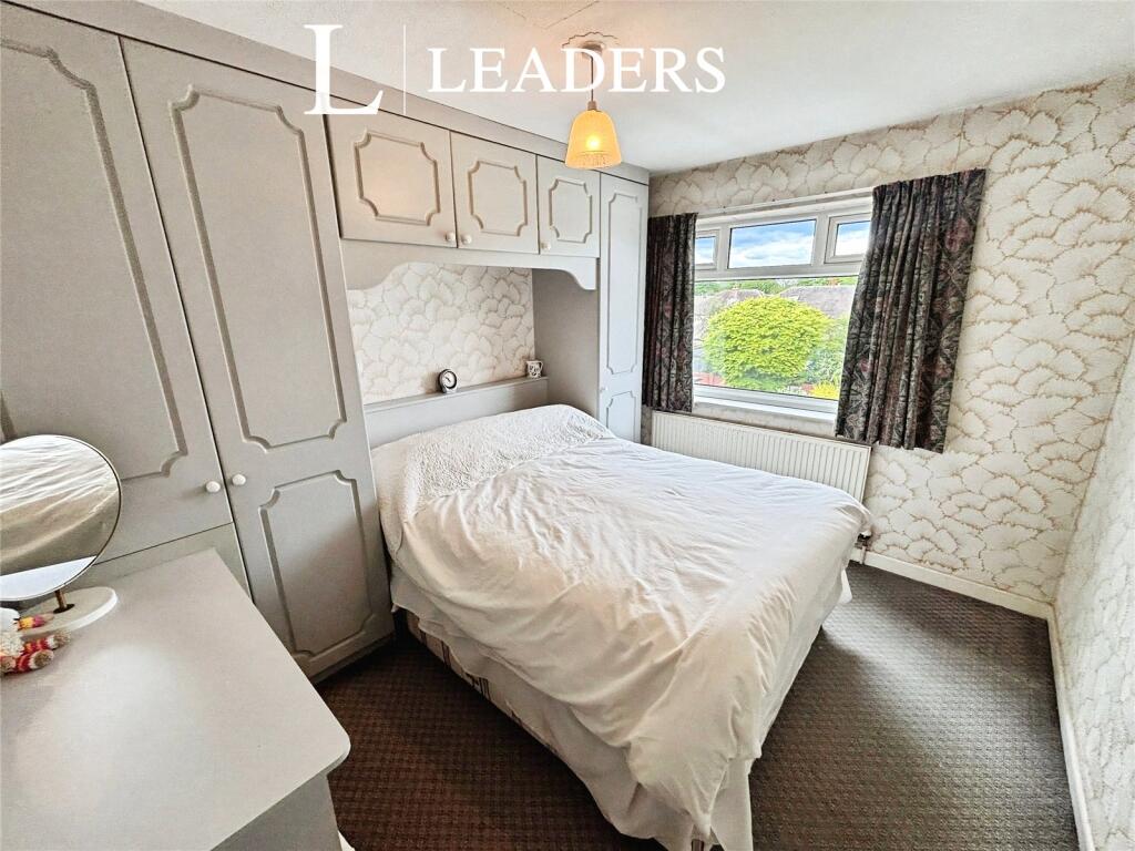
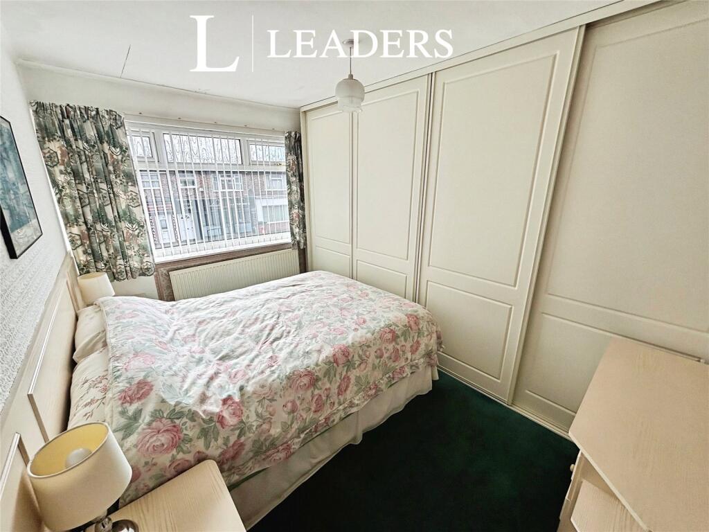
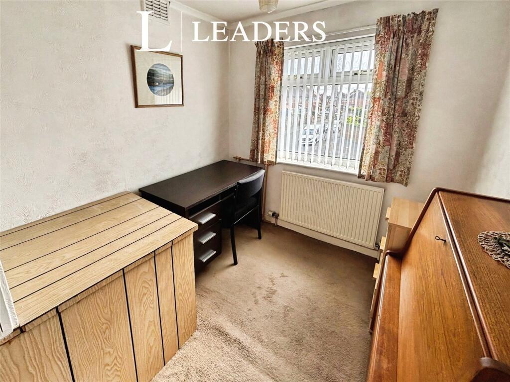
- Two double bedrooms plus single
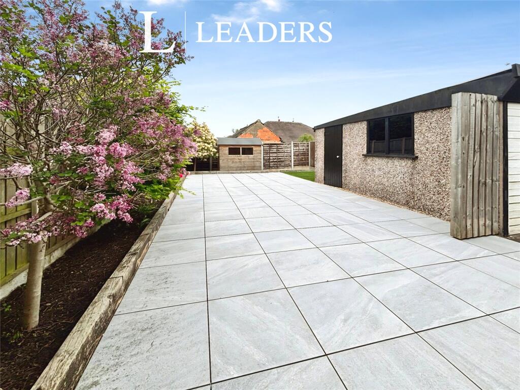
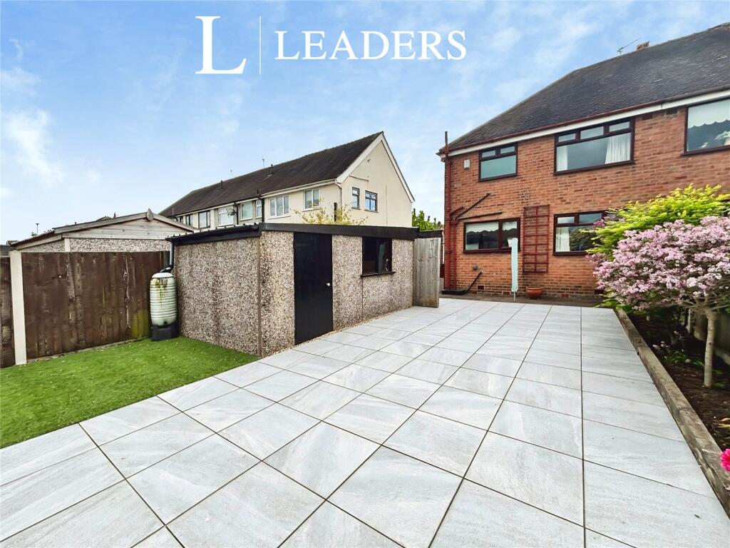
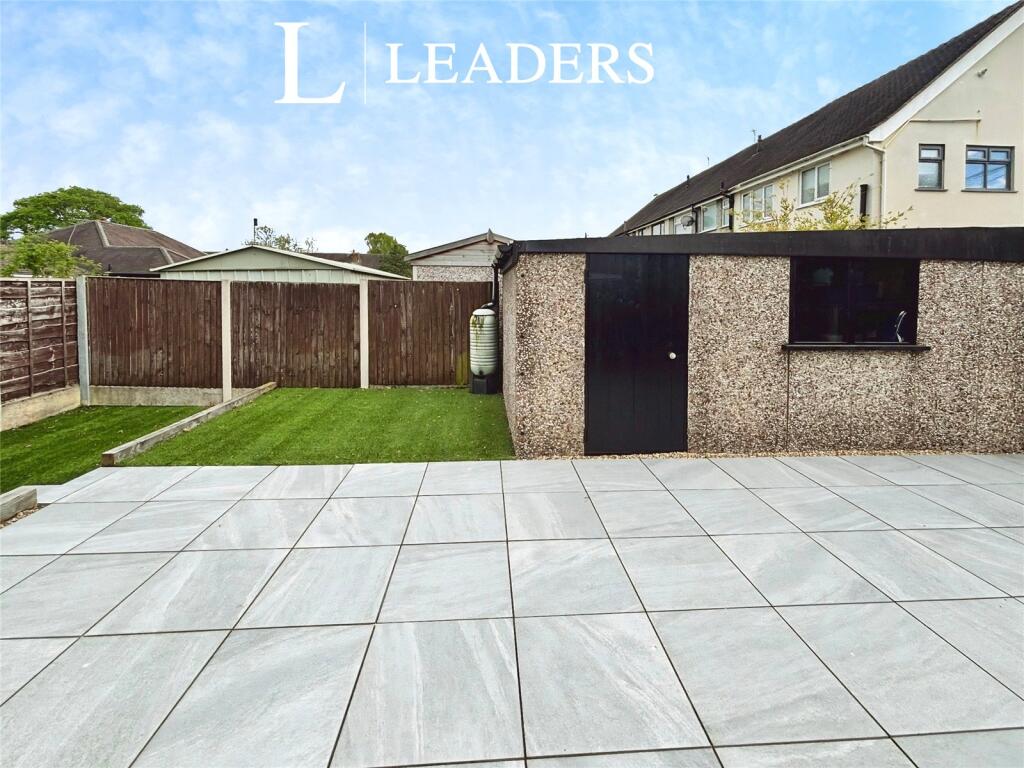
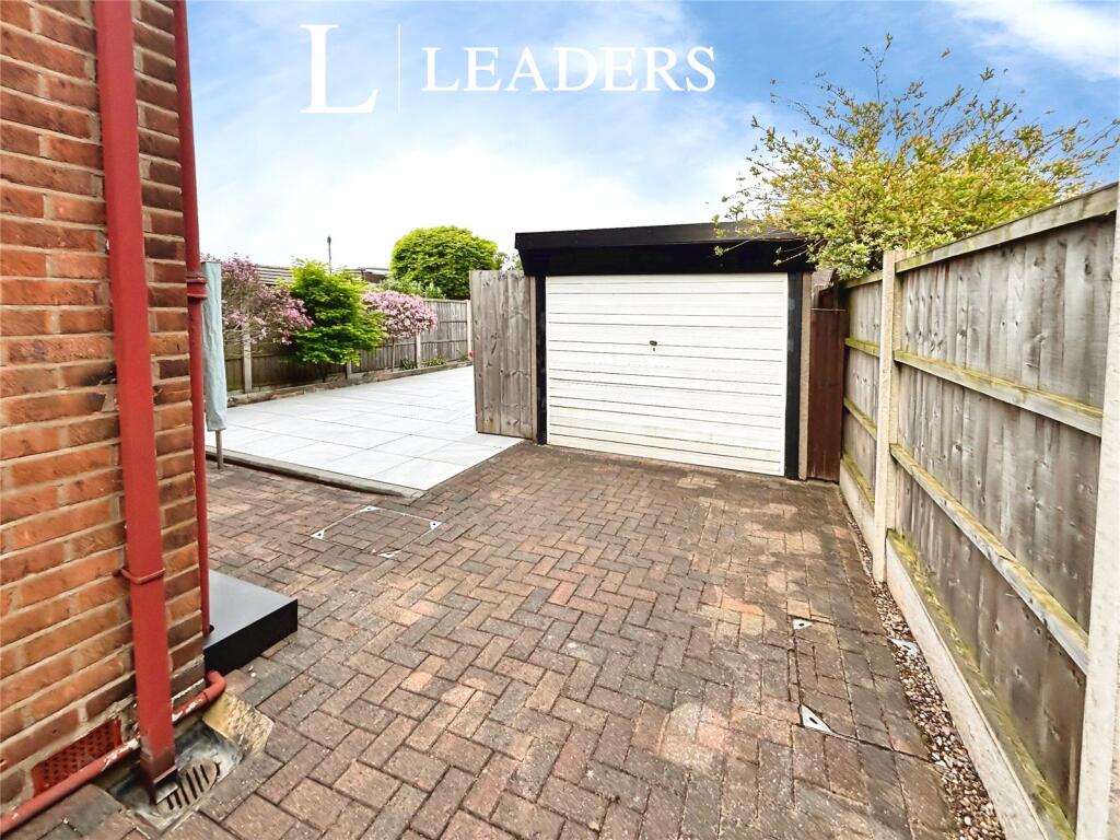
- Off-road parking and garden
- No onward chain sale
- Close to Stockton Heath village
- Good nearby schools for families
- Excellent rail links to cities
- Near parks, canal and riverside walks
Additional details
- Parking
- Yes
- Garden
- Yes
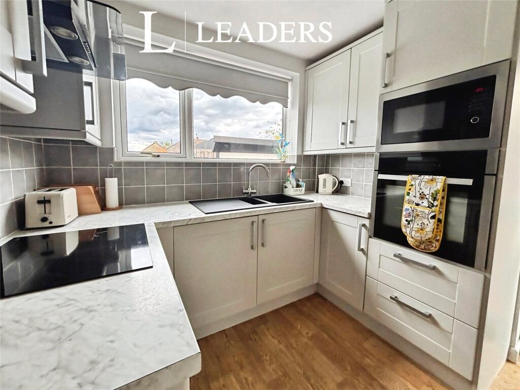
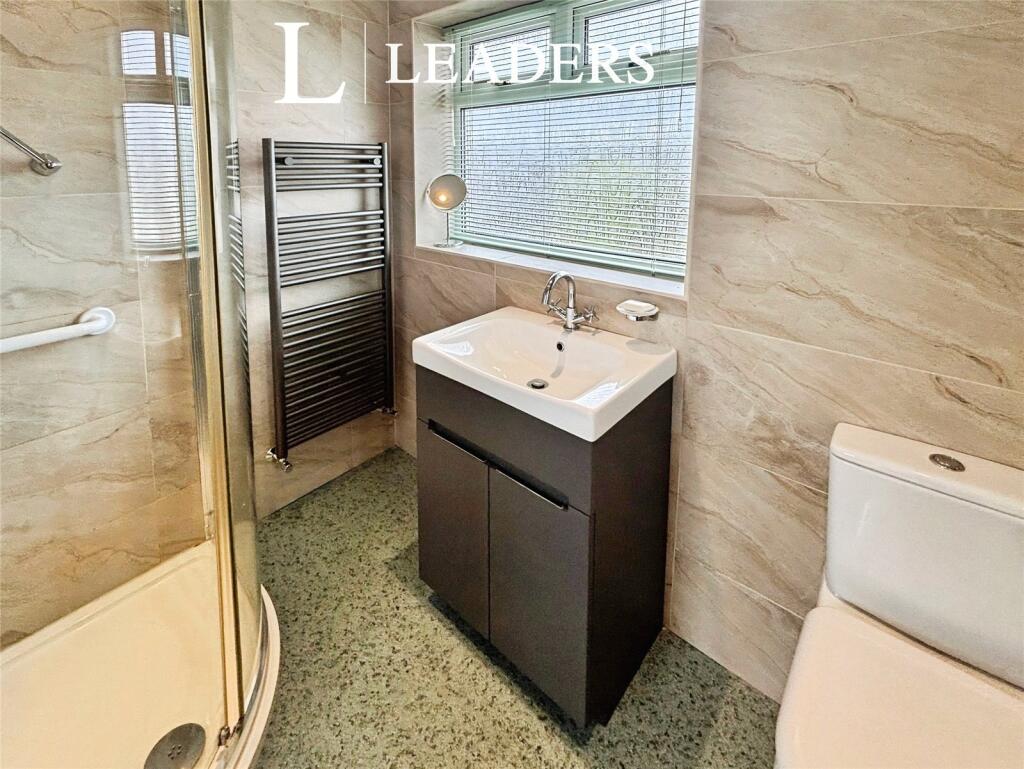
Description
Listed by
Warrington
Leaders and Romans Group
Reference: 88111098
EPC ratings on this postcode
We don't have a matched EPC for this property yet. Below are efficiency scores and details for other addresses on this postcode.
| Address | Current | Potential | Floor area | Age band | Type |
|---|---|---|---|---|---|
| 21, Irwell Road, WARRINGTON | 67 | 75 | 65 m² | England and Wales: 1930-1949 | Flat |
| 21A IRWELL ROAD, WARRINGTON | 67 | 67 | 63 m² | England and Wales: 1967-1975 | Flat |
| 22, Irwell Road, WARRINGTON | 57 | 78 | 85 m² | England and Wales: 1930-1949 | Terraced |
| 23a Irwell Road, WARRINGTON | 55 | 72 | 68 m² | England and Wales: 1930-1949 | Flat |
| 23a, Irwell Road, WARRINGTON | 52 | 72 | 62 m² | England and Wales: 1930-1949 | Flat |
| 24, Irwell Road, WARRINGTON | 66 | 90 | 70 m² | England and Wales: 1976-1982 | Terraced |
| 25 Irwell Road, WARRINGTON | 30 | 69 | 130 m² | England and Wales: 1950-1966 | Terraced |
| 25, Irwell Road, WARRINGTON | 50 | 57 | 97 m² | England and Wales: 1950-1966 | Flat |
| 28, Irwell Road, WARRINGTON | 59 | 80 | 74 m² | England and Wales: 1950-1966 | Detached |
| 29a, Irwell Road, WARRINGTON | 51 | 60 | 82 m² | England and Wales: 1950-1966 | Flat |
| 30 Irwell Road, WARRINGTON | 70 | 84 | 78 m² | England and Wales: 1950-1966 | Detached |
| 36 Irwell Road, WARRINGTON | 65 | 85 | 74 m² | England and Wales: 1950-1966 | Detached |
| 38, Irwell Road, WARRINGTON | 66 | 86 | 77 m² | England and Wales: 1950-1966 | Detached |
| 42 Irwell Road, WARRINGTON | 69 | 78 | 73 m² | England and Wales: 1950-1966 | Detached |
| 42, Irwell Road, WARRINGTON | 56 | 77 | 70 m² | England and Wales: 1930-1949 | Detached |
Flood risk
Zone: 1
Risk: Low
Job (default Low)
Floorplans
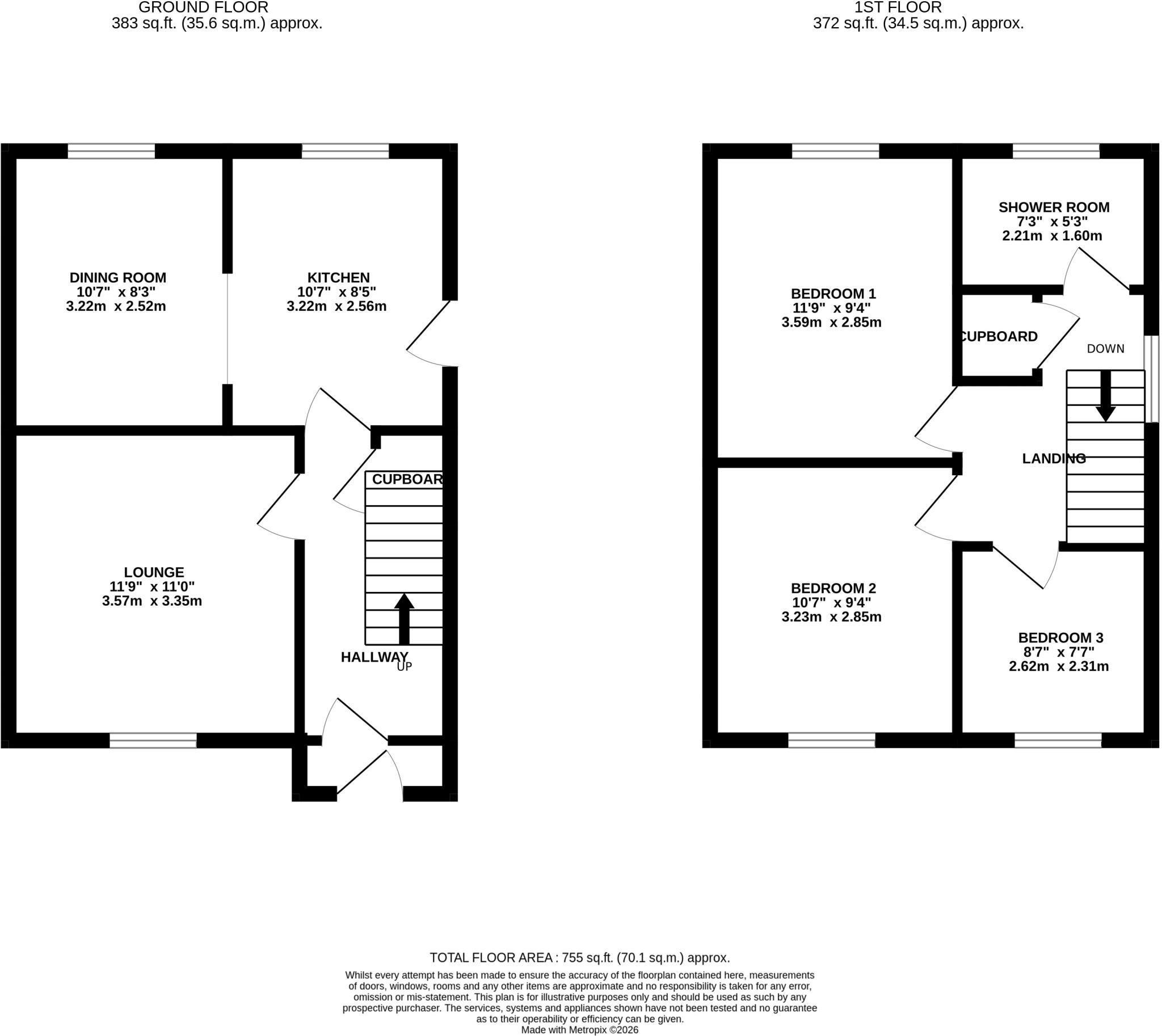
Floorplan
Price history
| Event | Date | Price | % change |
|---|---|---|---|
| Listed for sale | — | £280,000 | — |
Source: HM Land Registry Price Paid Data. Crown copyright.
Sold Comparables
Same street and nearby sales within 0.25 miles (last 5 years). Data from Land Registry Price Paid.
| Address | Price | Date | Type |
|---|---|---|---|
| 18 SILVERDALE ROAD, WARRINGTON, WA4 6BT | £260,000 | 17/12/2025 | Semi-detached |
| 8 WORDSWORTH AVENUE, WARRINGTON, WA4 6AN | £262,500 | 17/12/2025 | Semi-detached |
| 68 GAINSBOROUGH ROAD, WARRINGTON, WA4 6BS | £253,000 | 12/12/2025 | Semi-detached |
| 148 GAINSBOROUGH ROAD, WARRINGTON, WA4 6BN | £245,000 | 11/12/2025 | Semi-detached |
| 67 GAINSBOROUGH ROAD, WARRINGTON, WA4 6BP | £160,000 | 09/12/2025 | Semi-detached |
| 3 COPELAND ROAD, WARRINGTON, WA4 6DF | £316,000 | 02/12/2025 | Semi-detached |
| 8 MANX ROAD, WARRINGTON, WA4 6AL | £340,000 | 28/11/2025 | Semi-detached |
| 49 MANX ROAD, WARRINGTON, WA4 6AJ | £313,000 | 28/07/2025 | Semi-detached |
| 22 BOSWELL AVENUE, WARRINGTON, WA4 6DQ | £290,000 | 19/08/2024 | Semi-detached |
| 46 HILLBERRY CRESCENT, WARRINGTON, WA4 6AF | £225,000 | 20/10/2023 | Semi-detached |
| 31 RYDAL AVENUE, WARRINGTON, WA4 6AU | £239,950 | 18/08/2023 | Semi-detached |
| 20 DERWENT ROAD, WARRINGTON, WA4 6AY | £325,000 | 27/07/2023 | Semi-detached |
| 42 BOSWELL AVENUE, WARRINGTON, WA4 6DQ | £215,000 | 14/06/2023 | Semi-detached |
| 26 COPELAND ROAD, WARRINGTON, WA4 6DF | £200,000 | 09/06/2023 | Semi-detached |
| 38 HILLBERRY CRESCENT, WARRINGTON, WA4 6AF | £230,000 | 24/03/2023 | Semi-detached |
| 23 WORDSWORTH AVENUE, WARRINGTON, WA4 6AN | £185,000 | 22/12/2022 | Semi-detached |
| 16 MANX ROAD, WARRINGTON, WA4 6AJ | £235,000 | 30/11/2022 | Semi-detached |
| 26 HILLBERRY CRESCENT, WARRINGTON, WA4 6AF | £168,000 | 25/11/2022 | Semi-detached |
| 46 DERWENT ROAD, WARRINGTON, WA4 6AY | £350,000 | 18/11/2022 | Semi-detached |
| 56 IRWELL ROAD, WARRINGTON, WA4 6BB | £285,000 | 18/11/2022 | Semi-detached |
Area average: £254,873 (20 sales)
Capital growth trend
Land Registry outcode average: last 12 months vs 5y and 10y ago (from sold prices).
House Price Index (HM Land Registry — official index, not sold-price averages): Warrington. Series: Semi-detached. As of February 2026.
Rental Range
Estimated market rent for Warrington. Low = conservative, Realistic = average, Optimistic = best case.
Based on Local Authority from postcode lookup → Warrington.
LHA (30th percentile) floor for North Cheshire: £693/mo (Apr 2025 – Mar 2026)
Location
Address
Irwell Road
Nearby
Nearest stations, universities and amenities (distance from property).
| Type | Name | Distance |
|---|---|---|
| Bus stop | Meadow Avenue | 0.1 miles |
| Shop | Booze Bazaar | 0.2 miles |
| Bus stop | Sulby Avenue | 0.2 miles |
| Shop | Microbitz Computers | 0.2 miles |
| Train station | Warrington Bank Quay | 0.7 miles |
| Train station | Warrington Central | 1.0 miles |
| Hospital | Warrington Hospital | 1.3 miles |
| Hospital | Saint Mary's Hospital | 2.0 miles |
| University | University of Chester - Warrington Campus | 3.2 miles |
Street-level crime
| Category | Count |
|---|---|
| Violence and sexual offences | 105 |
| Public order | 46 |
| Shoplifting | 34 |
| Other theft | 18 |
| Drugs | 14 |
| Criminal damage and arson | 12 |
| Anti-social behaviour | 11 |
| Burglary | 11 |
| Bicycle theft | 7 |
| Other crime | 5 |
| Possession of weapons | 5 |
| Robbery | 5 |
| Vehicle crime | 4 |
| Total incidents | 277 |
Within 1 mile during Mar 2026. Source: data.police.uk (England & Wales).
Schools nearby
Nearest open schools with Ofsted ratings (England). Closed schools are not shown. Data from Get Information about Schools and Ofsted.
| Name | Type | Distance | Ofsted |
|---|---|---|---|
| Willow Green CIO | Other | 0.1 miles | — (No rating) |
| Priestley College | Other | 0.4 miles | — (No rating) |
| Latchford St James CofE Primary School | Primary | 0.5 miles | Good — 29 Nov 2022 |
| Stockton Heath Primary School | Primary | 0.6 miles | Good — 18 Feb 2015 |
| St Thomas' CofE Primary School | Primary | 0.8 miles | Good — 11 Nov 2018 |
Rental Comparables
Residential lets from OpenRent and Rightmove for the area (same bedroom count). Use to validate rent estimates. Student lets are excluded.
| Title | Rent | Beds | Distance | As seen on |
|---|---|---|---|---|
| 3 Bed Terraced House, Old Liverpool Road, WA5 | £2,464/mo | 3 | 1.07 miles | OpenRent |
Average rent: £2,464/mo (1 listing)
Rent-driven metrics
Based on OpenRent comparables.
- Rent ratio — Monthly rent ÷ purchase price (1% rule). 1%+ = strong, 0.8–1% = okay, <0.8% = weak for cashflow.
- Max investor price — Rent ÷ 0.8%; the price at which rent would be 0.8% of price (Stoke-style target).
- Target investor price — Rent ÷ 1%; the price at which rent would be 1% of price (strong cashflow band).
- Gross yield — Annual rent as % of purchase price (no costs).
- Cost-to-rent — Price ÷ annual rent (from OpenRent comparables). Under 14× = strong, 14–16× = acceptable, 17×+ = compressed.
- Cashflow — Rent minus mortgage, 10% maintenance, £25/mo compliance. Assumes 75% LTV, 3.95% APR (5yr fixed), 25yr term.
- ROI — Annual profit ÷ cash in (deposit + 4% purchase costs).
Enter House Number
Enter the house number to help us retrieve more accurate pricing history and property data.
Please log in to submit or correct the house number for this listing.
Log in to continue