56A
HEMPSTEAD ROAD, HOLT, NORFOLK NR25 6DG
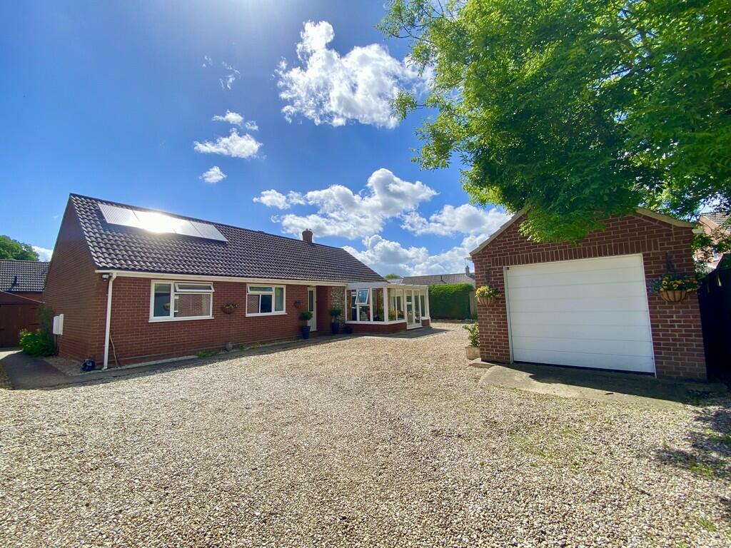
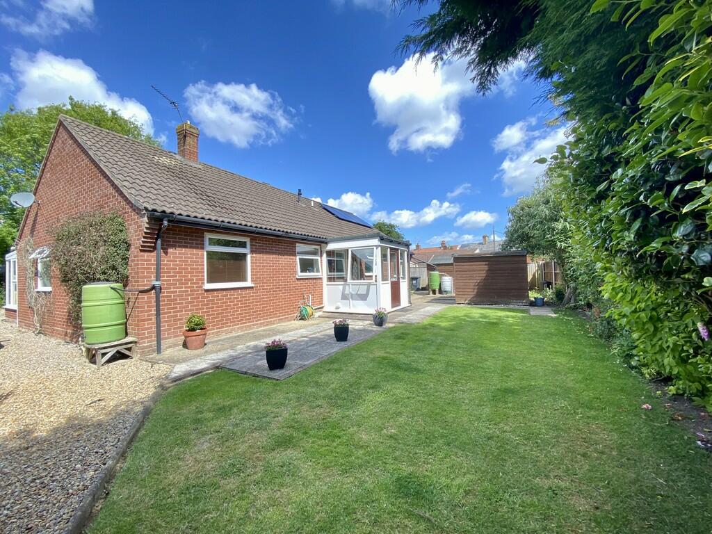
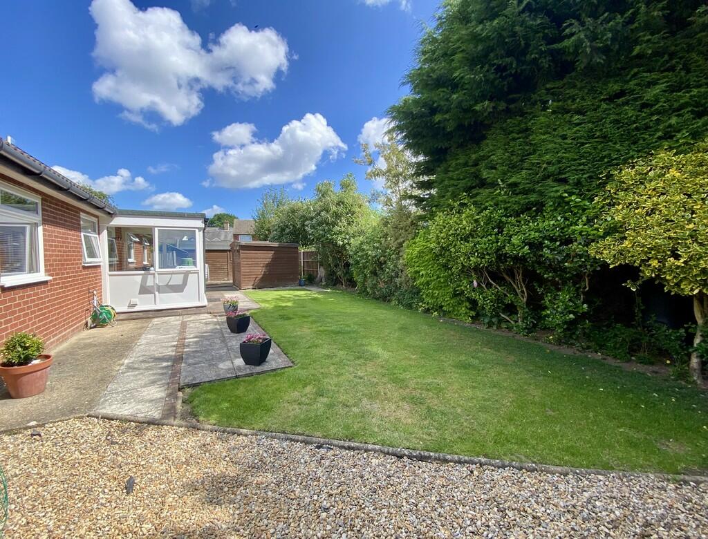
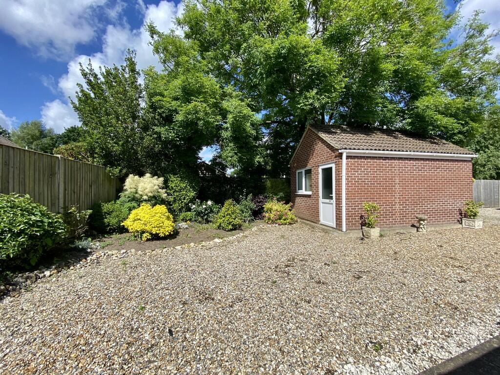
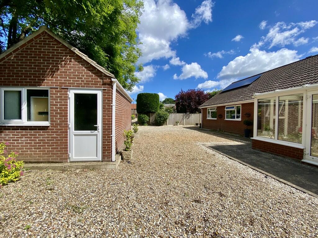
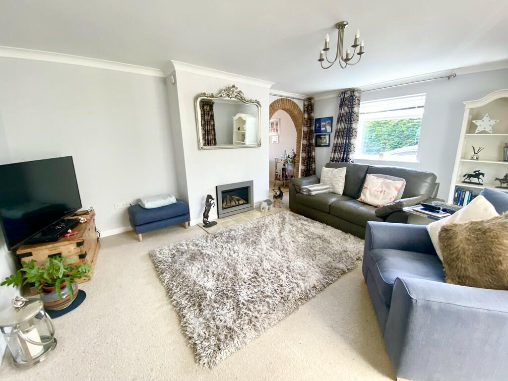
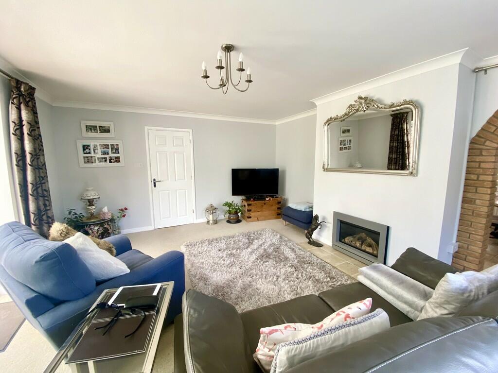
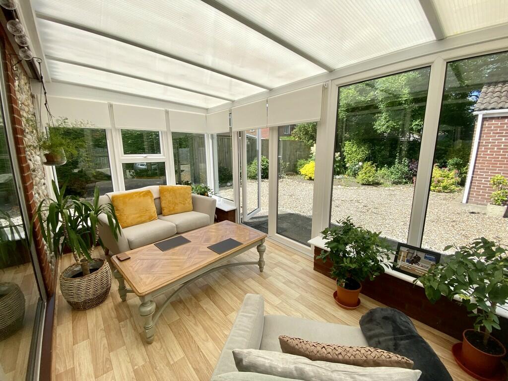
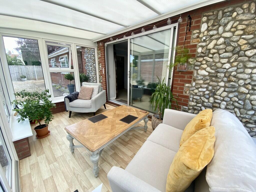
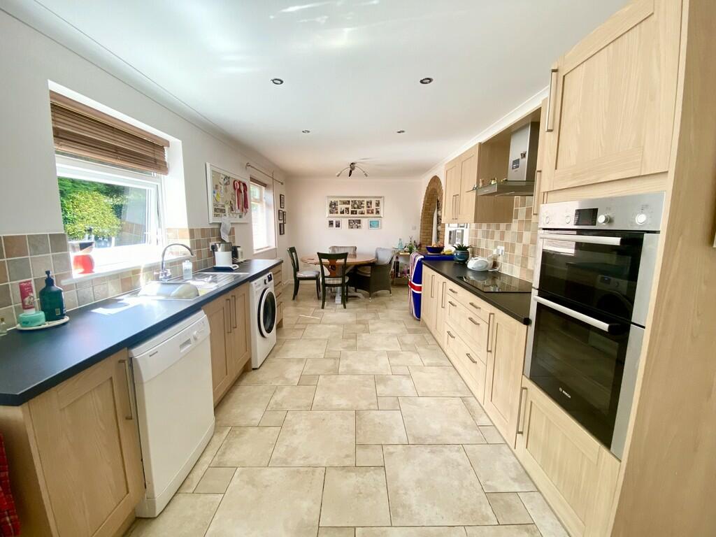
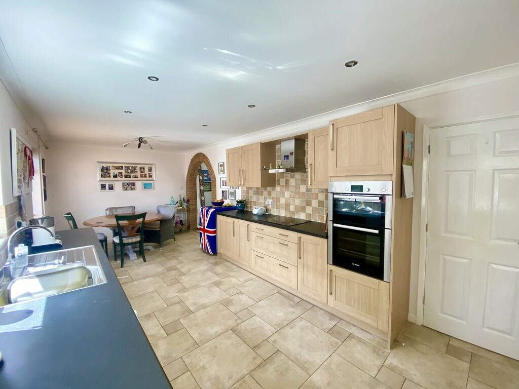
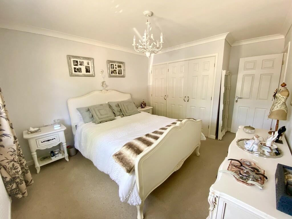
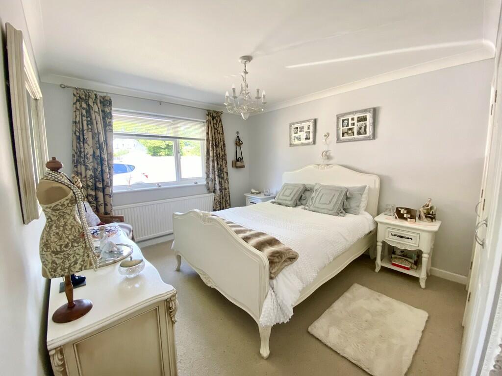
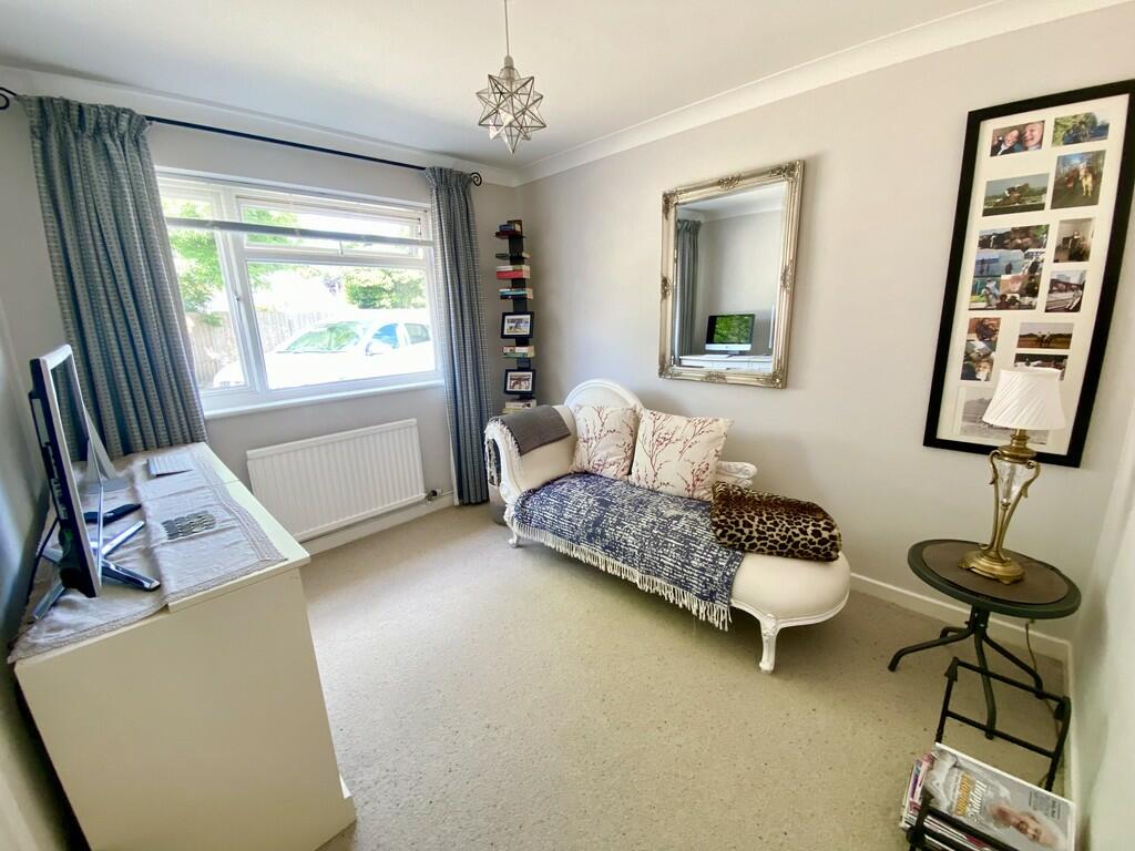
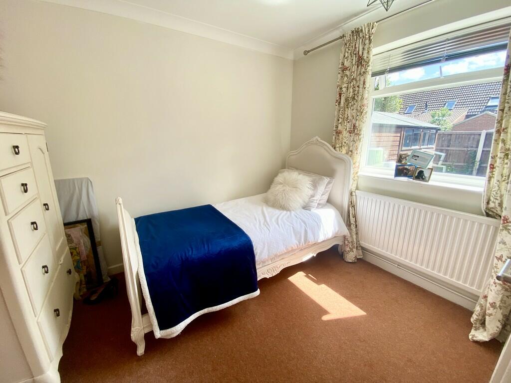
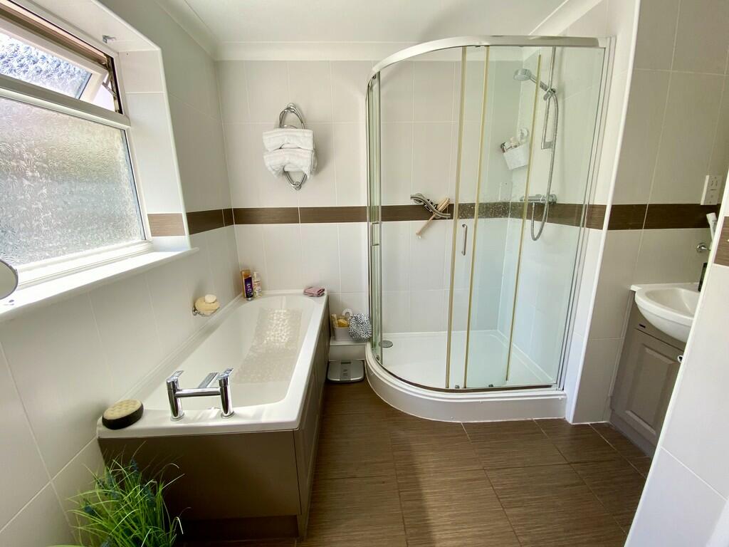
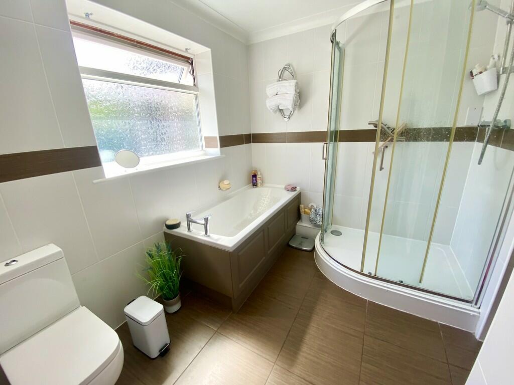
Photo 1 Photo 2 Photo 3 Photo 4 Photo 5 Photo 6 Photo 7 Photo 8 Photo 9 Photo 10 Photo 11 Photo 12 Photo 13 Photo 14 Photo 15 Photo 16 Photo 17
/ 17
Property details
Tenure
FREEHOLD
Floor area
99 m²
Council tax band
D
EPC rating
D
Year built
England and Wales: 1983-1990
Last sold
£365,000 Oct 2025
Price per m²
£3,838/m²
Local average
£643,279 (-40.9%)
Deprivation
Decile 4 (10,508 of 33,755)
Street crime
45 incidents within 1 mile (Apr 2026)
Additional details
- Heating
- Gas central
- Parking
- Garage, Off street
- Garden
- Yes
Description
The North Norfolk Coast is very close with superb walking, golfing, sailing and bird watching activities. The cathedral city of Norwich is just twenty-six miles away. From Norwich there are direct trains to London Liverpool Street. Norwich Airport is a convenient worldwide gateway via Schiphol Airport.
DIRECTIONS Leaving the agents Holt office turn right down the High Street proceeding towards the A148 Norwich Road and turn left. Take the first exit on the roundabout. Proceed a short distance and turn right onto the Hempstead Road, the property can be seen on the right hand side at the end of a gravelled driveway.
DESCRIPTION A very well presented three bedroom detached bungalow tucked away at the end of a long driveway on the outskirts of the highly desirable town of Holt. The spacious accommodation comprises; entrance hall, large sitting room opening through to kitchen/dining room, conservatory, three bedrooms, family bathroom, cloakroom and rear porch. To the outside there are beautifully landscaped gardens which wrap around the property together with ample off road parking and a single purpose built garage.
SPECIFICATION - Detached Bungalow within walking distance of Holt town centre.
- Tucked away at the end of a long driveway.
- UPVC Double Glazing.
- Gas Central Heating.
- Open Plan Kitchen/Dining Room.
- Living Room.
- Conservatory.
- Three Bedrooms.
- Family Bathroom.
- Cloakroom.
- Detached Single Garage with power & light.
- Ample off road parking.
- Beautifully Landscaped Gardens.
ANTI MONEY LAUNDERING LEGISLATION ** In accordance with the most recent Anti Money Laundering Legislation, buyers will be required to provide proof of identity and address to the selling agent once an offer has been submitted and accepted (subject to contract) prior to solicitors being instructed.
Listed by
Holt
Brown & Co
Reference: 150777527
EPC Rating & Upgrade Cost
Current rating: D
Potential rating: A
Inspection date: 01/06/2022
Expiry date: 31/05/2032
Current heating cost: £631/year
Potential heating cost: £558/year
Est. upgrade cost to C: £30,040
Recommendations
- Floor insulation (solid floor) (£4,000 - £6,000)
- Low energy lighting for all fixed outlets (£40)
- Solar water heating (£4,000 - £6,000)
- Wind turbine (£15,000 - £25,000)
Flood risk
Zone: 1
Risk: Low
Job (default Low)
Floorplans
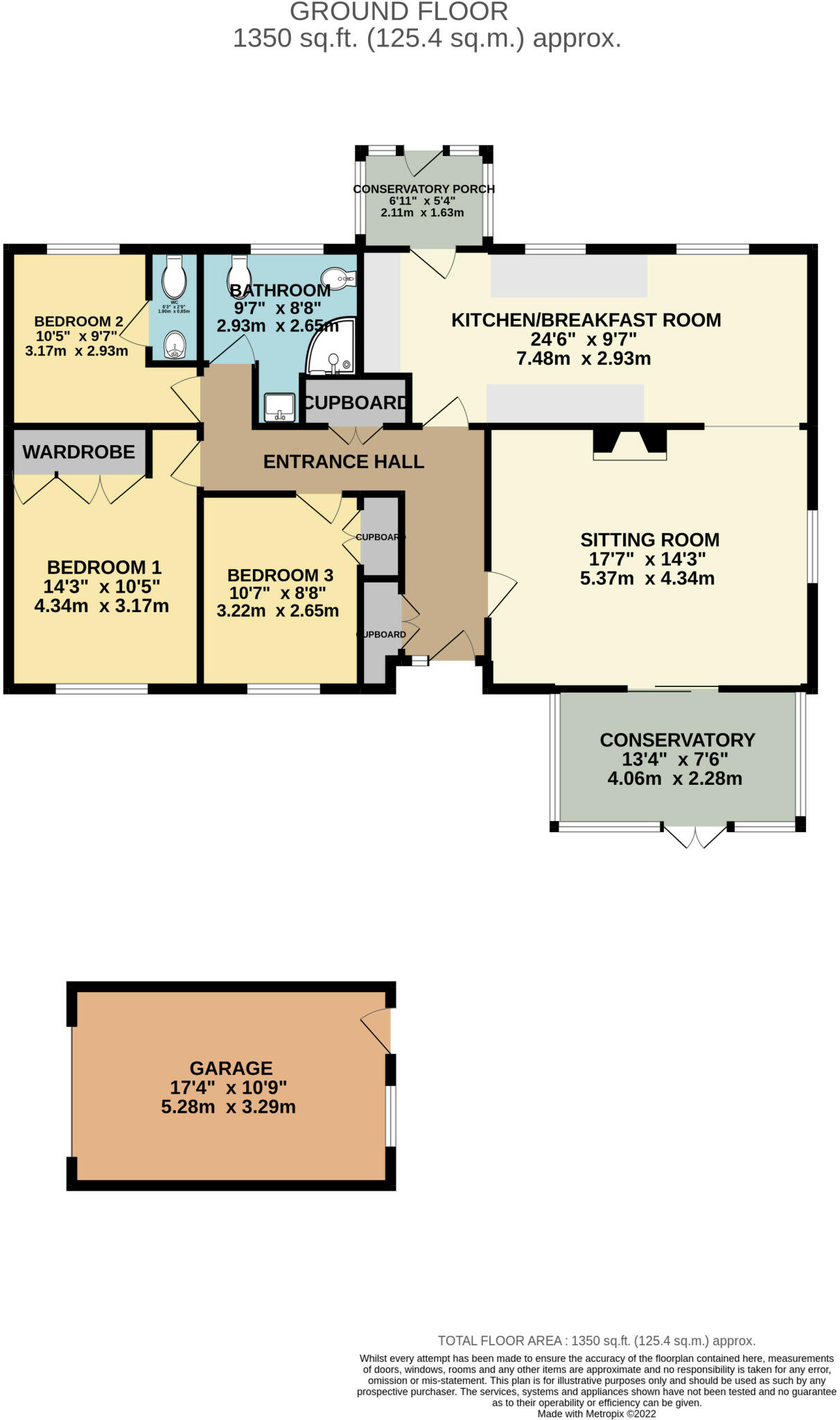
Floorplan 1
EPC Graphs
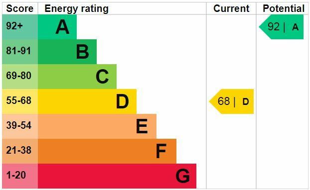
EPC 1
Price history
46% since 2011
| Event | Date | Price | % change |
|---|---|---|---|
| Sold | 24/10/2025 (7 months ago) | £365,000 | +21.7% |
| Sold | 20/07/2016 (9 years ago) | £300,000 | +20% |
| Sold | 21/09/2011 (14 years ago) | £249,950 | — |
Source: HM Land Registry Price Paid Data. Crown copyright.
Sold Comparables
Same street and nearby sales within 0.25 miles (last 5 years). Data from Land Registry Price Paid.
| Address | Price | Date | Type |
|---|---|---|---|
| Same street 50 HEMPSTEAD ROAD, HOLT, NORTH NORFOLK, NORFOLK, NR25 6DG | £325,000 | 19/01/2026 | Detached |
| HAWTHORNS THE DRIFTWAY, HOLT, NORTH NORFOLK, NORFOLK, NR25 6DF | £435,000 | 06/08/2025 | Detached |
| 11 PEARSONS CLOSE, HOLT, NORTH NORFOLK, NORFOLK, NR25 6EH | £339,975 | 10/06/2025 | Detached |
| 5 BARN OWL DRIVE, HOLT, NORTH NORFOLK, NORFOLK, NR25 6GP | £152,250 | 15/06/2023 | Detached |
| Same street 64 HEMPSTEAD ROAD, HOLT, NORTH NORFOLK, NORFOLK, NR25 6DG | £280,000 | 18/05/2023 | Detached |
| 3 PEARSONS CLOSE, HOLT, NORTH NORFOLK, NORFOLK, NR25 6EH | £550,000 | 05/05/2023 | Detached |
| 12 ELSDEN CLOSE, HOLT, NORTH NORFOLK, NORFOLK, NR25 6JW | £290,000 | 11/04/2023 | Detached |
| 4 OLBY CLOSE, HOLT, NORTH NORFOLK, NORFOLK, NR25 6FT | £425,000 | 16/12/2022 | Detached |
| 9 OLBY CLOSE, HOLT, NORTH NORFOLK, NORFOLK, NR25 6FT | £445,000 | 11/11/2022 | Detached |
| 2 THOMPSON AVENUE, HOLT, NORTH NORFOLK, NORFOLK, NR25 6EN | £283,000 | 23/08/2022 | Detached |
| 12A PEARSONS CLOSE, HOLT, NORTH NORFOLK, NORFOLK, NR25 6EH | £225,000 | 20/07/2022 | Detached |
| 10 PEARSONS CLOSE, HOLT, NORTH NORFOLK, NORFOLK, NR25 6EH | £340,000 | 14/07/2022 | Detached |
| 6 KESTREL DRIVE, HOLT, NORTH NORFOLK, NORFOLK, NR25 6GH | £560,000 | 30/06/2022 | Detached |
| 8 KESTREL DRIVE, HOLT, NORTH NORFOLK, NORFOLK, NR25 6GH | £495,000 | 27/05/2022 | Detached |
| 10 KESTREL DRIVE, HOLT, NORTH NORFOLK, NORFOLK, NR25 6GH | £425,000 | 27/05/2022 | Detached |
| 12 KESTREL DRIVE, HOLT, NORTH NORFOLK, NORFOLK, NR25 6GH | £539,000 | 27/05/2022 | Detached |
| 9 KESTREL DRIVE, HOLT, NORTH NORFOLK, NORFOLK, NR25 6GH | £485,500 | 20/05/2022 | Detached |
| 14 KESTREL DRIVE, HOLT, NORTH NORFOLK, NORFOLK, NR25 6GH | £425,000 | 29/04/2022 | Detached |
| 16 KESTREL DRIVE, HOLT, NORTH NORFOLK, NORFOLK, NR25 6GH | £460,000 | 29/04/2022 | Detached |
| 15 KESTREL DRIVE, HOLT, NORTH NORFOLK, NORFOLK, NR25 6GH | £550,000 | 29/04/2022 | Detached |
| 18 KESTREL DRIVE, HOLT, NORTH NORFOLK, NORFOLK, NR25 6GH | £490,000 | 28/04/2022 | Detached |
| 39 PARTRIDGE WAY, HOLT, NORTH NORFOLK, NORFOLK, NR25 6GG | £465,000 | 08/04/2022 | Detached |
Street average: £302,500 (2 sales)
Area average: £418,986 (20 sales)
Capital growth trend
Land Registry outcode average: last 12 months vs 5y and 10y ago (from sold prices).
House Price Index (HM Land Registry — official index, not sold-price averages): North Norfolk. Series: Detached. As of March 2026.
Rental Range
Estimated market rent for North Norfolk. Low = conservative, Realistic = average, Optimistic = best case.
Based on Local Authority from postcode lookup → North Norfolk.
LHA (30th percentile) floor for Central Norfolk & Norwich: £798/mo (Apr 2025 – Mar 2026)
Location
Nearby
Nearest stations, universities and amenities (distance from property).
| Type | Name | Distance |
|---|---|---|
| Shop | Holt Autocare | 0.1 miles |
| Shop | Coastal Stoves & Fires | 0.1 miles |
| Bus stop | Coronation Road, opp | 0.2 miles |
| Bus stop | Coronation Road, S-bound | 0.2 miles |
| Train station | Holt | 1.0 miles |
| Hospital | Kelling Hospital | 1.1 miles |
| Train station | Kelling Heath Park | 2.6 miles |
| Hospital | Cromer and District Hospital | 8.9 miles |
Street-level crime
| Category | Count |
|---|---|
| Anti-social behaviour | 26 |
| Violence and sexual offences | 7 |
| Criminal damage and arson | 5 |
| Other theft | 2 |
| Public order | 2 |
| Burglary | 1 |
| Shoplifting | 1 |
| Vehicle crime | 1 |
| Total incidents | 45 |
Within 1 mile during Apr 2026. Source: data.police.uk (England & Wales).
Schools nearby
Nearest open schools with Ofsted ratings (England). Closed schools are not shown. Data from Get Information about Schools and Ofsted.
| Name | Type | Distance | Ofsted |
|---|---|---|---|
| Holt Community Primary School | Primary | 0.5 miles | Good — 11 Jul 2014 |
| Gresham's School | Other | 0.6 miles | — (No rating) |
| Kelling CE Primary School | Primary | 2.9 miles | Good — 11 Jul 2014 |
| Astley Primary School | Primary | 3.8 miles | Good — 23 Jan 2022 |
Rental Comparables
Rental listings exist nearby, but none matched the 3-bedroom count for this property.
Rent-driven metrics
Based on Area rent estimate.
- Rent ratio — Monthly rent ÷ purchase price (1% rule). 1%+ = strong, 0.8–1% = okay, <0.8% = weak for cashflow.
- Max investor price — Rent ÷ 0.8%; the price at which rent would be 0.8% of price (Stoke-style target).
- Target investor price — Rent ÷ 1%; the price at which rent would be 1% of price (strong cashflow band).
- Gross yield — Annual rent as % of purchase price (no costs).