88A
ROTHBURY TERRACE, NEWCASTLE UPON TYNE, TYNE AND WEAR NE6 5XJ
£895 pcm
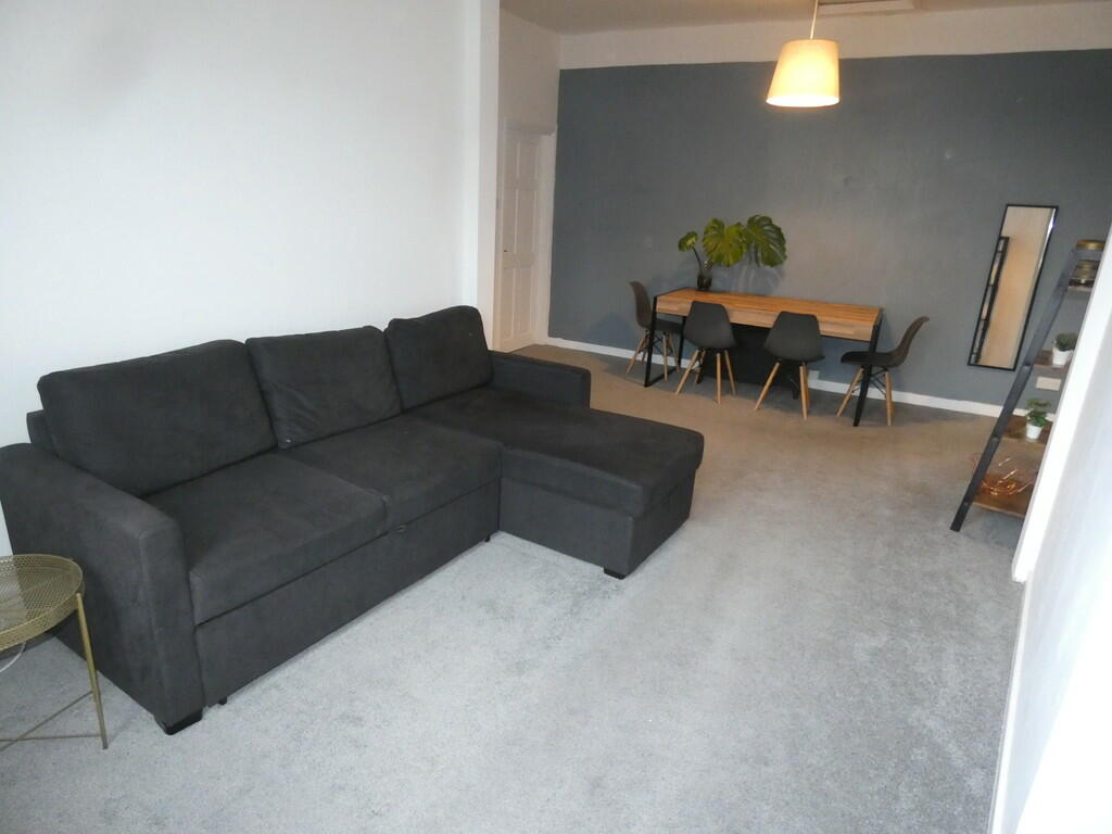
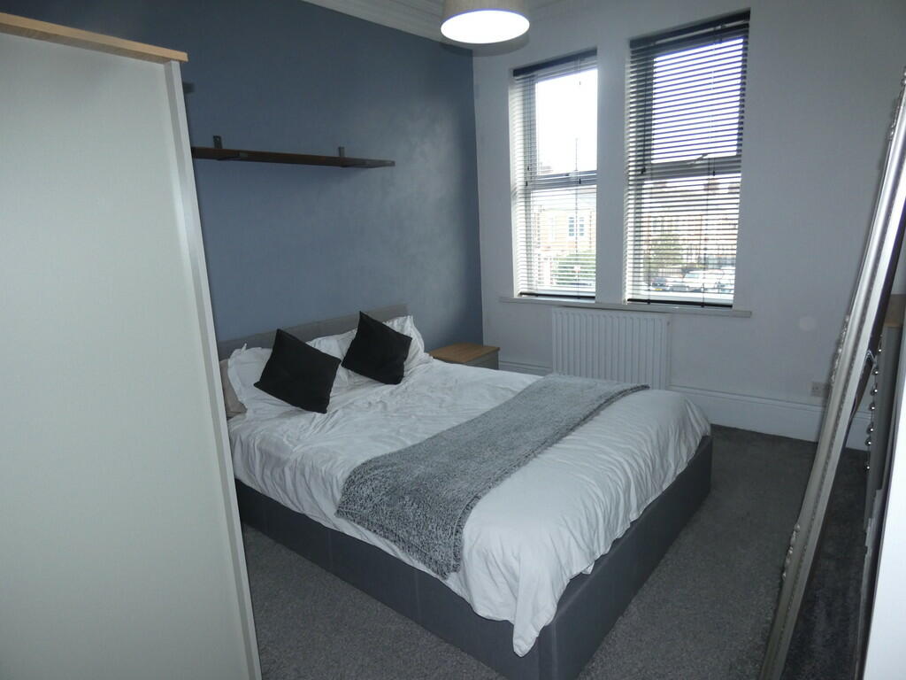
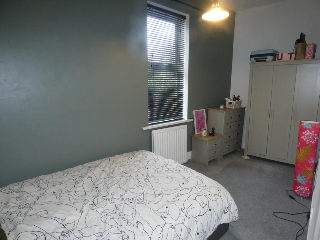
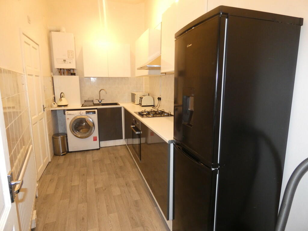
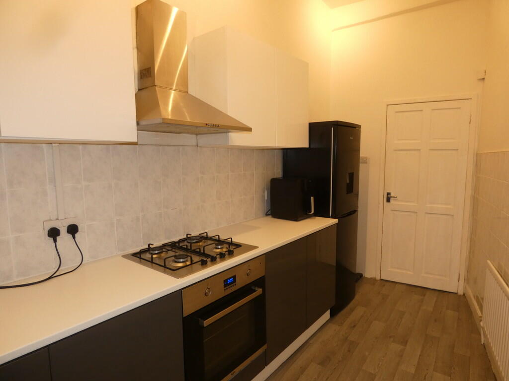
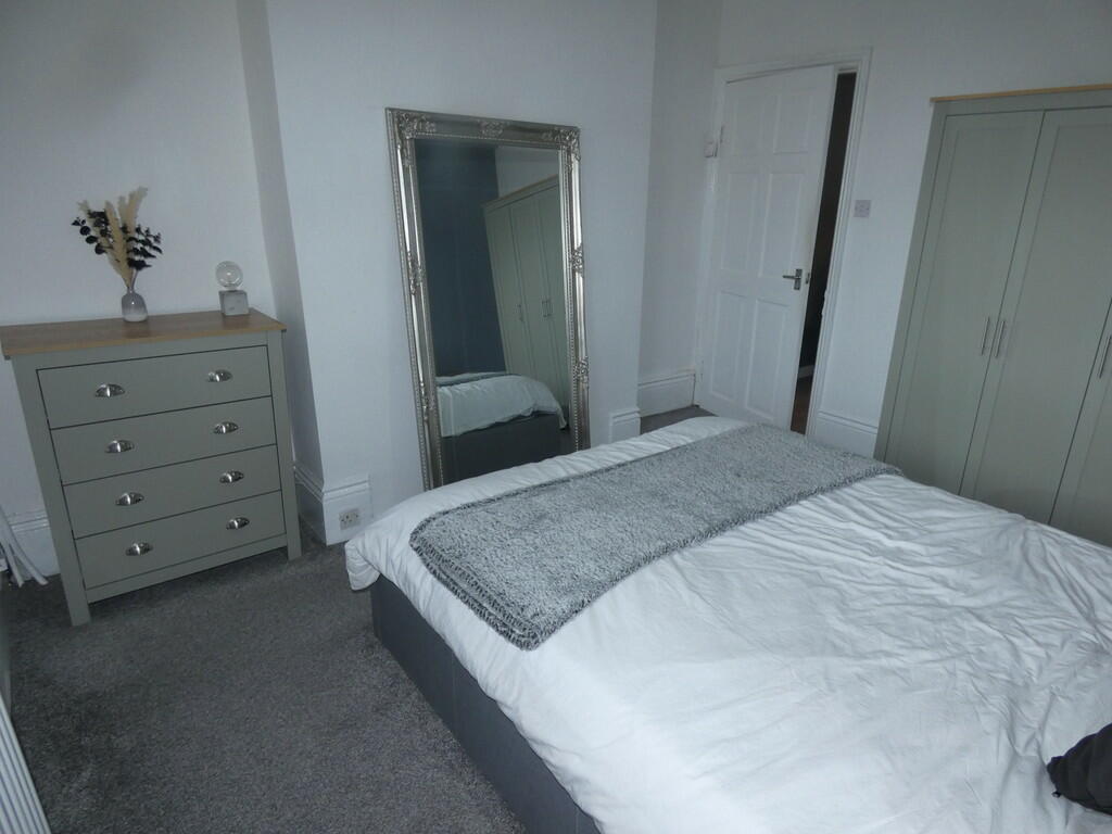
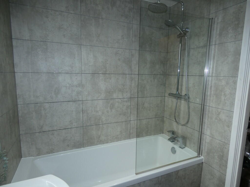
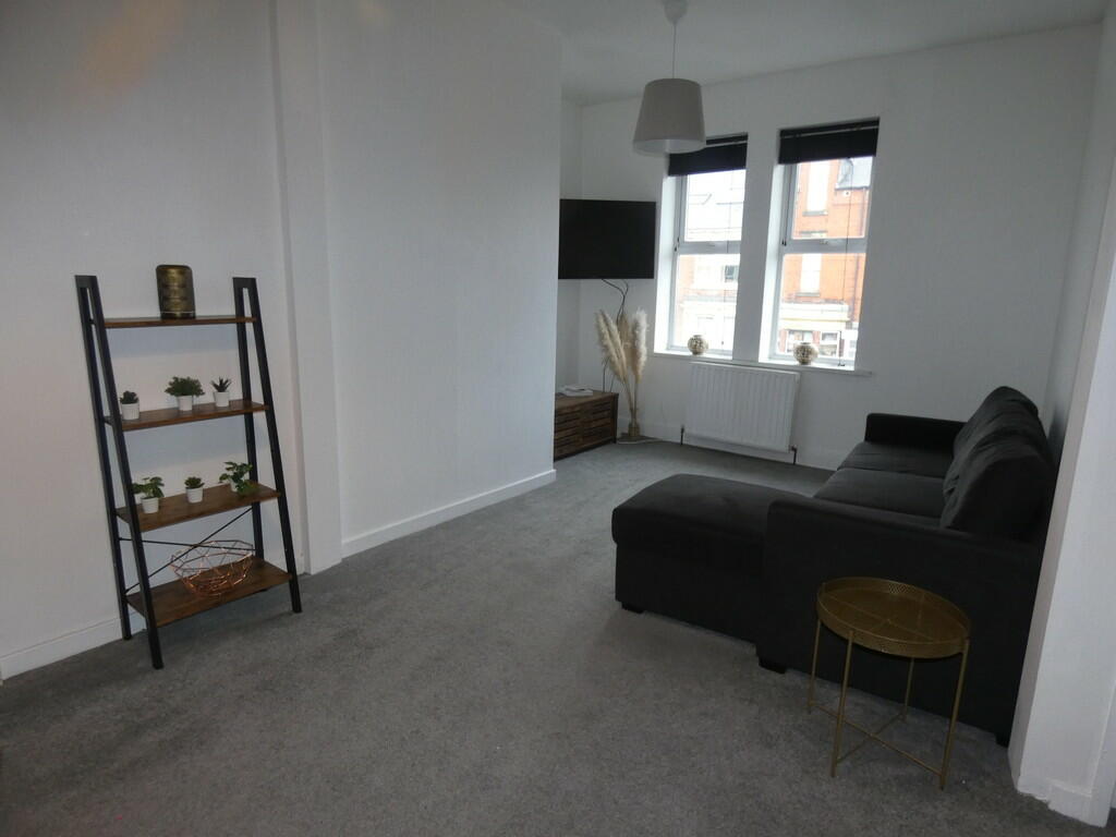
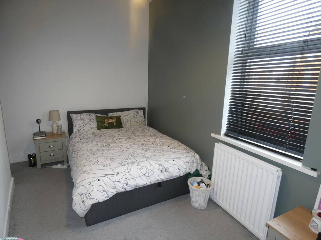
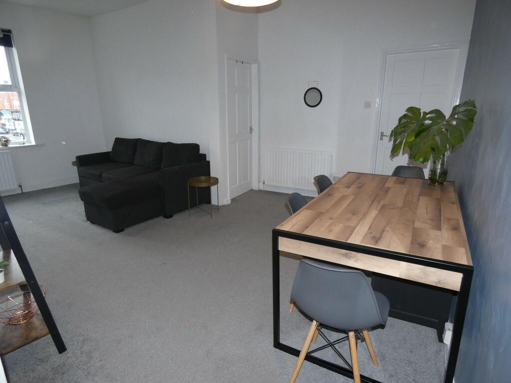
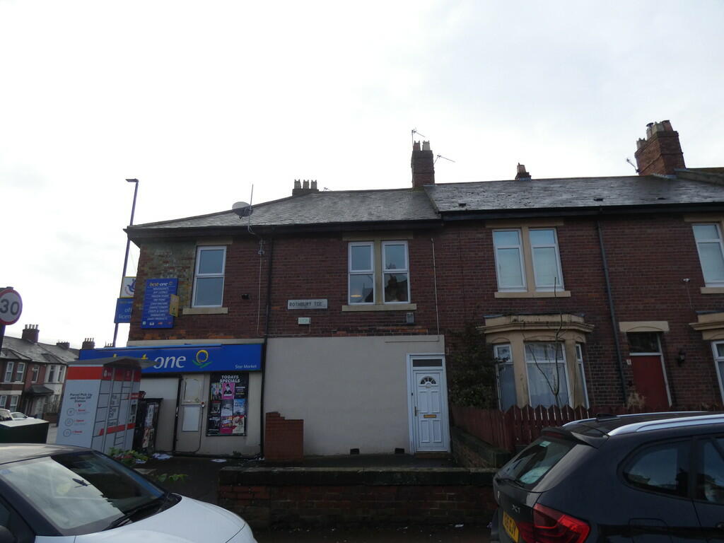
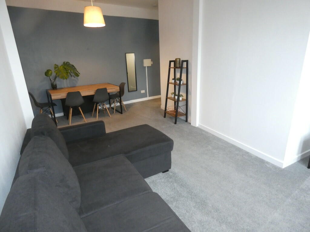
Photo 1 Photo 2 Photo 3 Photo 4 Photo 5 Photo 6 Photo 7 Photo 8 Photo 9 Photo 10 Photo 11 Photo 12 Photo 13
/ 13
Property details
Floor area
67 m²
Deprivation
Decile 5 (13,549 of 33,755)
Street crime
417 incidents within 1 mile (Mar 2026)
Key features
- HEATON
- UPPER FLAT
- TWO DOUBLE BEDROOMS
- MODERN DECOR
- OPEN PLAN LOUNGE/DINING ROOM
- GAS CENTRAL HEATING
- DOUBLE GLAZING
- FURNISHED
Description
Listed by
Newcastle-Upon-Tyne
Wright Residential Ltd
Reference: 142082690
EPC Rating & Upgrade Cost
Fetching EPC data… Refresh this page in a moment.
Flood risk
Zone: 1
Risk: Low
Job (default Low)
Floorplans
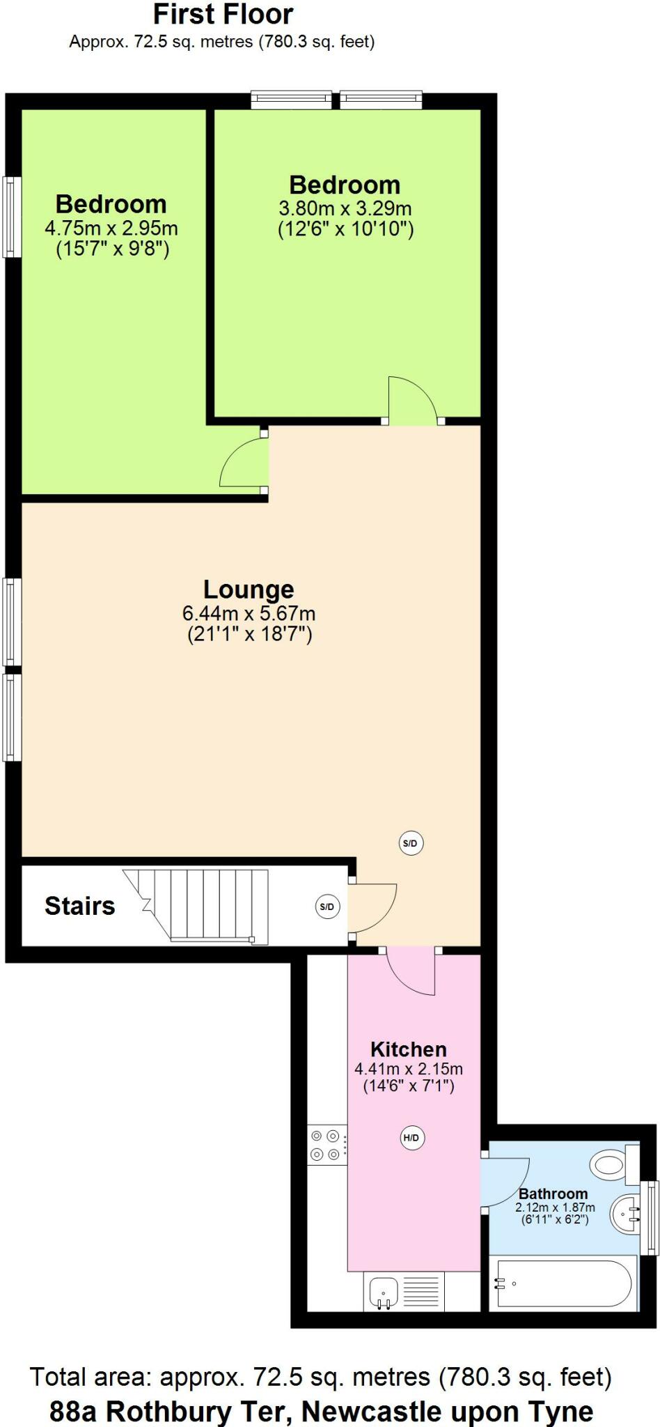
Floorplan 1
EPC Graphs
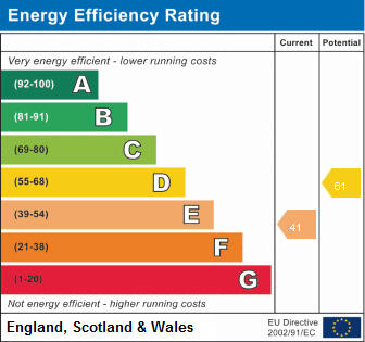
EPC 1
Rental Range
Estimated market rent for Newcastle upon Tyne. Low = conservative, Realistic = average, Optimistic = best case.
Based on Local Authority from postcode lookup → Newcastle upon Tyne.
LHA (30th percentile) floor for Tyneside: £549/mo (Apr 2025 – Mar 2026)
Location
Nearby
Nearest stations, universities and amenities (distance from property).
| Type | Name | Distance |
|---|---|---|
| Shop | Star Market | 0.1 miles |
| Shop | Phone Cube | 0.1 miles |
| Bus stop | SECOND AVENUE-KING JOHN STREET-N/B | 0.1 miles |
| Bus stop | CHILLINGHAM ROAD SHOPS | 0.1 miles |
| Train station | Chillingham Road | 0.3 miles |
| Hospital | Molineux Street NHS Centre | 0.6 miles |
| Train station | Byker | 0.7 miles |
| Hospital | Walkergate Park Hospital | 0.7 miles |
| University | Henderson Hall | 1.0 miles |
| University | Unknown | 1.3 miles |
Street-level crime
| Category | Count |
|---|---|
| Violence and sexual offences | 87 |
| Shoplifting | 84 |
| Anti-social behaviour | 81 |
| Criminal damage and arson | 47 |
| Vehicle crime | 26 |
| Public order | 23 |
| Burglary | 17 |
| Other theft | 16 |
| Robbery | 10 |
| Drugs | 9 |
| Other crime | 8 |
| Possession of weapons | 5 |
| Bicycle theft | 2 |
| Theft from the person | 2 |
| Total incidents | 417 |
Within 1 mile during Mar 2026. Source: data.police.uk (England & Wales).
Schools nearby
Nearest open schools with Ofsted ratings (England). Closed schools are not shown. Data from Get Information about Schools and Ofsted.
| Name | Type | Distance | Ofsted |
|---|---|---|---|
| Chillingham Road Primary School | Primary | 0.1 miles | Requires improvement — 8 Mar 2023 |
| St Teresa's Catholic Primary School, Heaton | Primary | 0.2 miles | Outstanding — 31 Jan 2024 |
| Ravenswood Primary School | Primary | 0.4 miles | Good — 23 Oct 2014 |
| St Catherine's Catholic Primary School | Primary | 0.7 miles | Good — 12 Feb 2015 |
| Hotspur Primary School | Primary | 0.7 miles | Good — 11 Mar 2014 |
Rental Comparables
Residential lets from OpenRent and Rightmove for the area (same bedroom count). Use to validate rent estimates. Student lets are excluded.
| Title | Rent | Beds | Distance | As seen on |
|---|---|---|---|---|
| 2 Bed Maisonette, Shields Road, NE6 | £825/mo | 2 | 0.75 miles | OpenRent |
Average rent: £825/mo (1 listing)