Ashford Street
ST4 2EN
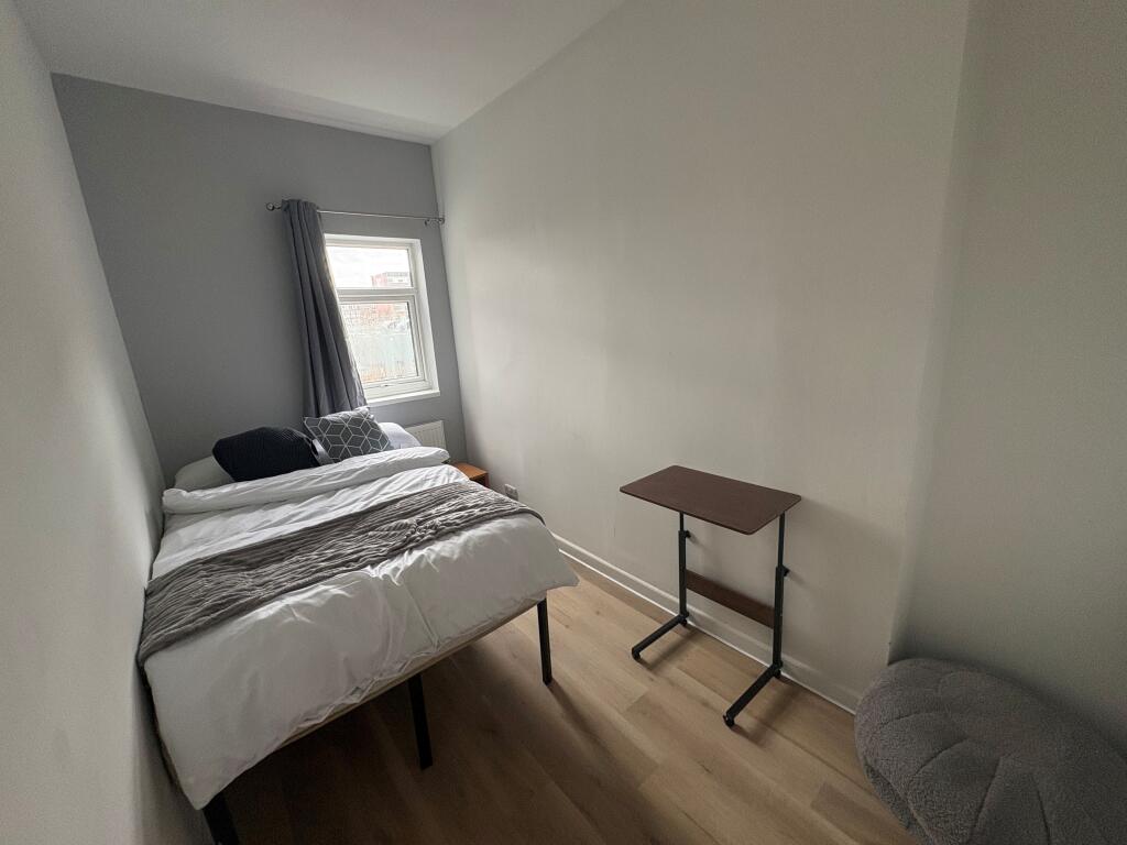
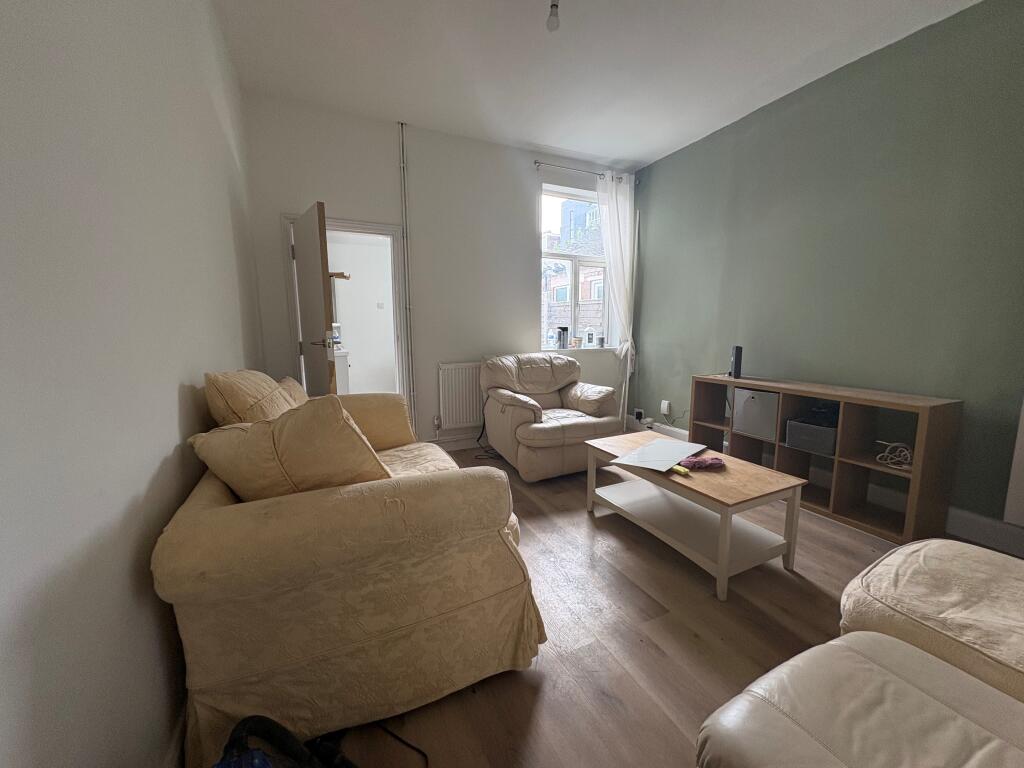
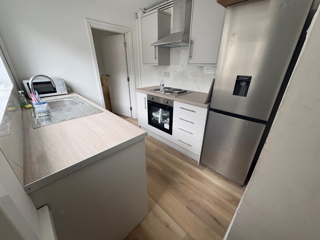
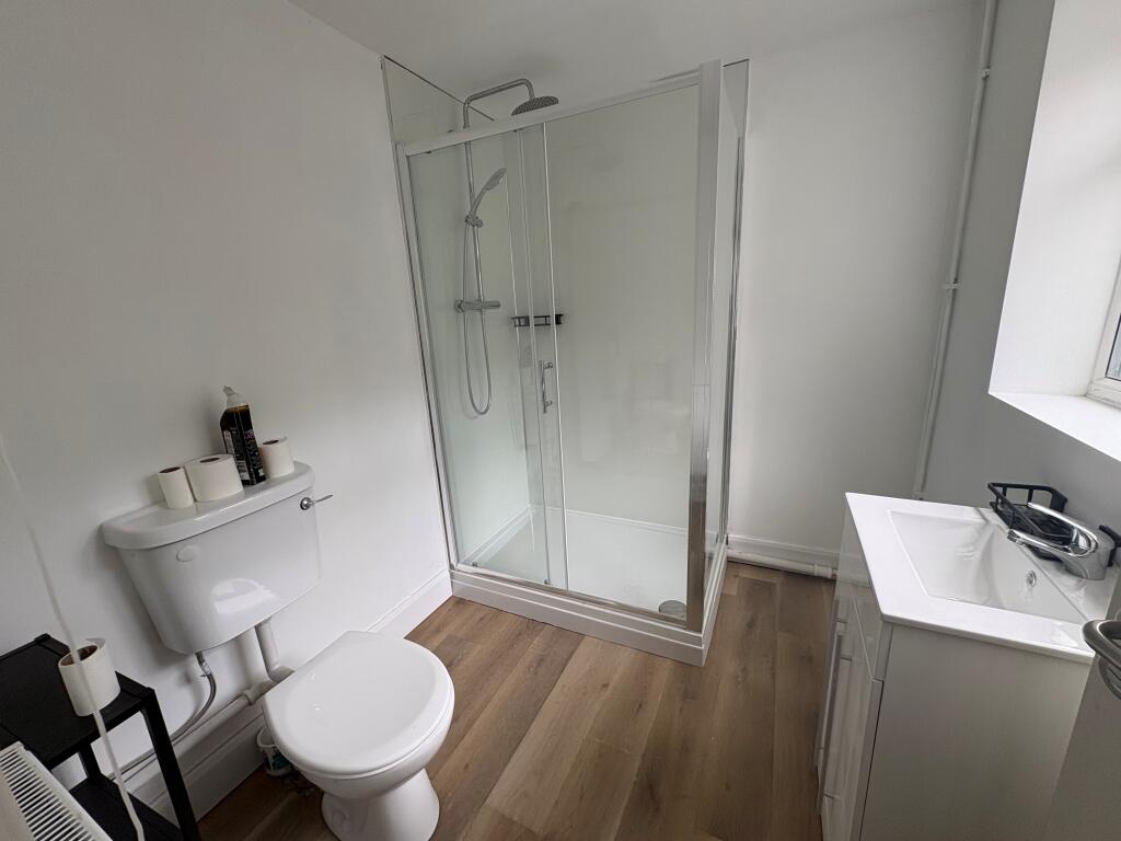
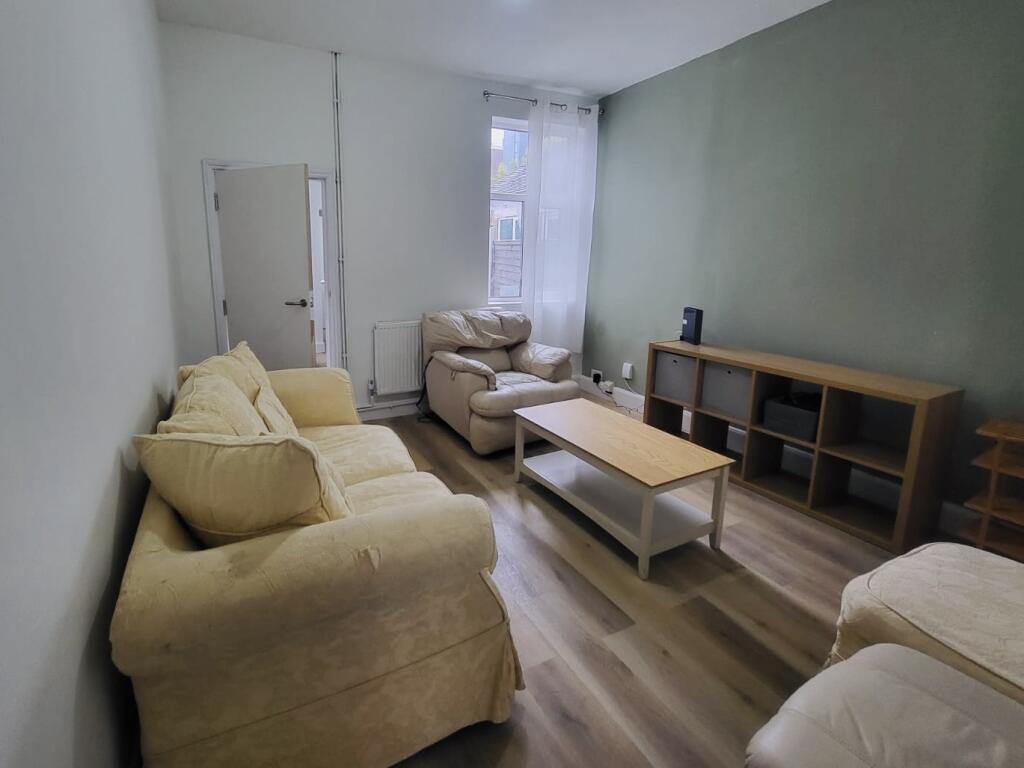
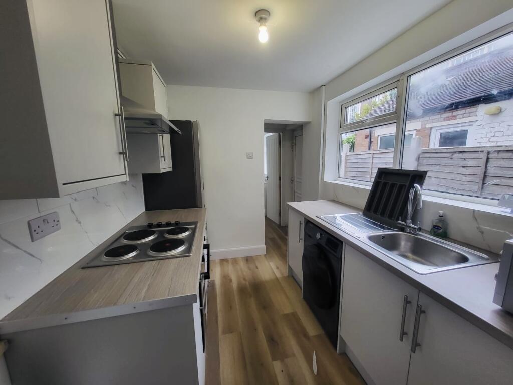
Photo 1 Photo 2 Photo 3 Photo 4 Photo 5 Photo 6
/ 6
Property details
Council tax band
A
Deprivation
Decile 2 (6,234 of 33,755)
Street crime
523 incidents within 1 mile (Apr 2026)
Key features
- Well-maintained property
- All bills included
- Great transport links
- Fully furnished throughout
Description
We are pleased to offer this fully furnished large double bedroom within a shared property in the popular ST4 area, ideally located close to Stoke town centre, Staffordshire University and excellent local transport links.
The property has been set up to provide comfortable, hassle-free living.
What’s Included:
• All bills included (gas, electric, water, council tax & WiFi)
• Fully furnished throughout
• Communal living areas ready to use
• Shared bathroom
• Well-maintained property
Location:
Situated in ST4, the property is within easy reach of:
• Staffordshire University
• Stoke town centre
• Shops, supermarkets, and local amenities
• Great transport links
This is a fantastic opportunity to secure a well-located room with everything included for simple, stress-free living.
Get in touch today on to arrange a viewing! Council Tax Band: A Holding Deposit: £92.00
Listed by
Newcastle Under Lyme
Countrywide UK Lettings - Connells
Reference: 173480018
EPC ratings on this postcode
We don't have a matched EPC for this property yet. Below are efficiency scores and details for other addresses on this postcode.
| Address | Current | Potential | Floor area | Age band | Type |
|---|---|---|---|---|---|
| 102 Ashford Street, STOKE-ON-TRENT | 56 | 86 | 77 m² | England and Wales: 1900-1929 | Terraced |
| 104, Ashford Street, STOKE-ON-TRENT | 60 | 85 | 77 m² | England and Wales: before 1900 | Terraced |
| 106 ASHFORD STREET, SHELTON, STOKE-ON-TRENT, STOKE-ON-TRENT | 58 | 81 | 92 m² | England and Wales: 1900-1929 | Terraced |
| 108 Ashford Street, STOKE-ON-TRENT | 64 | 85 | 64 m² | England and Wales: 1900-1929 | Terraced |
| 112, Ashford Street, STOKE-ON-TRENT | 60 | 82 | 84 m² | England and Wales: 1900-1929 | Terraced |
| 114 Ashford Street, STOKE-ON-TRENT | 59 | 79 | 76 m² | England and Wales: 1900-1929 | Terraced |
| 116, Ashford Street, STOKE-ON-TRENT | 58 | 77 | 95 m² | England and Wales: before 1900 | Terraced |
| 118, Ashford Street, STOKE-ON-TRENT | 74 | 89 | 98 m² | England and Wales: 1900-1929 | Terraced |
| 118, Ashford Street, STOKE-ON-TRENT | 71 | 82 | 96 m² | England and Wales: before 1900 | Terraced |
| 120, Ashford Street, STOKE-ON-TRENT | 74 | 89 | 98 m² | England and Wales: 1900-1929 | Terraced |
| 120, Ashford Street, STOKE-ON-TRENT | 71 | 82 | 96 m² | England and Wales: before 1900 | Terraced |
| 124, Ashford Street, STOKE-ON-TRENT | 61 | 82 | 94 m² | England and Wales: before 1900 | Terraced |
| 126, Ashford Street, STOKE-ON-TRENT | 67 | 87 | 70 m² | England and Wales: 1900-1929 | Terraced |
| 128, Ashford Street, STOKE-ON-TRENT | 69 | 75 | 83 m² | England and Wales: 1900-1929 | Terraced |
| 130, Ashford Street, STOKE-ON-TRENT | 63 | 84 | 90 m² | England and Wales: 1900-1929 | Terraced |
Flood risk
Zone: 1
Risk: Low
Job (default Low)
Rental Range
Estimated market rent for Stoke-on-Trent. Low = conservative, Realistic = average, Optimistic = best case.
Based on Local Authority from postcode lookup → Stoke-on-Trent.
LHA (30th percentile) floor for Staffordshire North: £424/mo (Apr 2025 – Mar 2026)
Location
Address
Thornton Road
Nearby
Nearest stations, universities and amenities (distance from property).
| Type | Name | Distance |
|---|---|---|
| Shop | Zeen Bakery & Convenience Store | 0.1 miles |
| University | University of Staffordshire Stoke Campus | 0.1 miles |
| Shop | Your Local Shop | 0.1 miles |
| Bus stop | Film Theatre | 0.1 miles |
| Bus stop | Seaford Street | 0.1 miles |
| Train station | Stoke-on-Trent | 0.2 miles |
| Hospital | North Staffordshire Hospital | 1.1 miles |
| Hospital | Hartshill Medical Centre | 1.3 miles |
| Train station | Longton | 2.2 miles |
Street-level crime
| Category | Count |
|---|---|
| Violence and sexual offences | 145 |
| Anti-social behaviour | 102 |
| Shoplifting | 59 |
| Public order | 51 |
| Criminal damage and arson | 38 |
| Other theft | 33 |
| Vehicle crime | 29 |
| Burglary | 18 |
| Drugs | 18 |
| Other crime | 11 |
| Possession of weapons | 9 |
| Bicycle theft | 6 |
| Robbery | 4 |
| Total incidents | 523 |
Within 1 mile during Apr 2026. Source: data.police.uk (England & Wales).
Schools nearby
Nearest open schools with Ofsted ratings (England). Closed schools are not shown. Data from Get Information about Schools and Ofsted.
| Name | Type | Distance | Ofsted |
|---|---|---|---|
| Staffordshire University | Other | 0.1 miles | — (No rating) |
| Excellence Girls Academy | Other | 0.1 miles | Good — 16 Jun 2024 |
| City of Stoke-On-Trent Sixth Form College | Other | 0.3 miles | — (No rating) |
| Stoke-on-Trent College | Other | 0.4 miles | — (No rating) |
| The Registry | Other | 0.4 miles | — (No rating) |
Rental Comparables
Residential lets from OpenRent and Rightmove for the area (same bedroom count). Use to validate rent estimates. Student lets are excluded.
Average rent: £619/mo (43 listings)
Enter House Number
Enter the house number to help us retrieve more accurate pricing history and property data.
Please log in to submit or correct the house number for this listing.
Log in to continue