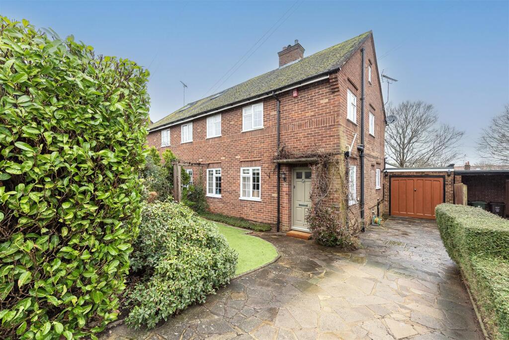
41 GRANBY AVENUE
HARPENDEN, HERTFORDSHIRE AL5 5QP
Property details
Tenure
FREEHOLD
Floor area
112 m²
Council tax band
F
EPC rating
D
Year built
England and Wales: 1950-1966
Last sold
£1,041,000 Jul 2025
Price per m²
£8,884/m²
Local average
£1,044,168 (-4.7%)
Deprivation
Decile 10 (33,452 of 33,755)
Street crime
118 incidents within 1 mile (Apr 2026)
Key features
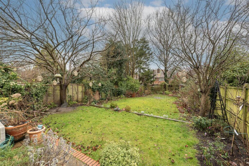
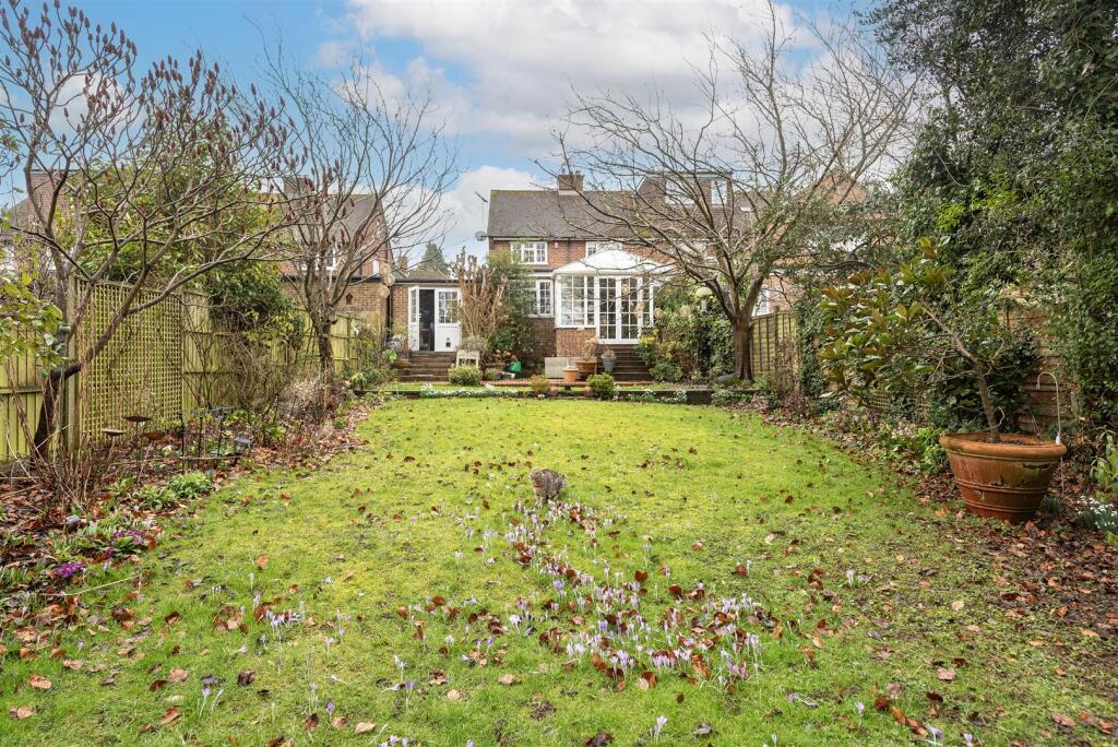
- Beautiful home over 1,650 sq ft
- Scope for further extension and development STPP
- Garden in excess of 50ft
- Attached Garage
- Off street parking
- Well placed for schooling
- Short walk to town centre and station
- Close to Batford Springs Nature Reserve
- Council Tax Band F
Additional details
- Parking
- Yes
- Garden
- Yes
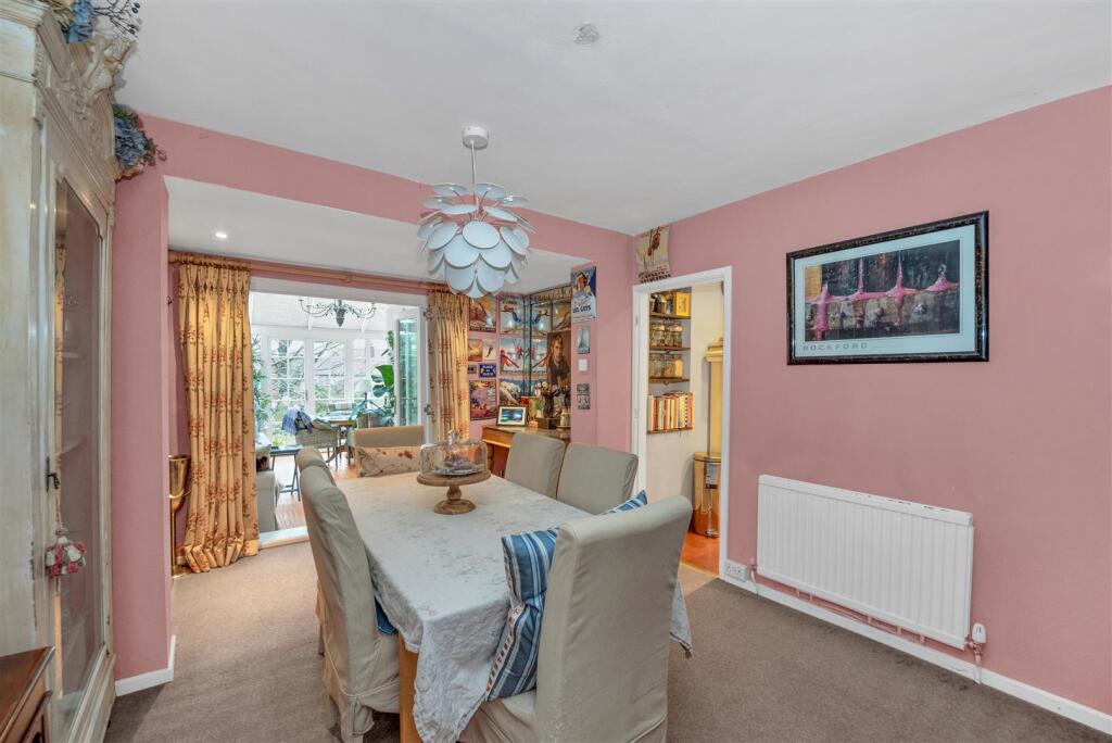
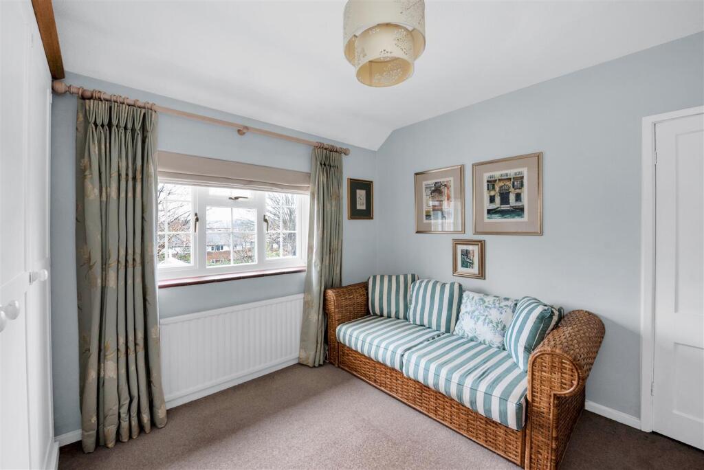
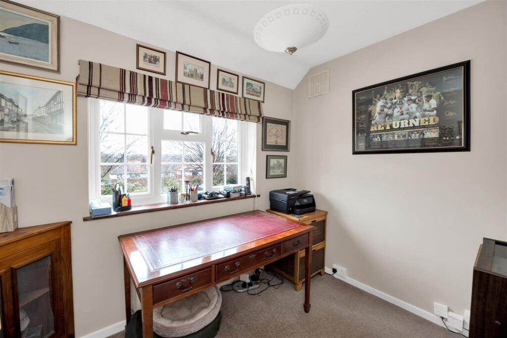
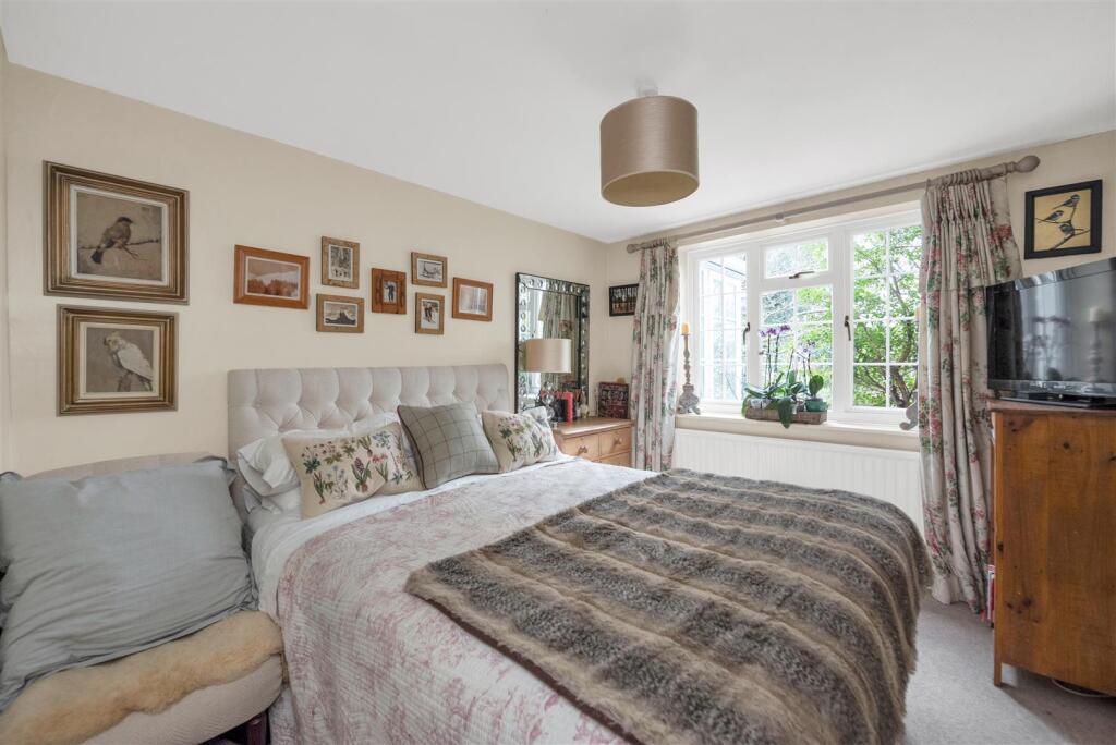
Description
Entrance Hall -
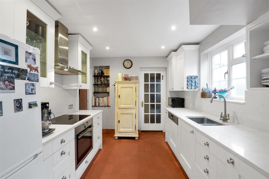
Kitchen - 3.13m x 2.80m (10'3" x 9'2") -
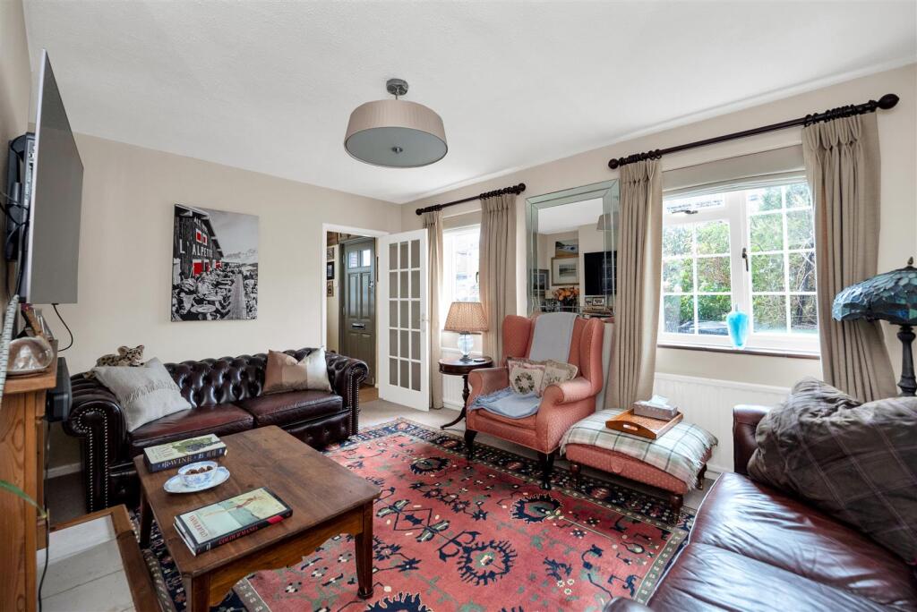
Living Room - 4.49m x 3.64m (14'8" x 11'11") -
Dining Room - 4.71m x 3.42m (15'5" x 11'2") -
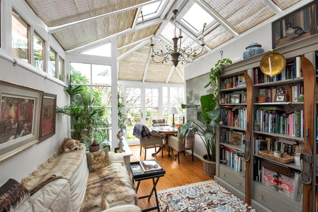
Conservatory - 4.95m x 2.94m (16'2" x 9'7") -
Bedroom Four - 3.33m x 2.83m (10'11" x 9'3") -
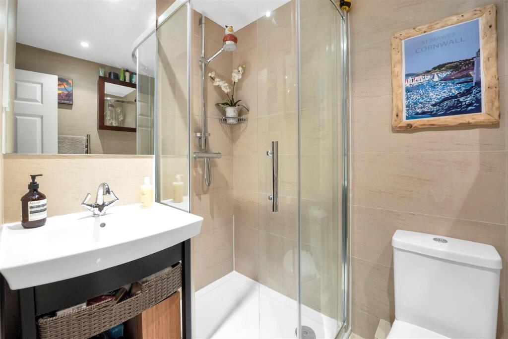
Shower Room -
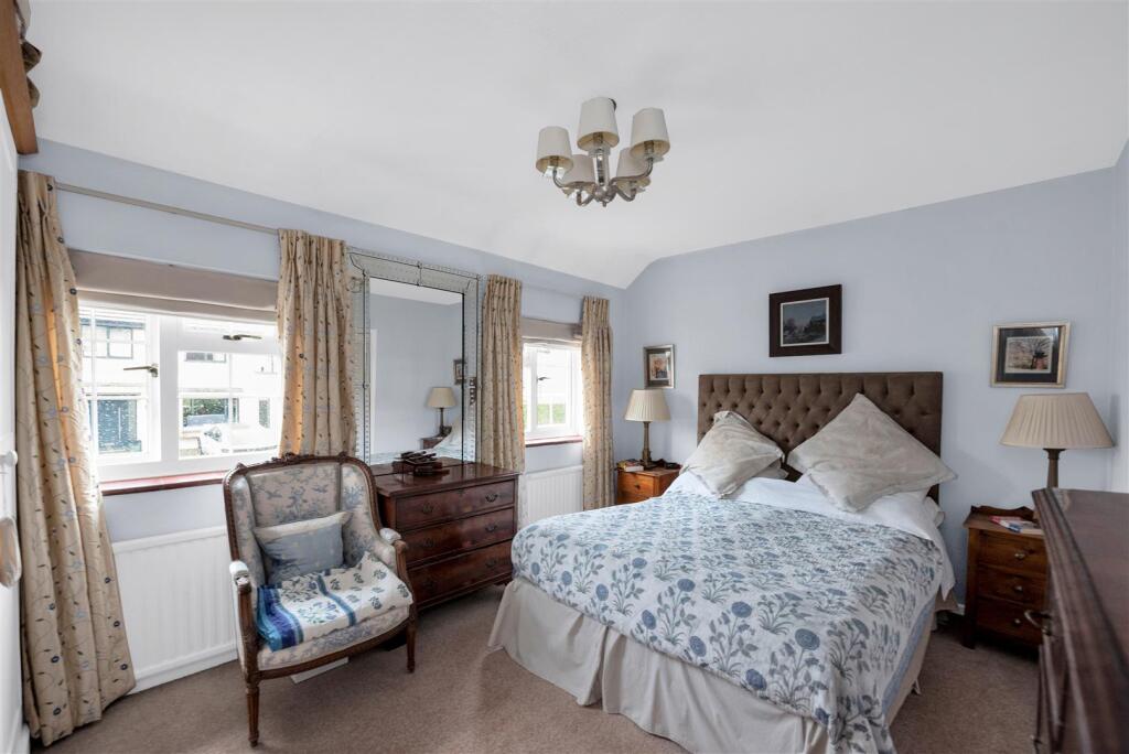
Bedroom One - 4.49m x 3.04m (14'8" x 9'11") -
Bedroom Two - 3.40m x 3.17m (11'1" x 10'4") -
Bedroom Three - 2.81m x 2.25m (9'2" x 7'4") -
Bathroom -
Garage - 6.84m x 2.68m (22'5" x 8'9") -
Listed by
Harpenden
Whittaker & Co
Reference: 158799188
EPC Rating & Upgrade Cost
Current rating: D
Potential rating: C
Inspection date: 12/02/2025
Expiry date: 11/02/2035
Current heating cost: £1,167/year
Potential heating cost: £1,119/year
Est. upgrade cost to C: £10,500
Recommendations
- Floor insulation (suspended floor) (£800 - £1,200)
- Solar water heating (£4,000 - £6,000)
- Solar photovoltaic panels, 2.5 kWp (£3,500 - £5,500)
Flood risk
Zone: 1
Risk: Low
Job (default Low)
Floorplans
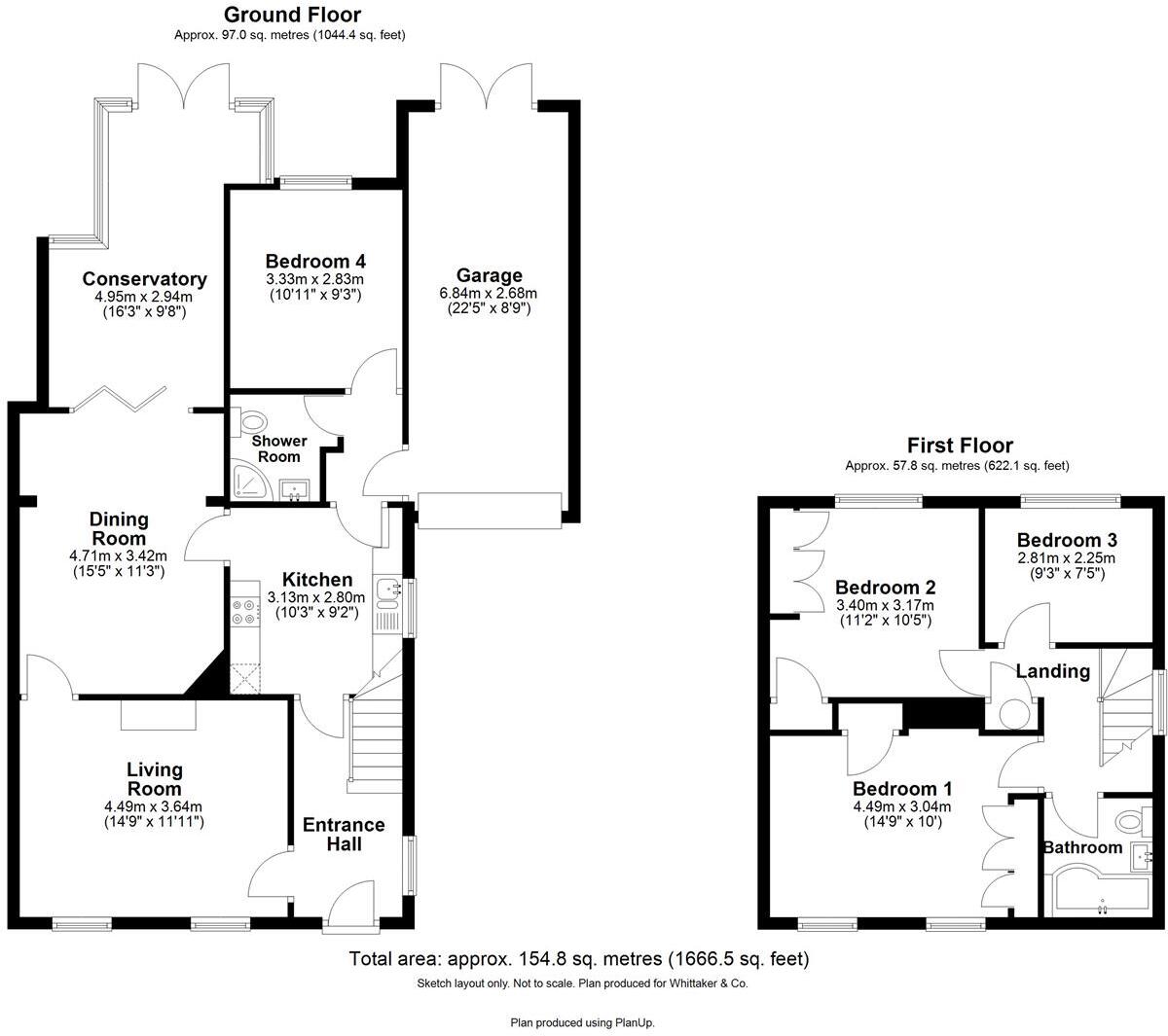
41 Granby Avenue, Harpenden - all floors.JPG
EPC Graphs
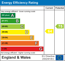
EE Rating
FENSA Certificates
This property has 1 FENSA certificate(s) on record, indicating window/door installations by FENSA-approved installers.
FENSA Certificate #4624030
Property Details
Street: 41 Granby Avenue
Town: HARPENDEN
Postcode: AL5 5QP
Installation Details
Items: 2 doors
Certificate Issued: 09/04/2007
Work Completed: 22/03/2007
This certificate data was retrieved from FENSA's database
What is FENSA? FENSA (Fenestration Self-Assessment Scheme) is a government-authorised scheme that monitors building regulation compliance for replacement windows and doors. Certificates indicate that work was completed by FENSA-approved installers.
Price history
423% since 1999
| Event | Date | Price | % change |
|---|---|---|---|
| Sold | 31/07/2025 (10 months ago) | £1,041,000 | +335.6% |
| Sold | 24/05/2000 (26 years ago) | £239,000 | +20.1% |
| Sold | 06/07/1999 (26 years ago) | £199,000 | — |
Source: HM Land Registry Price Paid Data. Crown copyright.
Sold Comparables
Same street and nearby sales within 0.25 miles (last 5 years). Data from Land Registry Price Paid.
| Address | Price | Date | Type |
|---|---|---|---|
| 3 HOLLY WALK, HARPENDEN, ST ALBANS, HERTFORDSHIRE, AL5 5RG | £1,000,000 | 12/12/2025 | Semi-detached |
| 31 CARISBROOKE ROAD, HARPENDEN, ST ALBANS, HERTFORDSHIRE, AL5 5QS | £905,000 | 11/07/2025 | Semi-detached |
| Same street 23 GRANBY AVENUE, HARPENDEN, ST ALBANS, HERTFORDSHIRE, AL5 5QP | £1,395,000 | 23/08/2023 | Detached |
| 43 LYNDHURST DRIVE, HARPENDEN, ST ALBANS, HERTFORDSHIRE, AL5 5RH | £1,130,000 | 20/07/2023 | Semi-detached |
| 17 LANGDALE AVENUE, HARPENDEN, ST ALBANS, HERTFORDSHIRE, AL5 5QU | £745,000 | 22/05/2023 | Semi-detached |
| 94 CRABTREE LANE, HARPENDEN, ST ALBANS, HERTFORDSHIRE, AL5 5RF | £875,000 | 12/12/2022 | Semi-detached |
| 15 GLEMSFORD DRIVE, HARPENDEN, ST ALBANS, HERTFORDSHIRE, AL5 5RB | £905,000 | 05/12/2022 | Semi-detached |
| 7 HOLLY WALK, HARPENDEN, ST ALBANS, HERTFORDSHIRE, AL5 5RG | £610,000 | 07/11/2022 | Semi-detached |
| 15 MARQUIS LANE, HARPENDEN, ST ALBANS, HERTFORDSHIRE, AL5 5AA | £840,000 | 07/09/2022 | Semi-detached |
| 2 AMBLESIDE, HARPENDEN, ST ALBANS, HERTFORDSHIRE, AL5 4RR | £475,000 | 20/04/2022 | Semi-detached |
| Same street 29 GRANBY AVENUE, HARPENDEN, ST ALBANS, HERTFORDSHIRE, AL5 5QP | £1,780,000 | 06/04/2022 | Other |
| 122 STATION ROAD, HARPENDEN, ST ALBANS, HERTFORDSHIRE, AL5 4RH | £1,115,000 | 21/01/2022 | Semi-detached |
| Same street 45 GRANBY AVENUE, HARPENDEN, ST ALBANS, HERTFORDSHIRE, AL5 5QP | £1,285,000 | 17/12/2021 | Semi-detached |
| 12 LANGDALE AVENUE, HARPENDEN, ST ALBANS, HERTFORDSHIRE, AL5 5QU | £950,000 | 17/11/2021 | Semi-detached |
| 14 GLEMSFORD DRIVE, HARPENDEN, ST ALBANS, HERTFORDSHIRE, AL5 5RB | £497,000 | 24/09/2021 | Semi-detached |
| 32 HOLLY WALK, HARPENDEN, ST ALBANS, HERTFORDSHIRE, AL5 5RG | £637,500 | 28/06/2021 | Semi-detached |
Street average: £1,486,667 (3 sales)
Area average: £821,885 (13 sales)
Capital growth trend
Land Registry outcode average: last 12 months vs 5y and 10y ago (from sold prices).
House Price Index (HM Land Registry — official index, not sold-price averages): St Albans. Series: Semi-detached. As of March 2026.
Rental Range
Estimated market rent for St Albans. Low = conservative, Realistic = average, Optimistic = best case.
Based on Local Authority from postcode lookup → St Albans.
LHA (30th percentile) floor for Luton: £1,346/mo (Apr 2025 – Mar 2026)
Location
Nearby
Nearest stations, universities and amenities (distance from property).
| Type | Name | Distance |
|---|---|---|
| Bus stop | Langdale Avenue | 0.1 miles |
| Shop | Harp's Coffee | 0.6 miles |
| Train station | Harpenden | 0.6 miles |
| Shop | Harpenden MOT Centre | 0.7 miles |
| Train station | Central Terminal | 4.4 miles |
| University | University Of Bedfordshire | 5.0 miles |
| Hospital | Widecombe Nursing Home | 7.8 miles |
| Hospital | Luton and Dunstable Hospital | 7.9 miles |
Street-level crime
| Category | Count |
|---|---|
| Anti-social behaviour | 28 |
| Violence and sexual offences | 21 |
| Shoplifting | 16 |
| Other theft | 15 |
| Criminal damage and arson | 11 |
| Vehicle crime | 10 |
| Other crime | 4 |
| Public order | 4 |
| Burglary | 3 |
| Bicycle theft | 2 |
| Drugs | 2 |
| Robbery | 2 |
| Total incidents | 118 |
Within 1 mile during Apr 2026. Source: data.police.uk (England & Wales).
Schools nearby
Nearest open schools with Ofsted ratings (England). Closed schools are not shown. Data from Get Information about Schools and Ofsted.
| Name | Type | Distance | Ofsted |
|---|---|---|---|
| Crabtree Junior School | Primary | 0.2 miles | Outstanding — 15 Jan 2024 |
| Crabtree Infants' School | Primary | 0.3 miles | Outstanding — 18 Mar 2024 |
| Sir John Lawes School | Secondary | 0.4 miles | Outstanding — 22 May 2023 |
| High Beeches Primary School | Primary | 0.4 miles | Outstanding — 26 Apr 2017 |
| Manland Primary School | Primary | 0.5 miles | Good — 18 Oct 2018 |
Rental Comparables
Loading rental comparables for this postcode. Refresh in a few minutes.
Rent-driven metrics
Based on Area rent estimate.
- Rent ratio — Monthly rent ÷ purchase price (1% rule). 1%+ = strong, 0.8–1% = okay, <0.8% = weak for cashflow.
- Max investor price — Rent ÷ 0.8%; the price at which rent would be 0.8% of price (Stoke-style target).
- Target investor price — Rent ÷ 1%; the price at which rent would be 1% of price (strong cashflow band).
- Gross yield — Annual rent as % of purchase price (no costs).