13 WOODMANCOTE
DURSLEY, GLOUCESTERSHIRE GL11 4AF
Property details
Floor area
30 m²
Deprivation
Decile 5 (14,641 of 33,755)
Street crime
1 incident within 1 mile (Apr 2026)
Description
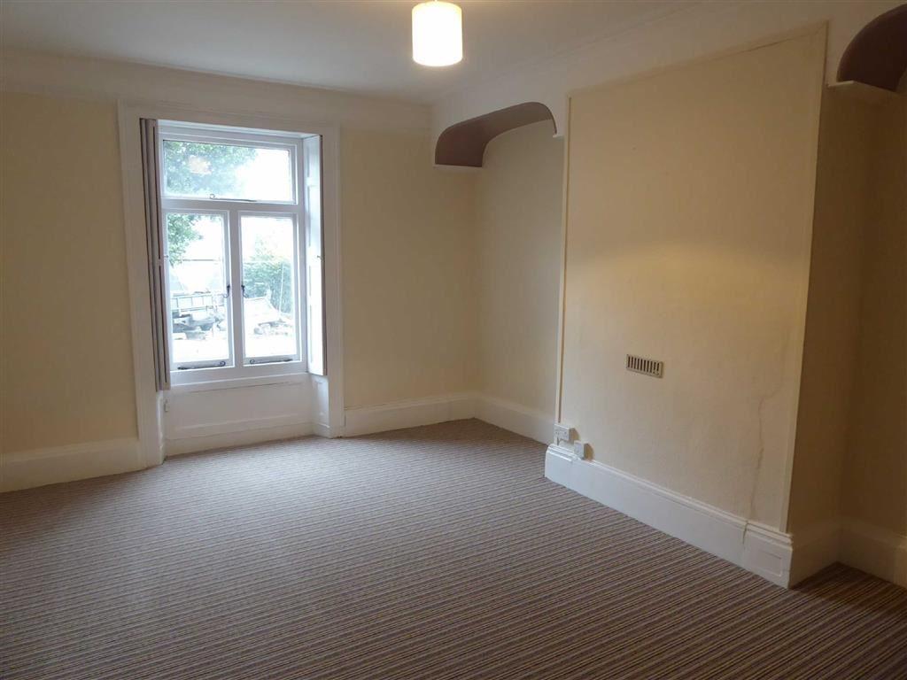
* Bedroom/Living Area. Refurbished Bathroom Suite.
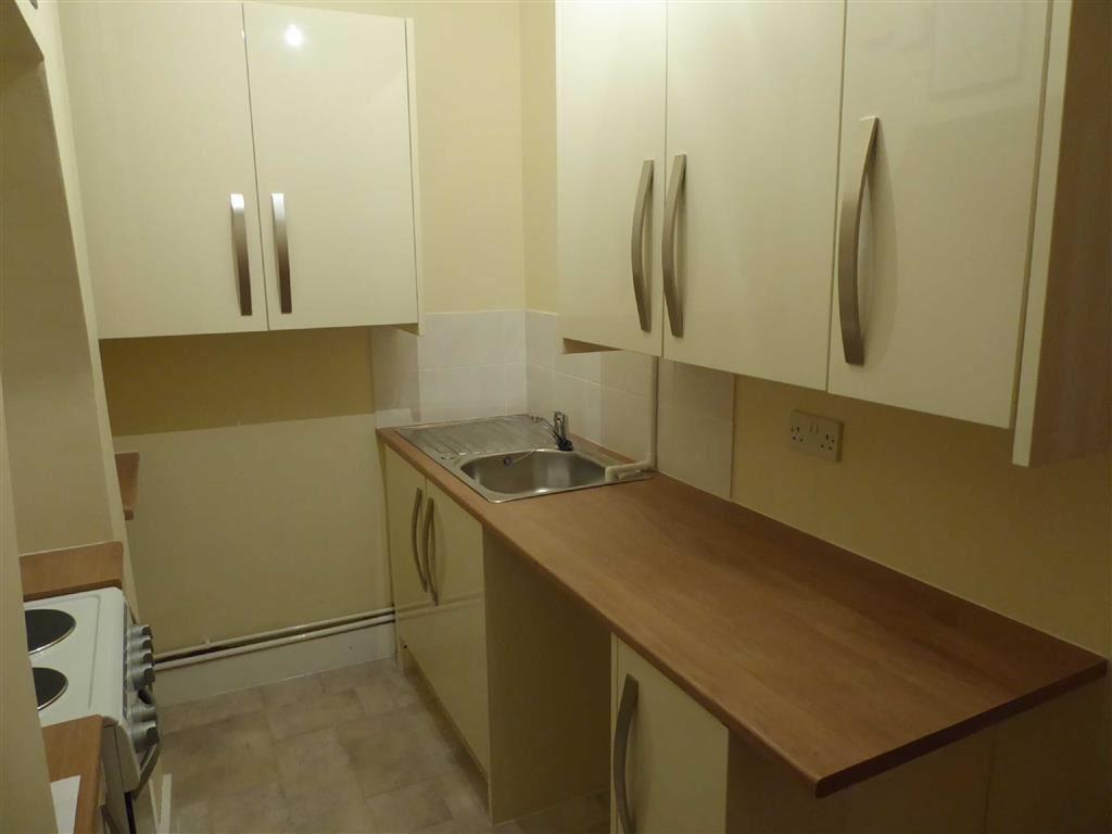
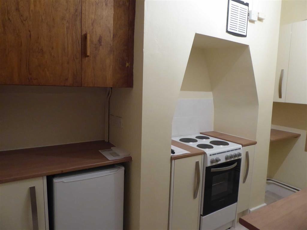
* Brand New Fitted Kitchen with Oven and Plumbing for WM.
* Communal Garden. Council Tax Band A = £1130.62 per year.
* Available Now. Energy Efficiency Rating F
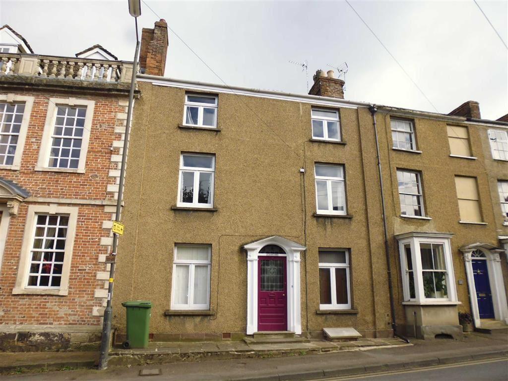
Situation - This property is situated in a convenient location on the outskirts of Dursley being within a few minutes walk of the wooded slopes of Stinchcombe Hill. Woodmancote borders an area designated as one of outstanding natural beauty and provides numerous country walks. The property is situated on the A4135 which provides easy access to the town centre having a good range of facilities including Sainsbury's supermarket and independent retailers, swimming pool, library, doctors and dentist surgeries along with Rednock comprehensive school. The larger centres of Gloucester Bristol and Cheltenham are easily accessible via the A38 and and M5/M4 motorway network. Cam village has 'park and ride' railway station with regular services to Gloucester and Bristol and onward connections to the National Rail Network
Directions - The property can be found by travelling out of Dursley in an easterly direction on the A4135 continuing straight across the mini roundabout and can be found immediately on the left hand side.
Description - The accommodation is situated on the ground floor and comprises of bedroom/living room area, newly fitted kitchen with appliances and newly fitted bathroom.
Kitchen - The kitchen has been newly fitted in 2017 and includes a range of wall and base units as well as fridge and oven.
Living Room/Bedroom - 4.73m x 3.16m (extending to 3.63m) (15'6" x 10'4" - The bedroom doubles up as the main living space and has a window to the front and night storage heater.
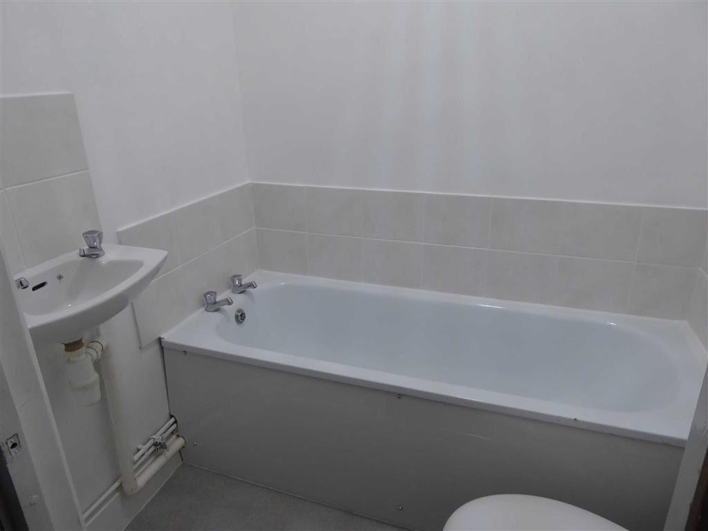
Bathroom - Newly fitted white suite including bath, WC and wash hand basin.
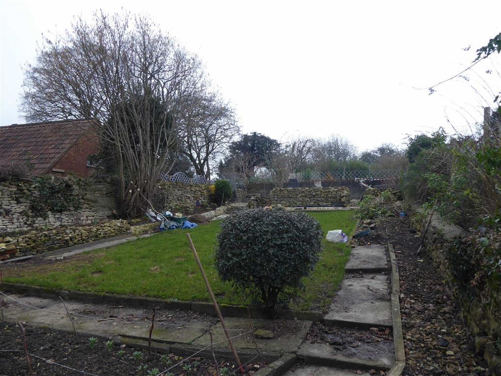
Communal Garden - There is a communal garden for tenants to use and is situated at the rear of the property.
MISREPRESENTATION ACT 1967. Messrs. Bennett Jones for themselves and for the Vendors of this property whose agents they are, give notice that: All statements contained in their particulars as to this property are made without responsibility on the part of the Agents or Vendors. None of the statements contained in their particulars as to this property is to be relied on as a statement or representation of fact. Any intending purchasers must satisfy himself by inspection or otherwise as to the correctness of the statements contained in these particulars. The Vendors do not make or give and neither the Agents nor any person in their employment has any authority to make or give any representation or warranty whatever in relation to this property.
Listed by
Dursley
Bennett Jones Partnership
Reference: 58012561
EPC Rating & Upgrade Cost
Fetching EPC data… Refresh this page in a moment.
Flood risk
Zone: 1
Risk: Low
Job (default Low)
Rental Range
Estimated market rent for Stroud. Low = conservative, Realistic = average, Optimistic = best case.
Based on Local Authority from postcode lookup → Stroud.
LHA (30th percentile) floor for Gloucester: £549/mo (Apr 2025 – Mar 2026)
Location
Nearby
Nearest stations, universities and amenities (distance from property).
| Type | Name | Distance |
|---|---|---|
| Bus stop | Uley Rd | 0.1 miles |
| Bus stop | Vizard Close | 0.1 miles |
| Shop | Picture Framers | 0.1 miles |
| Shop | Salon 54 | 0.1 miles |
| Train station | Cam and Dursley | 2.7 miles |
| Train station | Stonehouse | 5.5 miles |
| Hospital | Stroud Maternity Hospital | 7.5 miles |
| Hospital | Stroud General Hospital | 7.5 miles |
Street-level crime
| Category | Count |
|---|---|
| Violence and sexual offences | 1 |
| Total incidents | 1 |
Within 1 mile during Apr 2026. Source: data.police.uk (England & Wales).
Schools nearby
Nearest open schools with Ofsted ratings (England). Closed schools are not shown. Data from Get Information about Schools and Ofsted.
| Name | Type | Distance | Ofsted |
|---|---|---|---|
| Dursley Church of England Primary Academy | Primary | 0.4 miles | Good — 22 Apr 2015 |
| Rednock School | Secondary | 0.6 miles | Good — 23 Jan 2024 |
| Peak Academy | Other | 0.6 miles | Inadequate — 26 Sep 2021 |
| Cam Everlands Primary School | Primary | 1.1 miles | Good — 26 Feb 2016 |
| Cam Hopton Church of England Primary School | Primary | 1.2 miles | Good — 15 Jun 2015 |
Rental Comparables
Residential lets from OpenRent and Rightmove for the area (same bedroom count). Use to validate rent estimates. Student lets are excluded.
| Title | Rent | Beds | Distance | As seen on |
|---|---|---|---|---|
| 1 Bed Flat, Kingshill Road, GL11 | £775/mo | 1 | 0.65 miles | OpenRent |
Average rent: £775/mo (1 listing)