Halesowen
Windsor Road, B63 4BE
£169,950
Property details
Last sold
£230,000
Local average
£343,945 (-50.6%)
Deprivation
Decile 5 (14,955 of 33,755)
Street crime
141 incidents within 1 mile (Mar 2026)
Additional details
- Parking
- Yes
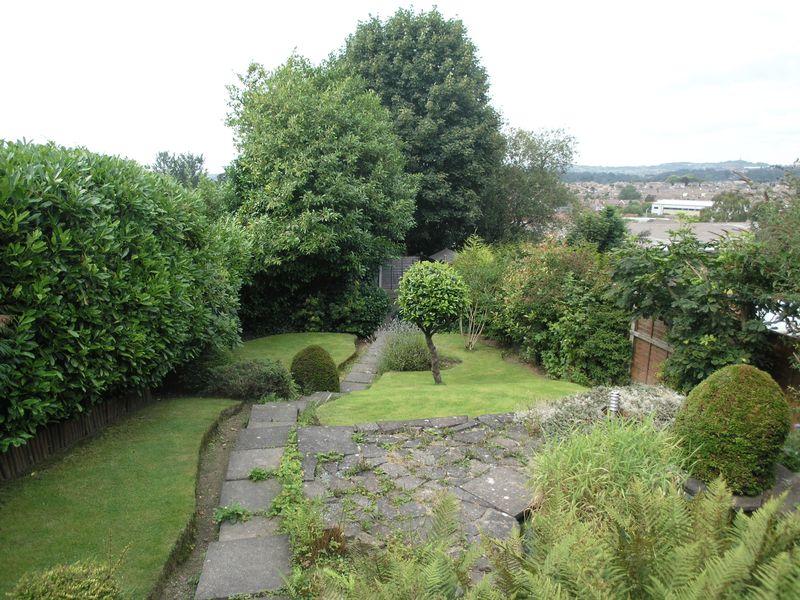
- Garden
- Yes
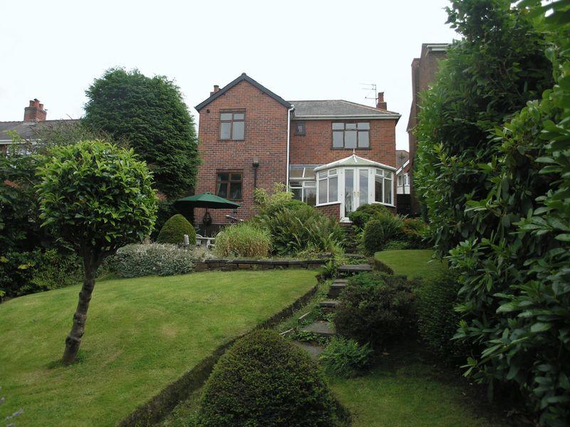
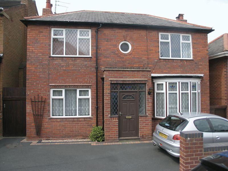
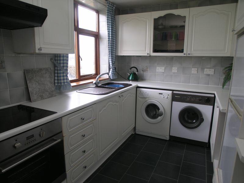
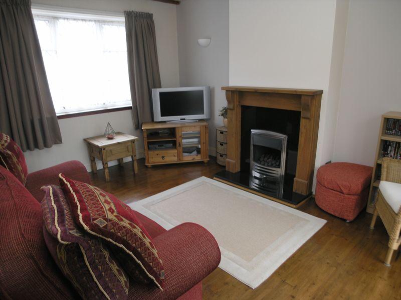
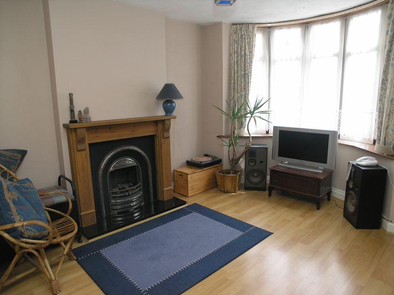
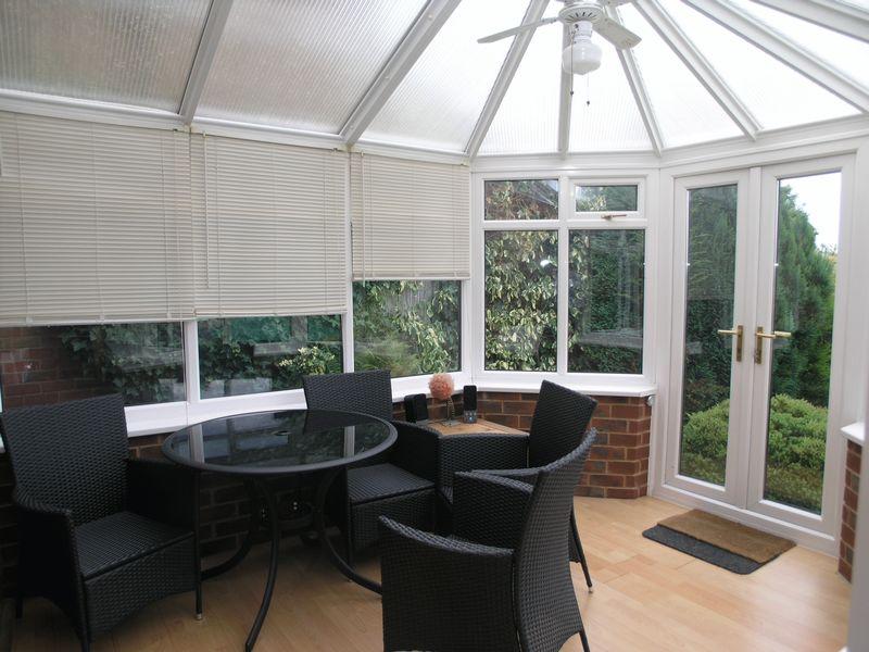
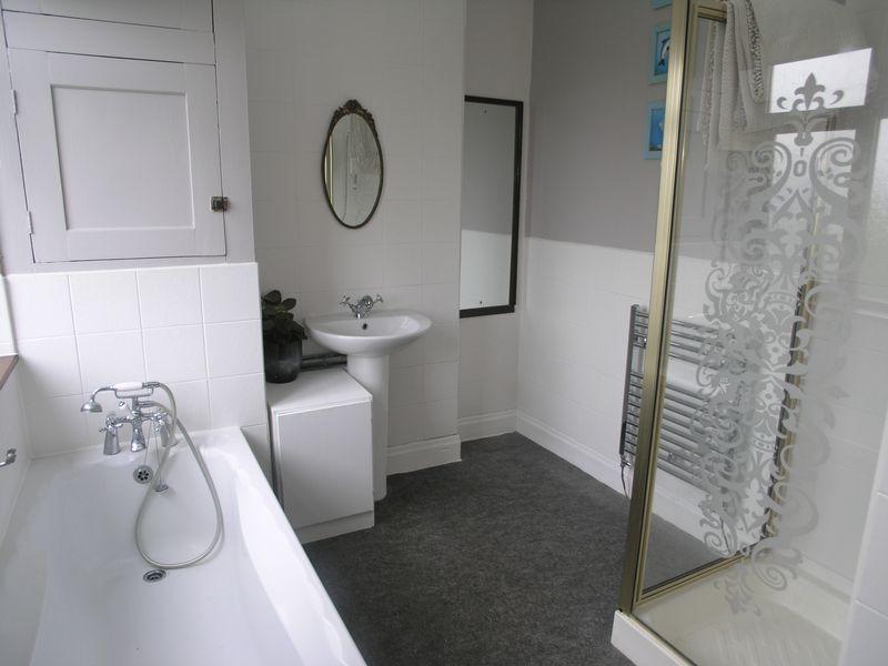
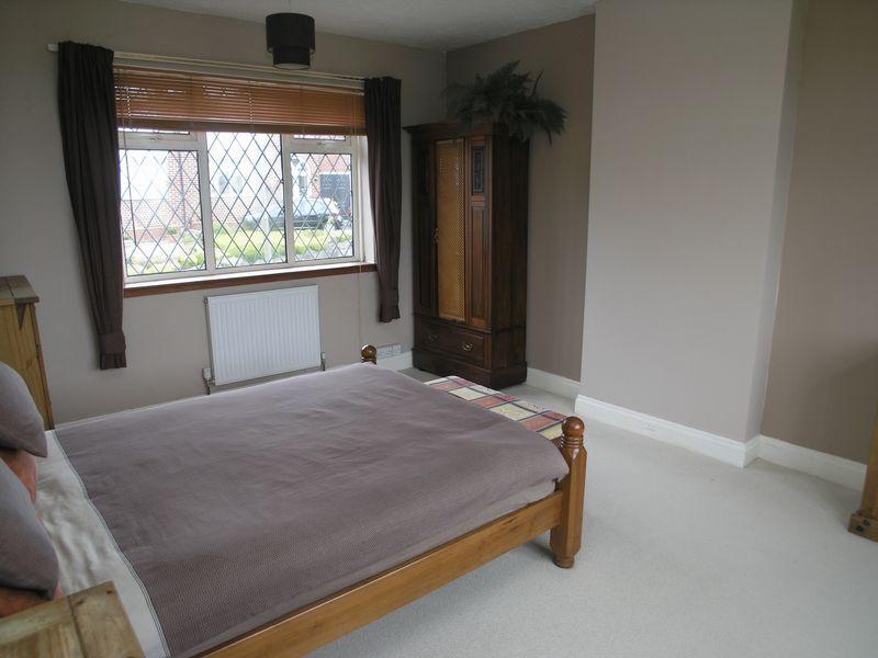
Description
Listed by
Halesowen
Taylors Estate Agents
Reference: 31895034
EPC ratings on this postcode
We don't have a matched EPC for this property yet. Below are efficiency scores and details for other addresses on this postcode.
| Address | Current | Potential | Floor area | Age band | Type |
|---|---|---|---|---|---|
| 1 Windsor Road, HALESOWEN | 70 | 86 | 54 m² | England and Wales: 1991-1995 | Terraced |
| 10a Windsor Road, HALESOWEN | 76 | 89 | 80 m² | England and Wales: 1900-1929 | Terraced |
| 10b Windsor Road, HALESOWEN | 70 | 86 | 71 m² | England and Wales: 1900-1929 | Terraced |
| 18, Windsor Road, HALESOWEN | 71 | 84 | 99 m² | England and Wales: 1900-1929 | Detached |
| 18, Windsor Road, HALESOWEN | 72 | 84 | 104 m² | England and Wales: 1930-1949 | Detached |
| 19, Windsor Road, HALESOWEN | 34 | 81 | 69 m² | England and Wales: 1930-1949 | Detached |
| 24, Windsor Road, HALESOWEN | 44 | 68 | 66 m² | England and Wales: 1950-1966 | Detached |
| 27 Windsor Road, HALESOWEN | 54 | 83 | 74 m² | England and Wales: 1900-1929 | Detached |
| 29, Windsor Road, HALESOWEN | 54 | 73 | 115 m² | England and Wales: 1900-1929 | Terraced |
| 3 Windsor Road, HALESOWEN | 67 | 89 | 57 m² | England and Wales: 1983-1990 | Terraced |
| 3, Windsor Road, HALESOWEN | 66 | 90 | 57 m² | England and Wales: 1983-1990 | Terraced |
| 30, Windsor Road, HALESOWEN | 51 | 78 | 84 m² | England and Wales: 1930-1949 | Detached |
| 31 Windsor Road, HALESOWEN | 68 | 75 | 82 m² | England and Wales: 1900-1929 | Detached |
| 31, Windsor Road, HALESOWEN | 54 | 83 | 83 m² | England and Wales: before 1900 | Detached |
| 33, Windsor Road, HALESOWEN | 41 | 81 | 83 m² | England and Wales: 1930-1949 | Detached |
Flood risk
Zone: 2
Risk: In flood risk area
Environment Agency Flood Risk Areas (APSFR)
Floorplans
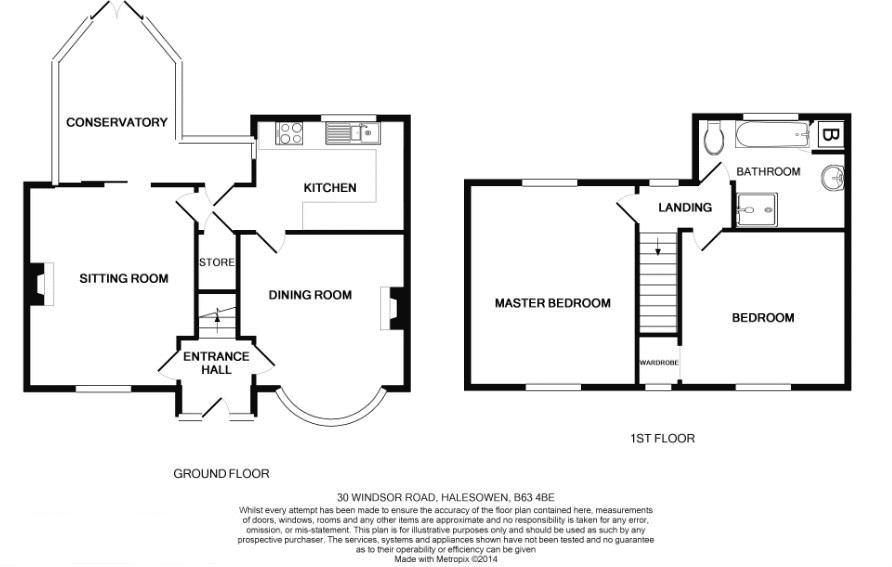
Floorplan 1
Price history
297% since 2008
| Event | Date | Price | % change |
|---|---|---|---|
| Sold | 01/01/2024 (2 years ago) | £230,000 | +42% |
| Sold | 01/01/2016 (10 years ago) | £162,000 | +179.3% |
| Sold | 01/01/2008 (18 years ago) | £58,000 | — |
Source: HM Land Registry Price Paid Data. Crown copyright.
Sold Comparables
Same street and nearby sales within 0.25 miles (last 5 years). Data from Land Registry Price Paid.
| Address | Price | Date | Type |
|---|---|---|---|
| 169 STOURBRIDGE ROAD, HALESOWEN, DUDLEY, WEST MIDLANDS, B63 3UD | £550,000 | 28/09/2022 | Detached |
| 71 ALEXANDRA ROAD, HALESOWEN, DUDLEY, WEST MIDLANDS, B63 4DA | £160,000 | 03/09/2021 | Detached |
Area average: £355,000 (2 sales)
Capital growth trend
Land Registry outcode average: last 12 months vs 5y and 10y ago (from sold prices).
House Price Index (HM Land Registry — official index, not sold-price averages): Dudley. Series: Detached. As of February 2026.
Rental Range
Estimated market rent for Dudley. Low = conservative, Realistic = average, Optimistic = best case.
Based on Local Authority from postcode lookup → Dudley.
LHA (30th percentile) floor for Black Country: £623/mo (Apr 2025 – Mar 2026)
Location
Address
Windsor Road
Nearby
Nearest stations, universities and amenities (distance from property).
| Type | Name | Distance |
|---|---|---|
| Bus stop | Richmond St / Slims Gate | 0.1 miles |
| Shop | Don Guest and Son | 0.2 miles |
| Shop | Hasbury Motors | 0.2 miles |
| Hospital | West Midlands Hospital Ramsay Health care | 0.9 miles |
| Train station | Old Hill | 1.4 miles |
| Train station | Cradley Heath | 1.9 miles |
| Hospital | Rowley Regis Hospital | 2.1 miles |
| University | Newman University | 2.9 miles |
| University | University of Wolverhampton ECMS National Foundry Training Centre | 4.7 miles |
Street-level crime
| Category | Count |
|---|---|
| Violence and sexual offences | 55 |
| Public order | 17 |
| Criminal damage and arson | 12 |
| Vehicle crime | 11 |
| Shoplifting | 10 |
| Other theft | 9 |
| Burglary | 7 |
| Possession of weapons | 7 |
| Other crime | 4 |
| Anti-social behaviour | 3 |
| Robbery | 2 |
| Theft from the person | 2 |
| Bicycle theft | 1 |
| Drugs | 1 |
| Total incidents | 141 |
Within 1 mile during Mar 2026. Source: data.police.uk (England & Wales).
Schools nearby
Nearest open schools with Ofsted ratings (England). Closed schools are not shown. Data from Get Information about Schools and Ofsted.
| Name | Type | Distance | Ofsted |
|---|---|---|---|
| Our Lady and St Kenelm RC School | Primary | 0.1 miles | Good — 11 Jan 2022 |
| Windsor High School and Sixth Form | Secondary | 0.1 miles | — (Inspected (no overall grade)) |
| Halesowen CofE Primary School | Primary | 0.3 miles | — (Inspected (no overall grade)) |
| Huntingtree Primary School | Primary | 0.4 miles | Good — 17 Mar 2019 |
| The Earls High School | Secondary | 0.4 miles | Good — 12 Feb 2020 |
Rental Comparables
Rental listings exist nearby, but none matched the 2-bedroom estimate from EPC for this property.
Rent-driven metrics
Based on Area rent estimate.
- Rent ratio — Monthly rent ÷ purchase price (1% rule). 1%+ = strong, 0.8–1% = okay, <0.8% = weak for cashflow.
- Max investor price — Rent ÷ 0.8%; the price at which rent would be 0.8% of price (Stoke-style target).
- Target investor price — Rent ÷ 1%; the price at which rent would be 1% of price (strong cashflow band).
- Gross yield — Annual rent as % of purchase price (no costs).
Enter House Number
Enter the house number to help us retrieve more accurate pricing history and property data.
Please log in to submit or correct the house number for this listing.
Log in to continue