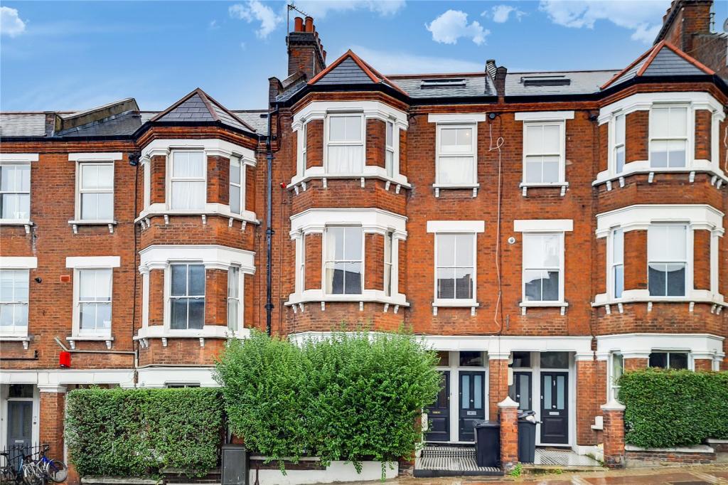
191 LATCHMERE ROAD
LONDON, LONDON, GREATER LONDON SW11 2LA
£2,600 pcm
Property details
Floor area
80 m²
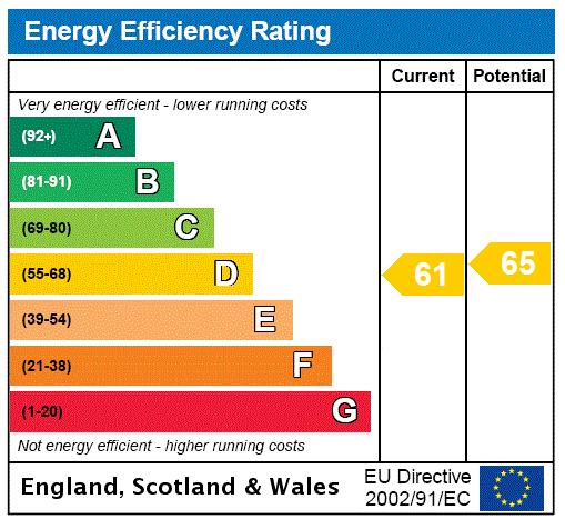
EPC rating
C
Year built
England and Wales: 1900-1929
Deprivation
Decile 7 (22,890 of 33,755)
Street crime
829 incidents within 1 mile (Mar 2026)
Key features
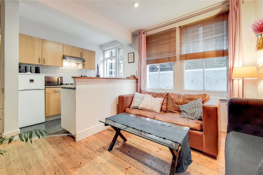
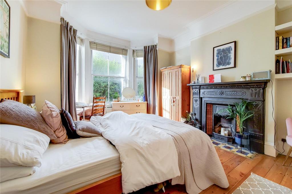
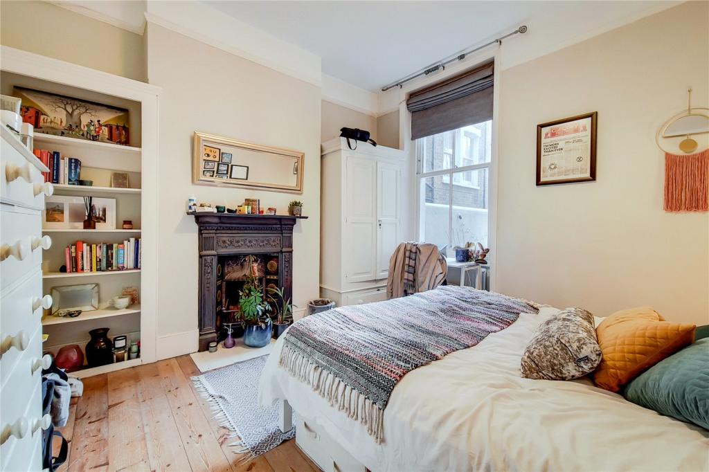
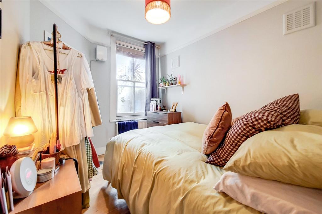
- Three Bedrooms
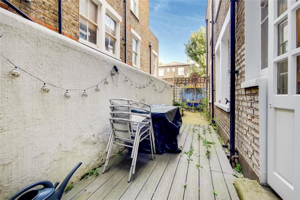
- Patio Garden
- Wooden Floors
- Close to Clapham Junction
Additional details
- Garden
- Yes
Description
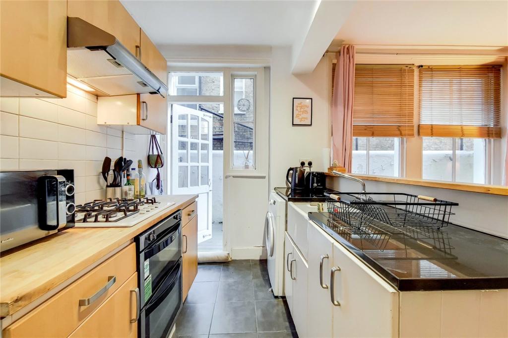
Latchmere Road is situated within easy reach of Clapham Junction station and is also a short walk away to Clapham Common. The many shops, bars and restaurants of Lavender Hill, Battersea Rise and Northcote Road can also be found moments away. Ideal for three professional sharers.
Listed by
Battersea
Campions - Chestertons
Reference: 115739297
EPC Rating & Upgrade Cost
Current rating: C
Potential rating: C
Inspection date: 18/12/2018
Current heating cost: £411/year
Potential heating cost: £245/year
Est. upgrade cost to C: £15,010
Recommendations
- 50 mm internal or external wall insulation (£4,000 - £14,000)
- Floor insulation (suspended floor) (£800 - £1,200)
- Draughtproof single-glazed windows (£80 - £120)
- Low energy lighting for all fixed outlets (£10)
- Replace single glazed windows with low-E double glazing (£3,300 - £6,500)
Flood risk
Zone: 1
Risk: Low
Job (default Low)
Floorplans
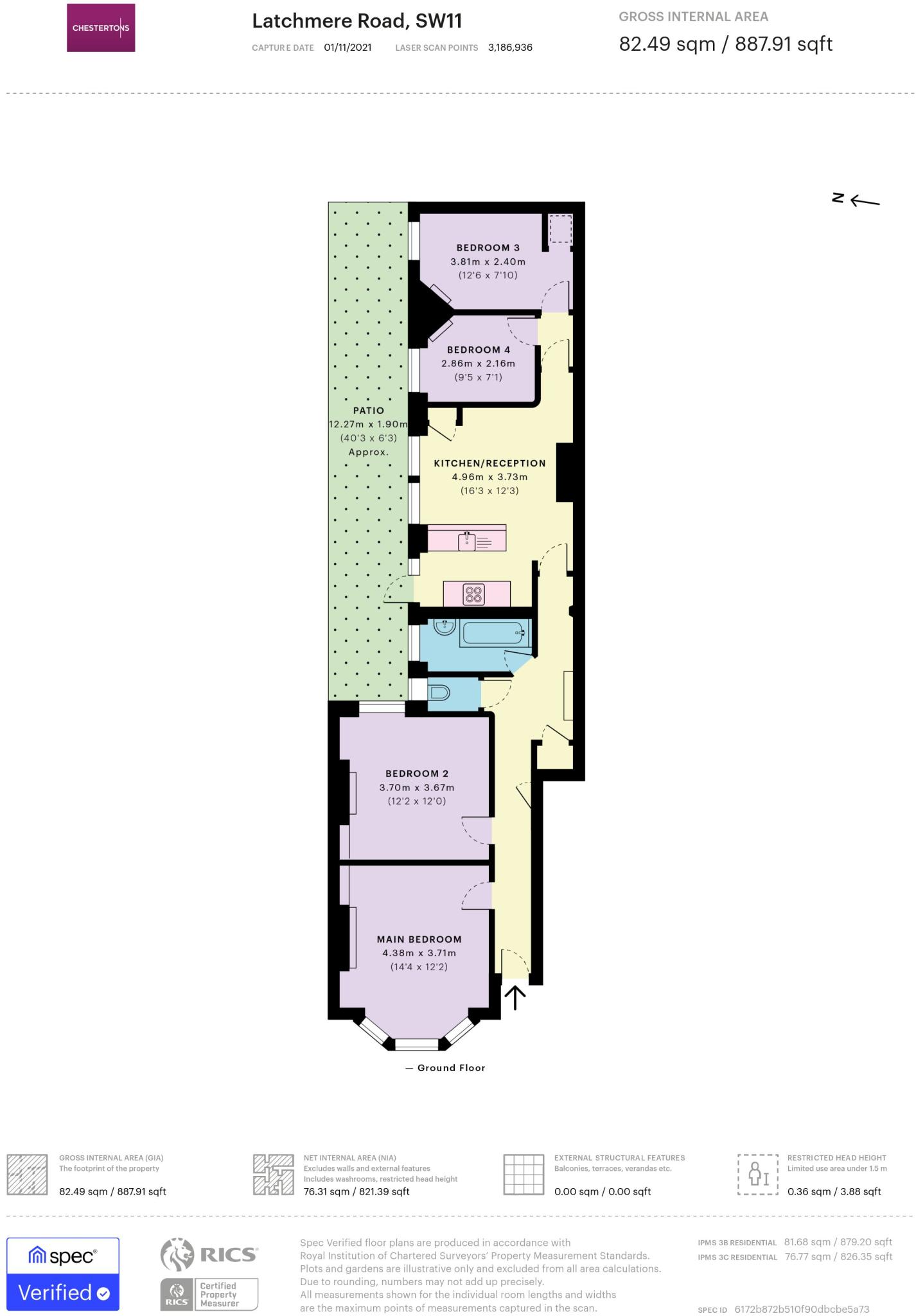
Floorplan
EPC Graphs
EPC Rating Graph
Company ownership
Registered legal owner is a company.
Rental Range
Estimated market rent for Wandsworth. Low = conservative, Realistic = average, Optimistic = best case.
Based on Local Authority from postcode lookup → Wandsworth.
LHA (30th percentile) floor for Stevenage & North Herts: £1,247/mo (Apr 2025 – Mar 2026)
Location
Nearby
Nearest stations, universities and amenities (distance from property).
| Type | Name | Distance |
|---|---|---|
| Shop | The Print Design | 0.0 miles |
| Shop | Costcutter | 0.0 miles |
| Bus stop | Battersea Arts Centre | 0.0 miles |
| Bus stop | Lavender Hill Police Station | 0.1 miles |
| Train station | Clapham Junction | 0.4 miles |
| Hospital | Bridge Lane Health Centre | 0.6 miles |
| Train station | Queenstown Road | 1.0 miles |
| University | National Heart and Lung Institute | 1.6 miles |
| University | BIMM Institute London | 1.8 miles |
| Hospital | King's College Hospital Emergency Department | 3.0 miles |
Street-level crime
| Category | Count |
|---|---|
| Anti-social behaviour | 204 |
| Violence and sexual offences | 187 |
| Other theft | 70 |
| Vehicle crime | 69 |
| Burglary | 65 |
| Shoplifting | 60 |
| Public order | 44 |
| Criminal damage and arson | 32 |
| Bicycle theft | 27 |
| Theft from the person | 21 |
| Robbery | 19 |
| Drugs | 17 |
| Other crime | 10 |
| Possession of weapons | 4 |
| Total incidents | 829 |
Within 1 mile during Mar 2026. Source: data.police.uk (England & Wales).
Schools nearby
Nearest open schools with Ofsted ratings (England). Closed schools are not shown. Data from Get Information about Schools and Ofsted.
| Name | Type | Distance | Ofsted |
|---|---|---|---|
| Shaftesbury Park Primary School | Primary | 0.3 miles | Good — 29 Nov 2013 |
| Sacred Heart Catholic Primary School, Battersea | Primary | 0.4 miles | Good — 26 Sep 2023 |
| Parkgate House School | Other | 0.4 miles | Outstanding — 28 Apr 2022 |
| Belleville Wix Academy | Primary | 0.5 miles | Good — 2 Dec 2019 |
| John Burns Primary School | Primary | 0.5 miles | Good — 6 Feb 2018 |
Rental Comparables
Residential lets from OpenRent and Rightmove for the area (same bedroom count). Use to validate rent estimates. Student lets are excluded.
| Title | Rent | Beds | Distance | As seen on |
|---|---|---|---|---|
| 3 Bed Maisonette, Sabine Road, SW11 | £3,500/mo | 3 | 0.24 miles | OpenRent |
| 3 Bed Flat, St. John's Road, SW11 | £2,500/mo | 3 | 0.37 miles | OpenRent |
| 3 Bed Terraced House, Dunston Road, SW11 | £3,500/mo | 3 | 0.48 miles | OpenRent |
Average rent: £3,167/mo (3 listings)