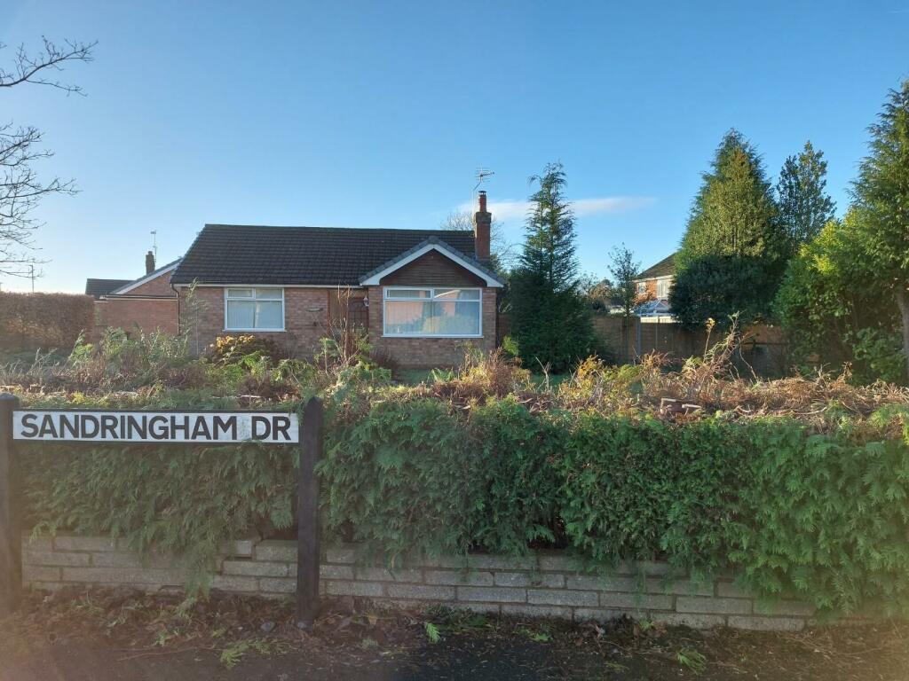
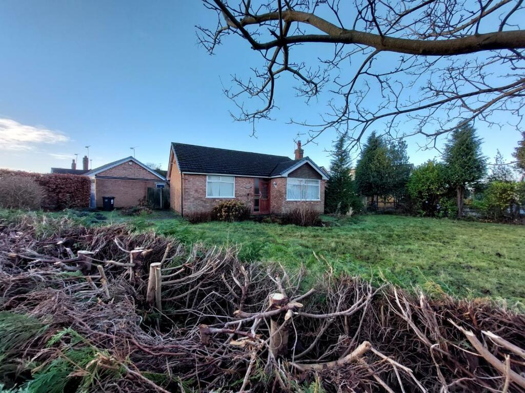
2 SANDRINGHAM DRIVE
CREWE, WISTASTON, CHESHIRE EAST CW2 8HZ
Property details
Floor area
64 m²
Council tax band
C
Deprivation
Decile 10 (31,003 of 33,755)
Street crime
62 incidents within 1 mile (Apr 2026)
Key features
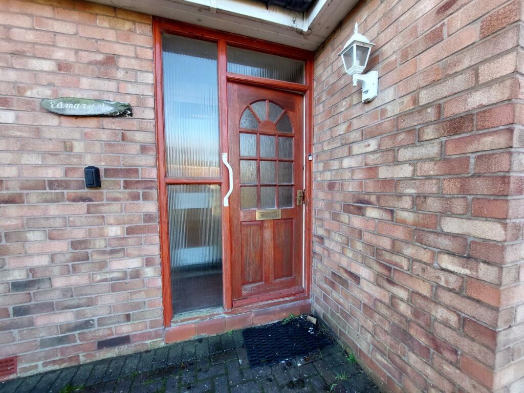
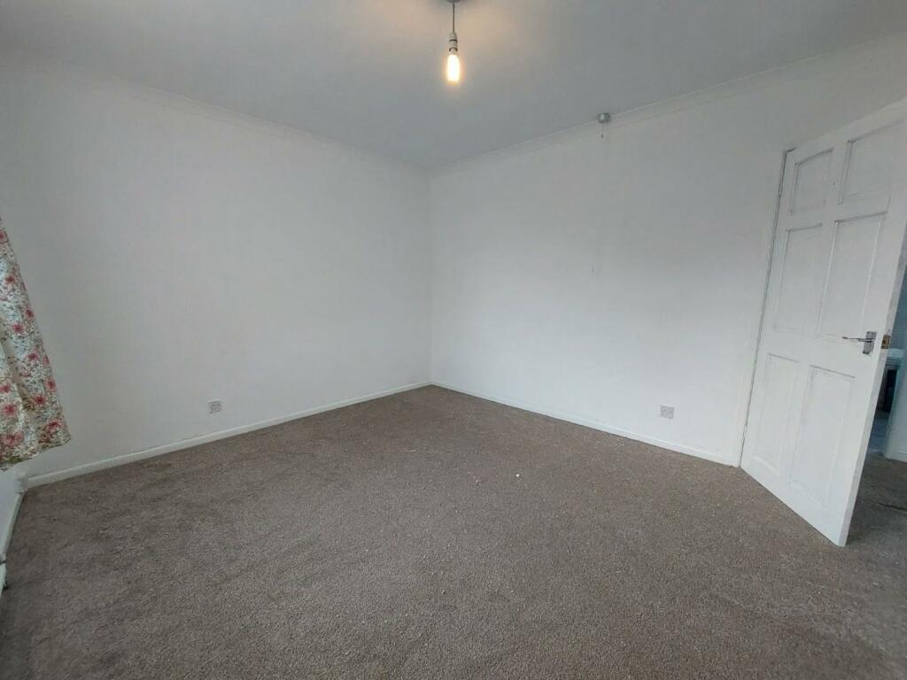
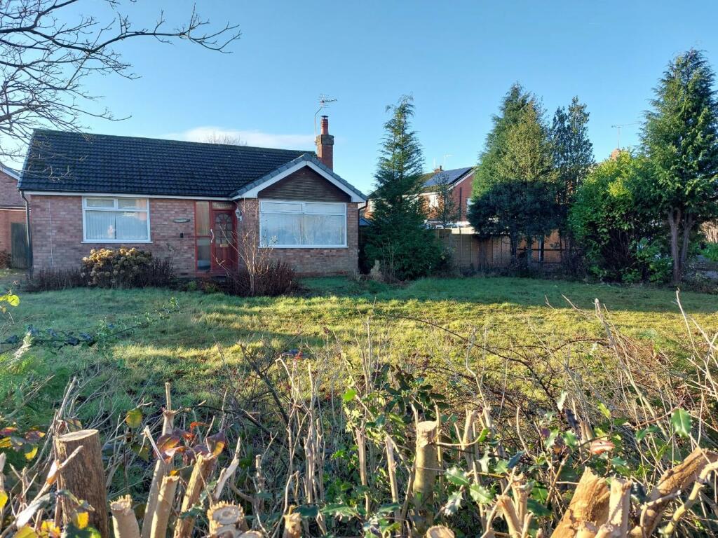
- 2 bedroom bungalow
- Redecorated throughout
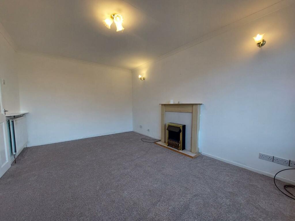
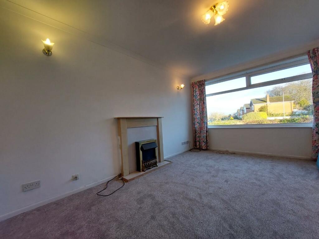
- Spacious lounge
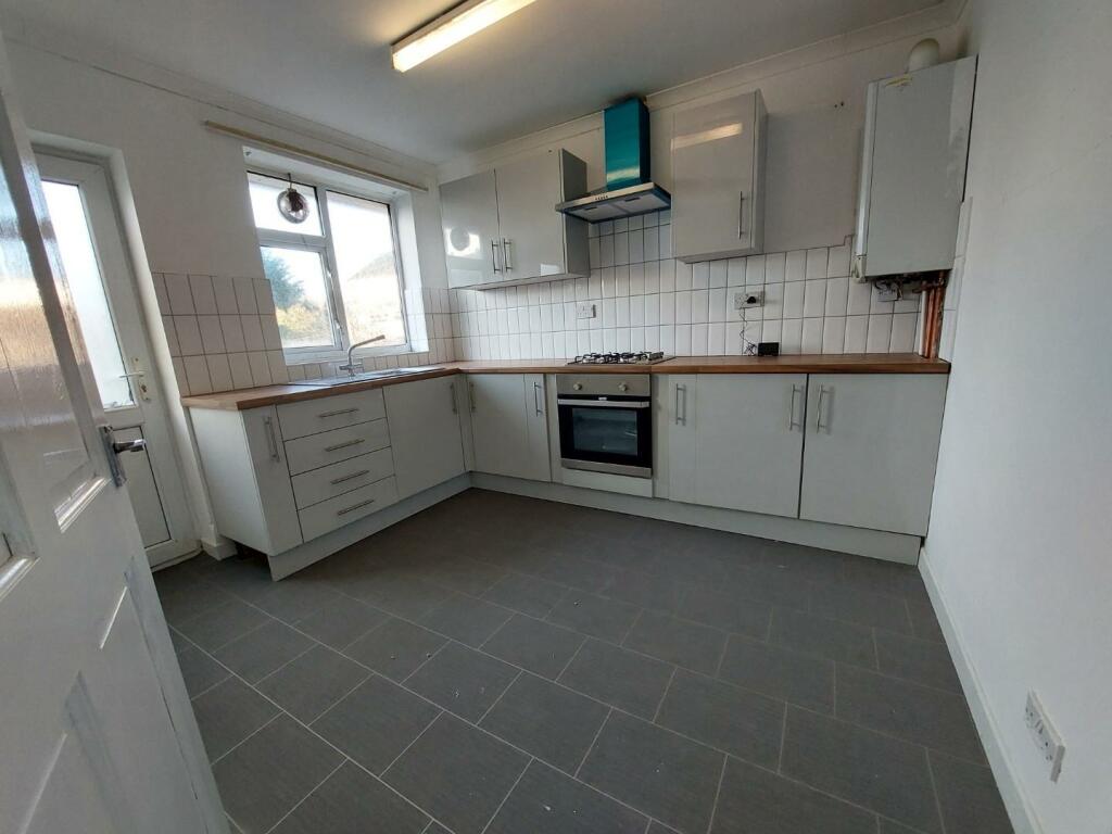
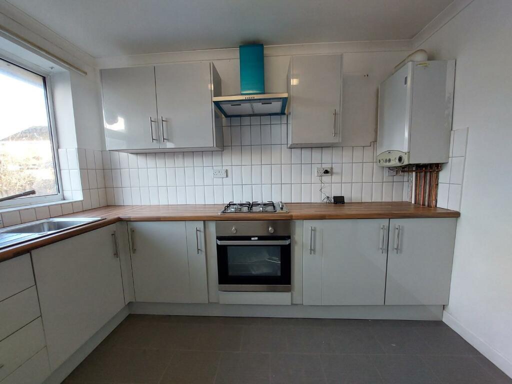
- New fitted kitchen with oven, hob and extractor fan
- 2 double bedrooms
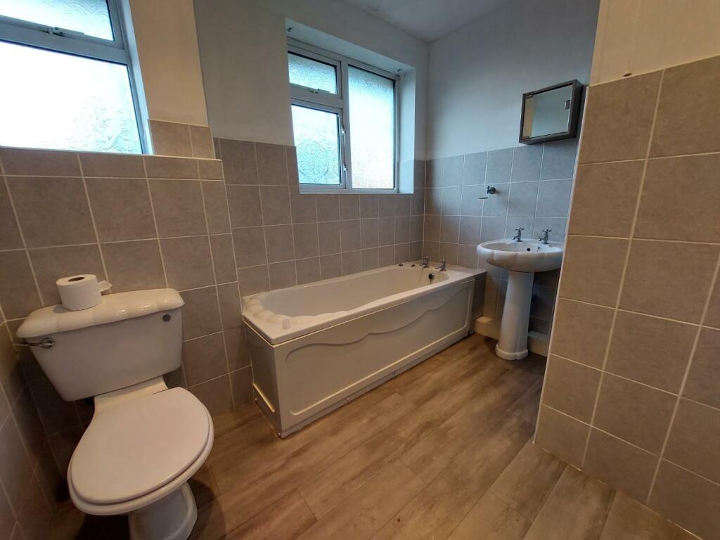
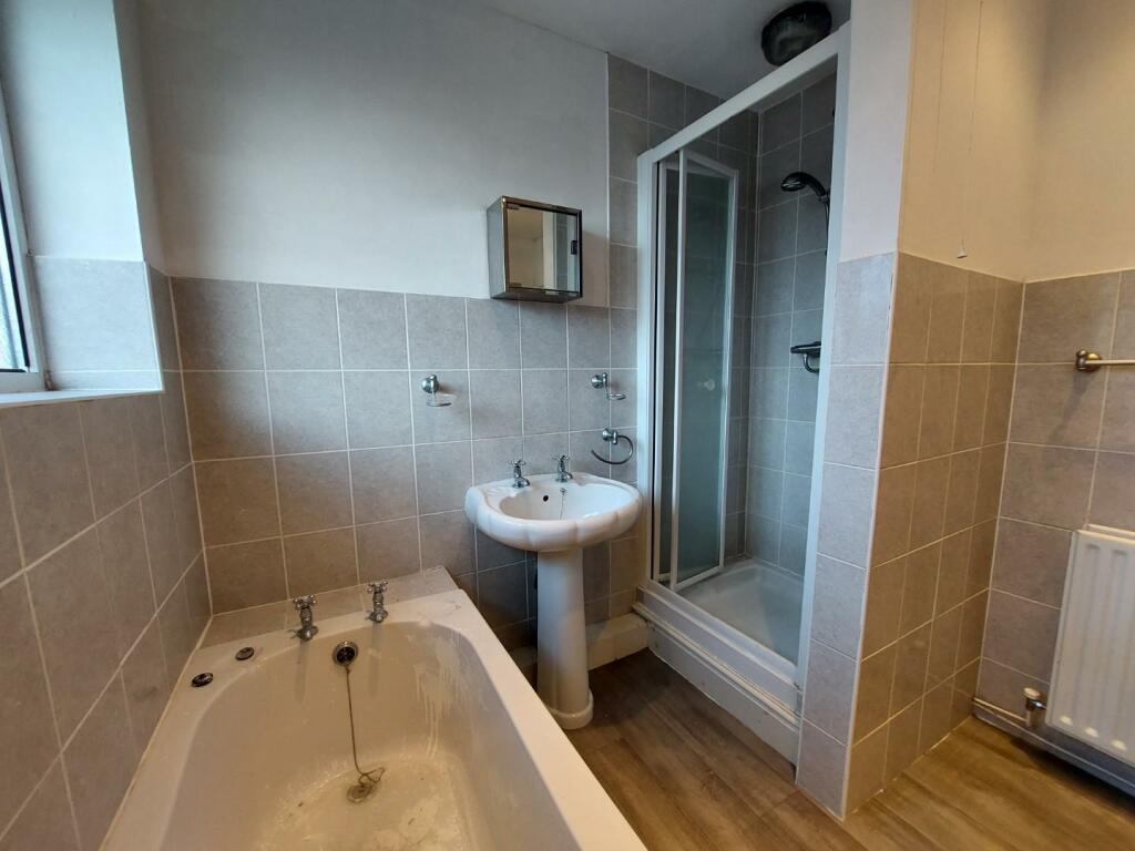
- Bathroom with separate shower enclosure
Additional details
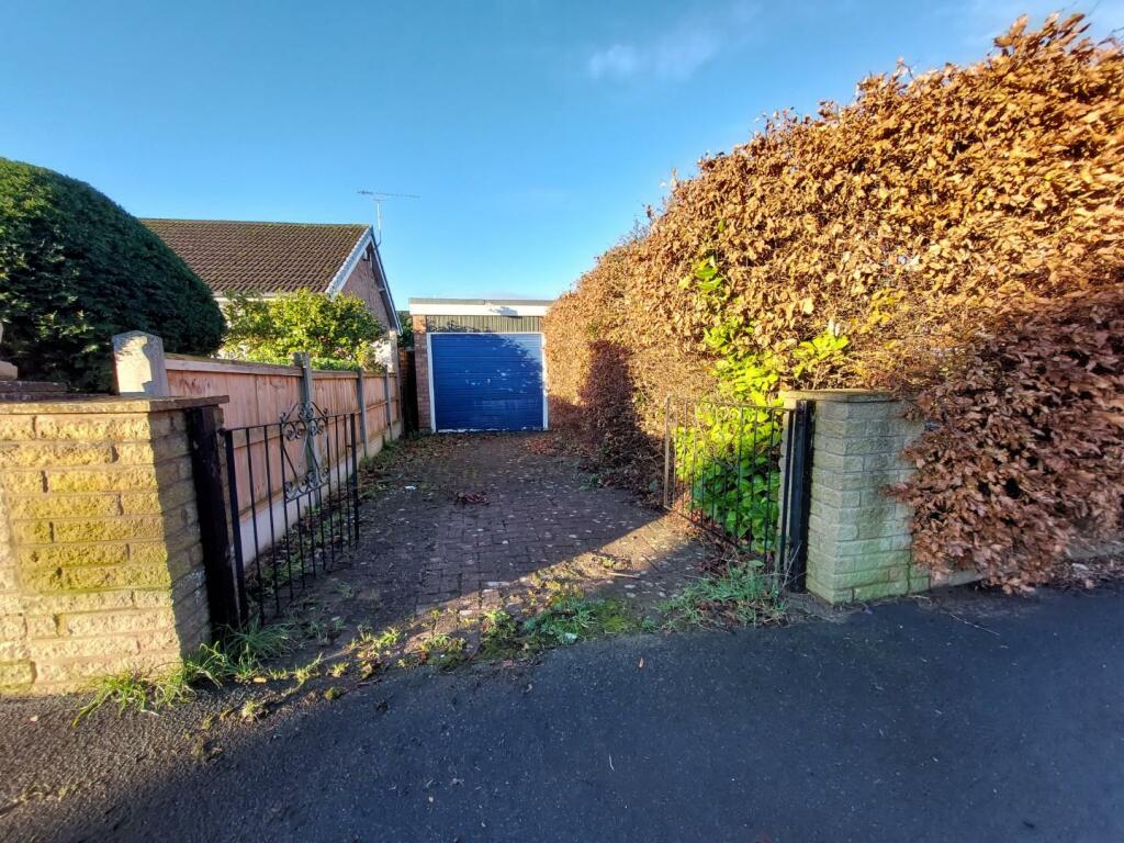
- Parking
- Yes
- Garden
- Yes
Description
There is a large garden to the front of the property and also to the rear. driveway and single garage.
Rent excludes all utilities, council tax band C
Listed by
Nantwich
Wright Lettings and Management
Reference: 142539053
EPC Rating & Upgrade Cost
Fetching EPC data… Refresh this page in a moment.
Flood risk
Zone: 1
Risk: Low
Job (default Low)
EPC Graphs
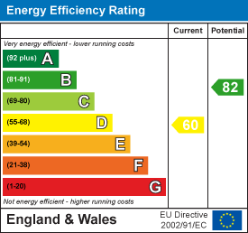
EE Rating
Rental Range
Estimated market rent for Cheshire East. Low = conservative, Realistic = average, Optimistic = best case.
Based on Local Authority from postcode lookup → Cheshire East.
LHA (30th percentile) floor for South Cheshire: £573/mo (Apr 2025 – Mar 2026)
Location
Nearby
Nearest stations, universities and amenities (distance from property).
| Type | Name | Distance |
|---|---|---|
| Shop | Bargain Booze | 0.1 miles |
| Shop | Klara's | 0.1 miles |
| Bus stop | Wistaston, Kings Drive / Shops | 0.1 miles |
| Train station | Crewe | 1.8 miles |
| Train station | Nantwich | 2.2 miles |
| University | University of Buckingham Crewe Campus | 2.4 miles |
| Hospital | Leighton Hospital | 2.7 miles |
| Hospital | Weaver Lodge Independent Hospital | 7.6 miles |
| University | Keele University | 10.1 miles |
Street-level crime
| Category | Count |
|---|---|
| Violence and sexual offences | 31 |
| Public order | 8 |
| Anti-social behaviour | 7 |
| Other theft | 6 |
| Burglary | 4 |
| Criminal damage and arson | 3 |
| Drugs | 2 |
| Shoplifting | 1 |
| Total incidents | 62 |
Within 1 mile during Apr 2026. Source: data.police.uk (England & Wales).
Schools nearby
Nearest open schools with Ofsted ratings (England). Closed schools are not shown. Data from Get Information about Schools and Ofsted.
| Name | Type | Distance | Ofsted |
|---|---|---|---|
| Wistaston Church Lane Academy | Primary | 0.1 miles | Good — 14 May 2019 |
| St Mary's Catholic Primary School, Crewe | Primary | 0.7 miles | Good — 13 Sep 2023 |
| St Thomas More Catholic High School | Secondary | 0.8 miles | — (Inspected (no overall grade)) |
| Vine Tree Primary School | Primary | 0.8 miles | Good — 12 Dec 2012 |
| Willaston Primary Academy | Primary | 0.8 miles | Good — 17 Oct 2013 |
Rental Comparables
Rental comparables are temporarily unavailable while listing-site fetches are paused. Try again later.