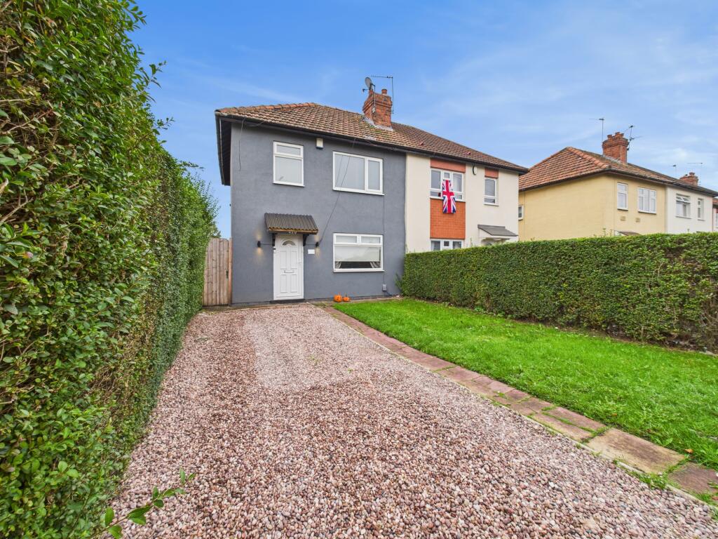
420 HARVEY ROAD
DERBY, CITY OF DERBY DE24 8JX
£975 pcm


Property details
Floor area
68 m²
Council tax band
A
EPC rating
D
Year built
England and Wales: 1930-1949
Deprivation
Decile 2 (3,963 of 33,755)
Street crime
448 incidents within 1 mile (Apr 2026)
Key features
- Available Now
- EPC - D
- Council Tax Band - A
- Driveway
- Close To Local Amenities
- Three Bedrooms
Additional details
- Parking
- Yes
- Garden
- Yes
Description
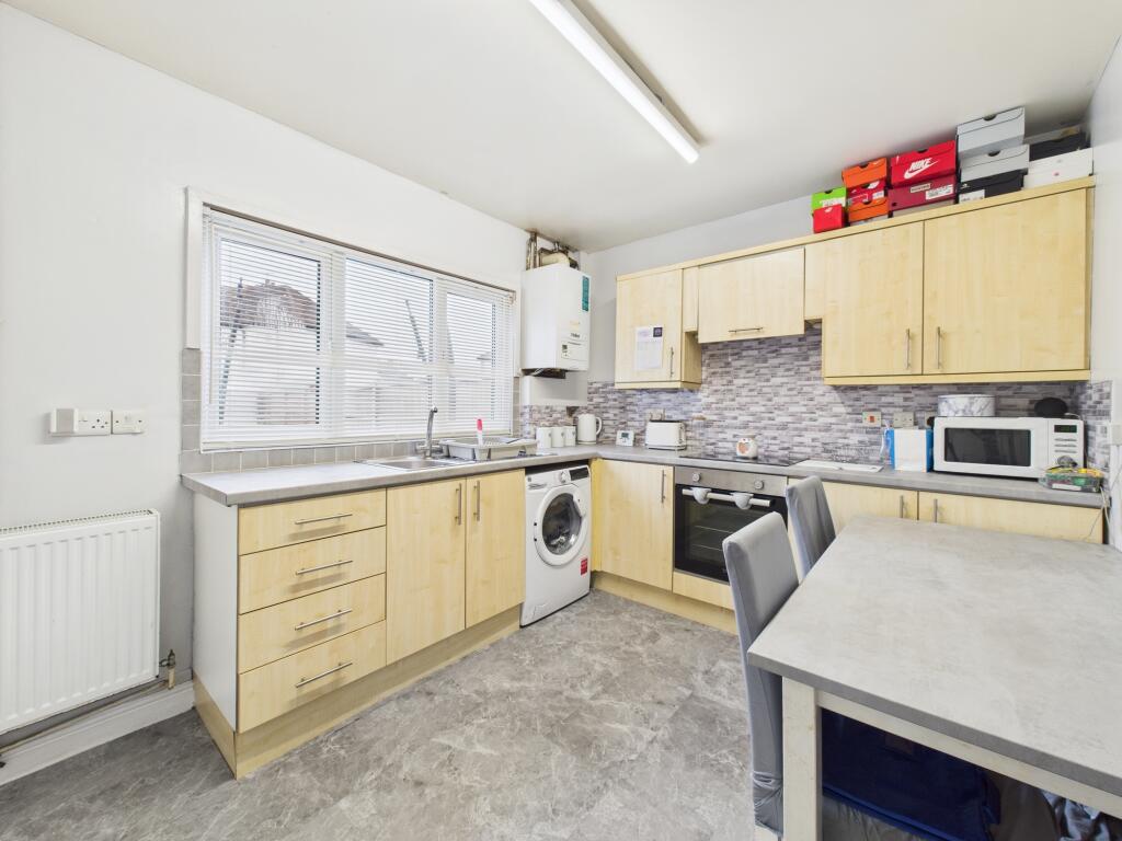
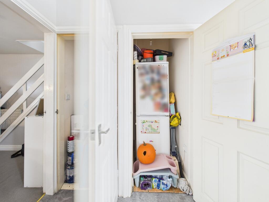
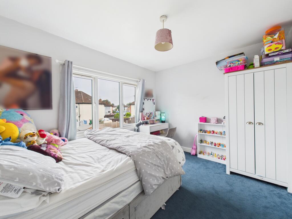
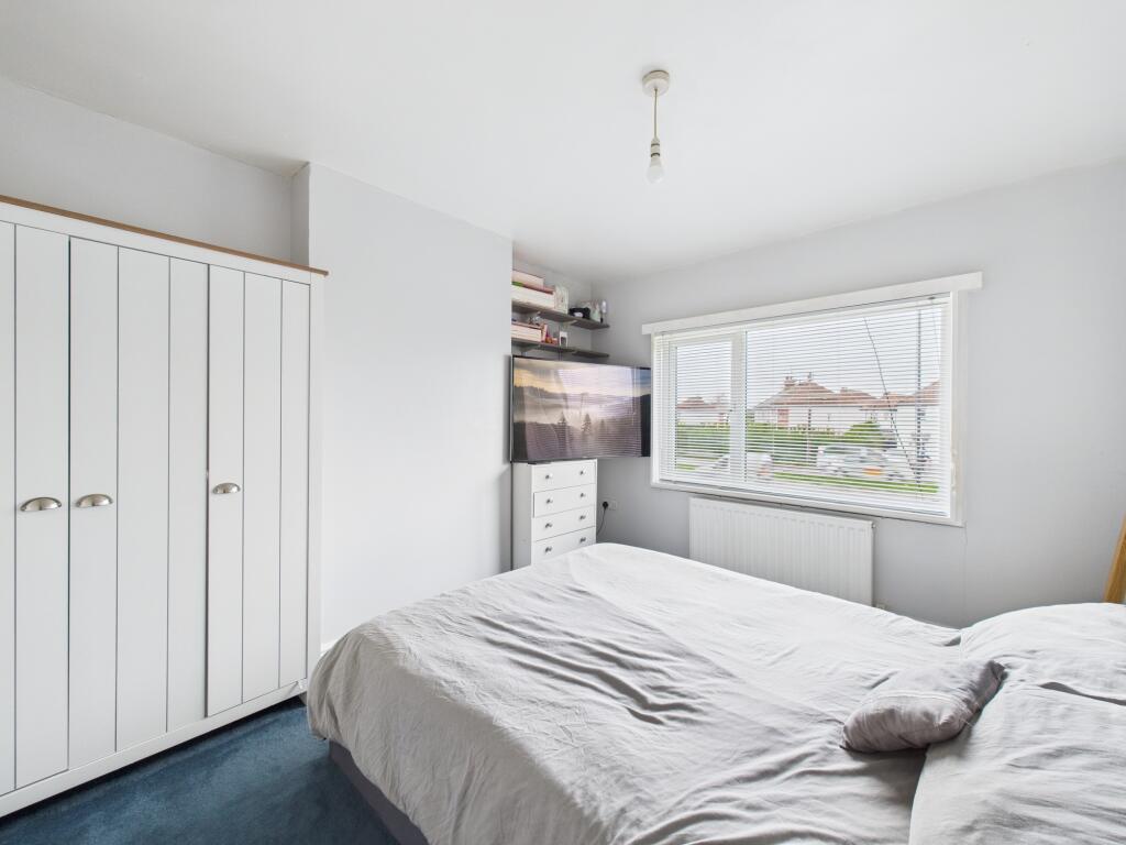
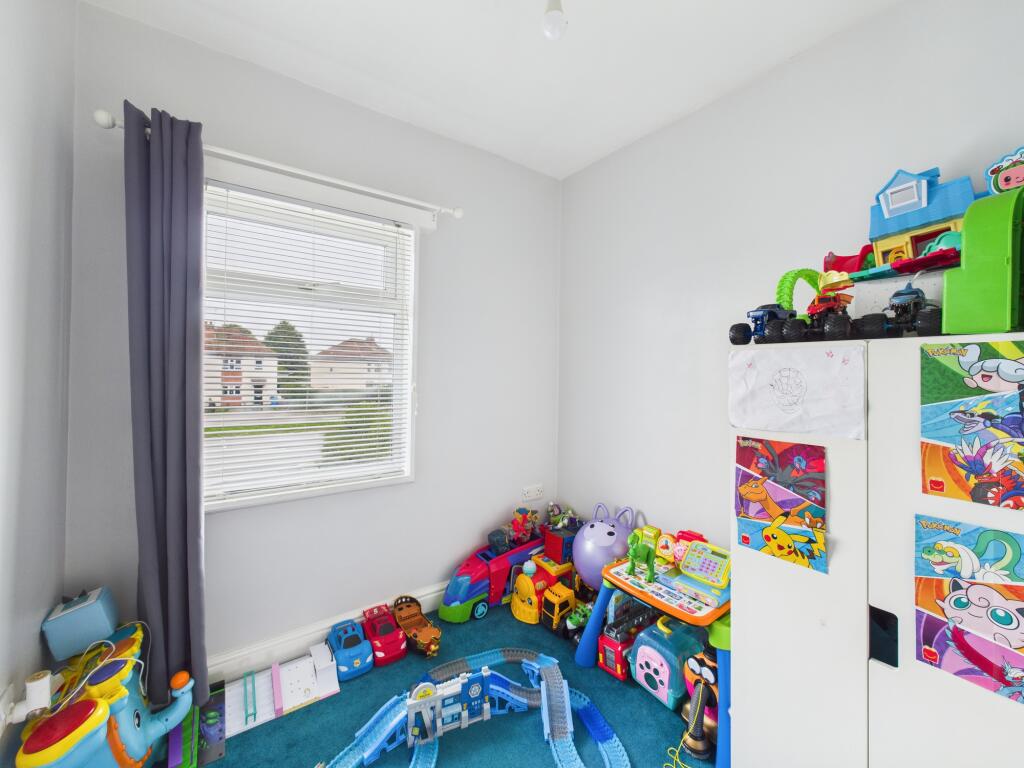
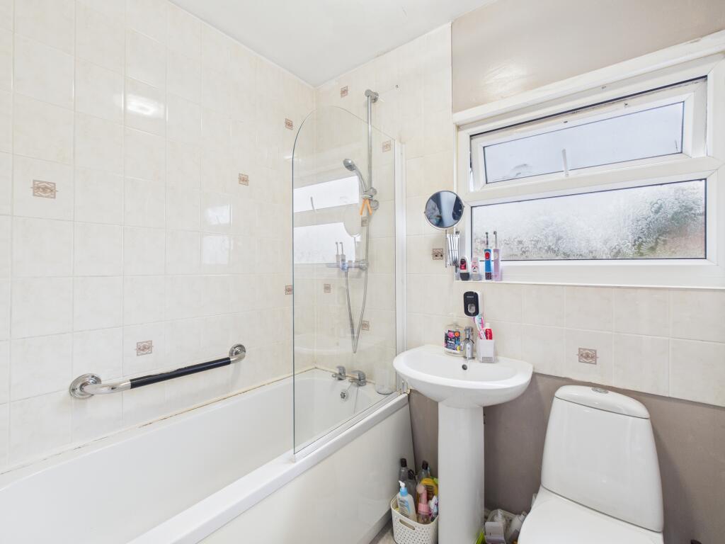
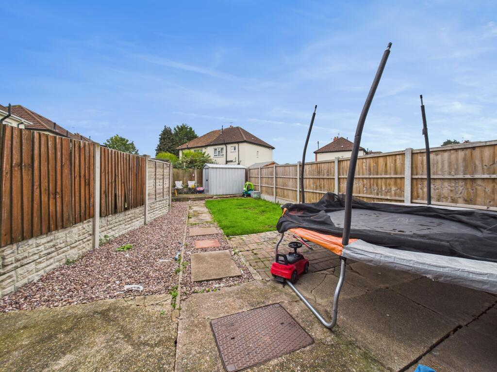
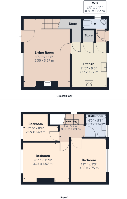
The accommodation in brief comprises: a spacious lounge to the front, a kitchen/diner to the rear with two storage spaces and a rear lobby leading through to a downstairs W.C and the back door. To the first floor are three good sized bedrooms and the family bathroom. To the front of the property is a front garden and driveway providing off road parking whilst to the rear is a good size garden with fenced boundaries, lawn and patio area.
Harvey Road lies convenient for local amenities including shops and schools together with good road links with the A50, A52, access for East Midlands Airport and the M1 motorway.
Listed by
Chellaston
Hannells Estate Agents
Reference: 172308338
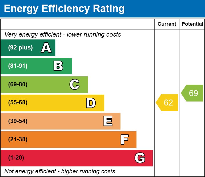
EPC Rating & Upgrade Cost
Current rating: D
Potential rating: C
Inspection date: 21/10/2025
Expiry date: 20/10/2035
Current heating cost: £973/year
Potential heating cost: £921/year
Est. upgrade cost to C: £16,500
Recommendations
- Floor insulation (solid floor) (£5,000 - £10,000)
- Solar photovoltaic panels, 2.5 kWp (£8,000 - £10,000)
Flood risk
Zone: 1
Risk: Low
Job (default Low)
Floorplans
FP
EPC Graphs
EE

EPC Report
FENSA Certificates
This property has 1 FENSA certificate(s) on record, indicating window/door installations by FENSA-approved installers.
FENSA Certificate #3547529
Property Details
Street: 420 Harvey Road
Town: DERBY
Postcode: DE24 8JX
Installation Details
Items: 1 window
Certificate Issued: 13/03/2006
Work Completed: 20/02/2006
This certificate data was retrieved from FENSA's database
What is FENSA? FENSA (Fenestration Self-Assessment Scheme) is a government-authorised scheme that monitors building regulation compliance for replacement windows and doors. Certificates indicate that work was completed by FENSA-approved installers.
Rental Range
Estimated market rent for Derby. Low = conservative, Realistic = average, Optimistic = best case.
Based on Local Authority from postcode lookup → Derby.
LHA (30th percentile) floor for Derby: £698/mo (Apr 2025 – Mar 2026)
Location
Nearby
Nearest stations, universities and amenities (distance from property).
| Type | Name | Distance |
|---|---|---|
| Bus stop | The Mitre | 0.0 miles |
| Bus stop | Ashby Street | 0.1 miles |
| Shop | Spondon Florists | 0.1 miles |
| Shop | Betfred | 0.1 miles |
| Train station | Peartree | 1.0 miles |
| Train station | Derby | 1.8 miles |
| Hospital | Royal Derby Hospital | 3.0 miles |
| Hospital | Nuffield Health Derby Hospital | 3.4 miles |
| University | University of Derby | 3.8 miles |
Street-level crime
| Category | Count |
|---|---|
| Violence and sexual offences | 189 |
| Anti-social behaviour | 58 |
| Shoplifting | 43 |
| Public order | 36 |
| Criminal damage and arson | 34 |
| Vehicle crime | 23 |
| Other theft | 20 |
| Drugs | 16 |
| Other crime | 10 |
| Burglary | 9 |
| Bicycle theft | 4 |
| Possession of weapons | 4 |
| Robbery | 1 |
| Theft from the person | 1 |
| Total incidents | 448 |
Within 1 mile during Apr 2026. Source: data.police.uk (England & Wales).
Schools nearby
Nearest open schools with Ofsted ratings (England). Closed schools are not shown. Data from Get Information about Schools and Ofsted.
| Name | Type | Distance | Ofsted |
|---|---|---|---|
| Lord Street Nursery School | Nursery | 0.3 miles | Good — 4 Nov 2013 |
| Alvaston Moor Academy | Secondary | 0.3 miles | Requires improvement — 18 Jan 2024 |
| Landau Forte Academy Moorhead | Primary | 0.3 miles | — (Inspected (no overall grade)) |
| Allenton Primary School | Primary | 0.3 miles | Good — 15 Nov 2017 |
| Ashwood Spencer Academy | Primary | 0.6 miles | Good — 30 Mar 2023 |
Rental Comparables
Loading rental comparables for this postcode. Refresh in a few minutes.