81 REDFERN CLOSE
SOLIHULL, WEST MIDLANDS B92 8SJ
£150,000
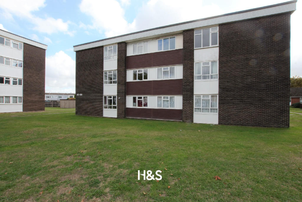

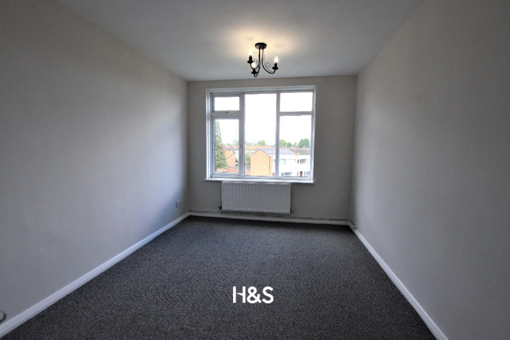
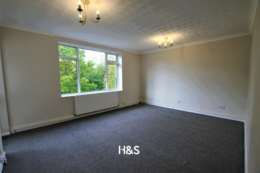
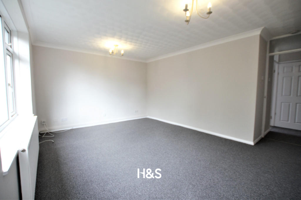
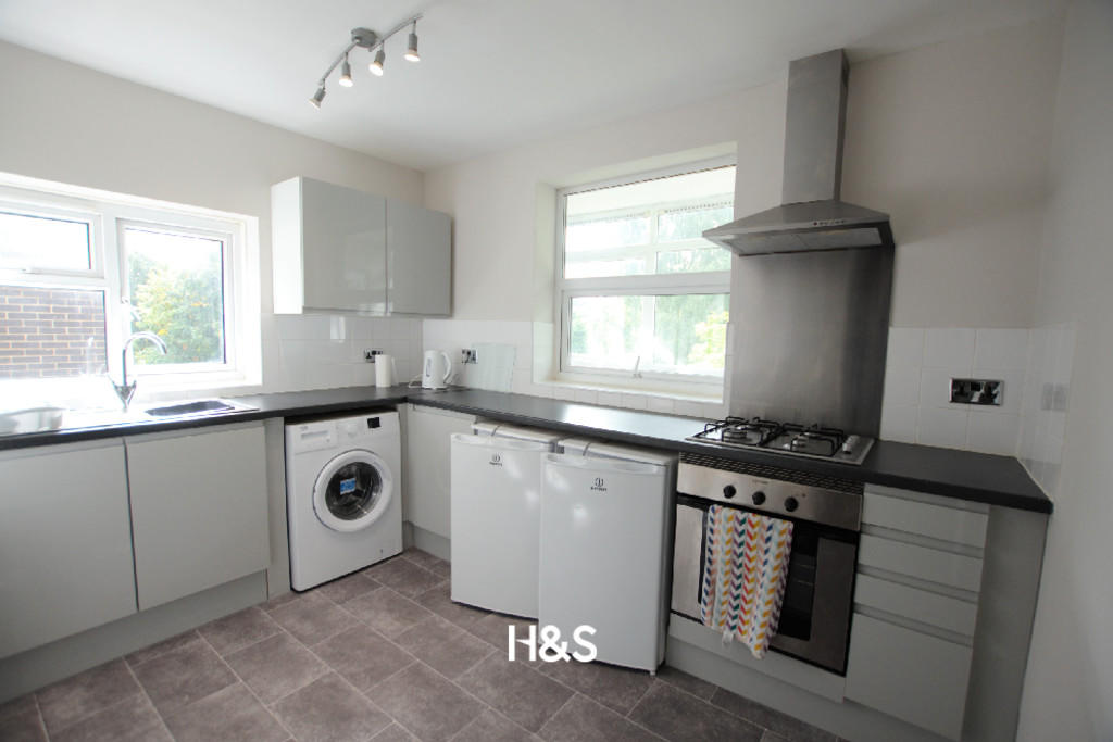
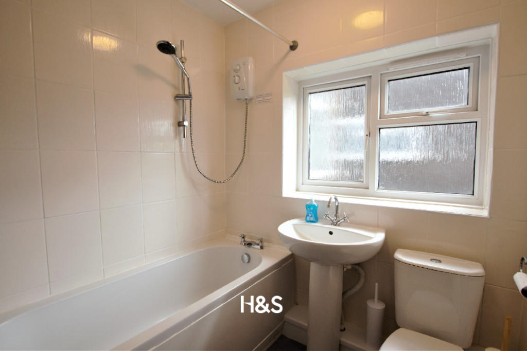
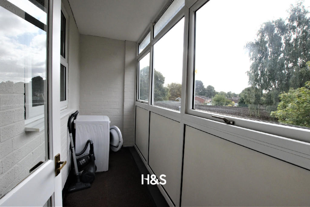
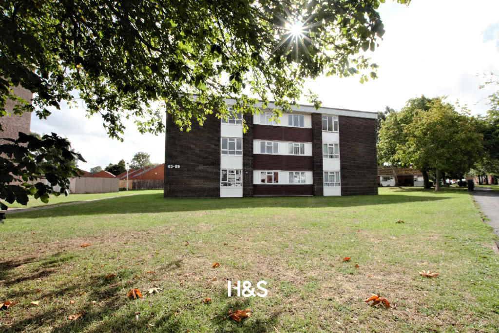
Photo 1 Photo 2 Photo 3 Photo 4 Photo 5 Photo 6 Photo 7 Photo 8 Photo 9
/ 9
Property details
Tenure
LEASEHOLD
Floor area
51 m²
Last sold
£147,000 Nov 2022
Local average
£169,243 (-11.4%)
Deprivation
Decile 3 (7,560 of 33,755)
Street crime
221 incidents within 1 mile (Apr 2026)
Additional details
- Parking
- Yes
Description
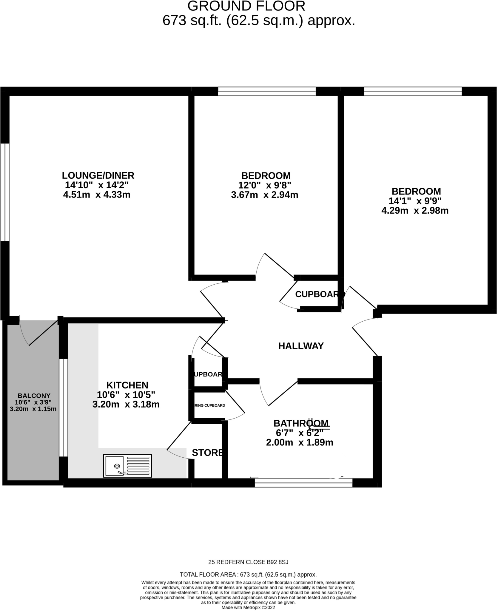
ON THE SECOND FLOOR
HALLWAY Central heating radiator, intercom system, doors off to lounge, bedrooms, bathroom and kitchen. Large useful storage cupboard housing electric consumer unit
BEDROOM ONE 13' 9" x 9' 8" (4.2m x 2.96m) Having a double-glazed window to the side elevation and central heating radiator
BEDROOM TWO 11' 11" x 9' 4" (3.64m x 2.85m) Having a double-glazed window to the side elevation and central heating radiator
LOUNGE 14' 10" x 11' 10" (4.54m x 3.63m) Having a double-glazed window to the rear elevation, central heating radiator and door onto enclosed balcony
ENCLOSED BALCONY 10' 5" x 3' 9" (3.2m x 1.16m) Double glazed windows to the rear elevation.
REFITTED KITCHEN 10' 8" x 7' 6" (3.26m x 2.3m) A range of eye and base level units with roll edge worktop, inset stainless steel electric oven, stainless steel gas hob and extractor, Space for fridge, freezer and washing machine, stainless steel sink with drainer and mixer tap, tiling to splashbacks, storage cupboard housing central heating combination boiler and gas meter, plus further built-in cupboard
BATHROOM Suite comprises pedestal sink with mixer tap and close coupled w.c, panel bath with mixer tap and triton power shower over, obscure double-glazed window to the side elevation, wall mounted central heating radiator and airing cupboard with wall heating radiator.
OUTSIDE There is unallocated parking at the front of the development.
**
Listed by
Shirley
Horton & Storey
Reference: 127010315
EPC Rating & Upgrade Cost
Fetching EPC data… Refresh this page in a moment.
Flood risk
Zone: 2
Risk: In flood risk area
Environment Agency Flood Risk Areas (APSFR)
Floorplans
Floorplan 1
EPC Graphs

EPC Front Page
FENSA Certificates
This property has 2 FENSA certificate(s) on record, indicating window/door installations by FENSA-approved installers.
FENSA Certificate #6471838
Property Details
Street: 81 Redfern Close
Town: SOLIHULL
Postcode: B92 8SJ
Installation Details
Items: 1 window
Certificate Issued: 13/04/2009
Work Completed: 30/03/2009
This certificate data was retrieved from FENSA's database
FENSA Certificate #2216443
Property Details
Street: 81 Redfern Close
Town: SOLIHULL
Postcode: B92 8SJ
Installation Details
Items: 1 window
Certificate Issued: 16/11/2004
Work Completed: 20/10/2004
This certificate data was retrieved from FENSA's database
What is FENSA? FENSA (Fenestration Self-Assessment Scheme) is a government-authorised scheme that monitors building regulation compliance for replacement windows and doors. Certificates indicate that work was completed by FENSA-approved installers.
Price history
| Event | Date | Price | % change |
|---|---|---|---|
| Sold | 25/11/2022 (3 years ago) | £147,000 | — |
Source: HM Land Registry Price Paid Data. Crown copyright.
Sold Comparables
Same street and nearby sales within 0.25 miles (last 5 years). Data from Land Registry Price Paid.
| Address | Price | Date | Type |
|---|---|---|---|
| 264 CASTLE LANE, SOLIHULL, WEST MIDLANDS, B92 8SN | £96,250 | 30/11/2023 | Flat |
| CHERRYWOOD COURT FLAT 14 MOORDOWN AVENUE, SOLIHULL, WEST MIDLANDS, B92 8QS | £145,000 | 28/07/2023 | Flat |
| 54 REDFERN CLOSE, SOLIHULL, WEST MIDLANDS, B92 8SL | £117,000 | 09/06/2023 | Flat |
| CHERRYWOOD COURT FLAT 9 MOORDOWN AVENUE, SOLIHULL, WEST MIDLANDS, B92 8QS | £160,000 | 23/03/2023 | Flat |
| 48 REDFERN CLOSE, SOLIHULL, WEST MIDLANDS, B92 8SL | £118,000 | 18/11/2022 | Flat |
| 310 CASTLE LANE, SOLIHULL, WEST MIDLANDS, B92 8SG | £110,000 | 21/10/2022 | Flat |
| CHERRYWOOD COURT FLAT 12 MOORDOWN AVENUE, SOLIHULL, WEST MIDLANDS, B92 8QS | £142,500 | 21/09/2021 | Flat |
| 5 REDFERN CLOSE, SOLIHULL, WEST MIDLANDS, B92 8SJ | £132,000 | 16/07/2021 | Flat |
| 20 OAKHAM WAY, SOLIHULL, WEST MIDLANDS, B92 8ST | £120,000 | 30/06/2021 | Flat |
Area average: £126,750 (9 sales)
Capital growth trend
Land Registry outcode average: last 12 months vs 5y and 10y ago (from sold prices).
House Price Index (HM Land Registry — official index, not sold-price averages): Solihull. Series: Flats and maisonettes. As of March 2026.
Rental Range
Estimated market rent for Solihull. Low = conservative, Realistic = average, Optimistic = best case.
Based on Local Authority from postcode lookup → Solihull.
LHA (30th percentile) floor for Solihull: £823/mo (Apr 2025 – Mar 2026)
Location
Nearby
Nearest stations, universities and amenities (distance from property).
| Type | Name | Distance |
|---|---|---|
| Bus stop | Highwood Ave / Castle Lane | 0.1 miles |
| Bus stop | Castle Lane / Highwood Ave | 0.1 miles |
| Shop | Vienna's Hair Salon | 0.3 miles |
| Shop | Launderette | 0.3 miles |
| Train station | Olton | 0.7 miles |
| Train station | Acocks Green | 1.5 miles |
| Hospital | Brian Oliver Centre | 2.9 miles |
| University | BIMM University Birmingham | 4.8 miles |
| University | University of Birmingham School of Dentistry | 5.4 miles |
| Hospital | Bromsgove Private Hospital | 11.8 miles |
Street-level crime
| Category | Count |
|---|---|
| Violence and sexual offences | 62 |
| Shoplifting | 54 |
| Vehicle crime | 26 |
| Criminal damage and arson | 16 |
| Anti-social behaviour | 13 |
| Public order | 11 |
| Other theft | 10 |
| Robbery | 10 |
| Burglary | 7 |
| Possession of weapons | 5 |
| Drugs | 4 |
| Other crime | 2 |
| Theft from the person | 1 |
| Total incidents | 221 |
Within 1 mile during Apr 2026. Source: data.police.uk (England & Wales).
Schools nearby
Nearest open schools with Ofsted ratings (England). Closed schools are not shown. Data from Get Information about Schools and Ofsted.
| Name | Type | Distance | Ofsted |
|---|---|---|---|
| Ulverley School | Primary | 0.2 miles | Good — 18 Jun 2012 |
| St Andrew's Catholic Primary School | Primary | 0.3 miles | Good — 24 Nov 2016 |
| Olton Primary School | Primary | 0.6 miles | Good — 8 Mar 2023 |
| St Margaret's Church of England Primary School | Primary | 0.7 miles | Good — 19 Jan 2022 |
| Lyndon School | Secondary | 0.7 miles | Good — 5 May 2022 |
Rental Comparables
Residential lets from OpenRent and Rightmove for the area (same bedroom count). Use to validate rent estimates. Student lets are excluded.
| Title | Rent | Beds | Distance | As seen on |
|---|---|---|---|---|
| 2 Bed Maisonette, Rowood Drive, B92 | £950/mo | 2 | 1.03 miles | OpenRent |
| 2 Bed Flat, City Green Block A, B26 | £1,340/mo | 2 | 1.04 miles | OpenRent |
| 2 Bed Flat, Coventry Road, B26 | £1,350/mo | 2 | 1.06 miles | OpenRent |
| 2 Bed Flat, Etna House, B26 | £1,300/mo | 2 | 1.19 miles | OpenRent |
Average rent: £1,235/mo (4 listings)
Rent-driven metrics
Based on OpenRent comparables.
- Rent ratio — Monthly rent ÷ purchase price (1% rule). 1%+ = strong, 0.8–1% = okay, <0.8% = weak for cashflow.
- Max investor price — Rent ÷ 0.8%; the price at which rent would be 0.8% of price (Stoke-style target).
- Target investor price — Rent ÷ 1%; the price at which rent would be 1% of price (strong cashflow band).
- Gross yield — Annual rent as % of purchase price (no costs).
- Cost-to-rent — Price ÷ annual rent (from OpenRent comparables). Under 14× = strong, 14–16× = acceptable, 17×+ = compressed.
- Cashflow — Rent minus mortgage, 10% maintenance, £25/mo compliance. Assumes 75% LTV, 3.95% APR (5yr fixed), 25yr term.
- ROI — Annual profit ÷ cash in (deposit + 4% purchase costs).