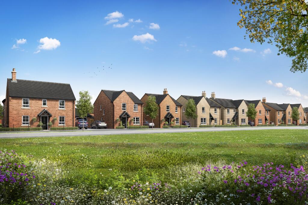
Eversley
DERBY ROAD, ASHBOURNE, YELDERSLEY, DERBYSHIRE DE6 1LS
£504,495
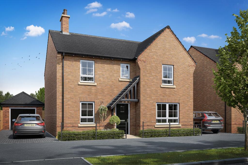

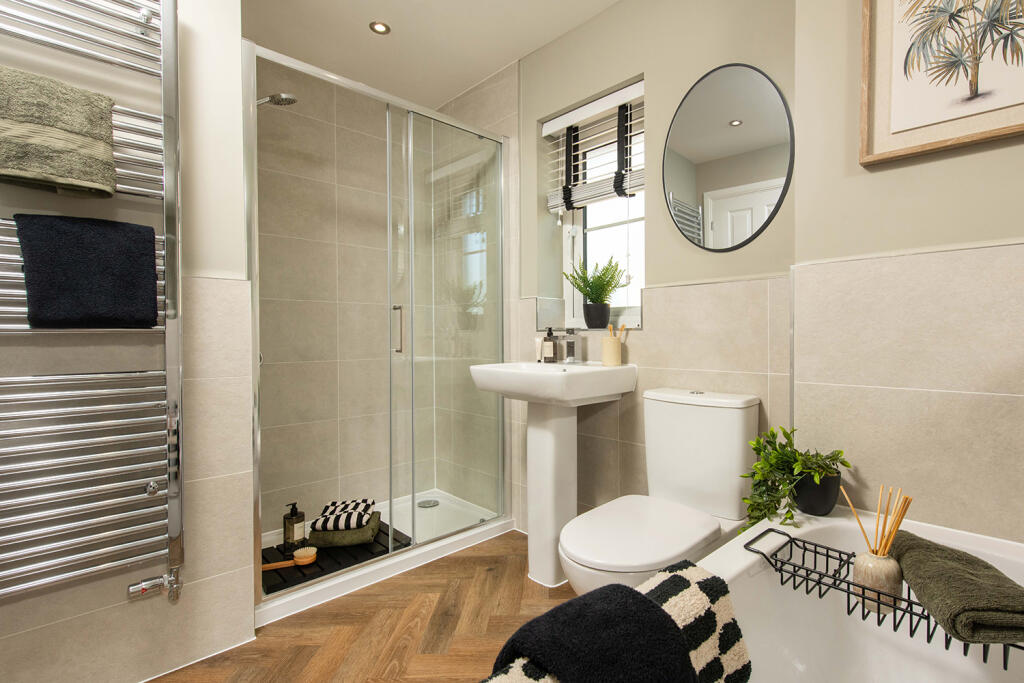
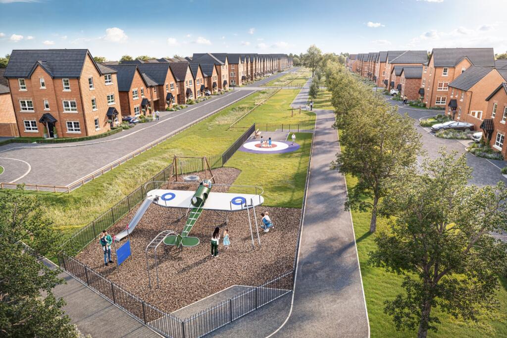
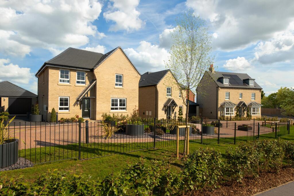
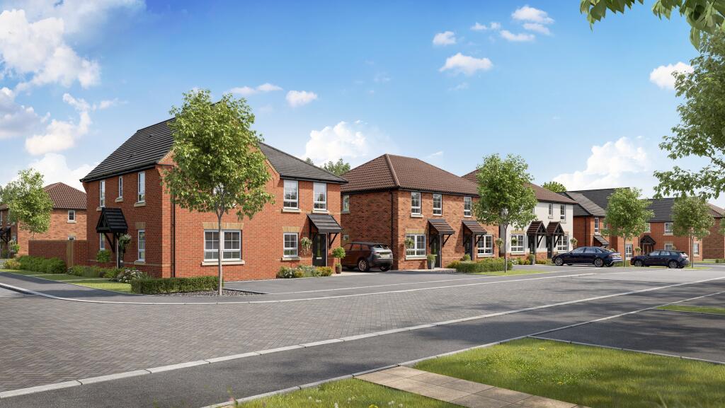
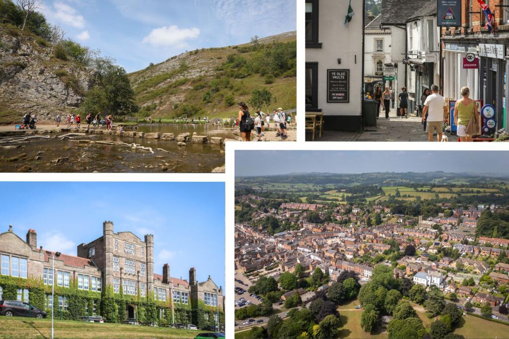
Fallow CGI external 1 Inside The Lamberton at Russet Park, Copmanthorpe Inside The Lamberton at Russet Park, Copmanthorpe Inside The Lamberton at Russet Park, Copmanthorpe Inside The Lamberton at Russet Park, Copmanthorpe Inside The Lamberton at Russet Park, Copmanthorpe Inside The Lamberton at Russet Park, Copmanthorpe Inside The Lamberton at Russet Park, Copmanthorpe Inside The Lamberton at Russet Park, Copmanthorpe Inside The Lamberton at Russet Park, Copmanthorpe Ashbourne Airfield street scene Ashbourne Airfield street scene Street scene at Ashbourne Airfield Ashbourne Airfield SC2 Ashbourne Airfield local area
/ 15
Property details
Floor area
281 m²
Last sold
£425,000 Jul 2004
Local average
£488,884 (+3.2%)
Deprivation
Decile 7 (22,038 of 33,755)
Street crime
1 incident within 1 mile (Apr 2026)
Key features
- Stamp Duty paid worth £15,224
- £5,000 moving cost contribution
- Upgraded kitchen package worth £1,748
- Flooring throughout worth £11,300
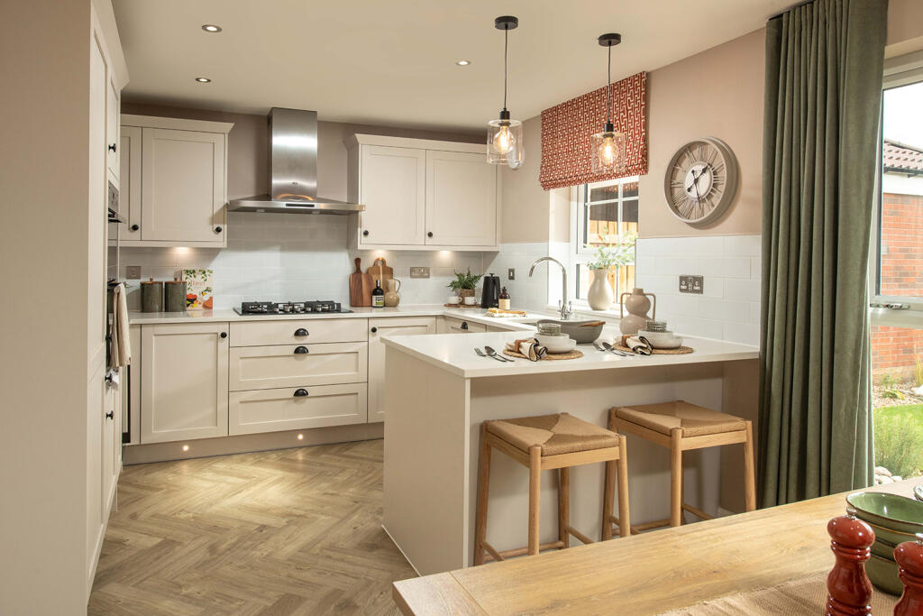
- Large open-plan kitchen
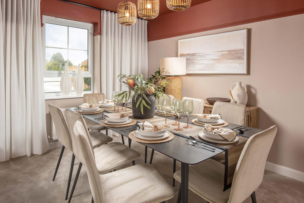
- Separate dining room
- 4 double bedrooms - main with en suite
- Single bedroom/home office
- Detached garage
- Private driveway parking for 2 cars
Additional details
- Parking
- Yes
- Garden
- Yes
Description
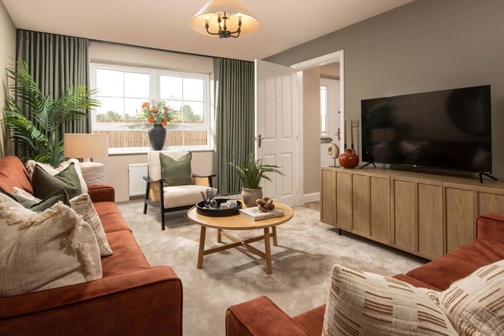
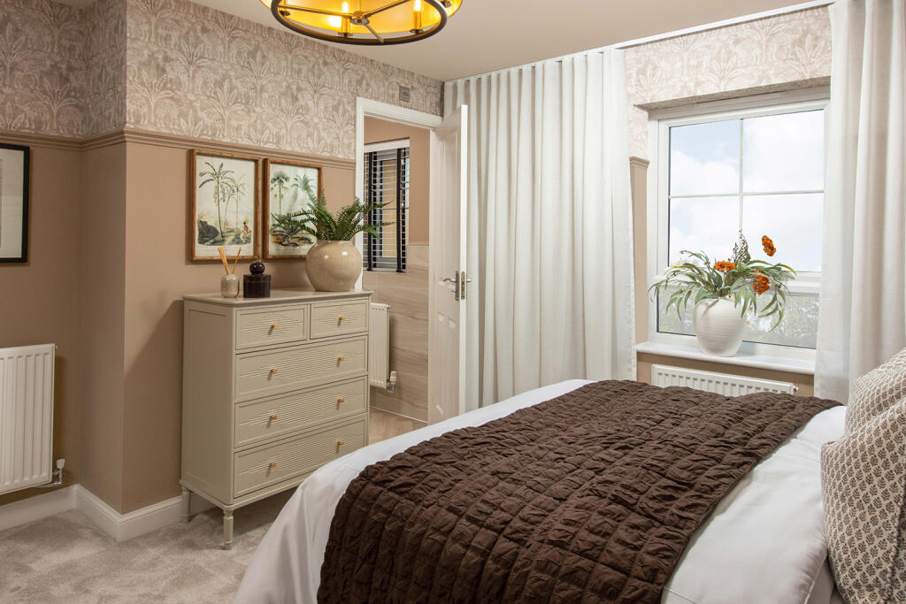
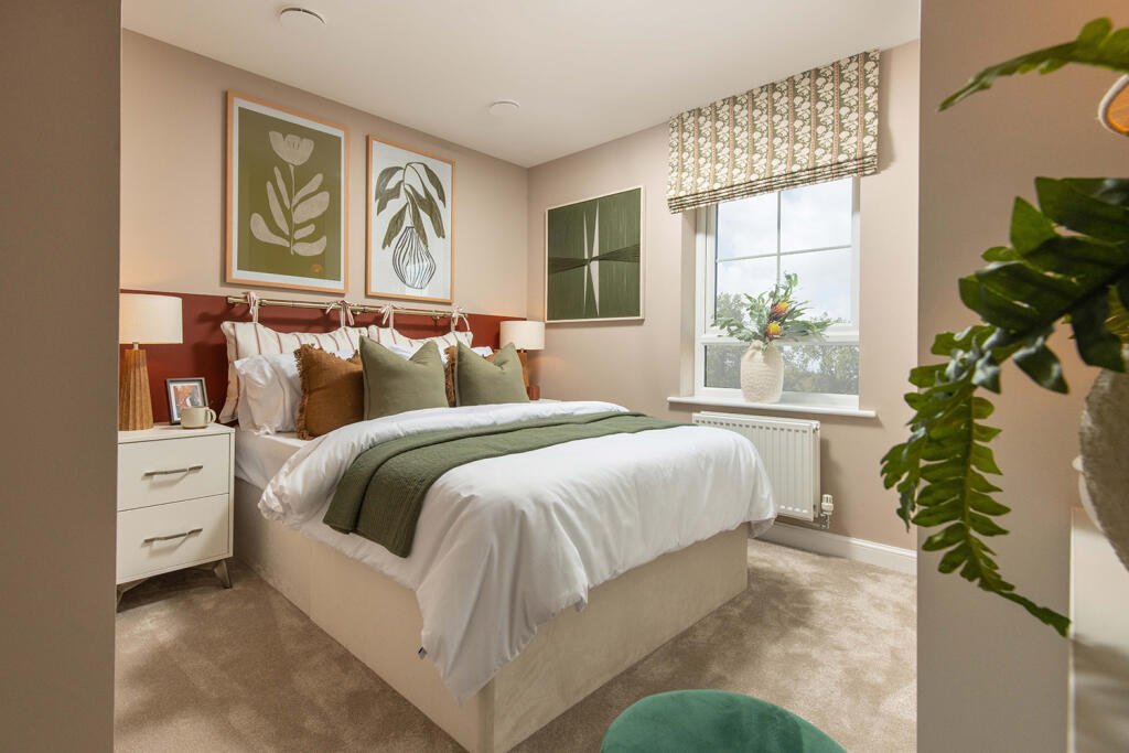
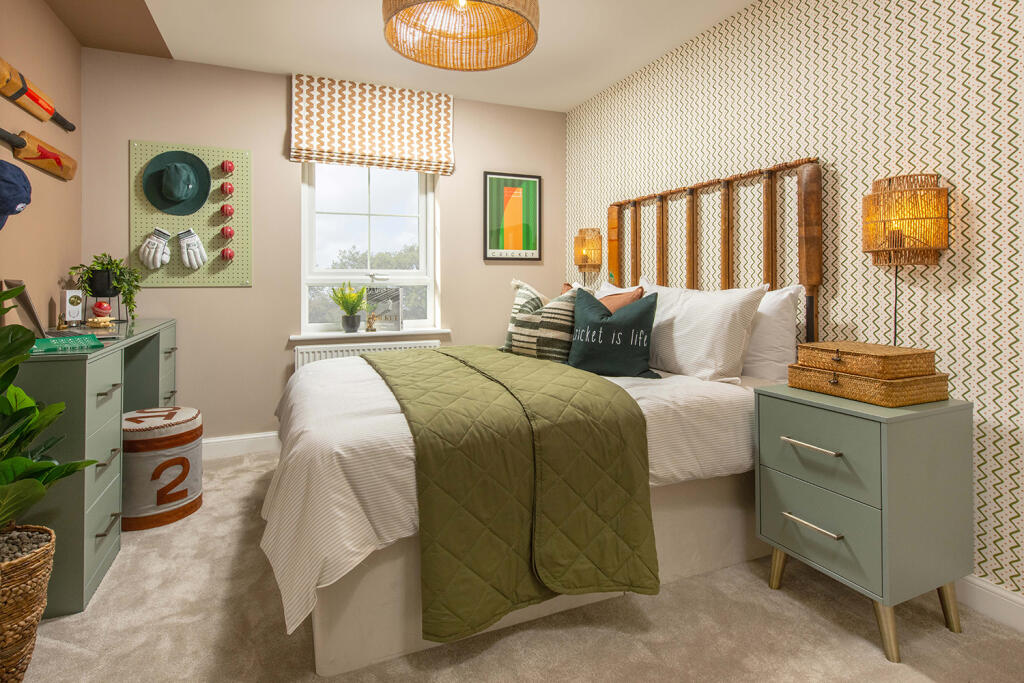
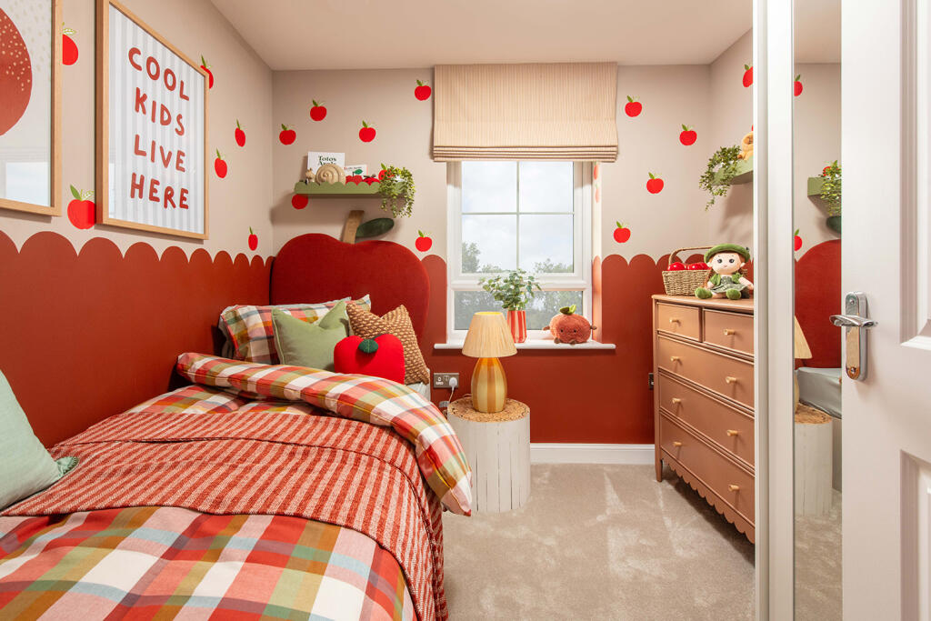
Your new home centres around the SPACIOUS open-plan kitchen with ample cupboard space and a bright and airy dining/family area overlooks the garden via French doors. The ground floor also includes a SEPARATE dining room and UTILITY. Upstairs features four GENEROUS DOUBLE bedrooms, main with EN SUITE, plus a single bedroom ideal as a home office. A detached garage and driveway parking complete the home.
Plot 159 | Fallow | Ashbourne Airfield -
Situated within the Derbyshire Dales, Ashbourne Airfield is a unique new development, combining the character of a former RAF Airfield with modern, energy-efficient homes, it's a place full of charm and convenience. Throughout the development, you will enjoy green open spaces, including a landscaped area ideal for relaxing and connecting with neighbours.
Room Dimensions
1
Bathroom - 2304mm x 3052mm (7'6" x 10'0")Bedroom 1 - 3986mm x 3687mm (13'0" x 12'1")Bedroom 2 - 3444mm x 3865mm (11'3" x 12'8")Bedroom 3 - 3200mm x 4143mm (10'5" x 13'7")Bedroom 4 - 2975mm x 3791mm (9'9" x 12'5")Bedroom 5 - 1911mm x 2339mm (6'3" x 7'8")Ensuite 1 - 1483mm x 2054mm (4'10" x 6'8")G
Dining - 2722mm x 4116mm (8'11" x 13'6")Kitchen / Dining - 6765mm x 9358mm (22'2" x 30'8")Utility - 1477mm x 2152mm (4'10" x 7'0")WC - 1477mm x 1878mm (4'10" x 6'1")
Listed by
Ashbourne Airfield
Barratt Developments Plc
Reference: 173600360
EPC ratings on this postcode
We don't have a matched EPC for this property yet. Below are efficiency scores and details for other addresses on this postcode.
| Address | Current | Potential | Floor area | Age band | Type |
|---|---|---|---|---|---|
| 1 Osmaston Lane End, Yeldersley, ASHBOURNE | 66 | 81 | 147 m² | England and Wales: 1930-1949 | Detached |
| 1 Yeldersley Hall Cottages, Yeldersley, ASHBOURNE | 53 | 77 | 143 m² | England and Wales: 1930-1949 | Terraced |
| 2 Home Farm Cottage, Derby Road, Yeldersley, ASHBOURNE | 62 | 81 | 130 m² | England and Wales: before 1900 | Detached |
| 2 Osmaston Lane End, Yeldersley, ASHBOURNE | 65 | 81 | 111 m² | England and Wales: 1930-1949 | Detached |
| 3 Yeldersley Hall Cottages, Yeldersley, ASHBOURNE | 73 | 105 | 114 m² | England and Wales: 1900-1929 | Terraced |
| 4 Yeldersley Hall Cottages, Derby Road, Yeldersley, ASHBOURNE | 61 | 84 | 100 m² | England and Wales: 1900-1929 | Terraced |
| Derby Road Lodge, Yeldersley, ASHBOURNE | 72 | 93 | 102 m² | England and Wales: before 1900 | Detached |
| Derby Road Lodge, Yeldersley, ASHBOURNE | 43 | 93 | 104 m² | England and Wales: before 1900 | Detached |
| Eversley, Derby Road, ASHBOURNE | 73 | 77 | 281 m² | England and Wales: 1930-1949 | Detached |
| Eversley, Derby Road, Yeldersley, ASHBOURNE | 58 | 70 | 288 m² | England and Wales: 1950-1966 | Detached |
| Fernwood, Derby Road, Yeldersley, ASHBOURNE | 57 | 83 | 99 m² | England and Wales: before 1900 | Detached |
| Home Farm, Yeldersley, ASHBOURNE | 17 | 72 | 187 m² | England and Wales: 1900-1929 | Detached |
| Home Farm, Yeldersley, ASHBOURNE | 24 | 82 | 215 m² | England and Wales: 1930-1949 | Detached |
| Ians Oak, Yeldersley, ASHBOURNE | 64 | 76 | 362 m² | England and Wales: 1900-1929 | Detached |
| Ians Oak, Yeldersley, ASHBOURNE | 60 | 79 | 330 m² | England and Wales: 1900-1929 | Detached |
Flood risk
Zone: 1
Risk: Low
Job (default Low)
Floorplans
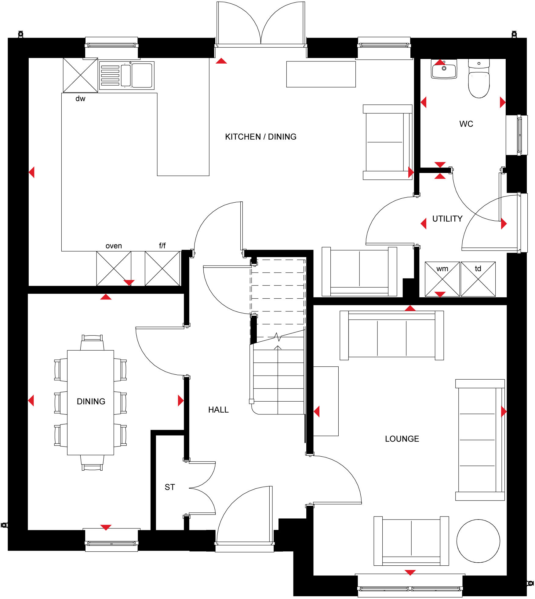
Fallow GF
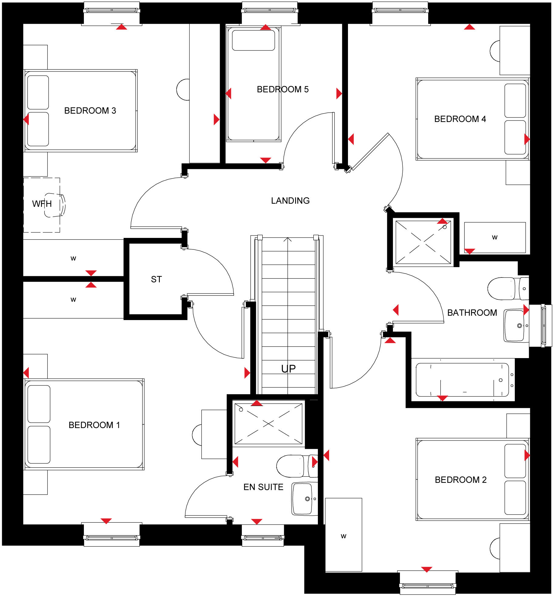
Fallow FF
Price history
517% since 1996
| Event | Date | Price | % change |
|---|---|---|---|
| Listed for sale | — | £504,495 | -9.1% |
| Sold | 07/07/2023 (2 years ago) | £555,000 | +30.6% |
| Sold | 22/07/2004 (21 years ago) | £425,000 | +372.2% |
| Sold | 11/07/1996 (29 years ago) | £90,000 | — |
Source: HM Land Registry Price Paid Data. Crown copyright.
Sold Comparables
Same street and nearby sales within 0.25 miles (last 5 years). Data from Land Registry Price Paid.
| Address | Price | Date | Type |
|---|---|---|---|
| 13 BOWER CLOSE, ASHBOURNE, DERBYSHIRE DALES, DERBYSHIRE, DE6 1TA | £418,000 | 07/01/2026 | Detached |
| 38 WINDMILL LANE, ASHBOURNE, DERBYSHIRE DALES, DERBYSHIRE, DE6 1EY | £650,000 | 18/12/2025 | Detached |
| 7 PREMIER AVENUE, ASHBOURNE, DERBYSHIRE DALES, DERBYSHIRE, DE6 1LH | £475,000 | 05/12/2025 | Detached |
| 65 LODGE FARM CHASE, ASHBOURNE, DERBYSHIRE DALES, DERBYSHIRE, DE6 1GY | £320,000 | 01/12/2025 | Detached |
| 11 SPIRE CLOSE, ASHBOURNE, DERBYSHIRE DALES, DERBYSHIRE, DE6 1DB | £725,000 | 01/12/2025 | Detached |
| 13 MUMFORD DRIVE, ASHBOURNE, DERBYSHIRE DALES, DERBYSHIRE, DE6 1BQ | £310,000 | 28/11/2025 | Detached |
| 16 MANOR ROAD, ASHBOURNE, DERBYSHIRE DALES, DERBYSHIRE, DE6 1EH | £425,000 | 25/11/2025 | Detached |
| BLACKTHORN COTTAGE, ATLOW, ASHBOURNE, DERBYSHIRE DALES, DERBYSHIRE, DE6 1NT | £657,352 | 21/11/2025 | Detached |
| LORASH THE CHANNEL, ASHBOURNE, DERBYSHIRE DALES, DERBYSHIRE, DE6 1FB | £160,000 | 20/11/2025 | Detached |
| 24 WYASTON ROAD, ASHBOURNE, DERBYSHIRE DALES, DERBYSHIRE, DE6 1TX | £410,000 | 07/11/2025 | Detached |
| THE MOUNT, PARWICH, ASHBOURNE, DERBYSHIRE DALES, DERBYSHIRE, DE6 1QJ | £340,000 | 21/03/2025 | Detached |
| 45 LODGE FARM CHASE, ASHBOURNE, DERBYSHIRE DALES, DERBYSHIRE, DE6 1GY | £344,000 | 12/03/2025 | Detached |
| TOLLGATE HOUSE DERBY ROAD, ASHBOURNE, DERBYSHIRE DALES, DERBYSHIRE, DE6 1LZ | £425,000 | 06/03/2025 | Detached |
| 7 HOLLY CLOSE, ASHBOURNE, DERBYSHIRE DALES, DERBYSHIRE, DE6 1HN | £270,000 | 14/02/2025 | Detached |
| 39 LODGE FARM CHASE, ASHBOURNE, DERBYSHIRE DALES, DERBYSHIRE, DE6 1GY | £350,000 | 07/02/2025 | Detached |
| 33 TUTBURY HOLLOW, ASHBOURNE, DERBYSHIRE DALES, DERBYSHIRE, DE6 1TD | £537,500 | 09/08/2024 | Detached |
| 7 HERMITAGE CLOSE, ASHBOURNE, DERBYSHIRE DALES, DERBYSHIRE, DE6 1TG | £355,000 | 19/12/2023 | Detached |
| CHURCH LANE CORNER YEW TREE COTTAGE, FENNY BENTLEY, ASHBOURNE, DERBYSHIRE DALES, DERBYSHIRE, DE6 1LB | £300,000 | 19/12/2023 | Detached |
| 15 DUNCOMBE DRIVE, ASHBOURNE, DERBYSHIRE DALES, DERBYSHIRE, DE6 1LJ | £316,000 | 18/12/2023 | Detached |
| RUSSETS WYASTON ROAD, ASHBOURNE, DERBYSHIRE DALES, DERBYSHIRE, DE6 1DD | £425,000 | 07/12/2023 | Detached |
Area average: £410,643 (20 sales)
Capital growth trend
Land Registry outcode average: last 12 months vs 5y and 10y ago (from sold prices).
House Price Index (HM Land Registry — official index, not sold-price averages): Derbyshire Dales. Series: Detached. As of March 2026.
Rental Range
Estimated market rent for Derbyshire Dales. Low = conservative, Realistic = average, Optimistic = best case.
Based on Local Authority from postcode lookup → Derbyshire Dales.
LHA (30th percentile) floor for Peaks & Dales: £898/mo (Apr 2025 – Mar 2026)
Location
Address
Painter's Lane
Nearby
Nearest stations, universities and amenities (distance from property).
| Type | Name | Distance |
|---|---|---|
| Bus stop | Home Farm | 0.0 miles |
| Shop | The Co-operative Food | 1.3 miles |
| Shop | David Neill | 2.2 miles |
| Hospital | Saint Oswald's Hospital | 2.3 miles |
| Train station | Idridgehay | 5.9 miles |
| Train station | Shottle | 6.3 miles |
| University | University of Derby | 6.9 miles |
| Hospital | Royal Derby Hospital | 9.5 miles |
Street-level crime
| Category | Count |
|---|---|
| Public order | 1 |
| Total incidents | 1 |
Within 1 mile during Apr 2026. Source: data.police.uk (England & Wales).
Schools nearby
Nearest open schools with Ofsted ratings (England). Closed schools are not shown. Data from Get Information about Schools and Ofsted.
| Name | Type | Distance | Ofsted |
|---|---|---|---|
| Osmaston CofE (VC) Primary School | Primary | 0.5 miles | Good — 9 Jun 2024 |
| Bradley CofE Primary School | Primary | 1.5 miles | Good — 9 Jun 2015 |
| Hilltop Primary Academy | Primary | 1.7 miles | Requires improvement — 9 Nov 2022 |
| Ashbourne Primary School | Primary | 2.2 miles | Good — 7 Apr 2022 |
| St Oswald's CofE Primary School | Primary | 2.4 miles | Good — 28 Feb 2019 |
Rental Comparables
Loading rental comparables for this postcode. Refresh in a few minutes.
Rent-driven metrics
Based on Area rent estimate.
- Rent ratio — Monthly rent ÷ purchase price (1% rule). 1%+ = strong, 0.8–1% = okay, <0.8% = weak for cashflow.
- Max investor price — Rent ÷ 0.8%; the price at which rent would be 0.8% of price (Stoke-style target).
- Target investor price — Rent ÷ 1%; the price at which rent would be 1% of price (strong cashflow band).
- Gross yield — Annual rent as % of purchase price (no costs).
Enter House Number
Enter the house number to help us retrieve more accurate pricing history and property data.
Please log in to submit or correct the house number for this listing.
Log in to continue