Penny Brook Fold
Hazel Grove, Stockport, SK7, SK7 4LU
£74,950
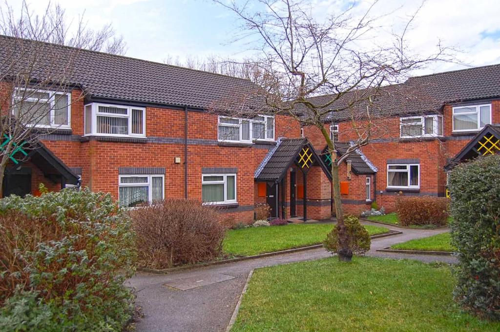
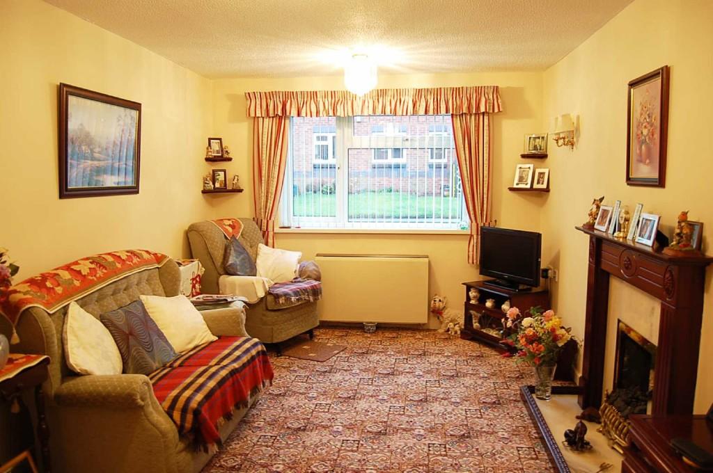
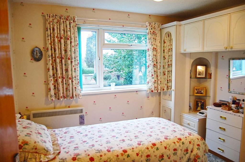
Photo 1 Photo 2 Photo 3
/ 3
Property details
Tenure
LEASEHOLD
Last sold
£120,000
Local average
£357,001 (-79%)
Deprivation
Decile 7 (20,293 of 33,755)
Street crime
2 incidents within 1 mile (Apr 2026)
Description
Listed by
Hazel Grove
Andrew Snape
Reference: 33153571
EPC ratings on this postcode
We don't have a matched EPC for this property yet. Below are efficiency scores and details for other addresses on this postcode.
| Address | Current | Potential | Floor area | Age band | Type |
|---|---|---|---|---|---|
| 1 Penney Brook Fold, Hazel Grove, STOCKPORT | 69 | 79 | 56 m² | England and Wales: 1983-1990 | Flat |
| 10 PENNEY BROOK FOLD, BOSDEN AVENUE, HAZEL GROVE, STOCKPORT | 64 | 82 | 42 m² | England and Wales: 1983-1990 | Flat |
| 10, Penney Brook Fold, Hazel Grove, STOCKPORT | 67 | 80 | 48 m² | England and Wales: 1983-1990 | Flat |
| 15, Penny Brook Fold, Hazel Grove, STOCKPORT | 60 | 74 | 42 m² | England and Wales: 1983-1990 | Flat |
| 17 PENNEY BROOK FOLD, BOSDEN AVENUE, HAZEL GROVE, STOCKPORT | 73 | 80 | 45 m² | England and Wales: 1991-1995 | Flat |
| 17 Penney Brook Fold, Hazel Grove, STOCKPORT | 63 | 78 | 44 m² | England and Wales: 1983-1990 | Flat |
| 18 Penney Brook Fold, Hazel Grove, STOCKPORT | 77 | 81 | 49 m² | England and Wales: 1983-1990 | Flat |
| 19, Penny Brook Fold, Hazel Grove, STOCKPORT | 74 | 80 | 46 m² | England and Wales: 1976-1982 | Flat |
| 22 Penney Brook Fold, Hazel Grove, STOCKPORT | 72 | 79 | 41 m² | England and Wales: 1983-1990 | Flat |
| 23 Penney Brook Fold, Hazel Grove, STOCKPORT | 70 | 79 | 45 m² | England and Wales: 1983-1990 | Flat |
| 6 Penney Brook Fold, Hazel Grove, STOCKPORT | 68 | 78 | 54 m² | England and Wales: 1983-1990 | Flat |
| 6, Penny Brook Fold, Hazel Grove, STOCKPORT | 77 | 79 | 52 m² | England and Wales: 1983-1990 | Flat |
| 6, Penny Brook Fold, Hazel Grove, STOCKPORT | 77 | 79 | 52 m² | England and Wales: 1983-1990 | Flat |
| 7, Penny Brook Fold, Hazel Grove, STOCKPORT | 78 | 81 | 51 m² | England and Wales: 1991-1995 | Flat |
| 8 Penney Brook Fold, Hazel Grove, STOCKPORT | 70 | 77 | 63 m² | England and Wales: 1976-1982 | Flat |
Flood risk
Zone: 1
Risk: Low
Job (default Low)
Price history
66% since 2012
| Event | Date | Price | % change |
|---|---|---|---|
| Sold | 01/01/2025 (1 year ago) | £120,000 | +65.5% |
| Sold | 01/01/2012 (14 years ago) | £72,500 | — |
Source: HM Land Registry Price Paid Data. Crown copyright.
Sold Comparables
Same street and nearby sales within 0.25 miles (last 5 years). Data from Land Registry Price Paid.
| Address | Price | Date | Type |
|---|---|---|---|
| 8 HAZELWOOD ROAD, HAZEL GROVE, STOCKPORT, GREATER MANCHESTER, SK7 4LZ | £12,220 | 21/01/2025 | Other |
| 63B CLARENDON ROAD, HAZEL GROVE, STOCKPORT, GREATER MANCHESTER, SK7 4NT | £485,095 | 19/10/2022 | Other |
| 22 HAZELWOOD ROAD, HAZEL GROVE, STOCKPORT, GREATER MANCHESTER, SK7 4LZ | £440 | 21/04/2022 | Other |
Area average: £165,918 (3 sales)
Capital growth trend
Land Registry outcode average: last 12 months vs 5y and 10y ago (from sold prices).
House Price Index (HM Land Registry — official index, not sold-price averages): Stockport. Series: All dwelling types. As of March 2026.
Rental Range
Estimated market rent for Stockport. Low = conservative, Realistic = average, Optimistic = best case.
Based on Local Authority from postcode lookup → Stockport.
LHA (30th percentile) floor for Richmond & Hambleton: £549/mo (Apr 2025 – Mar 2026)
Location
Address
Penney Brook Fold
Nearby
Nearest stations, universities and amenities (distance from property).
| Type | Name | Distance |
|---|---|---|
| Bus stop | Hazel Grove, Bosden Fold Road / outside St Simon's School | 0.0 miles |
| Bus stop | Hazel Grove, Bosden Fold Road / near Farndon Avenue | 0.0 miles |
| Shop | Hazeldine's | 0.3 miles |
| Shop | Bicycle Smithy | 0.4 miles |
| Train station | Hazel Grove | 0.6 miles |
| Train station | Woodsmoor | 1.1 miles |
| Hospital | Newlands Care Home | 4.0 miles |
| Hospital | Withington Clinic | 5.7 miles |
| University | University of Manchester Fallowfield Campus | 5.8 miles |
| University | Fallowfield Reception and Richmond Amenities Building | 5.9 miles |
Street-level crime
| Category | Count |
|---|---|
| Violence and sexual offences | 2 |
| Total incidents | 2 |
Within 1 mile during Apr 2026. Source: data.police.uk (England & Wales).
Schools nearby
Nearest open schools with Ofsted ratings (England). Closed schools are not shown. Data from Get Information about Schools and Ofsted.
| Name | Type | Distance | Ofsted |
|---|---|---|---|
| St Simon's Catholic Primary School | Primary | 0.1 miles | Good — 1 Aug 2023 |
| Hazel Grove Primary School | Primary | 0.3 miles | Good — 12 Nov 2012 |
| Torkington Primary School | Primary | 0.6 miles | Good — 30 Oct 2012 |
| Dial Park Primary School | Primary | 0.7 miles | Good — 13 Mar 2023 |
| Lisburne School | Other | 0.7 miles | Outstanding — 27 Jun 2012 |
Rental Comparables
Rental listings exist nearby, but none matched the 2-bedroom count for this property.
Rent-driven metrics
Based on Area rent estimate.
- Rent ratio — Monthly rent ÷ purchase price (1% rule). 1%+ = strong, 0.8–1% = okay, <0.8% = weak for cashflow.
- Max investor price — Rent ÷ 0.8%; the price at which rent would be 0.8% of price (Stoke-style target).
- Target investor price — Rent ÷ 1%; the price at which rent would be 1% of price (strong cashflow band).
- Gross yield — Annual rent as % of purchase price (no costs).
Enter House Number
Enter the house number to help us retrieve more accurate pricing history and property data.
Please log in to submit or correct the house number for this listing.
Log in to continue