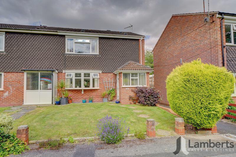
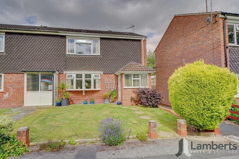
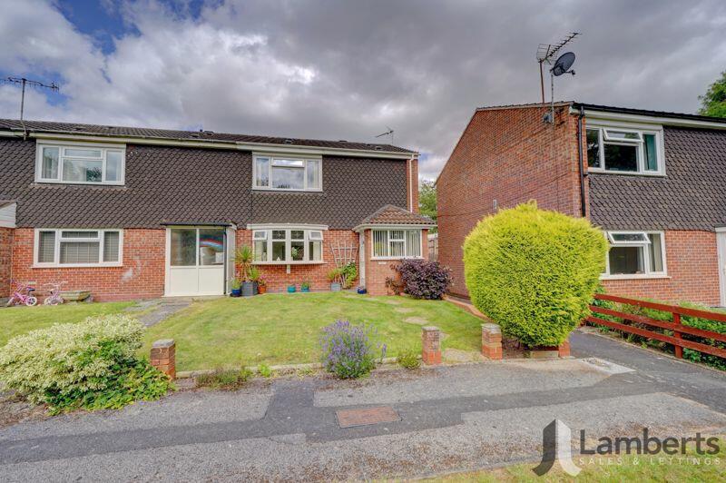
Lea Croft Road
Crabbs Cross, Redditch, B97 5LZ
Property details
Tenure
FREEHOLD
Council tax band
B
Last sold
£210,000
Local average
£220,600 (-4.8%)
Deprivation
Decile 5 (16,376 of 33,755)
Street crime
37 incidents within 1 mile (Apr 2026)
Key features
- Viewing Redditch Office
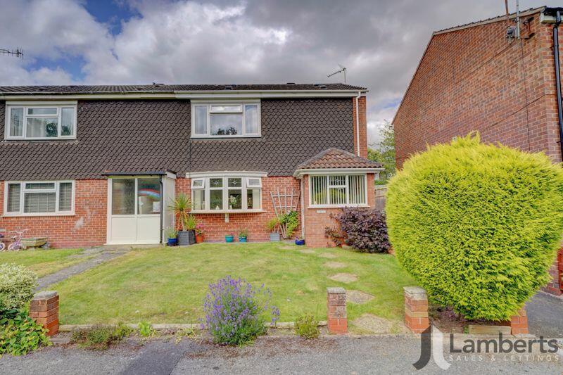
- Popular Crabbs Cross Location
- Close To Local Amenities And Popular Schooling
- Ideal Property For A First Time Buyer Or Investor
- Rent Potential Of £900 Per Month
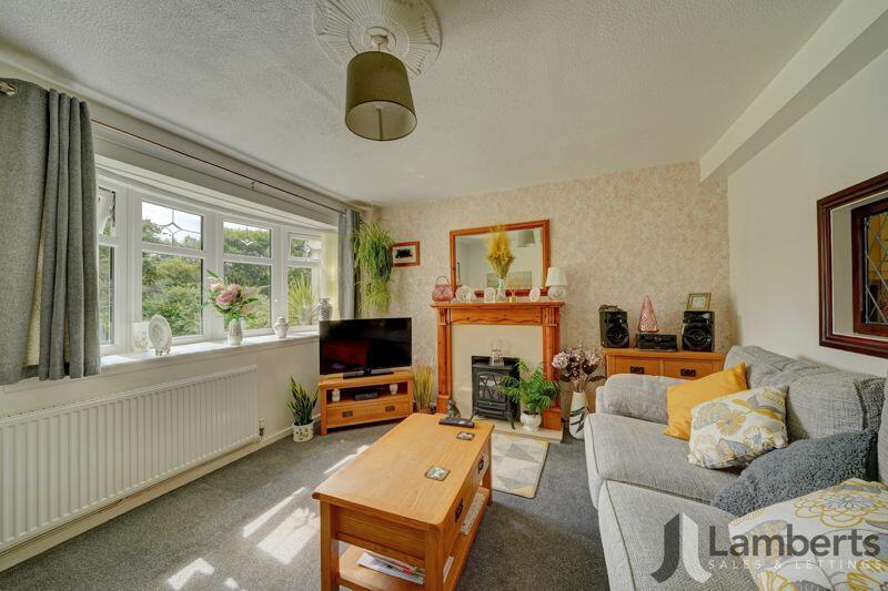
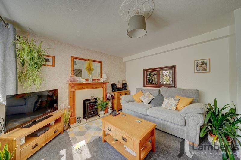
- A Very Well Presented Two Double Bedroom End Of Terrace House
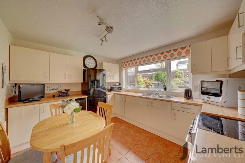
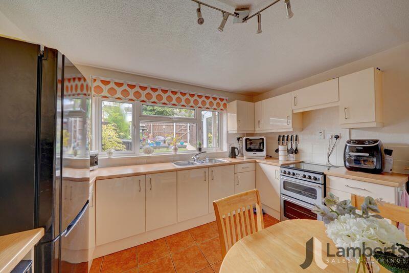
- Modern Kitchen/Diner
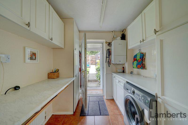
- Utility Room And Downstairs Cloakroom
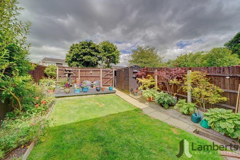
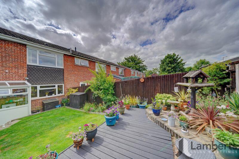
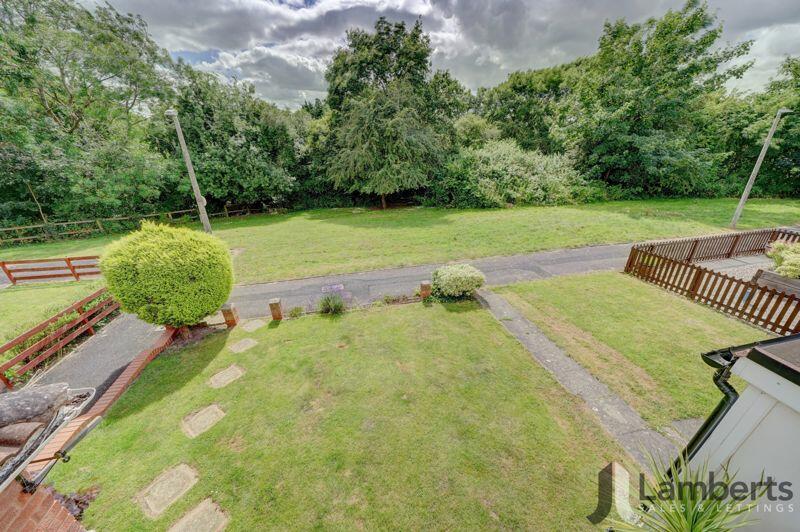
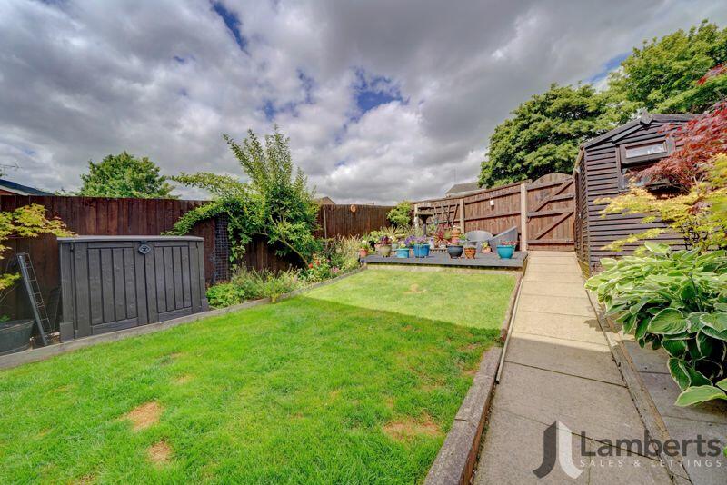
- Gardens To The Front And Rear
- Viewing Highly Advised
Additional details
- Parking
- Yes
- Garden
- Yes
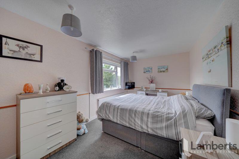
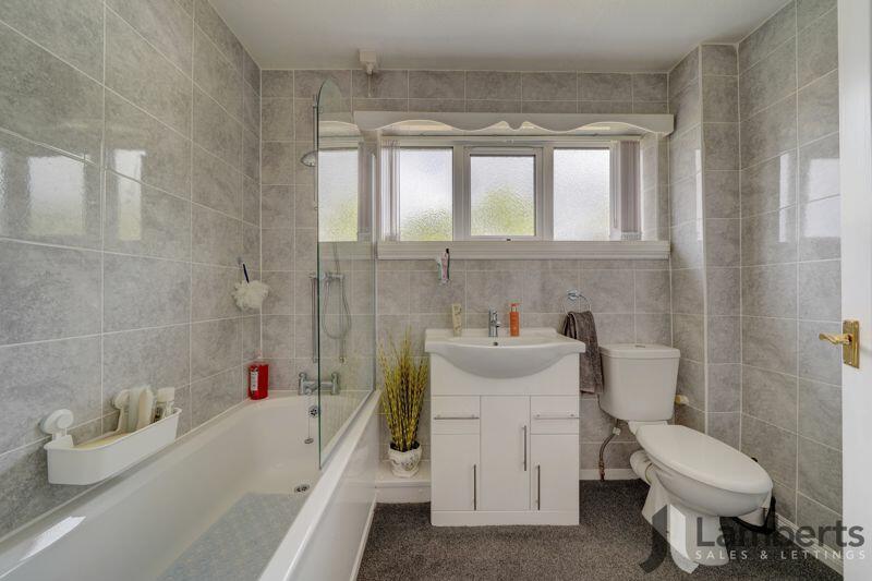
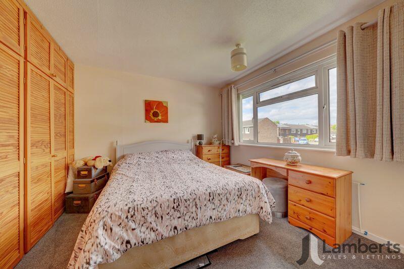
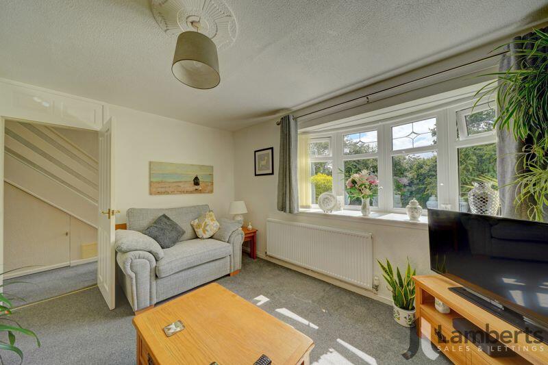
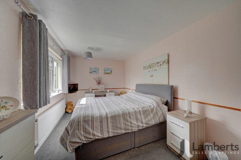
Description
Listed by
Worcestershire
Lamberts
Reference: 149662028
EPC ratings on this postcode
We don't have a matched EPC for this property yet. Below are efficiency scores and details for other addresses on this postcode.
| Address | Current | Potential | Floor area | Age band | Type |
|---|---|---|---|---|---|
| 44 Lea Croft Road, REDDITCH | 69 | 75 | 46 m² | England and Wales: 1967-1975 | Flat |
| 45 LEA CROFT ROAD, REDDITCH, REDDITCH | 69 | 75 | 46 m² | England and Wales: 1967-1975 | Flat |
| 46, Lea Croft Road, REDDITCH | 73 | 75 | 46 m² | England and Wales: 1991-1995 | Flat |
| 47 Lea Croft Road, REDDITCH | 72 | 92 | 45 m² | England and Wales: 1983-1990 | Detached |
| 47, Lea Croft Road, REDDITCH | 57 | 76 | 31 m² | England and Wales: 1967-1975 | Flat |
| 48, Lea Croft Road, REDDITCH | 74 | 77 | 47 m² | England and Wales: 1967-1975 | Flat |
| 50 LEA CROFT ROAD, REDDITCH | 43 | 79 | 47 m² | England and Wales: 1967-1975 | Flat |
| 52 Lea Croft Road, REDDITCH | 74 | 77 | 47 m² | England and Wales: 1967-1975 | Flat |
| 52, Lea Croft Road, REDDITCH | 70 | 77 | 47 m² | England and Wales: 1967-1975 | Flat |
| 53, Lea Croft Road, REDDITCH | 75 | 78 | 47 m² | England and Wales: 1967-1975 | Flat |
| 55, Lea Croft Road, REDDITCH | 75 | 78 | 47 m² | England and Wales: 1976-1982 | Flat |
| 57, Lea Croft Road, REDDITCH | 79 | 79 | 47 m² | England and Wales: 1976-1982 | Flat |
| 58 Lea Croft Road, REDDITCH | 75 | 77 | 48 m² | England and Wales: 1967-1975 | Flat |
| 59, Lea Croft Road, REDDITCH | 74 | 76 | 47 m² | England and Wales: 1967-1975 | Flat |
| 61, Lea Croft Road, REDDITCH | 67 | 87 | 72 m² | England and Wales: 1976-1982 | Terraced |
Flood risk
Zone: 1
Risk: Low
Job (default Low)
Floorplans
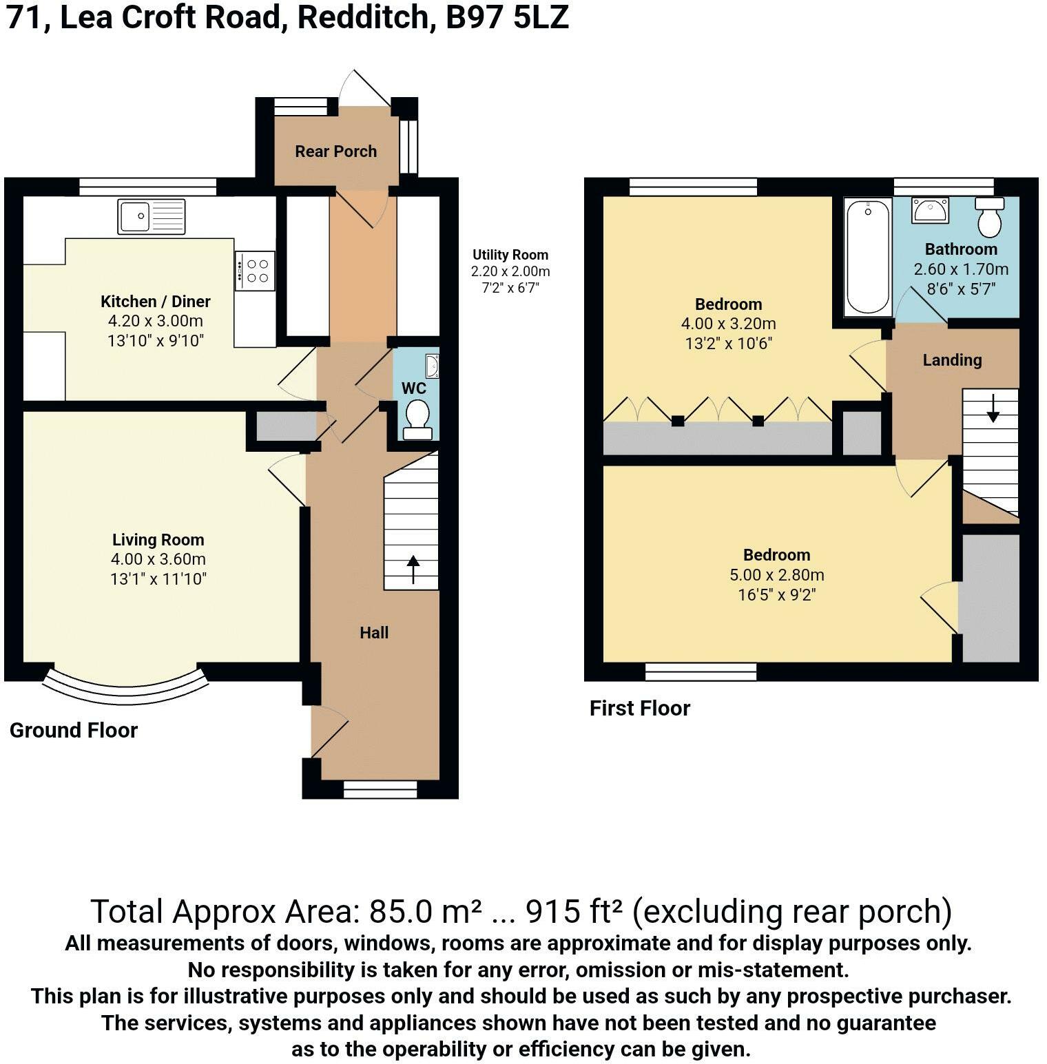
Floorplan 1
EPC Graphs

Energy Performance Certificate
Price history
338% since 1996
| Event | Date | Price | % change |
|---|---|---|---|
| Sold | 01/01/2024 (2 years ago) | £210,000 | +338% |
| Sold | 01/01/1996 (30 years ago) | £47,950 | — |
Source: HM Land Registry Price Paid Data. Crown copyright.
Sold Comparables
Same street and nearby sales within 0.25 miles (last 5 years). Data from Land Registry Price Paid.
| Address | Price | Date | Type |
|---|---|---|---|
| 16 ASHMORES CLOSE, REDDITCH, WORCESTERSHIRE, B97 5LP | £170,000 | 25/07/2025 | Terraced |
| 12 ASHMORES CLOSE, REDDITCH, WORCESTERSHIRE, B97 5LP | £220,000 | 18/07/2025 | Terraced |
| 23 LEA CROFT ROAD, REDDITCH, WORCESTERSHIRE, B97 5LY | £230,000 | 14/07/2025 | Terraced |
| 21 WELL CLOSE, REDDITCH, WORCESTERSHIRE, B97 5LU | £195,000 | 01/12/2023 | Terraced |
| 25 ASHMORES CLOSE, REDDITCH, WORCESTERSHIRE, B97 5LP | £208,000 | 02/10/2023 | Terraced |
| Same street 44 LEA CROFT ROAD, REDDITCH, WORCESTERSHIRE, B97 5LZ | £72,000 | 21/09/2023 | Flat |
| 8 WELL CLOSE, REDDITCH, WORCESTERSHIRE, B97 5LU | £185,000 | 28/04/2023 | Terraced |
| 19 WYCHWOOD DRIVE, REDDITCH, WORCESTERSHIRE, B97 5NW | £272,500 | 10/02/2023 | Terraced |
| 37 ASHMORES CLOSE, REDDITCH, WORCESTERSHIRE, B97 5LP | £205,000 | 31/10/2022 | Terraced |
| 17 SLIMBRIDGE CLOSE, REDDITCH, WORCESTERSHIRE, B97 5XL | £167,500 | 30/08/2022 | Terraced |
| 61 SLIMBRIDGE CLOSE, REDDITCH, WORCESTERSHIRE, B97 5XL | £119,830 | 29/07/2022 | Terraced |
| 33 ASHMORES CLOSE, REDDITCH, WORCESTERSHIRE, B97 5LP | £180,000 | 25/07/2022 | Terraced |
| 56 SLIMBRIDGE CLOSE, REDDITCH, WORCESTERSHIRE, B97 5XL | £200,000 | 30/05/2022 | Terraced |
| 23 ASHMORES CLOSE, REDDITCH, WORCESTERSHIRE, B97 5LP | £203,000 | 29/04/2022 | Terraced |
| 24 WELL CLOSE, REDDITCH, WORCESTERSHIRE, B97 5LU | £186,500 | 21/04/2022 | Terraced |
| 1 WELL CLOSE, REDDITCH, WORCESTERSHIRE, B97 5LU | £182,500 | 28/02/2022 | Terraced |
| 74 CRABBS CROSS LANE, REDDITCH, WORCESTERSHIRE, B97 5LG | £270,000 | 15/12/2021 | Terraced |
| 16 ASHMORES CLOSE, REDDITCH, WORCESTERSHIRE, B97 5LP | £135,500 | 01/12/2021 | Terraced |
| Same street 50 LEA CROFT ROAD, REDDITCH, WORCESTERSHIRE, B97 5LZ | £82,500 | 26/11/2021 | Flat |
| 17 ASHMORES CLOSE, REDDITCH, WORCESTERSHIRE, B97 5LP | £140,000 | 12/06/2021 | Terraced |
Street average: £77,250 (2 sales)
Area average: £192,796 (18 sales)
Capital growth trend
Land Registry outcode average: last 12 months vs 5y and 10y ago (from sold prices).
House Price Index (HM Land Registry — official index, not sold-price averages): Redditch. Series: Terraced. As of March 2026.
Rental Range
Estimated market rent for Redditch. Low = conservative, Realistic = average, Optimistic = best case.
Based on Local Authority from postcode lookup → Redditch.
Location
Address
Lea Croft Road
Nearby
Nearest stations, universities and amenities (distance from property).
| Type | Name | Distance |
|---|---|---|
| Bus stop | St. Augustine's School | 0.1 miles |
| Bus stop | Wychwood Drive | 0.1 miles |
| Shop | Co-op | 0.4 miles |
| Shop | Tesco | 0.8 miles |
| Hospital | Alexandra Hospital | 1.4 miles |
| Train station | Redditch | 2.1 miles |
| Hospital | Bromsgove Private Hospital | 4.6 miles |
| Train station | Alvechurch | 5.0 miles |
| University | Birmingham City University, Bournville Campus | 10.6 miles |
Street-level crime
| Category | Count |
|---|---|
| Violence and sexual offences | 17 |
| Other theft | 5 |
| Burglary | 4 |
| Public order | 4 |
| Shoplifting | 3 |
| Criminal damage and arson | 2 |
| Bicycle theft | 1 |
| Other crime | 1 |
| Total incidents | 37 |
Within 1 mile during Apr 2026. Source: data.police.uk (England & Wales).
Schools nearby
Nearest open schools with Ofsted ratings (England). Closed schools are not shown. Data from Get Information about Schools and Ofsted.
| Name | Type | Distance | Ofsted |
|---|---|---|---|
| St Augustine's Catholic High School | Secondary | 0.1 miles | Outstanding — 23 May 2024 |
| Crabbs Cross Academy | Primary | 0.3 miles | — (Inspected (no overall grade)) |
| The Vaynor First School | Primary | 0.9 miles | Good — 10 Feb 2011 |
| Astwood Bank Primary School | Primary | 0.9 miles | Good — 29 Jan 2024 |
| Walkwood Church of England Middle School | Primary | 0.9 miles | Good — 12 Mar 2018 |
Rental Comparables
Residential lets from OpenRent and Rightmove for the area (same bedroom count). Use to validate rent estimates. Student lets are excluded.
| Title | Rent | Beds | Distance | As seen on |
|---|---|---|---|---|
| 2 Bed Penthouse, Coppice Gate, B97 | £1,100/mo | 2 | 0.29 miles | OpenRent |
| 2 Bed Terraced House, Tidbury Close, B97 | £950/mo | 2 | 0.51 miles | OpenRent |
| 2 Bed Maisonette, Evesham Road, B96 | £900/mo | 2 | 0.86 miles | OpenRent |
Average rent: £983/mo (3 listings)
Rent-driven metrics
Based on OpenRent comparables.
- Rent ratio — Monthly rent ÷ purchase price (1% rule). 1%+ = strong, 0.8–1% = okay, <0.8% = weak for cashflow.
- Max investor price — Rent ÷ 0.8%; the price at which rent would be 0.8% of price (Stoke-style target).
- Target investor price — Rent ÷ 1%; the price at which rent would be 1% of price (strong cashflow band).
- Gross yield — Annual rent as % of purchase price (no costs).
- Cost-to-rent — Price ÷ annual rent (from OpenRent comparables). Under 14× = strong, 14–16× = acceptable, 17×+ = compressed.
- Cashflow — Rent minus mortgage, 10% maintenance, £25/mo compliance. Assumes 75% LTV, 3.95% APR (5yr fixed), 25yr term.
- ROI — Annual profit ÷ cash in (deposit + 4% purchase costs).
Enter House Number
Enter the house number to help us retrieve more accurate pricing history and property data.
Please log in to submit or correct the house number for this listing.
Log in to continue