125 BURTON ROAD
LONDON, GREATER LONDON SW9 6TG
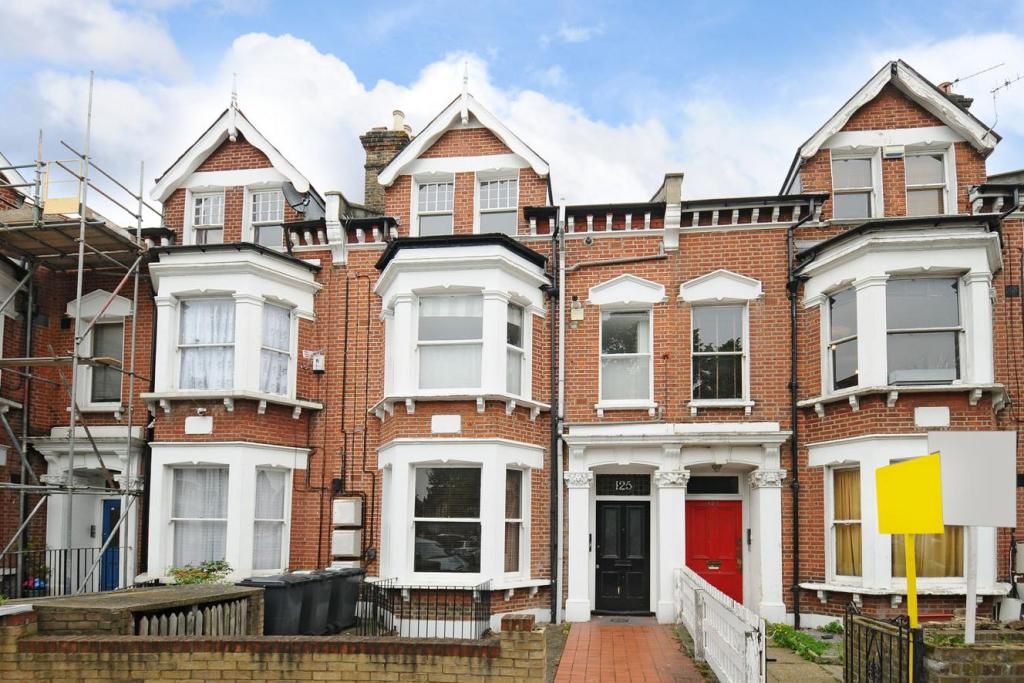
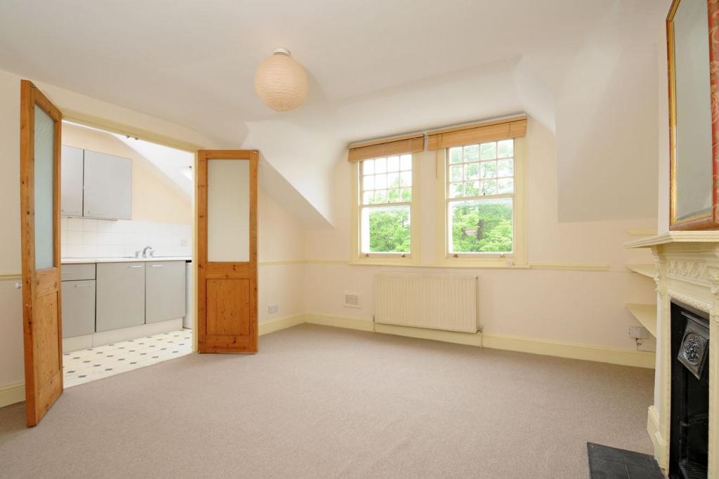
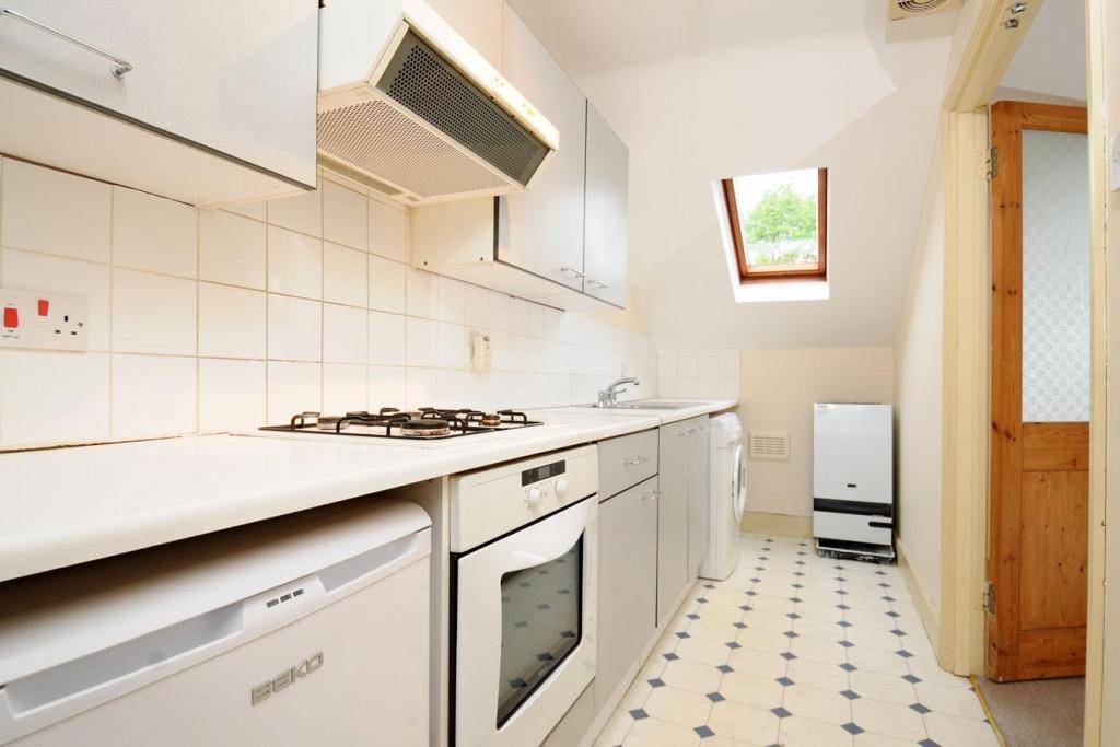
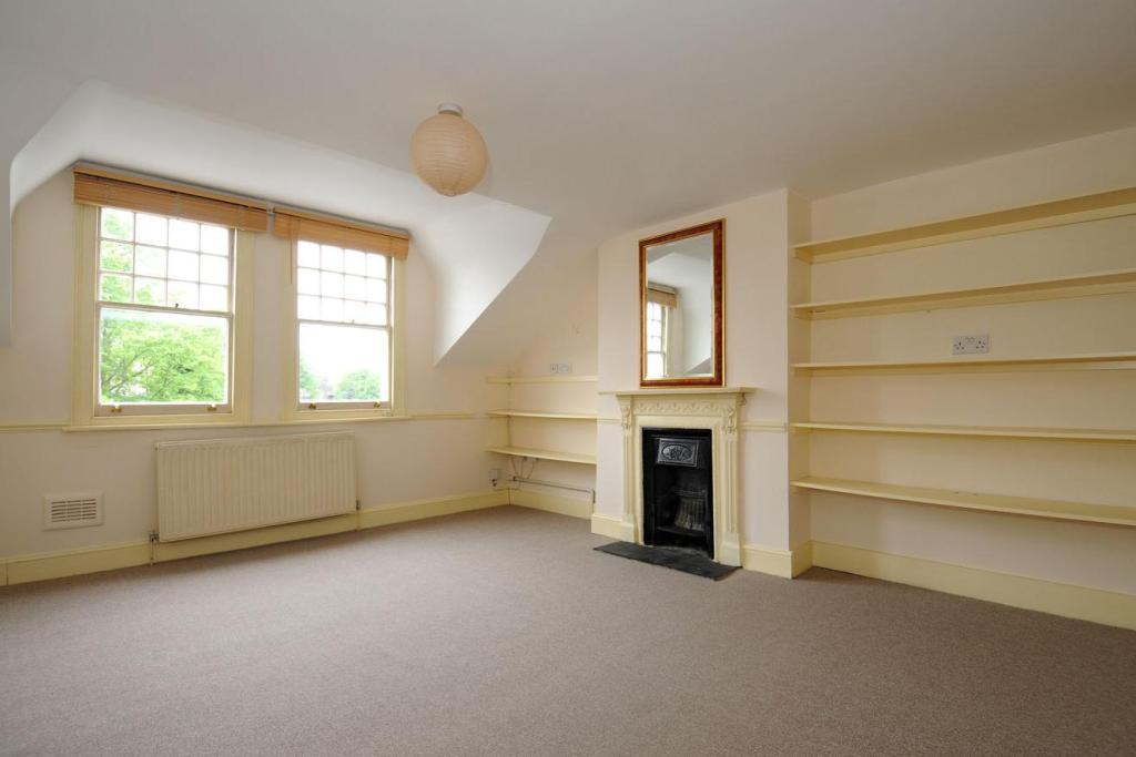
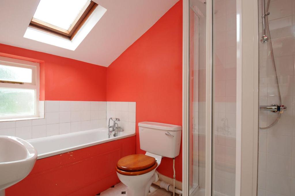
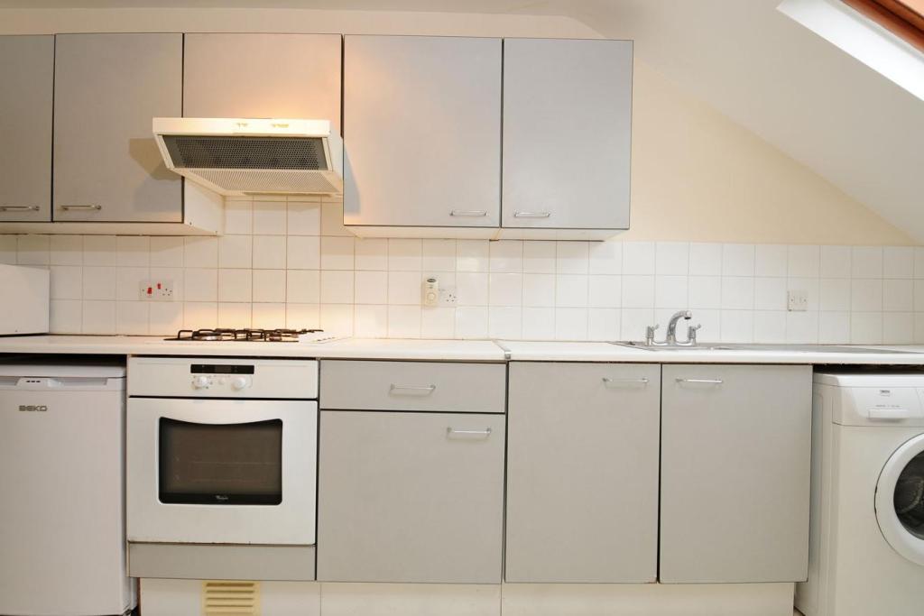
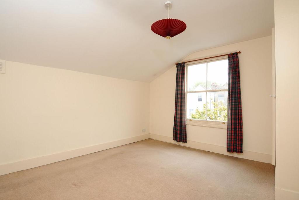
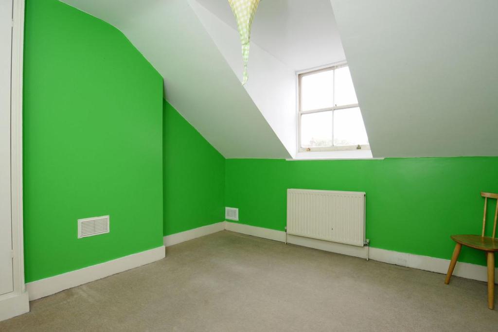
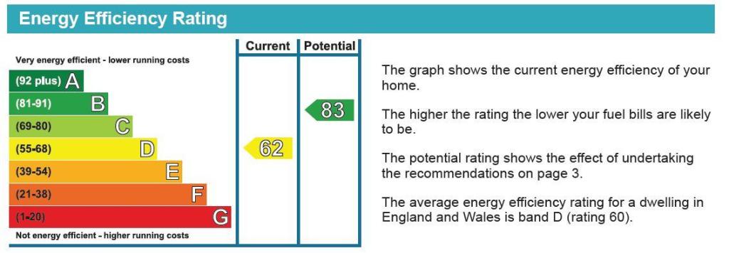
Photo 1 Photo 2 Photo 3 Photo 4 Photo 5 Photo 6 Photo 7 Photo 8 EPC
/ 9
Property details
Tenure
SHARE_OF_FREEHOLD
Floor area
59 m²
Year built
England and Wales: 1900-1929
Last sold
£373,000 Aug 2013
Price per m²
£6,186/m²
Local average
£492,089 (-25.8%)
Deprivation
Decile 3 (9,224 of 33,755)
Street crime
1575 incidents within 1 mile (Apr 2026)
Key features
- 14Ft 7 Reception Room
- Two Double Bedrooms
- Four Piece Bathroom
- No Onward Chain
- Victorian Terrace
- Internal Area 788SqFt
Description
Listed by
Kennington
The Lomond Group
Reference: 42041336
EPC Rating & Upgrade Cost
Fetching EPC data… Refresh this page in a moment.
Flood risk
Zone: 1
Risk: Low
Job (default Low)
Floorplans
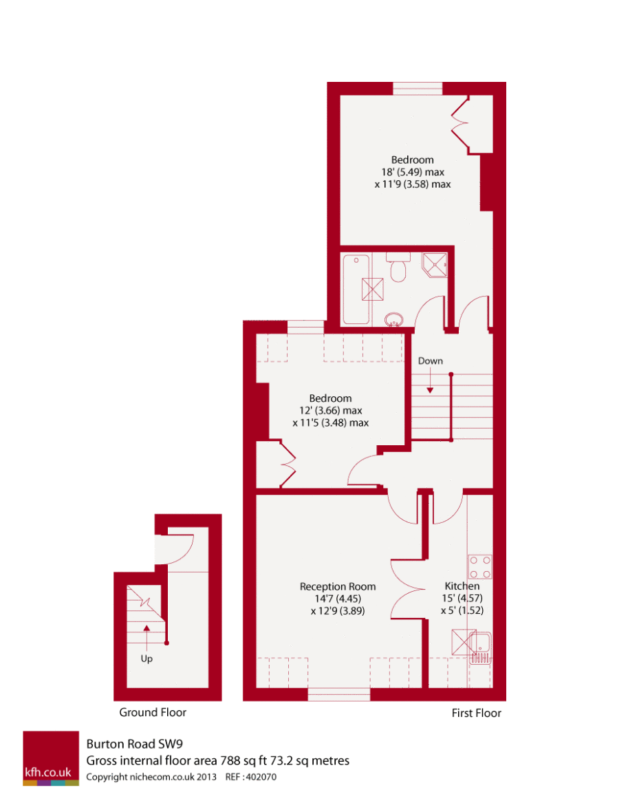
Floorplan 1
FENSA Certificates
This property has 2 FENSA certificate(s) on record, indicating window/door installations by FENSA-approved installers.
FENSA Certificate #11739847
Property Details
Street: 125 Burton Road
Town: LONDON
Postcode: SW9 6TG
Installation Details
Items: 4 windows
Certificate Issued: 18/07/2016
Work Completed: 20/06/2016
This certificate data was retrieved from FENSA's database
FENSA Certificate #16649380 Recent
Property Details
Street: 125 Burton Road
Town: LONDON
Postcode: SW9 6TG
Installation Details
Items: 1 window
Certificate Issued: 26/01/2025
Work Completed: 17/01/2025
This certificate data was retrieved from FENSA's database
What is FENSA? FENSA (Fenestration Self-Assessment Scheme) is a government-authorised scheme that monitors building regulation compliance for replacement windows and doors. Certificates indicate that work was completed by FENSA-approved installers.
Price history
| Event | Date | Price | % change |
|---|---|---|---|
| Sold | 16/08/2013 (12 years ago) | £373,000 | — |
Source: HM Land Registry Price Paid Data. Crown copyright.
Sold Comparables
Same street and nearby sales within 0.25 miles (last 5 years). Data from Land Registry Price Paid.
| Address | Price | Date | Type |
|---|---|---|---|
| 26C LILFORD ROAD, LONDON, LAMBETH, GREATER LONDON, SE5 9HX | £500,000 | 31/03/2025 | Flat |
| Same street 115B BURTON ROAD, LONDON, LAMBETH, GREATER LONDON, SW9 6TG | £600,000 | 23/02/2024 | Terraced |
| Same street 129 FLAT A BURTON ROAD, LONDON, LAMBETH, GREATER LONDON, SW9 6TG | £388,400 | 20/12/2023 | Flat |
| 5 URLWIN WALK, LONDON, LAMBETH, GREATER LONDON, SW9 6QG | £452,000 | 07/12/2023 | Flat |
| 54 - 56 FLAT 9 KNATCHBULL ROAD, LONDON, LAMBETH, GREATER LONDON, SE5 9QY | £420,000 | 11/08/2023 | Flat |
| 71 FLAT 1 LOUGHBOROUGH ROAD, LONDON, LAMBETH, GREATER LONDON, SW9 7TF | £433,500 | 13/01/2023 | Flat |
| 13 FLAT A LILFORD ROAD, LONDON, LAMBETH, GREATER LONDON, SE5 9HY | £692,000 | 19/12/2022 | Flat |
| 60 FLAT B LILFORD ROAD, LONDON, LAMBETH, GREATER LONDON, SE5 9HX | £635,000 | 16/12/2022 | Flat |
| 17 FLAT 2 LILFORD ROAD, LONDON, LAMBETH, GREATER LONDON, SE5 9HY | £725,000 | 02/12/2022 | Flat |
| 79 KNATCHBULL ROAD, LONDON, LAMBETH, GREATER LONDON, SE5 9QU | £410,934 | 07/11/2022 | Flat |
| 41 FLAT C LOUGHBOROUGH ROAD, LONDON, LAMBETH, GREATER LONDON, SW9 7TB | £487,500 | 31/10/2022 | Flat |
| 2 PAULET ROAD, LONDON, LAMBETH, GREATER LONDON, SE5 9HZ | £330,000 | 28/10/2022 | Flat |
| 28A MINET ROAD, LONDON, LAMBETH, GREATER LONDON, SW9 7UA | £310,000 | 12/10/2022 | Flat |
| 39 FLAT 7 LOUGHBOROUGH ROAD, LONDON, LAMBETH, GREATER LONDON, SW9 7TB | £500,000 | 30/09/2022 | Flat |
| 1 FLAT B UPSTALL STREET, LONDON, LAMBETH, GREATER LONDON, SE5 9JE | £732,000 | 29/09/2022 | Flat |
| 68 URLWIN WALK, LONDON, LAMBETH, GREATER LONDON, SW9 6QJ | £491,750 | 27/09/2022 | Flat |
| Same street 127 FLAT A BURTON ROAD, LONDON, LAMBETH, GREATER LONDON, SW9 6TG | £775,000 | 23/09/2022 | Flat |
| 71 FLAT 16 AKERMAN ROAD, LONDON, LAMBETH, GREATER LONDON, SW9 6FX | £420,000 | 12/09/2022 | Flat |
| 78 BURTON ROAD, LONDON, LAMBETH, GREATER LONDON, SW9 6TQ | £635,000 | 12/09/2022 | Flat |
| 8 FLAT 2 AKERMAN ROAD, LONDON, LAMBETH, GREATER LONDON, SW9 6SW | £600,000 | 12/08/2022 | Flat |
| 30 HORLE WALK, LONDON, LAMBETH, GREATER LONDON, SE5 9EF | £382,500 | 09/08/2022 | Flat |
| 71 FLAT 19 AKERMAN ROAD, LONDON, LAMBETH, GREATER LONDON, SW9 6FX | £532,500 | 20/06/2022 | Flat |
| 39 FLAT 9 LOUGHBOROUGH ROAD, LONDON, LAMBETH, GREATER LONDON, SW9 7TB | £440,000 | 17/06/2022 | Flat |
| Same street 125 FLAT 2 BURTON ROAD, LONDON, LAMBETH, GREATER LONDON, SW9 6TG | £525,000 | 15/12/2021 | Flat |
Street average: £572,100 (4 sales)
Area average: £506,484 (20 sales)
Capital growth trend
Land Registry outcode average: last 12 months vs 5y and 10y ago (from sold prices).
House Price Index (HM Land Registry — official index, not sold-price averages): Lambeth. Series: Flats and maisonettes. As of March 2026.
Company ownership
Registered legal owner is a company.
Company: 125 BURTON ROAD LIMITED (35882321)
Rental Range
Estimated market rent for Lambeth. Low = conservative, Realistic = average, Optimistic = best case.
Based on Local Authority from postcode lookup → Lambeth.
LHA (30th percentile) floor for Inner North London: £1,789/mo (Apr 2025 – Mar 2026)
Location
Nearby
Nearest stations, universities and amenities (distance from property).
| Type | Name | Distance |
|---|---|---|
| Bus stop | Burton Road | 0.1 miles |
| Shop | A to Z | 0.1 miles |
| Shop | Millenium Pharmacy | 0.1 miles |
| Train station | Loughborough Junction | 0.4 miles |
| University | University of Wales Trinity Saint David London Campus | 0.6 miles |
| Hospital | Dental Hospital | 0.6 miles |
| Hospital | King's College Hospital Emergency Department | 0.6 miles |
| Train station | Brixton | 0.7 miles |
| University | University Library | 1.8 miles |
Street-level crime
| Category | Count |
|---|---|
| Violence and sexual offences | 407 |
| Anti-social behaviour | 271 |
| Shoplifting | 178 |
| Theft from the person | 140 |
| Other theft | 104 |
| Criminal damage and arson | 83 |
| Vehicle crime | 83 |
| Public order | 82 |
| Drugs | 64 |
| Burglary | 48 |
| Robbery | 47 |
| Bicycle theft | 40 |
| Other crime | 17 |
| Possession of weapons | 11 |
| Total incidents | 1575 |
Within 1 mile during Apr 2026. Source: data.police.uk (England & Wales).
Schools nearby
Nearest open schools with Ofsted ratings (England). Closed schools are not shown. Data from Get Information about Schools and Ofsted.
| Name | Type | Distance | Ofsted |
|---|---|---|---|
| Loughborough Primary School | Primary | 0.2 miles | Good — 17 Apr 2013 |
| Van Gogh Primary | Primary | 0.3 miles | Good — 28 Mar 2023 |
| St John's Angell Town Church of England Primary School | Primary | 0.3 miles | Good — 18 Jul 2019 |
| Christ Church Primary SW9 | Primary | 0.3 miles | Good — 9 Jul 2019 |
| Saint Gabriel's College | Secondary | 0.3 miles | Good — 13 Jan 2019 |
Rental Comparables
Residential lets from OpenRent and Rightmove for the area (same bedroom count). Use to validate rent estimates. Student lets are excluded.
| Title | Rent | Beds | Distance | As seen on |
|---|---|---|---|---|
| 2 Bed Flat, Akerman Road, SW9 | £2,500/mo | 2 | 0.12 miles | OpenRent |
| 2 Bed Flat, Alvanley House, SW9 | £2,300/mo | 2 | 0.37 miles | OpenRent |
Average rent: £2,400/mo (2 listings)
Rent-driven metrics
Based on OpenRent comparables.
- Rent ratio — Monthly rent ÷ purchase price (1% rule). 1%+ = strong, 0.8–1% = okay, <0.8% = weak for cashflow.
- Max investor price — Rent ÷ 0.8%; the price at which rent would be 0.8% of price (Stoke-style target).
- Target investor price — Rent ÷ 1%; the price at which rent would be 1% of price (strong cashflow band).
- Gross yield — Annual rent as % of purchase price (no costs).
- Cost-to-rent — Price ÷ annual rent (from OpenRent comparables). Under 14× = strong, 14–16× = acceptable, 17×+ = compressed.
- Cashflow — Rent minus mortgage, 10% maintenance, £25/mo compliance. Assumes 75% LTV, 3.95% APR (5yr fixed), 25yr term.
- ROI — Annual profit ÷ cash in (deposit + 4% purchase costs).