11 BRODICK CLOSE
HINCKLEY, LEICESTERSHIRE LE10 0TU
£650 pcm
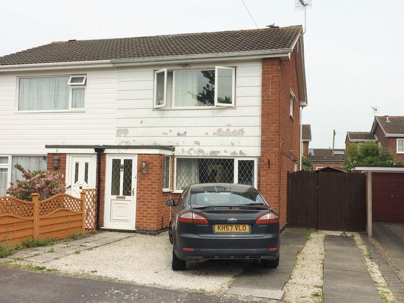
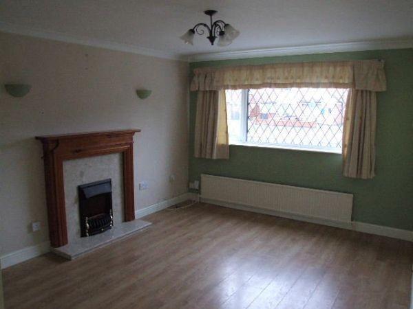
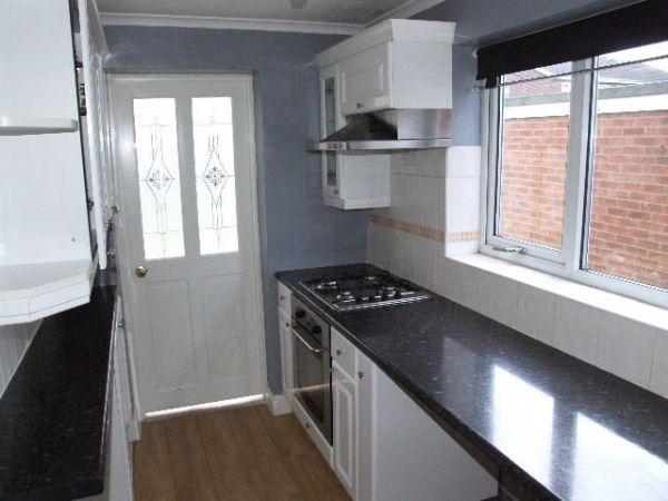
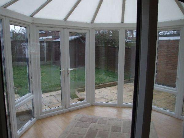
Property details
Floor area
67 m²
Street crime
167 incidents within 1 mile (Mar 2026)
Additional details
- Parking
- Yes
- Garden
- Yes
Description
Listed by
Hinckley
Wright & Wright (Hinckley) Limited
Reference: 62837894
EPC Rating & Upgrade Cost
Fetching EPC data… Refresh this page in a moment.
Flood risk
Zone: 1
Risk: Low
Job (default Low)
EPC Graphs
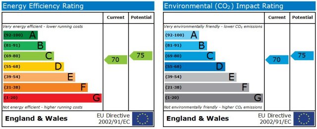
Energy Perform...
FENSA Certificates
This property has 2 FENSA certificate(s) on record, indicating window/door installations by FENSA-approved installers.
FENSA Certificate #572097
Property Details
Street: 11 Brodick Close
Town: HINCKLEY
Postcode: LE10 0TU
Installation Details
Items: 4 windows
Certificate Issued: 26/08/2003
Work Completed: 05/03/2003
This certificate data was retrieved from FENSA's database
FENSA Certificate #14699980 Recent
Property Details
Street: 11 Brodick Close
Town: HINCKLEY
Postcode: LE10 0TU
Installation Details
Items: 1 door
Certificate Issued: 25/07/2021
Work Completed: 02/07/2021
This certificate data was retrieved from FENSA's database
What is FENSA? FENSA (Fenestration Self-Assessment Scheme) is a government-authorised scheme that monitors building regulation compliance for replacement windows and doors. Certificates indicate that work was completed by FENSA-approved installers.
Rental Range
Estimated market rent for Hinckley and Bosworth. Low = conservative, Realistic = average, Optimistic = best case.
Based on Local Authority from postcode lookup → Hinckley and Bosworth.
LHA (30th percentile) floor for Leicester: £773/mo (Apr 2025 – Mar 2026)
Location
Nearby
Nearest stations, universities and amenities (distance from property).
| Type | Name | Distance |
|---|---|---|
| Bus stop | Brodick Road | 0.1 miles |
| Bus stop | Lochmore Close | 0.1 miles |
| Shop | Co-op Food | 0.3 miles |
| Shop | Screwfix | 0.3 miles |
| Train station | Hinckley | 1.2 miles |
| Train station | Nuneaton | 3.0 miles |
| Hospital | Stewart House | 8.4 miles |
| Hospital | George Elliot Medical Centre | 9.6 miles |
| University | University of Leicester | 11.9 miles |
Street-level crime
| Category | Count |
|---|---|
| Violence and sexual offences | 49 |
| Criminal damage and arson | 25 |
| Anti-social behaviour | 22 |
| Other theft | 12 |
| Vehicle crime | 12 |
| Burglary | 10 |
| Shoplifting | 10 |
| Drugs | 8 |
| Other crime | 8 |
| Public order | 6 |
| Possession of weapons | 3 |
| Robbery | 1 |
| Theft from the person | 1 |
| Total incidents | 167 |
Within 1 mile during Mar 2026. Source: data.police.uk (England & Wales).
Schools nearby
Nearest open schools with Ofsted ratings (England). Closed schools are not shown. Data from Get Information about Schools and Ofsted.
| Name | Type | Distance | Ofsted |
|---|---|---|---|
| Westfield Infant School | Primary | 0.6 miles | Outstanding — 7 Mar 2014 |
| Battling Brook Primary School | Primary | 0.7 miles | Good — 7 Jul 2024 |
| Hollycroft Primary School | Primary | 0.7 miles | — (No rating) |
| Dovetree School | Other | 0.7 miles | Good — 30 Jan 2024 |
| Westfield Junior School | Primary | 0.7 miles | Requires improvement — 5 Dec 2022 |
Rental Comparables
Residential lets from OpenRent and Rightmove for the area (same bedroom count). Use to validate rent estimates. Student lets are excluded.
| Title | Rent | Beds | Distance | As seen on |
|---|---|---|---|---|
| 3 Bed Semi-Detached House, Thirlmere Road, LE10 | £1,150/mo | 3 | 0.3 miles | OpenRent |
| 3 Bed Semi-Detached House, Strathmore Road, LE10 | £1,200/mo | 3 | 0.45 miles | OpenRent |
| 3 Bed Terraced House, John Nichols St, LE10 | £1,650/mo | 3 | 0.62 miles | OpenRent |
| 3 Bed Terraced House, Beams Meadow, LE10 | £1,300/mo | 3 | 0.63 miles | OpenRent |
| 3 Bed Semi-Detached House, John Nichols St, LE10 | £1,200/mo | 3 | 0.66 miles | OpenRent |
| 3 Bed Terraced House, Granville Road, LE10 | £1,200/mo | 3 | 0.78 miles | OpenRent |
Average rent: £1,283/mo (6 listings)