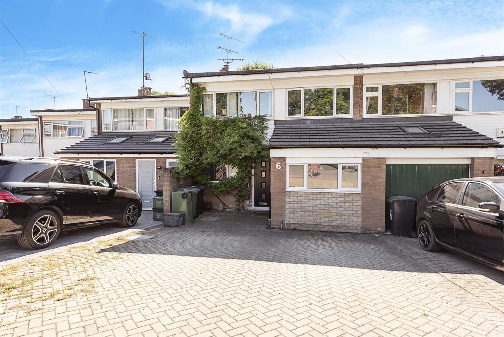
6 WELLS CLOSE
HARPENDEN, HERTFORDSHIRE AL5 3LQ
Property details
Tenure
FREEHOLD
Floor area
109 m²
Last sold
£600,000 Sep 2023
Local average
£772,320 (-22.3%)
Deprivation
Decile 10 (33,752 of 33,755)
Street crime
23 incidents within 1 mile (Apr 2026)
Key features
- Mid-terrace property
- Circa 1,150 sq ft
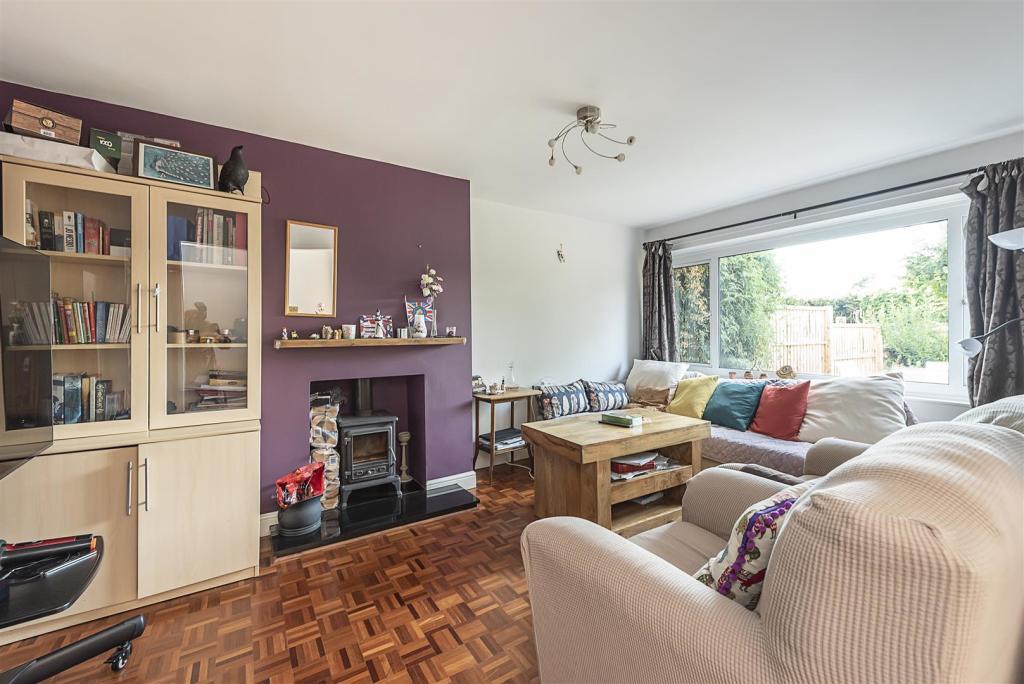
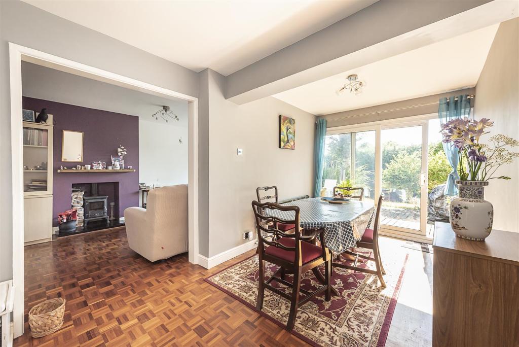
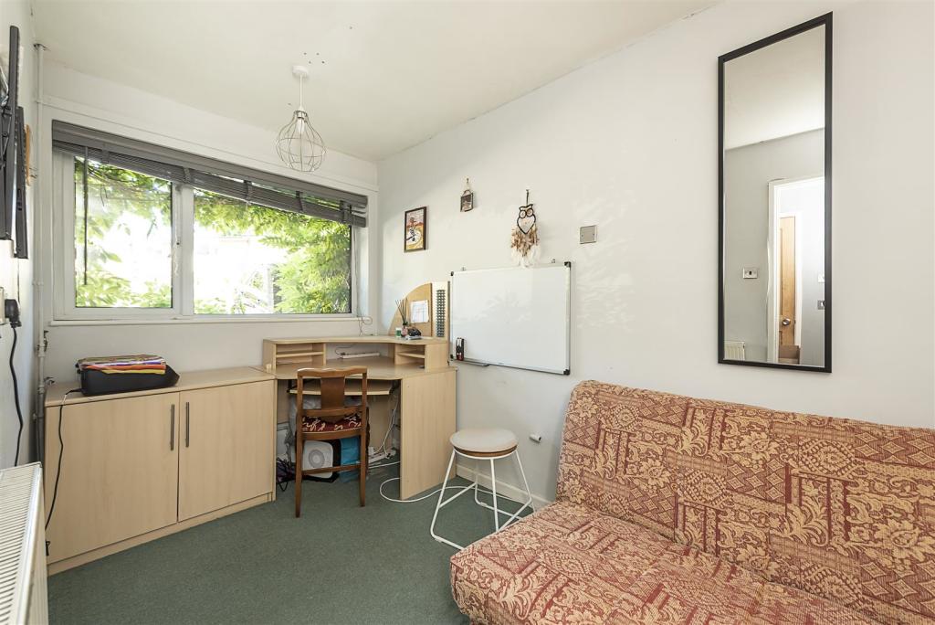
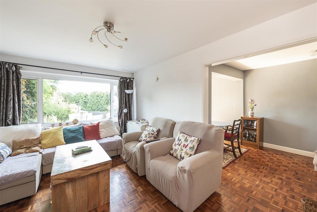
- Three Reception Rooms
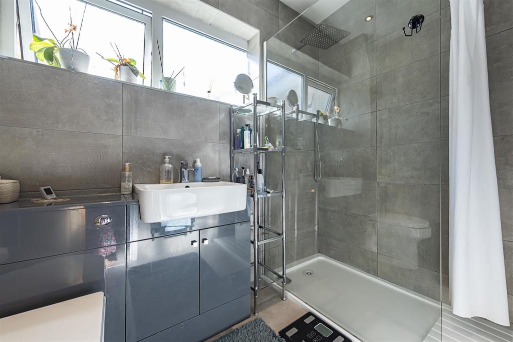
- Two Bathrooms
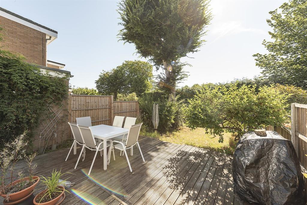
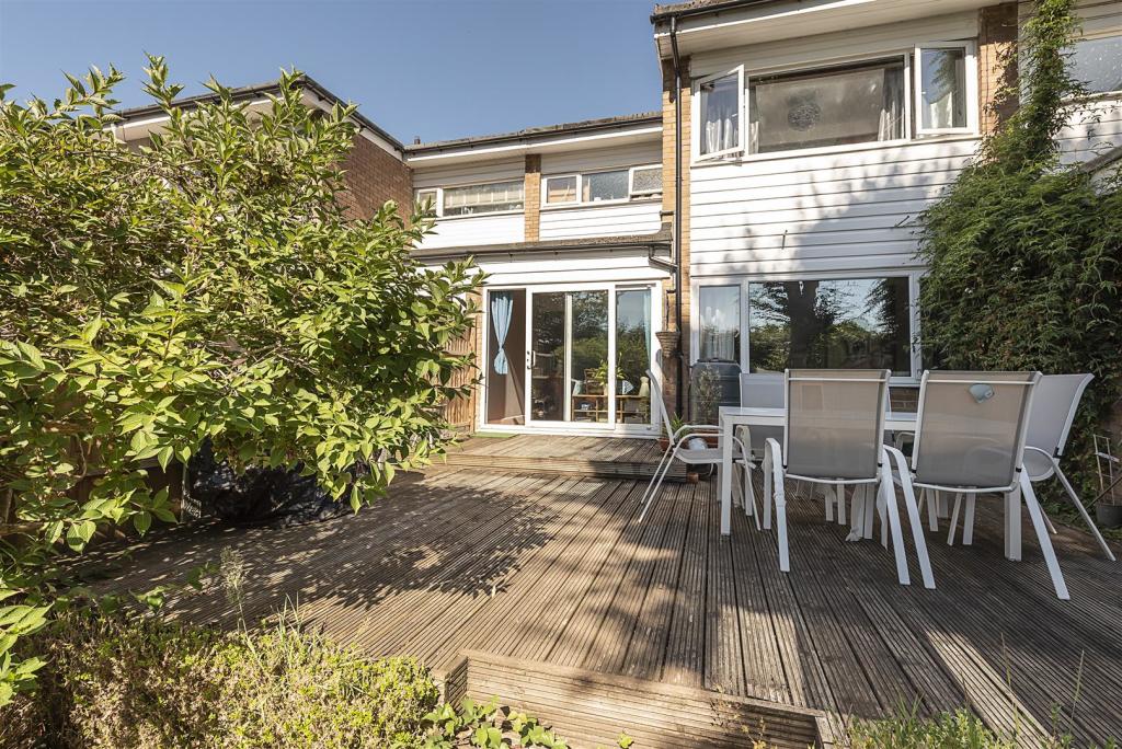
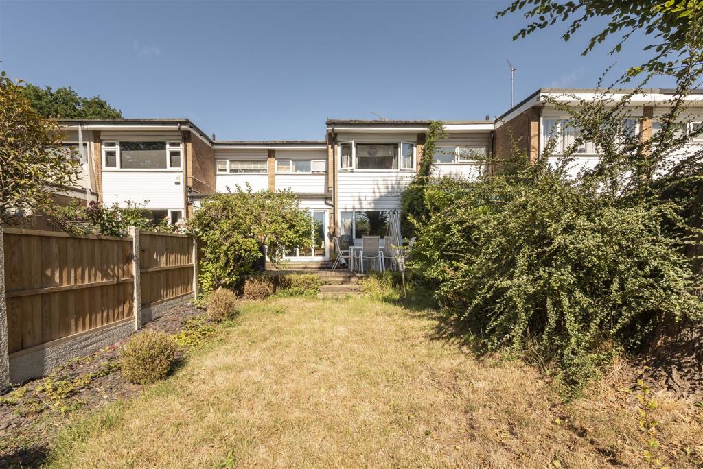
- Private Garden
- Driveway for two cars
- Peaceful location
- Well placed for schooling
- Chain Free
Additional details
- Parking
- Yes
- Garden
- Yes
Description
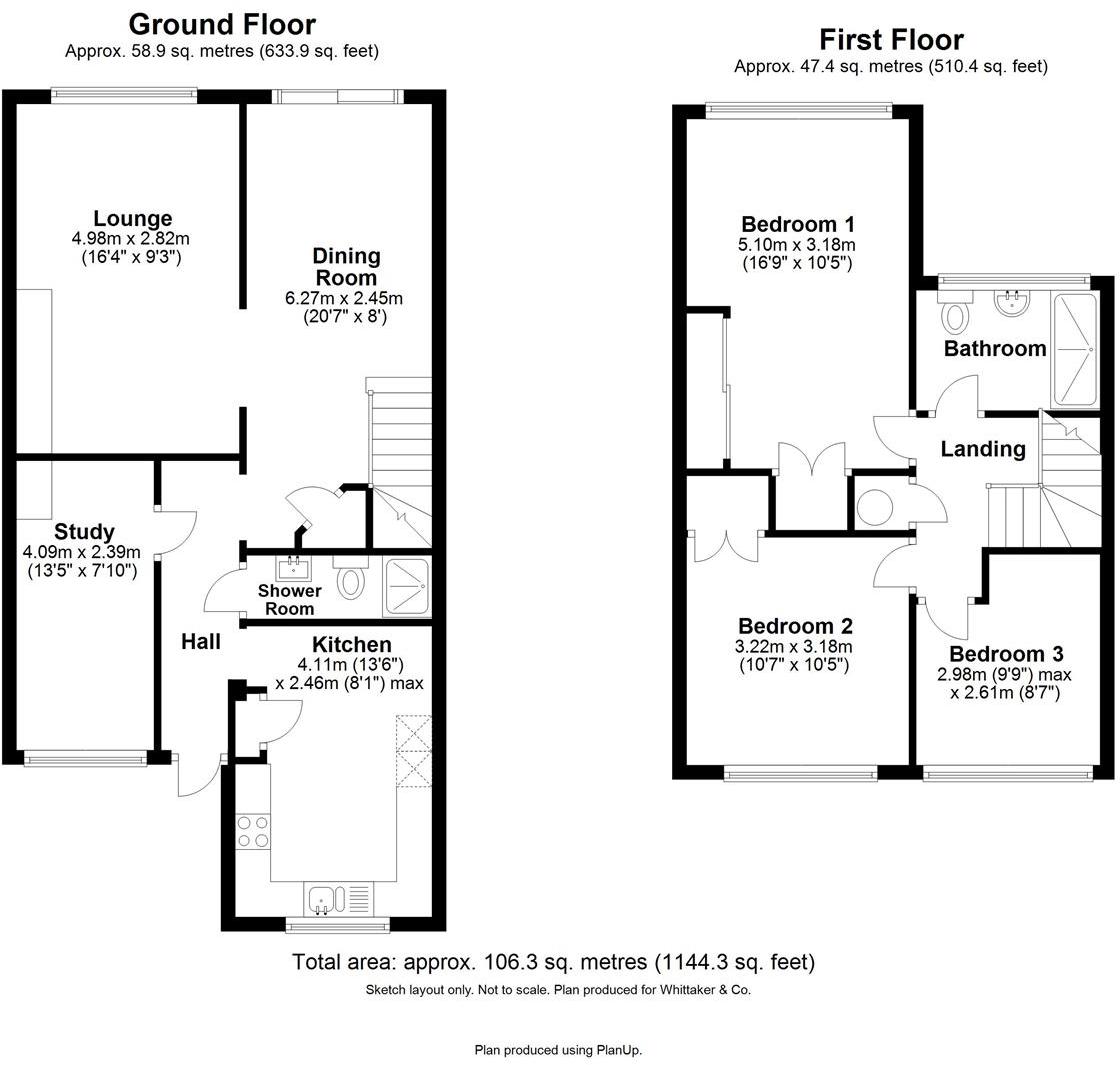
Entrance Hall -
Lounge - 4.98 x 2.82 (16'4" x 9'3") -
Dining Room - 6.27 x 2.45 (20'6" x 8'0") -
Study - 4.09 x 2.39 (13'5" x 7'10") -
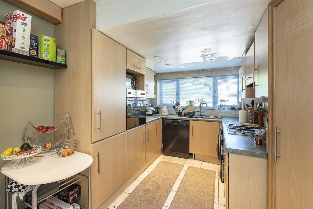
Kitchen - 4.11 x 2.46 (max) (13'5" x 8'0" (max)) -
Shower Room -
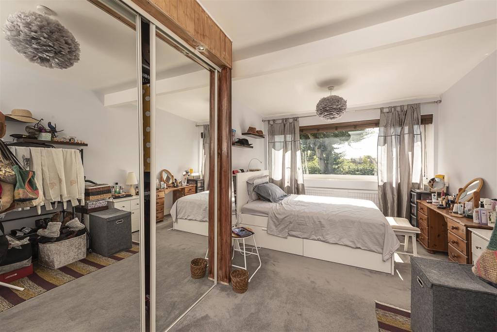
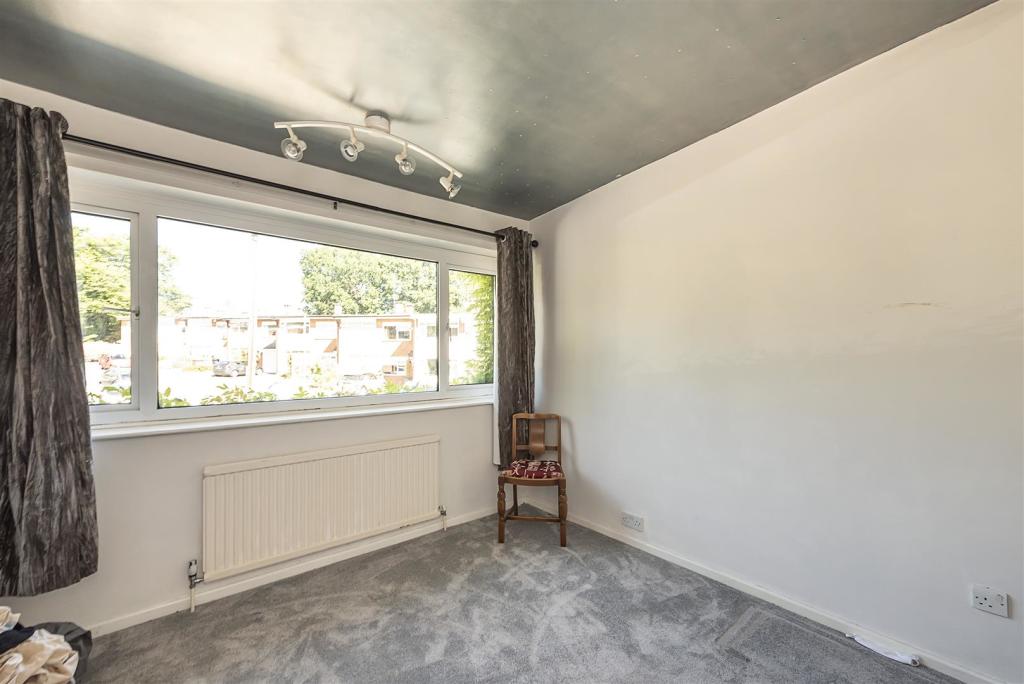
Bedroom One - 5.10 x 3.18 (16'8" x 10'5") -
Bedroom Two - 3.22 x 3.18 (10'6" x 10'5") -
Bedroom Three - 2.98 (max) x 2.61 (9'9" (max) x 8'6") -
Family Shower Room -
Listed by
Harpenden
Whittaker & Co
Reference: 131766746
EPC Rating & Upgrade Cost
Fetching EPC data… Refresh this page in a moment.
Flood risk
Zone: 1
Risk: Low
Job (default Low)
Floorplans
6 Wells Close, Harpenden.JPG
EPC Graphs
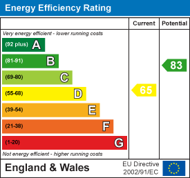
EE Rating
FENSA Certificates
This property has 2 FENSA certificate(s) on record, indicating window/door installations by FENSA-approved installers.
FENSA Certificate #17254407 Recent
Property Details
Street: 6 Wells Close
Town: HARPENDEN
Postcode: AL5 3LQ
Installation Details
Items: 1 window
Certificate Issued: 19/04/2026
Work Completed: 17/04/2026
This certificate data was retrieved from FENSA's database
FENSA Certificate #769948
Property Details
Street: 6 Wells Close
Town: HARPENDEN
Postcode: AL5 3LQ
Installation Details
Items: 5 windows and 2 doors
Certificate Issued: 21/07/2003
Work Completed: 25/04/2003
This certificate data was retrieved from FENSA's database
What is FENSA? FENSA (Fenestration Self-Assessment Scheme) is a government-authorised scheme that monitors building regulation compliance for replacement windows and doors. Certificates indicate that work was completed by FENSA-approved installers.
Price history
382% since 1999
| Event | Date | Price | % change |
|---|---|---|---|
| Sold | 08/09/2023 (2 years ago) | £600,000 | +66.7% |
| Sold | 20/04/2013 (13 years ago) | £360,000 | +189.2% |
| Sold | 02/09/1999 (26 years ago) | £124,500 | — |
Source: HM Land Registry Price Paid Data. Crown copyright.
Sold Comparables
Same street and nearby sales within 0.25 miles (last 5 years). Data from Land Registry Price Paid.
| Address | Price | Date | Type |
|---|---|---|---|
| 8 FARM CLOSE, HARPENDEN, ST ALBANS, HERTFORDSHIRE, AL5 3NH | £570,000 | 01/09/2023 | Terraced |
| Same street 16 WELLS CLOSE, HARPENDEN, ST ALBANS, HERTFORDSHIRE, AL5 3LQ | £610,000 | 30/06/2023 | Terraced |
| Same street 9 WELLS CLOSE, HARPENDEN, ST ALBANS, HERTFORDSHIRE, AL5 3LQ | £620,000 | 24/11/2022 | Terraced |
| 317 LUTON ROAD, HARPENDEN, ST ALBANS, HERTFORDSHIRE, AL5 3LW | £875,000 | 10/10/2022 | Terraced |
| Same street 19 WELLS CLOSE, HARPENDEN, ST ALBANS, HERTFORDSHIRE, AL5 3LQ | £675,000 | 09/05/2022 | Terraced |
| Same street 24 WELLS CLOSE, HARPENDEN, ST ALBANS, HERTFORDSHIRE, AL5 3LQ | £695,000 | 29/06/2021 | Terraced |
Street average: £650,000 (4 sales)
Area average: £722,500 (2 sales)
Capital growth trend
Land Registry outcode average: last 12 months vs 5y and 10y ago (from sold prices).
House Price Index (HM Land Registry — official index, not sold-price averages): St Albans. Series: Terraced. As of March 2026.
Rental Range
Estimated market rent for St Albans. Low = conservative, Realistic = average, Optimistic = best case.
Based on Local Authority from postcode lookup → St Albans.
LHA (30th percentile) floor for Luton: £1,097/mo (Apr 2025 – Mar 2026)
Location
Nearby
Nearest stations, universities and amenities (distance from property).
| Type | Name | Distance |
|---|---|---|
| Bus stop | Ridgewood Drive | 0.2 miles |
| Shop | Tesco Express | 0.5 miles |
| Hospital | Spire Hospital | 0.6 miles |
| Shop | BP Shop | 0.8 miles |
| Hospital | Harpenden Memorial Hospital | 1.1 miles |
| Train station | Harpenden | 1.3 miles |
| Train station | Luton DART Parkway | 3.2 miles |
| University | University Of Bedfordshire | 3.7 miles |
Street-level crime
| Category | Count |
|---|---|
| Anti-social behaviour | 7 |
| Other theft | 7 |
| Violence and sexual offences | 5 |
| Burglary | 1 |
| Possession of weapons | 1 |
| Public order | 1 |
| Vehicle crime | 1 |
| Total incidents | 23 |
Within 1 mile during Apr 2026. Source: data.police.uk (England & Wales).
Schools nearby
Nearest open schools with Ofsted ratings (England). Closed schools are not shown. Data from Get Information about Schools and Ofsted.
| Name | Type | Distance | Ofsted |
|---|---|---|---|
| Wood End School | Primary | 0.3 miles | Outstanding — 30 Jan 2024 |
| The King's School | Other | 0.5 miles | — (No rating) |
| Roundwood Park School | Secondary | 0.5 miles | Outstanding — 15 Jan 2024 |
| Roundwood Primary School | Primary | 0.5 miles | Good — 22 Nov 2021 |
| St Hilda's School | Other | 0.7 miles | — (No rating) |
Rental Comparables
Rental comparables are temporarily unavailable while listing-site fetches are paused. Try again later.
Rent-driven metrics
Based on Area rent estimate.
- Rent ratio — Monthly rent ÷ purchase price (1% rule). 1%+ = strong, 0.8–1% = okay, <0.8% = weak for cashflow.
- Max investor price — Rent ÷ 0.8%; the price at which rent would be 0.8% of price (Stoke-style target).
- Target investor price — Rent ÷ 1%; the price at which rent would be 1% of price (strong cashflow band).
- Gross yield — Annual rent as % of purchase price (no costs).