Newcastle Road
Whitmore, Newcastle, Staffordshire, ST5, ST5 5HU
£2,700 pcm
Property details
Council tax band
H
Deprivation
Decile 8 (24,560 of 33,755)
Street crime
5 incidents within 1 mile (Apr 2026)
Key features
- 7 Bedrooms (2 with en suite)
- Family Bathroom
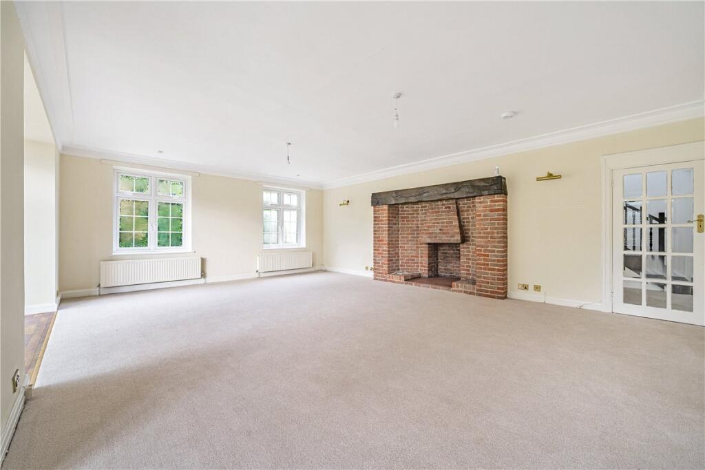
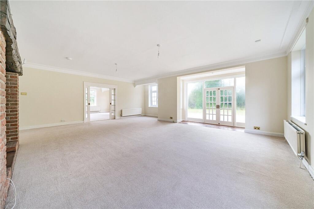
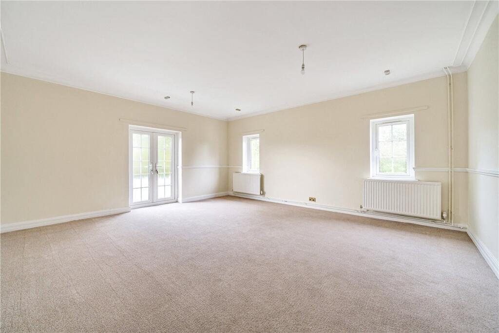
- 3 Receptions
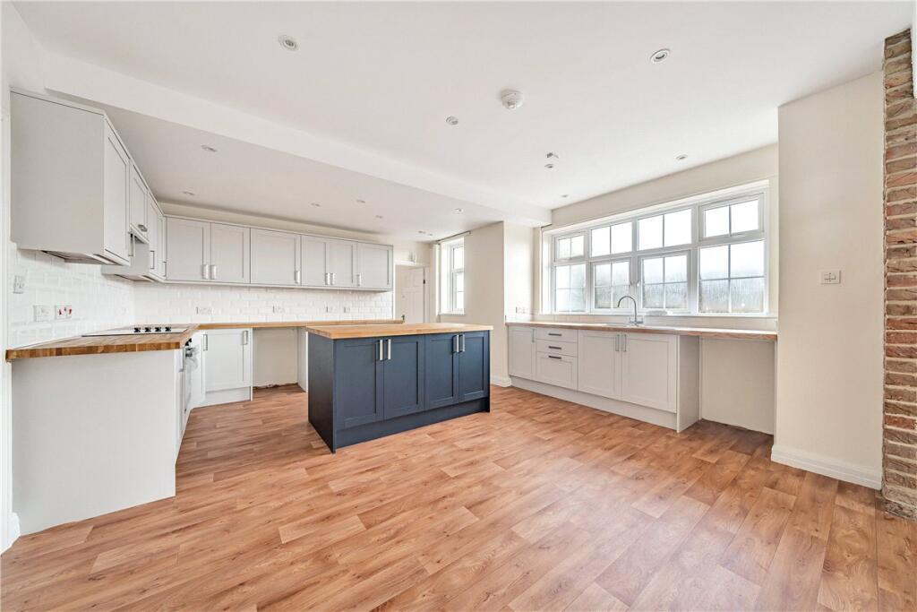
- Kitchen/Breakfast Room
- Utility
- Pantry
- Outbuilding
- Triple Garages
- Boiler Room
- Electric Gates
Additional details
- Parking
- Garage, Driveway, Gated
- Garden
- Yes
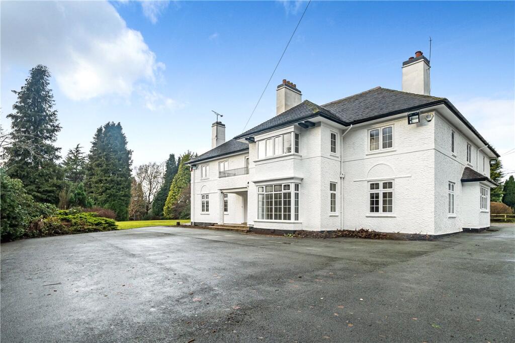
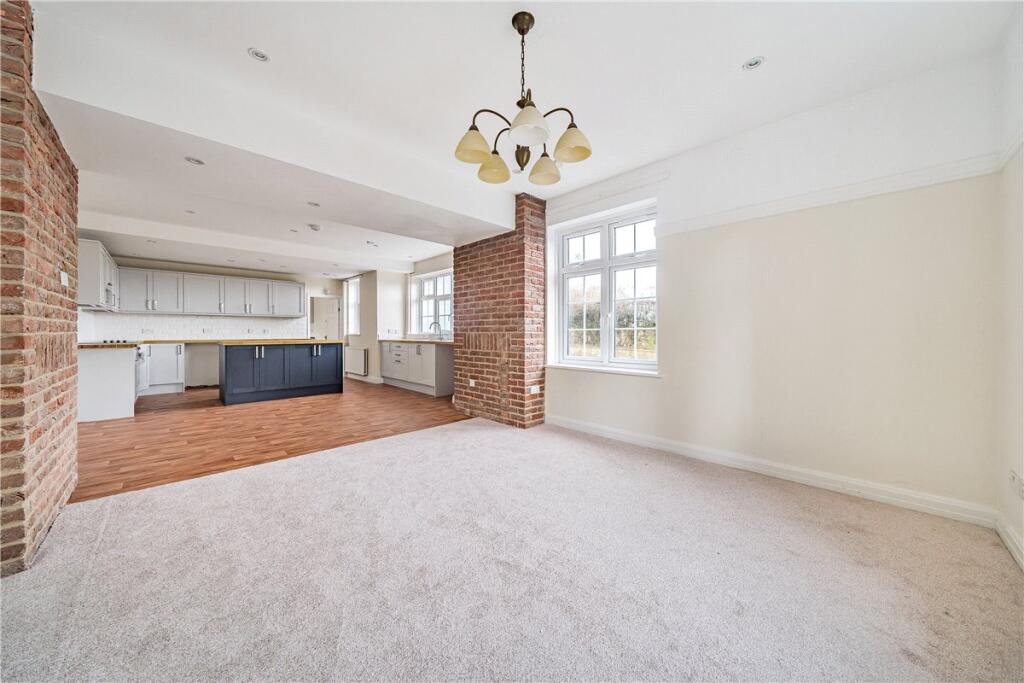
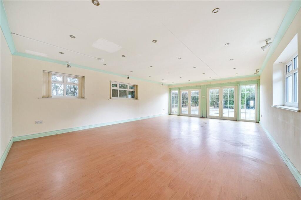
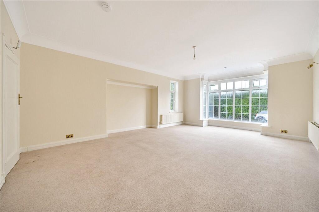
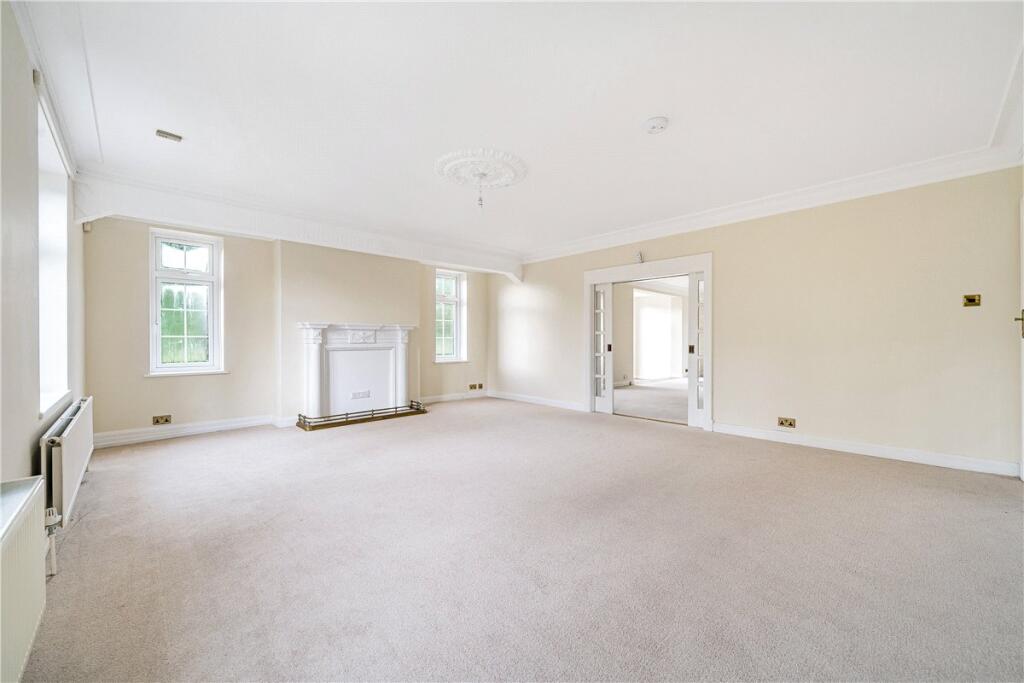
Description
Accommodation comprises -
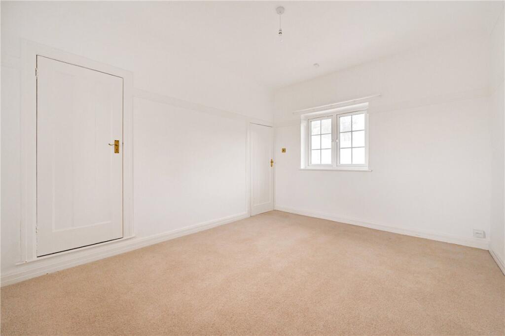
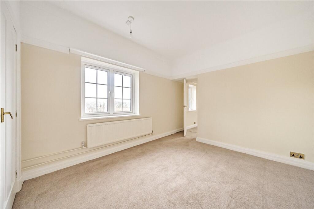
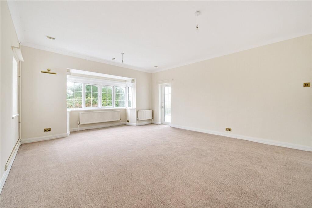
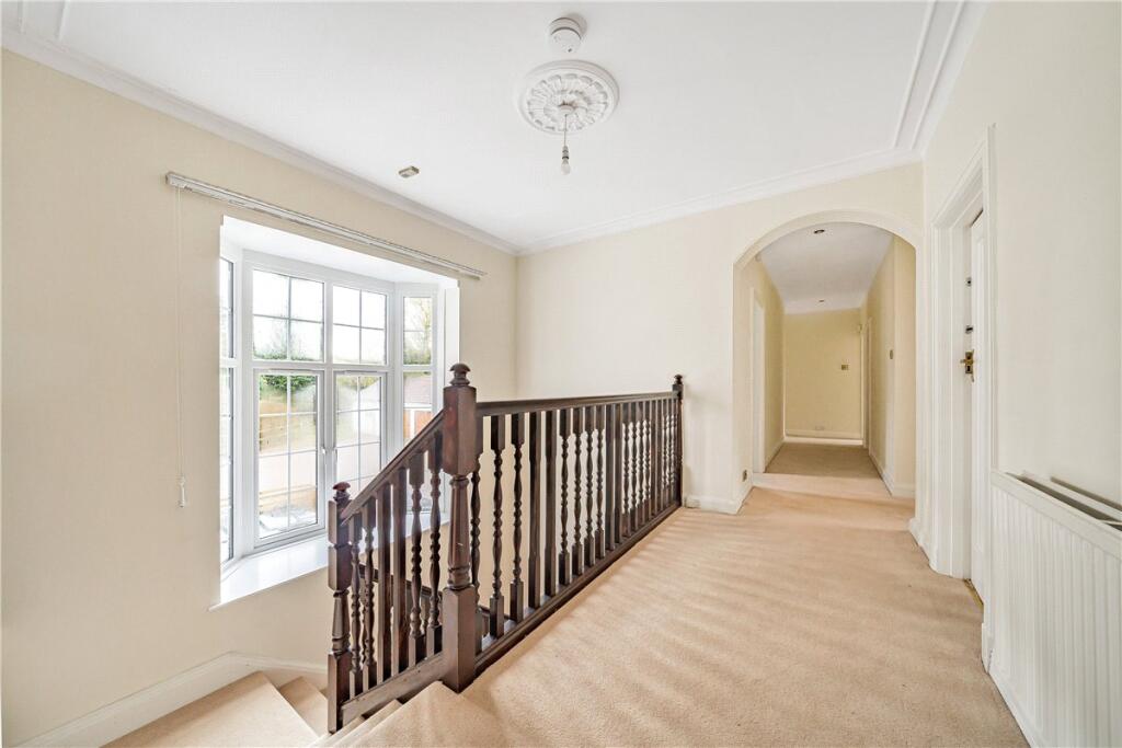
Ground Floor: A large reception hallway, three reception rooms, kitchen/ breakfast room, utility, pantry, and w/c.
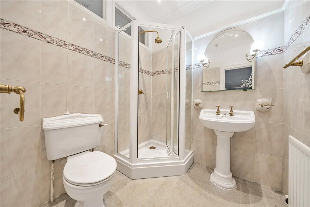
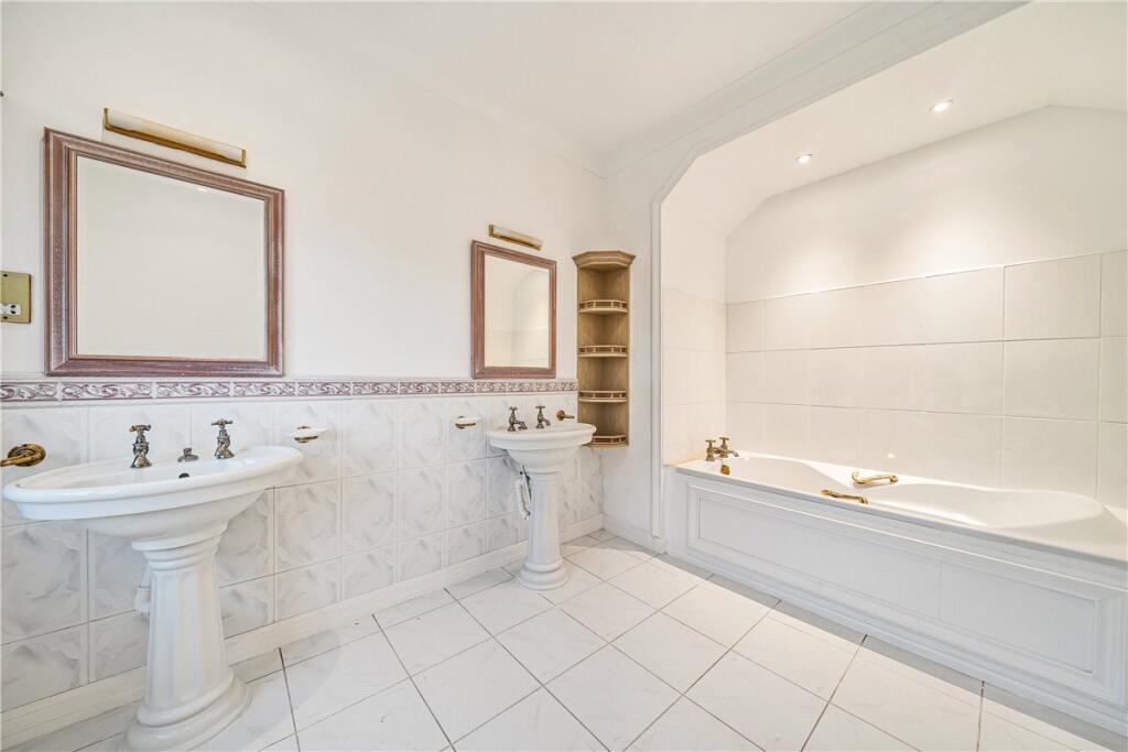
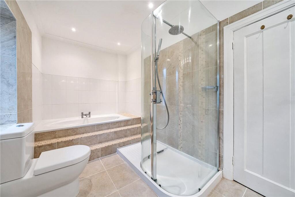
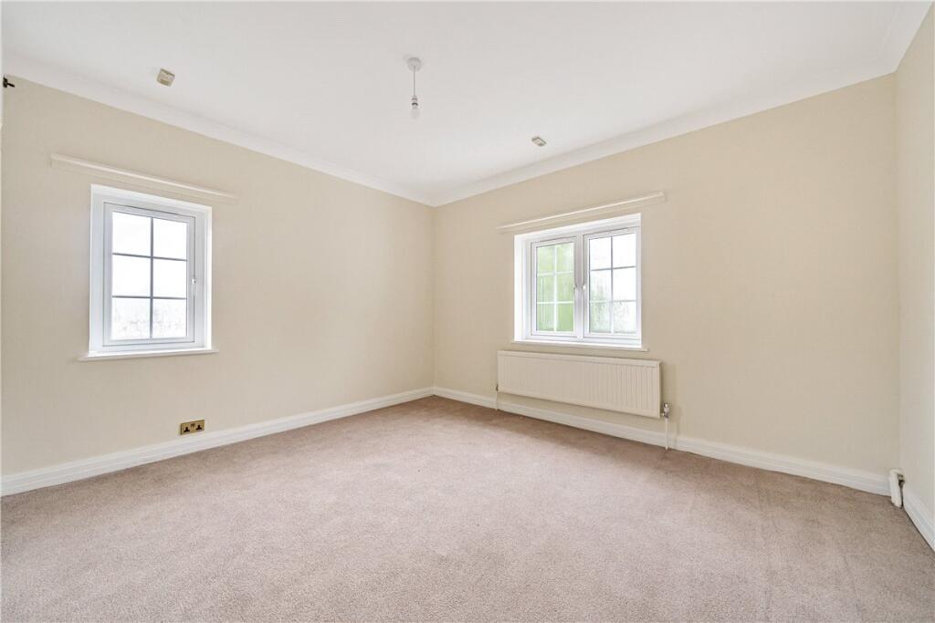
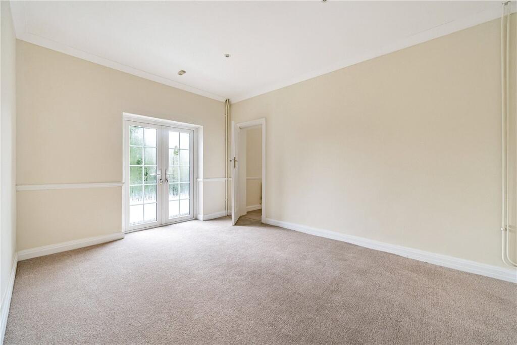
First floor: A master bedroom with dressing room and ensuite, five further bedrooms, one with an ensuite and family bathroom.
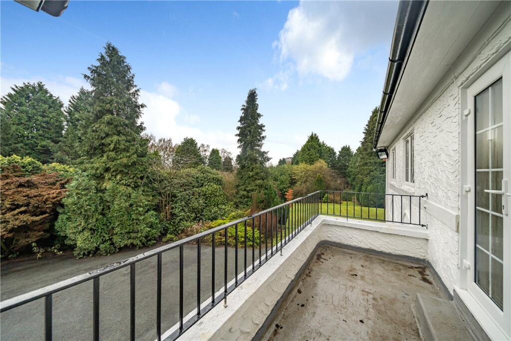
External : A triple garage, games room, tennis court, surrounding gardens extending 3 acres, and a large parking area with driveway behind electric gates.
Unfurnished and available now for a 6 or 12 month tenancy.
Pets considered.
Please be advised that white goods and window dressings are not provided.
Oil Heating. Mains electricity, water and drainage.
EPC Rating (E). Council Tax Band (H). Please see Rotherham Council website for current cost.
Flood Risk – N/a.
Internet & Mobile: Information on availability and speeds can be found at checker.ofcom.org.uk
The property is under Phase 2 of the HS2 project, which the Government announced was cancelled in October 2023. Safeguarding in this area has been lifted, however Bill Limits remain in place. If the project were to proceed in this area, the proximity to planned construction is available by request.
Please note that this property is let under a Crown Tenancy, which operates under a different legal framework to standard private tenancies.
At a rent of £2,700 per calendar month -
Holding deposit of 1 weeks’ rent £623
Security deposit of 5 weeks’ rent £3,115
Listed by
National
Carter Jonas
Reference: 90193479
EPC ratings on this postcode
We don't have a matched EPC for this property yet. Below are efficiency scores and details for other addresses on this postcode.
| Address | Current | Potential | Floor area | Age band | Type |
|---|---|---|---|---|---|
| Coneygreave Farmhouse, Whitmore, NEWCASTLE | 53 | 89 | 203 m² | England and Wales: before 1900 | Detached |
| Coneygreave Farmhouse, Whitmore, NEWCASTLE | 26 | 65 | 213 m² | England and Wales: before 1900 | Detached |
| Coneygreave Farmhouse, Whitmore, NEWCASTLE | 25 | 65 | 213 m² | England and Wales: before 1900 | Detached |
| Coneygreave Farmhouse, Whitmore, NEWCASTLE | 36 | 83 | 145 m² | England and Wales: before 1900 | Detached |
| The Hill, Newcastle Road, Whitmore, NEWCASTLE | 55 | 69 | 471 m² | England and Wales: 1950-1966 | Detached |
| The Hill, Whitmore, NEWCASTLE | 49 | 72 | 426 m² | England and Wales: 1950-1966 | Detached |
| The Hill, Whitmore, NEWCASTLE | 15 | 78 | 442 m² | England and Wales: 1900-1929 | Detached |
| The Hill, Whitmore, NEWCASTLE | 12 | 78 | 442 m² | England and Wales: 1900-1929 | Detached |
| The Hill, Whitmore, NEWCASTLE | 24 | 70 | 432 m² | England and Wales: 1930-1949 | Detached |
| The Old Rectory, Newcastle Road, Whitmore, NEWCASTLE | 35 | 51 | 301 m² | England and Wales: 1930-1949 | Detached |
Flood risk
Zone: 1
Risk: Low
Job (default Low)
Floorplans
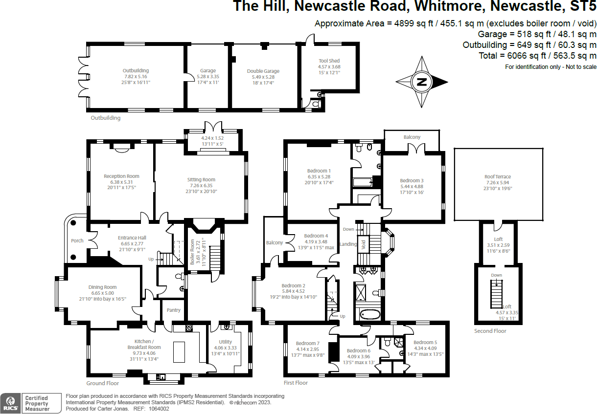
Floorplan
EPC Graphs
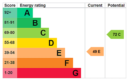
EPC Rating Graph
Rental Range
Estimated market rent for Newcastle-under-Lyme. Low = conservative, Realistic = average, Optimistic = best case.
Based on Local Authority from postcode lookup → Newcastle-under-Lyme.
LHA (30th percentile) floor for Staffordshire North: Apr 2025 – Mar 2026
Location
Address
Newcastle Road
Nearby
Nearest stations, universities and amenities (distance from property).
| Type | Name | Distance |
|---|---|---|
| Bus stop | Common Lane | 0.1 miles |
| Shop | WHSmith | 2.1 miles |
| Shop | Waitrose | 2.1 miles |
| Hospital | North Staffordshire Nuffield Hospital | 3.5 miles |
| Train station | Trentham Leisure | 4.1 miles |
| Train station | Unknown | 4.2 miles |
| Hospital | Royal Stoke University Hospital | 4.4 miles |
| University | University of Staffordshire Stoke Campus | 6.0 miles |
| University | University of Buckingham Crewe Campus | 10.3 miles |
Street-level crime
| Category | Count |
|---|---|
| Violence and sexual offences | 3 |
| Burglary | 1 |
| Criminal damage and arson | 1 |
| Total incidents | 5 |
Within 1 mile during Apr 2026. Source: data.police.uk (England & Wales).
Schools nearby
Nearest open schools with Ofsted ratings (England). Closed schools are not shown. Data from Get Information about Schools and Ofsted.
| Name | Type | Distance | Ofsted |
|---|---|---|---|
| Baldwins Gate CofE(VC) Primary School | Primary | 0.5 miles | Good — 7 Nov 2012 |
| Sir John Offley CofE (VC) Primary School | Primary | 2.9 miles | Good — 16 Mar 2023 |
| St John's CofE (C) Primary School | Primary | 2.9 miles | Requires improvement — 13 Jul 2023 |
| University of Keele | Other | 3.0 miles | — (No rating) |
| Madeley High School | Secondary | 3.1 miles | Good — 7 Feb 2013 |
Rental Comparables
Residential lets from OpenRent and Rightmove for the area. Bedroom counts vary — use the Beds column to compare like-for-like lets. Student lets are excluded.
Average rent: £987/mo (129 listings)
Enter House Number
Enter the house number to help us retrieve more accurate pricing history and property data.
Please log in to submit or correct the house number for this listing.
Log in to continue