Westwood House
20, MEADOW RIGGS, ALNWICK, NORTHUMBERLAND NE66 1AP
£289,000
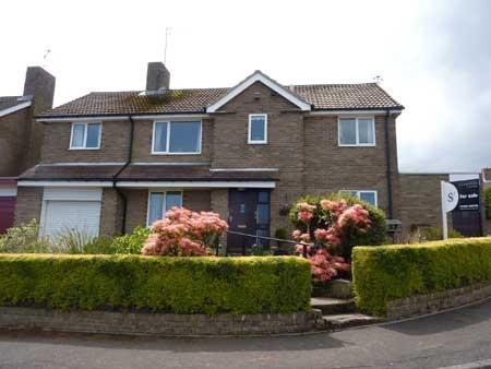
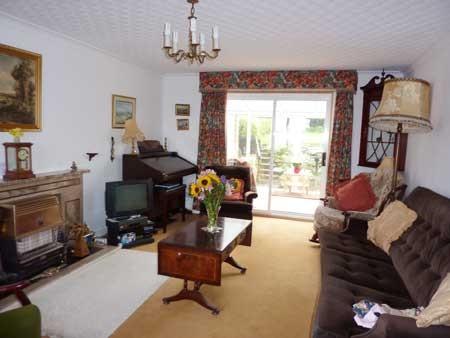
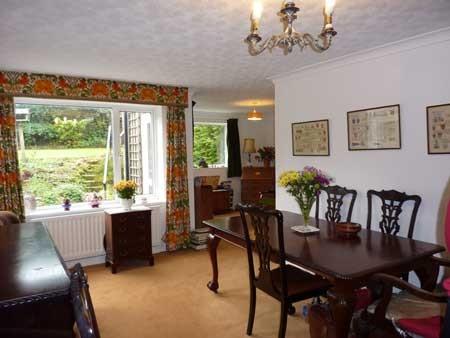
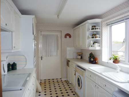
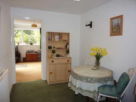
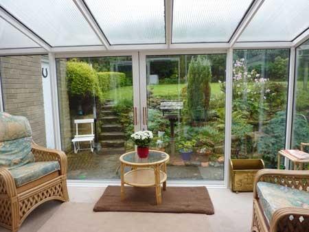
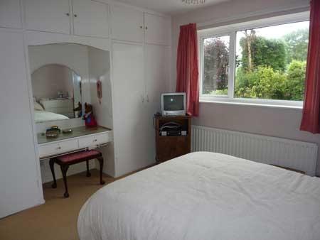
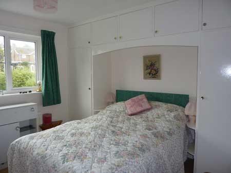
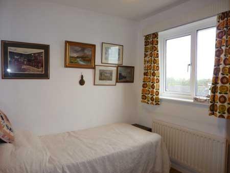
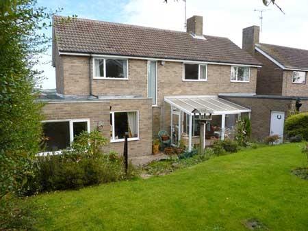
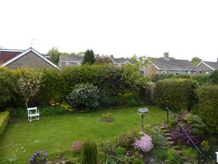
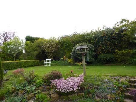
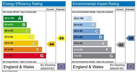
Photo 1 Photo 2 Photo 3 Photo 4 Photo 5 Photo 6 Photo 7 Photo 8 Photo 9 Photo 10 Photo 11 Photo 12 Photo 13
/ 13
Property details
Last sold
£260,000 Oct 2010
Local average
£521,778 (-44.6%)
Deprivation
Decile 9 (28,662 of 33,755)
Street crime
72 incidents within 1 mile (Apr 2026)
Additional details
- Parking
- Yes
- Garden
- Yes
Description
Meadow Riggs is a popular and established residential cul de sac development which occupies a commanding hillside position to the westerly area of Alnwick Town, and enjoys commanding views to the east across Alnwick to the coast in the distance. The property is conveniently positioned for access to a range of amenities in Alnwick Town.
Listed by
Alnwick
D G Young Ltd
Reference: 26961511
EPC ratings on this postcode
We don't have a matched EPC for this property yet. Below are efficiency scores and details for other addresses on this postcode.
| Address | Current | Potential | Floor area | Age band | Type |
|---|---|---|---|---|---|
| 10, Meadow Riggs, ALNWICK | 66 | 87 | 104 m² | England and Wales: 1967-1975 | Detached |
| 11, Meadow Riggs, ALNWICK | 68 | 80 | 140 m² | England and Wales: 1967-1975 | Detached |
| 11, Meadow Riggs, ALNWICK | 48 | 96 | 137 m² | England and Wales: 1967-1975 | Detached |
| 13 MEADOW RIGGS, ALNWICK, ALNWICK | 65 | 81 | 109 m² | England and Wales: 1967-1975 | Detached |
| 14 MEADOW RIGGS, ALNWICK, ALNWICK | 66 | 81 | 120 m² | England and Wales: 1967-1975 | Detached |
| 15 Meadow Riggs, ALNWICK | 66 | 82 | 80 m² | England and Wales: 1967-1975 | Detached |
| 16 Meadow Riggs, ALNWICK | 66 | 83 | 82 m² | England and Wales: 1967-1975 | Detached |
| 2, Meadow Riggs, ALNWICK | 56 | 79 | 81 m² | England and Wales: 1976-1982 | Detached |
| 22 Meadow Riggs, ALNWICK | 65 | 81 | 74 m² | England and Wales: 1967-1975 | Detached |
| 23 Meadow Riggs, ALNWICK | 75 | 83 | 182 m² | England and Wales: 1983-1990 | Detached |
| 25 Meadow Riggs, ALNWICK | 69 | 77 | 81 m² | England and Wales: 1967-1975 | Detached |
| 26, Meadow Riggs, ALNWICK | 64 | 80 | 78 m² | England and Wales: 1967-1975 | Detached |
| 26, Meadow Riggs, ALNWICK | 68 | 84 | 77 m² | England and Wales: 1967-1975 | Detached |
| 26, Meadow Riggs, ALNWICK | 50 | 83 | 81 m² | England and Wales: 1967-1975 | Detached |
| 28 MEADOW RIGGS, ALNWICK, ALNWICK | 67 | 81 | 107 m² | England and Wales: 1967-1975 | Detached |
Flood risk
Zone: 1
Risk: Low
Job (default Low)
Price history
| Event | Date | Price | % change |
|---|---|---|---|
| Sold | 06/10/2010 (15 years ago) | £260,000 | — |
Source: HM Land Registry Price Paid Data. Crown copyright.
Sold Comparables
Same street and nearby sales within 0.25 miles (last 5 years). Data from Land Registry Price Paid.
| Address | Price | Date | Type |
|---|---|---|---|
| Same street 25 MEADOW RIGGS, ALNWICK, NORTHUMBERLAND, NE66 1AP | £330,000 | 17/12/2025 | Semi-detached |
| 71 FAIRFIELDS, ALNWICK, NORTHUMBERLAND, NE66 1BT | £340,000 | 12/12/2025 | Detached |
| 18 FAIRFIELDS, ALNWICK, NORTHUMBERLAND, NE66 1BT | £285,000 | 13/12/2024 | Detached |
| Same street 23 MEADOW RIGGS, ALNWICK, NORTHUMBERLAND, NE66 1AP | £401,000 | 12/08/2024 | Detached |
| Same street 16 MEADOW RIGGS, ALNWICK, NORTHUMBERLAND, NE66 1AP | £270,000 | 21/12/2023 | Detached |
| 64 SWANSFIELD PARK ROAD, ALNWICK, NORTHUMBERLAND, NE66 1AR | £435,000 | 08/12/2023 | Detached |
| 13 FAIRFIELDS, ALNWICK, NORTHUMBERLAND, NE66 1BT | £222,500 | 20/10/2023 | Detached |
| 25 FAIRFIELDS, ALNWICK, NORTHUMBERLAND, NE66 1BT | £235,000 | 30/06/2023 | Detached |
| 17 AYDON VIEW, ALNWICK, NORTHUMBERLAND, NE66 1BF | £317,000 | 28/04/2023 | Detached |
| 16 FAIRFIELDS, ALNWICK, NORTHUMBERLAND, NE66 1BT | £292,000 | 17/04/2023 | Detached |
| 9 DRAPER CLOSE, SWORDY PARK, ALNWICK, NORTHUMBERLAND, NE66 1DF | £399,995 | 31/03/2023 | Detached |
| 8 DRAPER CLOSE, SWORDY PARK, ALNWICK, NORTHUMBERLAND, NE66 1DF | £275,995 | 24/03/2023 | Detached |
| 7 DRAPER CLOSE, SWORDY PARK, ALNWICK, NORTHUMBERLAND, NE66 1DF | £379,995 | 24/03/2023 | Detached |
| 10 DRAPER CLOSE, SWORDY PARK, ALNWICK, NORTHUMBERLAND, NE66 1DF | £319,995 | 10/03/2023 | Detached |
| 12 DRAPER CLOSE, SWORDY PARK, ALNWICK, NORTHUMBERLAND, NE66 1DF | £367,995 | 17/02/2023 | Detached |
| 6 DRAPER CLOSE, SWORDY PARK, ALNWICK, NORTHUMBERLAND, NE66 1DF | £339,995 | 03/02/2023 | Detached |
| 16 DRAPER CLOSE, SWORDY PARK, ALNWICK, NORTHUMBERLAND, NE66 1DF | £354,995 | 13/01/2023 | Detached |
| 5 DRAPER CLOSE, SWORDY PARK, ALNWICK, NORTHUMBERLAND, NE66 1DF | £362,995 | 22/12/2022 | Detached |
| 11 DRAPER CLOSE, SWORDY PARK, ALNWICK, NORTHUMBERLAND, NE66 1DF | £309,995 | 21/12/2022 | Detached |
| 2 DRAPER CLOSE, SWORDY PARK, ALNWICK, NORTHUMBERLAND, NE66 1DF | £298,995 | 21/12/2022 | Detached |
| 4 DRAPER CLOSE, SWORDY PARK, ALNWICK, NORTHUMBERLAND, NE66 1DF | £379,995 | 21/12/2022 | Detached |
| 3 DRAPER CLOSE, SWORDY PARK, ALNWICK, NORTHUMBERLAND, NE66 1DF | £299,995 | 20/12/2022 | Detached |
| 14 DRAPER CLOSE, SWORDY PARK, ALNWICK, NORTHUMBERLAND, NE66 1DF | £279,995 | 19/12/2022 | Detached |
| Same street 26 MEADOW RIGGS, ALNWICK, NORTHUMBERLAND, NE66 1AP | £306,000 | 31/10/2022 | Detached |
| Same street 23 MEADOW RIGGS, ALNWICK, NORTHUMBERLAND, NE66 1AP | £345,000 | 17/12/2021 | Detached |
Street average: £330,400 (5 sales)
Area average: £324,872 (20 sales)
Capital growth trend
Land Registry outcode average: last 12 months vs 5y and 10y ago (from sold prices).
House Price Index (HM Land Registry — official index, not sold-price averages): Northumberland. Series: Detached. As of March 2026.
Rental Range
Estimated market rent for Northumberland. Low = conservative, Realistic = average, Optimistic = best case.
Based on Local Authority from postcode lookup → Northumberland.
LHA (30th percentile) floor for Northumberland: £758/mo (Apr 2025 – Mar 2026)
Location
Address
Meadow Riggs
Nearby
Nearest stations, universities and amenities (distance from property).
| Type | Name | Distance |
|---|---|---|
| Shop | Unknown | 0.4 miles |
| Shop | Carefully Crafted | 0.4 miles |
| Bus stop | St James East | 0.4 miles |
| Bus stop | Waggonway Road, Co-op | 0.4 miles |
| Hospital | Alnwick Infirmary | 0.6 miles |
| Train station | Lionheart | 0.9 miles |
| Train station | Greenrigg Halt | 2.0 miles |
| Hospital | Coquetdale Community Hospital | 10.6 miles |
Street-level crime
| Category | Count |
|---|---|
| Violence and sexual offences | 28 |
| Anti-social behaviour | 13 |
| Public order | 7 |
| Shoplifting | 7 |
| Criminal damage and arson | 4 |
| Drugs | 3 |
| Other crime | 3 |
| Other theft | 2 |
| Theft from the person | 2 |
| Bicycle theft | 1 |
| Possession of weapons | 1 |
| Vehicle crime | 1 |
| Total incidents | 72 |
Within 1 mile during Apr 2026. Source: data.police.uk (England & Wales).
Schools nearby
Nearest open schools with Ofsted ratings (England). Closed schools are not shown. Data from Get Information about Schools and Ofsted.
| Name | Type | Distance | Ofsted |
|---|---|---|---|
| Swansfield Park Primary School | Primary | 0.3 miles | Good — 21 Jan 2024 |
| St Paul's Catholic Primary School, Alnwick | Primary | 0.6 miles | Good — 12 Nov 2012 |
| NCEA St Michael's Church of England Primary School | Primary | 0.6 miles | Good — 22 Dec 2022 |
| Barndale House School | Other | 0.6 miles | Good — 24 Jun 2024 |
| The Duchess's Community High School | Secondary | 0.7 miles | Requires improvement — 2 Dec 2021 |
Rental Comparables
Rental comparables are temporarily unavailable while listing-site fetches are paused. Try again later.
Rent-driven metrics
Based on Area rent estimate.
- Rent ratio — Monthly rent ÷ purchase price (1% rule). 1%+ = strong, 0.8–1% = okay, <0.8% = weak for cashflow.
- Max investor price — Rent ÷ 0.8%; the price at which rent would be 0.8% of price (Stoke-style target).
- Target investor price — Rent ÷ 1%; the price at which rent would be 1% of price (strong cashflow band).
- Gross yield — Annual rent as % of purchase price (no costs).
Enter House Number
Enter the house number to help us retrieve more accurate pricing history and property data.
Please log in to submit or correct the house number for this listing.
Log in to continue