33A
MARKET STREET, HIGH PEAK, NEW MILLS, DERBYSHIRE SK22 4AA
£695 pcm


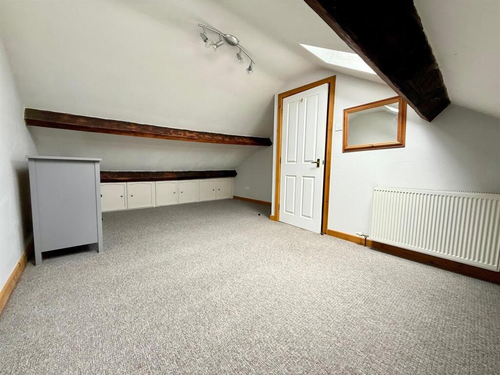


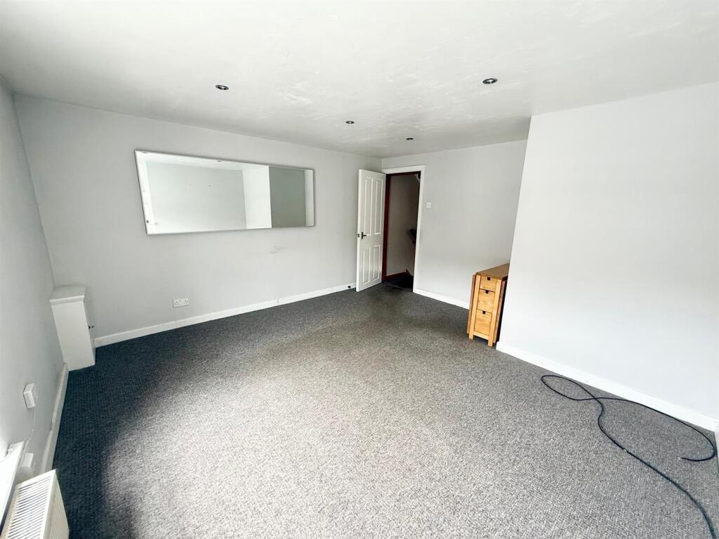
Photo 1 Photo 2 Photo 3 Photo 4 Photo 5 Photo 6
/ 6
Property details
Floor area
57 m²
Council tax band
A
EPC rating
D
Year built
England and Wales: 1900-1929
Deprivation
Decile 8 (25,644 of 33,755)
Street crime
34 incidents within 1 mile (Apr 2026)
Key features
- Available Now
- One Bedroom
- Town Centre Location
- Gas Central Heating
- Walking Distance to Transport Links
- Unfurnished
Additional details
- Electricity
- Mains supply
- Water
- Mains supply
- Sewerage
- Mains supply
- Heating
- Gas central
Description
Entrance -
Stairs To First Floor -
Living Room - 4.06m x 3.94m (13'4 x 12'11) -
Kitchen - 2.67m x 2.54m (8'9 x 8'4) -
Bathroom -
Stairs To Second Floor -
Bedroom - 5.38m x 3.84m max (limited head height) (17'8 x 1 -
Listed by
Disley
Jordan Fishwick
Reference: 164233661
EPC Rating & Upgrade Cost
Current rating: D
Potential rating: C
Inspection date: 19/07/2025
Expiry date: 18/07/2035
Est. upgrade cost to C: £3,443
Recommendations
- Low energy lighting for all fixed outlets (£330 - £385)
- Upgrade heating controls (£220 - £250)
- Replace boiler with new condensing boiler (£2,200 - £3,500)
Flood risk
Zone: 1
Risk: Low
Job (default Low)
Rental Range
Estimated market rent for High Peak. Low = conservative, Realistic = average, Optimistic = best case.
Based on Local Authority from postcode lookup → High Peak.
LHA (30th percentile) floor for Southern Greater Manchester: £623/mo (Apr 2025 – Mar 2026)
Location
Nearby
Nearest stations, universities and amenities (distance from property).
| Type | Name | Distance |
|---|---|---|
| Shop | Mind | 0.0 miles |
| Shop | The Tan Mill | 0.0 miles |
| Train station | New Mills Central | 0.2 miles |
| Bus stop | New Mills, Church Road / NE-bound Queens Bridge | 0.2 miles |
| Bus stop | New Mills, Church Road / SW-bound Queens Bridge | 0.2 miles |
| Train station | New Mills Newtown | 0.6 miles |
| Hospital | Corbar hall | 7.9 miles |
| University | University of Derby, Buxton | 8.1 miles |
| Hospital | Newlands Care Home | 8.5 miles |
| University | University of Manchester Fallowfield Campus | 10.2 miles |
Street-level crime
| Category | Count |
|---|---|
| Violence and sexual offences | 19 |
| Criminal damage and arson | 6 |
| Burglary | 2 |
| Drugs | 2 |
| Public order | 2 |
| Anti-social behaviour | 1 |
| Other theft | 1 |
| Vehicle crime | 1 |
| Total incidents | 34 |
Within 1 mile during Apr 2026. Source: data.police.uk (England & Wales).
Schools nearby
Nearest open schools with Ofsted ratings (England). Closed schools are not shown. Data from Get Information about Schools and Ofsted.
| Name | Type | Distance | Ofsted |
|---|---|---|---|
| New Mills Nursery School | Nursery | 0.0 miles | Good — 9 Jan 2013 |
| St Mary's Catholic Voluntary Academy | Primary | 0.1 miles | Good — 11 Oct 2013 |
| New Mills Primary School | Primary | 0.2 miles | Good — 18 Dec 2013 |
| New Mills School | Secondary | 0.2 miles | Requires improvement — 20 Oct 2022 |
| St George's CofE Primary School | Primary | 0.3 miles | Requires improvement — 3 Apr 2022 |
Rental Comparables
Residential lets from OpenRent and Rightmove for the area (same bedroom count). Use to validate rent estimates. Student lets are excluded.
| Title | Rent | Beds | Distance | As seen on |
|---|---|---|---|---|
| 1 Bed Flat, Dyehouse Lane, SK22 | £750/mo | 1 | 0.28 miles | OpenRent |
Average rent: £750/mo (1 listing)