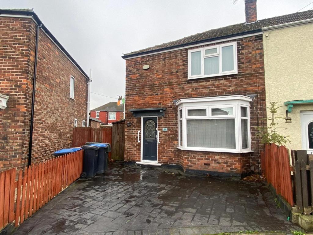
38 FALCON ROAD
MIDDLESBROUGH, MIDDLESBROUGH TS3 8EE
Property details
Floor area
84 m²
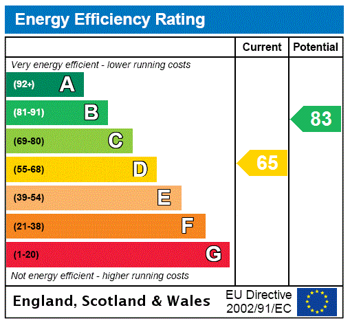
EPC rating
D
Year built
England and Wales: 1930-1949
Last sold
£105,000 Mar 2023
Price per m²
£1,250/m²
Local average
£73,842 (+42.2%)
Deprivation
Decile 1 (1,322 of 33,755)
Street crime
468 incidents within 1 mile (Apr 2026)
Additional details
- Parking
- Yes
- Garden
- Yes
Description
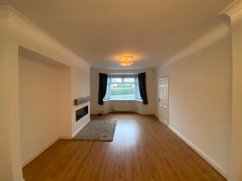
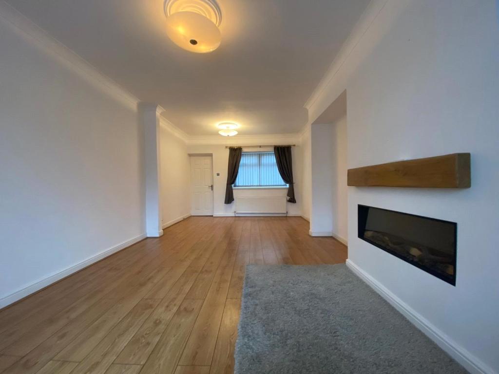
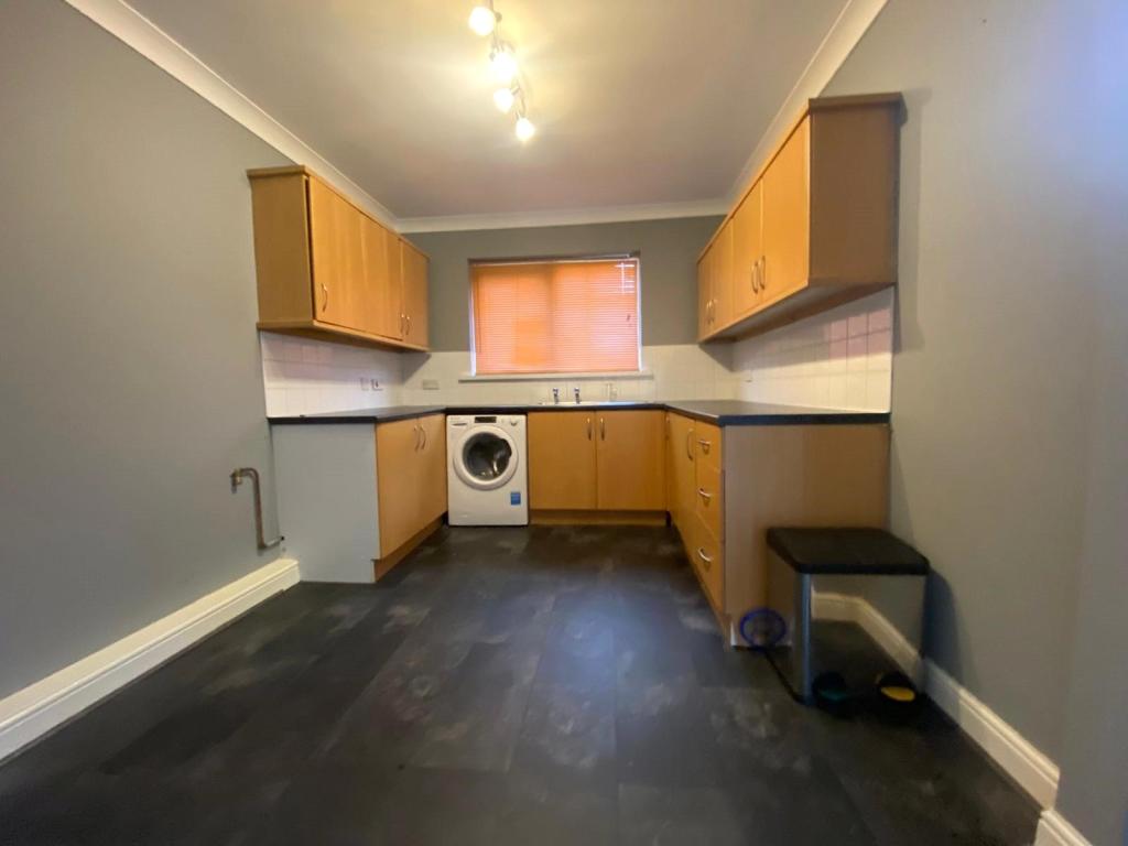
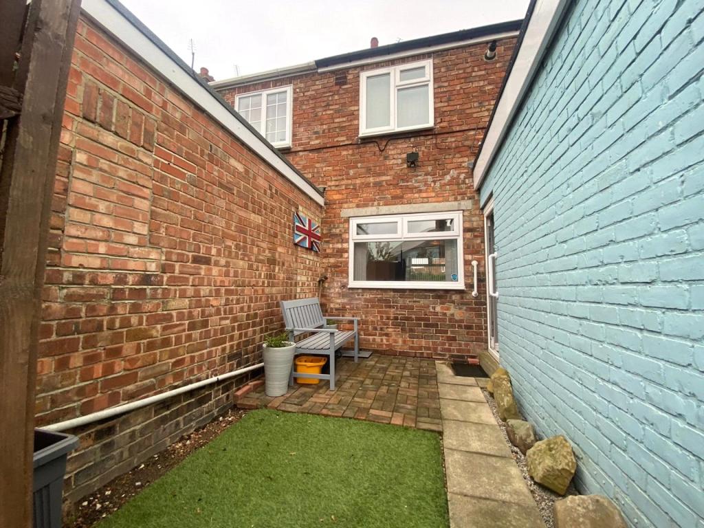
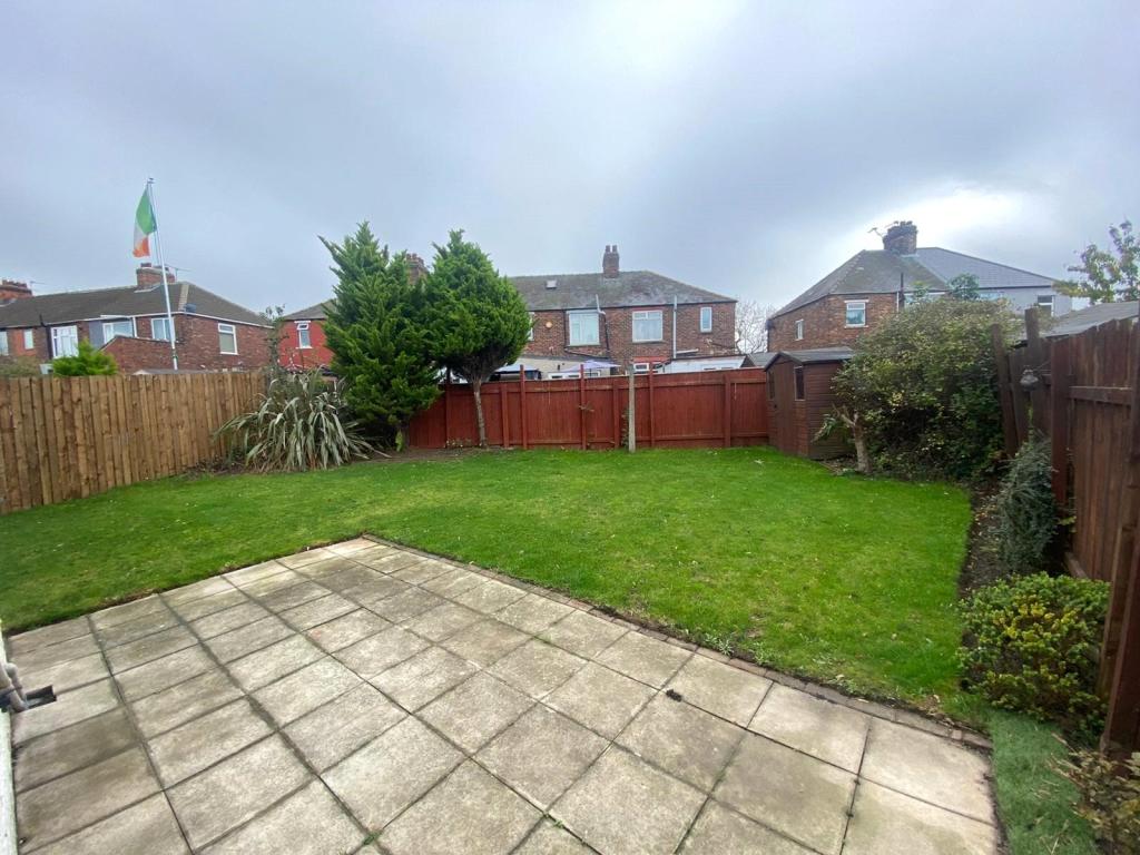
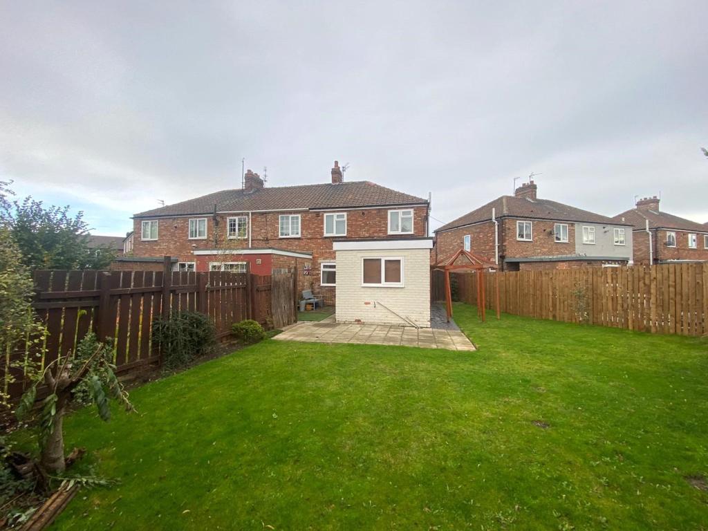
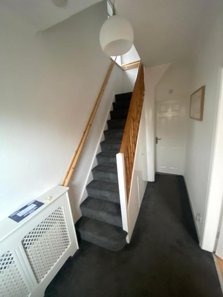
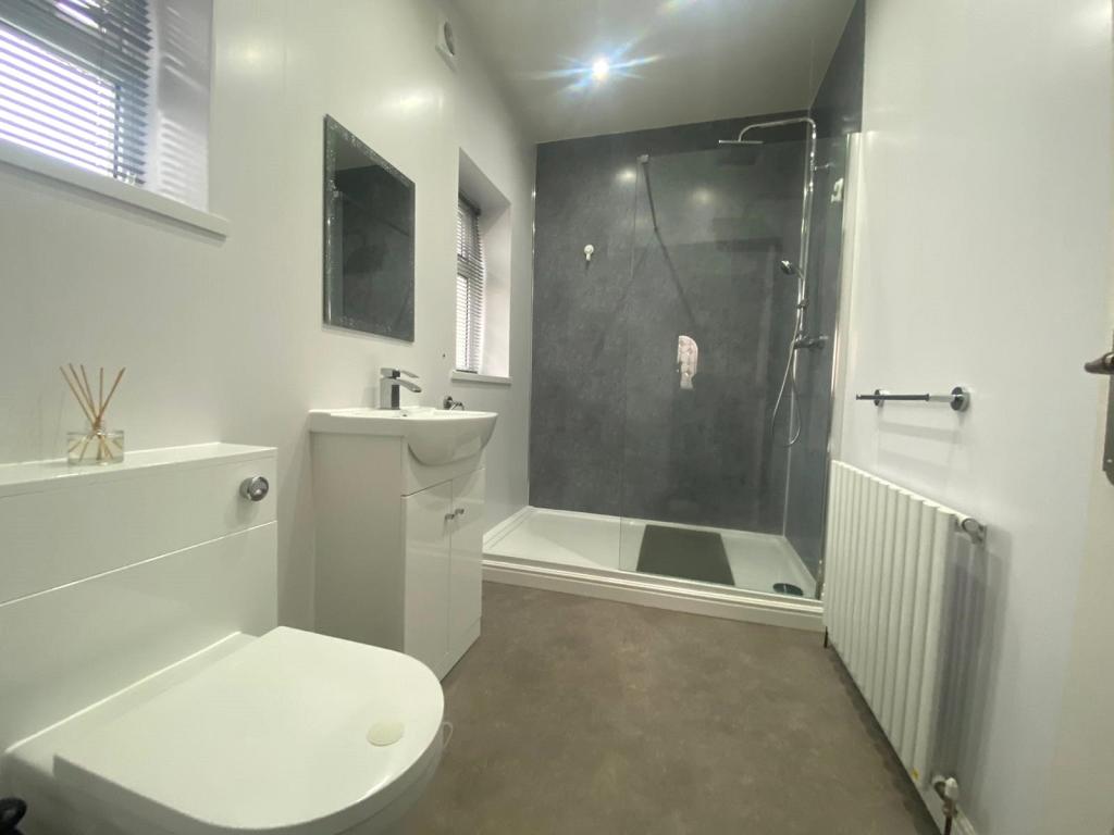
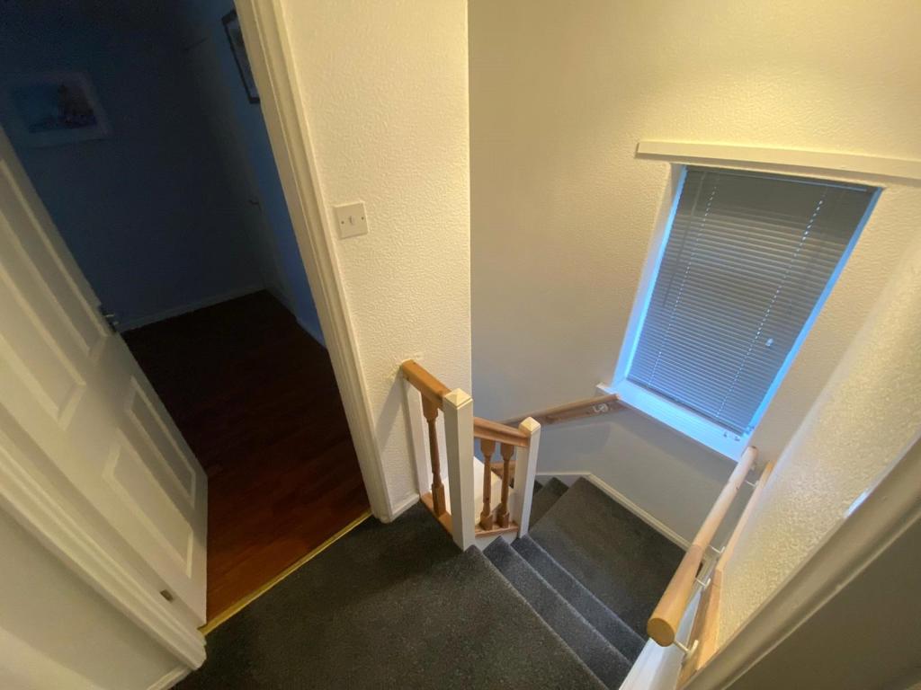
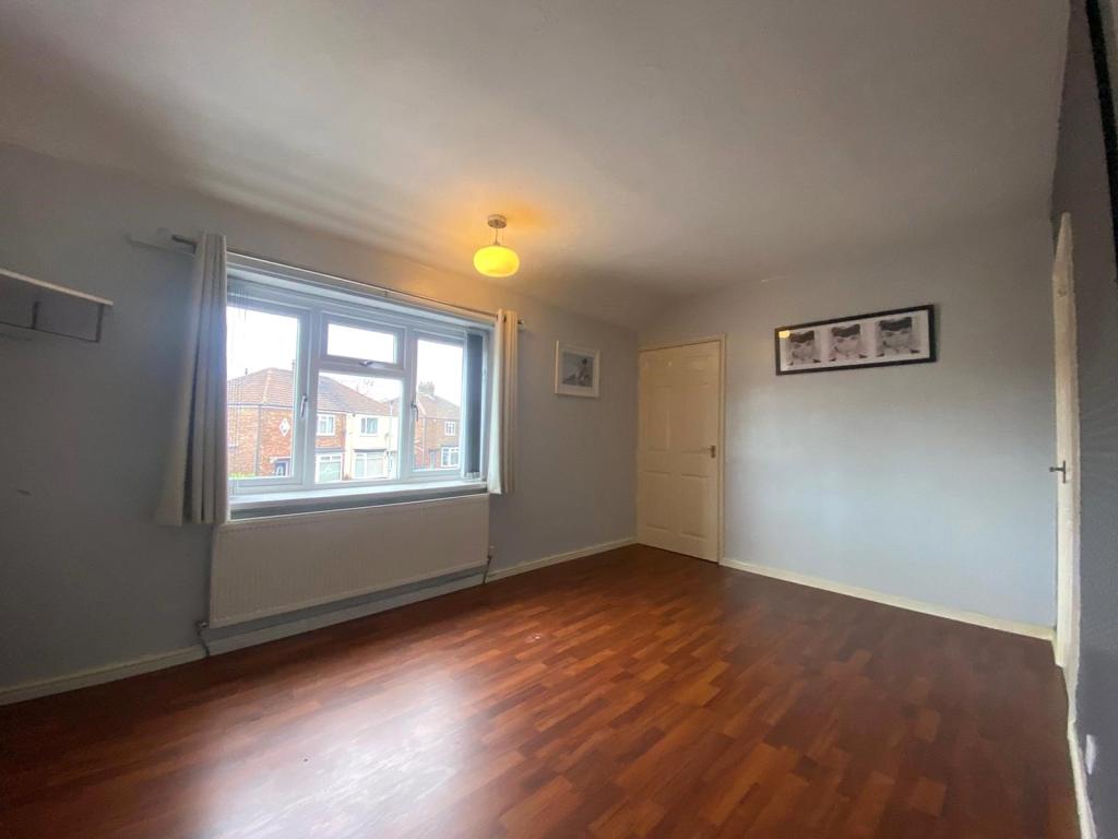
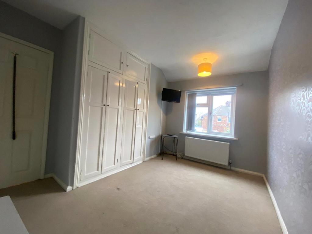
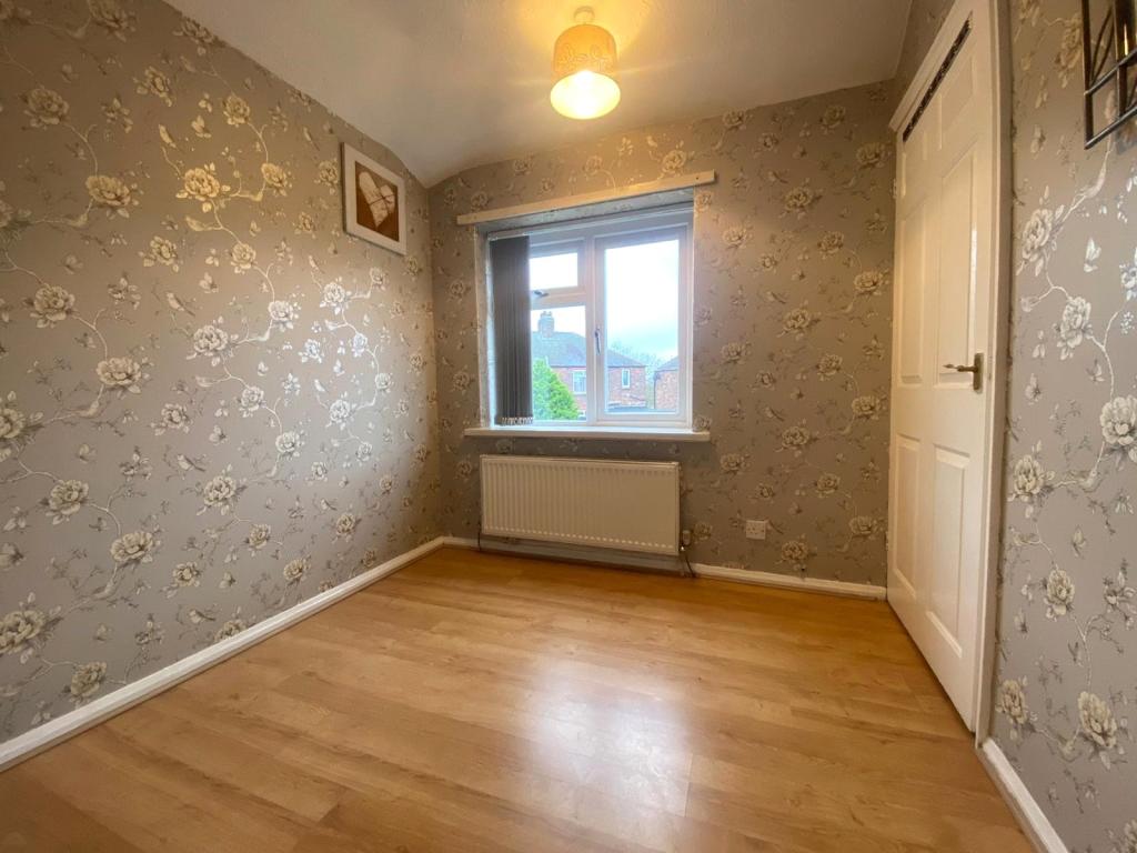
The accommodation on offer comprises: Entrance hallway with staircase to first floor, through lounge diner with Bay window and feature fireplace. Fitted kitchen and white family bathroom W.C. To first floor are three well proportioned bedrooms all with fitted storage. Externally is a front forecourt garden, driveway and rear enclosed garden with lawned area and raised patio.
Located in the popular Boyds Estate area of Middlesbrough, the property is well situated for local schools and colleges. Within close proximity you can find a post office, Lidl, Morrisons and Pallister Park for recreational outdoor space. There is also the bonus of the A66 close by and A19 for access to further afield.
We anticipate a huge amount of interest in the property and viewings are strictly by appointment only.
Listed by
Middlesbrough
Countrywide UK Sales - Connells
Reference: 129106097
EPC Rating & Upgrade Cost
Current rating: D
Potential rating: B
Inspection date: 04/11/2022
Expiry date: 03/11/2032
Current heating cost: £653/year
Potential heating cost: £513/year
Est. upgrade cost to C: £20,675
Recommendations
- Flat roof or sloping ceiling insulation (£850 - £1,500)
- 50 mm internal or external wall insulation (£4,000 - £14,000)
- Floor insulation (suspended floor) (£800 - £1,200)
- Solar water heating (£4,000 - £6,000)
- Solar photovoltaic panels, 2.5 kWp (£3,500 - £5,500)
Flood risk
Zone: 1
Risk: Low
Job (default Low)
EPC Graphs
EPC Rating Graph
Price history
| Event | Date | Price | % change |
|---|---|---|---|
| Sold | 28/03/2023 (3 years ago) | £105,000 | — |
Source: HM Land Registry Price Paid Data. Crown copyright.
Sold Comparables
Same street and nearby sales within 0.25 miles (last 5 years). Data from Land Registry Price Paid.
| Address | Price | Date | Type |
|---|---|---|---|
| 37 PALLISTER AVENUE, MIDDLESBROUGH, TS3 9AP | £70,000 | 30/11/2023 | Terraced |
| 79 PALLISTER AVENUE, MIDDLESBROUGH, TS3 9BE | £92,000 | 28/11/2023 | Terraced |
| 14 KESTREL AVENUE, MIDDLESBROUGH, TS3 8EG | £62,000 | 29/11/2022 | Terraced |
| 25 PALLISTER AVENUE, MIDDLESBROUGH, TS3 9AP | £65,000 | 03/11/2022 | Terraced |
| 5 ARNSIDE AVENUE, MIDDLESBROUGH, TS3 8HA | £71,000 | 26/10/2022 | Terraced |
| 93 MERLIN ROAD, MIDDLESBROUGH, TS3 8EA | £106,500 | 13/09/2022 | Terraced |
| Same street 33 FALCON ROAD, MIDDLESBROUGH, TS3 8EE | £72,500 | 21/04/2022 | Semi-detached |
| 2 HAWK ROAD, MIDDLESBROUGH, TS3 8EQ | £82,500 | 11/02/2022 | Terraced |
| 91 MERLIN ROAD, MIDDLESBROUGH, TS3 8EA | £80,000 | 29/09/2021 | Terraced |
| 37 PALLISTER AVENUE, MIDDLESBROUGH, TS3 9AP | £42,000 | 19/08/2021 | Terraced |
| 222 CARGO FLEET LANE, MIDDLESBROUGH, TS3 8EJ | £50,000 | 16/07/2021 | Terraced |
| 57 PALLISTER AVENUE, MIDDLESBROUGH, TS3 9BE | £68,000 | 16/07/2021 | Terraced |
| 37 PALLISTER AVENUE, MIDDLESBROUGH, TS3 9AP | £39,950 | 18/06/2021 | Terraced |
Street average: £72,500 (1 sale)
Area average: £69,079 (12 sales)
Capital growth trend
Land Registry outcode average: last 12 months vs 5y and 10y ago (from sold prices).
House Price Index (HM Land Registry — official index, not sold-price averages): Middlesbrough. Series: Terraced. As of March 2026.
Rental Range
Estimated market rent for Middlesbrough. Low = conservative, Realistic = average, Optimistic = best case.
Based on Local Authority from postcode lookup → Middlesbrough.
LHA (30th percentile) floor for Teesside: £549/mo (Apr 2025 – Mar 2026)
Location
Nearby
Nearest stations, universities and amenities (distance from property).
| Type | Name | Distance |
|---|---|---|
| Bus stop | Brambles Farm Hotel | 0.0 miles |
| Shop | Rumple Ink Skin | 0.1 miles |
| Shop | Bark in Style | 0.1 miles |
| Hospital | Roseberry Park | 1.3 miles |
| Train station | South Bank | 1.3 miles |
| Train station | James Cook | 1.3 miles |
| Hospital | The James Cook University Hospital | 1.4 miles |
| University | Teesside University | 1.5 miles |
| University | Durham University, Queen's Campus | 4.1 miles |
Street-level crime
| Category | Count |
|---|---|
| Violence and sexual offences | 132 |
| Shoplifting | 82 |
| Criminal damage and arson | 54 |
| Anti-social behaviour | 53 |
| Public order | 41 |
| Robbery | 20 |
| Vehicle crime | 19 |
| Burglary | 17 |
| Other theft | 14 |
| Other crime | 13 |
| Drugs | 10 |
| Bicycle theft | 6 |
| Possession of weapons | 5 |
| Theft from the person | 2 |
| Total incidents | 468 |
Within 1 mile during Apr 2026. Source: data.police.uk (England & Wales).
Schools nearby
Nearest open schools with Ofsted ratings (England). Closed schools are not shown. Data from Get Information about Schools and Ofsted.
| Name | Type | Distance | Ofsted |
|---|---|---|---|
| Keys Tees Valley College | Other | 0.1 miles | Requires improvement — 30 Apr 2024 |
| Reintegreat Education Solutions Ltd | Other | 0.2 miles | Good — 31 Jan 2024 |
| Corpus Christi RC Primary School | Primary | 0.3 miles | Good — 5 Apr 2012 |
| Brambles Primary Academy | Primary | 0.3 miles | Outstanding — 2 Jul 2014 |
| River Tees Primary Academy | Other | 0.4 miles | Good — 18 Feb 2015 |
Rental Comparables
Loading rental comparables for this postcode. Refresh in a few minutes.
Rent-driven metrics
Based on Area rent estimate.
- Rent ratio — Monthly rent ÷ purchase price (1% rule). 1%+ = strong, 0.8–1% = okay, <0.8% = weak for cashflow.
- Max investor price — Rent ÷ 0.8%; the price at which rent would be 0.8% of price (Stoke-style target).
- Target investor price — Rent ÷ 1%; the price at which rent would be 1% of price (strong cashflow band).
- Gross yield — Annual rent as % of purchase price (no costs).