11 BRANTWOOD ROAD
LONDON, GREATER LONDON N17 0DT
£399,999
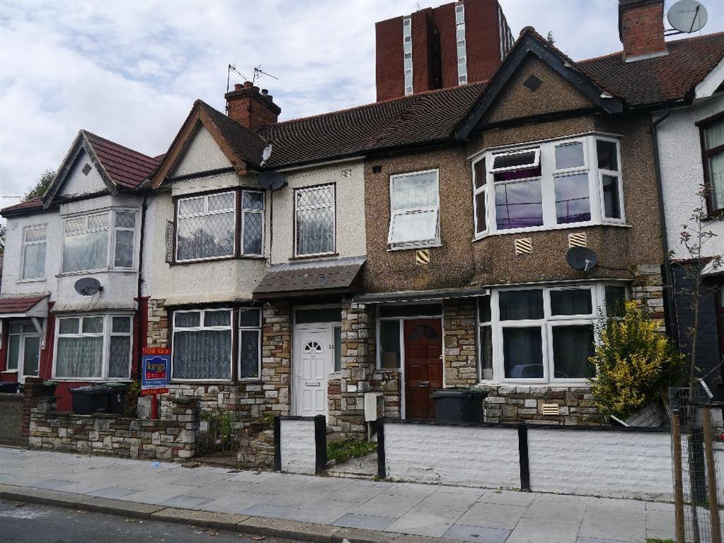
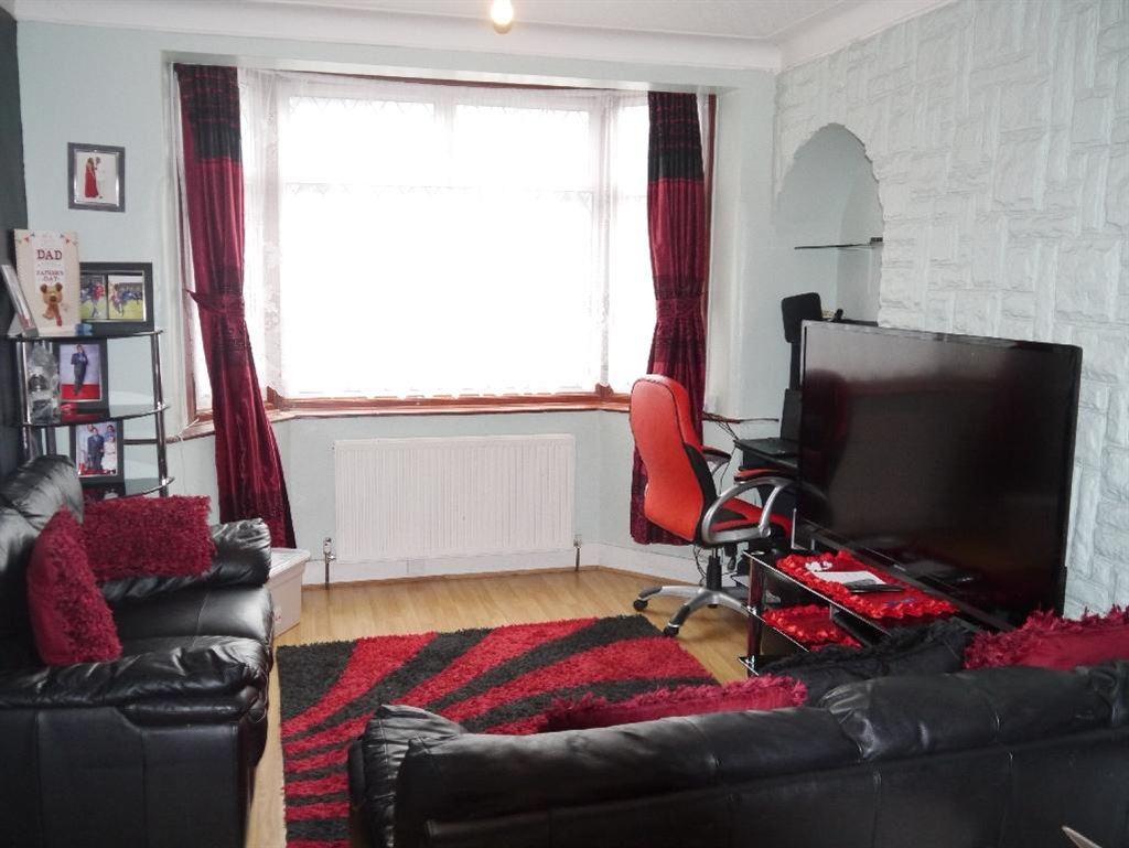
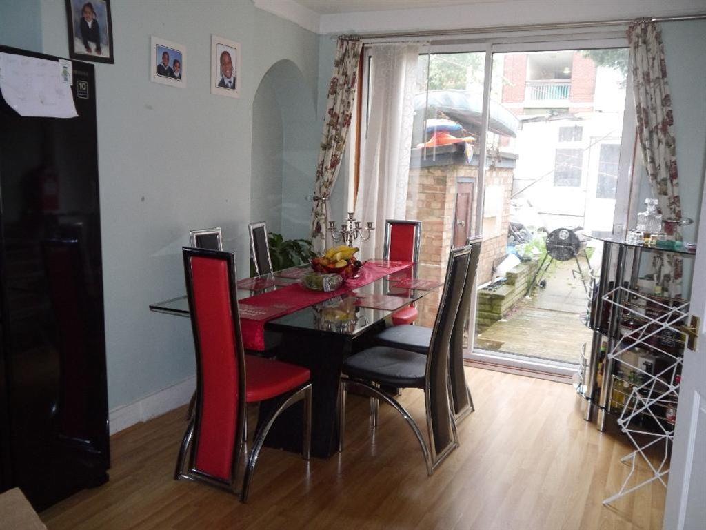
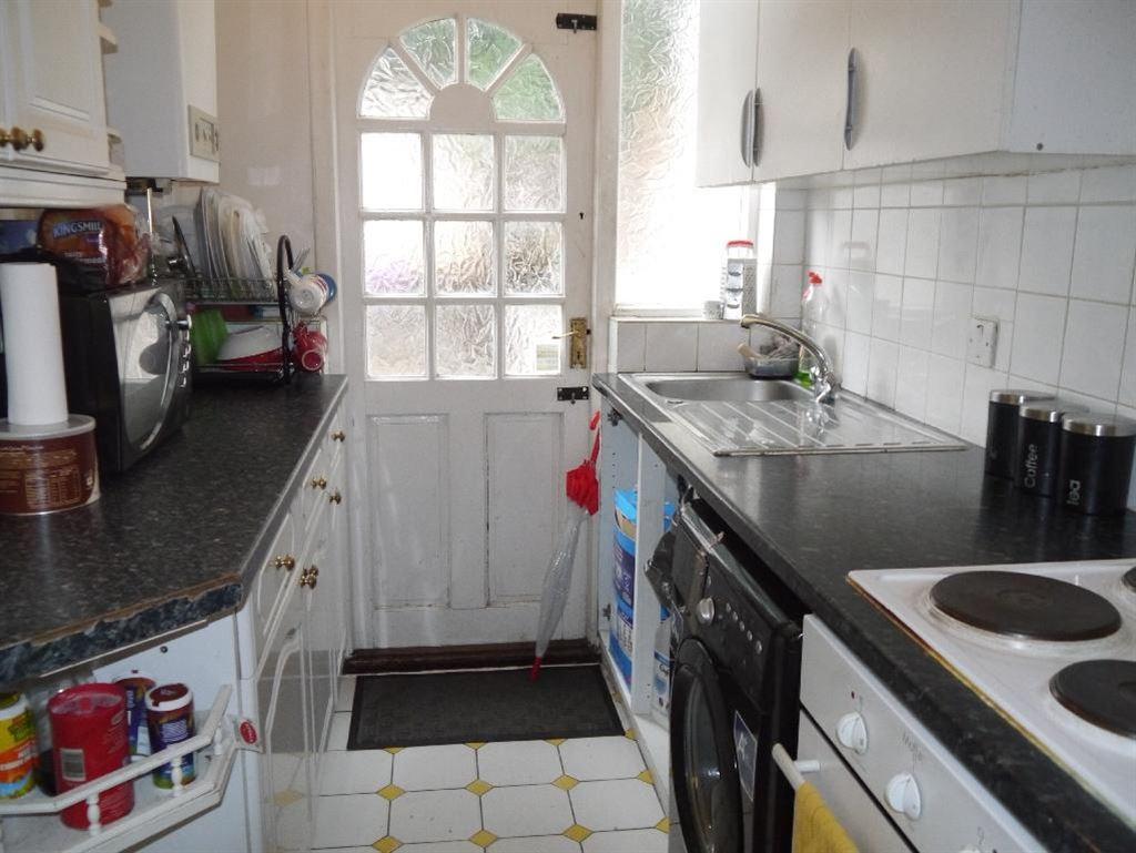
Photo 1 Photo 2 Photo 3 Photo 4 Photo 5
/ 5
Property details
Floor area
78 m²
EPC rating
D
Year built
England and Wales: 1930-1949
Last sold
£385,000 Jul 2016
Price per m²
£5,128/m²
Local average
£557,870 (-28.3%)
Deprivation
Decile 1 (565 of 33,755)
Street crime
983 incidents within 1 mile (Apr 2026)
Key features
- Three Bedroom House
- Mid Terrace
- 1930's Build
- Through Lounge With Space For Dining Area
- Gas Central Heating (Untested By KINGS)
- Located Off Tottenham High Road With Easy Access..
- Chain Free
- Double Glazed Windows
- 1.3 Miles To Bruce Grove Station
- EPC Rating E
Description
* Mid Terrace
* 1930's Build
* Through Lounge With Space For Dining Area
* Gas Central Heating (Untested By KINGS)
* Located Off Tottenham High Road With Easy Access To The A406
* Chain Free
* Double Glazed Windows
* 1.3 Miles To Bruce Grove Station
* EPC Rating E
Listed by
Tottenham
Kings Group
Reference: 53549047
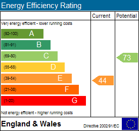
EPC Rating & Upgrade Cost
Current rating: D
Potential rating: B
Inspection date: 28/11/2015
Expiry date: 27/11/2025 (expired)
Current heating cost: £569/year
Potential heating cost: £349/year
Est. upgrade cost to C: £21,725
Recommendations
- Increase loft insulation to 270 mm (£100 - £350)
- 50 mm internal or external wall insulation (£4,000 - £14,000)
- Floor insulation (suspended floor) (£800 - £1,200)
- Solar water heating (£4,000 - £6,000)
- Solar photovoltaic panels, 2.5 kWp (£5,000 - £8,000)
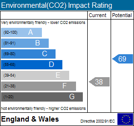
Flood risk
Zone: 1
Risk: Low
Job (default Low)
EPC Graphs
EE Rating
EI Rating
Price history
| Event | Date | Price | % change |
|---|---|---|---|
| Sold | 26/07/2016 (9 years ago) | £385,000 | — |
Source: HM Land Registry Price Paid Data. Crown copyright.
Sold Comparables
Same street and nearby sales within 0.25 miles (last 5 years). Data from Land Registry Price Paid.
| Address | Price | Date | Type |
|---|---|---|---|
| Same street 59 BRANTWOOD ROAD, TOTTENHAM, LONDON, HARINGEY, GREATER LONDON, N17 0DT | £400,000 | 05/12/2025 | Terraced |
| 13 NORTHUMBERLAND PARK, LONDON, HARINGEY, GREATER LONDON, N17 0TA | £540,000 | 26/09/2025 | Terraced |
| 54 BRANTWOOD ROAD, TOTTENHAM, LONDON, HARINGEY, GREATER LONDON, N17 0EU | £480,000 | 21/08/2025 | Terraced |
| Same street 87B BRANTWOOD ROAD, TOTTENHAM, LONDON, HARINGEY, GREATER LONDON, N17 0DT | £350,000 | 13/09/2023 | Flat |
| 1A CLIVE AVENUE, LONDON, ENFIELD, GREATER LONDON, N18 2RW | £265,000 | 01/09/2023 | Terraced |
| 10 INGLETON ROAD, LONDON, HARINGEY, GREATER LONDON, N18 2RU | £392,000 | 14/04/2023 | Terraced |
| 52 CONISTON ROAD, TOTTENHAM, LONDON, HARINGEY, GREATER LONDON, N17 0EX | £485,000 | 18/05/2022 | Terraced |
| 195 MIDDLEHAM ROAD, LONDON, ENFIELD, GREATER LONDON, N18 2RY | £360,000 | 18/04/2022 | Terraced |
| 197 MIDDLEHAM ROAD, LONDON, ENFIELD, GREATER LONDON, N18 2RY | £388,000 | 01/04/2022 | Terraced |
| Same street 9 BRANTWOOD ROAD, TOTTENHAM, LONDON, HARINGEY, GREATER LONDON, N17 0DT | £465,000 | 10/08/2021 | Terraced |
| 201 MIDDLEHAM ROAD, LONDON, ENFIELD, GREATER LONDON, N18 2RY | £375,000 | 28/06/2021 | Terraced |
| 19 CONISTON ROAD, TOTTENHAM, LONDON, HARINGEY, GREATER LONDON, N17 0EX | £420,000 | 28/06/2021 | Terraced |
| 94 INGLETON ROAD, LONDON, ENFIELD, GREATER LONDON, N18 2RT | £445,000 | 25/06/2021 | Terraced |
| 84 BRANTWOOD ROAD, TOTTENHAM, LONDON, HARINGEY, GREATER LONDON, N17 0EU | £619,000 | 23/06/2021 | Terraced |
Street average: £405,000 (3 sales)
Area average: £433,545 (11 sales)
Capital growth trend
Land Registry outcode average: last 12 months vs 5y and 10y ago (from sold prices).
House Price Index (HM Land Registry — official index, not sold-price averages): Haringey. Series: Terraced. As of March 2026.
Rental Range
Estimated market rent for Haringey. Low = conservative, Realistic = average, Optimistic = best case.
Based on Local Authority from postcode lookup → Haringey.
LHA (30th percentile) floor for Cambridge: £1,122/mo (Apr 2025 – Mar 2026)
Location
Nearby
Nearest stations, universities and amenities (distance from property).
| Type | Name | Distance |
|---|---|---|
| Bus stop | Brantwood Road | 0.1 miles |
| Shop | D.W. General Wood Machinists ltd. | 0.1 miles |
| Bus stop | Unknown | 0.1 miles |
| Shop | Sainsbury's | 0.1 miles |
| Train station | White Hart Lane | 0.3 miles |
| Train station | Silver Street | 0.5 miles |
| Hospital | North London Hospice Winchmore Hill | 1.6 miles |
| Hospital | Priory Hospital | 2.8 miles |
| University | Arden University Stratford Campus | 5.1 miles |
| University | University of Wales Trinity Saint David London | 5.3 miles |
Street-level crime
| Category | Count |
|---|---|
| Violence and sexual offences | 264 |
| Anti-social behaviour | 229 |
| Vehicle crime | 79 |
| Other theft | 72 |
| Public order | 59 |
| Drugs | 46 |
| Burglary | 44 |
| Criminal damage and arson | 43 |
| Shoplifting | 43 |
| Theft from the person | 42 |
| Robbery | 33 |
| Possession of weapons | 13 |
| Other crime | 11 |
| Bicycle theft | 5 |
| Total incidents | 983 |
Within 1 mile during Apr 2026. Source: data.police.uk (England & Wales).
Schools nearby
Nearest open schools with Ofsted ratings (England). Closed schools are not shown. Data from Get Information about Schools and Ofsted.
| Name | Type | Distance | Ofsted |
|---|---|---|---|
| Brook House Primary School | Primary | 0.1 miles | Outstanding — 26 Sep 2023 |
| St John and St James CofE Primary School | Primary | 0.2 miles | Good — 13 Jan 2022 |
| London Academy of Excellence Tottenham | Other | 0.2 miles | — (No rating) |
| Vale School | Other | 0.2 miles | Good — 26 Oct 2012 |
| Duke's Aldridge | Secondary | 0.2 miles | Good — 9 Feb 2012 |
Rental Comparables
Rental listings exist nearby, but none matched the 3-bedroom count for this property.
Rent-driven metrics
Based on Area rent estimate.
- Rent ratio — Monthly rent ÷ purchase price (1% rule). 1%+ = strong, 0.8–1% = okay, <0.8% = weak for cashflow.
- Max investor price — Rent ÷ 0.8%; the price at which rent would be 0.8% of price (Stoke-style target).
- Target investor price — Rent ÷ 1%; the price at which rent would be 1% of price (strong cashflow band).
- Gross yield — Annual rent as % of purchase price (no costs).