7 MILL LANE
YORK, AMPLEFORTH, NORTH YORKSHIRE YO62 4DJ


Property details
Tenure
FREEHOLD
Floor area
61 m²
Council tax band
B
EPC rating
D
Year built
England and Wales: 1991-1995
Last sold
£199,950 Oct 2024
Price per m²
£3,278/m²
Local average
£286,644 (-30.2%)
Deprivation
Decile 6 (17,522 of 33,755)
Street crime
3 incidents within 1 mile (Apr 2026)
Key features
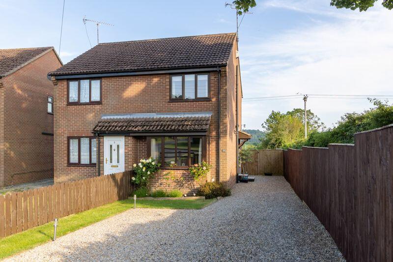
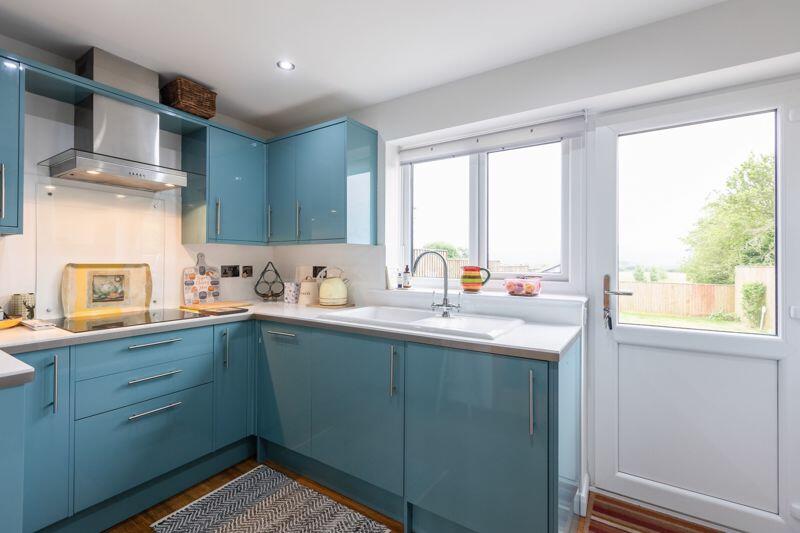
- IMMACULATELY RENOVATED SEMI-DETACHED HOUSE IN A SOUGHT-AFTER VILLAGE
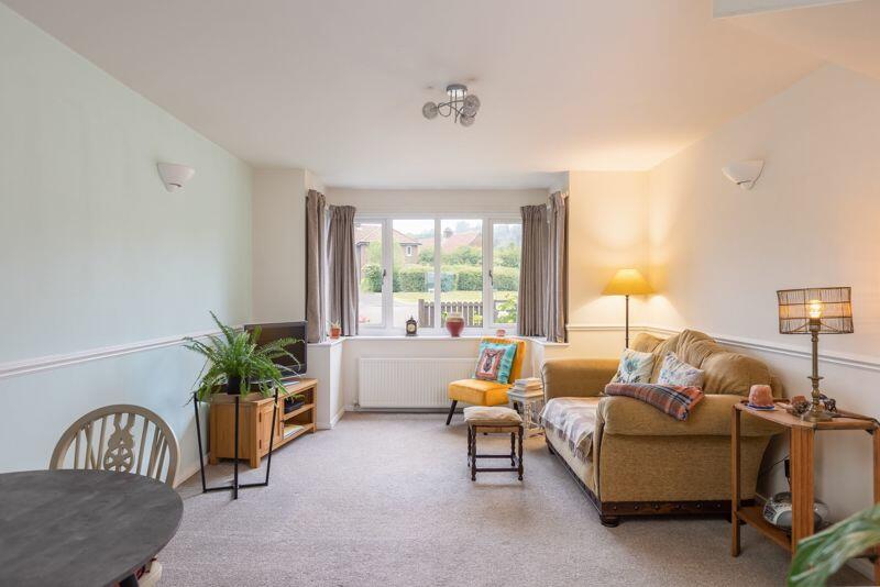
- OPEN PLAN LOUNGE DINER
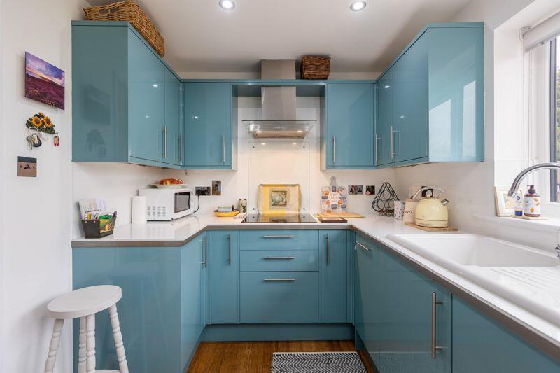
- STYLISH FITTED KITCHEN WITH INTEGRATED APPLIANCES
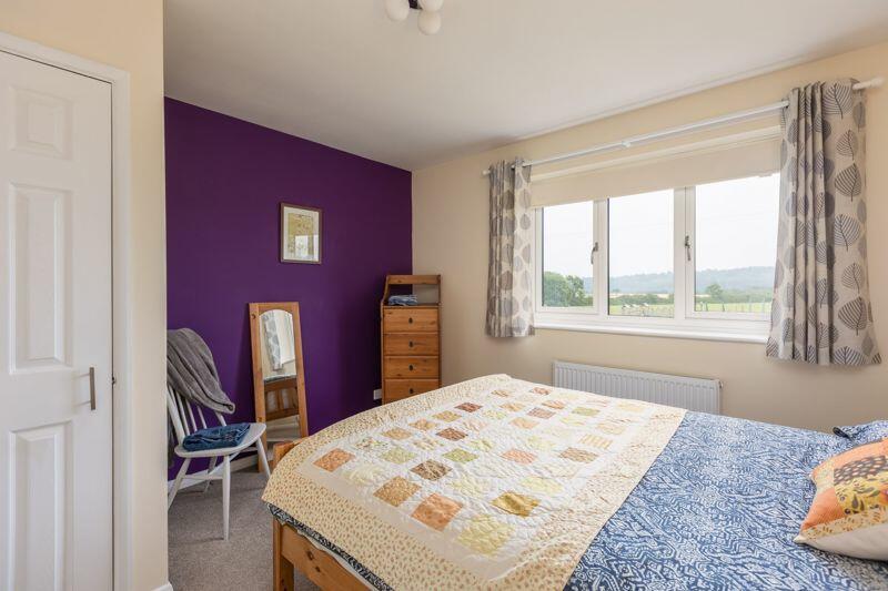
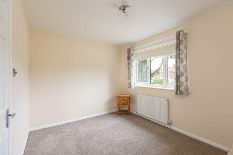
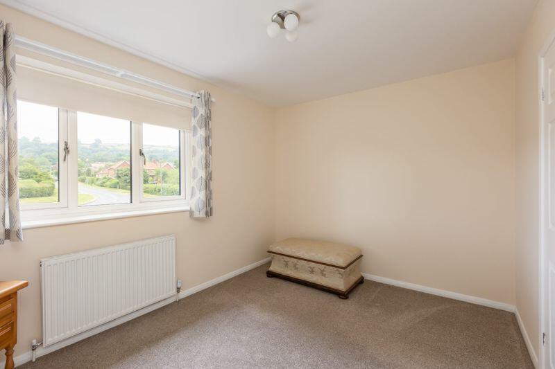
- TWO DOUBLE BEDROOMS
- HOUSE BATHROOM WITH WHITE SUITE
- CENTRAL HEATING & UPVC DOUBLE-GLAZING
- AMPLE DRIVEWAY PARKING
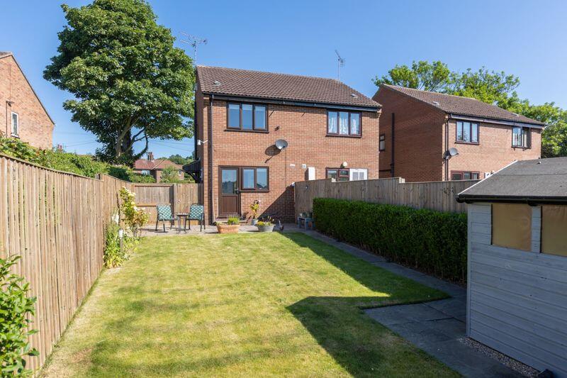
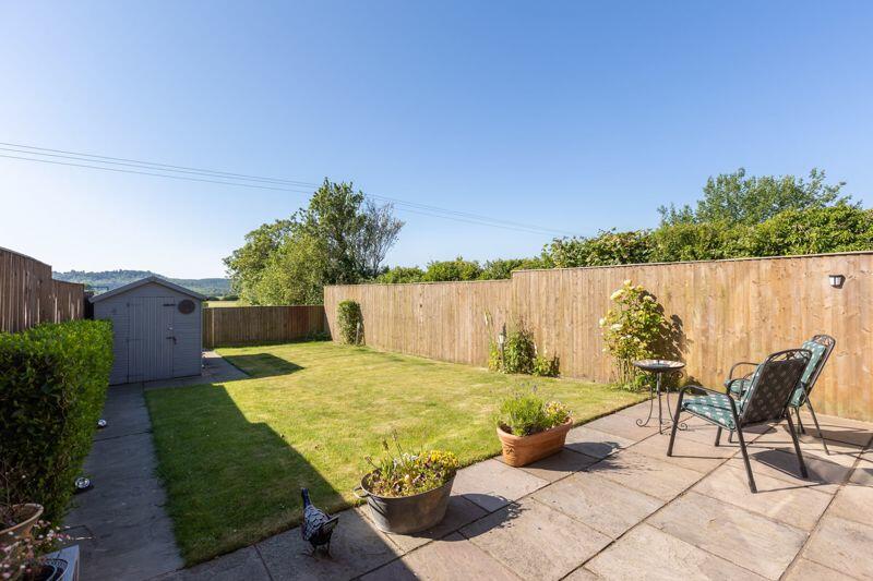
- SOUTH-FACING REAR GARDEN
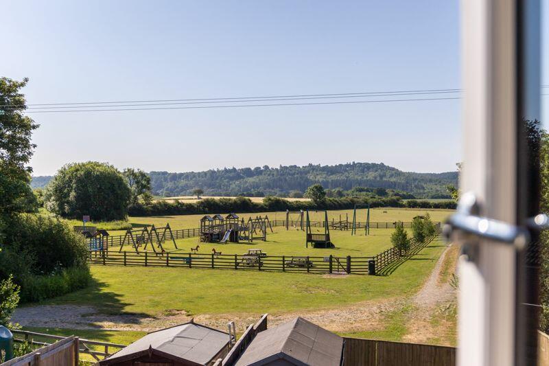
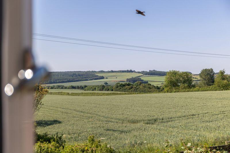
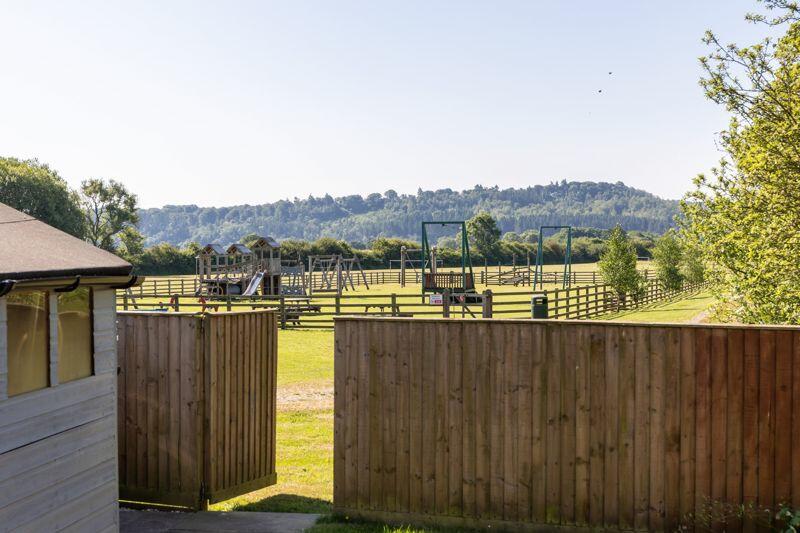
- SUPERB OPEN VIEWS
- POPULAR VILLAGE ON THE EDGE OF THE NORTH YORK MOORS
Additional details
- Parking
- Yes
- Garden
- Yes
Description
Listed by
Malton
Cundalls
Reference: 149348801
EPC Rating & Upgrade Cost
Current rating: D
Potential rating: A
Inspection date: 16/06/2021
Expiry date: 15/06/2031
Current heating cost: £447/year
Potential heating cost: £364/year
Est. upgrade cost to C: £33,100
Recommendations
- Floor insulation (suspended floor) (£800 - £1,200)
- Replace boiler with new condensing boiler (£2,200 - £3,000)
- Solar water heating (£4,000 - £6,000)
- Solar photovoltaic panels, 2.5 kWp (£3,500 - £5,500)
- Wind turbine (£15,000 - £25,000)
Flood risk
Zone: 1
Risk: Low
Job (default Low)
Floorplans
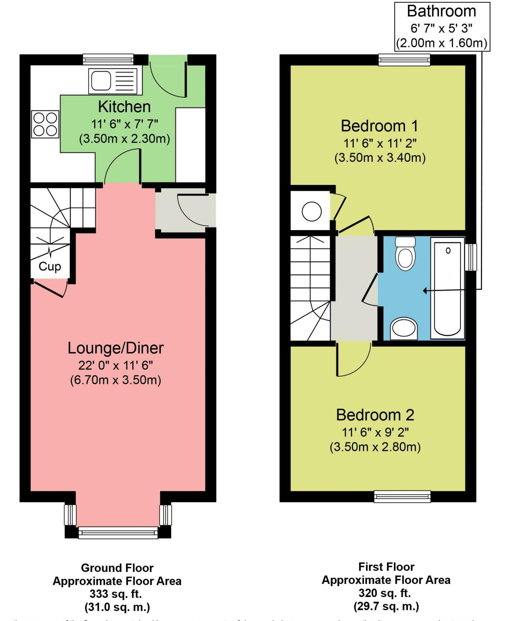
Floorplan 1
EPC Graphs

Energy Performance Certificate
FENSA Certificates
This property has 1 FENSA certificate(s) on record, indicating window/door installations by FENSA-approved installers.
FENSA Certificate #11734258
Property Details
Street: 7 Mill Lane
Town: Ampleforth
Postcode: YO62 4DJ
Installation Details
Items: 5 windows
Certificate Issued: 18/07/2016
Work Completed: 22/06/2016
This certificate data was retrieved from FENSA's database
What is FENSA? FENSA (Fenestration Self-Assessment Scheme) is a government-authorised scheme that monitors building regulation compliance for replacement windows and doors. Certificates indicate that work was completed by FENSA-approved installers.
Price history
| Event | Date | Price | % change |
|---|---|---|---|
| Sold | 15/10/2024 (1 year ago) | £199,950 | — |
Source: HM Land Registry Price Paid Data. Crown copyright.
Sold Comparables
Same street and nearby sales within 0.25 miles (last 5 years). Data from Land Registry Price Paid.
| Address | Price | Date | Type |
|---|---|---|---|
| 19 MILLWAY, AMPLEFORTH, YORK, NORTH YORKSHIRE, YO62 4DR | £199,000 | 16/10/2023 | Semi-detached |
| 18 FIELD VIEW CLOSE, AMPLEFORTH, YORK, NORTH YORKSHIRE, YO62 4EL | £470,000 | 14/07/2023 | Semi-detached |
| 6 BIRDFORTH WAY, AMPLEFORTH, YORK, NORTH YORKSHIRE, YO62 4BY | £150,000 | 31/03/2023 | Semi-detached |
| Same street 3 MILL LANE, AMPLEFORTH, YORK, NORTH YORKSHIRE, YO62 4DJ | £182,000 | 22/03/2023 | Other |
| 10 FIELD VIEW CLOSE, AMPLEFORTH, YORK, RYEDALE, NORTH YORKSHIRE, YO62 4EL | £400,000 | 10/06/2022 | Semi-detached |
| Same street 7 MILL LANE, AMPLEFORTH, YORK, RYEDALE, NORTH YORKSHIRE, YO62 4DJ | £218,250 | 01/03/2022 | Semi-detached |
| 22 FAIRFAX CLOSE, AMPLEFORTH, YORK, RYEDALE, NORTH YORKSHIRE, YO62 4DW | £165,000 | 18/11/2021 | Semi-detached |
Street average: £200,125 (2 sales)
Area average: £276,800 (5 sales)
Capital growth trend
Land Registry outcode average: last 12 months vs 5y and 10y ago (from sold prices).
House Price Index (HM Land Registry — official index, not sold-price averages): Yorkshire and The Humber. Series: Semi-detached. As of March 2026.
Rental Range
Estimated market rent for Yorkshire and The Humber. Low = conservative, Realistic = average, Optimistic = best case.
Based on Region from postcode lookup → Yorkshire and The Humber.
LHA (30th percentile) floor for Scarborough: £549/mo (Apr 2025 – Mar 2026)
Location
Nearby
Nearest stations, universities and amenities (distance from property).
| Type | Name | Distance |
|---|---|---|
| Bus stop | Unknown | 0.3 miles |
| Shop | Ampleforth Abbey Gift Shop | 0.8 miles |
| Shop | Waas Farm Shop | 1.3 miles |
| Hospital | St Monicas Hospital | 6.4 miles |
| Train station | Thirsk | 11.0 miles |
Street-level crime
| Category | Count |
|---|---|
| Violence and sexual offences | 2 |
| Other crime | 1 |
| Total incidents | 3 |
Within 1 mile during Apr 2026. Source: data.police.uk (England & Wales).
Schools nearby
Nearest open schools with Ofsted ratings (England). Closed schools are not shown. Data from Get Information about Schools and Ofsted.
| Name | Type | Distance | Ofsted |
|---|---|---|---|
| St Benedict's Catholic Primary School - a Catholic voluntary academy | Primary | 0.3 miles | Good — 16 Jul 2019 |
| Ampleforth College | Other | 1.0 miles | Inadequate — 24 May 2022 |
| Helmsley Community Primary School | Primary | 4.1 miles | Good — 11 Mar 2024 |
Rental Comparables
Loading rental comparables for this postcode. Refresh in a few minutes.
Rent-driven metrics
Based on Area rent estimate.
- Rent ratio — Monthly rent ÷ purchase price (1% rule). 1%+ = strong, 0.8–1% = okay, <0.8% = weak for cashflow.
- Max investor price — Rent ÷ 0.8%; the price at which rent would be 0.8% of price (Stoke-style target).
- Target investor price — Rent ÷ 1%; the price at which rent would be 1% of price (strong cashflow band).
- Gross yield — Annual rent as % of purchase price (no costs).