3 BROAD WALK
WILMSLOW, CHESHIRE SK9 5PJ
£2,850 pcm
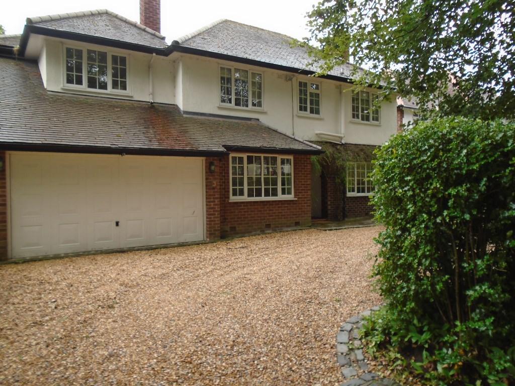
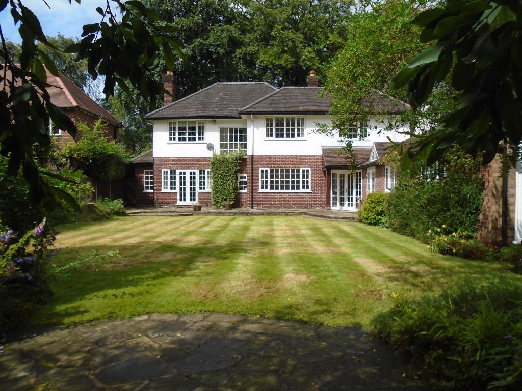
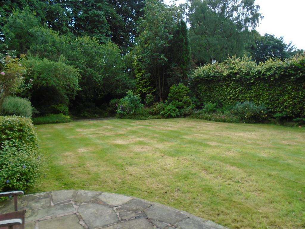
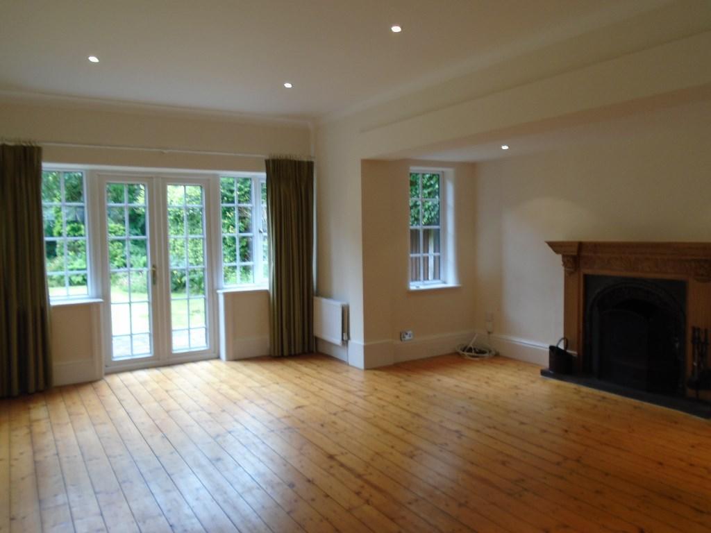
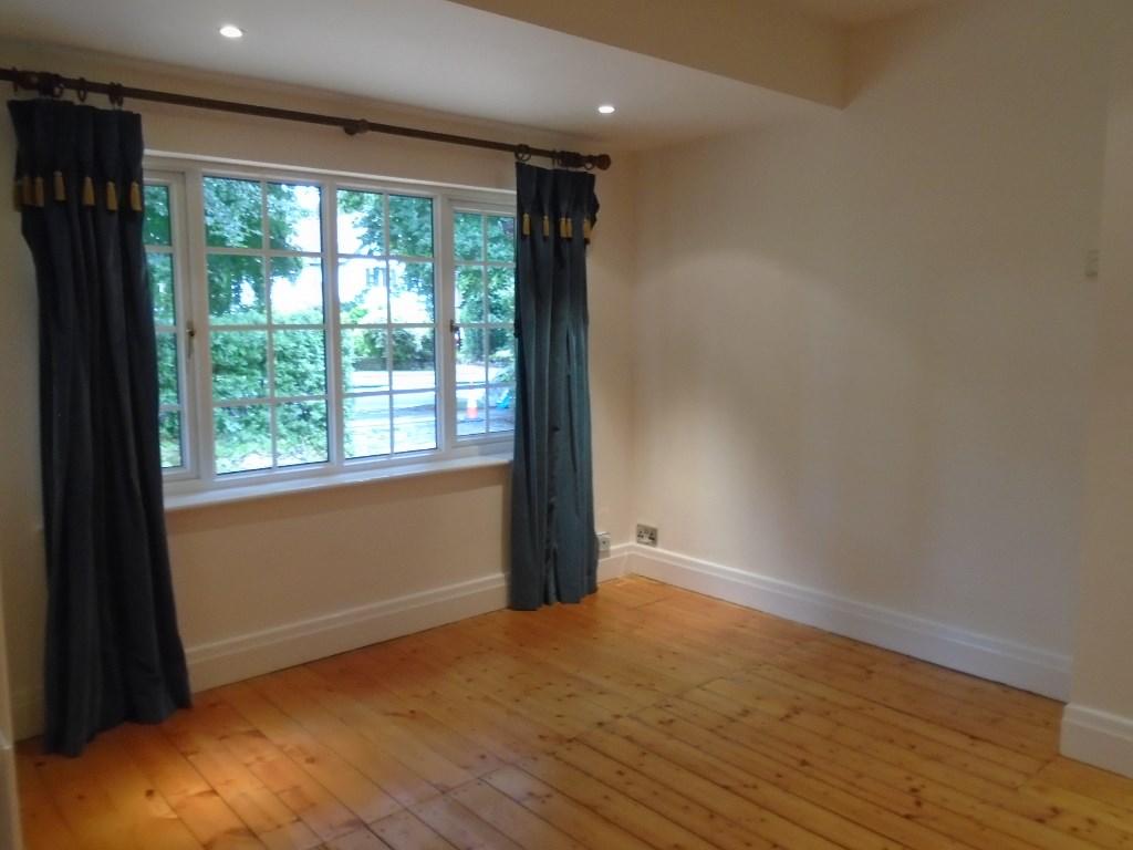
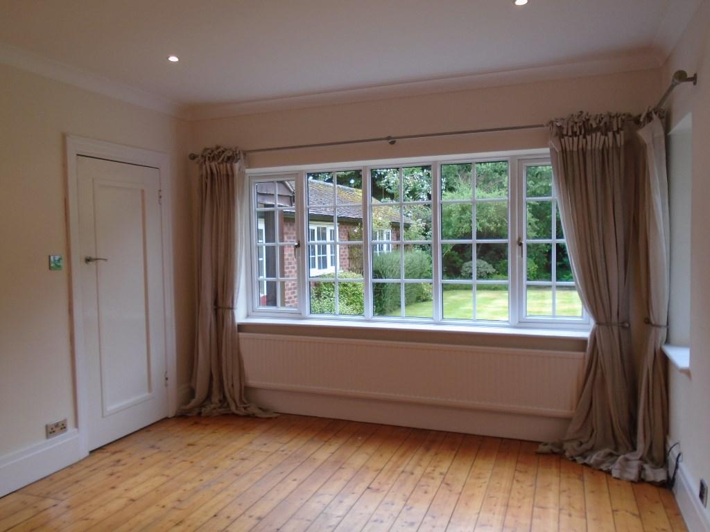
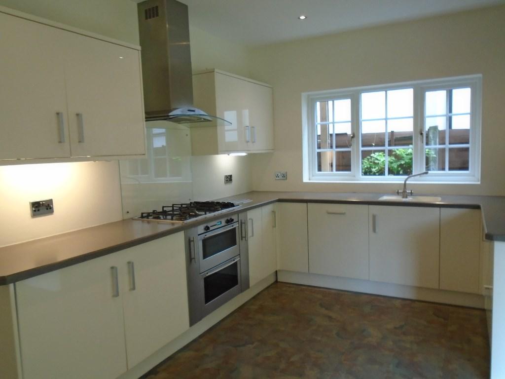
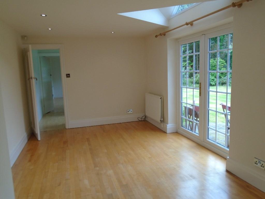
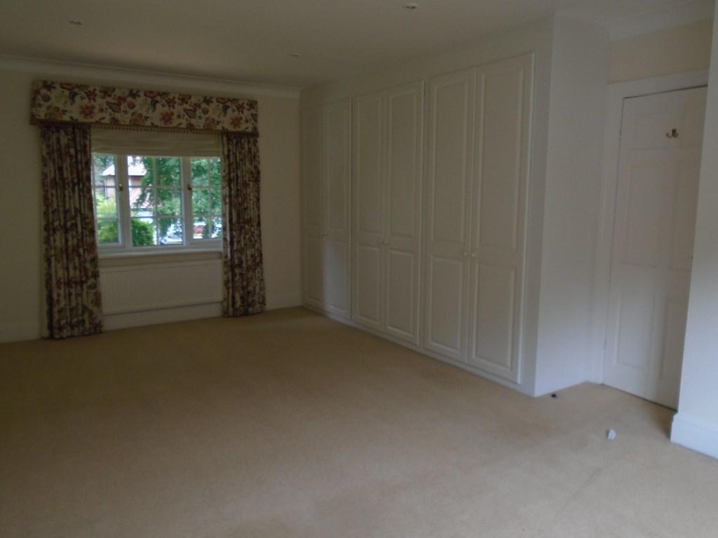
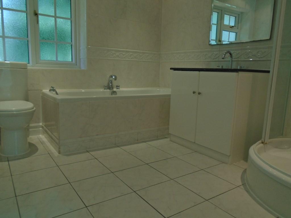
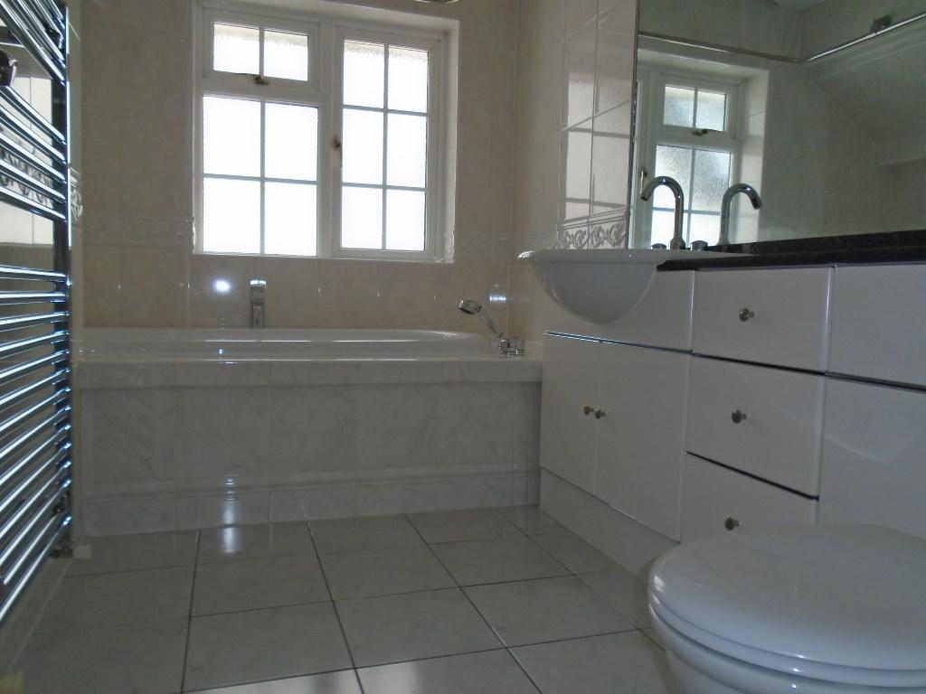

Photo 1 Photo 2 Photo 3 Photo 4 Photo 5 Photo 6 Photo 7 Photo 8 Photo 9 Photo 10 Photo 11 Photo 12
/ 12
Property details
Tenure
LEASEHOLD
Floor area
208 m²
Deprivation
Decile 10 (33,516 of 33,755)
Street crime
86 incidents within 1 mile (Apr 2026)
Key features
- Enviable Location in most popular area of Wilmslow
- Within Walking Distance of Wilmslow Centre and Railway Station
- Conveneint for Local Schools.
- Large South Facing Rear Gardens
- Double Garage and Off-Road Parking
Additional details
- Heating
- Gas central
- Accessibility
- Level access
- Parking
- Garage, Yes, Driveway, Off street
- Garden
- Front garden, Patio, Enclosed garden, Rear garden, Terrace, Yes
Description
The property benefits from private south facing rear gardens, together with double garage and off-road parking to the front.
Downstairs accommodation has been cleverly designed to suit "growing family" requirements or a professional couple who just require a little "extra space" to entertain. Lounge with Inglenook Fireplace, Dining Room, Morning Room, Kitchen with Family Room, Utility, Playroom/Study, Downstairs WC., Sep Cloaks. Five Bedrooms and 2 Bathrooms on first floor with the master bedroom having the benefit of double aspect windows and good size fitted wardrobes.
Beautifully presented throughout with some recent updates internally.
EPC Band E
Deposit £2,950
Listed by
Knutsford
K.L (Knutsford) Ltd
Reference: 60644381
EPC Rating & Upgrade Cost
Fetching EPC data… Refresh this page in a moment.
Flood risk
Zone: 1
Risk: Low
Job (default Low)
Rental Range
Estimated market rent for Cheshire East. Low = conservative, Realistic = average, Optimistic = best case.
Based on Local Authority from postcode lookup → Cheshire East.
LHA (30th percentile) floor for West Pennine: £760/mo (Apr 2025 – Mar 2026)
Location
Nearby
Nearest stations, universities and amenities (distance from property).
| Type | Name | Distance |
|---|---|---|
| Shop | Girl Boss xox | 0.2 miles |
| Shop | Vogue Hairdressing | 0.2 miles |
| Bus stop | Wilmslow, Altrincham Road / Park Road | 0.2 miles |
| Bus stop | Wilmslow, Water Lane / Fire Station | 0.2 miles |
| Hospital | The Wilmslow Hospital | 0.4 miles |
| Train station | Wilmslow | 0.6 miles |
| Train station | Styal | 1.3 miles |
| Hospital | Soss Moss Hospital | 3.2 miles |
| University | Fallowfield Reception and Richmond Amenities Building | 8.0 miles |
| University | University of Manchester Fallowfield Campus | 8.0 miles |
Street-level crime
| Category | Count |
|---|---|
| Violence and sexual offences | 37 |
| Public order | 11 |
| Anti-social behaviour | 8 |
| Shoplifting | 8 |
| Criminal damage and arson | 6 |
| Other theft | 5 |
| Other crime | 3 |
| Robbery | 3 |
| Drugs | 2 |
| Vehicle crime | 2 |
| Burglary | 1 |
| Total incidents | 86 |
Within 1 mile during Apr 2026. Source: data.police.uk (England & Wales).
Schools nearby
Nearest open schools with Ofsted ratings (England). Closed schools are not shown. Data from Get Information about Schools and Ofsted.
| Name | Type | Distance | Ofsted |
|---|---|---|---|
| Gorsey Bank Primary School | Primary | 0.3 miles | Outstanding — 2 Jul 2023 |
| Wilmslow Preparatory School | Other | 0.3 miles | — (No rating) |
| Pownall Hall School | Other | 0.4 miles | — (No rating) |
| St Anne's Fulshaw C of E Primary School | Primary | 0.5 miles | Good — 24 May 2023 |
| Lacey Green Primary Academy | Primary | 0.6 miles | Good — 4 Feb 2024 |
Rental Comparables
Rental comparables are temporarily unavailable while listing-site fetches are paused. Try again later.