14 PORTIA STREET
ASHINGTON, NORTHUMBERLAND NE63 9DX
£320 pcm
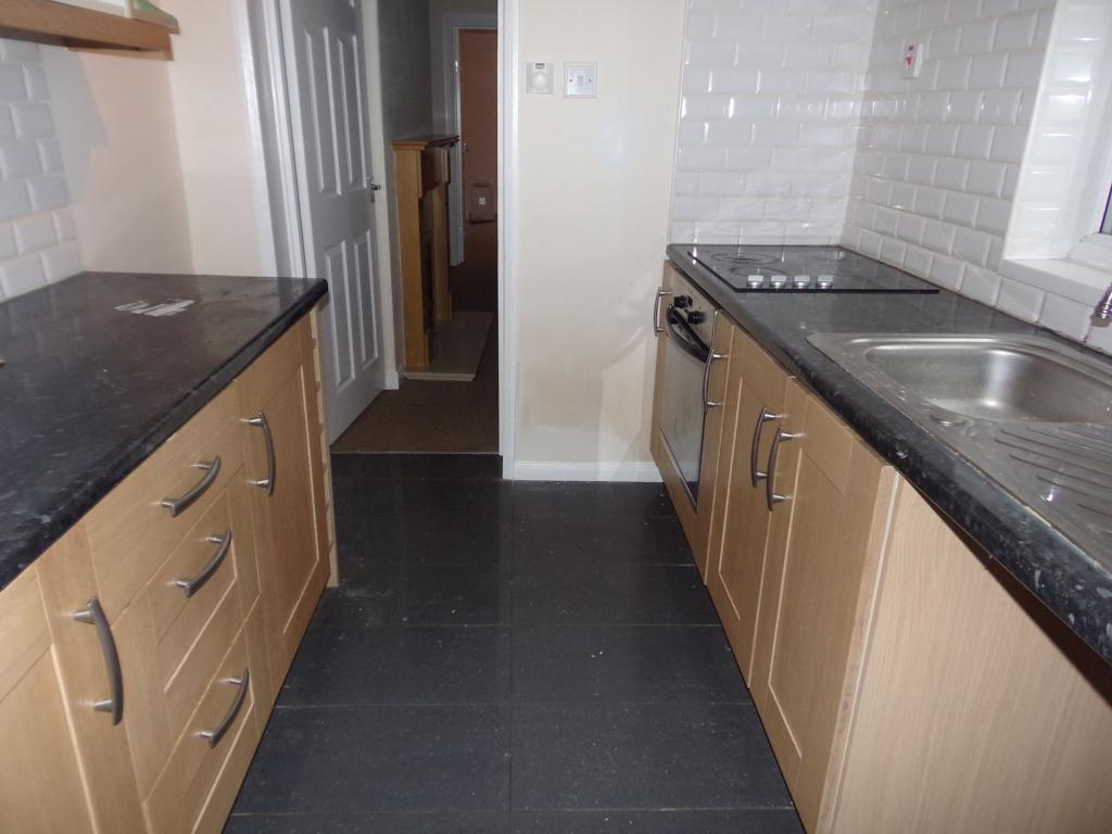
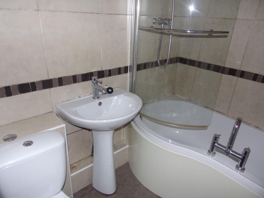
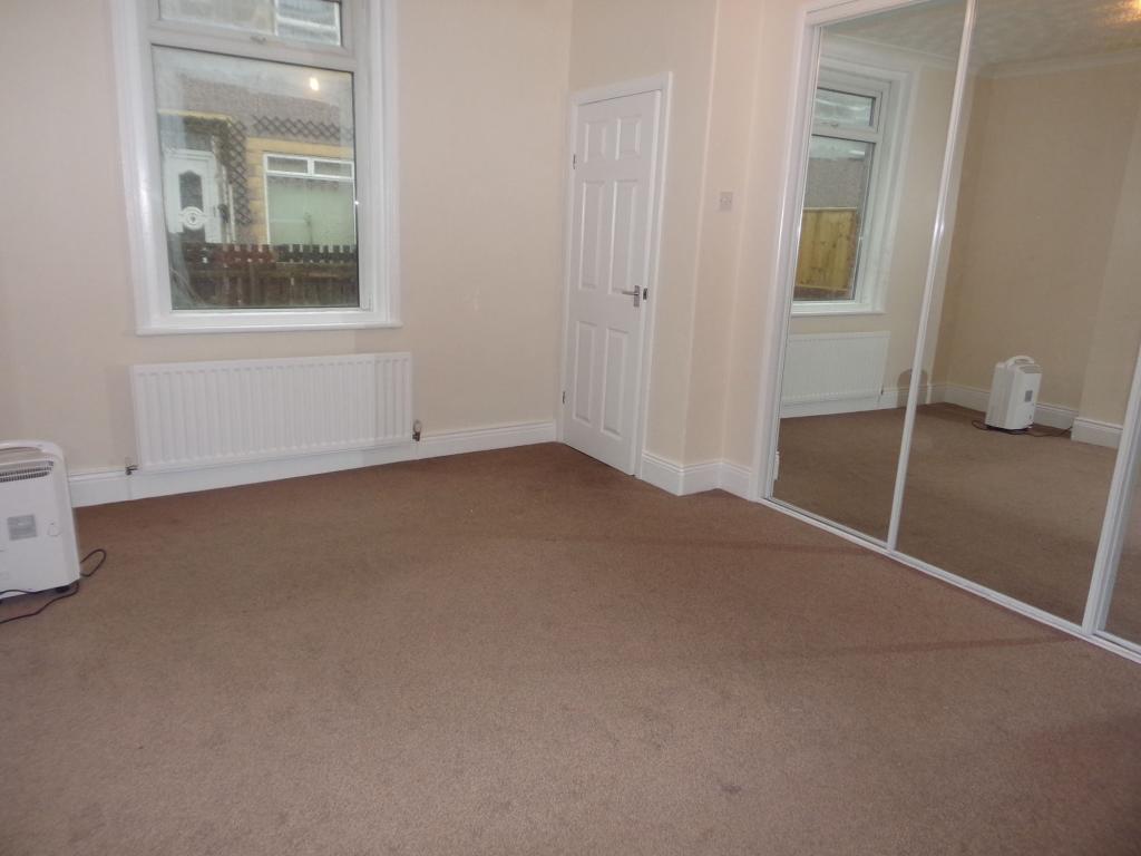
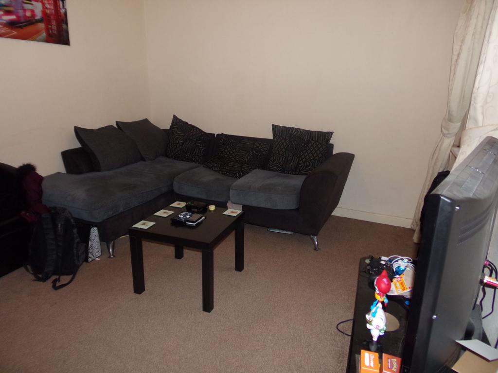
Photo 1 Photo 2 Photo 3 Photo 4
/ 4
Property details
Floor area
49 m²
EPC rating
D
Year built
England and Wales: 1900-1929
Deprivation
Decile 1 (550 of 33,755)
Street crime
231 incidents within 1 mile (Apr 2026)
Key features
- Ground Floor Flat
- One Bedroom
- Modern Accommodation
- Available In August
- NO ADMIN FEE PAYABLE
Additional details
- Heating
- Gas
- Parking
- On street
- Garden
- Yes
Description
Pattinsons are delighted to offer to the market for rent this one bedroom ground floor flat located on Portia Street in Ashington. Located close to amenities, and local bus links. The accommodation briefly comprises of: Entrance, Bedroom, Lounge, Kitchen and Bathroom. Externally there is a shared yard to the rear of the property.
Listed by
Blyth
Pattinson Estate Agents
Reference: 62469645
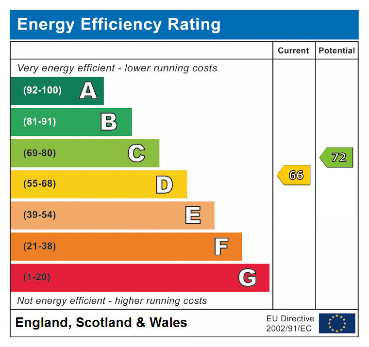
EPC Rating & Upgrade Cost
Current rating: D
Potential rating: C
Inspection date: 04/04/2019
Expiry date: 03/04/2029
Current heating cost: £453/year
Potential heating cost: £342/year
Est. upgrade cost to C: £2,000
Recommendations
- Cavity wall insulation (£500 - £1,500)
- Floor insulation (suspended floor) (£800 - £1,200)
Flood risk
Zone: 1
Risk: Low
Job (default Low)
EPC Graphs
EPC
Rental Range
Estimated market rent for Northumberland. Low = conservative, Realistic = average, Optimistic = best case.
Based on Local Authority from postcode lookup → Northumberland.
LHA (30th percentile) floor for Northumberland: £374/mo (Apr 2025 – Mar 2026)
Location
Nearby
Nearest stations, universities and amenities (distance from property).
| Type | Name | Distance |
|---|---|---|
| Bus stop | Alexandra Road Top | 0.1 miles |
| Shop | Nice Price | 0.1 miles |
| Bus stop | Ashington, Alexandra Road top | 0.1 miles |
| Shop | Sun World 2 Deep Tanning Centre | 0.1 miles |
| Train station | Ashington | 0.5 miles |
| Hospital | Wansbeck General Hospital | 0.6 miles |
| Train station | Museum Halt | 0.6 miles |
| Hospital | The Rutherford Cancer Centre North East | 2.1 miles |
| University | Blyth Marine Station | 4.8 miles |
| University | Dove Marine Laboratory | 11.5 miles |
Street-level crime
| Category | Count |
|---|---|
| Violence and sexual offences | 67 |
| Anti-social behaviour | 55 |
| Criminal damage and arson | 30 |
| Shoplifting | 16 |
| Vehicle crime | 15 |
| Burglary | 11 |
| Other crime | 10 |
| Other theft | 8 |
| Public order | 8 |
| Possession of weapons | 4 |
| Theft from the person | 4 |
| Drugs | 2 |
| Robbery | 1 |
| Total incidents | 231 |
Within 1 mile during Apr 2026. Source: data.police.uk (England & Wales).
Schools nearby
Nearest open schools with Ofsted ratings (England). Closed schools are not shown. Data from Get Information about Schools and Ofsted.
| Name | Type | Distance | Ofsted |
|---|---|---|---|
| Central Primary School | Primary | 0.3 miles | Good — 6 Dec 2023 |
| NCEA Thomas Bewick C of E Primary School | Primary | 0.5 miles | Good — 16 Jun 2024 |
| Rosewood Independent School | Other | 0.5 miles | Good — 29 Nov 2023 |
| St Aidan's Catholic Primary School, Ashington | Primary | 0.5 miles | Good — 1 Feb 2022 |
| Gust Independent School | Other | 0.6 miles | Good — 12 May 2024 |
Rental Comparables
Loading rental comparables for this postcode. Refresh in a few minutes.