Portman Square
Marylebone, W1, W1H 6LL
£5,200 pcm
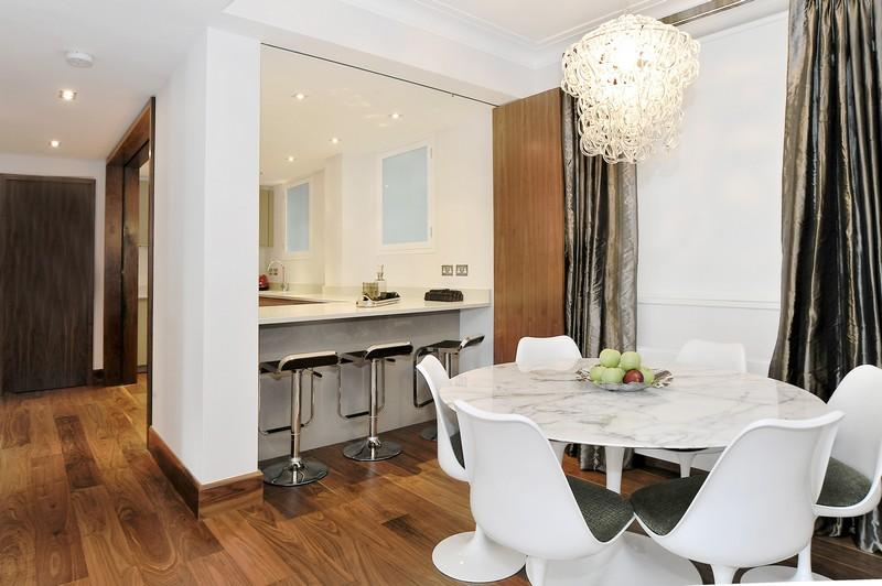
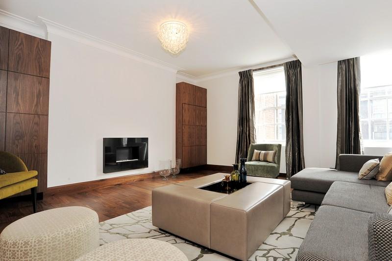
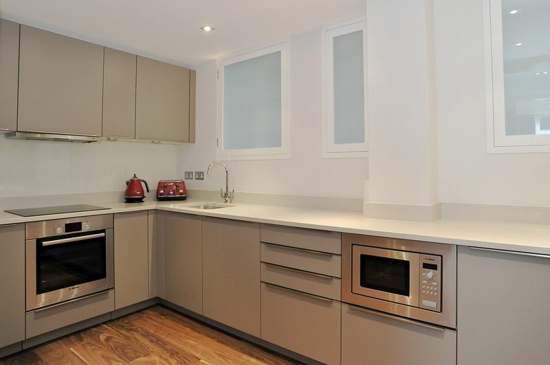

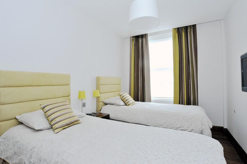

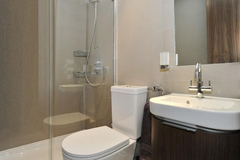
Photo 1 Photo 2 Photo 3 Photo 4 Photo 5 Photo 6 Photo 7
/ 7
Property details
Deprivation
Decile 8 (26,473 of 33,755)
Street crime
3184 incidents within 1 mile (Apr 2026)
Description
Listed by
London - Lettings
Manors
Reference: 27007213
EPC Rating & Upgrade Cost
Fetching EPC data… Refresh this page in a moment.
Flood risk
Zone: 1
Risk: Low
Job (default Low)
Company ownership
Registered legal owner is a company.
Rental Range
Estimated market rent for Westminster. Low = conservative, Realistic = average, Optimistic = best case.
Based on Local Authority from postcode lookup → Westminster.
LHA (30th percentile) floor for Central London: £2,154/mo (Apr 2025 – Mar 2026)
Location
Address
15 Portman Square
Nearby
Nearest stations, universities and amenities (distance from property).
| Type | Name | Distance |
|---|---|---|
| Shop | Sharps | 0.0 miles |
| Shop | Back in Action | 0.1 miles |
| Bus stop | Portman Square | 0.1 miles |
| Bus stop | George Street | 0.1 miles |
| Train station | Marble Arch | 0.2 miles |
| Train station | Bond Street | 0.3 miles |
| University | LBS Behaviour Lab | 0.7 miles |
| Hospital | The Portland Hospital | 0.7 miles |
| Hospital | National Hospital for Neurology and Neurosurgery at Cleveland Street | 0.8 miles |
| University | Department of Geography | 1.1 miles |
Street-level crime
| Category | Count |
|---|---|
| Theft from the person | 693 |
| Other theft | 561 |
| Shoplifting | 429 |
| Anti-social behaviour | 397 |
| Violence and sexual offences | 370 |
| Drugs | 220 |
| Public order | 106 |
| Robbery | 105 |
| Burglary | 94 |
| Vehicle crime | 75 |
| Criminal damage and arson | 57 |
| Bicycle theft | 40 |
| Other crime | 19 |
| Possession of weapons | 18 |
| Total incidents | 3184 |
Within 1 mile during Apr 2026. Source: data.police.uk (England & Wales).
Schools nearby
Nearest open schools with Ofsted ratings (England). Closed schools are not shown. Data from Get Information about Schools and Ofsted.
| Name | Type | Distance | Ofsted |
|---|---|---|---|
| St Vincent's Catholic Primary School | Primary | 0.2 miles | Outstanding — 4 Feb 2024 |
| Wetherby Preparatory School | Other | 0.2 miles | — (No rating) |
| Halcyon London International School | Other | 0.3 miles | Outstanding — 27 May 2020 |
| Wetherby Senior School | Other | 0.3 miles | — (No rating) |
| Sylvia Young Theatre School | Other | 0.3 miles | — (No rating) |
Rental Comparables
Rental listings exist nearby, but none matched the 3-bedroom count for this property.