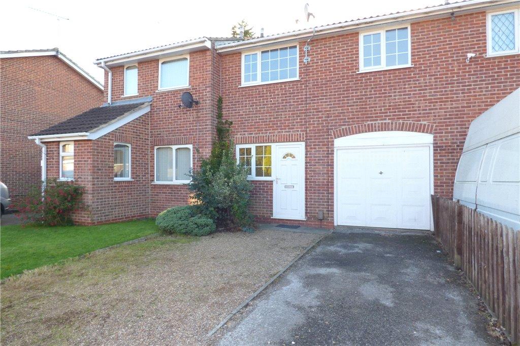
15 WOLVERLEY GRANGE
DERBY, ALVASTON, CITY OF DERBY DE24 0SS
Property details
Tenure
FREEHOLD
Floor area
44 m²
EPC rating
C
Year built
England and Wales: 1976-1982
Last sold
£119,000 Apr 2021
Price per m²
£2,840/m²
Local average
£157,271 (-20.6%)
Deprivation
Decile 6 (18,572 of 33,755)
Street crime
162 incidents within 1 mile (Apr 2026)
Key features
- Two Bedrooms
- Garage
- Investment Opportunity
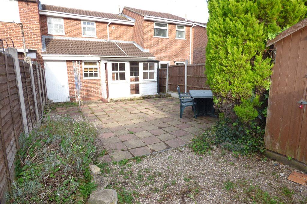
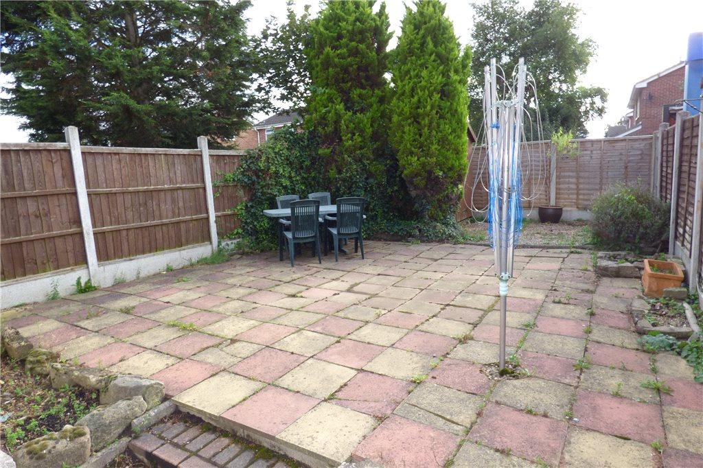
- Enclosed Rear Garden
- Cul De Sac Location
- Easy Access To Elvaston Castle
- No Upward Chain
Additional details
- Parking
- Yes
- Garden
- Yes
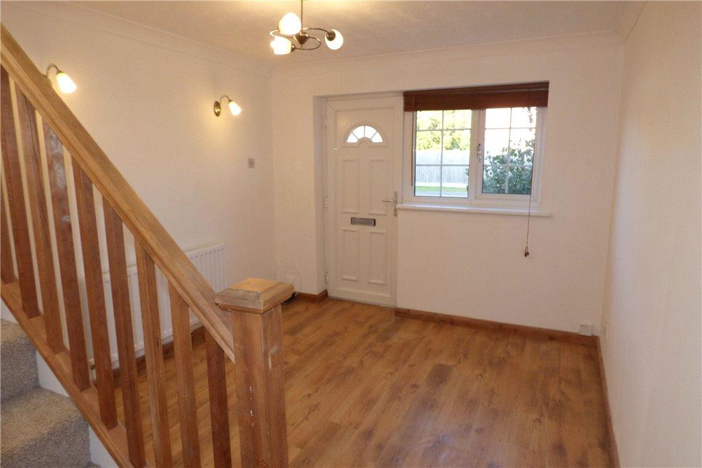
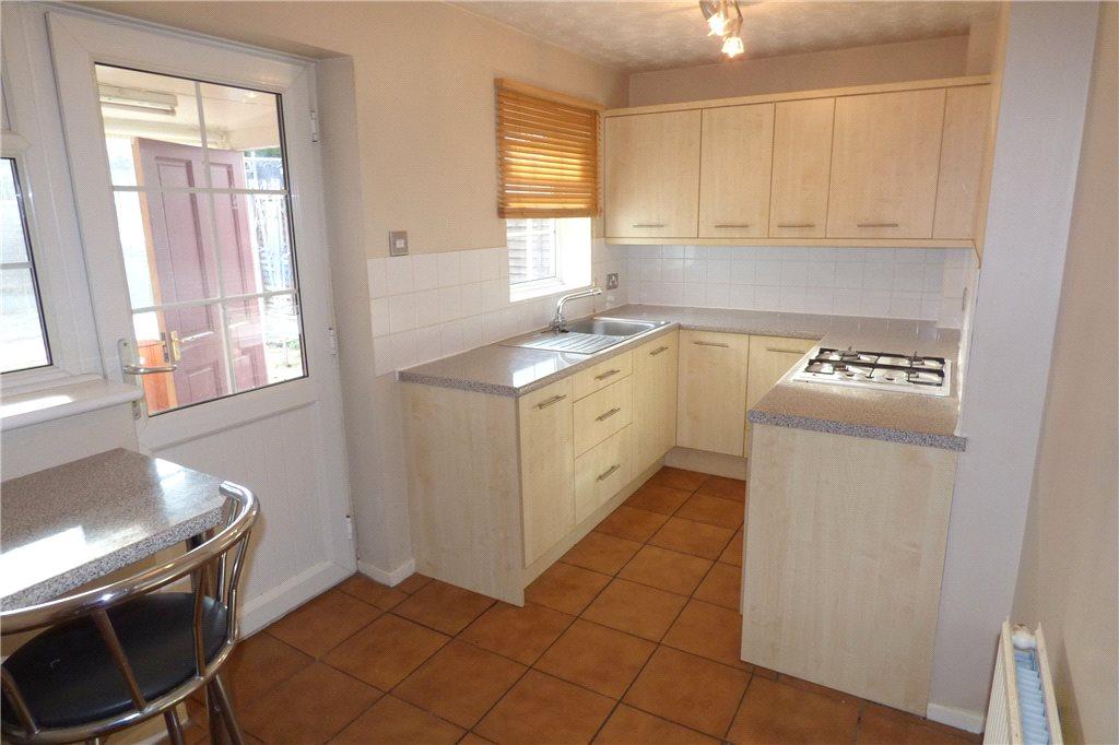
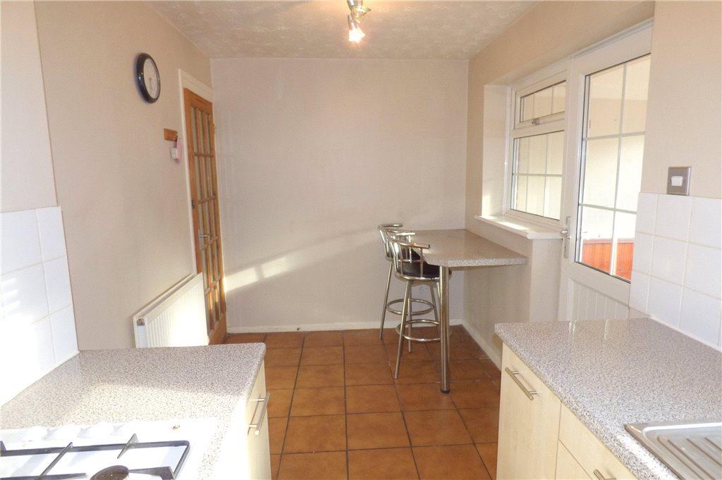
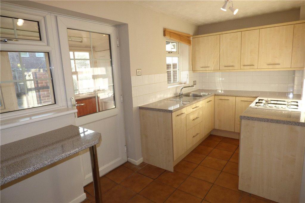
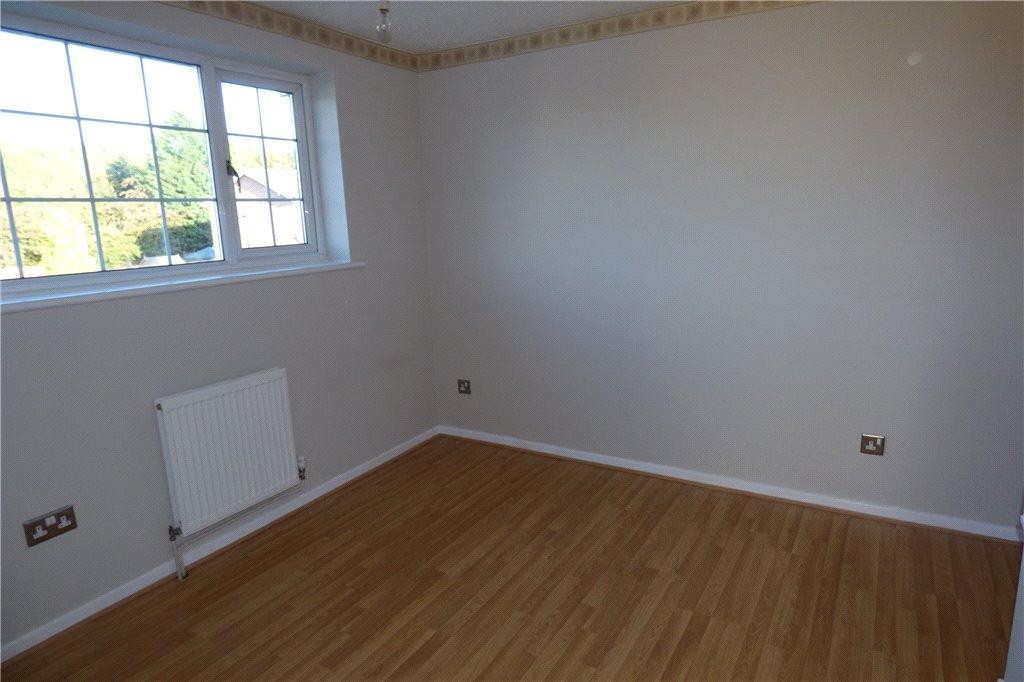
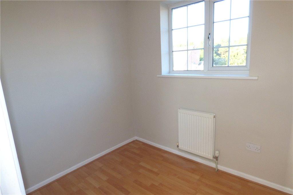
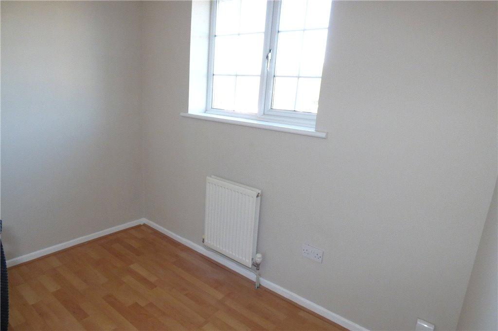
Description
Listed by
Derby
Leaders and Romans Group
Reference: 85607356
EPC Rating & Upgrade Cost
Current rating: C
Potential rating: B
Inspection date: 21/03/2019
Expiry date: 20/03/2029
Recommendations
- Floor insulation (suspended floor) (1,200)
- Floor insulation (solid floor) (6,000)
- Solar water heating (6,000)
- Solar photovoltaic panels, 2.5 kWp (8,000)
Flood risk
Zone: 1
Risk: Low
Job (default Low)
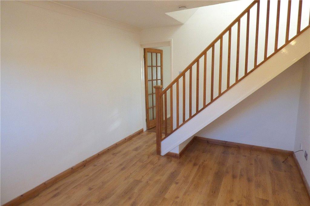
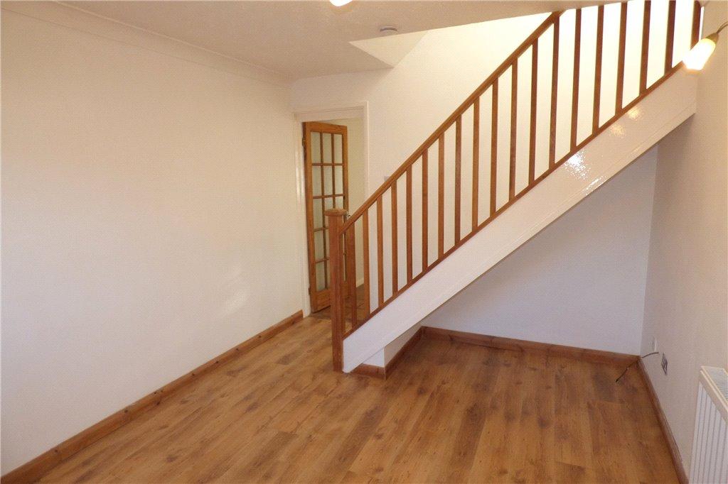
Floorplans
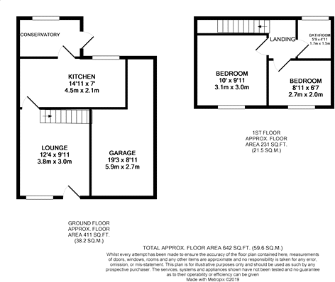
Floorplan
EPC Graphs
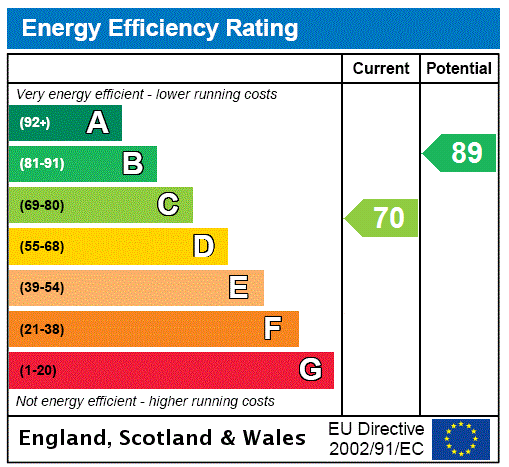
EPC Rating Graph
FENSA Certificates
This property has 1 FENSA certificate(s) on record, indicating window/door installations by FENSA-approved installers.
FENSA Certificate #3725039
Property Details
Street: 15 Wolverley Grange
Town: Alvaston
Postcode: DE24 0SS
Installation Details
Items: 7 windows and 2 doors
Certificate Issued: 16/05/2006
Work Completed: 03/05/2006
This certificate data was retrieved from FENSA's database
What is FENSA? FENSA (Fenestration Self-Assessment Scheme) is a government-authorised scheme that monitors building regulation compliance for replacement windows and doors. Certificates indicate that work was completed by FENSA-approved installers.
Price history
29% since 2005
| Event | Date | Price | % change |
|---|---|---|---|
| Sold | 15/04/2021 (5 years ago) | £119,000 | +4.4% |
| Sold | 05/09/2008 (17 years ago) | £114,000 | +23.9% |
| Sold | 20/05/2005 (21 years ago) | £92,000 | — |
Source: HM Land Registry Price Paid Data. Crown copyright.
Sold Comparables
Same street and nearby sales within 0.25 miles (last 5 years). Data from Land Registry Price Paid.
| Address | Price | Date | Type |
|---|---|---|---|
| Same street 27 WOLVERLEY GRANGE, ALVASTON, DERBY, CITY OF DERBY, DE24 0SS | £155,000 | 09/01/2026 | Semi-detached |
| FARNDALE COURT 17 COD BECK CLOSE, ALVASTON, DERBY, CITY OF DERBY, DE24 0RL | £170,000 | 14/11/2025 | Terraced |
| Same street 9 WOLVERLEY GRANGE, ALVASTON, DERBY, CITY OF DERBY, DE24 0SS | £176,000 | 06/08/2025 | Semi-detached |
| 21 CADWELL CLOSE, ALVASTON, DERBY, CITY OF DERBY, DE24 0SH | £165,000 | 27/10/2023 | Terraced |
| Same street 16 WOLVERLEY GRANGE, ALVASTON, DERBY, CITY OF DERBY, DE24 0SS | £158,000 | 22/09/2023 | Semi-detached |
| 3 ESKDALE WALK, ALVASTON, DERBY, CITY OF DERBY, DE24 0RW | £167,000 | 16/09/2022 | Terraced |
| 30 ARKENDALE WALK, ALVASTON, DERBY, CITY OF DERBY, DE24 0RJ | £140,000 | 09/09/2022 | Terraced |
| 38 ARKENDALE WALK, ALVASTON, DERBY, CITY OF DERBY, DE24 0RJ | £148,000 | 01/07/2022 | Terraced |
| FARNDALE COURT 3 COD BECK CLOSE, ALVASTON, DERBY, CITY OF DERBY, DE24 0RL | £152,000 | 30/06/2022 | Terraced |
| 233 KELDHOLME LANE, ALVASTON, DERBY, CITY OF DERBY, DE24 0ST | £160,000 | 28/06/2022 | Terraced |
| 273 KELDHOLME LANE, ALVASTON, DERBY, CITY OF DERBY, DE24 0ST | £117,000 | 22/04/2022 | Terraced |
Street average: £163,000 (3 sales)
Area average: £152,375 (8 sales)
Capital growth trend
Land Registry outcode average: last 12 months vs 5y and 10y ago (from sold prices).
House Price Index (HM Land Registry — official index, not sold-price averages): City of Derby. Series: Terraced. As of March 2026.
Rental Range
Estimated market rent for Derby. Low = conservative, Realistic = average, Optimistic = best case.
Based on Local Authority from postcode lookup → Derby.
LHA (30th percentile) floor for Derby: £593/mo (Apr 2025 – Mar 2026)
Location
Nearby
Nearest stations, universities and amenities (distance from property).
| Type | Name | Distance |
|---|---|---|
| Bus stop | James Wyatt | 0.1 miles |
| Shop | Tesco Express | 0.2 miles |
| Shop | Sak + American Candy | 0.2 miles |
| Train station | Spondon | 1.4 miles |
| Train station | Peartree | 2.6 miles |
| Hospital | Royal Derby Hospital | 4.5 miles |
| University | University of Derby | 4.8 miles |
| Hospital | Nuffield Health Derby Hospital | 5.0 miles |
| University | Loughborough University | 11.5 miles |
Street-level crime
| Category | Count |
|---|---|
| Violence and sexual offences | 69 |
| Shoplifting | 33 |
| Anti-social behaviour | 21 |
| Vehicle crime | 10 |
| Public order | 9 |
| Other theft | 5 |
| Criminal damage and arson | 4 |
| Drugs | 3 |
| Other crime | 2 |
| Robbery | 2 |
| Bicycle theft | 1 |
| Burglary | 1 |
| Possession of weapons | 1 |
| Theft from the person | 1 |
| Total incidents | 162 |
Within 1 mile during Apr 2026. Source: data.police.uk (England & Wales).
Schools nearby
Nearest open schools with Ofsted ratings (England). Closed schools are not shown. Data from Get Information about Schools and Ofsted.
| Name | Type | Distance | Ofsted |
|---|---|---|---|
| Alvaston Infant and Nursery School | Primary | 0.4 miles | Good — 15 Nov 2017 |
| Alvaston Junior Academy | Primary | 0.4 miles | Requires improvement — 10 Sep 2024 |
| St John Fisher Catholic Voluntary Academy | Primary | 0.6 miles | Good — 3 Dec 2023 |
| Oakwood Infant and Nursery School | Primary | 0.8 miles | Good — 28 Feb 2018 |
| Clover Leys Spencer Academy | Primary | 0.9 miles | Good — 3 Jul 2024 |
Rental Comparables
Rental listings exist nearby, but none matched the 2-bedroom count for this property.
Rent-driven metrics
Based on Area rent estimate.
- Rent ratio — Monthly rent ÷ purchase price (1% rule). 1%+ = strong, 0.8–1% = okay, <0.8% = weak for cashflow.
- Max investor price — Rent ÷ 0.8%; the price at which rent would be 0.8% of price (Stoke-style target).
- Target investor price — Rent ÷ 1%; the price at which rent would be 1% of price (strong cashflow band).
- Gross yield — Annual rent as % of purchase price (no costs).