11 ST HUGHS CLOSE
PRENTON, MERSEYSIDE CH43 4YS
£149,950
Property details
Last sold
£149,950 Nov 2018
Local average
£219,282 (-31.6%)
Deprivation
Decile 1 (2,063 of 33,755)
Street crime
499 incidents within 1 mile (Apr 2026)
Key features
- Spacious end of terrace
- 891 sq ft approx
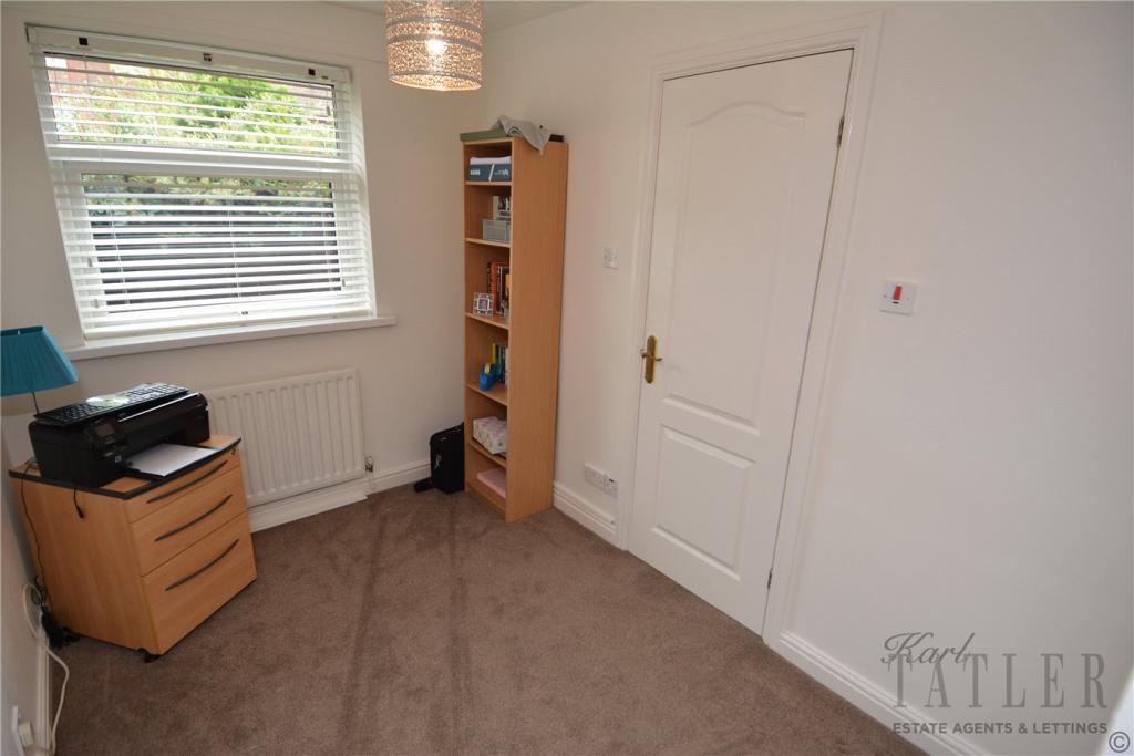
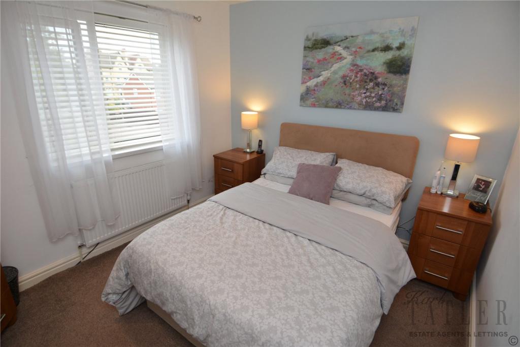
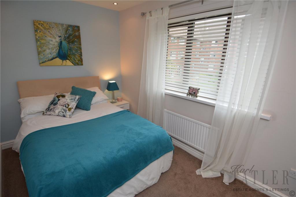
- Three bedrooms
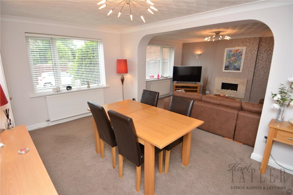
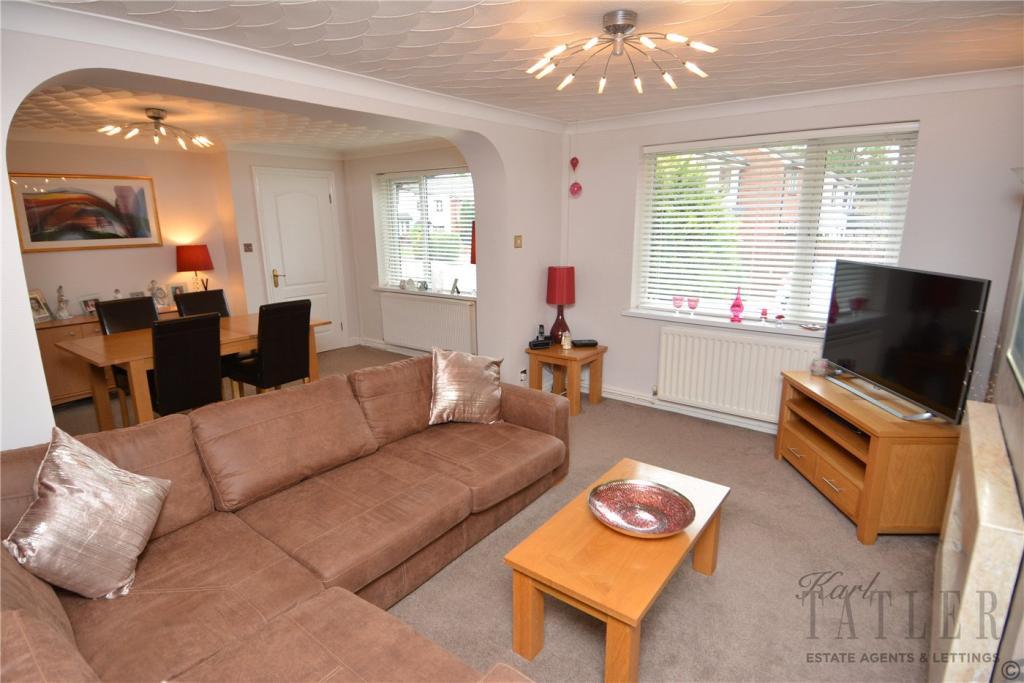
- Living room
- Large dining room
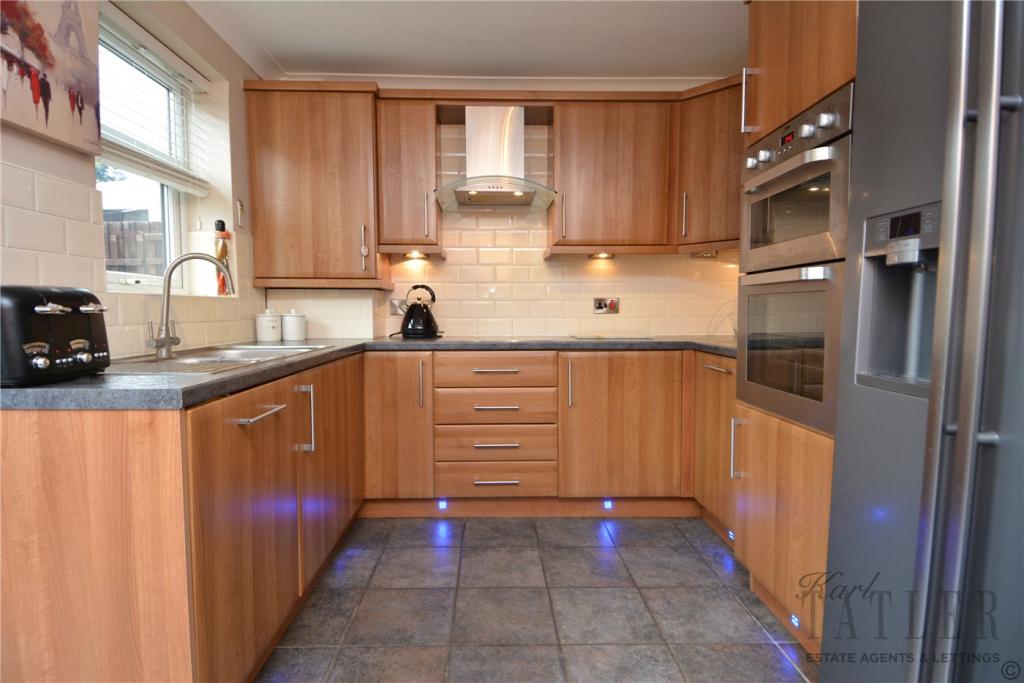
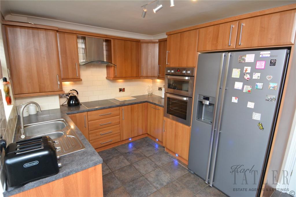
- Modern kitchen
- Downstairs bedroom with
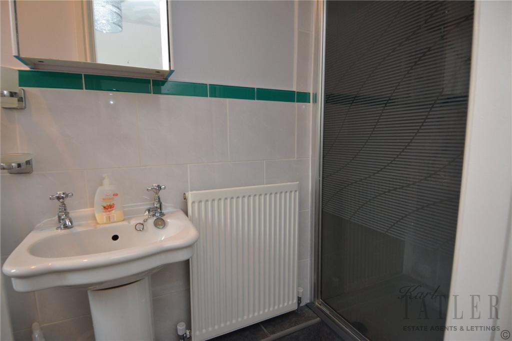
- En-suite shower room
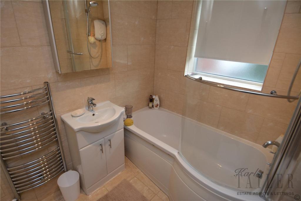
- Family bathroom
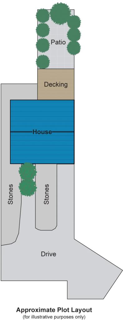
- Large driveway
Additional details
- Parking
- Yes
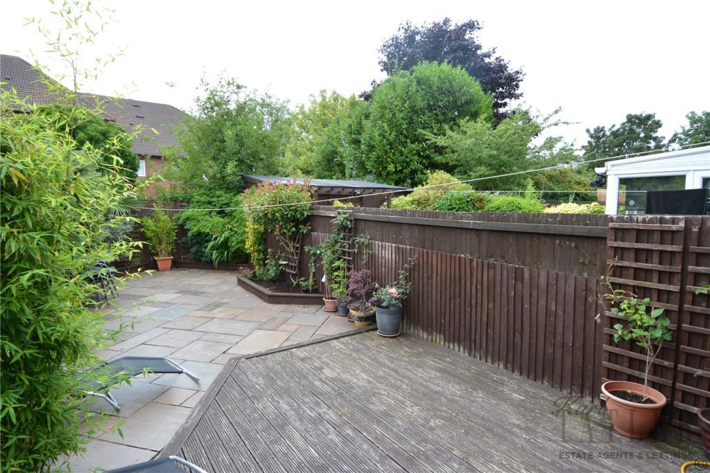
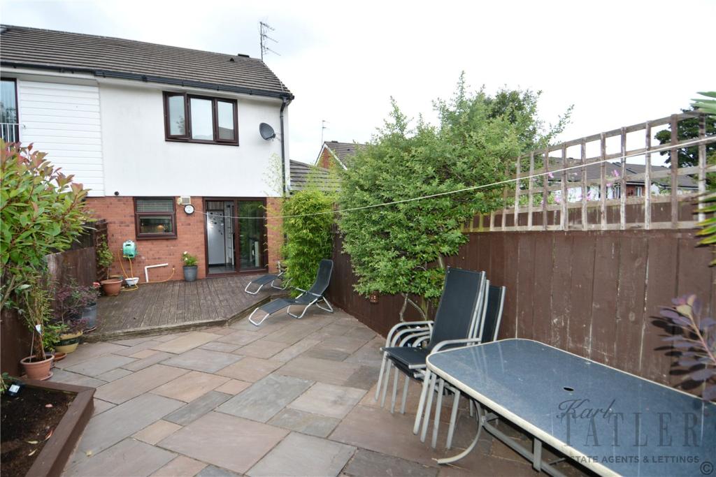
- Garden
- Yes
Description
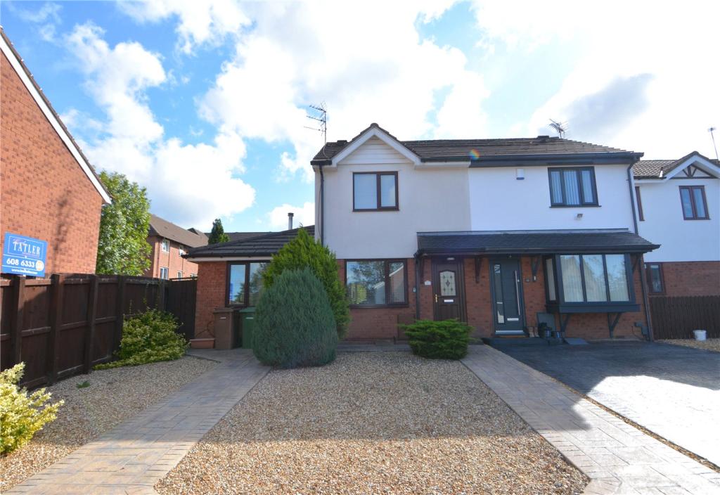
This deceptively spacious, extended house is well appointed and tucked away in an already quiet cul-de-sac. Perfect for a family or even a first time buyer, all you need to do is drop your bags and move in.
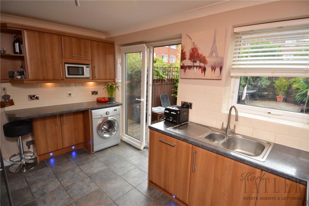
Occupying one of the larger plots is this superb end of terrace. A huge driveway guides you towards the front door where you will enter a small hallway. Off the hallway is a large dining room which leads into a living room and ground floor bedroom with en suite. The bedroom has many uses but has previously been perfect for an elderly family member. The kitchen is modern and contemporary and offers access to the rear garden through sliding doors. The garden is South facing and a real suntrap which is ideal for entertaining throughout the summer.
Upstairs offers two double bedrooms of which both come complete with fitted wardrobes and room for bedside tables. The family bathroom is spotless and completes the upstairs.
To arrange a viewing of this superb house, call the office on 0151 608 6333.
Listed by
Prenton
Karl Tatler
Reference: 74830988
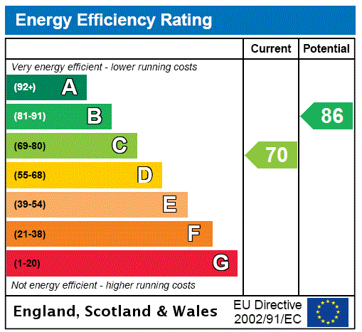
EPC Rating & Upgrade Cost
Fetching EPC data… Refresh this page in a moment.
Flood risk
Zone: 1
Risk: Low
Job (default Low)
Floorplans
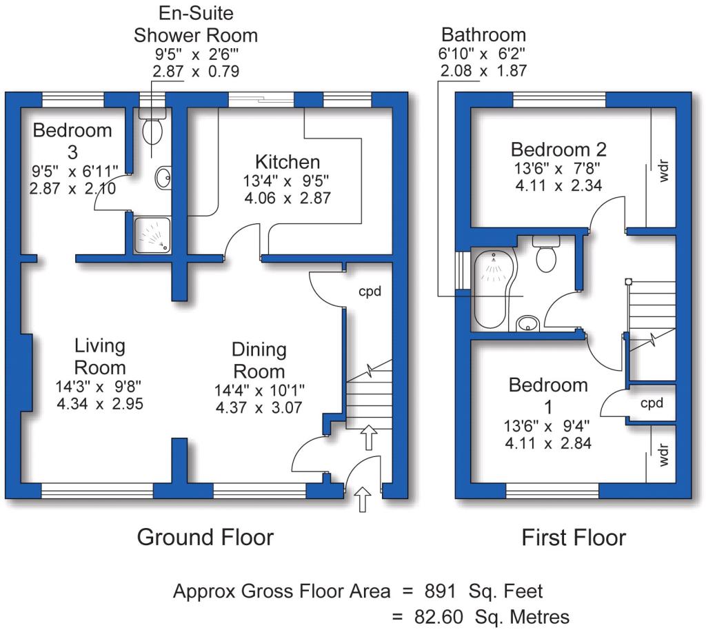
Floorplan
Floorplan
EPC Graphs
EPC Rating Graph
Price history
| Event | Date | Price | % change |
|---|---|---|---|
| Sold | 30/11/2018 (7 years ago) | £149,950 | — |
Source: HM Land Registry Price Paid Data. Crown copyright.
Sold Comparables
Same street and nearby sales within 0.25 miles (last 5 years). Data from Land Registry Price Paid.
| Address | Price | Date | Type |
|---|---|---|---|
| 20 GROSVENOR ROAD, PRENTON, WIRRAL, MERSEYSIDE, CH43 4UR | £135,000 | 27/10/2023 | Terraced |
| 63 PARK ROAD SOUTH, PRENTON, WIRRAL, MERSEYSIDE, CH43 4YU | £155,000 | 29/09/2023 | Terraced |
| Same street 29 ST HUGHS CLOSE, PRENTON, WIRRAL, MERSEYSIDE, CH43 4YS | £120,000 | 30/06/2023 | Terraced |
| 14 RADNOR PLACE, PRENTON, WIRRAL, MERSEYSIDE, CH43 4XH | £184,950 | 04/10/2022 | Terraced |
| 17 HAWARDEN AVENUE, PRENTON, WIRRAL, MERSEYSIDE, CH43 4XJ | £189,500 | 30/09/2022 | Terraced |
| Same street 9 ST HUGHS CLOSE, PRENTON, WIRRAL, MERSEYSIDE, CH43 4YS | £153,000 | 14/03/2022 | Semi-detached |
| 14 RADNOR PLACE, PRENTON, WIRRAL, MERSEYSIDE, CH43 4XH | £157,000 | 16/11/2021 | Terraced |
| Same street 25 ST HUGHS CLOSE, PRENTON, WIRRAL, MERSEYSIDE, CH43 4YS | £120,000 | 06/10/2021 | Terraced |
Street average: £131,000 (3 sales)
Area average: £164,290 (5 sales)
Capital growth trend
Land Registry outcode average: last 12 months vs 5y and 10y ago (from sold prices).
House Price Index (HM Land Registry — official index, not sold-price averages): Wirral. Series: Terraced. As of March 2026.
Rental Range
Estimated market rent for Wirral. Low = conservative, Realistic = average, Optimistic = best case.
Based on Local Authority from postcode lookup → Wirral.
LHA (30th percentile) floor for Wirral: £648/mo (Apr 2025 – Mar 2026)
Location
Nearby
Nearest stations, universities and amenities (distance from property).
| Type | Name | Distance |
|---|---|---|
| Bus stop | Park Road South/slatey Road | 0.0 miles |
| Bus stop | PARK ROAD SOUTH/FRANCIS AVE | 0.1 miles |
| Shop | Big PB's Trading Post | 0.3 miles |
| Shop | Care Launderette | 0.3 miles |
| Train station | Birkenhead Park | 0.6 miles |
| Train station | Conway Park | 0.8 miles |
| Hospital | Parkfield Medical Centre | 2.5 miles |
| Hospital | Clatterbridge Cancer Centre - Wirral | 4.1 miles |
| University | Liverpool Hope University | 6.1 miles |
Street-level crime
| Category | Count |
|---|---|
| Violence and sexual offences | 165 |
| Shoplifting | 69 |
| Anti-social behaviour | 55 |
| Drugs | 44 |
| Public order | 42 |
| Criminal damage and arson | 33 |
| Vehicle crime | 27 |
| Other theft | 22 |
| Burglary | 16 |
| Other crime | 10 |
| Possession of weapons | 6 |
| Robbery | 6 |
| Bicycle theft | 3 |
| Theft from the person | 1 |
| Total incidents | 499 |
Within 1 mile during Apr 2026. Source: data.police.uk (England & Wales).
Schools nearby
Nearest open schools with Ofsted ratings (England). Closed schools are not shown. Data from Get Information about Schools and Ofsted.
| Name | Type | Distance | Ofsted |
|---|---|---|---|
| Birkenhead Park School | Secondary | 0.1 miles | Requires improvement — 18 Jan 2024 |
| St Anselm's College | Secondary | 0.3 miles | Good — 23 Jul 2019 |
| Progress Schools - Wirral | Other | 0.4 miles | Good — 5 Dec 2022 |
| Birkenhead High School Academy | Other | 0.4 miles | Good — 18 Jun 2023 |
| Birkenhead Christ Church CofE Primary School | Primary | 0.5 miles | Good — 1 Mar 2024 |
Rental Comparables
Rental listings exist nearby, but none matched the 3-bedroom count for this property.
Rent-driven metrics
Based on Area rent estimate.
- Rent ratio — Monthly rent ÷ purchase price (1% rule). 1%+ = strong, 0.8–1% = okay, <0.8% = weak for cashflow.
- Max investor price — Rent ÷ 0.8%; the price at which rent would be 0.8% of price (Stoke-style target).
- Target investor price — Rent ÷ 1%; the price at which rent would be 1% of price (strong cashflow band).
- Gross yield — Annual rent as % of purchase price (no costs).