15 KINGSWAY CRESCENT
HARROW, GREATER LONDON HA2 6BG
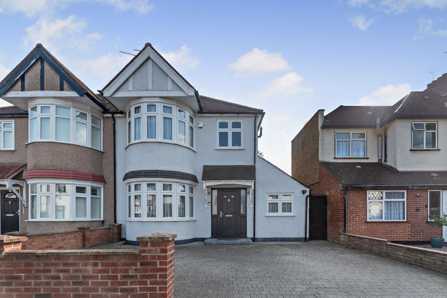


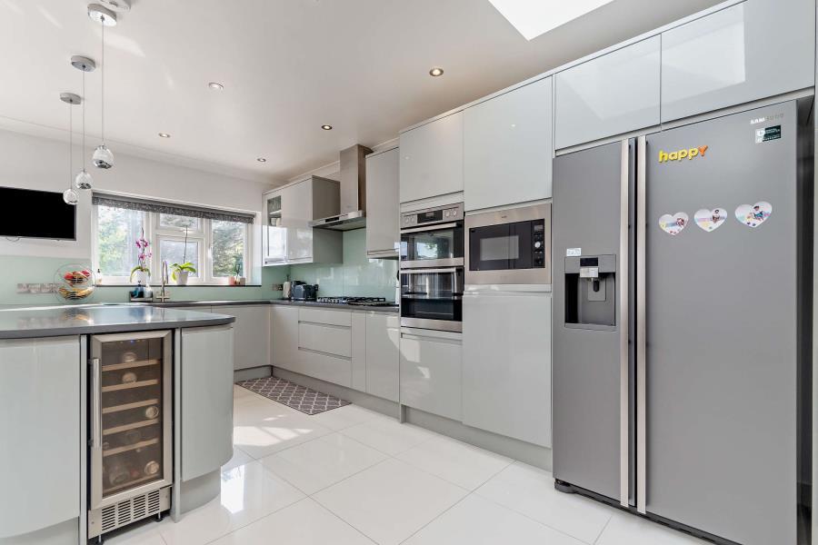


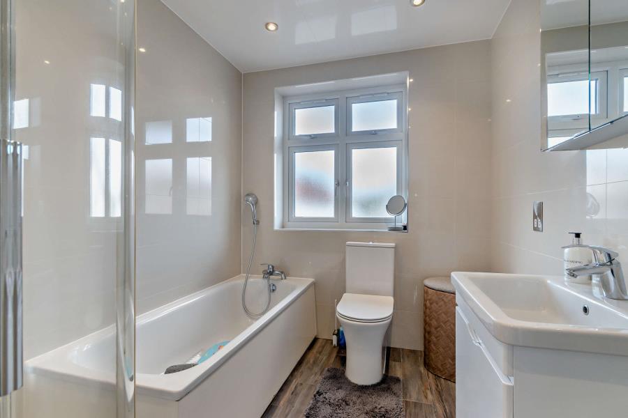

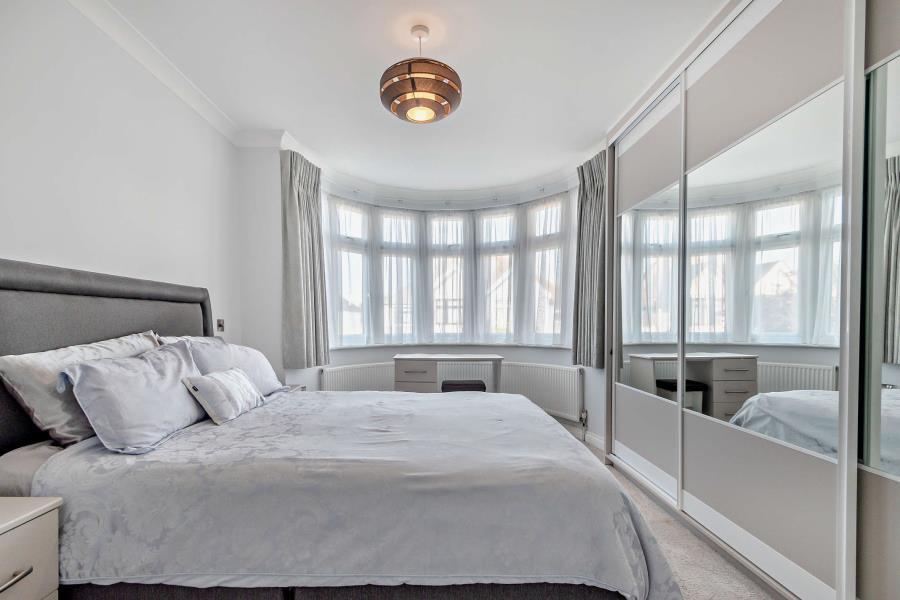


Photo 1 Photo 2 Photo 3 Photo 4 Photo 5 Photo 6 Photo 7 Photo 8 Photo 9 Photo 10 Photo 11 Photo 12 Photo 13 Photo 14
/ 14
Property details
Floor area
144 m²
Council tax band
E
EPC rating
C
Year built
England and Wales: 1930-1949
Deprivation
Decile 9 (29,382 of 33,755)
Street crime
589 incidents within 1 mile (Apr 2026)
Key features
- ENTRANCE HALL
- LOUNGE
- KITCHEN/DINING ROOM & UTILITY ROOM
- OFFICE
- CLOAK/SHOWER ROOM
- THREE BEDROOMS - TWO WITH FITTED WARDROBES
- FAMILY BATHROOM
- EXTENSIVE REAR GARDEN
- DRIVEWAY
Additional details
- Parking
- Driveway
- Garden
- Yes
Description
An advance reservation payment of one weeks rent is required to secure the property
Listed by
Pinner
Robsons
Reference: 163152752
EPC Rating & Upgrade Cost
Current rating: C
Potential rating: A
Inspection date: 04/08/2025
Expiry date: 03/08/2035
Est. upgrade cost to C: £28,750
Recommendations
- Flat roof or sloping ceiling insulation (£900 - £1,200)
- Cavity wall insulation (£900 - £1,500)
- Air or ground source heat pump with underfloor heating (£5,000 - £30,000)
- Solar photovoltaic panels, 2.5 kWp (£8,000 - £10,000)
Flood risk
Zone: 1
Risk: Low
Job (default Low)
Floorplans

Floorplan
EPC Graphs

EPC Graph
Rental Range
Estimated market rent for Harrow. Low = conservative, Realistic = average, Optimistic = best case.
Based on Local Authority from postcode lookup → Harrow.
LHA (30th percentile) floor for South West Herts: £1,496/mo (Apr 2025 – Mar 2026)
Location
Nearby
Nearest stations, universities and amenities (distance from property).
| Type | Name | Distance |
|---|---|---|
| Bus stop | Kingsfield Avenue | 0.2 miles |
| Shop | Millennium Fire Protection | 0.2 miles |
| Shop | Londis | 0.3 miles |
| Train station | North Harrow | 0.5 miles |
| Train station | West Harrow | 0.6 miles |
| Hospital | Watford General Hospital | 4.7 miles |
| University | Middlesex University | 4.8 miles |
| University | Flood Hazard Research Centre | 4.9 miles |
| Hospital | Hounslow Medical Centre | 8.3 miles |
Street-level crime
| Category | Count |
|---|---|
| Violence and sexual offences | 148 |
| Anti-social behaviour | 138 |
| Shoplifting | 82 |
| Theft from the person | 40 |
| Vehicle crime | 38 |
| Other theft | 32 |
| Criminal damage and arson | 30 |
| Public order | 24 |
| Drugs | 20 |
| Robbery | 16 |
| Burglary | 15 |
| Bicycle theft | 3 |
| Other crime | 2 |
| Possession of weapons | 1 |
| Total incidents | 589 |
Within 1 mile during Apr 2026. Source: data.police.uk (England & Wales).
Schools nearby
Nearest open schools with Ofsted ratings (England). Closed schools are not shown. Data from Get Information about Schools and Ofsted.
| Name | Type | Distance | Ofsted |
|---|---|---|---|
| Nower Hill High School | Secondary | 0.5 miles | Outstanding — 25 Jan 2024 |
| Marlborough Primary School | Primary | 0.6 miles | Good — 13 Nov 2023 |
| Pinner Park Primary School | Primary | 0.6 miles | Good — 30 Apr 2024 |
| Vaughan Primary School | Primary | 0.6 miles | Outstanding — 11 Feb 2019 |
| Norbury School | Primary | 0.7 miles | Good — 12 Nov 2012 |
Rental Comparables
Rental listings exist nearby, but none matched the 3-bedroom count for this property.