156 ORME ROAD
NEWCASTLE, STAFFORDSHIRE ST5 2PD
£950 pcm
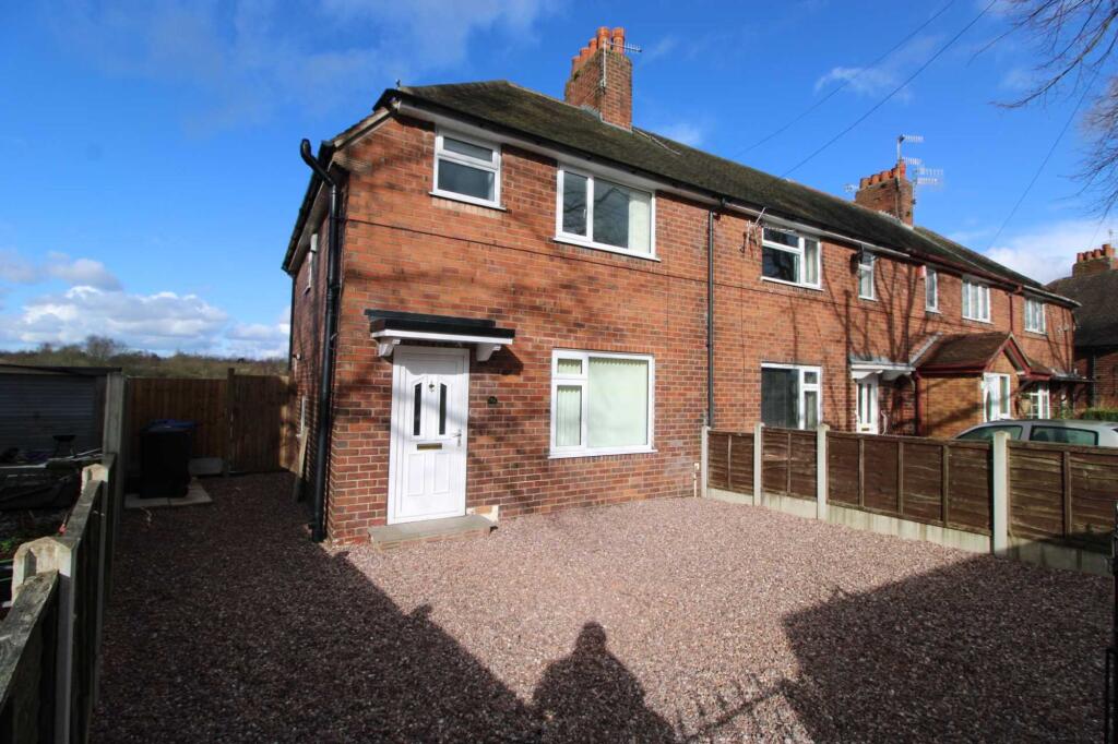
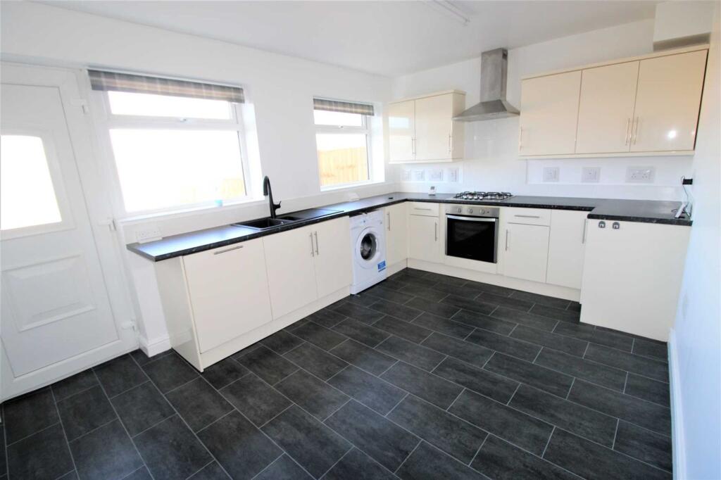
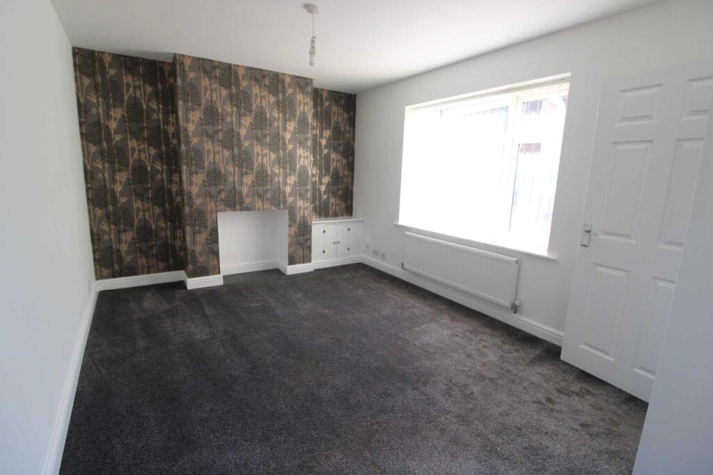
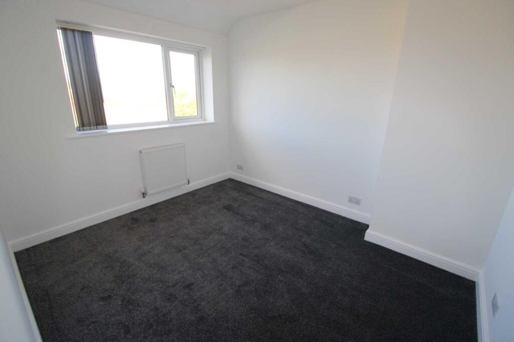
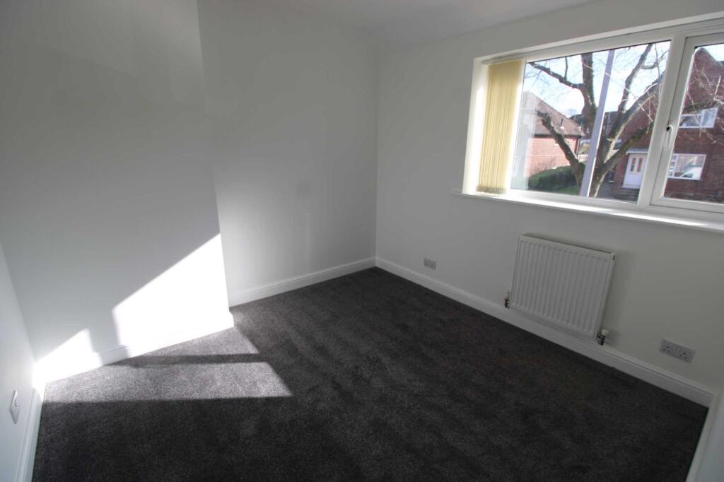
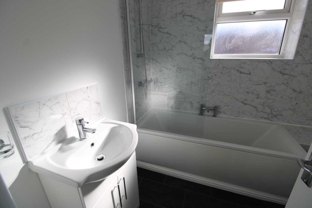
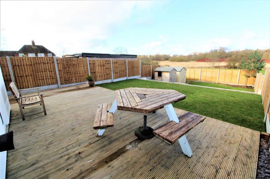
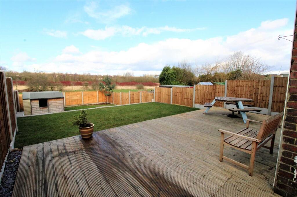
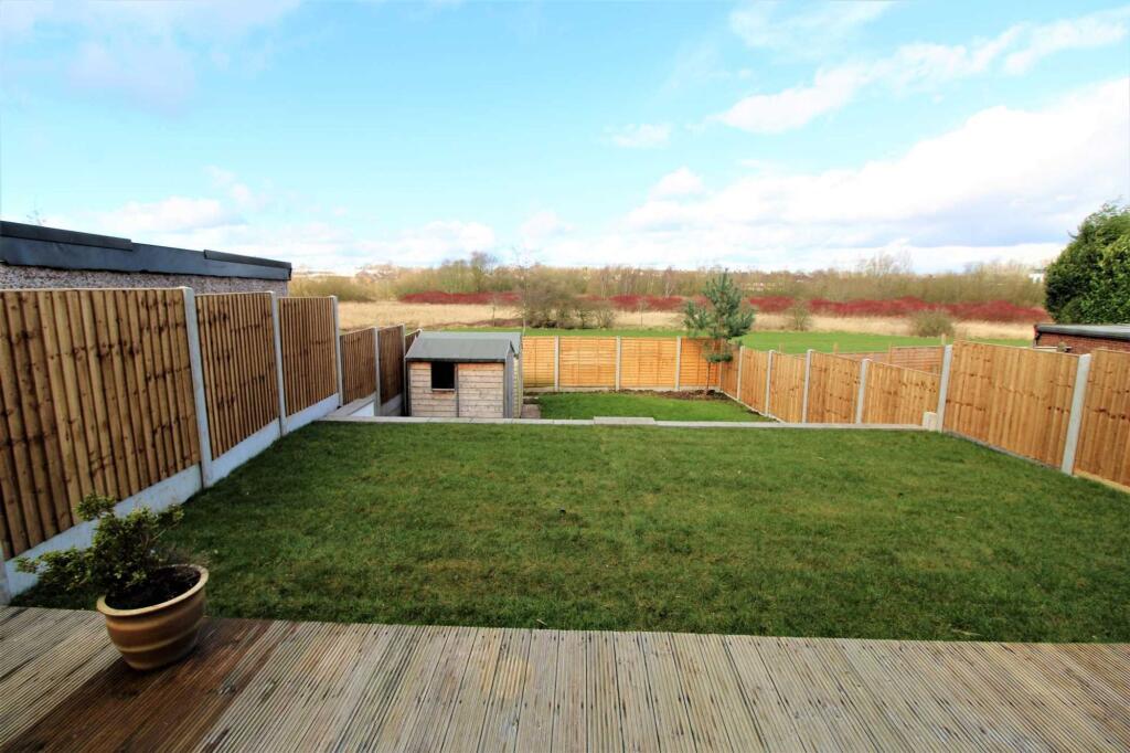
Photo 1 Photo 2 Photo 3 Photo 4 Photo 5 Photo 6 Photo 7 Photo 8 Photo 9
/ 9
Property details
Floor area
65 m²
Council tax band
A
EPC rating
C
Year built
England and Wales: 1930-1949
Deprivation
Decile 4 (11,963 of 33,755)
Street crime
297 incidents within 1 mile (May 2026)
Key features
- Three well-proportioned bedrooms
- Spacious lounge ideal for relaxing and entertaining
- Modern fitted kitchen with ample storage
- Contemporary family bathroom
- Generous enclosed rear garden
- Convenient location close to Newcastle-under-Lyme town centre, Keele University and Royal Stoke Hospital
- Excellent transport links with easy access to the A34, A500 and M6 motorway network
Additional details
- Heating
- Gas central
- Parking
- Driveway
- Garden
- Rear garden
- Listed property
- No
- Restrictions
- No
- Required access
- No
- Rights of way
- No
- Flooded in last 5 years
- No
- Flood defences
- No
Description
The property comprises a welcoming entrance hallway leading into a bright and comfortable living room, alongside a modern fitted kitchen offering plenty of cupboard and worktop space. Upstairs, there are three well-sized bedrooms and a contemporary family bathroom finished to a good standard.
Externally, the property benefits from an enclosed rear garden, providing an ideal outdoor space for relaxing or entertaining, while gas central heating and double glazing ensure year-round comfort.
Ideally positioned in the popular Poolfields area, the property is within easy reach of Newcastle-under-Lyme town centre, Keele University, the Royal Stoke University Hospital and a range of local shops, schools and everyday amenities. Excellent road links to the A34, A500 and M6 also make it a convenient base for commuters.
EPC Rating: C
Listed by
Newcastle-under-Lyme
Critchlow Estate Agents
Reference: 90981990
EPC Rating & Upgrade Cost
Current rating: C
Potential rating: C
Inspection date: 17/06/2025
Expiry date: 16/06/2035
Current heating cost: £611/year
Potential heating cost: £554/year
Est. upgrade cost to C: £16,500
Recommendations
- Floor insulation (suspended floor) (£5,000 - £10,000)
- Solar photovoltaic panels, 2.5 kWp (£8,000 - £10,000)
Flood risk
Zone: 1
Risk: Low
Job (default Low)
FENSA Certificates
This property has 2 FENSA certificate(s) on record, indicating window/door installations by FENSA-approved installers.
FENSA Certificate #8777603
Property Details
Street: 156 Orme Road
Town: NEWCASTLE
Postcode: ST5 2PD
Installation Details
Items: 3 windows and 1 door
Certificate Issued: 04/04/2012
Work Completed: 23/03/2012
This certificate data was retrieved from FENSA's database
FENSA Certificate #7125024
Property Details
Street: 156 Orme Road
Town: NEWCASTLE
Postcode: ST5 2PD
Installation Details
Items: 1 door
Certificate Issued: 02/02/2010
Work Completed: 22/01/2010
This certificate data was retrieved from FENSA's database
What is FENSA? FENSA (Fenestration Self-Assessment Scheme) is a government-authorised scheme that monitors building regulation compliance for replacement windows and doors. Certificates indicate that work was completed by FENSA-approved installers.
Rental Range
Estimated market rent for Newcastle-under-Lyme. Low = conservative, Realistic = average, Optimistic = best case.
Based on Local Authority from postcode lookup → Newcastle-under-Lyme.
LHA (30th percentile) floor for Staffordshire North: £593/mo (Apr 2025 – Mar 2026)
Location
Nearby
Nearest stations, universities and amenities (distance from property).
| Type | Name | Distance |
|---|---|---|
| Bus stop | Rotterdam Road | 0.1 miles |
| Bus stop | St Andrew's Drive | 0.1 miles |
| Shop | Argos | 0.5 miles |
| Shop | Timpson | 0.7 miles |
| Hospital | Royal Stoke University Hospital | 1.3 miles |
| University | Keele University | 1.4 miles |
| Train station | Silverdale | 1.8 miles |
| Hospital | North Staffordshire Nuffield Hospital | 1.9 miles |
| Train station | Apedale Road | 2.0 miles |
| University | University of Buckingham Crewe Campus | 9.3 miles |
Street-level crime
| Category | Count |
|---|---|
| Violence and sexual offences | 111 |
| Anti-social behaviour | 58 |
| Shoplifting | 27 |
| Public order | 24 |
| Other theft | 18 |
| Drugs | 16 |
| Criminal damage and arson | 13 |
| Burglary | 12 |
| Vehicle crime | 6 |
| Bicycle theft | 3 |
| Possession of weapons | 3 |
| Robbery | 3 |
| Other crime | 2 |
| Theft from the person | 1 |
| Total incidents | 297 |
Within 1 mile during May 2026. Source: data.police.uk (England & Wales).
Schools nearby
Nearest open schools with Ofsted ratings (England). Closed schools are not shown. Data from Get Information about Schools and Ofsted.
| Name | Type | Distance | Ofsted |
|---|---|---|---|
| Newcastle and Stafford Colleges Group | Other | 0.3 miles | — (No rating) |
| St Mary's Catholic Primary School | Primary | 0.3 miles | Good — 17 Feb 2017 |
| St Giles' and St George's Church of England Academy | Primary | 0.4 miles | Good — 21 May 2023 |
| St John Fisher Catholic College | Secondary | 0.4 miles | Requires improvement — 5 Mar 2024 |
| Blackfriars Academy | Other | 0.5 miles | Outstanding — 6 Feb 2013 |
Rental Comparables
Residential lets from OpenRent and Rightmove for the area (same bedroom count). Use to validate rent estimates. Student lets are excluded.
| Title | Rent | Beds | Distance | As seen on |
|---|---|---|---|---|
| Orme Road, Newcastle, ST5 | £950/mo | 3 | 0 miles | Rightmove |
| 3 Bed Terraced House, St Andrews Drive, ST5 | £1,000/mo | 3 | 0.11 miles | OpenRent |
| Snowgoose Way, Newcastle, ST5 | £1,300/mo | 3 | 0.16 miles | Rightmove |
| Wesley Place, Newcastle, ST5 | £1,000/mo | 3 | 0.21 miles | Rightmove |
| Greylag Gate, Newcastle, Staffordshire, ST5 | £1,200/mo | 3 | 0.23 miles | Rightmove |
| Waters Edge Close, Silverdale, Newcastle, ST5 | £1,000/mo | 3 | 0.32 miles | Rightmove |
| Prospect Terrace, Newcastle, Staffordshire, ST5 | £775/mo | 3 | 0.39 miles | Rightmove |
| 3 Bed Semi-Detached House, Emery Avenue, ST5 | £1,250/mo | 3 | 0.47 miles | OpenRent |
| Thistleberry Avenue, The Westlands, Newcastle Under Lyme, Staffordshire, ST5 | £1,445/mo | 3 | 0.47 miles | Rightmove |
| Rosemary Hill, ST5 | £1,400/mo | 3 | 0.47 miles | Rightmove |
| 3 Bed End Terrace, Enderley Street, ST5 | £1,300/mo | 3 | 0.62 miles | OpenRent |
| Enderley Street, Newcastle-Under-Lyme, ST5 | £1,350/mo | 3 | 0.62 miles | Rightmove |
| Navigation Way, Newcastle, Staffordshire, ST5 | £1,050/mo | 3 | 0.73 miles | Rightmove |
| Brunswick Street, Newcastle, Staffordshire, ST5 | £1,000/mo | 3 | 0.81 miles | Rightmove |
| Webster Street, Newcastle Under Lyme, ST5 | £900/mo | 3 | 0.92 miles | Rightmove |
| Car Park Lymedale Cross Industrial Estate, Newcastle Under Lyme ST5 | £1/mo | — | 0.97 miles | Rightmove |
| Crown Street, Silverdale, ST5 | £925/mo | 3 | 1.06 miles | Rightmove |
| Earls Drive, Westlands, Newcastle-under-Lyme, ST5 | £800/mo | 3 | 1.12 miles | Rightmove |
| Liverpool Road, Newcastle, Staffordshire, ST5 | £1,200/mo | 3 | 1.22 miles | Rightmove |
| Maureen Grove, Newcastle, Staffordshire, ST5 | £995/mo | 3 | 1.24 miles | Rightmove |
Average rent: £1,133/mo (37 listings)