14 WORCESTER TERRACE
SUNDERLAND, SUNDERLAND, TYNE AND WEAR SR2 7AR
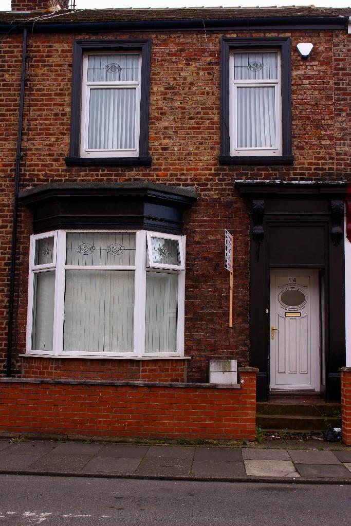
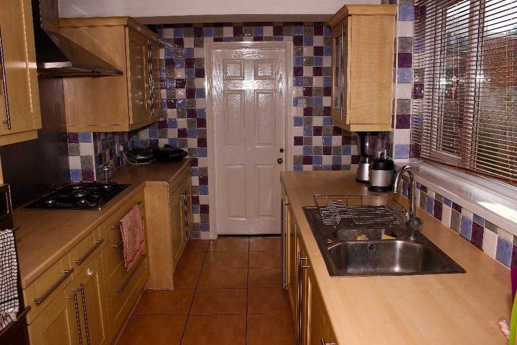
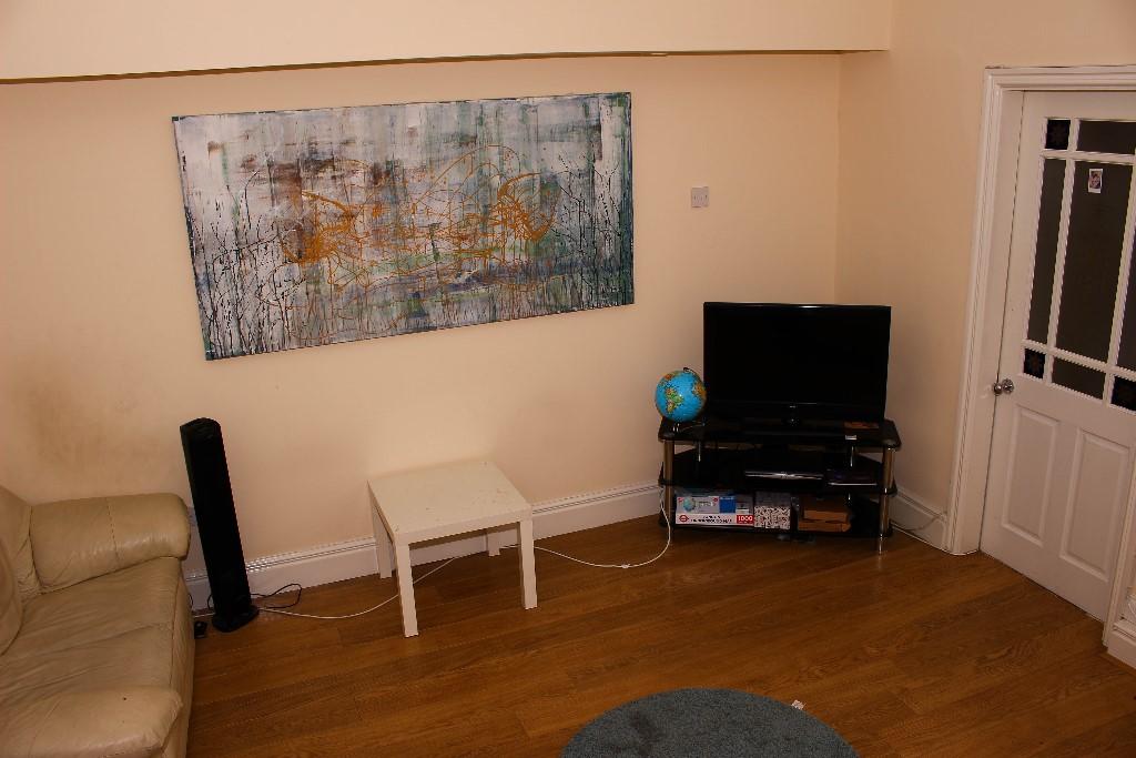
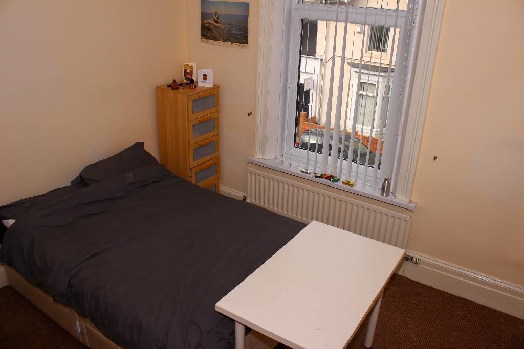
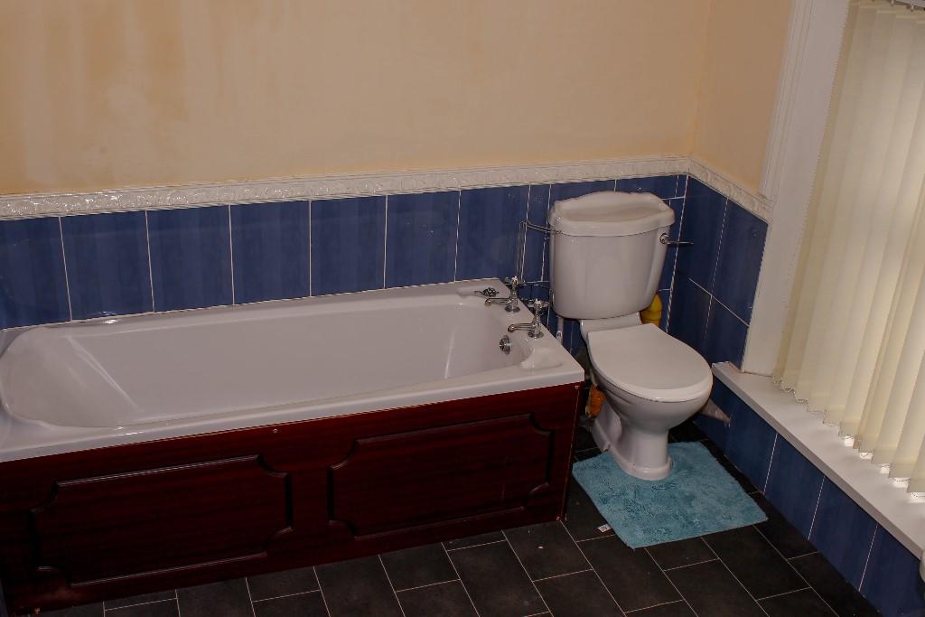
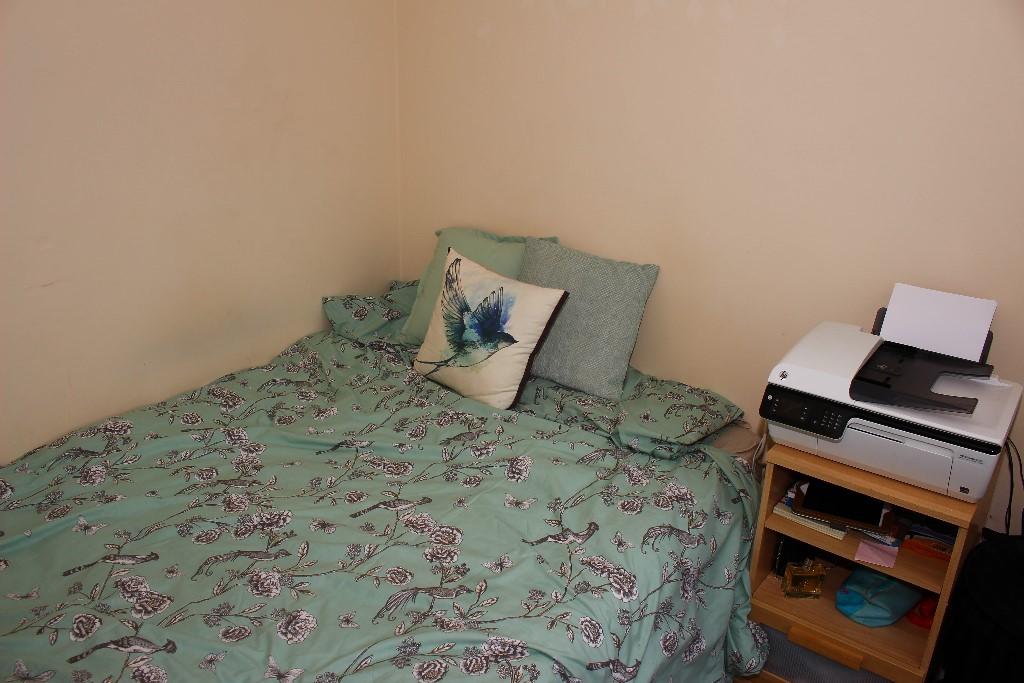
Photo 1 Photo 2 Photo 3 Photo 4 Photo 5 Photo 6
/ 6
Property details
Floor area
127 m²
Last sold
£119,000 Mar 2006
Local average
£119,798 (-99.8%)
Deprivation
Decile 2 (4,616 of 33,755)
Street crime
520 incidents within 1 mile (Mar 2026)
Key features
- AVAILABLE JULY 2020
- NO ADMIN FEES
- FLEXIBLE DEPOSITS
- MEMBERS OF ACCREDITED LANDLORD SCHEME
- CLOSE TO UNIVERSITY CAMPUS AND CITY CENTRE
- COMPLIMENTARY SKY TV PACKAGE AND SUPERFAST WIFI
- DOUBLE GLAZED THROUGHOUT
- OFF STREET PARKING
- VIRTUAL VIEWINGS AVAILABLE
Additional details
- Heating
- Gas central
- Parking
- On street, Permit, Off street
- Garden
- Rear garden
Description
£65.00 pppw with ALL BILLS included! This package includes SKY TV Package and super fast fibre broadband.
This well placed student property is located near City Campus, offers great access to local amenities and is a short distance to Park Lane Interchange and City Centre.
Features:
* Fully furnished
* Double glazed throughout
* Combi boiler
* Stylish kitchen and bathroom
* 5 bedrooms with double beds, wardrobe, chest of drawers and desk
* Lounge
* Bathroom featuring a bath with shower above, basin and toilet.
* Separate WC
* Off street parking
* EPC rating - D
Available 1st July 2020.
Viewings are essential, call us today to arrange your viewing.
Listed by
Sunderland
Select Property Management NE Ltd
Reference: 76269695
EPC Rating & Upgrade Cost
Fetching EPC data… Refresh this page in a moment.
Flood risk
Zone: 1
Risk: Low
Job (default Low)
Floorplans
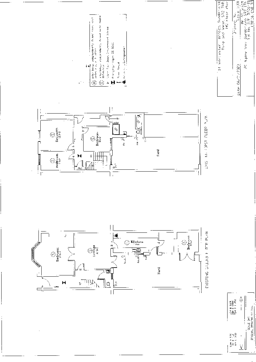
14 Worcester Terrace
EPC Graphs

EPC 1
FENSA Certificates
This property has 1 FENSA certificate(s) on record, indicating window/door installations by FENSA-approved installers.
FENSA Certificate #1048664
Property Details
Street: 14 Worcester Terrace
Town: Ashbrooke
Postcode: SR2 7AR
Installation Details
Items: 11 windows and 2 doors
Certificate Issued: 11/10/2003
Work Completed: 18/08/2003
This certificate data was retrieved from FENSA's database
What is FENSA? FENSA (Fenestration Self-Assessment Scheme) is a government-authorised scheme that monitors building regulation compliance for replacement windows and doors. Certificates indicate that work was completed by FENSA-approved installers.
Price history
213% since 1995
| Event | Date | Price | % change |
|---|---|---|---|
| Sold | 06/03/2006 (20 years ago) | £119,000 | +213.2% |
| Sold | 01/09/1995 (30 years ago) | £38,000 | — |
Source: HM Land Registry Price Paid Data. Crown copyright.
Sold Comparables
Same street and nearby sales within 0.25 miles (last 5 years). Data from Land Registry Price Paid.
| Address | Price | Date | Type |
|---|---|---|---|
| 1 PRINCESS STREET, SUNDERLAND, TYNE AND WEAR, SR2 7AS | £92,000 | 28/11/2023 | Terraced |
| 10 AZALEA TERRACE NORTH, SUNDERLAND, TYNE AND WEAR, SR2 7ES | £127,000 | 18/09/2023 | Terraced |
| 10 AZALEA TERRACE NORTH, SUNDERLAND, TYNE AND WEAR, SR2 7ES | £122,000 | 14/06/2023 | Terraced |
| 6 ARGYLE STREET, SUNDERLAND, TYNE AND WEAR, SR2 7DH | £99,000 | 11/04/2023 | Terraced |
| 10 PRINCESS STREET, SUNDERLAND, TYNE AND WEAR, SR2 7AS | £91,500 | 14/03/2023 | Terraced |
| 11 CRESSWELL TERRACE, SUNDERLAND, TYNE AND WEAR, SR2 7ER | £183,500 | 17/01/2023 | Terraced |
| HALLGATE HOUSE, 9 GRANGE TERRACE, SUNDERLAND, TYNE AND WEAR, SR2 7DF | £180,000 | 09/12/2022 | Terraced |
| 10 ALICE STREET, SUNDERLAND, TYNE AND WEAR, SR2 7AL | £90,000 | 16/11/2022 | Terraced |
| 16 DERBY STREET, SUNDERLAND, TYNE AND WEAR, SR2 7AB | £159,500 | 01/11/2022 | Terraced |
| 4 ALICE STREET, SUNDERLAND, TYNE AND WEAR, SR2 7AL | £115,000 | 03/10/2022 | Terraced |
| 22 ARGYLE SQUARE, SUNDERLAND, TYNE AND WEAR, SR2 7BS | £185,000 | 15/08/2022 | Terraced |
| 6 CRESSWELL TERRACE, SUNDERLAND, TYNE AND WEAR, SR2 7ER | £150,000 | 09/08/2022 | Terraced |
| 22 ALICE STREET, SUNDERLAND, TYNE AND WEAR, SR2 7AL | £122,500 | 09/08/2022 | Terraced |
| 20 ALICE STREET, SUNDERLAND, TYNE AND WEAR, SR2 7AL | £122,500 | 09/08/2022 | Terraced |
| 25 STOCKTON ROAD, SUNDERLAND, TYNE AND WEAR, SR2 7AQ | £80,000 | 19/07/2022 | Terraced |
| 17 AZALEA TERRACE NORTH, SUNDERLAND, TYNE AND WEAR, SR2 7ES | £155,000 | 13/07/2022 | Terraced |
| 9 THORNHILL TERRACE, SUNDERLAND, TYNE AND WEAR, SR2 7JL | £360,000 | 06/07/2022 | Terraced |
| 14 AZALEA TERRACE NORTH, SUNDERLAND, TYNE AND WEAR, SR2 7ES | £260,000 | 23/05/2022 | Terraced |
| 17 THORNHILL TERRACE, SUNDERLAND, TYNE AND WEAR, SR2 7JL | £475,000 | 07/04/2022 | Terraced |
| 24 THORNHILL TERRACE, SUNDERLAND, TYNE AND WEAR, SR2 7JL | £295,000 | 31/03/2022 | Terraced |
| Same street 9 WORCESTER TERRACE, SUNDERLAND, TYNE AND WEAR, SR2 7AR | £160,000 | 23/11/2021 | Semi-detached |
Street average: £160,000 (1 sale)
Area average: £173,225 (20 sales)
Capital growth trend
Land Registry outcode average: last 12 months vs 5y and 10y ago (from sold prices).
House Price Index (HM Land Registry — official index, not sold-price averages): Sunderland. Series: Terraced. As of February 2026.
Rental Range
Estimated market rent for Sunderland. Low = conservative, Realistic = average, Optimistic = best case.
Based on Local Authority from postcode lookup → Sunderland.
LHA (30th percentile) floor for Sunderland: £698/mo (Apr 2025 – Mar 2026)
Location
Nearby
Nearest stations, universities and amenities (distance from property).
| Type | Name | Distance |
|---|---|---|
| Bus stop | Stockton Road | 0.1 miles |
| Shop | Bold Faces | 0.1 miles |
| Shop | Recycle Boutique | 0.1 miles |
| Bus stop | TUNSTALL ROAD-ARGYLE STREET-N/B | 0.1 miles |
| Train station | Park Lane | 0.1 miles |
| Train station | University | 0.2 miles |
| University | University of Sunderland, City Campus | 0.2 miles |
| University | The Precinct | 0.4 miles |
| Hospital | Sunderland Royal Hospital | 0.8 miles |
| Hospital | Sunderland Eye Infirmary | 0.9 miles |
Street-level crime
| Category | Count |
|---|---|
| Violence and sexual offences | 163 |
| Anti-social behaviour | 101 |
| Shoplifting | 57 |
| Criminal damage and arson | 42 |
| Public order | 42 |
| Vehicle crime | 33 |
| Other theft | 22 |
| Burglary | 21 |
| Drugs | 13 |
| Other crime | 7 |
| Robbery | 6 |
| Possession of weapons | 5 |
| Theft from the person | 5 |
| Bicycle theft | 3 |
| Total incidents | 520 |
Within 1 mile during Mar 2026. Source: data.police.uk (England & Wales).
Schools nearby
Nearest open schools with Ofsted ratings (England). Closed schools are not shown. Data from Get Information about Schools and Ofsted.
| Name | Type | Distance | Ofsted |
|---|---|---|---|
| St Anthony's Girls' Catholic Academy | Secondary | 0.2 miles | Good — 12 Mar 2023 |
| Argyle House School | Other | 0.2 miles | — (No rating) |
| University of Sunderland | Other | 0.2 miles | — (No rating) |
| Thornhill Academy | Secondary | 0.3 miles | Good — 19 Jun 2024 |
| Consilium Evolve | Other | 0.4 miles | Good — 26 Feb 2020 |
Rental Comparables
Rental listings exist nearby, but none matched the 5-bedroom estimate from EPC for this property.
Rent-driven metrics
Based on Area rent estimate.
- Rent ratio — Monthly rent ÷ purchase price (1% rule). 1%+ = strong, 0.8–1% = okay, <0.8% = weak for cashflow.
- Max investor price — Rent ÷ 0.8%; the price at which rent would be 0.8% of price (Stoke-style target).
- Target investor price — Rent ÷ 1%; the price at which rent would be 1% of price (strong cashflow band).
- Gross yield — Annual rent as % of purchase price (no costs).